Kristina Rothstein and Tamsin Grainger took a third walk, together yet apart in October 2025.
We walked at the same time as each other, Kristina in Canada and Tamsin in Scotland, agreeing that the location would be woods, and the subject, mapping. Stopping at 20, 40 and 60 minutes, we drew and/or recorded verbal maps on site and then followed up with artwork that included collage and video.
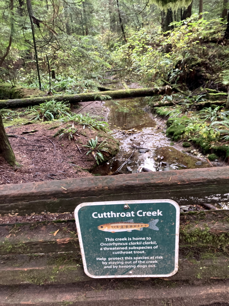
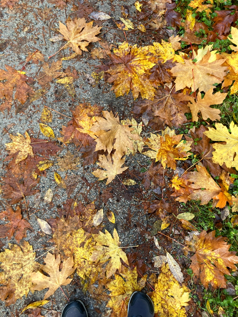
The top two images above were taken by Kristina Rothstein in Canada and the two below by me, on our Woods Walk.
The top two images above were taken by me, and the two below by Kristina Rothstein in Canada, on our Woods Walk.
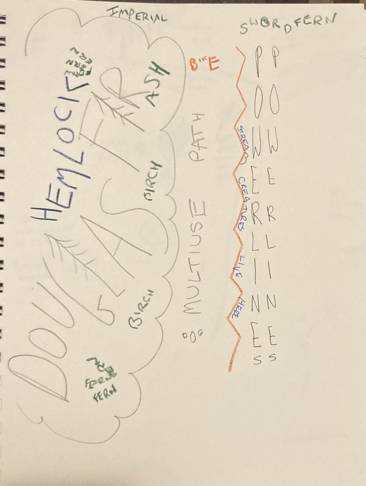
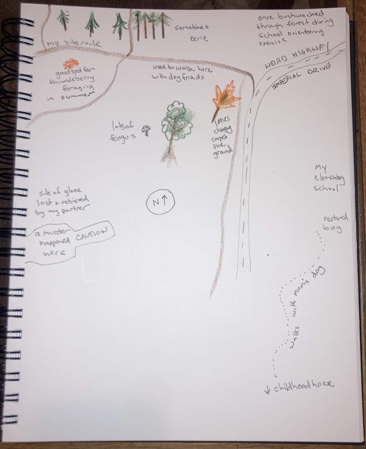
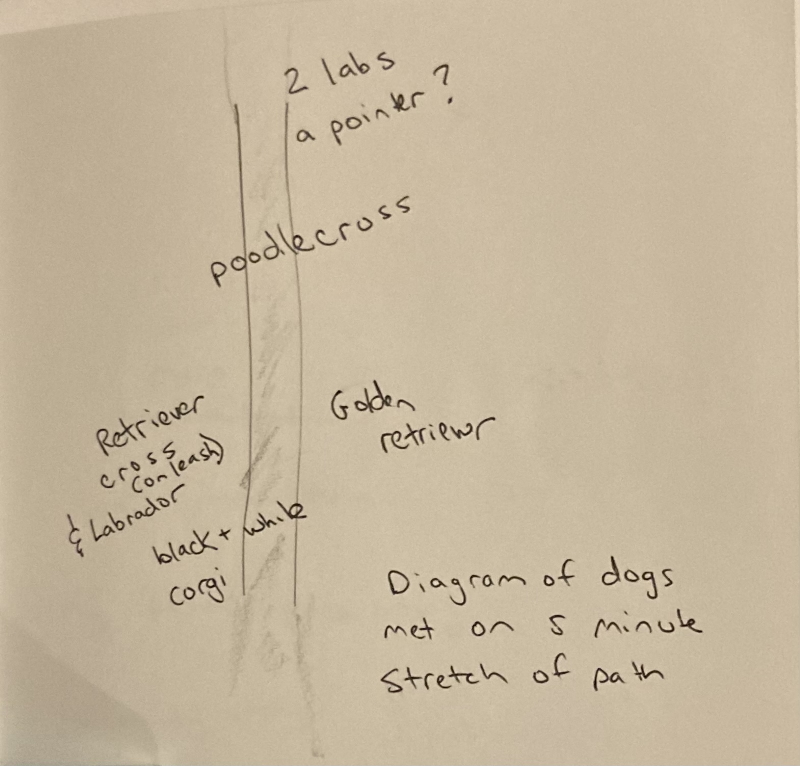
The three illustrations above show Kristina’s maps of words, memories and dogs respectively.
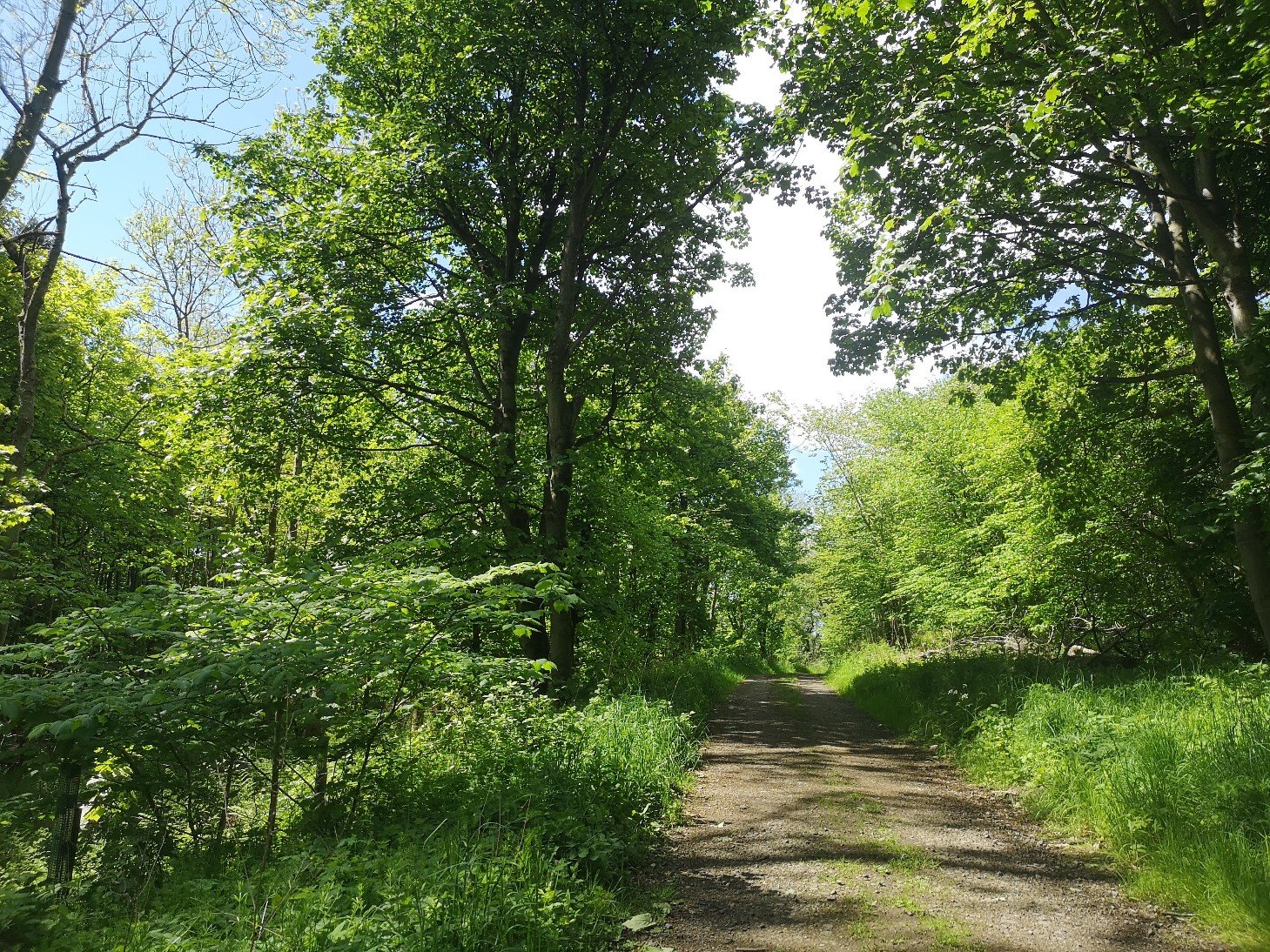
This video shows images (photographic and hand-drawn in pencil), from Tamsin’s walk in Scotland, together with recorded audio maps of the natural species found in the woods, and the rubbish that threatens to engulf them. It also includes two collages made using the InCollage app and paper/glue/scissors.
This is a new collaboration between Kristina Rothstein and Tamsin Grainger where we walk together, apart. Kristina is in Vancouver, Canada, and I am in Edinburgh, Scotland.
Last week, we walked at the same time as each other, despite the time difference of 8 hours and having only spoken together once online. We didn’t exchange maps or describe where we were going, but agreed that we would walk on edgeland (whatever that meant to us), and stop to communicate in some way at 30, 60 and 90 minutes during our walks. We both viewed and listened to each other’s work before we began. Our interest was in the process, experience and outcome of such an experiment, whether we would find that there were any cross-overs or influences, despite the geographical distance.
Kristina walks in Vancouver
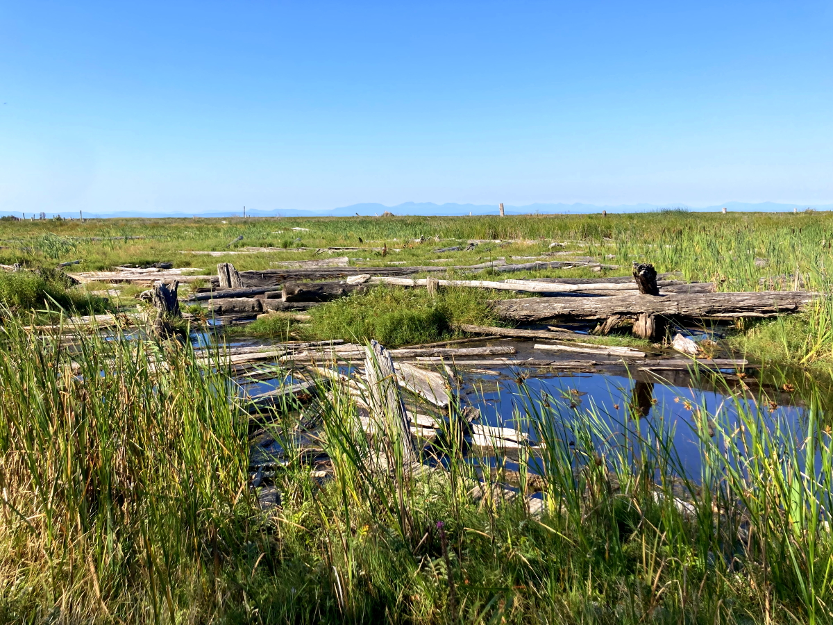
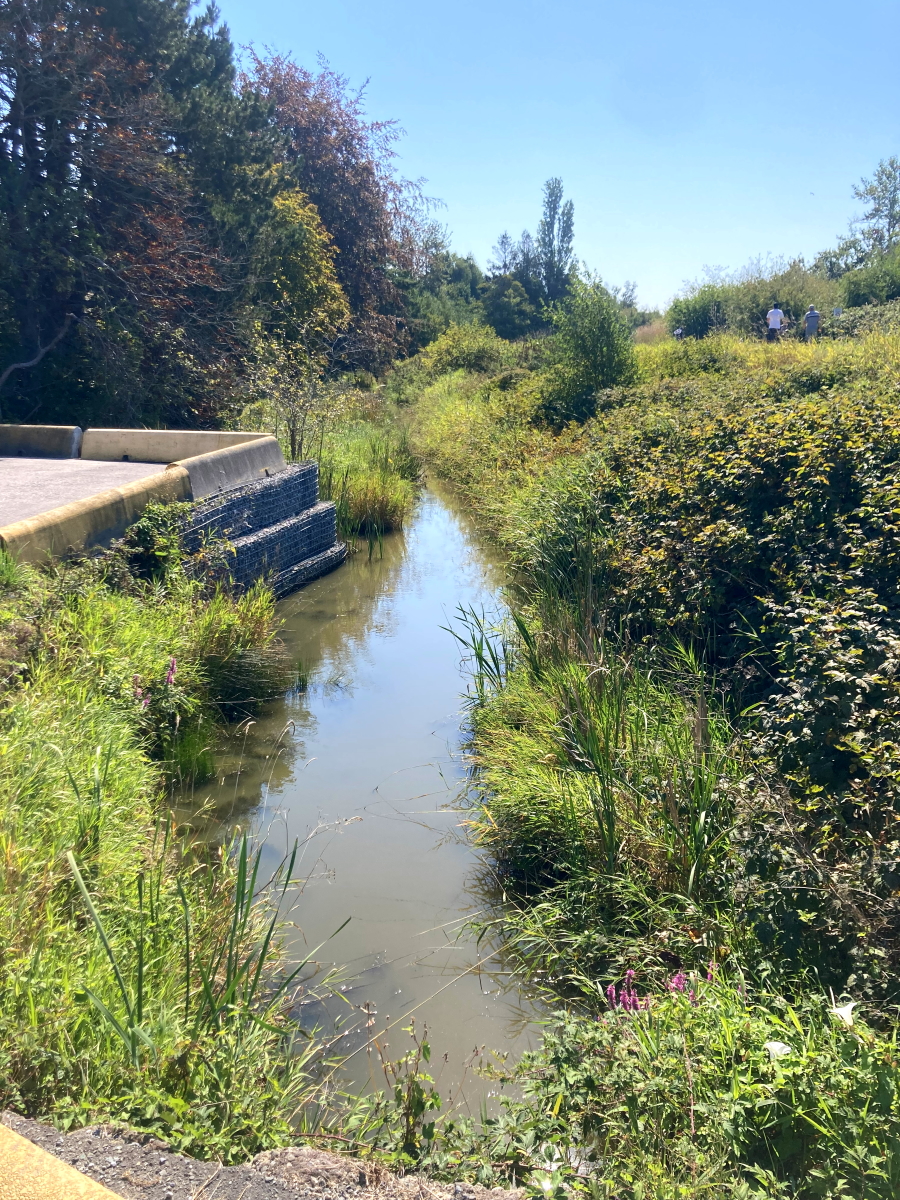
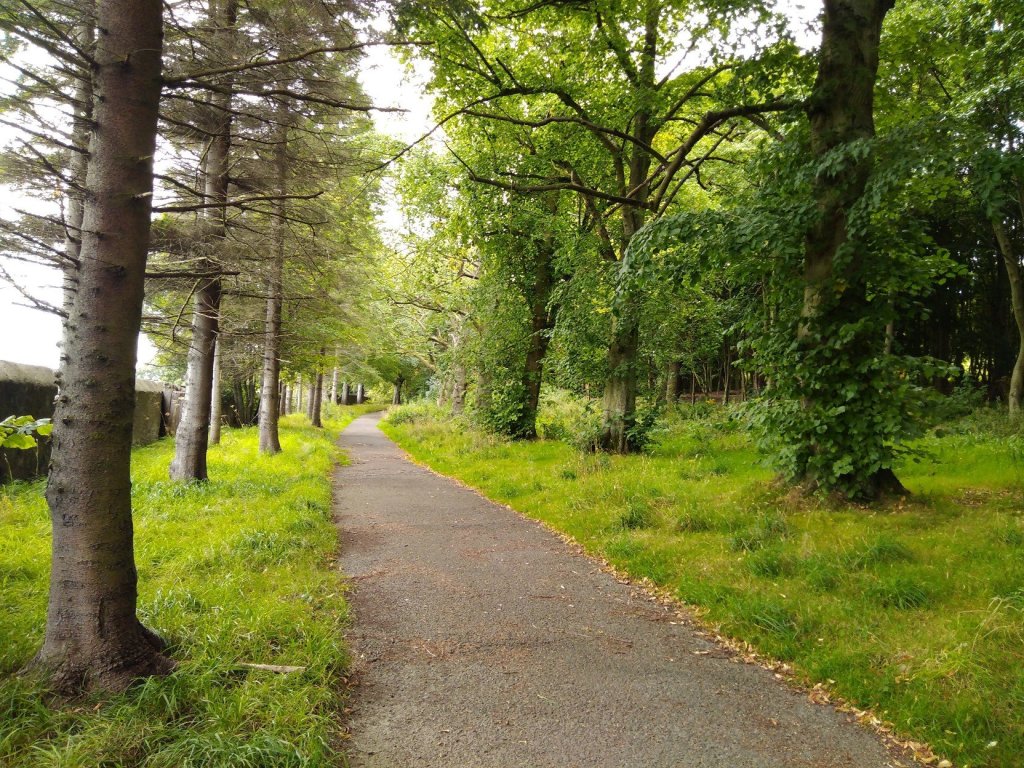
Kristina writes: I began my walk at a parking area (///swimmer.behaving.sailor) where the middle fork of the Fraser River meets the Straight of Georgia (Pacific Ocean). I followed a multi-use trail along the dike. When possible, I took unofficial trails that skirted closer to the intertidal flats area, passing through some thickets to where the ground becomes watery. My first intervention happened there. Leaving the path felt right. My second intervention was on the gravel dike path, where a long row of tall trees lines a golf course. My third intervention occurred where a residential road dead-ends at the trail, with a rural park on the other side.
Tamsin walks in Edinburgh
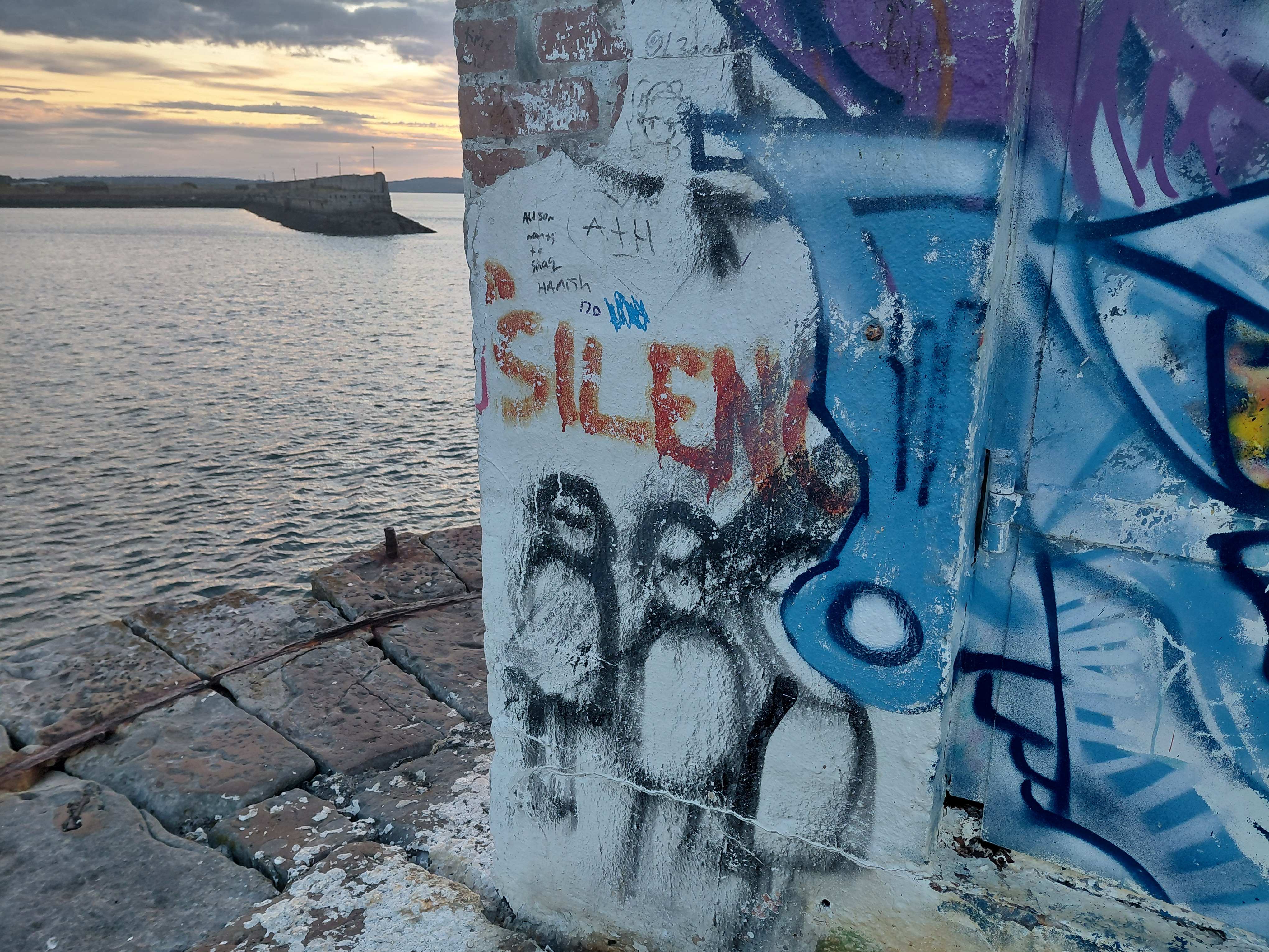
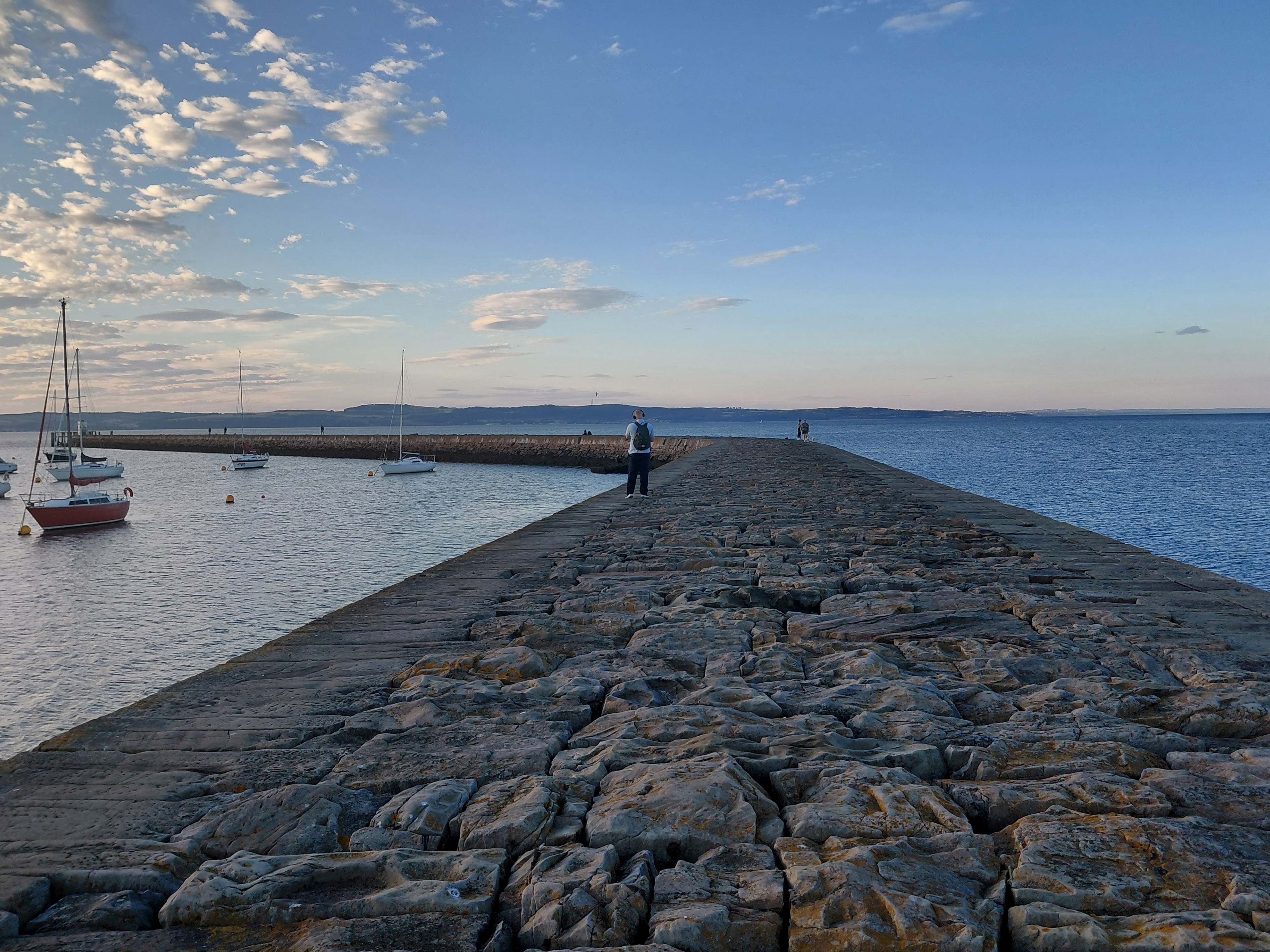
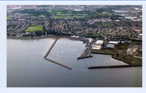
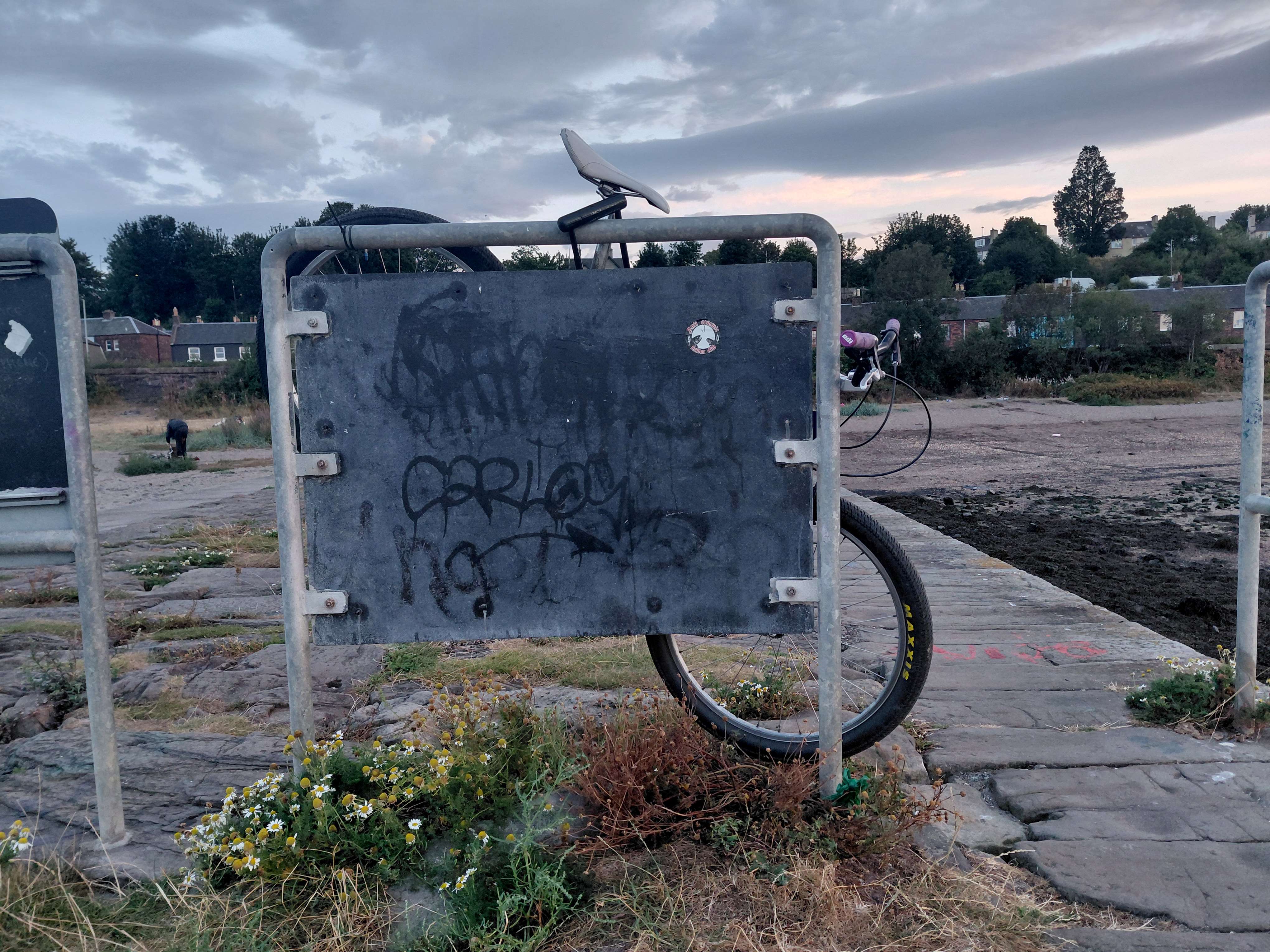
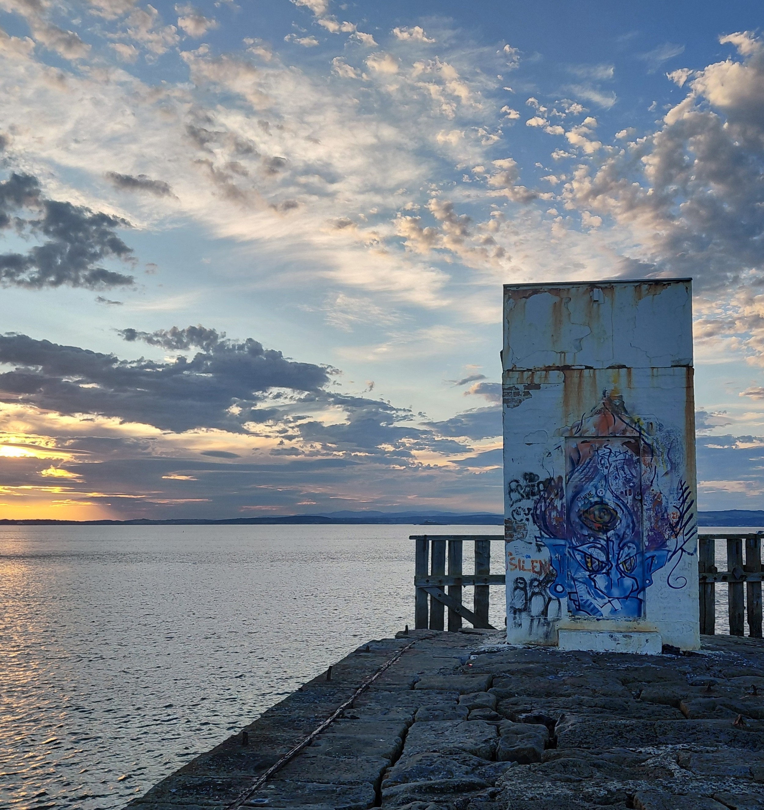
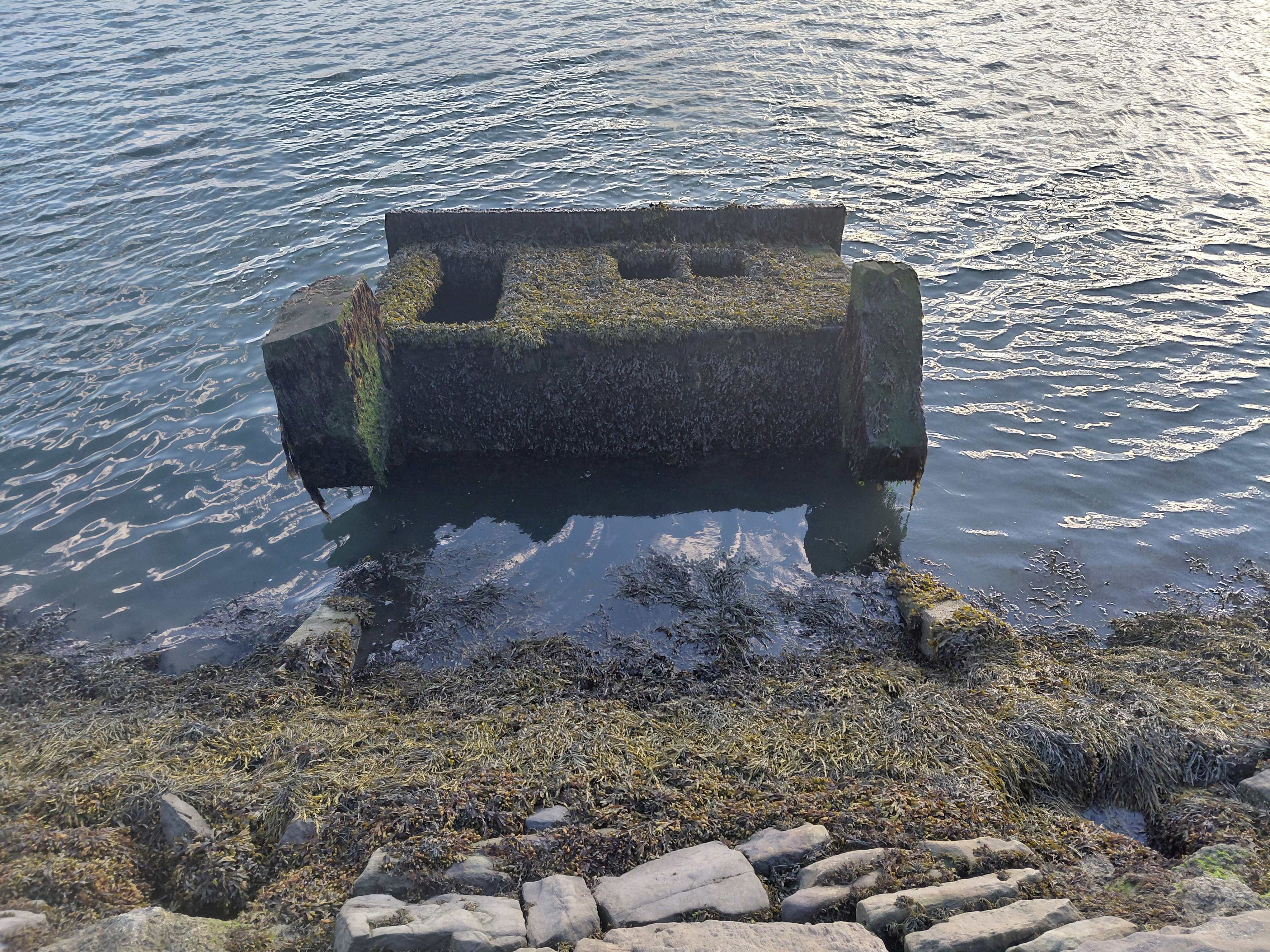
Tamsin writes: I began my walk at the intersection between land and the Firth of Forth (///kinks.coats.salsa), an estuary of the North Sea at the edge of the city of Edinburgh. I followed the Eastern Breakwater, the right arm of Granton Harbour. This long, stone wall (would you call it a dike?) is raised above the sea and divides the calmer waters where the yachts are moored, from Wardie Bay which is used for wild swimming. The Breakwater travels directly out to sea and then bends left, eventually coming to an end where the ocean surrounded me on three sides. A graffiti-covered structure stands sentinel. ‘Silence’ I read to myself. I looked down to the skirt of stones which appear at low tide around the base of the wall and saw a fisherman casting his rod. If he was aware of me speaking into my microphone to Kristina, he didn’t show it.
TG EdinburghKR Vancouver
KR: I looked at the land differently, with a focus on transmitting to Tamsin, my walking partner. Carrying her with me psychically changed my relationship to the landscape and my experience of the place. It did feel like I had a passenger. I imagined seeing things through her eyes and also tried to imagine her own edgeland superimposed alongside mine and what she might be seeing and thinking. This one to one connection felt very different from walking remotely with a group. I thought about allowing myself to flow and seep into my walking partner and I opened myself to receive signals.
TG: I was pleased to walk with Kristina as my companion. I had the phone recorder on most of the time so I could share the sounds of the landscape with her. I chatted away as if she was there beside me. Not knowing what she was seeing and hearing, I trusted that our connection would bring about some synchronicity. I actively merged myself with my imagination of her, attempting to walk in time with her footsteps, and see my views through her eyes.
KR: This is a trail I walk or cycle on infrequently. There were more borders and edges than I remembered: the line of a golf course and houses, a drainage ditch, the dike, a border of brambles and rosehips, the tidal marsh, the sea.
Breakwater, Tamsin Grainger, Edinburgh, Scotland
TG: I’m familiar with this walk, can actually see through the window if I stand on the edge of my bed. The Breakwater cuts a clean line into the sea, dissecting the outer limit of the city and points a crooked finger towards the far shore of Fife. Before the harbour was completed, in 1863, the shore showed on the maps as a smooth curve. Now, I like to think that we reach out and gather people into our arms (as the nation of Scotland welcomes refugees and people seeking asylum), extending our limits and, hopefully, opening our minds beyond borders.
KR: It was late morning for me, on a clear sunny day. I passed a lot of walkers and cyclists, saw and heard many birds including a flock of herons and a lot of airplanes and seaplanes. I liked using this vague prompt to begin. It would be interesting to see what happened if a more detailed idea of the walk was given ahead of time.
TG: It was a very fine evening – unseasonably warm, though breezy as usual – and a popular place to be. Planes were banking overhead, then soaring towards the airport. I counted at least eight different languages being spoken, evidence of this multi-cultural area. I met a local friend walking with a visitor, who was delighted when I said I was walking, remotely, with someone in Vancouver, as she’d been there.
KR VancouverTG Edinburgh
KR: “Edgeland” is not that descriptive so I don’t know whether the similarity and overlap in our landscapes was a connection or based on me knowing something about Tamsin’s work. After sharing some of our experiences I was taken by the ways in which large birds played a role. It was also exciting that we were moved to make percussive use of the surroundings, something I have not done before. Wind was a strong presence, somewhat common by water, but not necessarily. We were also both drawn to vertical structures, perhaps because they stand out on edges.
TG: What sounds and words should I include in the final recording? I wasn’t using quality recording technology (or even a sock), so the wind often drowned out my voice. There were the constant tunes coming from the bagpipers rehearsing on the Middle Breakwater. And I had also picked up a stick, using it to play persussive rhythms on various surfaces in time with the regular pace of my footsteps. Listening to my commentary afterwards, I was reminded of the line from the Twelve Days of Christmas, “Eleven Pipers Piping” and following that thought thread, I wrote the text, juxtaposing it with the found sounds of the environment. It was only later that I discovered Kristina had also picked up a stick and played it. Then I wished I had included it in the final cut!
KR VancouverTG Edinburgh
Listen to the Sounds we made in response to our walks together, apart
We both hope to repeat this Walking in Pairs, exploring different landscapes and experimenting with various briefs and prompts to see what happens when we walk together, apart.
Here is the film on Vimeo. Poppies have long been seen as a symbol of sleep, peace and death, not, for me, a sign of patriotism, nor any sort of justification for war
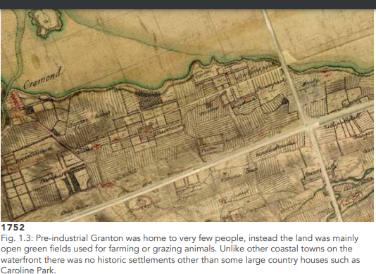
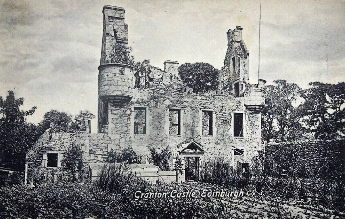
I chose to walk on the familiar site of Granton Castle in Edinburgh, now naturalised wasteland to the sea-side of the Granton Gasholder, which you can see glimpses of in the film. I’d been researching the Rough Wooing, an attack on Scotland by Henry VIII (1543-1551). It was in retaliation for Mary Queen of Scots refusing to marry Edward and allying herself, instead, with France. The first tranche ruined this Medieval castle which stood overlooking the Firth of Forth, where the marauders landed.
The historian William Ferguson contrasted “the jocular nickname of the ‘Rough Wooing’ with the savagery and devastation of the war, “the English policy was simply to pulverise Scotland, to beat her either into acquiescence or out of existence,…”” and that reminded me of wars happening now in Palestine and the Ukraine. Luckily, I am geographically far away from them, but nevertheless I see and read about what is happening, and my heart goes out to the people for their enormous loss. I ask, What can I do?
So, I walked this familiar route with war in mind, inviting the landscape to reveal ways in which I might be able to get insight, to deepen my understanding of the outcome of such actions, and develop compassion for what it might be like to be in the middle of it.
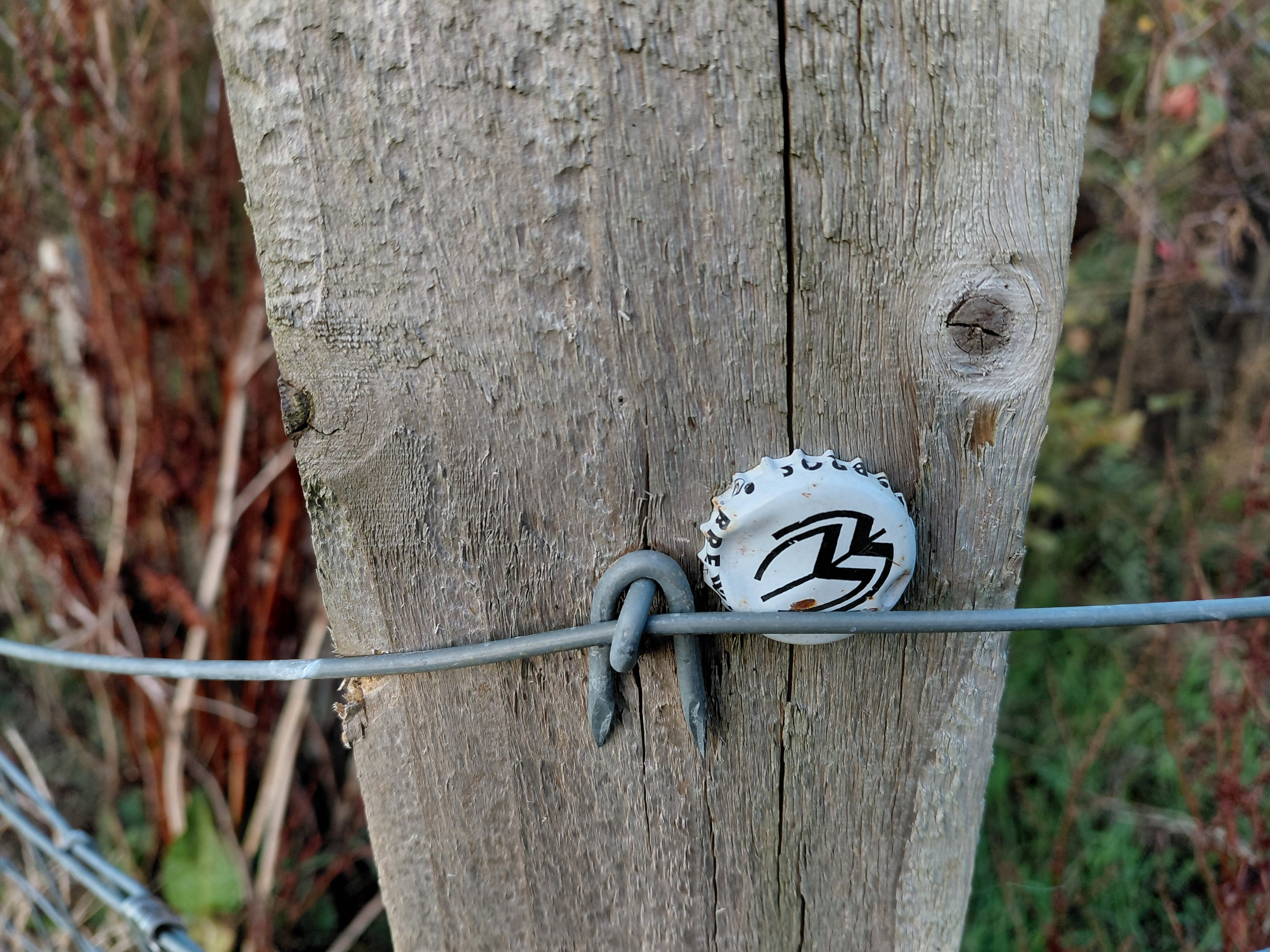
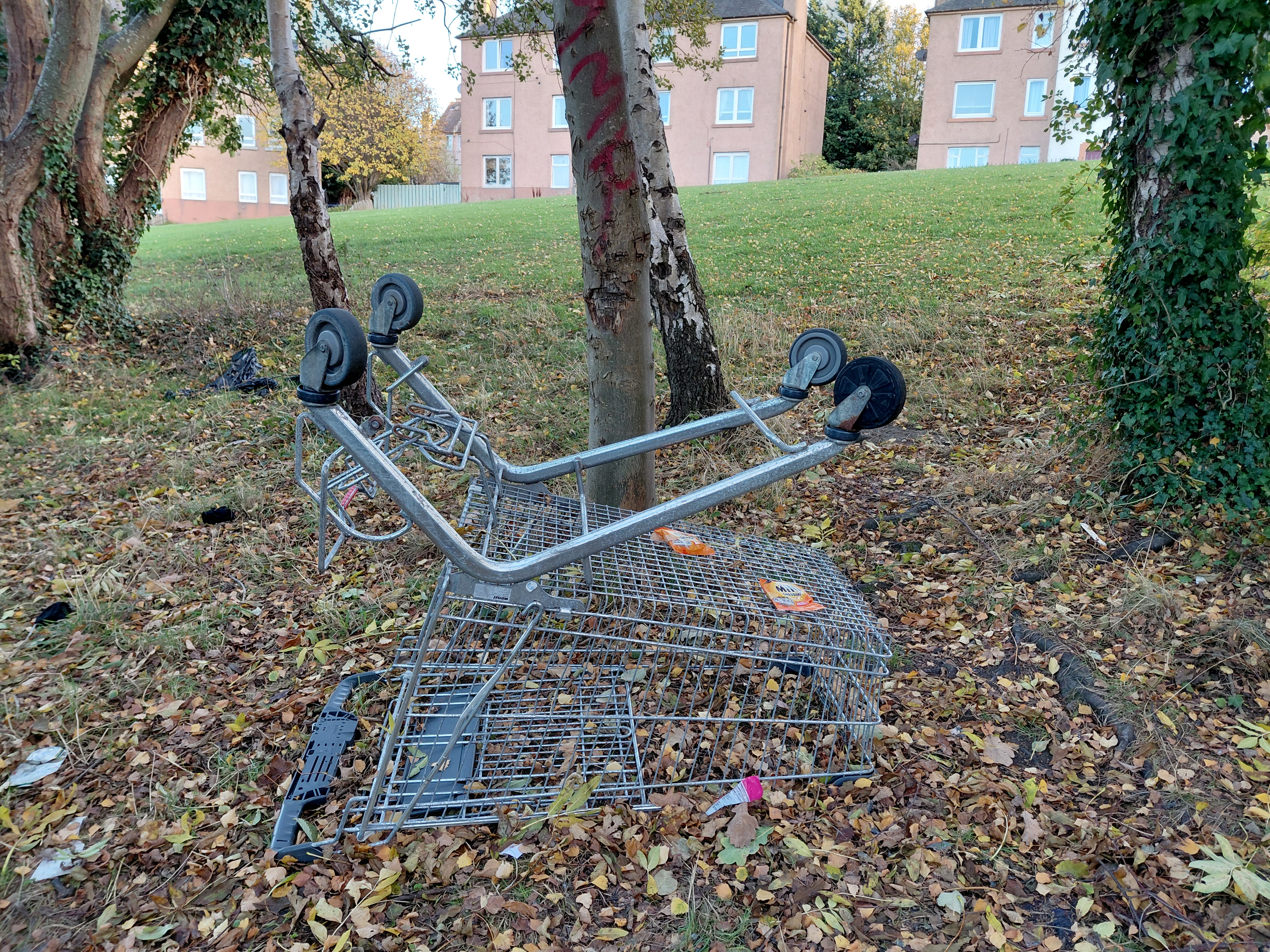
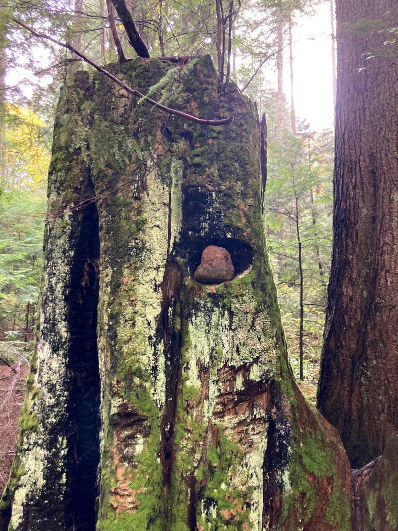
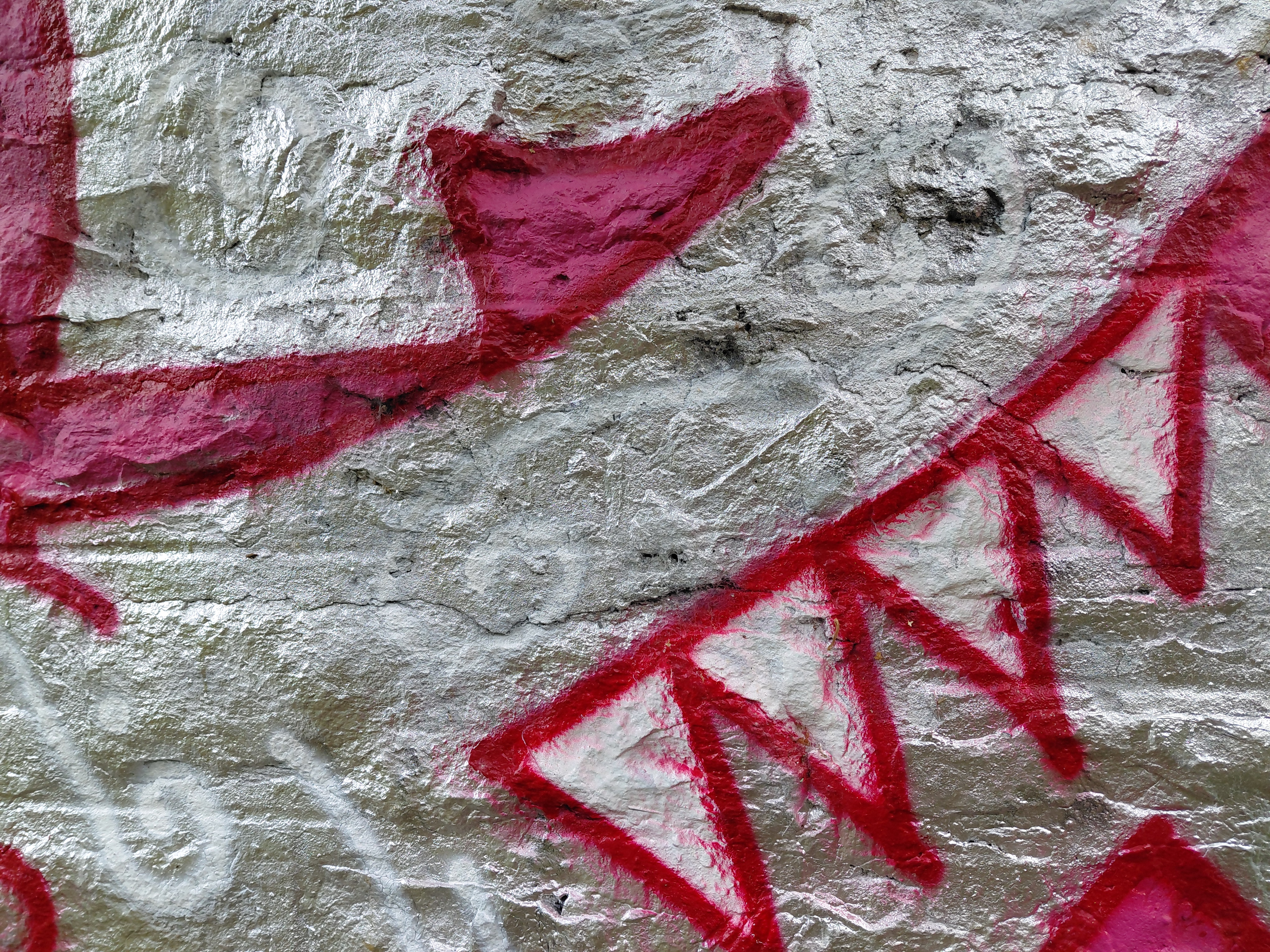
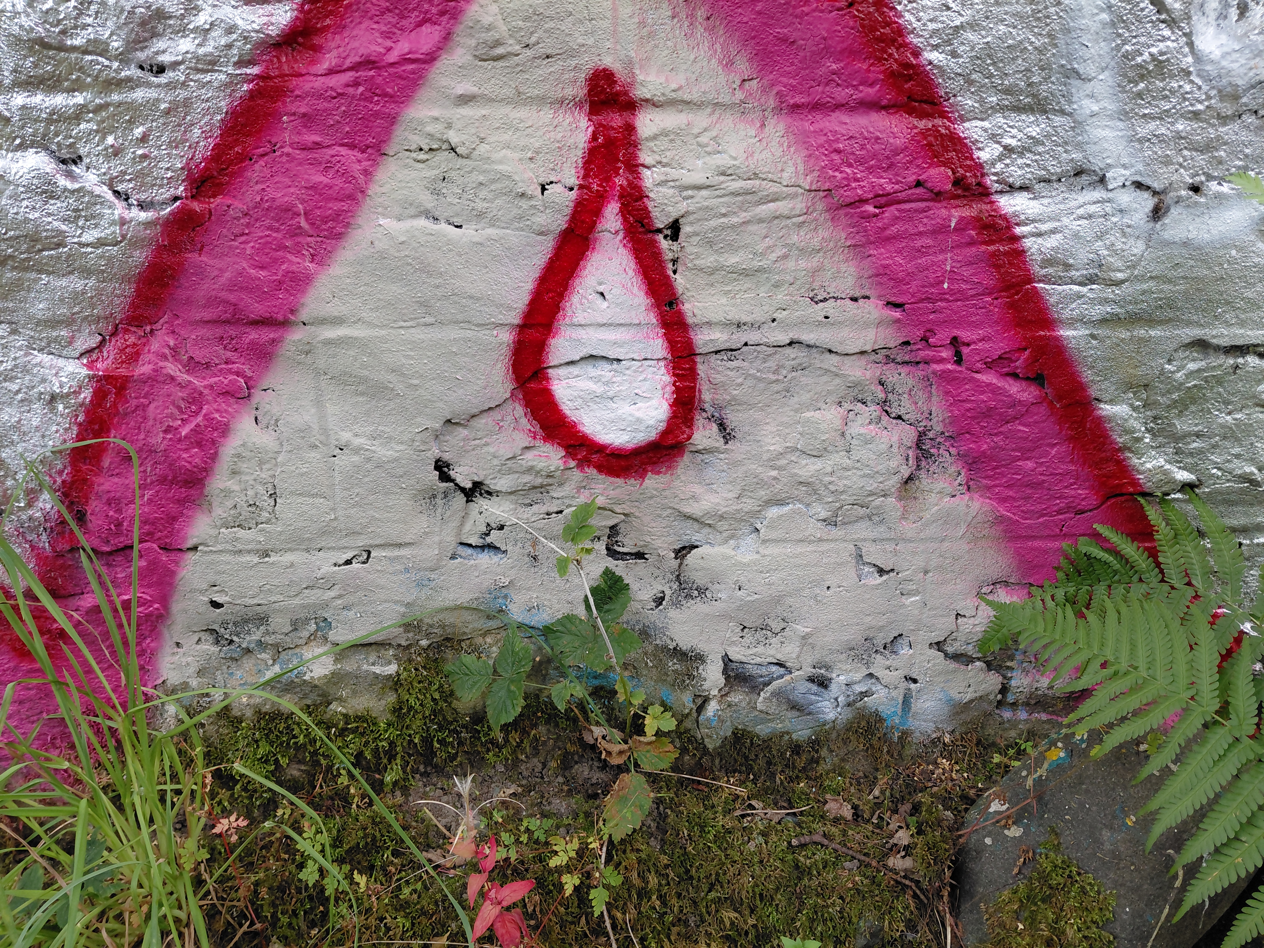
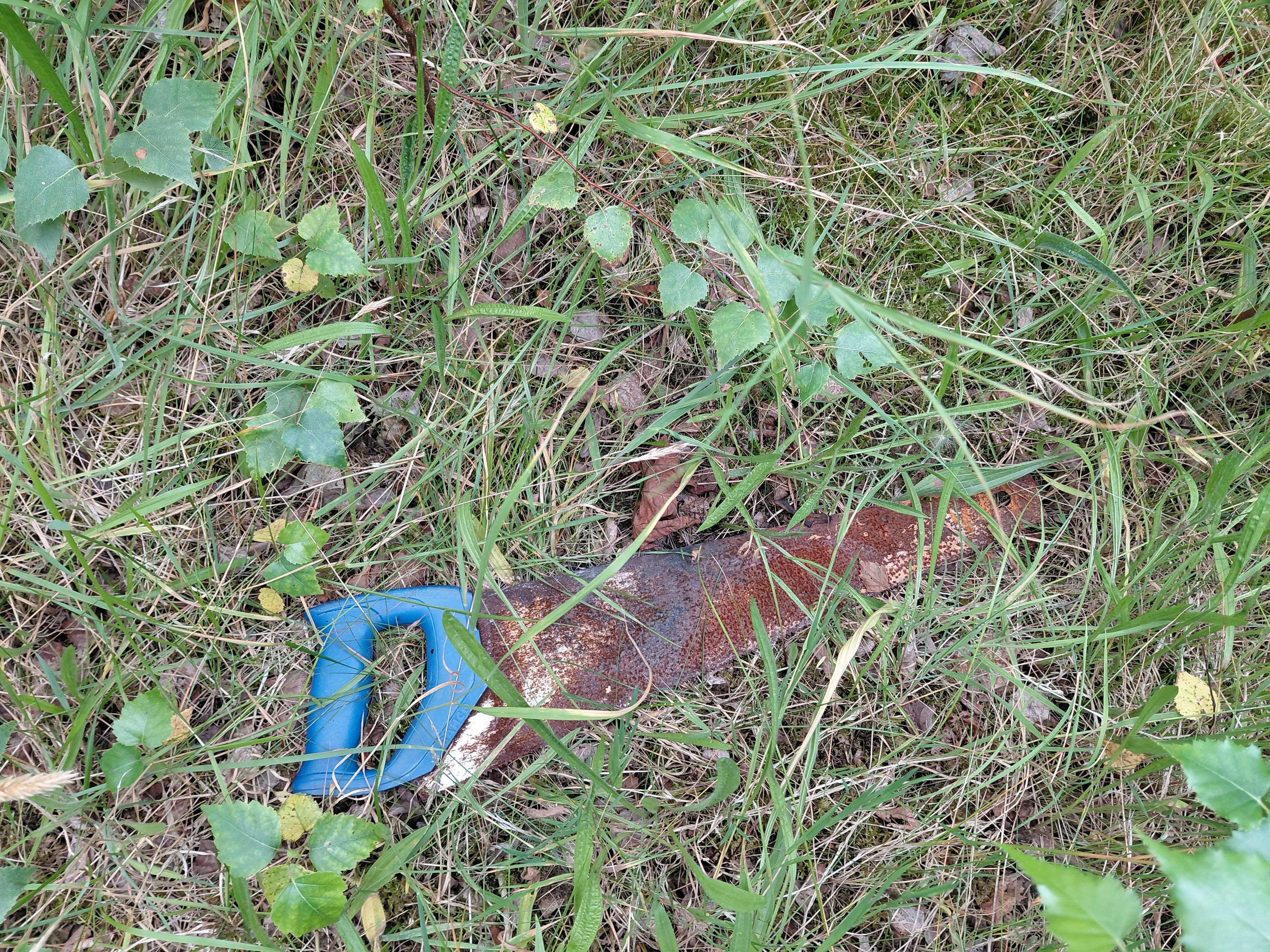
You will see symbols of remembrance, Rowan berries like drops of blood, damaged household items strewn everywhere, indications of brutality, seemingly apt graffiti, what might be a grave and a tombstone, and stumps – trees and metal cut down in their prime. The soundtrack features the cries of a pair of unseen sparrowhawks, quaking poplars, the threatening rumble of a surveillance helicopter, the comments of magpies, and empty silences. (Please note that you may need to turn up the sound on your device.) There are trees which have been wounded including one that was burned, and I spent some time beside it drawing its poor body with some of its own charcoal.
Found saw, Granton, Edinburgh
Finally, I walked into a quiet clearing where butterflies, bees and other insects were alive. There is, as always with living entities, the instinct to continue, to keep on climbing over obstacles, even if you’re a tiny ladybird in a vast place. The natural landscape does renew itself, eventually, and although this is hard won and in no way negates the horror of human conflict, it was a hopeful reminder that these wars will end. Some people, at least, will learn from them, will understand that though they have been wronged, such aggression does not justify attrocity, nor forge positive relationships for the future or bring about the peace for which we all yearn.
For the record: I, in no way condone the attack on Be’eri, the Israeli kibbutz and the killing and capturing of civilians there by Hammas.
I walked this route in 2022 and it is a varied one – urban and rural, located both inland and along the coast. I did so as part of a bigger project, Separation and Unity, in which I walked the landscapes of Scotland and Catalonia finding similarity and difference in their volcanic history and oak woods. I am interested in the human need for both togetherness and sharing, and at the same time a recognition of individuality.
The only Scottish pilgrimage named after a woman, the St Margaret’s Way, is representative of so many women’s stories – there are no waymarkers on the ground and apparently no detailed information online about it.
[These women were] “strong, creative, independent-minded
women who achieved a visibility in their society that led to recognition of sanctity.
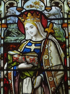
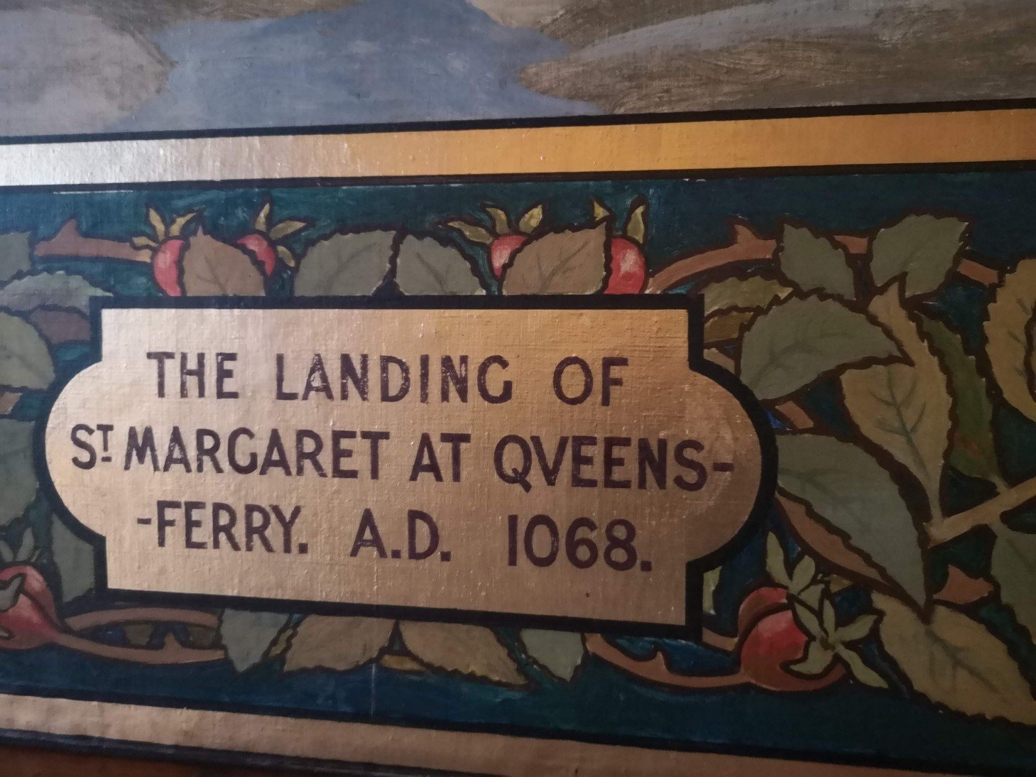
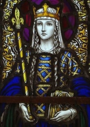
And yet Margaret (c1045-1093) was a Queen. More, she was a highly influential, practical, intelligent and determined woman, who was later sainted, and is almost always described as pious. Someone who was dedicated to serving others, and mother to a queen and three kings (she birthed eight children in total), she was also a Hungarian refugee who must have understood what it was like to arrive on foreign shores after a long boat journey. Devoutly religious (Catholic), she was a pilgrim who launched a ferry service to take walkers across the Firth of Forth, before there were bridges, so they could continue to St Andrews.
St Margaret, Brabourne, Kent, from A Clerk of Oxford blogspot
She was not in charge of her life, you might say [because she was a queen and because of the age in which she lived]…. but she rose above that to become her own woman who would establish monasteries, infrastructure and so on. She would journey from being a potential pawn in power games to becoming a power in her own right, a power for good, a power for the poor…..
Tom Shields, St Fillan’s RC Parish Church Crail
Reading the backstories of female saints, you will find a common theme; how they were wanted by men and often had to go to great lengths to make it clear that they had other feelings and plans for themselves. Margaret was no exception (we are told in the Anglo-Saxon Chronicles): “Then King Malcolm began to desire Edgar’s sister Margaret for his wife, but he and his men all argued against it for a long time, and she herself also refused, and said that she would not have him or anyone, if the divine mercy would grant that she should please the mighty Lord in virginity, with a bodily heart in pure continence in this brief life. The king urged her brother pressingly until he said yes – and indeed he dared not do otherwise, because they had come into the king’s power….though it was against her will” (translation A Clerk of Oxford blogspot ) [It goes on to say that God wanted it this way as she was to go on to “lay aside the sinful customs which that nation previously followed” including influencing the king himself, so it is clear that this was not an altogether unbiased account.]
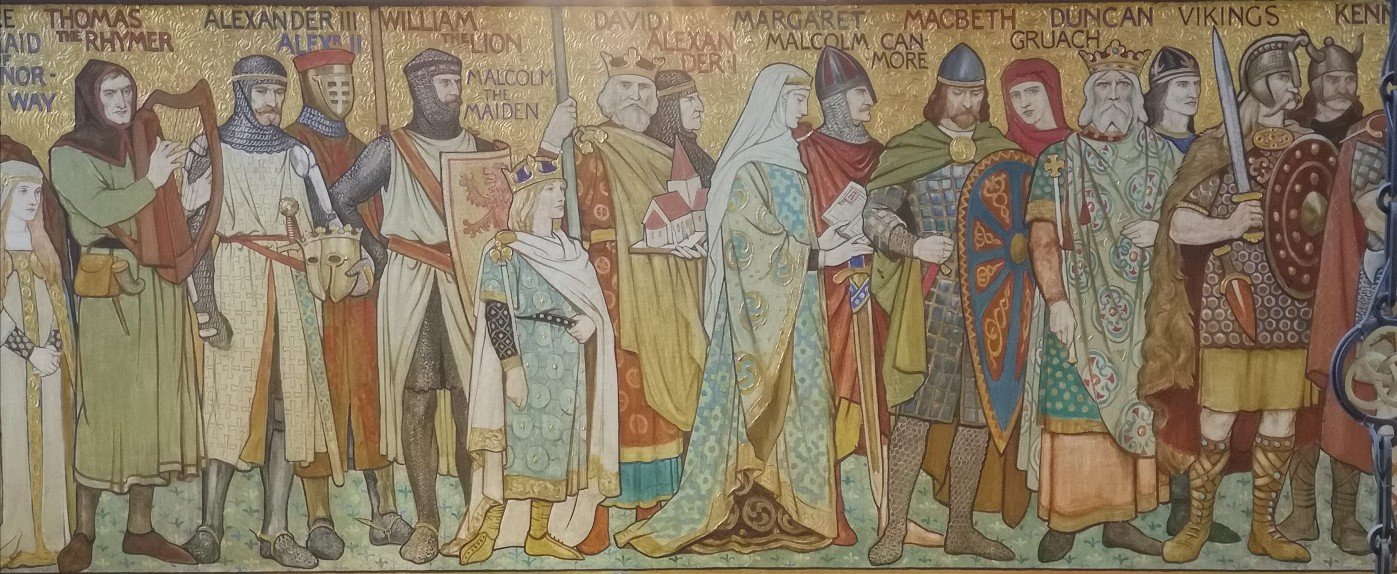
Margaret and Malcolm Canmore, Scottish National Portrait Gallery mural
I am not a religious person, so my interest in Margaret is in her standing as a woman in Medieval society; the kindness she is said to have shown to everyone, including prisoners of war; what is recorded about her relationship with her husband (we are told that he was illiterate and that she read to him); and the role she plays in the history of walking pilgrimage.
a pathway of meditation and devotion
Margaret was exceptionally well read and raised in an environment of enlightened devotion and charity…throughout her life she balanced her charitable and family work with a desire for seclusion and contemplation. Margaret strongly supported devotion to the Celtic saints while also connecting Scotland with the Europe wide development of monasticism.
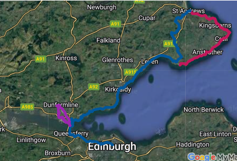
The version of the St Margaret’s Way which I walked is 100kms / 62 miles in length. Here are the stages:
Centre of Edinburgh to South Queensferry between 17km/10.5m-22/13.5 6 hrs
South Queensferry across the old road bridge to Burntisland 20km/12.5-22/13.5 7hrs
Burntisland to East Wemyss
East Wemyss to Earlsferry
Earlsferry to Cameron Reservoir
Cameron Reservoir to St Andrews
The British Pilgrimage Trust St Margaret’s Way map. I walked the blue line
There are a number of maps available and I had difficulty downloading The Way of St Andrews one, so I used the Long Distance Walkers Association (LDWA) which is out of date just now, though soon to be updated.
Before you leave Edinburgh, you may like to visit St Margaret’s Chapel at the Castle, the city’s oldest building (early 12th c), built by her youngest son, David. It is looked after by a Guild, all run by women called Margaret.
St Margaret
The Way of St Andrews website calls this path “a modern restoration of a medieval pilgrimage walk”. The British Pilgrimage Trust offers to email you a version if you fill in their online form, which I recommend. The path is also listed in their hefty and valuable tome Britain’s Pilgrim Places (Nick Mayhew-Smith and Guy Hayward) with a little, basic information.
Strangely, Follow the Camino describes walking the St Margaret’s Way as being in “the footsteps of Scotland’s patron saint, St. Andrew”, and Fiona Diack, too, in Spotted by Locals, notes that it “dates back to the 10th century as a way to honour St Andrew, the patron saint of Scotland”.
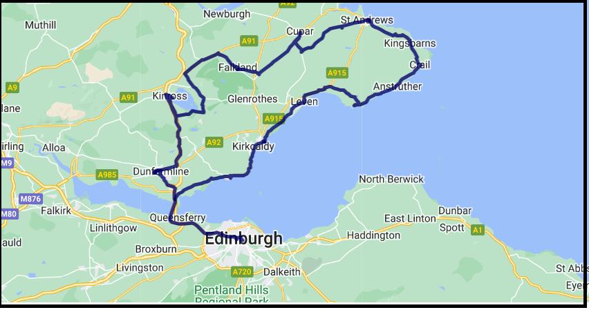
Ian Bradley, in Fife’s Pilgrim Way, cites Hugh Lockhart as devising the route in 2011 (p26), and Donald Smith (author, scholar and instigator of the Storytelling Centre in Edinburgh) as having devised the St Margaret’s Journey, offering “two routes from North Queensferry to St Andrew’s one using the Fife Coastal Path [the one I took] and the other broadly taking the same course as Cameron Black’s St Andrew’s Way.” (p27/28) which I am unfamiliar with.
The St Margaret Pilgrim Journey (link above) – a quite different tour from the route I took
Note: The link on this page (Ways and Trails.co.uk) is out of date.
Pittencrieff Park, Dunfermline, Fife
Cameron Black’s St Andrew’s Way moves through Dunfermline where you can visit St Margaret’s cave; the Roman Catholic Memorial church which bears her name and to where a relic of the saint was returned in 1998, 900 years after her death; and the Benedictine Abbey founded by Margaret. Dunfermline Abbey and the ruins around it are all that remain of that Benedictine Abbey founded by her in the eleventh century. The foundations are under the present nave (or`Old Church`). Outside the east gable is where you can see her shrine, itself a place of pilgrimage since medieval times.
‘that âme d’élite’, the ‘exquisite St Margaret’,
Baker, Derek. “‘A Nursery of Saints’: St Margaret of Scotland Reconsidered.” Studies in Church History Subsidia 1 (1978): 119-141. citing Knowles, MO p 242.
Earlsferry, Fife
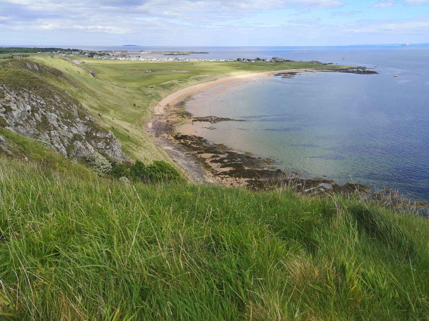
St Andrews was a very popular place to visit. From the south the pilgrims would have come via South Queensferry and then got the boat to Fife. From the south east, pilgrims arrived mainly from the Continent at North Berwick, where they took the ferry to the opposite coast arriving at Earlsferry (the end of my fourth day). From there they continued northwards, cutting off the East Neuk (the site of the continuation of the Fife Coastal Path and St Margaret’s Elbow) and heading directly to the final city.
Looking at St Andrews, Fife
They travelled the last 15 miles on foot to St Andrews along a track the width of “a donkey with two panniers”
This web page has some fun information about St Margaret. Uncover Travel
More information about St Margaret
Early primary texts about St Margaret: the Anglo-Saxon Chronicle‘s account of her marriage contains extracts from the Life of Margaret written for her daughter, by a monk, Turgot, Prior of Durham, between 1100-1107. He knew Margaret and her family well, and wrote that she, “showed herself to be a pearl”. She is now known as The Pearl of Scotland.
Gerda Stevenson reminds us, however, that it was she who was credited with persuading the King, her husband, to ban the use of Scots in favour of English.
I yearned / for the old tongue my mother learned me on her lap, / words that once rose up from deep inside me; / but they’re lost, the well is dry – it’s like a fatal thirst / that can’t be quenched; and I know now why / my mother called her Margaret the Accursed.
from ‘Quines’ by Gerda Stevenson (2018:34)
Whether you like to walk for the pleasure of the activity, the beauty of the landscape, or for religious reasons, the St Margaret’s Way is well worth the time. Please note that Komoot, the walking app, rates it as level: expert.
Walking the St Margaret’s Way
This is an enjoyable route that covers a great deal of the Fife Coastal Path excepting the final ‘day’ stage from Earlsferry to St Andrews (marked ‘Expert’ ) which is tough, especially if you attempt it all in 1 go.
One of many such road side signs
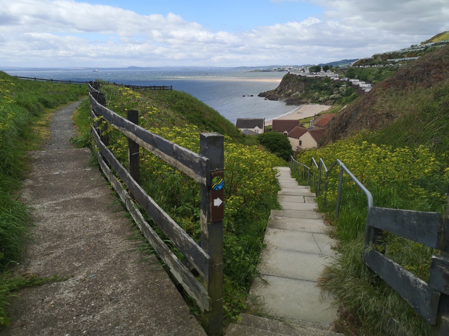
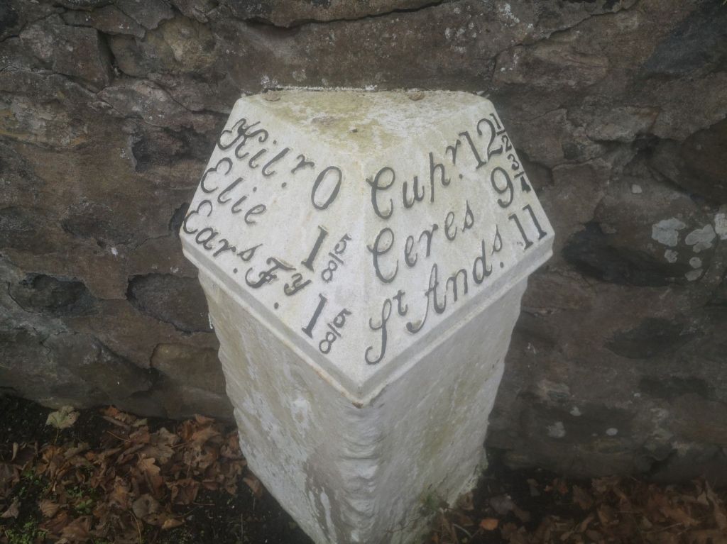
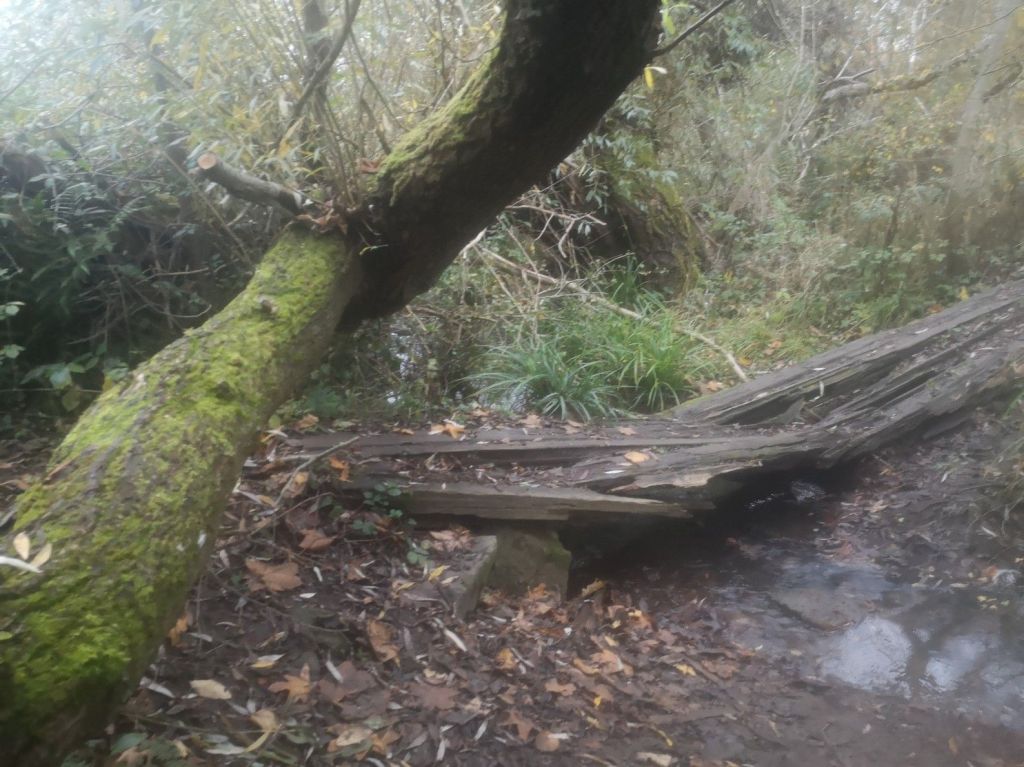
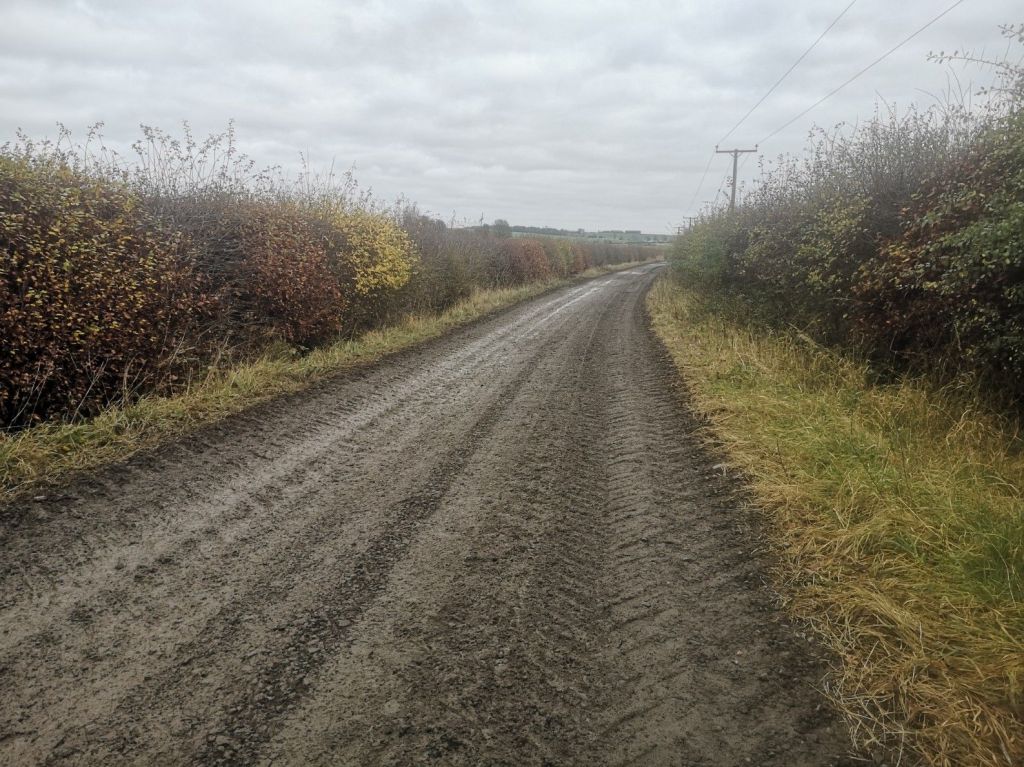
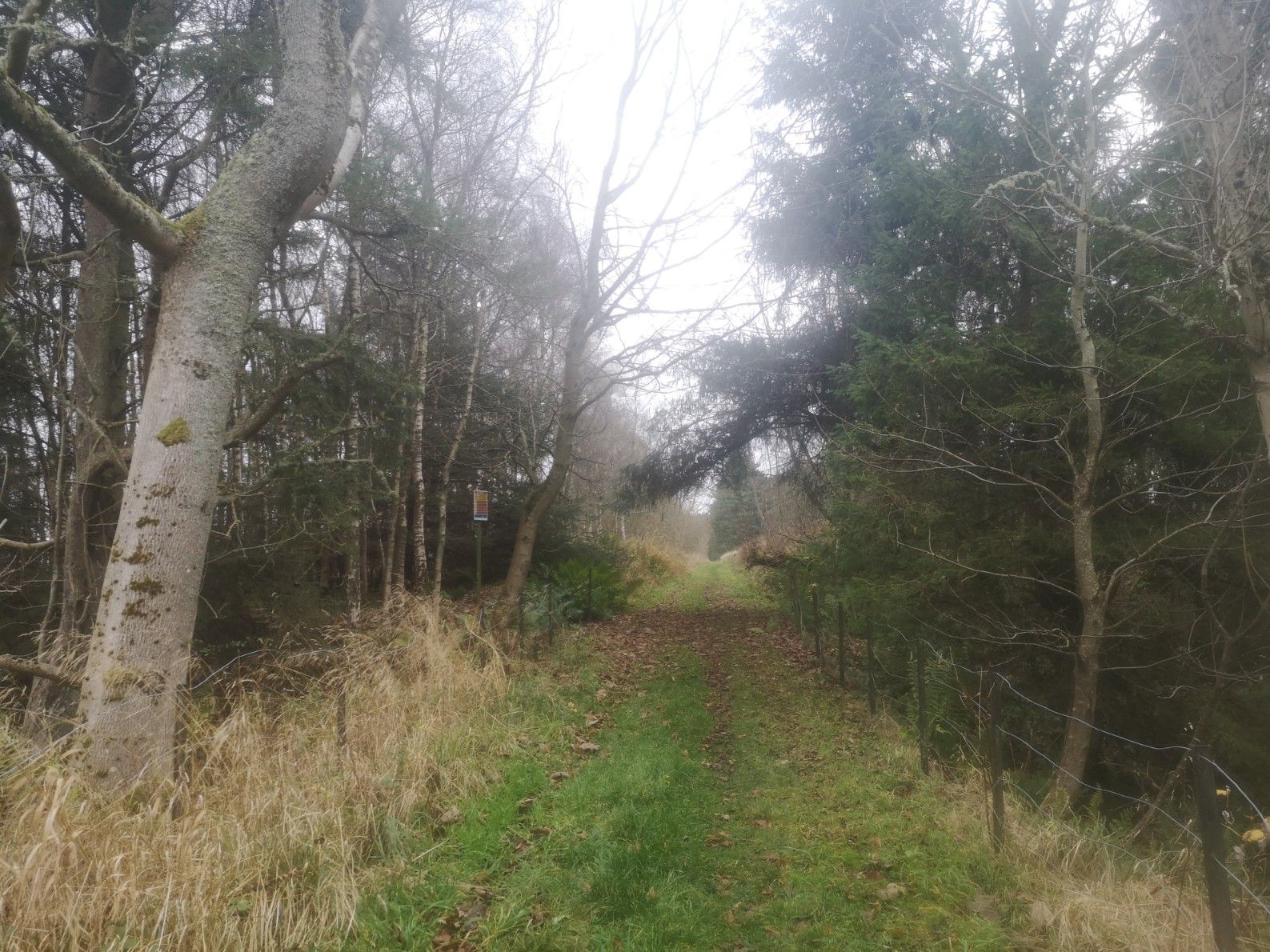
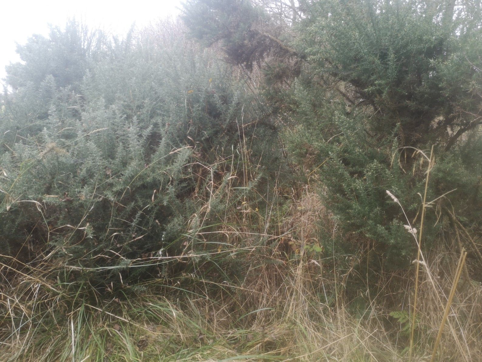
A lot of it is uphill and includes much road walking (there are green verges to avoid cars, but they are not suitable for walking on as there are regular (every 20 paces) ditches across them for water run-off from the road). There is also a long stretch of path which verges on pushing through undergrowth (very prickly gorse which I had to protect myself from, including my head – though I am very short in stature, the bushes are high). This is despite what the Way of St Andrews website says about it having been recently cleared (I walked it in early November 2024). Towards the end, just after the smart Duke’s Golf Course (there are toilets at the main building, very kind staff, and a kit kat cost £2!) and Craigtoun Park, the path is hard to find and the bridge broken, but it’s possible to cross the Cairnsmill burn on stones.
Broken bridge over Cairnsmill Burn
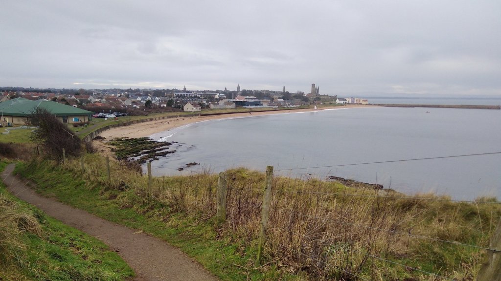
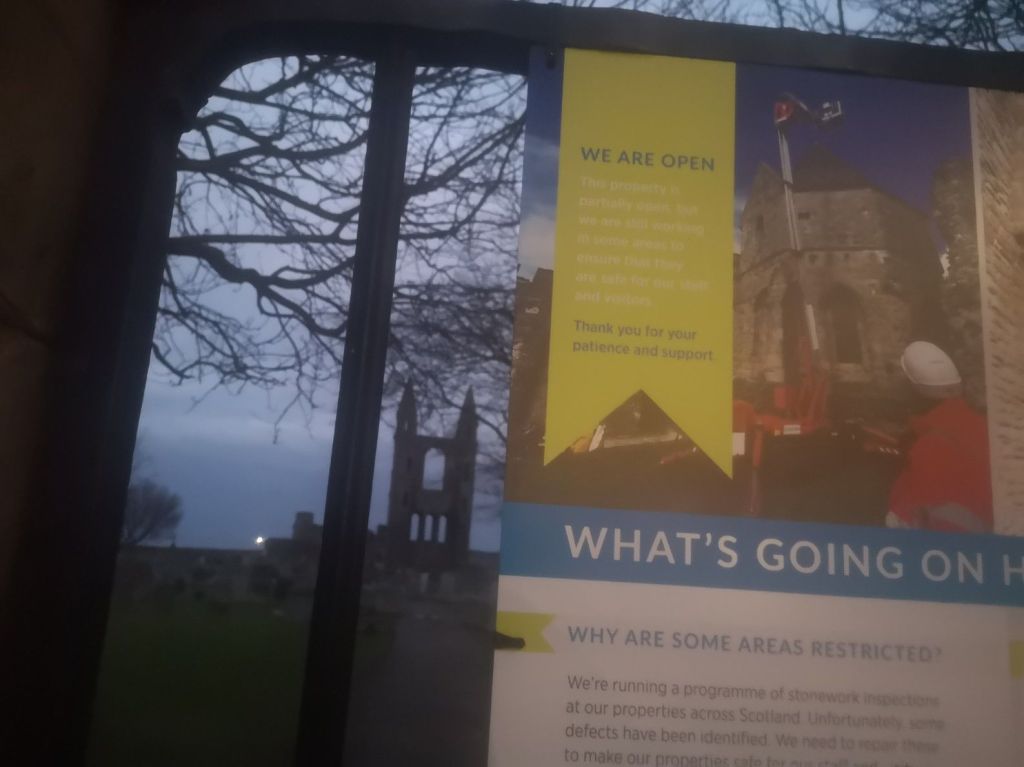
I enjoyed the day very much, though it was a long, tough hike. Due to the time of year I had to watch daylight hours ending at 4.30pm, and because I was coming from Edinburgh by bus (approx. 3 hours) I was only able to start at 9.30am. I got to the end just as the light went out of the sky, arriving in the dark and finding that the Cathedral was closed, so there was no welcoming committee.
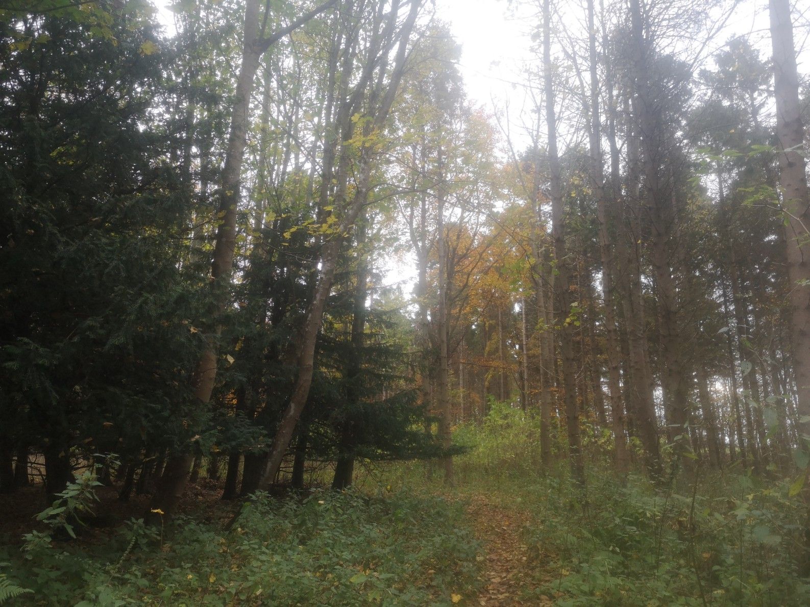
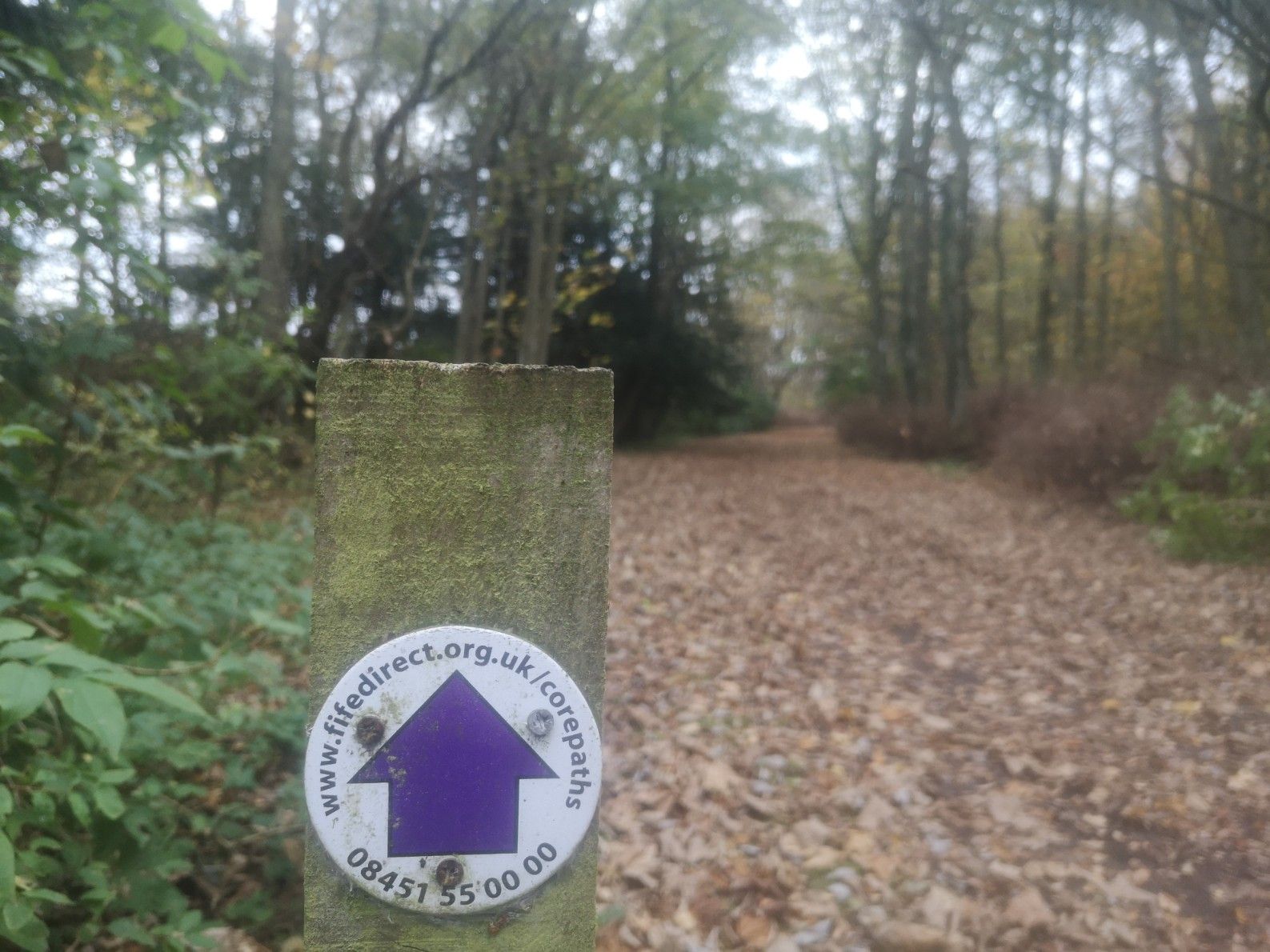
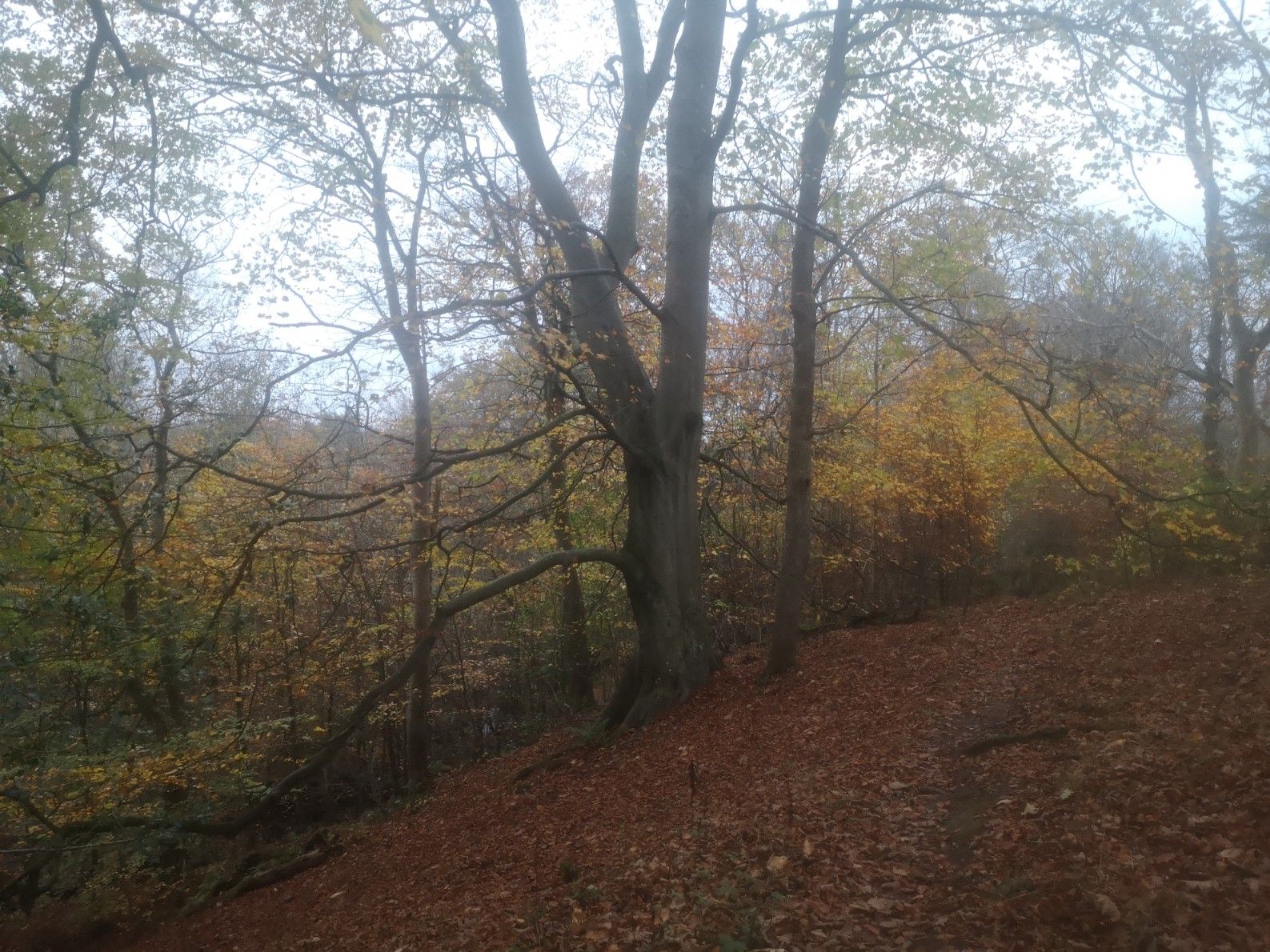
Extremely muddy in places though no rain all day, luckily Gorgeous Autumn colours through the woods Some is waymarked, not many signs Lovely tree slopes when nearly into St Andrews Ideal path for walking A 5 km stretch was hard to find at the start, spiky to push through and overall, hard going
The website says to allow 10 hours. I did it in 8 from the junction between the main road A917 and B941 north of Earlsferry. I walked fast when I could and didn’t get lost too many times!
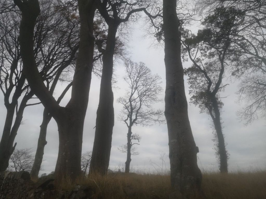
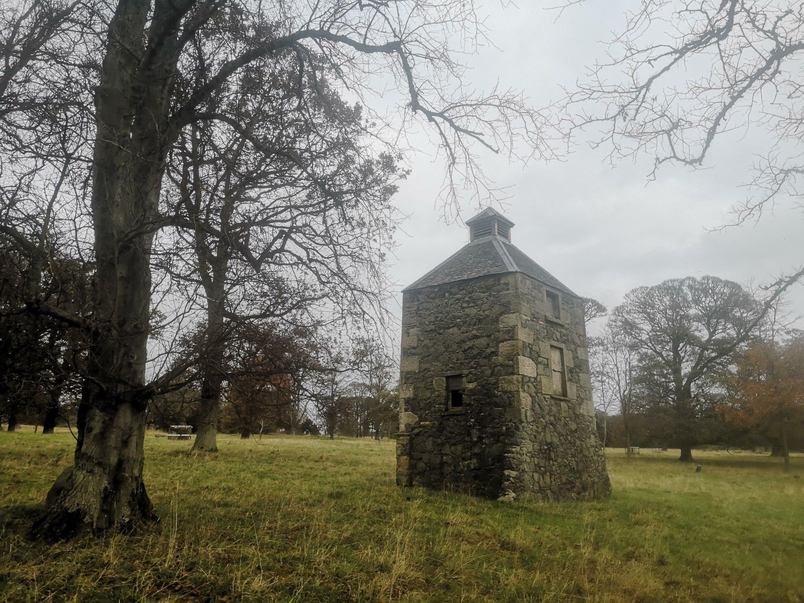
Winter trees against a dull sky, with temperate weather but no windThrough well-kept estate lands with large houses and interesting small buildings scattered around
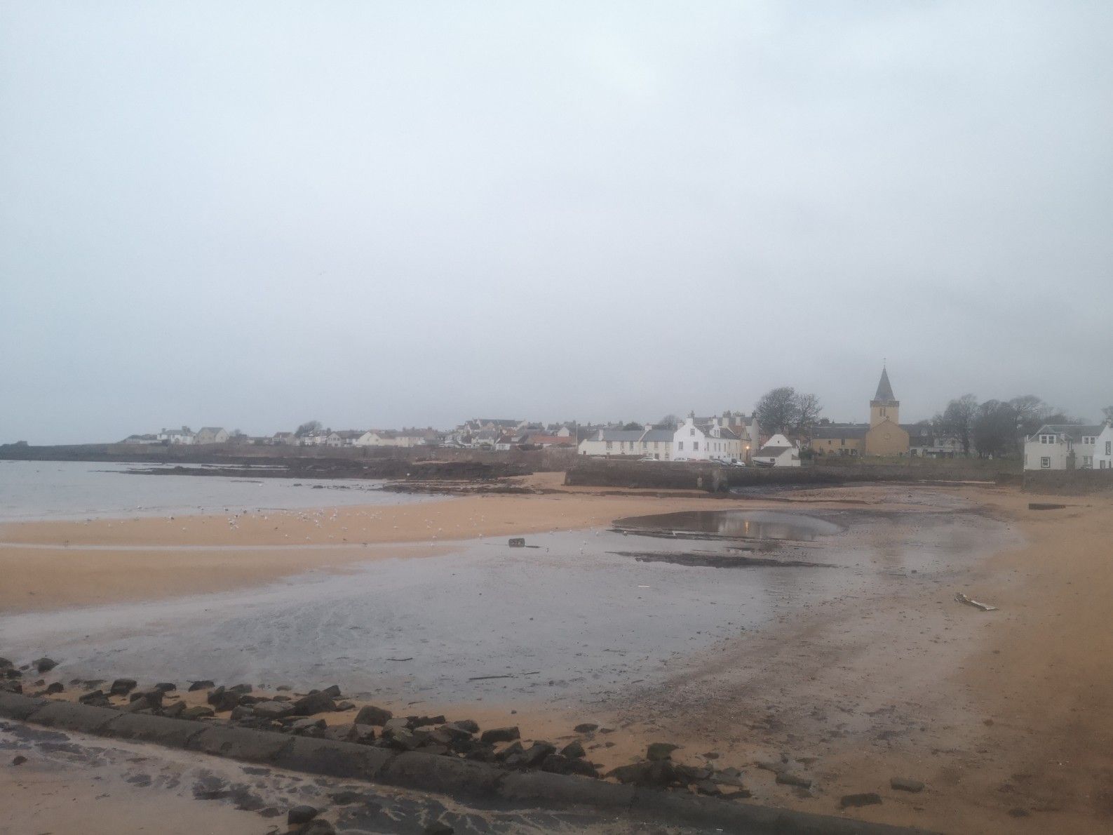
Beware the complete lack of affordable accommodation in St Andrews and expensive drinks and snacks. It’s very attractive, but inhospitable unless you’re rich. There is no hostel as advertised (as far as I could tell), so either expect to pay a lot and book a hotel in advance, or you can take a short bus ride to Anstruther to the Murray Library Hostel there which (in 2024) was really clean with a well-stocked kitchen, lots of heating, comfy sitting room, and friendly staff. Downsides: does not use eco-friendly products, pay £3 for a towel, no soap or products in showers (though generous when I asked), no drying room (tbc), nor dorm bedside lights or bed curtains. Cost £26. Does not include breakfast, but there are lots of cafés and 2 fish and chip restaurants (Wee Chippy is good, not cheap).
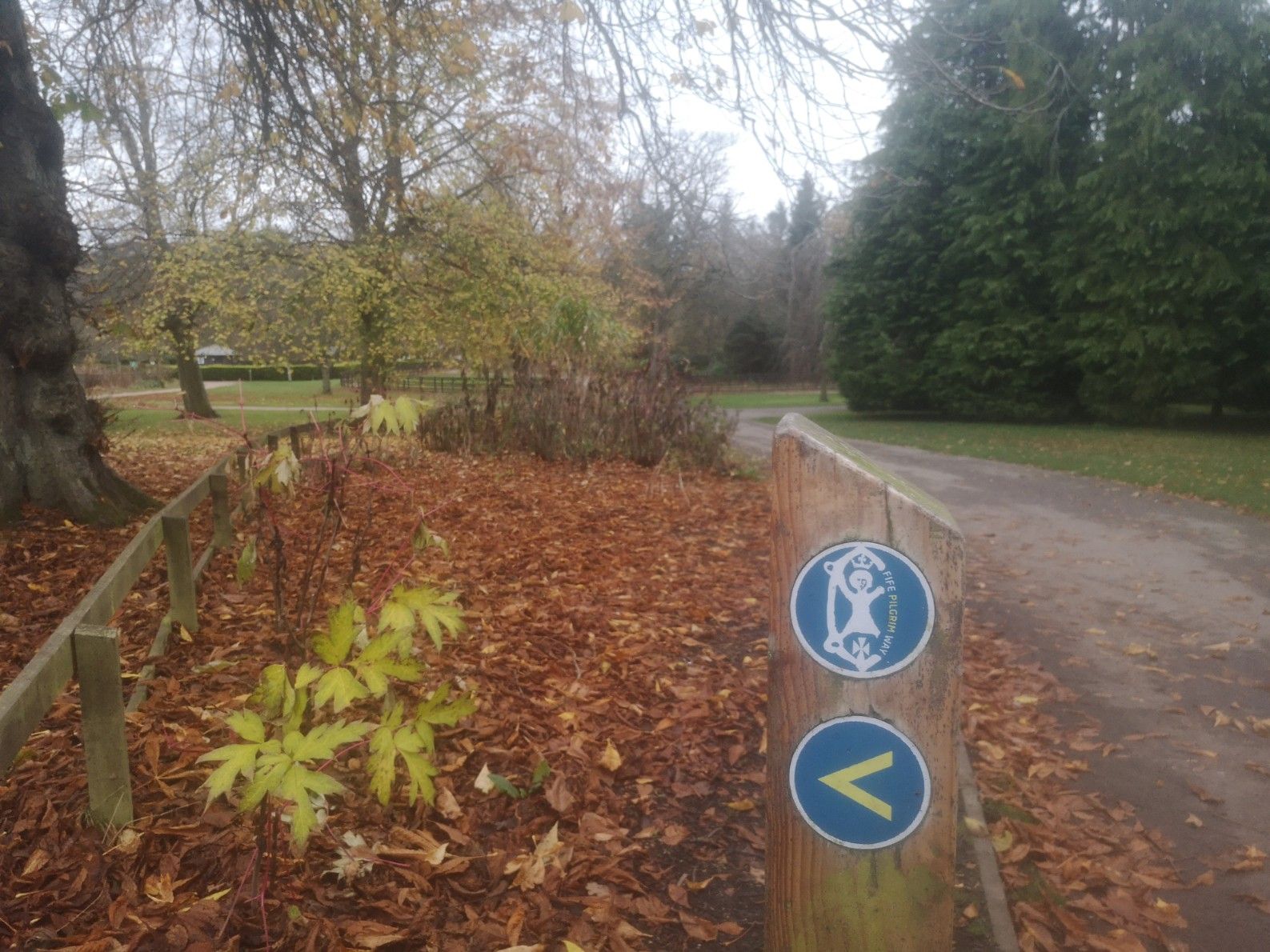
Joining the Fife Pilgrims Way through the Craigtoun Park The ruined Cathedral of St Andrews is the end point, closed when I arrived Murray Library Hostel kitchen, Anstruther Murray Library Hostel sitting room, Anstruther Beautiful Anstruther (on the St Margaret’s Way elbow or Fife Coastal Path) beach opposite the Murray Library Hostel
I would recommend you take a tent and a friend(s), divide the last stage into 2 days, and take it leisurely in the summer!
Have you already walked the St Margaret’s Way? Please do leave a comment below as I’d love to hear from you.