
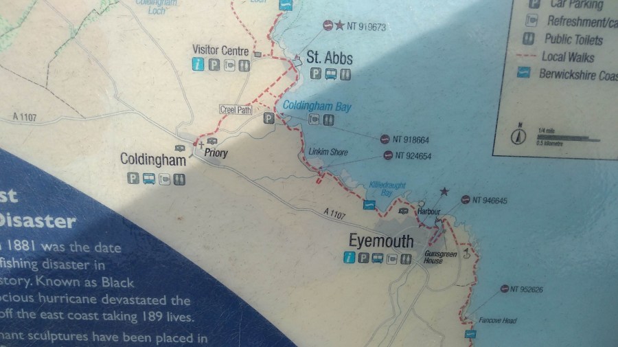
I took the bus from Edinburgh to Eyemouth where I ended the previous stage of the Berwickshire Coastal Path (BCP). From there I walked to St Abbs (6 km, 3.5 miles) going north east wards, and on to St Abbs Head and the lighthouse. Then I hiked back again to get the bus! (The village of Coldingham is 1.5 miles inland). More practicalities are at the end of the blog.
The Journey
As I left Edinburgh (on the 253 bus at 8am), almost everyone else was going to Monday morning work. There were four of us heading eastwards: a cyclist and three walkers including a second solo woman who was consumately prepared (that was when I realised I had left my pole at home!) She was doing walking the BCP over 2 days, for the second time.
Everyone was reading books rather than their phones as we passed through the pretty town of Haddington where children were making their way to school. Even before we drove into Dunbar, the odour from the Belhaven Brewery assailed my nostrils!
The others alighted in the sun at Cockburnspath, near the wee round-towered church, technically the start of the Berwickshire Coastal Path (BCP). I went on to Eyemouth and wondered why I was doing it backwards. It seems to be a habit of mine: reading the Sunday paper from the back to front; starting the Via de la Plata in Santiago de Compostella (rather than in Seville which I did later). What does that say about my personality?
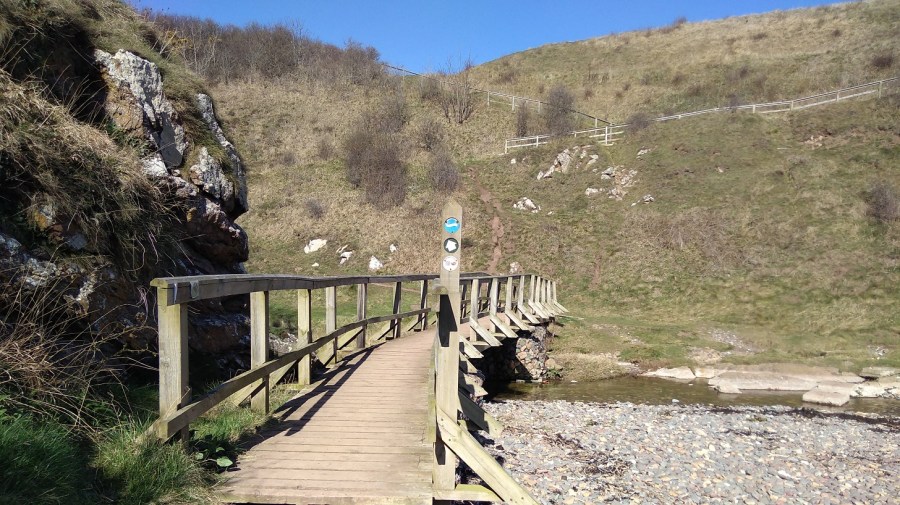
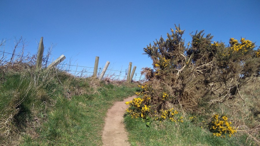
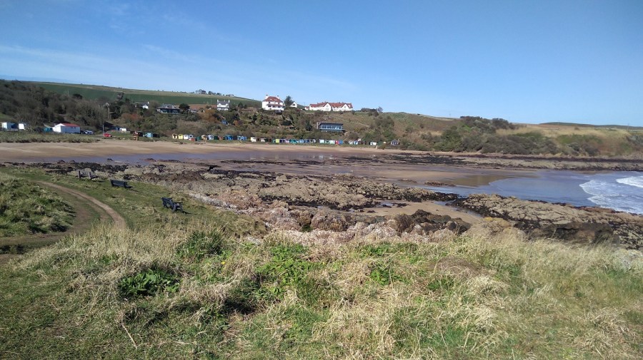
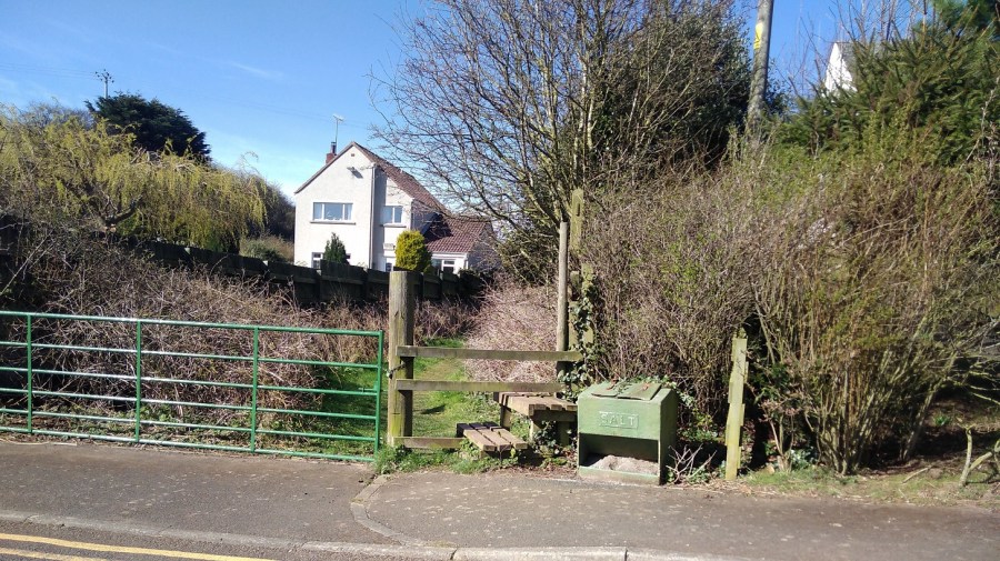
Note to those who might want to do this: leaving Eyemouth (10.05am), be careful not to walk along the road as it is a dead end. Instead, go across the sands to the steps and up there are BCP signs. On the beach it was ever so warm, whereas at the top I needed a hat and a hood to keep out the gusts.
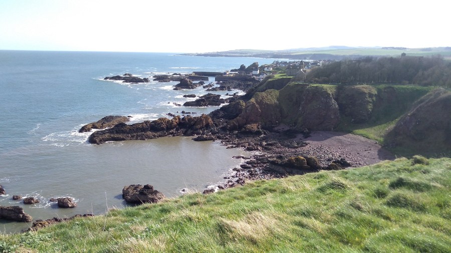
Eyemouth to Coldingham
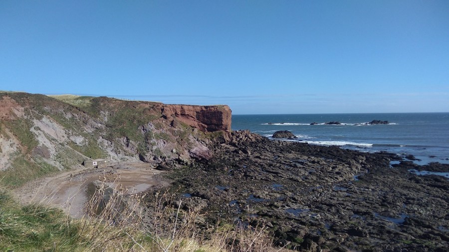
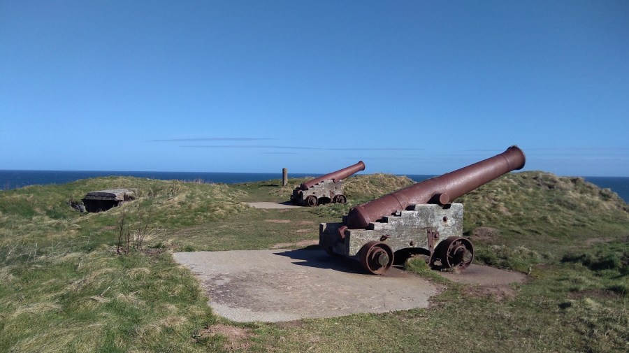
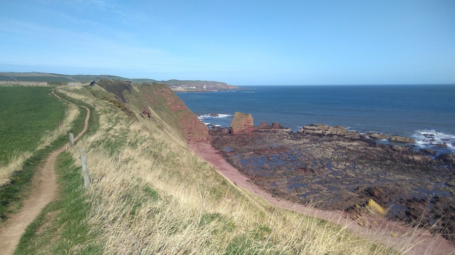
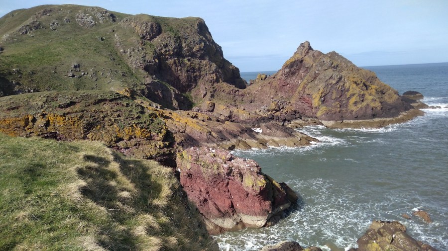
I visited the site of two forts: one English (1547) and the other French (1557), neither of which survived due to changes to the Crown of the day. Guns mark their existence now, facing out to foreign lands – a sign of outmoded protectionism, sadly very present in current foreign policy.
I inhaled the smell of brine and sun-warmed turf. The woman walking in the other direction had a north English accent and needed sunglasses it was so bright. We both turned and looked up at the tuneful sound and when I asked her if she knew what it was she said, ‘a type of skyark, I only do generic when it comes to birds.’
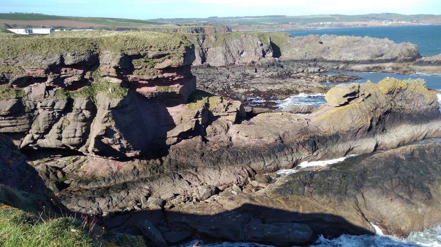
Immediately there is a caravan park which was inhabited: a black labrador sitting patiently by the door; a woman inside with her hat on. There were daffodils lining the fence and Danger signs (people do disregard these and have serious accidents). Not much further along were lots of memorials – benches, bunches of dead or pretend flowers, and moving inscriptions, perhaps to those whose ashes had been taken by the wind out to sea.
Further along was a camper van and a coachload of German tourists, but they didn’t stray far – just had a quick look and then left. Of course there were dog walkers here too, close to the road where they could get easy access. One small hound barked vociferously at me and his owner said it was the rucksacks which set him off!
The wind was so strong that it moved my camera as I pointed it.
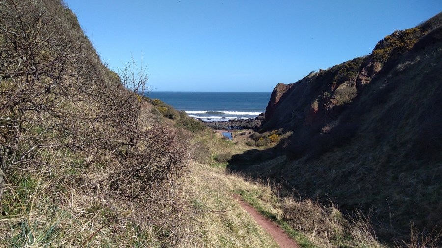
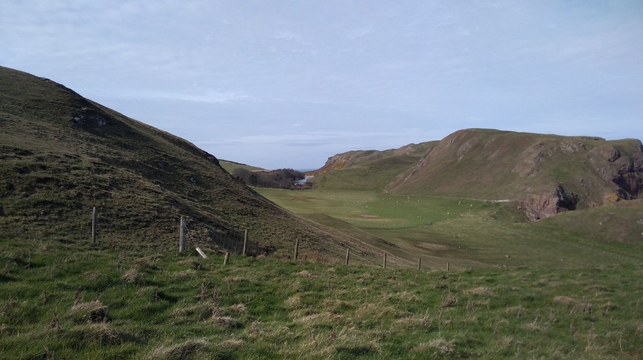
You could easily miss the tiny sign at the top of an orangy-red clay track to the right, but I had watched a hiker ahead of me turn down, so I knew to look out for it.
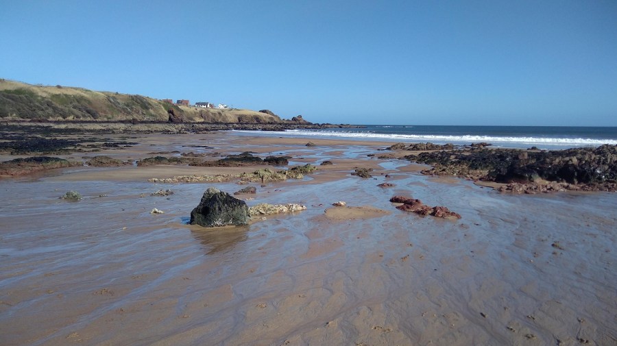
Just ahead is the sign that you are not advised to take to ‘Coldingham via Fleurs Farm’. There was a woman beachcombing at the next cove which was full of smelly seasweed.
There were violets by the path and the merest hint of primrose scent, taking me back to my childhood when we used to pick them at St Julian’s (Sevenoaks, Kent). Can I pick wildflowers in Britain? Technically yes if you don’t uproot them or take them from an area of Outstanding Natural Beauty, but think carefully first – they don’t last in a vase and do look ever so good in their native surroundings.
The wildflowers were all yellow here (the photo was not good enough to use): celandine, dandelion, daffoldils and gorse.
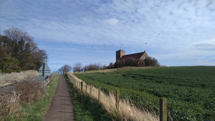
Coldingham
Here I saw my first bluebells of 2019 as I climbed very steeply up behind the beach huts and past the bed and breakfast (now a private house) where I stayed for my birthday with Lesley a few years ago.
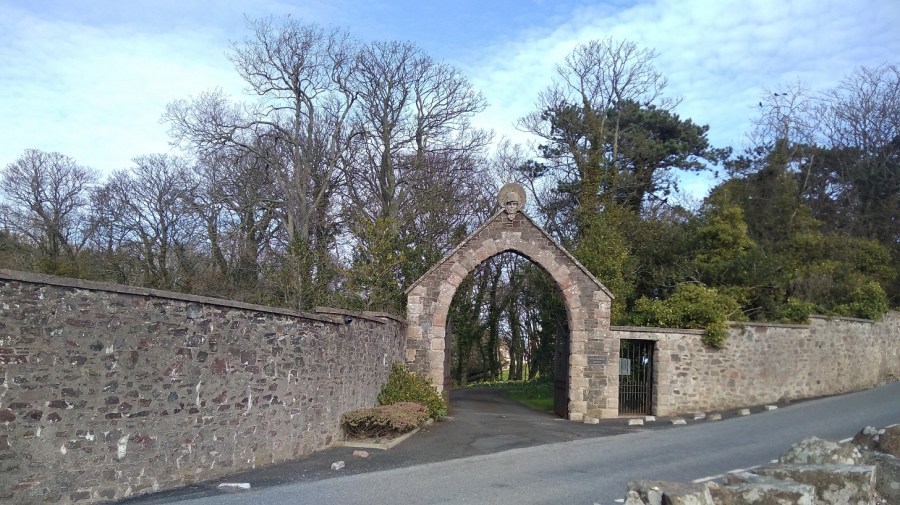
At the T junction, the signs point left to Coldingham which this time I did not visit and I therefore missed the Coldingham Priory which was a Benedictine Abbey. There has been Christian worship on the site for over a thousand years and the present Priory Church building includes walls dated to around 1200. The Priory was founded in 1098 by Edgar, King of Scots, son of Queen Margaret (later Saint M) and Malcolm III, after recovering his kingdom from Donald Bane, his uncle, who had usurped it at his father’s death.
The first monastic community consisted of thirty Benedictine monks from Durham until 1590. The original Church, built in Edgar’s time, was destroyed by King John of England in 1216, but was replaced by a greater and more magnificent one, which in turn was largely destroyed in 1545 during the great raid of the Earl of Hertford, which brought ruin also to the abbeys of Kelso, Dryburgh and Melrose. The choir, however, though further damaged by the forces of Oliver Cromwell in 1650, survives and constitutes the present Priory Church.
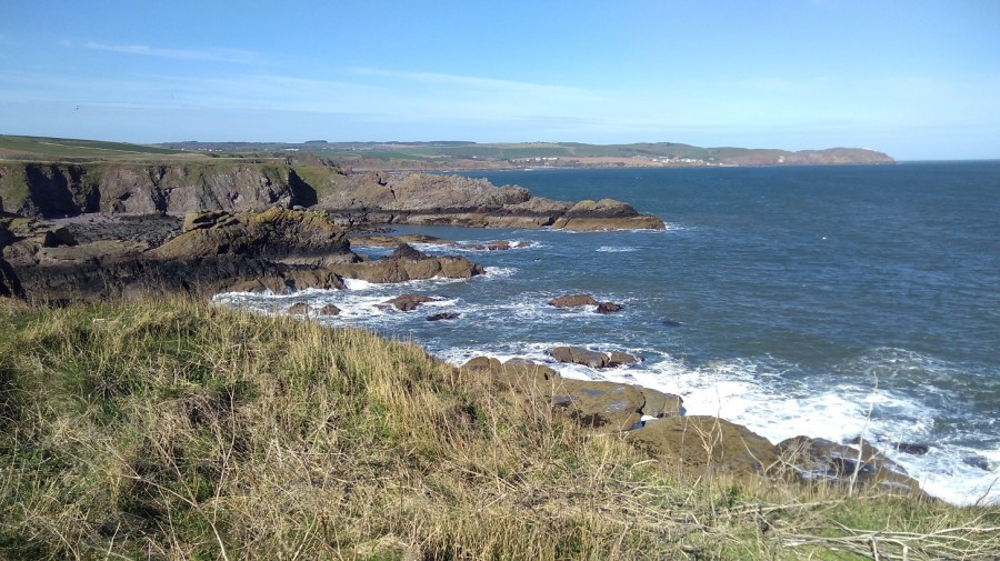
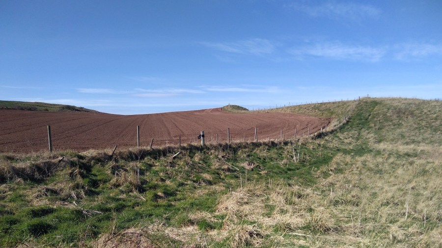
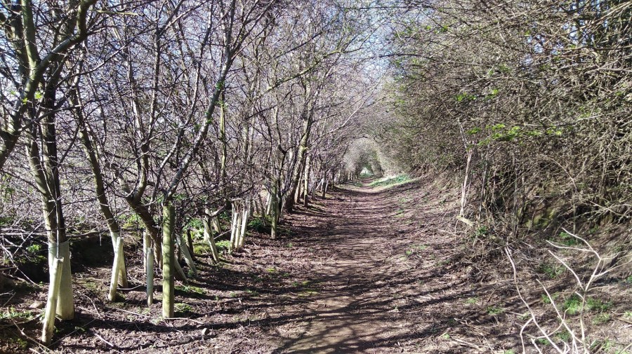
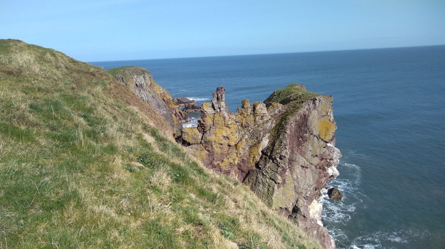
I passed two other signs indicating that I could have taken earlier ways, but I was pleased to have walked along the famous Creel Path. It is so called because the fishermen used to carry their creels (lobster pots) along here to the beach in days gone by.
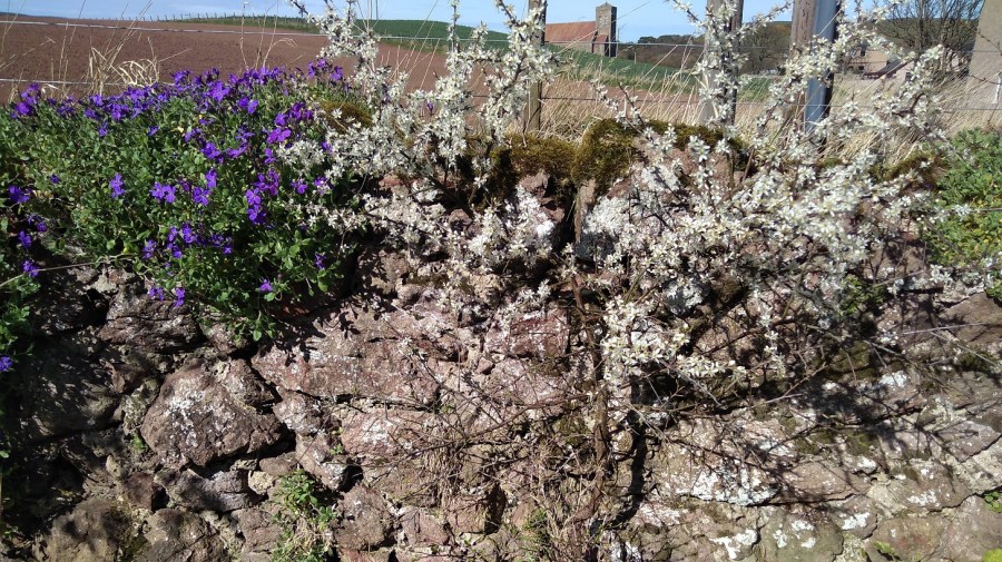
Earlier I spotted the old, brown seed heads of tansy and teasle, but here in the warmth that came off the earth were haphazard flies and in sheltered corners there were the new season’s flowers. What a welcome, bright sight they were attracting the first butterfly I had seen after the long winter. I was about to come across primula and pansies, even white garlic flowers on top of juicy wild garlic stalks. That confirms it, I thought to myself, no argument, Spring is here!
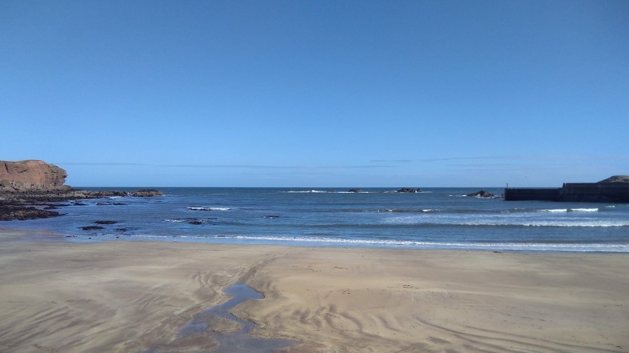
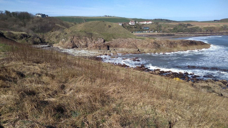
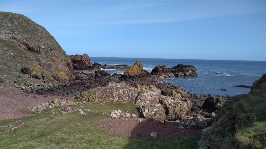
St Abbs
On entry down the hill, there was white washing fluttering in the breeze and a restaurant and visitor centre, both shut of course on account of the time of year.
Through the harbour and up the other side, to my delight however, was an old school building with an open cafe. I had a picnic with me, but can never seem to resist a hot cup of tea. The baking (avocado and courgette gluten free cake) was excellent and the staff were all kindness – initially organising a chair and table outside for me and then adding a cosy blanket for warmth. By the way, you can also buy a very pretty, homemade pink magic wand for £3.50 too!
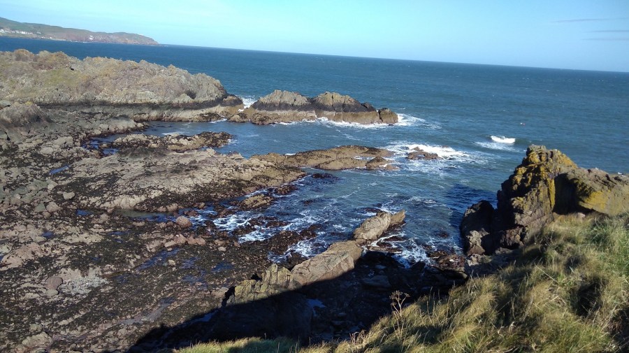
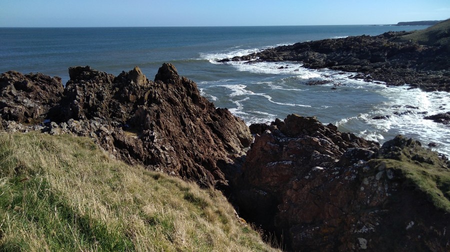
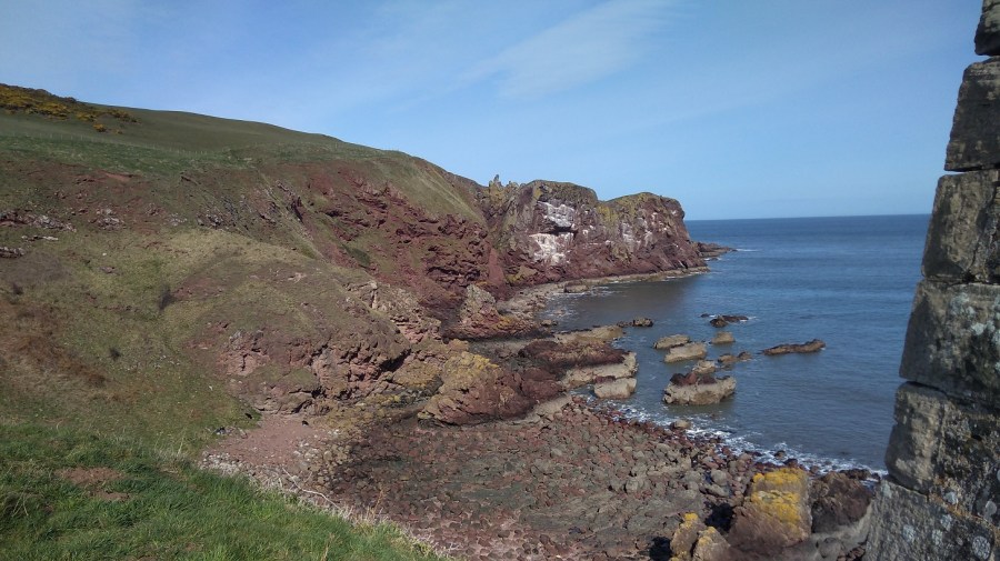
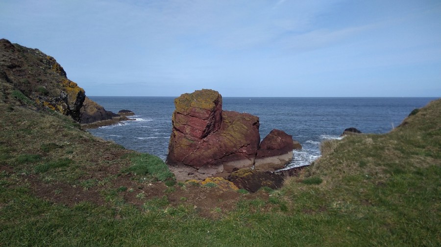
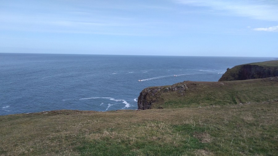
After a break and refreshments in the sun (with wi-fi), I continued along the road and then entered the protected Nature Reserve to the St Abbs lighthouse at St Abbs Head. where I have walked many times before.
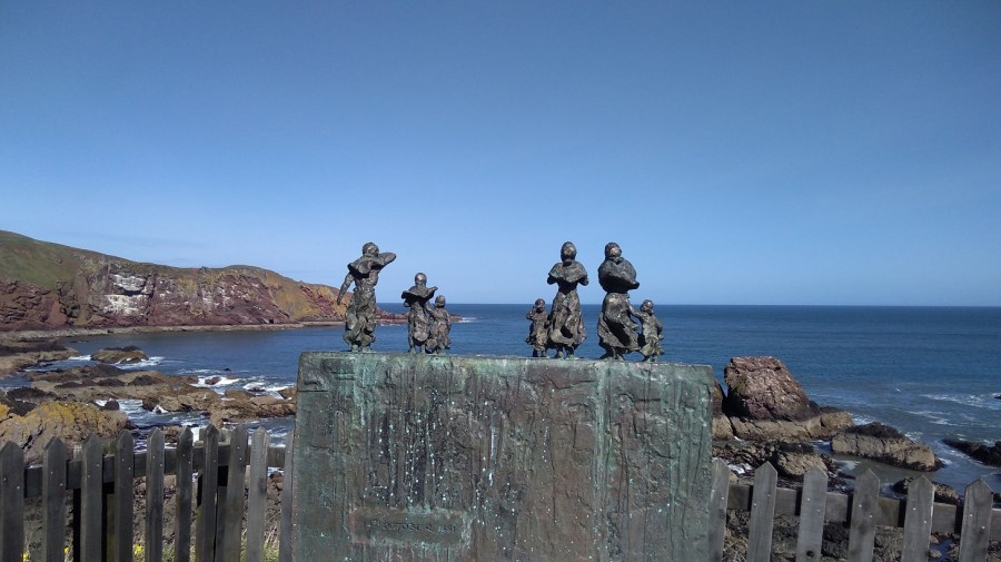
These small bronze figures are the wives and children of Charles Purves and brothers William and James Thorburn who were lost in the great storm of 1881 when 189 fishermen lost their lives. The harbour does not belong to the Council but to the local people via the Community Council and a Trust. There is an important Lifeboat Station here, privately funded and independent.
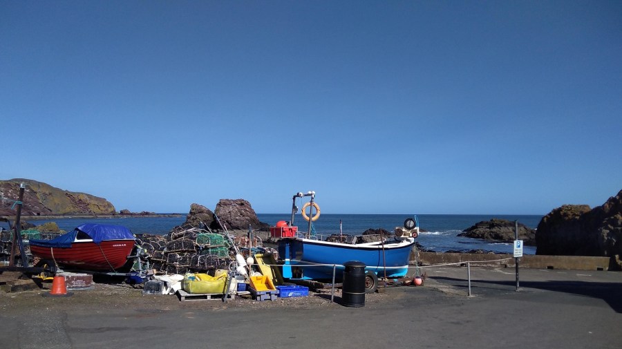
St Abbs with its super clear waters is a favourite place for scuba divers, including beginners. For details of the new bunkhouse, see below.
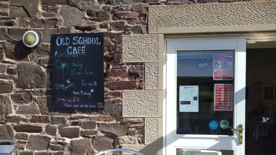
The cafe is named after Ebba (Ebbe), ‘Mother of Northumbria’, so the signs in the Ebba Centre told me. She was born c. 615 AD, daughter of Aethelfrith the first king of Northumbria and in 643 AD she founded a nunnery nearby which predates the priory mentioned above. Later she was made a saint.
I spent ages admiring the gliding birds with blanched tips to their tail feathers – they seemed effortless. Many were perched on the rocks like tiny pearls in an invisible hairnet. Apart from the bumble bee, everything here was white: feathers and wool, gulls chests, and the foamy most-white of the waves between the rocks.
I was reading about Sarah Marquis, a very experienced walker who could smell water when she was hiking in Australia. I believe I could smell the grass happily growing in the sun after being dormant for so long.
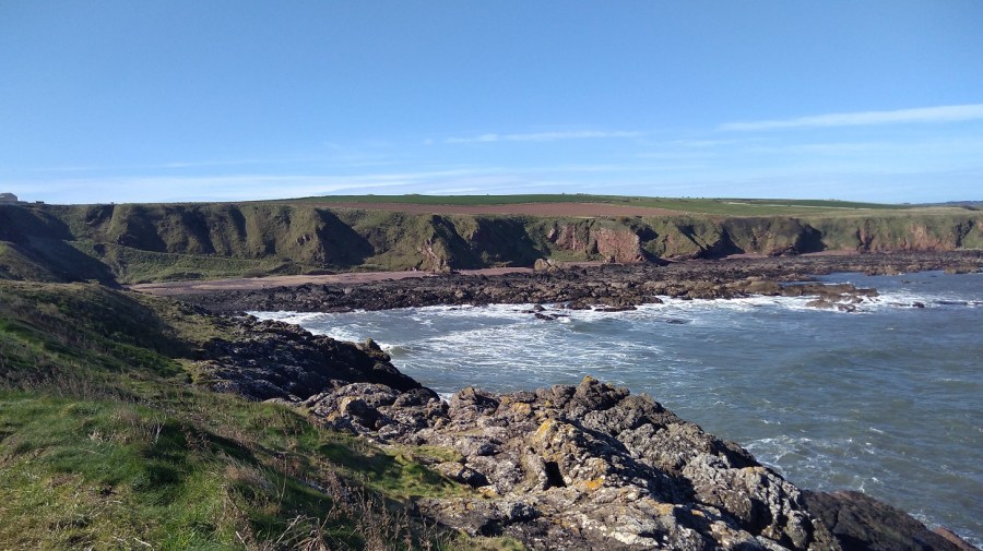
The path took me around and behind hillocks on the way, but I went up and over them on my return. Once I caught myself avoiding looking – the grandeur of the views, the colours – as if I didn’t know what to do with them they were so wonderful.
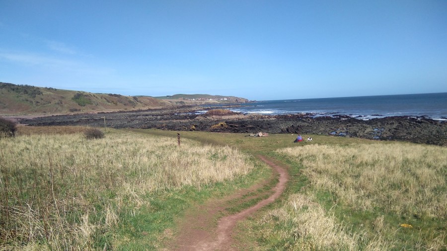
Going back I wasn’t the only one out on this beautiful afternoon – I discovered it is quite a busy stretch.
Gentle paths curve through the spring-green grass, undulating with the landscape – there is some good climbing to strengthen your thighs!
You can spot the Northern Brown Argus butterfly according to the sign, and it’s a bird watchers paradise (guillemots and razorbills, shags and cormorants amongs others). I watched a starling with its petrol green head, perched on a fencepost, feathers disrupted as the wind attempted to dislodge it.
St Abbs Lighthouse
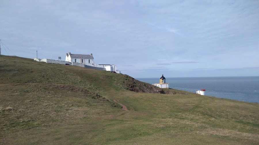
68 Metres above sea level, the lighthouse was built by David and Thomas Stevenson. It is automated now, remotely monitored, so there is no lighthouse keeper. It flashes white every 10 seconds to warn sailors of the rocks below.
My walking future was ahead of me: a tarmaced road between knolls, jagged rocks and chiselled cliffs; the power station with a polluting cloud coming out of its tallest chimney; Berwick Law (a little hill all on its own near North Berwick); Bass Rock (an island off that coast); and Edinburgh beyond.
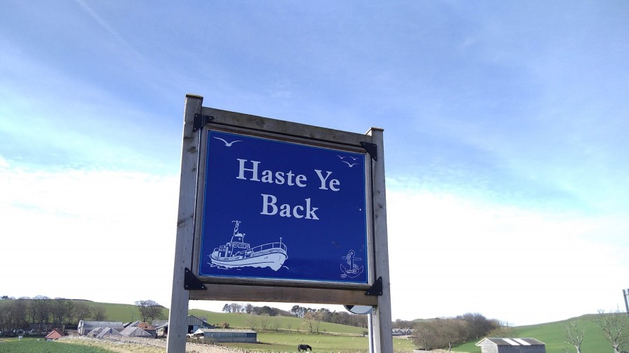
Back in the village, I was sitting dozing in the sun when William came up to tell me his life story. At 88 years he has had two sticks and two wives, he told me in his Sussex accent. He was born 2 months after his parents were married, he explained, which was why they left the place of his birth, but later they were forgiven and returned. He was a member of the fire service in both Salisbury and Hereford (both places I have relatives, I said, but he wasn’t really listening!). He was drawn to speak to me with my rucksack beside me because he is a lifelong member of the Berwick Ramblers.
After our conversation, the bus came into view and only then did I realise that I barely had any cash. The driver said coins only and waited while I dashed back to the cafe (visit #3 that day) where they gave me £2 (they couldn’t do cash-back) saying I could give it to them another time. What a fantastic gesture!
It was a short day’s walk (4 hours maximum) with quite a lot of climbing. I felt taller and prouder inside and only at the end did I feel a twinge in the instep of my left foot, otherwise no pain or difficulty at all. Less is more!
Practicalities
I advise you to walk in the other direction if you do not have a car and a friendly person to pick you up because there is nowhere to stay at Drylaw, only a car park, and it is too far (29 kms – remember that there are a lot of slopes and hills) to walk from Eyemouth all the way to Cockburnspath.
My timings: 2 hours on the bus from Edinburgh to Eyemouth; 1.5 hours walk to Coldingham Bay; half an hour on to St Abbs Village; 45 minutes to St Abbs Head lighthouse. You could probably do it quicker, but I savoured it all. The 235 bus from St Abbs to Berwick-upon-Tweed takes about half an hour (£3 odd), and the train from Berwick to Edinburgh about 45 minutes.
Remember to check the sunrise and -set, and co-ordinate with travel and walking times if you are also hiking in winter/early spring!
There is almost no accommodation along the path excepting at Berwick-upon-Tweed. If you know of any (other than the bunkhouse below) please do let me know and I will add it to the blog later. Of course if it was summer you could wild camp like Rucksack Rose.
For more information about the Berwickshire Coastal Path, please see the excellent leaflet produced by Scottish Borders Council Newtown St Boswells, Melrose TD6 0SA 0300 100 1800 enquiries@scotborders.gov.uk www.scotborders.gov.uk
Bunkhouse email address: divestabbs@gmail.com (Paul Crowe, skipper of the boat MV> Topline who takes fishermen, tourists and divers out to see the area).
St Abbs Marine Station (research into marine science, conservation and education).
National Trust for Scotland Seal pups at St Abbs Head

It is not the Power Station spewing out smoke, it is nuclear! However the cement works gives out a good spume of what they say is steam. It acts as a good guide to wind strength and direction to Dunbar residents when the furnaces are going.
LikeLike
Thank you, Anne, of course, how silly of me. Ah, steam, I see! Thanks again
LikeLike