
Tag: Eyemouth
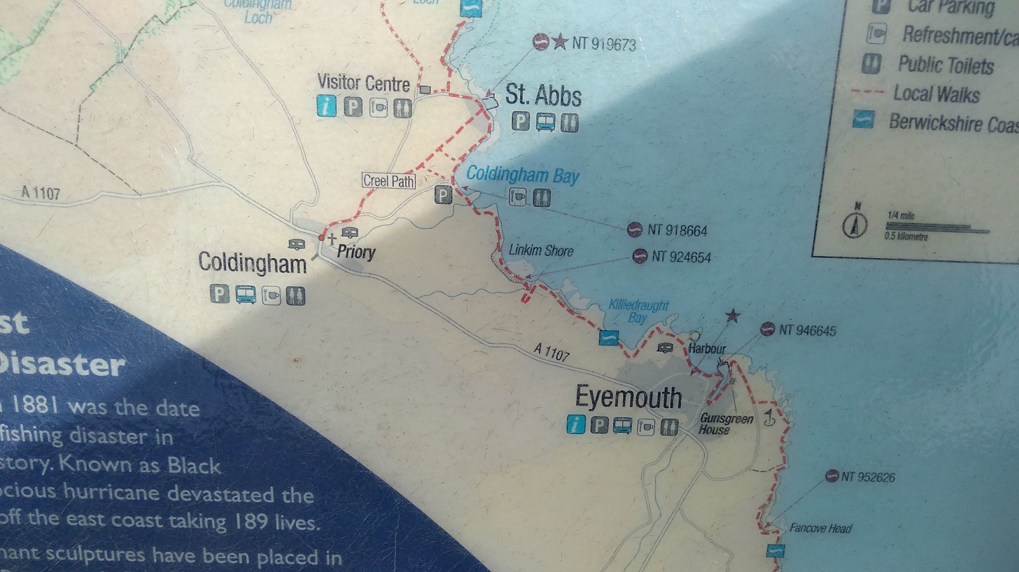
I took the bus from Edinburgh to Eyemouth where I ended the previous stage of the Berwickshire Coastal Path (BCP). From there I walked to St Abbs (6 km, 3.5 miles) going north east wards, and on to St Abbs Head and the lighthouse. Then I hiked back again to get the bus! (The village of Coldingham is 1.5 miles inland). More practicalities are at the end of the blog.
The Journey
As I left Edinburgh (on the 253 bus at 8am), almost everyone else was going to Monday morning work. There were four of us heading eastwards: a cyclist and three walkers including a second solo woman who was consumately prepared (that was when I realised I had left my pole at home!) She was doing walking the BCP over 2 days, for the second time.
Everyone was reading books rather than their phones as we passed through the pretty town of Haddington where children were making their way to school. Even before we drove into Dunbar, the odour from the Belhaven Brewery assailed my nostrils!
The others alighted in the sun at Cockburnspath, near the wee round-towered church, technically the start of the Berwickshire Coastal Path (BCP). I went on to Eyemouth and wondered why I was doing it backwards. It seems to be a habit of mine: reading the Sunday paper from the back to front; starting the Via de la Plata in Santiago de Compostella (rather than in Seville which I did later). What does that say about my personality?
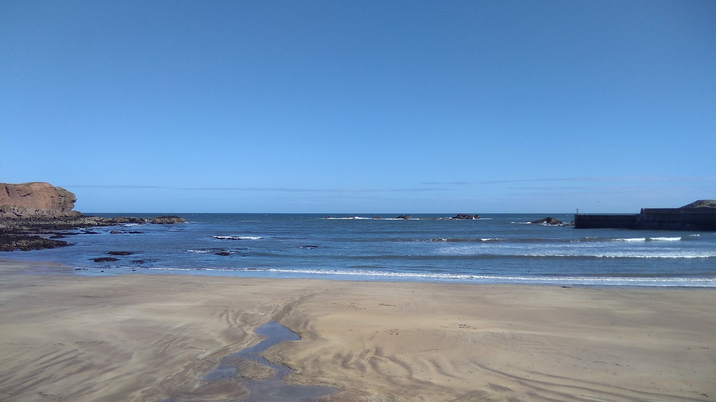
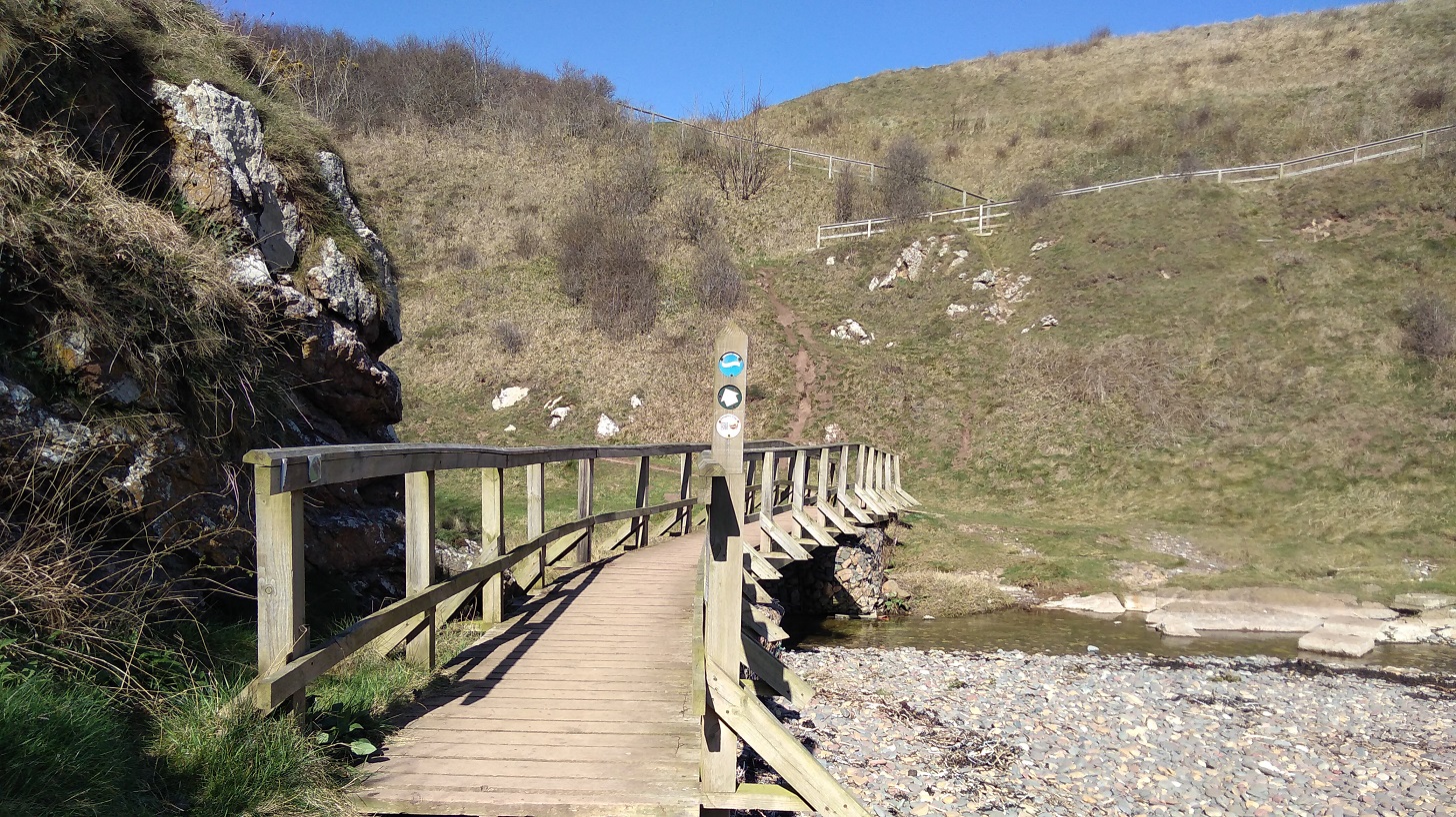
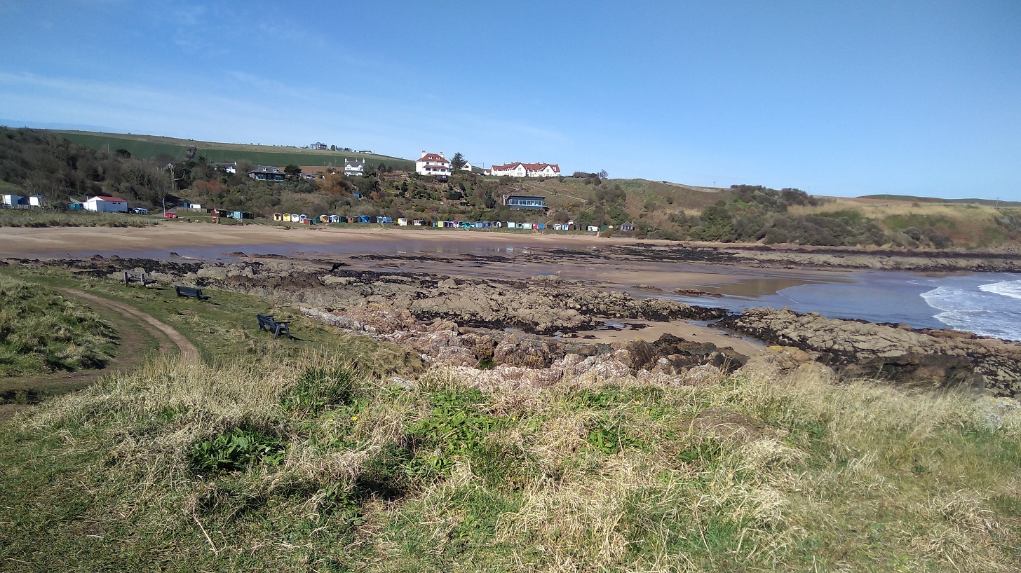
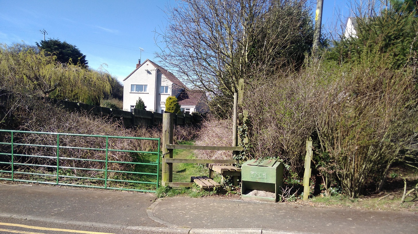
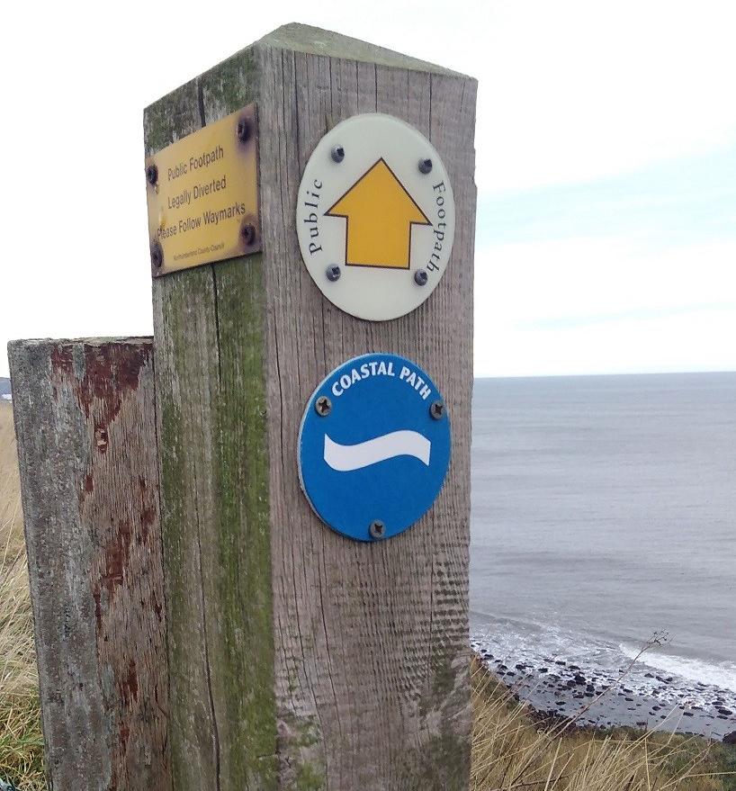
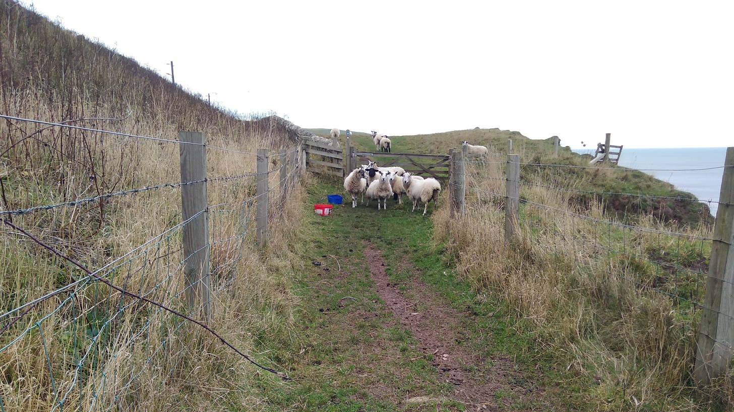
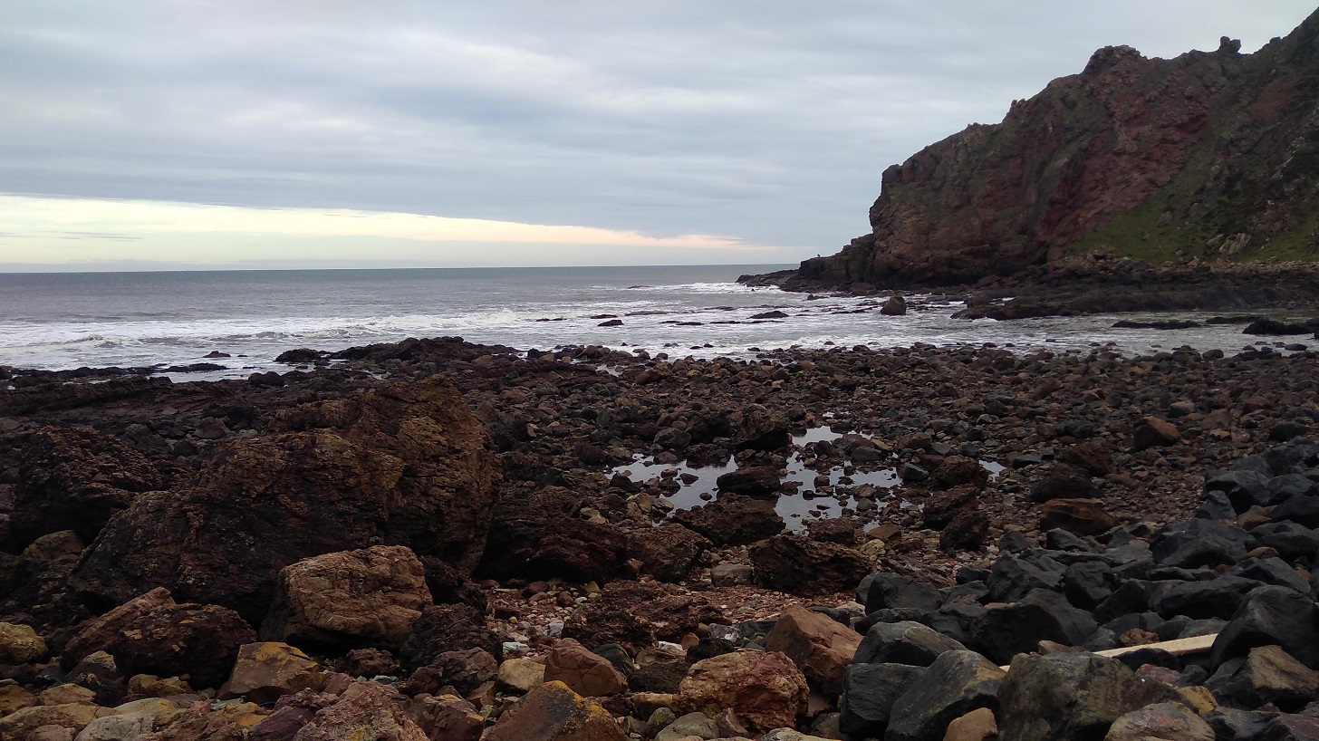
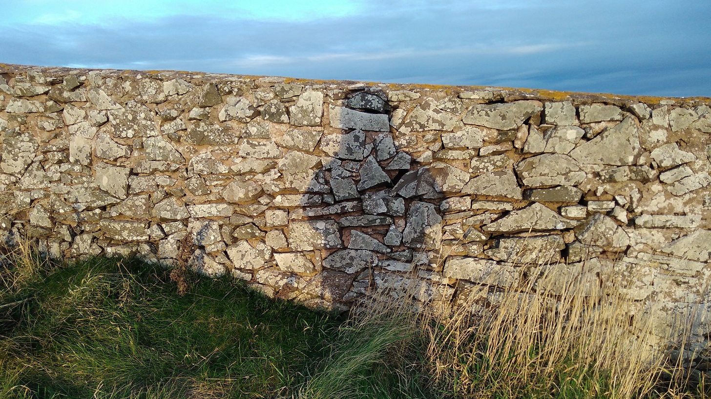
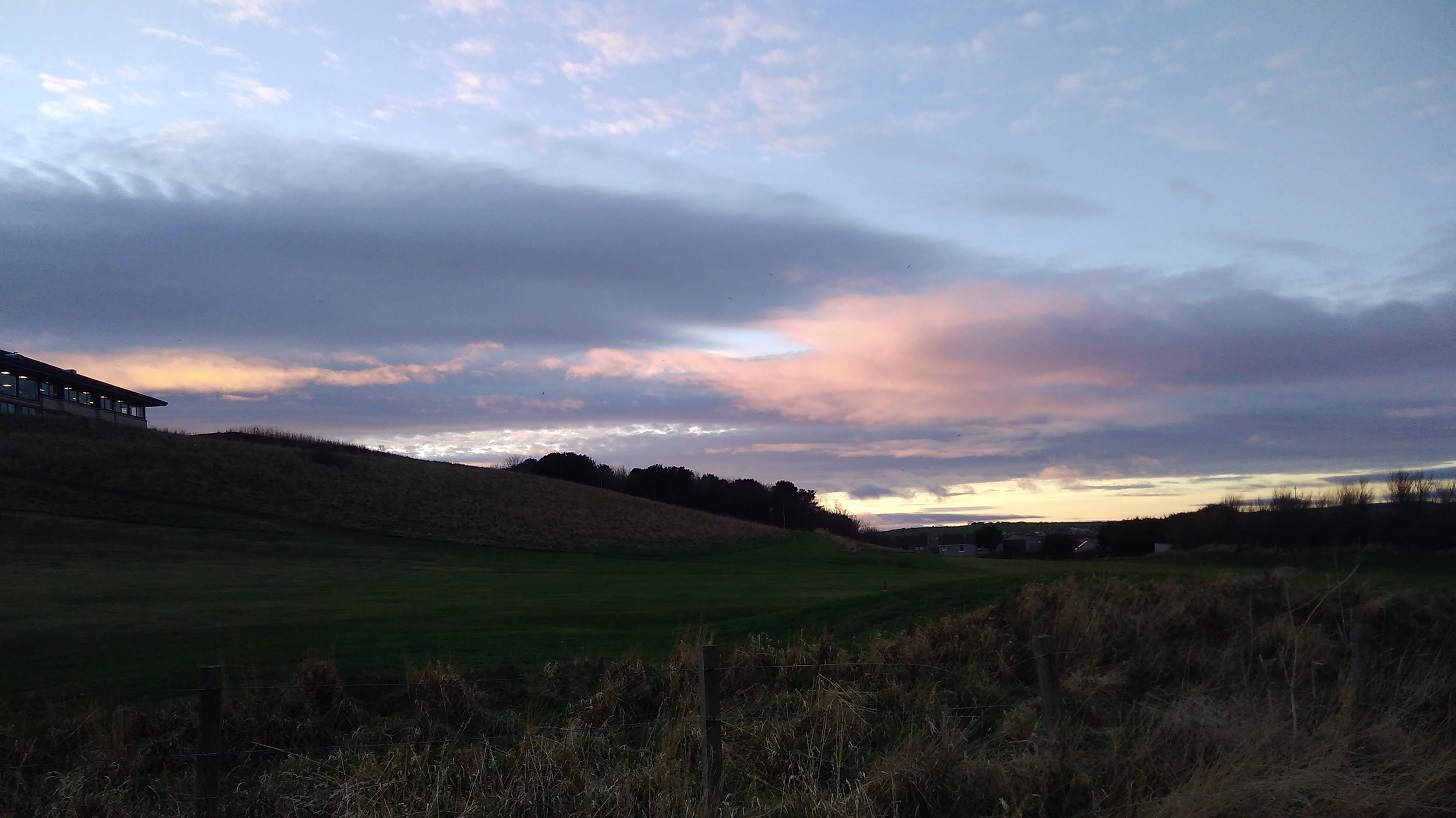
Note to those who might want to do this: leaving Eyemouth (10.05am), be careful not to walk along the road as it is a dead end. Instead, go across the sands to the steps and up there are BCP signs. On the beach it was ever so warm, whereas at the top I needed a hat and a hood to keep out the gusts.
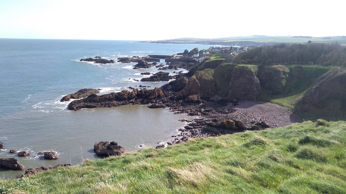
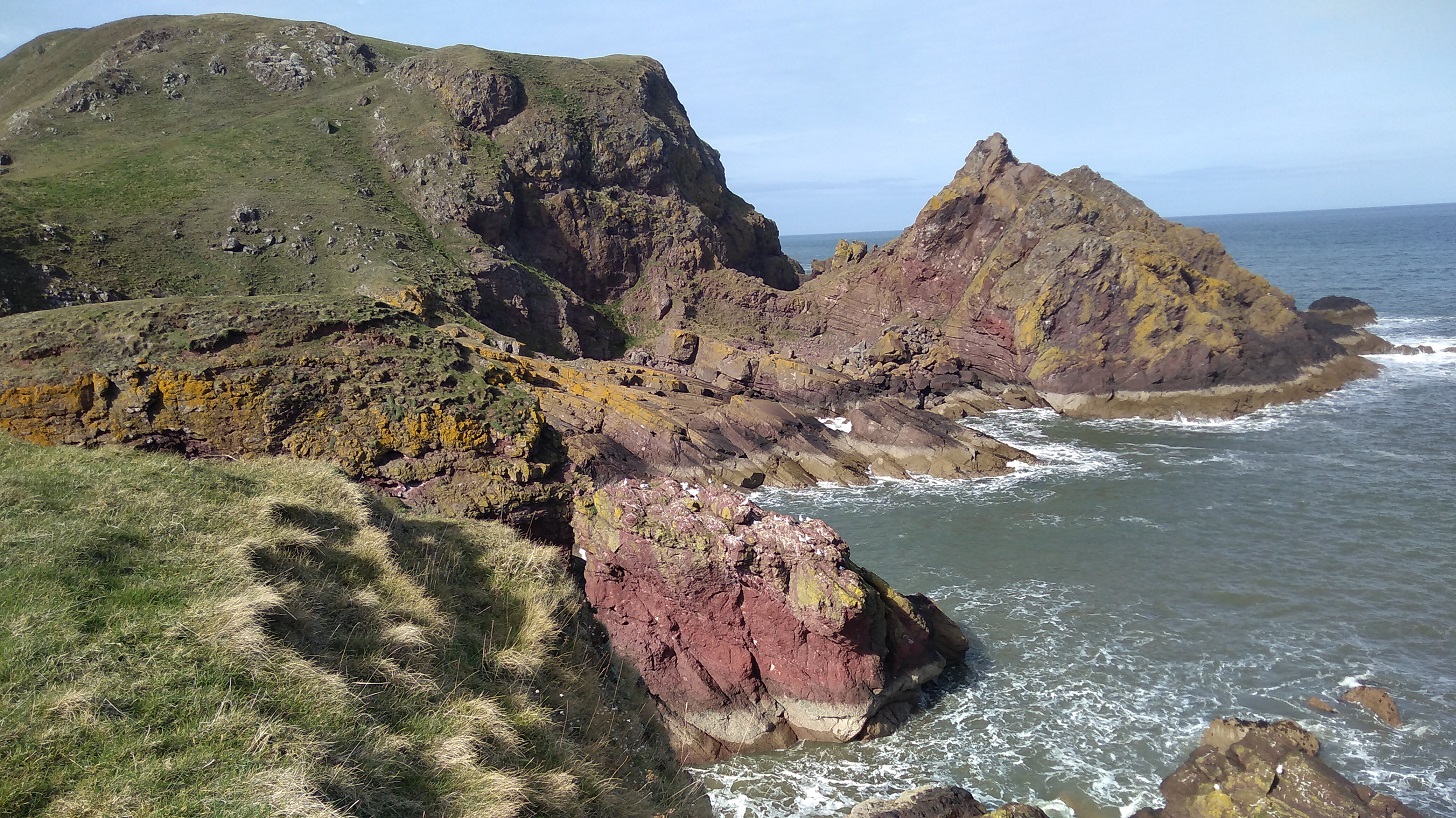
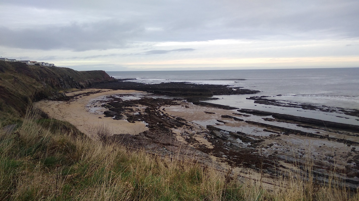
Eyemouth to Coldingham
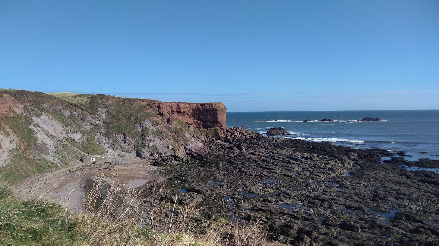
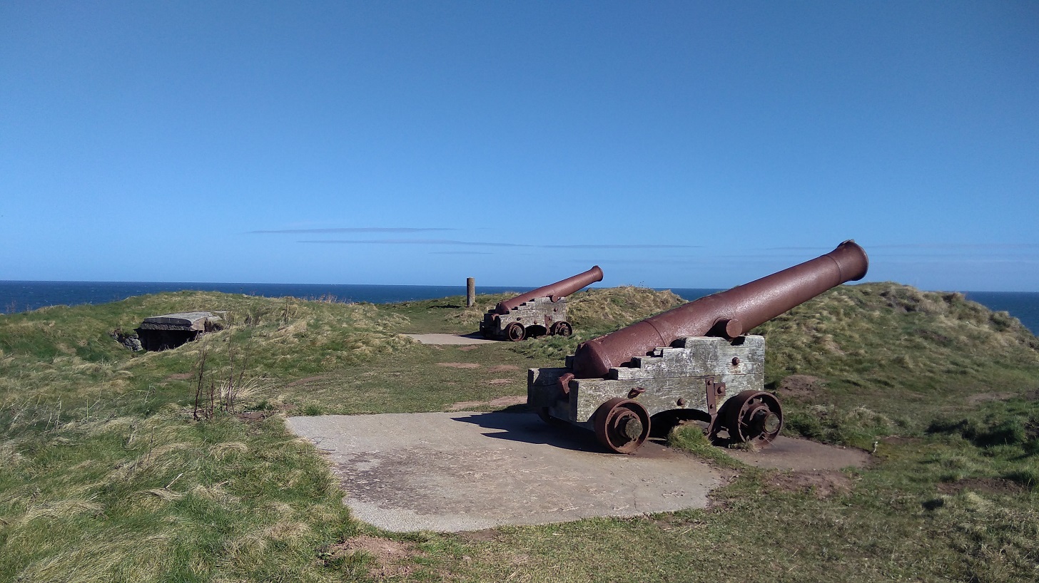
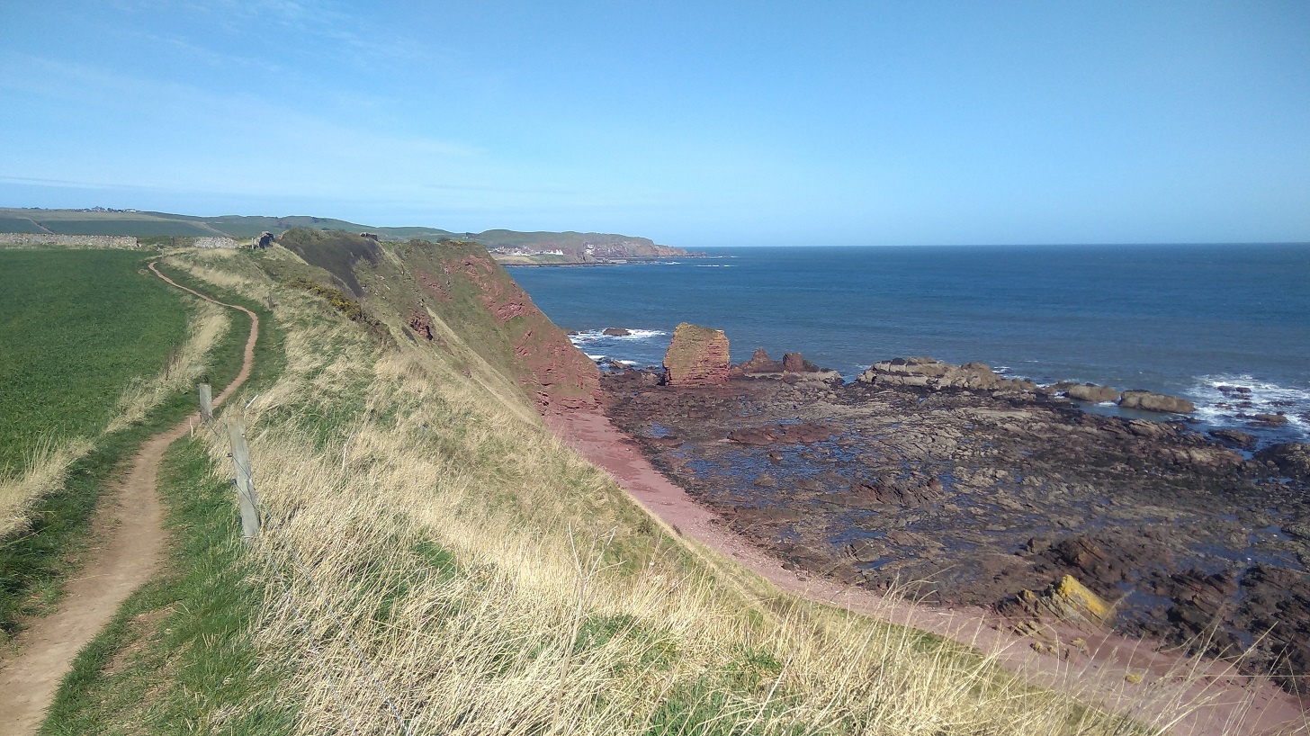
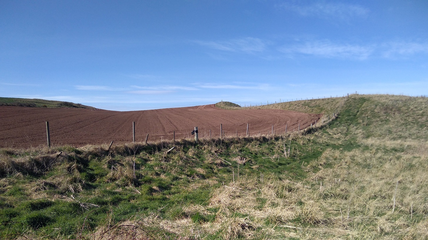
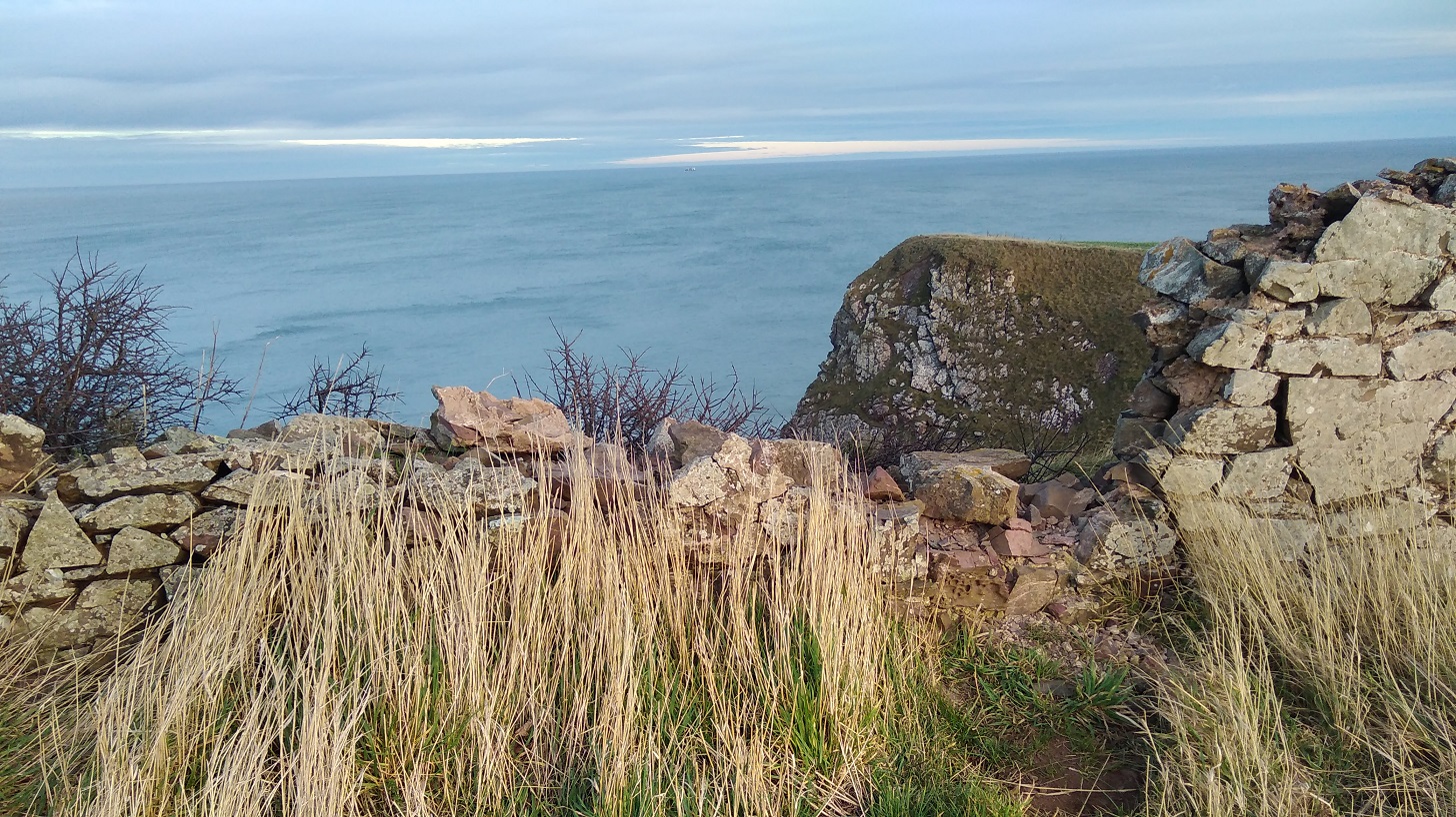
I visited the site of two forts: one English (1547) and the other French (1557), neither of which survived due to changes to the Crown of the day. Guns mark their existence now, facing out to foreign lands – a sign of outmoded protectionism, sadly very present in current foreign policy.
I inhaled the smell of brine and sun-warmed turf. The woman walking in the other direction had a north English accent and needed sunglasses it was so bright. We both turned and looked up at the tuneful sound and when I asked her if she knew what it was she said, ‘a type of skyark, I only do generic when it comes to birds.’
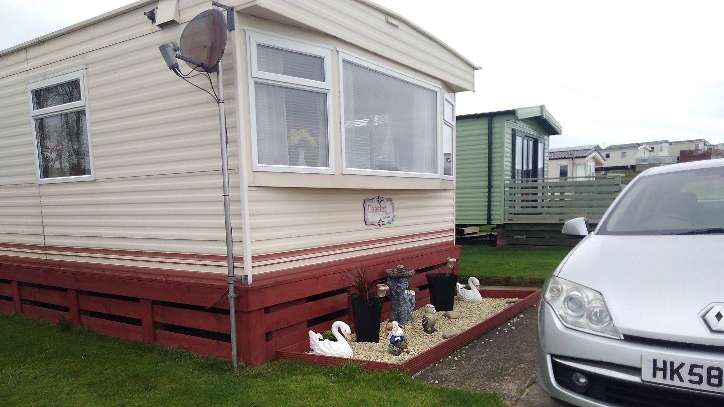
Immediately there is a caravan park which was inhabited: a black labrador sitting patiently by the door; a woman inside with her hat on. There were daffodils lining the fence and Danger signs (people do disregard these and have serious accidents). Not much further along were lots of memorials – benches, bunches of dead or pretend flowers, and moving inscriptions, perhaps to those whose ashes had been taken by the wind out to sea.
Further along was a camper van and a coachload of German tourists, but they didn’t stray far – just had a quick look and then left. Of course there were dog walkers here too, close to the road where they could get easy access. One small hound barked vociferously at me and his owner said it was the rucksacks which set him off!
The wind was so strong that it moved my camera as I pointed it.
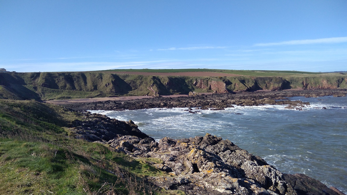
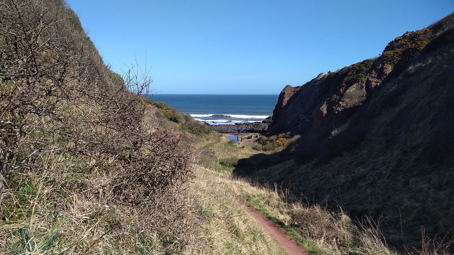
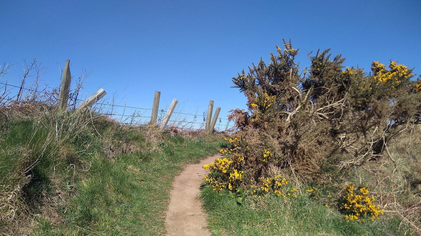
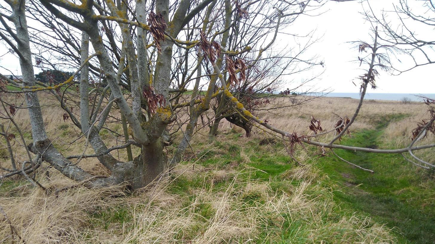
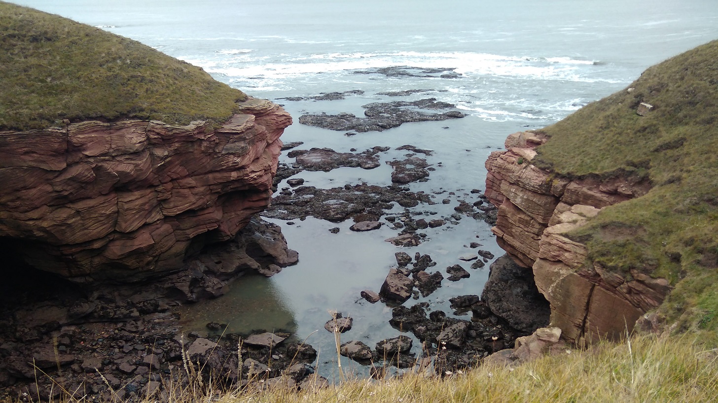
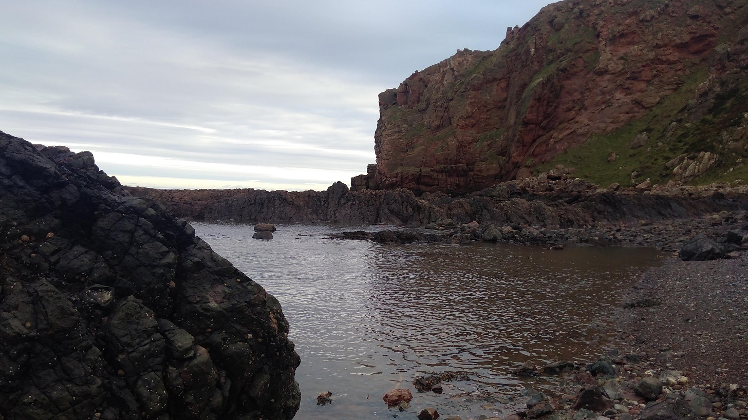
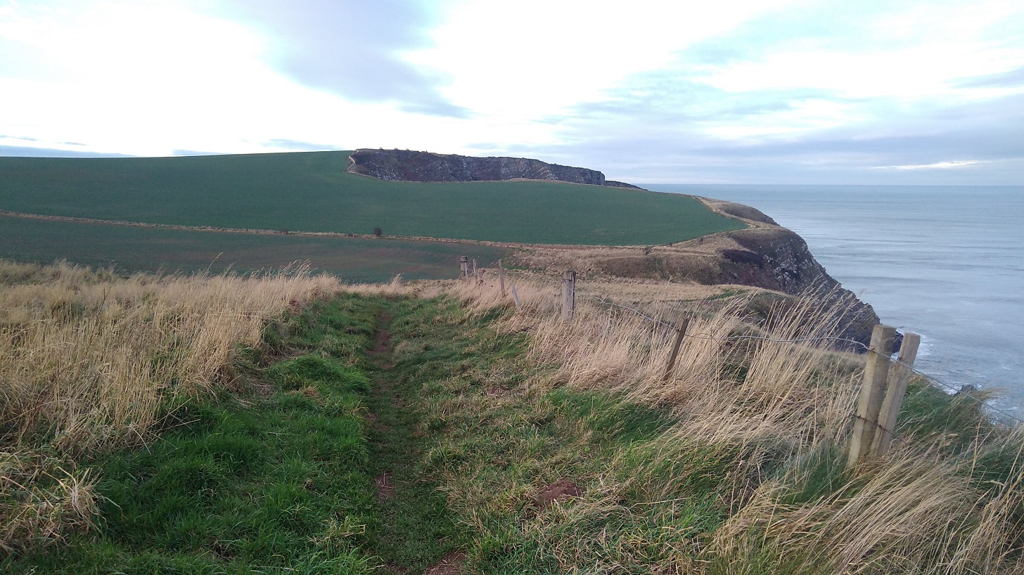
You could easily miss the tiny sign at the top of an orangy-red clay track to the right, but I had watched a hiker ahead of me turn down, so I knew to look out for it.
Just ahead is the sign that you are not advised to take to ‘Coldingham via Fleurs Farm’. There was a woman beachcombing at the next cove which was full of smelly seasweed.
There were violets by the path and the merest hint of primrose scent, taking me back to my childhood when we used to pick them at St Julian’s (Sevenoaks, Kent). Can I pick wildflowers in Britain? Technically yes if you don’t uproot them or take them from an area of Outstanding Natural Beauty, but think carefully first – they don’t last in a vase and do look ever so good in their native surroundings.
The wildflowers were all yellow here (the photo was not good enough to use): celandine, dandelion, daffoldils and gorse.
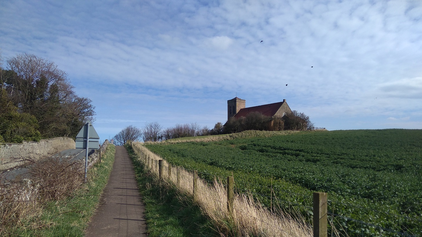
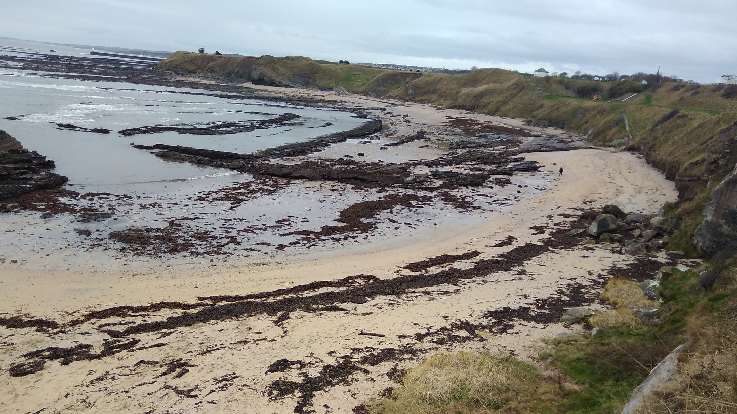
Coldingham
Here I saw my first bluebells of 2019 as I climbed very steeply up behind the beach huts and past the bed and breakfast (now a private house) where I stayed for my birthday with Lesley a few years ago.
At the T junction, the signs point left to Coldingham which this time I did not visit and I therefore missed the Coldingham Priory which was a Benedictine Abbey. There has been Christian worship on the site for over a thousand years and the present Priory Church building includes walls dated to around 1200. The Priory was founded in 1098 by Edgar, King of Scots, son of Queen Margaret (later Saint M) and Malcolm III, after recovering his kingdom from Donald Bane, his uncle, who had usurped it at his father’s death.
The first monastic community consisted of thirty Benedictine monks from Durham until 1590. The original Church, built in Edgar’s time, was destroyed by King John of England in 1216, but was replaced by a greater and more magnificent one, which in turn was largely destroyed in 1545 during the great raid of the Earl of Hertford, which brought ruin also to the abbeys of Kelso, Dryburgh and Melrose. The choir, however, though further damaged by the forces of Oliver Cromwell in 1650, survives and constitutes the present Priory Church.
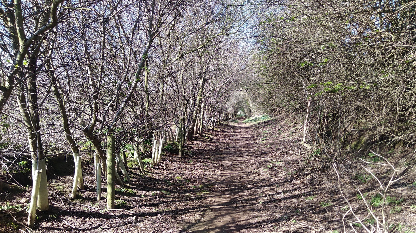
I passed two other signs indicating that I could have taken earlier ways, but I was pleased to have walked along the famous Creel Path. It is so called because the fishermen used to carry their creels (lobster pots) along here to the beach in days gone by.
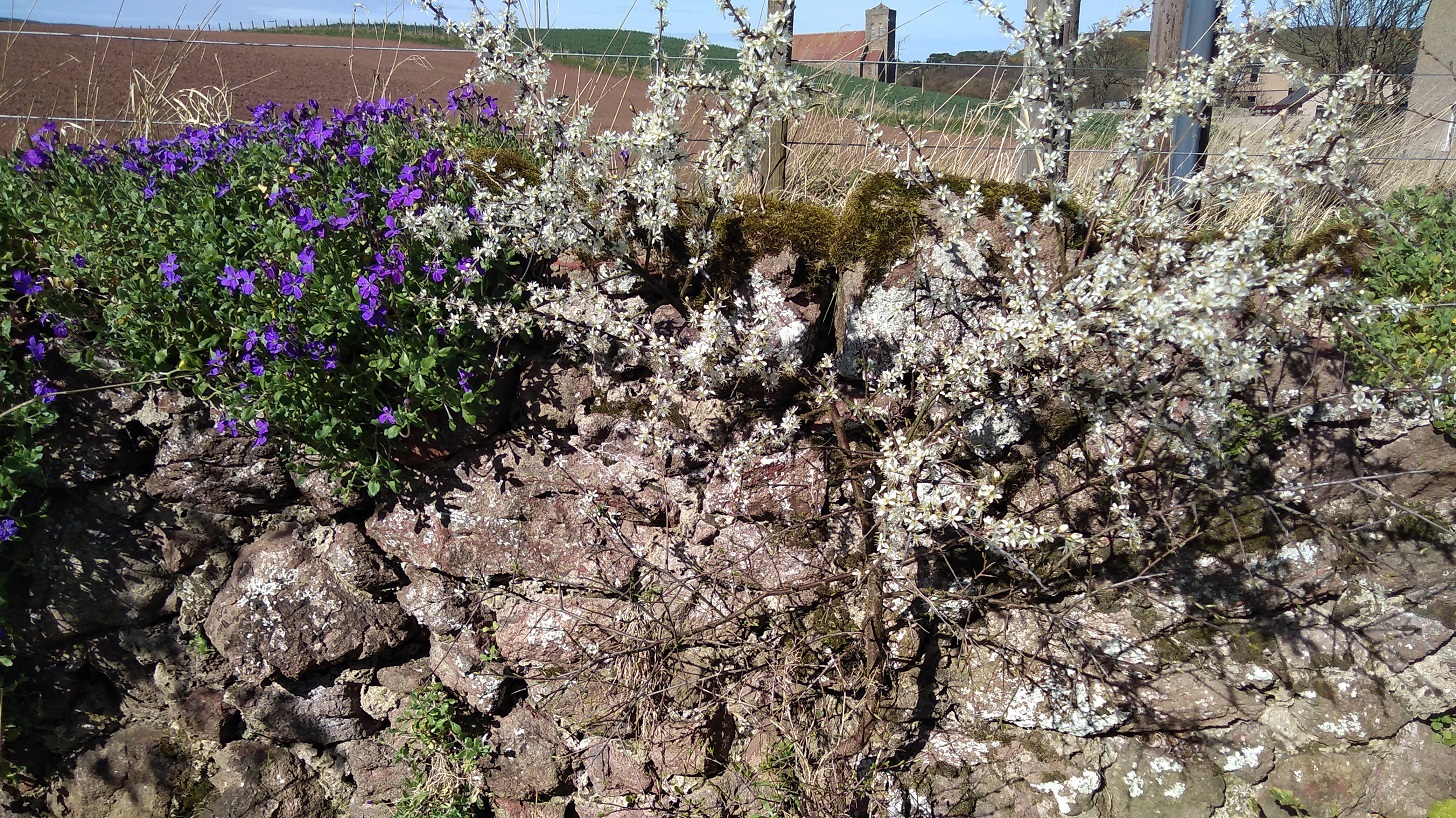
Earlier I spotted the old, brown seed heads of tansy and teasle, but here in the warmth that came off the earth were haphazard flies and in sheltered corners there were the new season’s flowers. What a welcome, bright sight they were attracting the first butterfly I had seen after the long winter. I was about to come across primula and pansies, even white garlic flowers on top of juicy wild garlic stalks. That confirms it, I thought to myself, no argument, Spring is here!
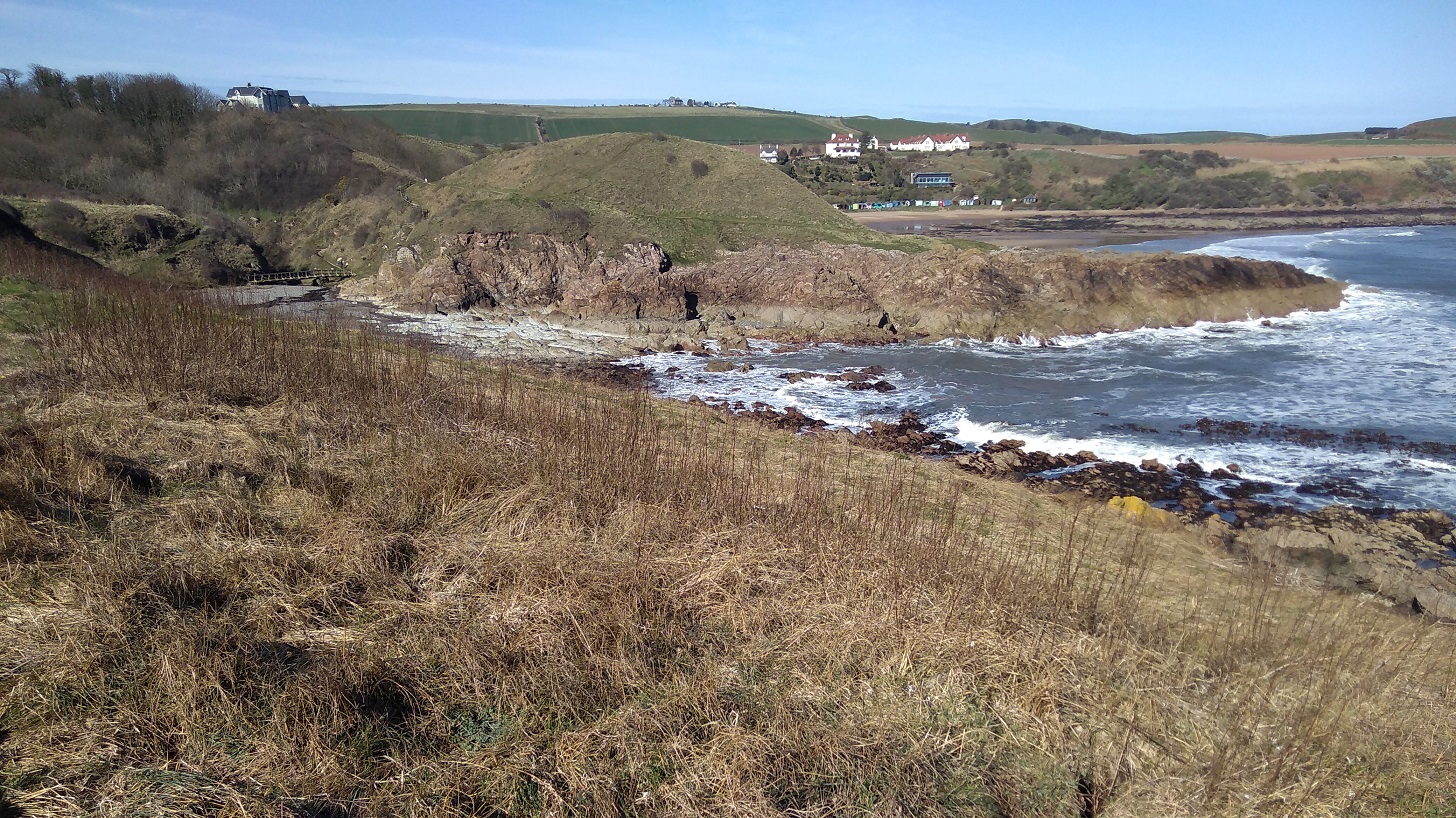
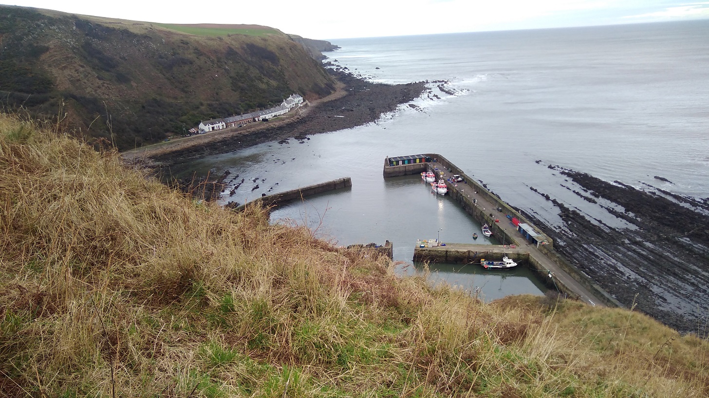
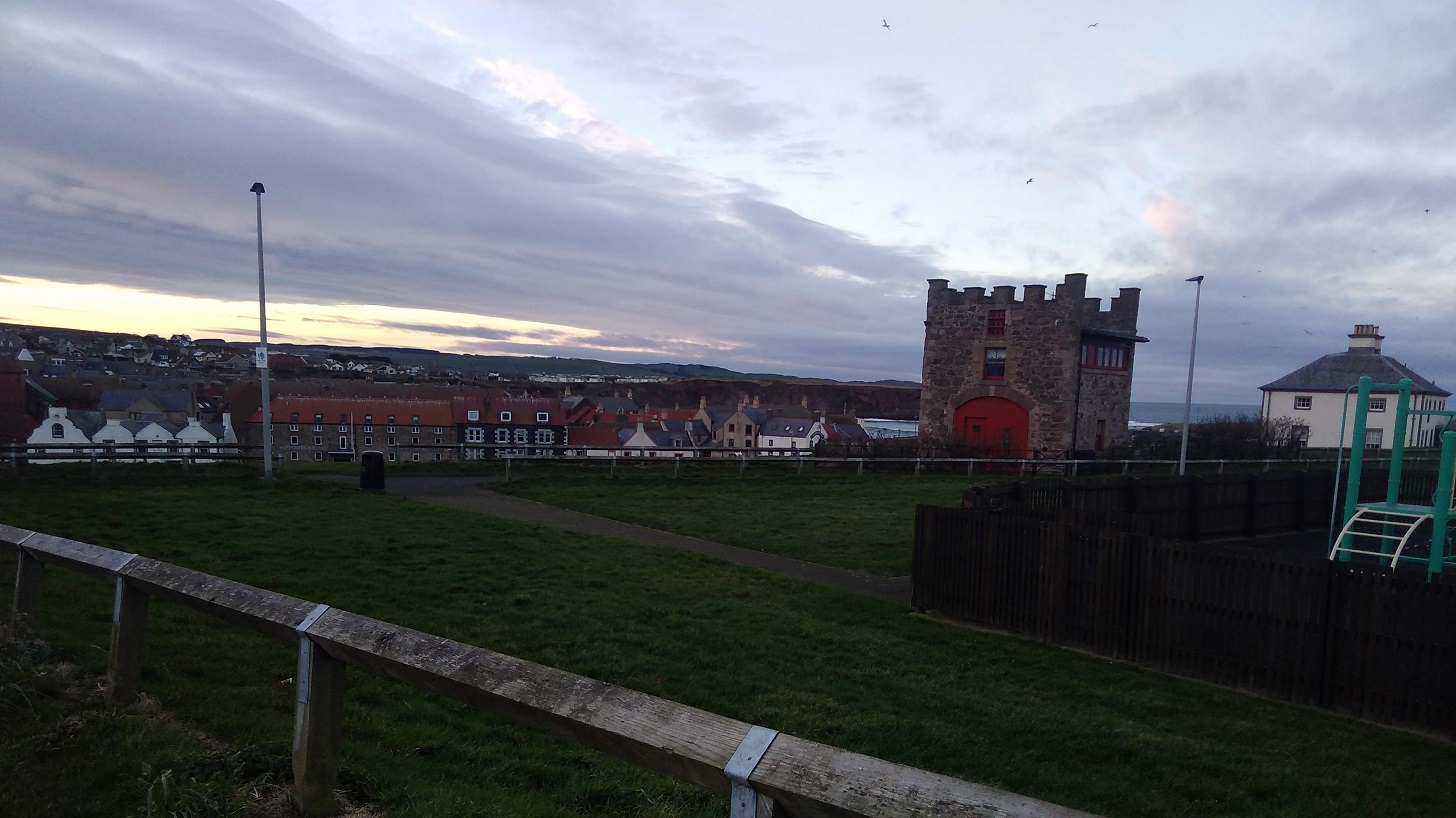
St Abbs
On entry down the hill, there was white washing fluttering in the breeze and a restaurant and visitor centre, both shut of course on account of the time of year.
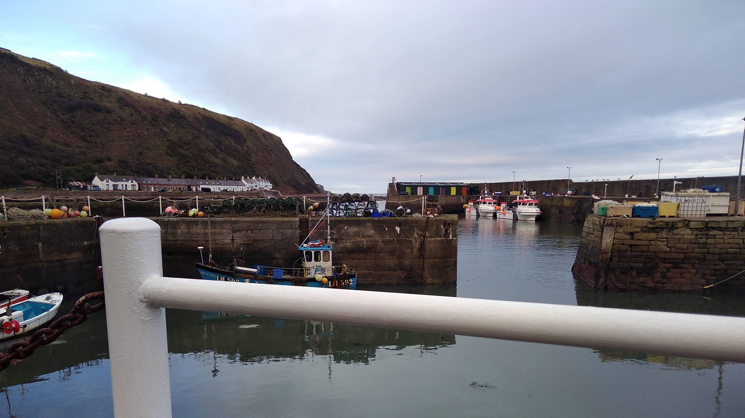
Through the harbour and up the other side, to my delight however, was an old school building with an open cafe. I had a picnic with me, but can never seem to resist a hot cup of tea. The baking (avocado and courgette gluten free cake) was excellent and the staff were all kindness – initially organising a chair and table outside for me and then adding a cosy blanket for warmth. By the way, you can also buy a very pretty, homemade pink magic wand for £3.50 too!
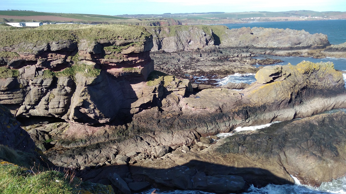
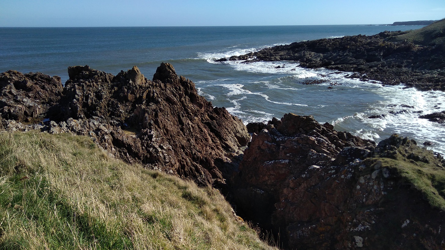
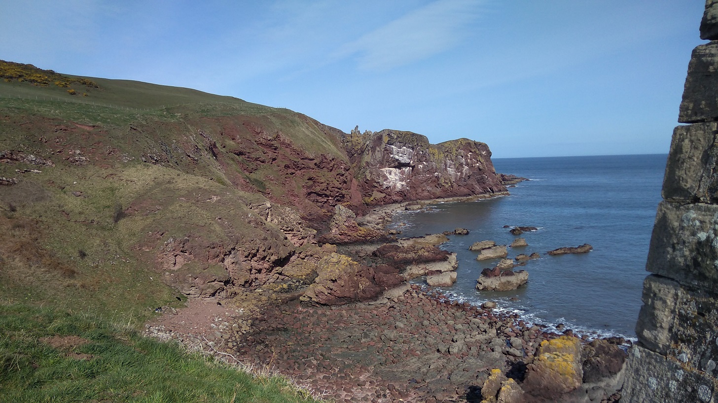
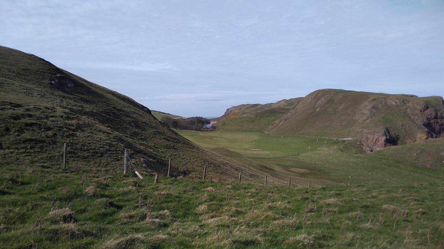
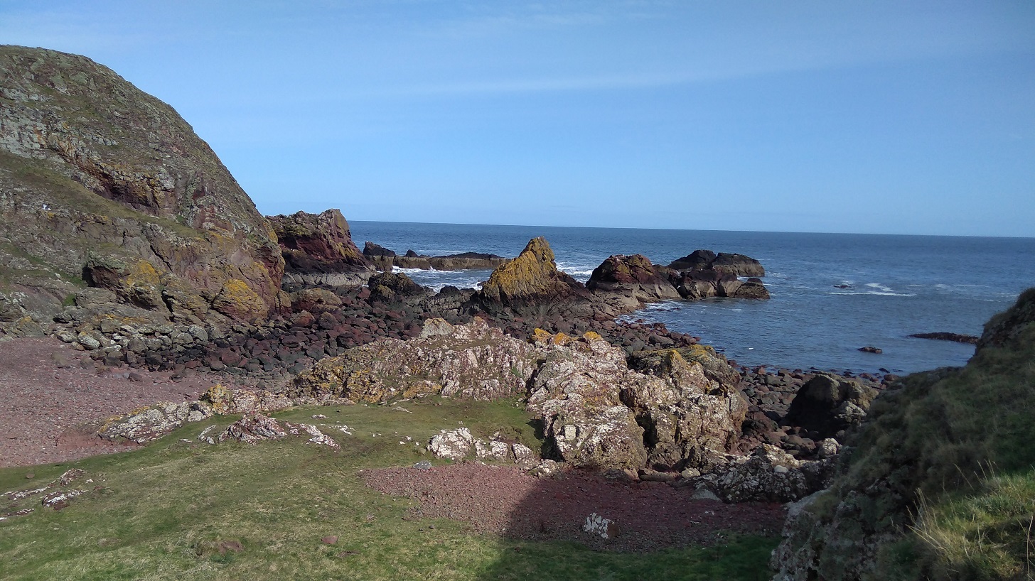
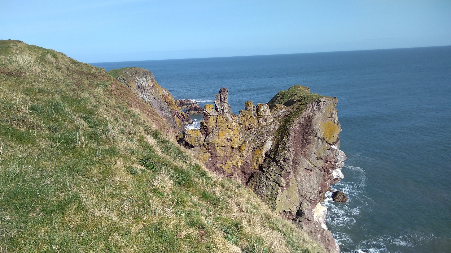
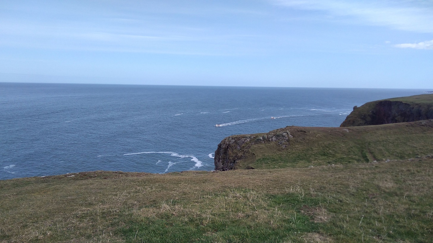
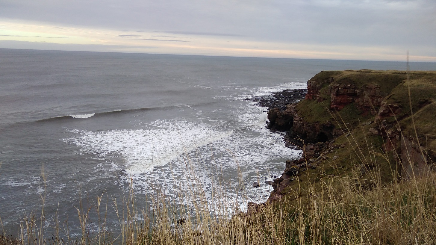
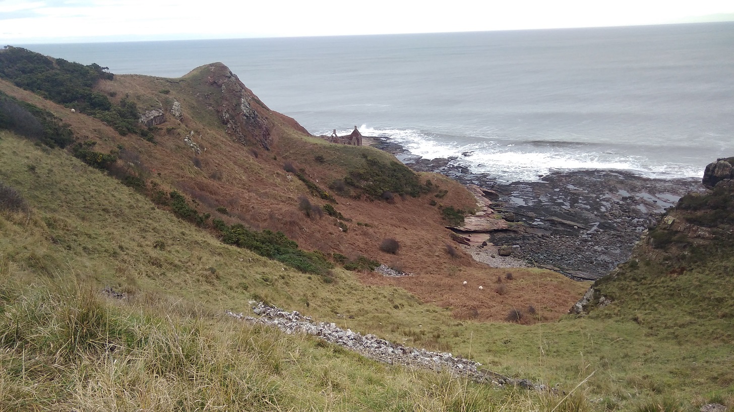
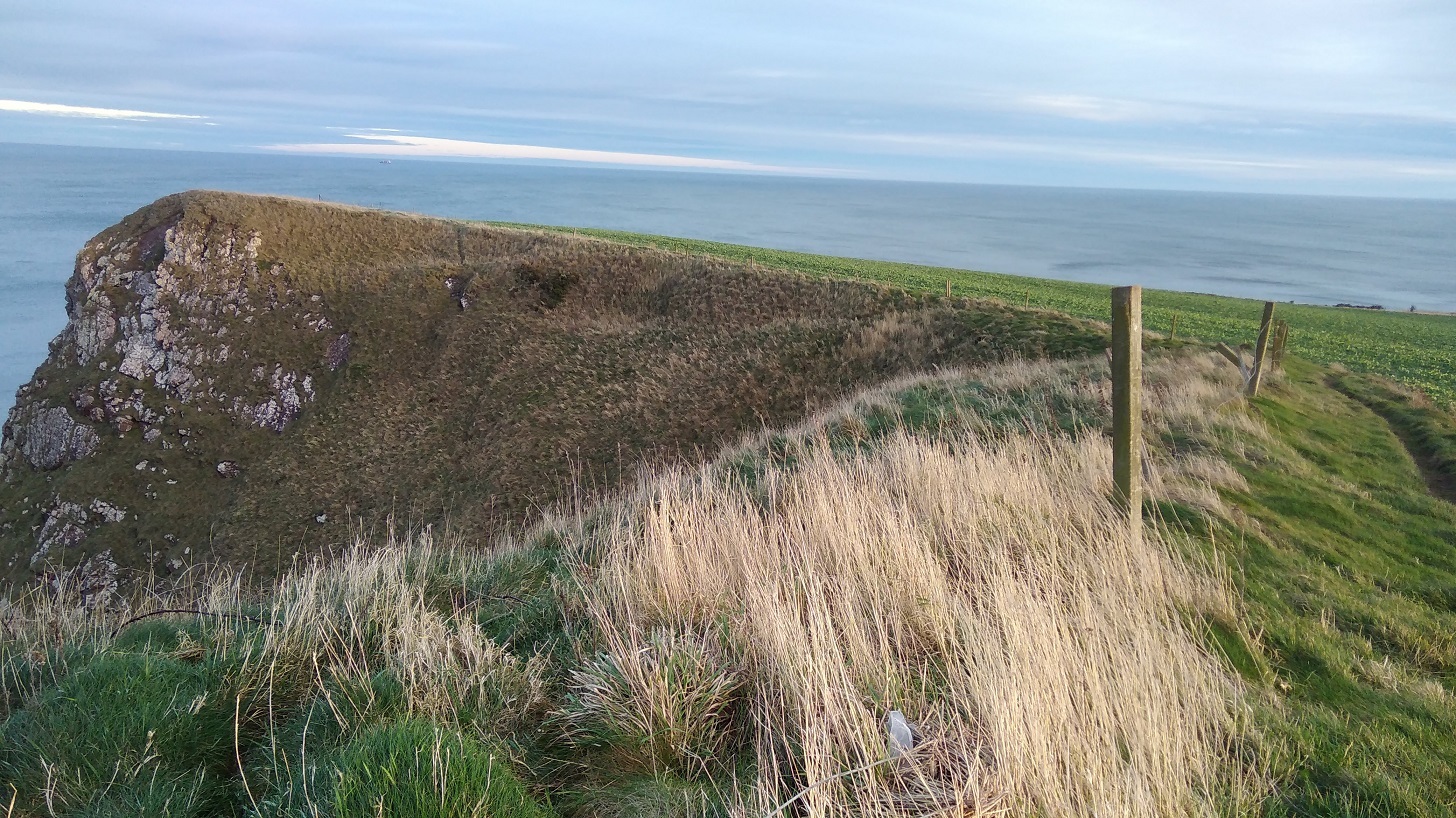
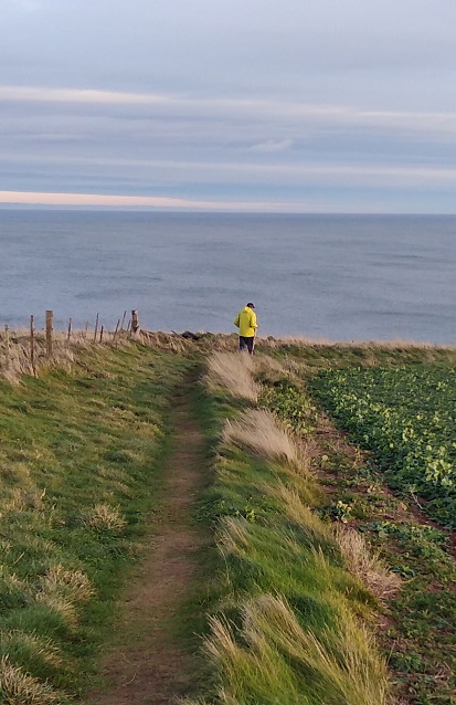
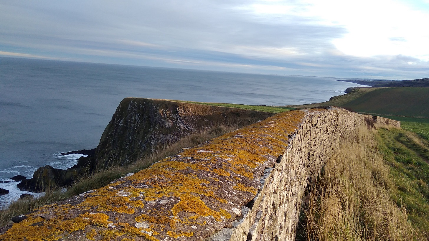
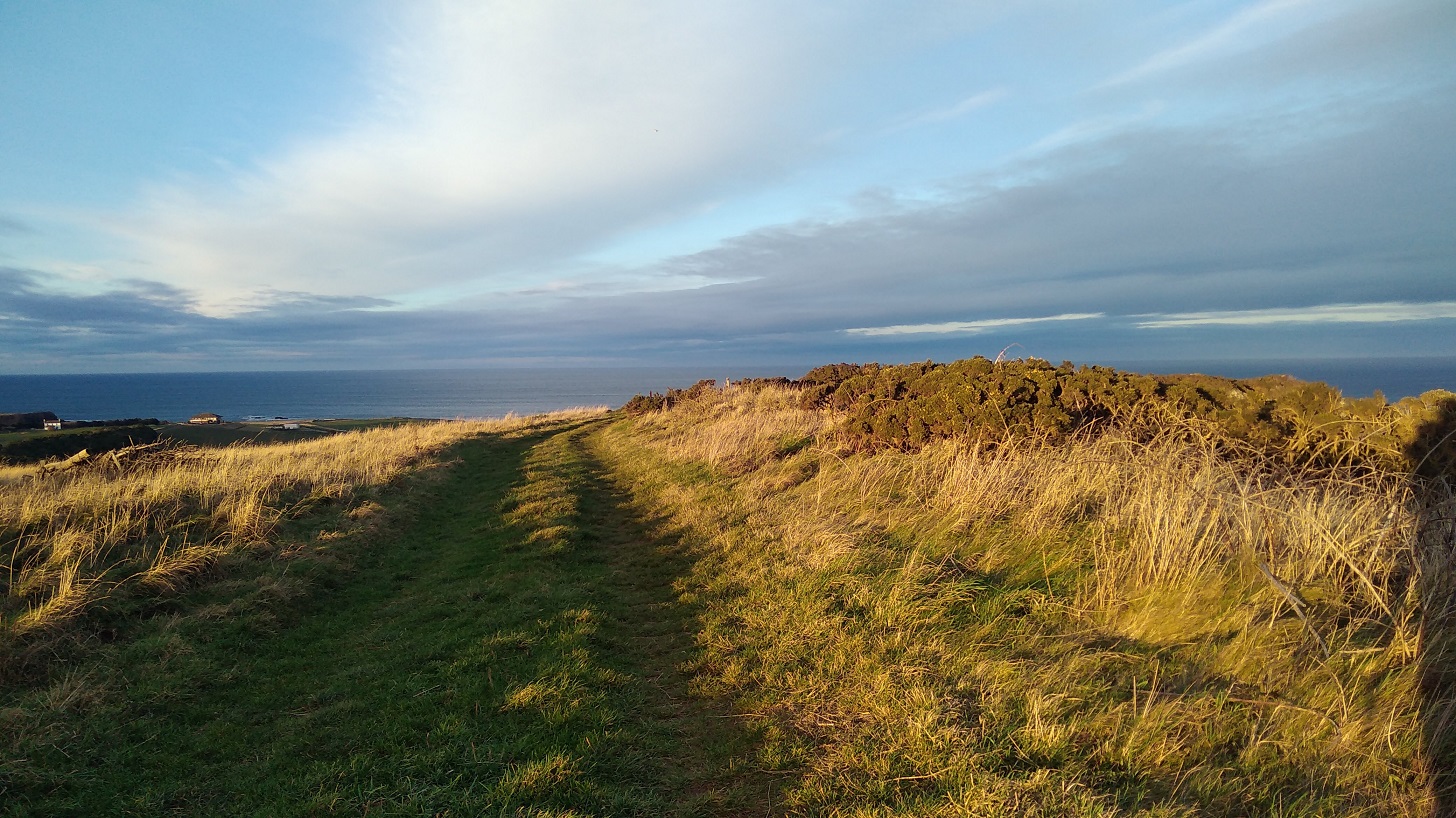
After a break and refreshments in the sun (with wi-fi), I continued along the road and then entered the protected Nature Reserve to the St Abbs lighthouse at St Abbs Head. where I have walked many times before.
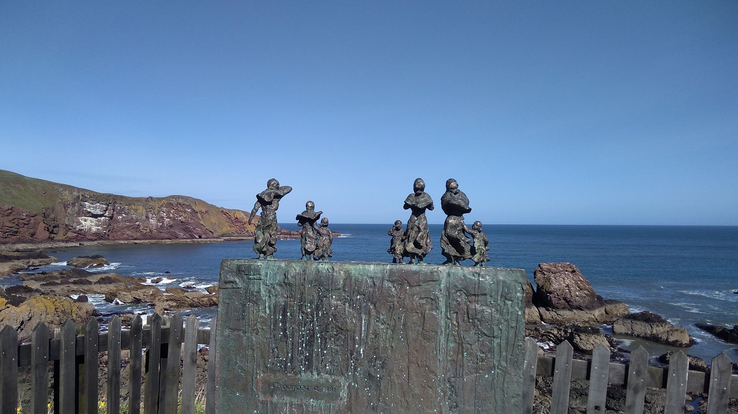
These small bronze figures are the wives and children of Charles Purves and brothers William and James Thorburn who were lost in the great storm of 1881 when 189 fishermen lost their lives. The harbour does not belong to the Council but to the local people via the Community Council and a Trust. There is an important Lifeboat Station here, privately funded and independent.
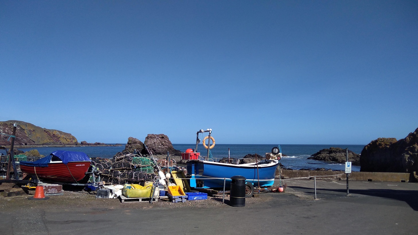
St Abbs with its super clear waters is a favourite place for scuba divers, including beginners. For details of the new bunkhouse, see below.
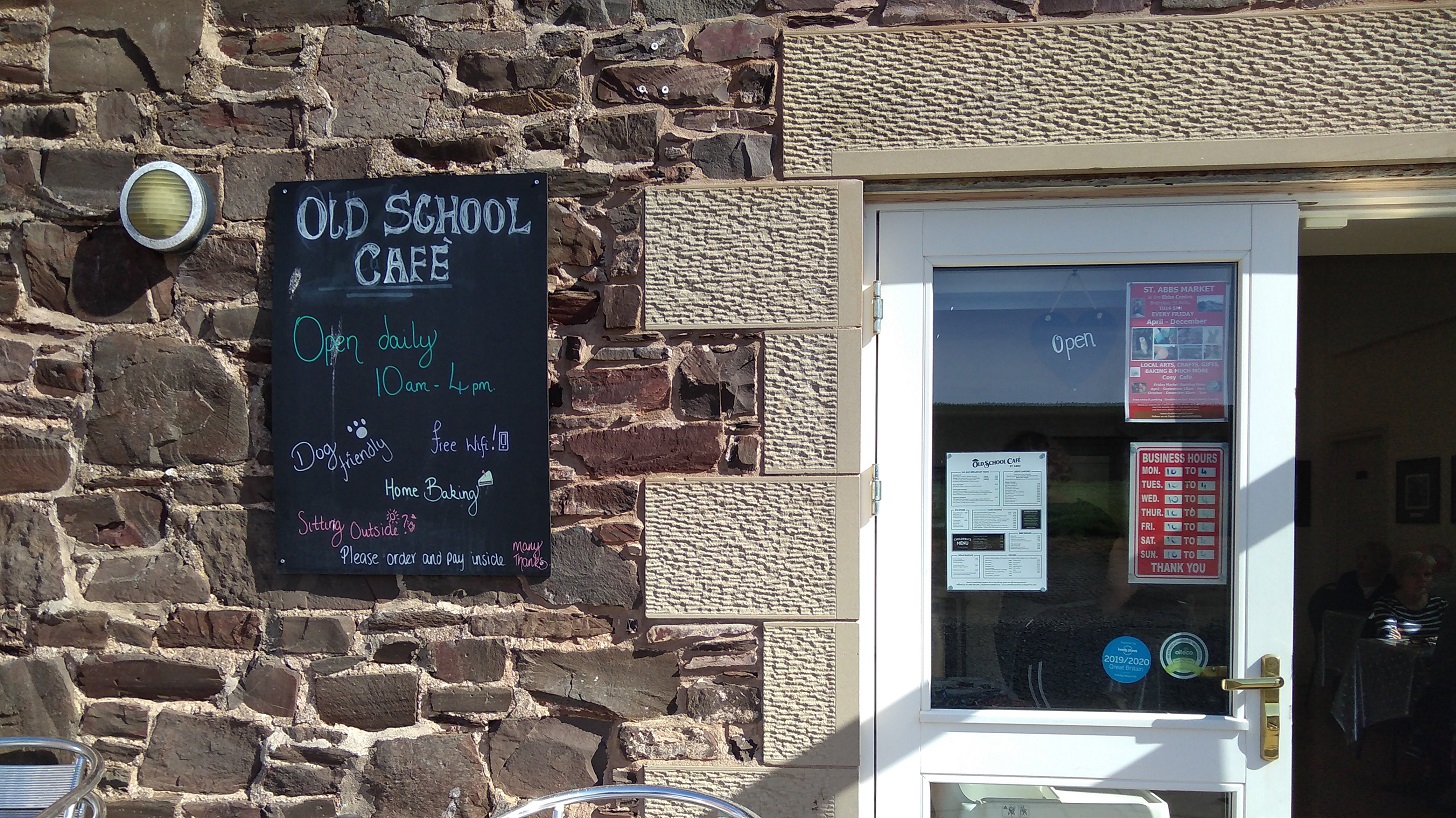
The cafe is named after Ebba (Ebbe), ‘Mother of Northumbria’, so the signs in the Ebba Centre told me. She was born c. 615 AD, daughter of Aethelfrith the first king of Northumbria and in 643 AD she founded a nunnery nearby which predates the priory mentioned above. Later she was made a saint.
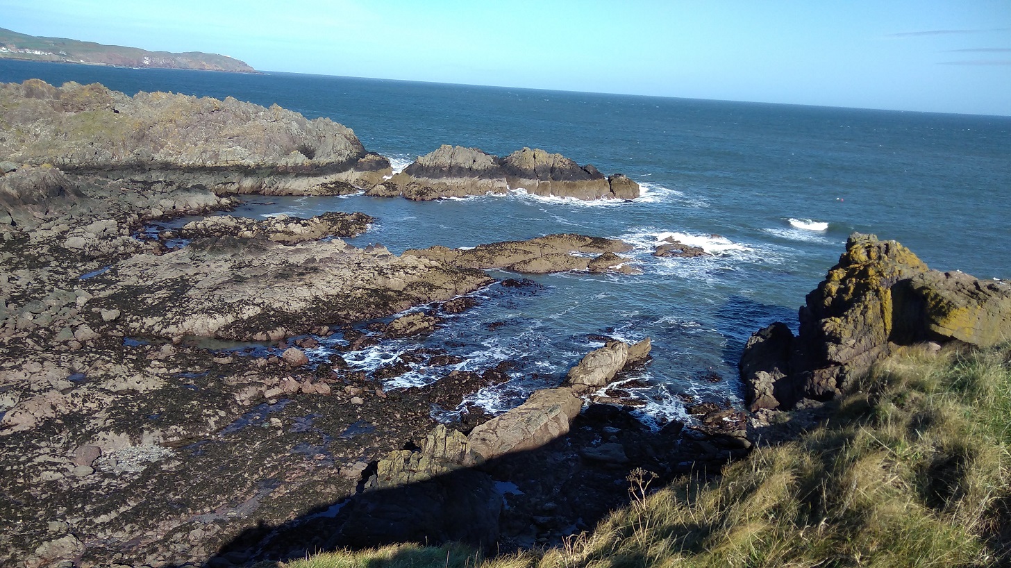
I spent ages admiring the gliding birds with blanched tips to their tail feathers – they seemed effortless. Many were perched on the rocks like tiny pearls in an invisible hairnet. Apart from the bumble bee, everything here was white: feathers and wool, gulls chests, and the foamy most-white of the waves between the rocks.
I was reading about Sarah Marquis, a very experienced walker who could smell water when she was hiking in Australia. I believe I could smell the grass happily growing in the sun after being dormant for so long.
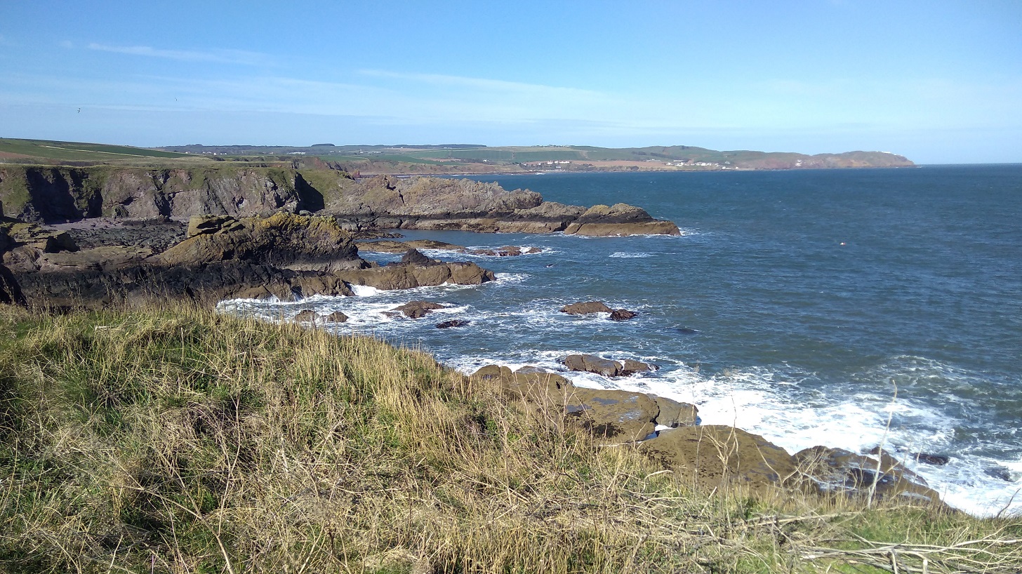
The path took me around and behind hillocks on the way, but I went up and over them on my return. Once I caught myself avoiding looking – the grandeur of the views, the colours – as if I didn’t know what to do with them they were so wonderful.
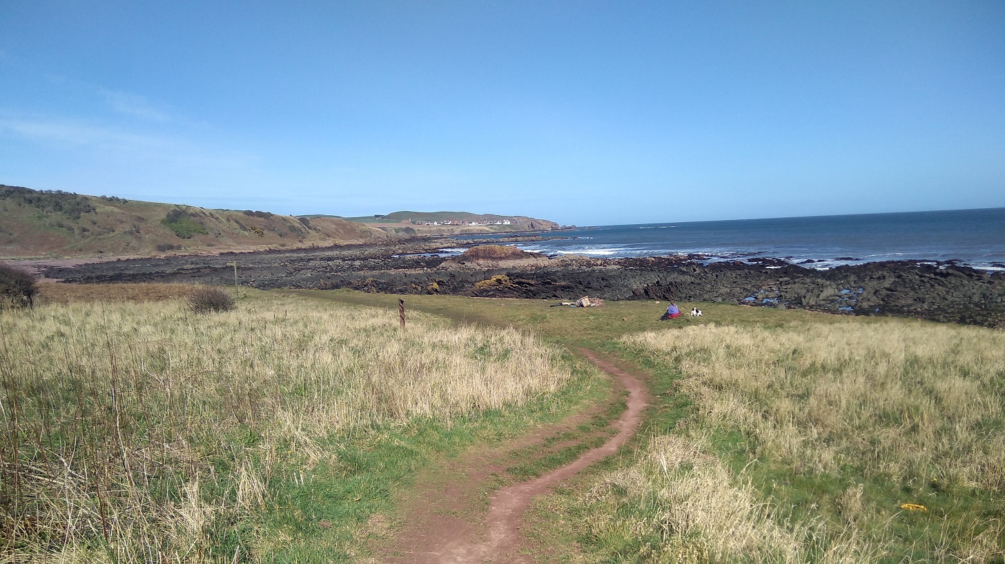
Going back I wasn’t the only one out on this beautiful afternoon – I discovered it is quite a busy stretch.
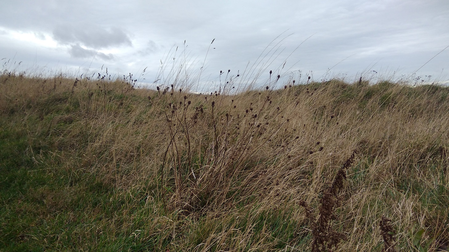
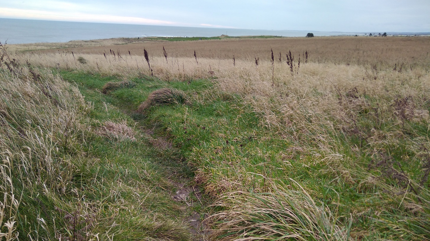
Gentle paths curve through the spring-green grass, undulating with the landscape – there is some good climbing to strengthen your thighs!
You can spot the Northern Brown Argus butterfly according to the sign, and it’s a bird watchers paradise (guillemots and razorbills, shags and cormorants amongs others). I watched a starling with its petrol green head, perched on a fencepost, feathers disrupted as the wind attempted to dislodge it.
St Abbs Lighthouse
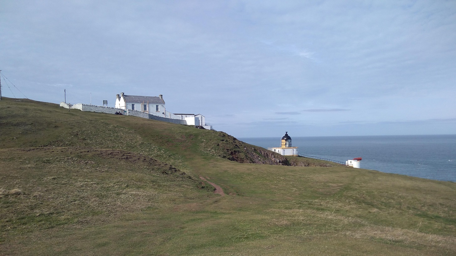
68 Metres above sea level, the lighthouse was built by David and Thomas Stevenson. It is automated now, remotely monitored, so there is no lighthouse keeper. It flashes white every 10 seconds to warn sailors of the rocks below.
My walking future was ahead of me: a tarmaced road between knolls, jagged rocks and chiselled cliffs; the power station with a polluting cloud coming out of its tallest chimney; Berwick Law (a little hill all on its own near North Berwick); Bass Rock (an island off that coast); and Edinburgh beyond.
Back in the village, I was sitting dozing in the sun when William came up to tell me his life story. At 88 years he has had two sticks and two wives, he told me in his Sussex accent. He was born 2 months after his parents were married, he explained, which was why they left the place of his birth, but later they were forgiven and returned. He was a member of the fire service in both Salisbury and Hereford (both places I have relatives, I said, but he wasn’t really listening!). He was drawn to speak to me with my rucksack beside me because he is a lifelong member of the Berwick Ramblers.
After our conversation, the bus came into view and only then did I realise that I barely had any cash. The driver said coins only and waited while I dashed back to the cafe (visit #3 that day) where they gave me £2 (they couldn’t do cash-back) saying I could give it to them another time. What a fantastic gesture!
It was a short day’s walk (4 hours maximum) with quite a lot of climbing. I felt taller and prouder inside and only at the end did I feel a twinge in the instep of my left foot, otherwise no pain or difficulty at all. Less is more!
Practicalities
I advise you to walk in the other direction if you do not have a car and a friendly person to pick you up because there is nowhere to stay at Drylaw, only a car park, and it is too far (29 kms – remember that there are a lot of slopes and hills) to walk from Eyemouth all the way to Cockburnspath.
My timings: 2 hours on the bus from Edinburgh to Eyemouth; 1.5 hours walk to Coldingham Bay; half an hour on to St Abbs Village; 45 minutes to St Abbs Head lighthouse. You could probably do it quicker, but I savoured it all. The 235 bus from St Abbs to Berwick-upon-Tweed takes about half an hour (£3 odd), and the train from Berwick to Edinburgh about 45 minutes.
Remember to check the sunrise and -set, and co-ordinate with travel and walking times if you are also hiking in winter/early spring!
There is almost no accommodation along the path excepting at Berwick-upon-Tweed. If you know of any (other than the bunkhouse below) please do let me know and I will add it to the blog later. Of course if it was summer you could wild camp like Rucksack Rose.
For more information about the Berwickshire Coastal Path, please see the excellent leaflet produced by Scottish Borders Council Newtown St Boswells, Melrose TD6 0SA 0300 100 1800 enquiries@scotborders.gov.uk www.scotborders.gov.uk
Bunkhouse email address: divestabbs@gmail.com (Paul Crowe, skipper of the boat MV> Topline who takes fishermen, tourists and divers out to see the area).
St Abbs Marine Station (research into marine science, conservation and education).
National Trust for Scotland Seal pups at St Abbs Head
12th January 2019
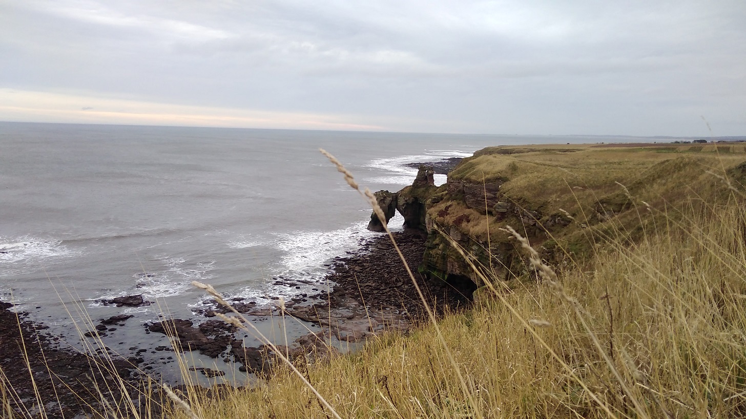
The second highest cliffs on the east coast of Britain are to be found along this path.
It may be that when we no longer know what to do
we have come to our real work,and that when we no longer know which way to go
we have come to our real journey.The mind that is not baffled is not employed.
The impeded stream is the one that sings.
In the middle of winter I headed south on a train to Berwick-upon-Tweed along the coast of East Lothian with the sea on my left. It was just after 9am and I could see brown fields, a slate grey sea, even darker land on the other side of the Firth of Forth and the silhouettes of the trees without their leaves. As it lightened there was more detail: cows in coats; four-by-fours speeding between fields; ruined castles; and low, red-roofed farm buildings. The train was quiet.
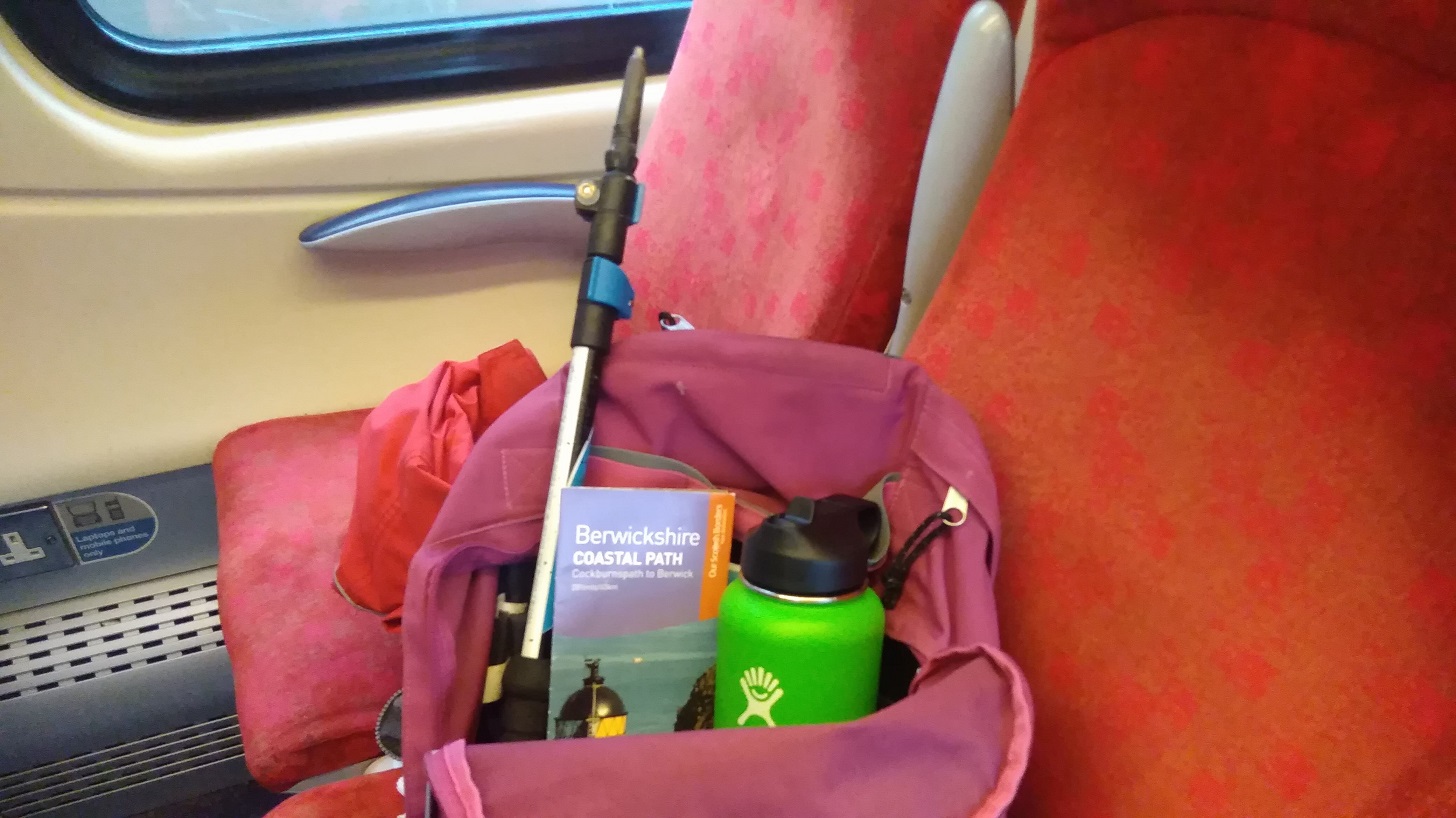
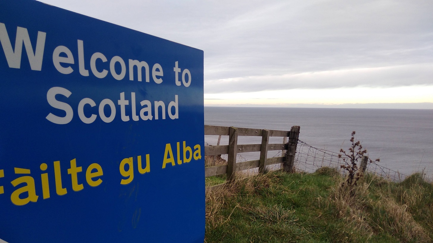
I am hiking part of the Berwickshire Coastal Path (45.5 kms / 28.5 miles in total = a recommended 3 day walk). Berwick upon Tweed is technically in England (although their football team is Scottish!) and my destination is Eyemouth, 17km (11 miles) away.
The fields become green as I travel and on my left is the point of Berwick Law, the only high place in this flat landscape. Combine harvesters are frozen mid field; barrels of wrapped up straw lie waiting; there are borders of louring pines in the distance; and beyond, a complicated sky: wispy dark clouds against a bright blue though pale background and at the same time, little bands of cotton wool balls stretching from east to west.


Found photos of (from top left) Torness Nuclear Power Station, Dunbar Town House, St Abbs Head Lighthouse.
A few golden strips of corn have been left lying in the fields, birds are black shapes in the bright sky, the bare bones of the trees are like hardened and flattened seaweed fans. People were sniffing and blowing their noses all around me.
There were acres of half-built houses as I drew near to Dunbar, birthplace of John Muir, friend to all walkers and nature lovers. A small town with the arrow-head tower of the newly-painted-white, 16th century Town House; Saturday people with pushchairs; glimpsing the sea between buildings.
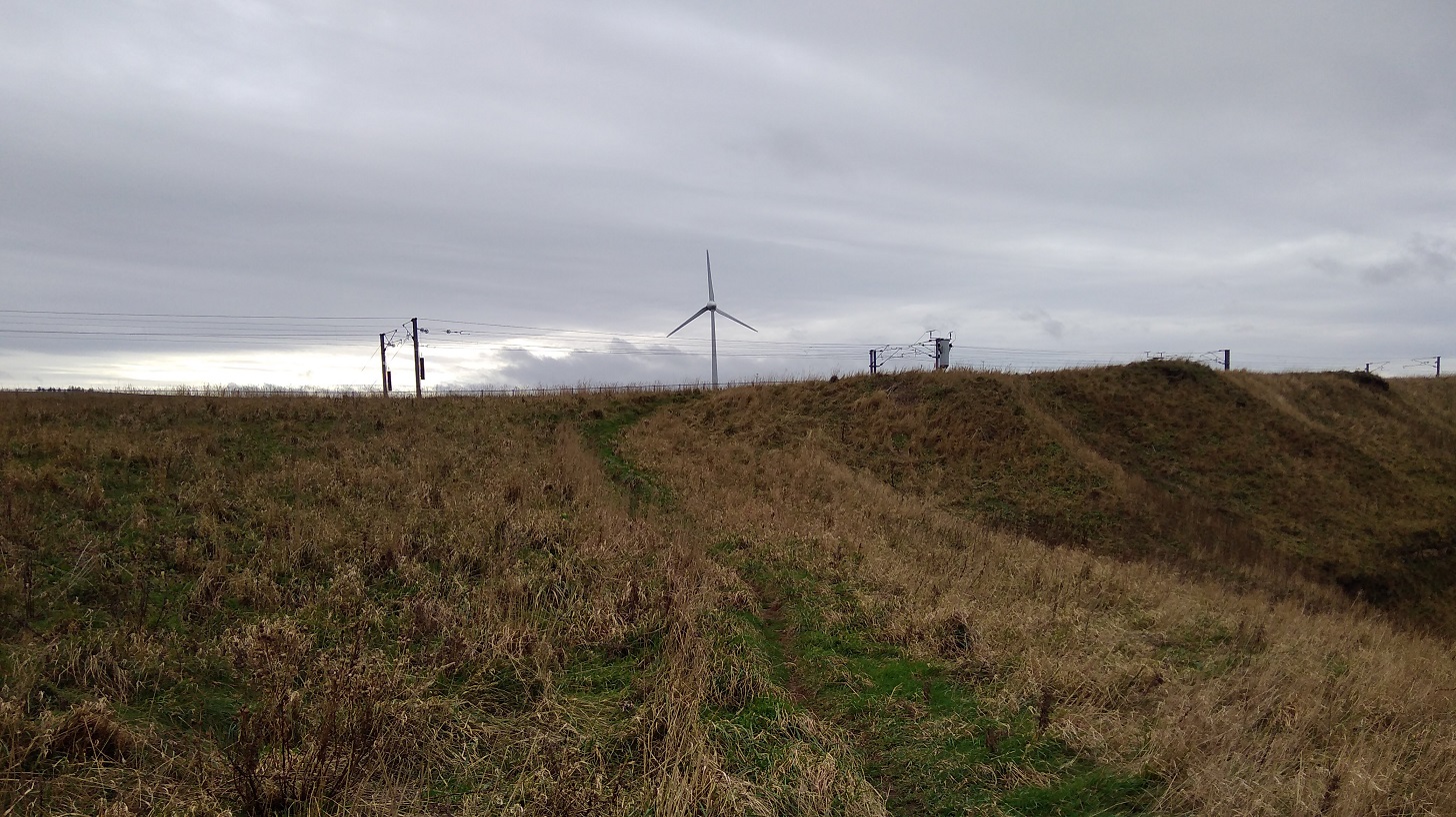
Then once more rolling by the deep chestnut loam, and a more varied landscape. We were edging further from the sea where the iconic Torness nuclear power station like children’s blocks which have been fitted together wrongly. Sheep grazed in miles of brussel sprouts fields; low, dry stone walls divided; and a solo bird perched, waiting for the morning to come. We skimmed past the St Abbs Lighthouse, where I was planning to walk to today (see below).
I could see the path I was going to be walking at the top of the cliffs as they tumbled down to the rocks and the white waves below. Men in red and blue were playing golf, their trolleys angled beside them, pools of sand dipped in the ocean of green turf.
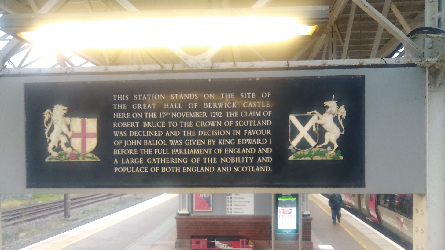
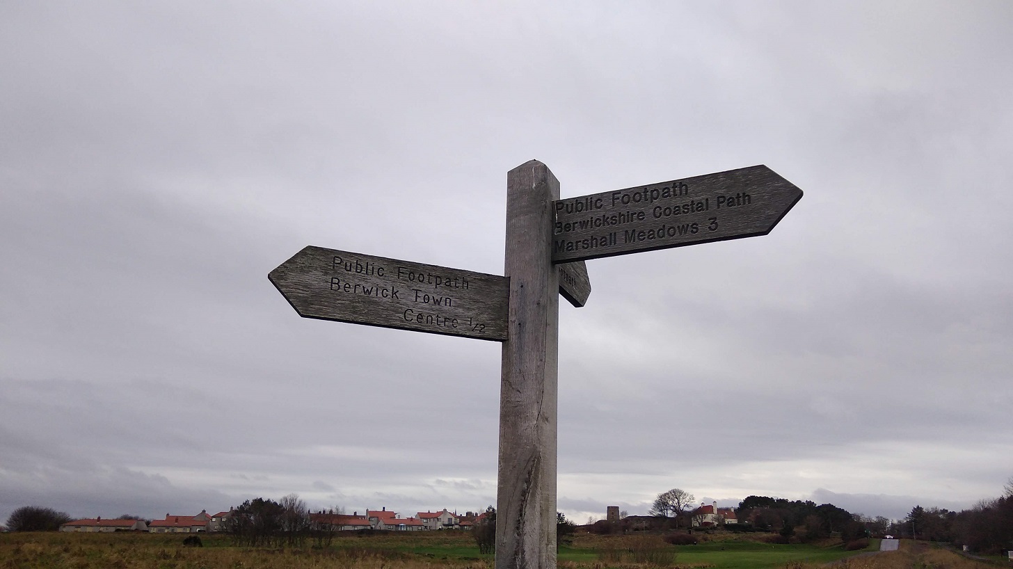
As always, it was difficult to find the beginning of the walk, so, here are the directions for you: come out of the station, go up the little slope, turn left and then take the first right.
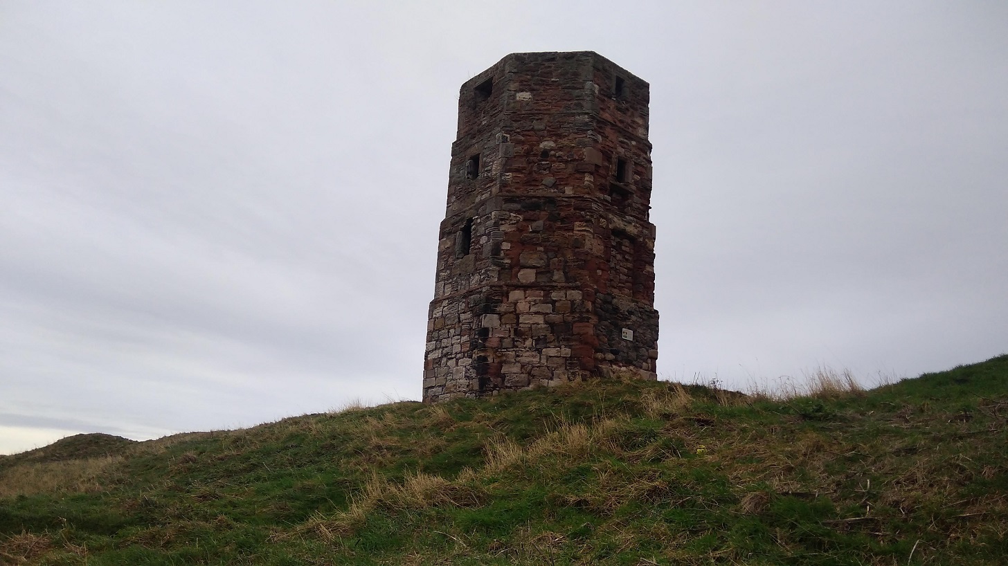
A man with 2 dogs stopped while I was taking a photograph of the Round Bell Tower , not knowing that I was waiting for him to come into shot so that I could include him! He told me that he used to work for the local newspaper and one April Fool’s Day he took a photo of it leaning, said it was toppling over, and published it with the caption, The Leaning Tower of Berwick. Crowds of people came to watch it, he said!
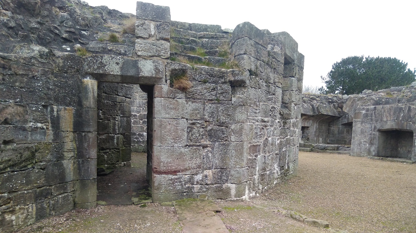
Next to the tower is Lord’s Mount, Henry VIII’s gun tower (completed in 1542). Its massive wall contains six gun positions and a latrine. The artillery included ‘the falconet’ which fired a solid ball 1000 yards (914 m).
Before I even got to the sea I lost my pole, which I went back for and luckily found, and a glove which I didn’t.
The Northumberland people I met were lovely and friendly and gave me directions out of the town and onto the path.
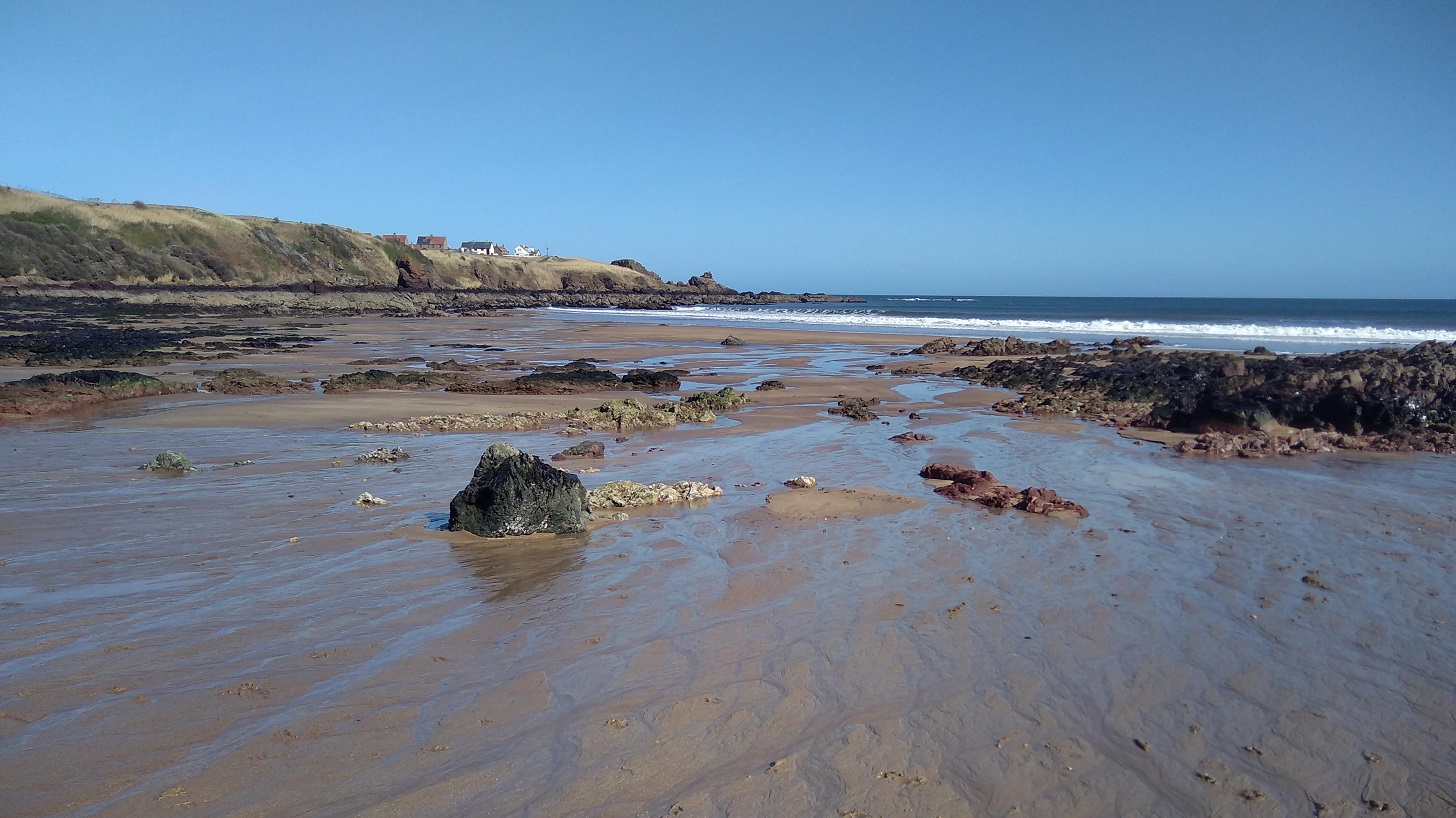
Oyster catchers were wading and ridges of diagonal rocks showed dark against the washed yellow sands. I went down the steps to a tiny cove, and along the well-trodden beach full of footprints and seaweed. There was the sound of trickling water as I made my way up at the other end.
Up above were ranks of holiday caravans where shells had been hung between railings. I could see a red and white lighthouse beacon at the end of the pier in the distance and hear the single, shrill whistle of a bird overhead – just as if he fancied me.
Immediately I came round to the next bay. It was larger this time with delightfully pig-pink cliffs and tufty tops. The wind was trying to blow the pale, beige stalks seaward. Once again it was just me and another man with his dog. Vestiges of yellow flowered gorse gleamed on the bank opposite.
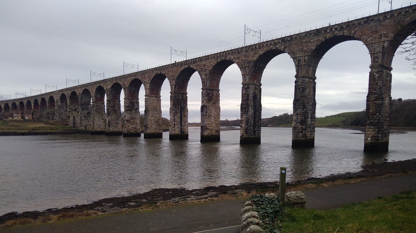
The squawk of the train reminded me that the railway line matches the path to the left, and I was walking between that and the sea.
The links (golf course) was on my left; slippy mud down to a little wooden bridge over a trickle of water; the sweet tweet of a leaf shaped bird overhead, its wings fluttering fast. It was a very narrow, windy and uneven part so I was glad that I had found my pole to steady myself – it is definitely not accessible to wheelchairs or baby buggies.
The path follows the highly eroded coast line in and out; my nose was running, tickling; and my mind returned to other similar trails: Normandy, Brittany, and Orkney.
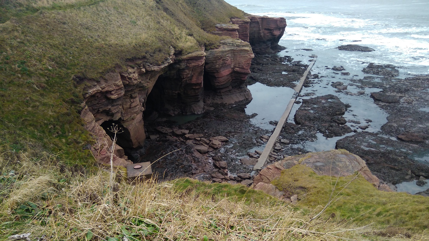
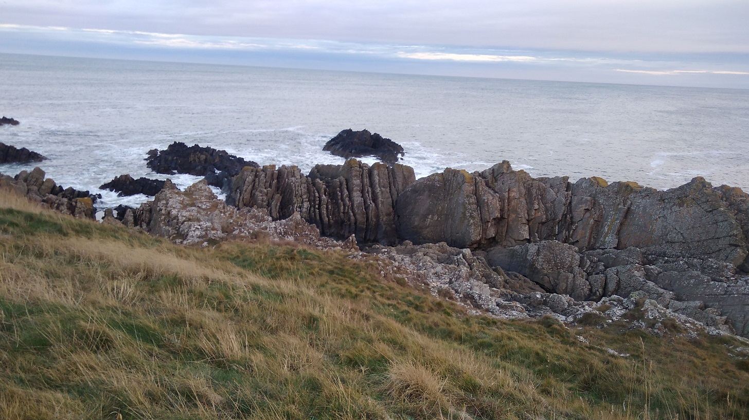
It is an impressive landscape: thin horizontal layers of pink rock, tiny slices but massive boulders. My eyes were getting a welcome break from the computer as I gazed out to sea and admired the hues and cries of this stimulating view and the birds who live here.
The sky was opening up; I could identify the peeps of oyster catchers and see sparks of black ravens; I was scanning the sea for any sign of whales. My forehead was cold as I walked straight into the northerly wind. How I appreciated not heaving the heavy rucksack for once.
I only stopped for a couple of minutes for a comfort break and to put some chapstick on my lips, but I was already cold afterwards. There were single, brown birds with long curving beaks (curlews, probably), and others in huge crowds sweeping around in the sky above me, sticking together in formation, communicating wordlessly. I was entranced by these murmurations.
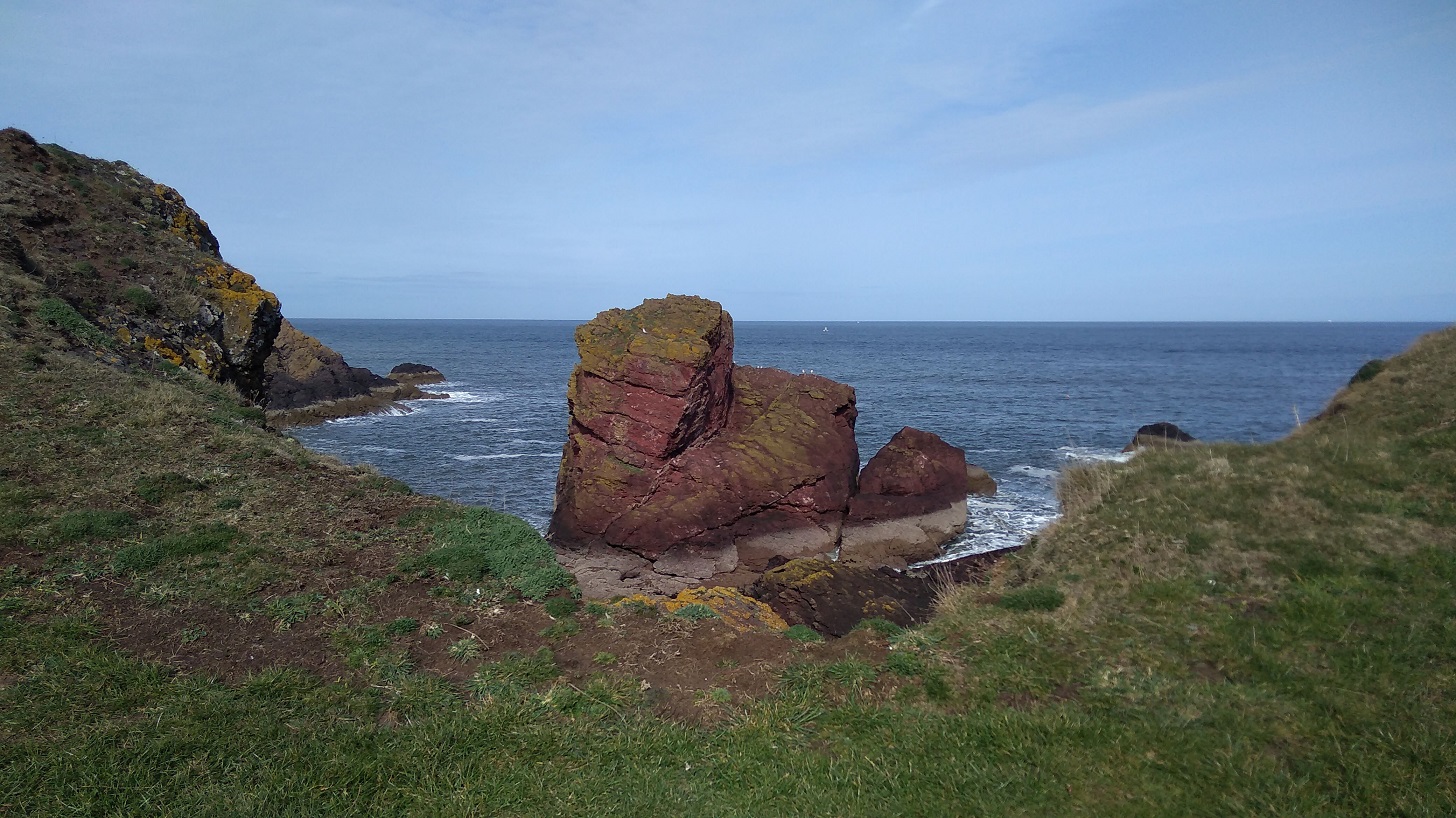
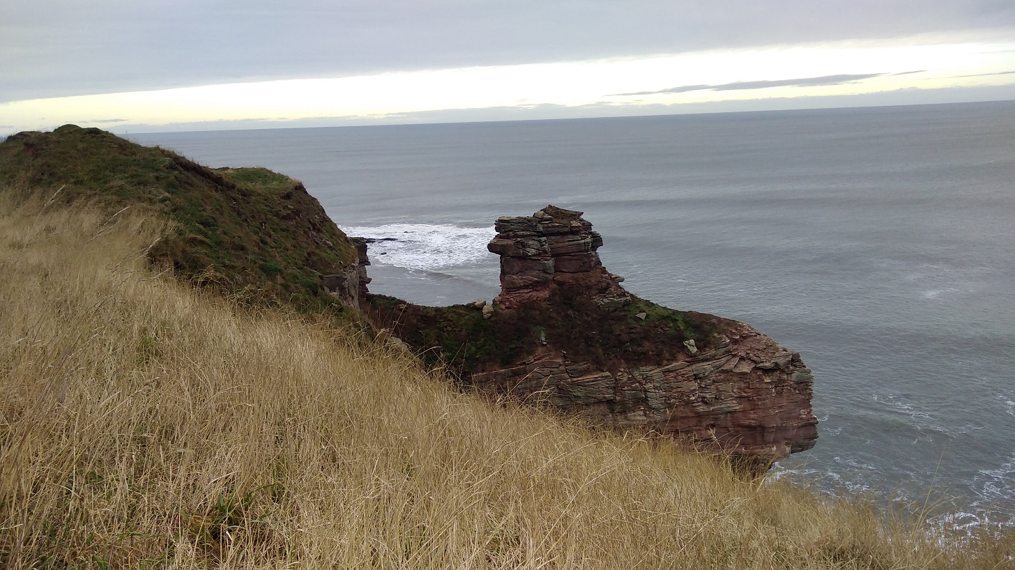
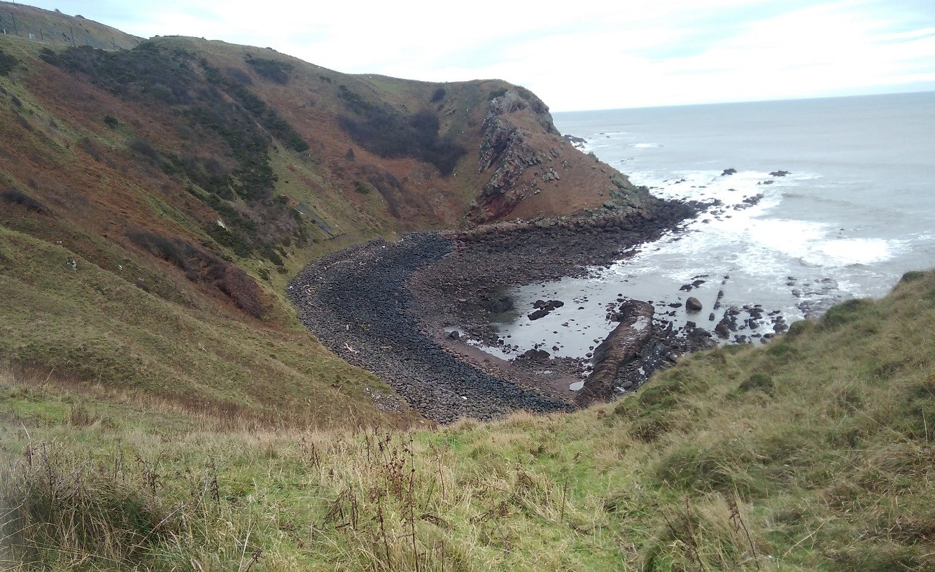
For a moment I wondered why I do this, especially in winter when it is so chilly. Then I looked out to the horizon and saw the world – so much bigger than me, and down at the rocks and the majestic sea stack – the land simply missing between it and the cliff; and it was good to be reminded how small I am.
I saw the people in their cars rushing between Edinburgh and Newcastle on the A1, and the high speed train making its way down south to London. Here I was being blown and buffeted by the wind, breathing the fresh air, listening to the natural sounds around, the brushing of my feet as they passed through the grasses, stumbling and toppling over uneven ground which is good for balancing my brain, and looking ahead. Things were coming into perspective.
Up a short wooden ladder, over a stone wall and I discovered I was in a caravan park called Marshall Meadows. Much to my disappointment it was not the pastures I had imagined!
Back onto concrete I immediately felt my sore feet and realised I hadn’t been aware of them since the pavements in Berwick.
By this time I was looking for a place to shelter and sit for a cup of tea and a banana to keep my sugar levels up. I didn’t want to lose my sense of proportion, which has happened in the past.
The Cuddy Trail is here. Cuddy is Scots for a donkey and the ‘beasts of burden’ were used to transport coal and fish from the shore to Lamberton and the Great North Road.
I had to climb over the gate as the farmer, in his wisdom, had padlocked it shut despite this being a public right of way and well-known footpath.
Then I curved back towards the wild cliff corner and the sound of the crashing water. The wind was causing shadows on the ocean. It had that look about it as if it was rising up to the horizon and down to the beach. It was heaving. The surface colour looked flat and even, until I really paid attention to it. Then I saw the variations of the olive, seaweed and sage green, with slate, business suit, and pewter grays, all edged with white lace and set against a peach sky.
There were lots of helpful signs indicating that badgers, yellow meadow ants and peregrine falcons can be seen here, but not by me. I did get glimpses of the fulmars on the ‘cliffes’, nesting in their flint and white plumage, so far away that all the photos were too blurred to be reproduced.
Twenty minutes earlier I had passed two men getting out of a car and preparing to surf, clad in black wetsuits with their white boards. I bet they had a good time in those rollers!
It was then that things started to go wrong.
But I did. I thought, ‘really?’ but I couldn’t see anywhere else to walk as the railway came so close to the edge, so I went anyway.
I skirted the steep slope first of all, grabbing handfuls of grass to stop myself slipping and edging my feet into the side, until it became too hard going. Then I dropped down onto the rocks. They didn’t look too bad from a distance, but they were – it was really hard scrambling over them. I could see a way out on the other side and I still assumed that was the right way. I pushed and tore through the brambly undergrowth, I fell down and got myself back up. I persevered. My pole kept collapsing itself and up at the top was a sheep’s face peering over at me. I could see hoof marks where they obviously managed fine, but I sure was struggling. Was there a way? What could I do?
Go back, that’s what! It was impossible. I was very hot and bothered and there was nothing for it but to retrace my steps, which was easier said than done and something I don’t enjoy. I traversed the rocks closer to the sea which were slippery as well as treacherously uneven.
I had completely lost my cool until I came across such a beautiful sight that I just had to stop and breathe.
It took a lot of time (perhaps three quarters of an hour) and I used up a great deal of my available energy. And it took quite a bit of serious tramping to get over the anger and frustration of the experience. On the back of the BCP map it says: It may seem unnecessary to provide directions other than saying – walk north or south keeping the sea on your right or left!’ Am I the only person to have missed the most straightforward path?
Slowly I realised I had to relax and get back onto the right path. I had to let it go or I couldn’t enjoy the remainder of the walk, so I focused on anything but my feelings and picked up pace.
In my recording I said that I chose not to walk where two others were, around a field when I could clearly see a short-cut straight across the top of it. I saw the trampled down barbed wire and said to myself, I’m not falling into that trap again!
Next was a straight and concrete side road to Homestead, and I spotted a brightly coloured lifeboat chugging along. When I turned round, there was a deer lolloping in the undergrowth very close by with its beacon of a white tail. It seemed to be rather a special sight. The Medicine Cards say that when deer appears, ‘apply gentleness to your situation.
At 1.50pm, my phone battery was already down to 32% and I quickly came across another conundrum. I took a second wrong turn. This time I crossed a field to the left because it looked as if the alternative went over the edge. It was not clear, so I stood and debated and as the gate was open I chose to go through.
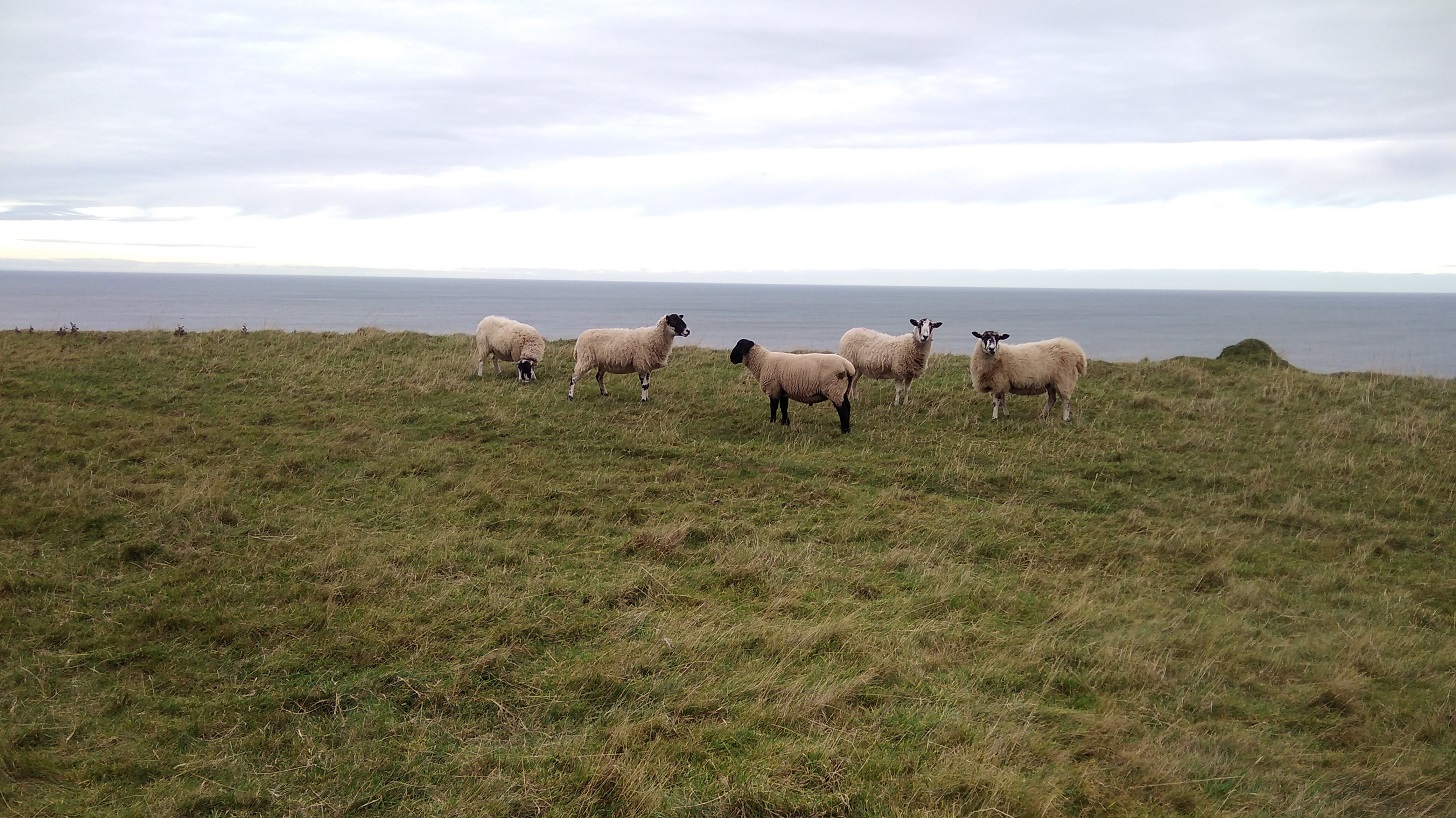
Right to the end of that green field I went, past all the sheep who may well have been watching wisely for all I knew! And then I didn’t know where to go but back – it was a dead end. Never again will I walk without an ordnance survey map, I declare to the sheep!
So I went through the other field (not in a straight line), climbed over a stile, and doubled back (presumably the path avoids the farm land).
There was the village of Burnmouth below me at last, tucked under the heights. I zigzagged steeply down in the opposite direction from the yellow arrows, behind the gardens and at last found a BCP sign. Amazing how this often happens at a time when there is absolutely no other possible way anyway! For some reason the walk is not as enjoyable if I am not going in the right direction.
Apparently Burnmouth was ‘once a hotbed of smuggling’ (tea, brandy, silks etc) engendering lively stories from 1780. A pretty but secluded village, it is divided into two halves with a harbour inbetween. Candy coloured cottages seemed to be for visitors. The tide was out leaving streaks of low rocks, as if someone had painted on a glassy surface and the paint had separated unevenly.
A man stopped to do up the zip of the woman he was with and my black mood meant I could barely manage to say a friendly hello. My knees hurt going down and my insteps going up. The sign pointed in the direction of two roads, one to the right and the other uphill. I took the path which ran to the right of a dour chapel, curving through woods, over a planked boardwalk, then up a steep hillside with a horrible groaning noise going on – something to do with the fishing in the harbour.
There was a handy bench ‘Dedicated to William Telford, born Burnmouth 1925’ for resting my weary feet and admiring the vista but I was very stiff when I got up. I hadn’t been walking for a month of so and it was showing. I thought I wouldn’t need the chocolate I bought yesterday and wished I hadn’t left it at home.
Blue tits played in the briars, zipping in front of me; silvery green lichen covered the branches. Humbled and cut down, I did not recover quickly. I was reduced to little more than zero miles an hour.
Once up high again and back into the windy onslaught, I needed a hat and two hoods – it was a mere two weeks after the winter solstice.
Then, halleluja! the sun started to show its lovely self. 3.15pm. What a wonderful light.
I had to ask for directions from a group of teenagers heading out for some fun, giggling. I wound my way along the jetty and around the end remembering that I was here for my birthday with Lesley in 2016. The wandering geese took no notice. I was aiming for the co-op store at the centre (ye cannae miss the co-op, it’s the biggest building in the toun I was told) and the most helpful girl who checked the bus times on her phone for me – my fingers were too cold to work mine and it was threatening to run out of battery.
I was focused now on getting warm and fed as I always am after a long day’s hike. I had to spend a great deal of time in a Wetherspoons in Berwick until my return train to Edinburgh, but I warmed up and rested my weary limbs.
I didn’t make it to St Abbs so I will have to start next time at Eyemouth and cover that stretch on day 2.
Train: Edinburgh to Berwick upon Tweed (Scotrail £14.60)
