Timing: Beware! the official coastal path website says this day’s walking takes 3-5 hours. I defy a human to do it in 3 hours – I think it is a mistake. I am not the quickest walker, but it took me 7 hours with 3 x 15 minute stops and a last minute detour
Overall: I would not recommend that people do this all in one day, especially immediately after the previous stage of the FCP, and with the transport difficulties and wintry conditions
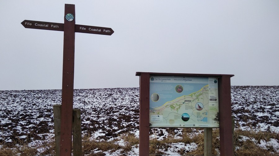
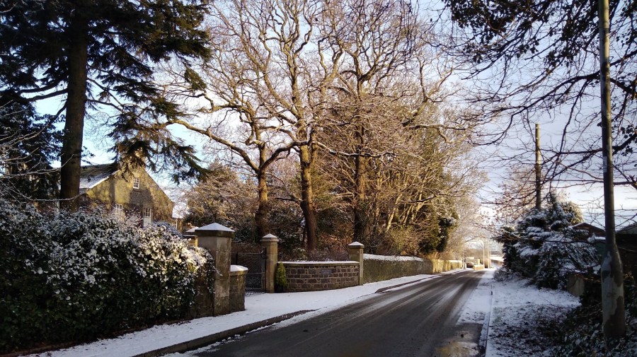
Dundee to Woodhaven via St Andrews
My day began in Dundee where I had unwittingly spent the night. See Leuchars to Wormit for details. I took the earliest 99B bus to St Andrews (8.19) which was straightforward.
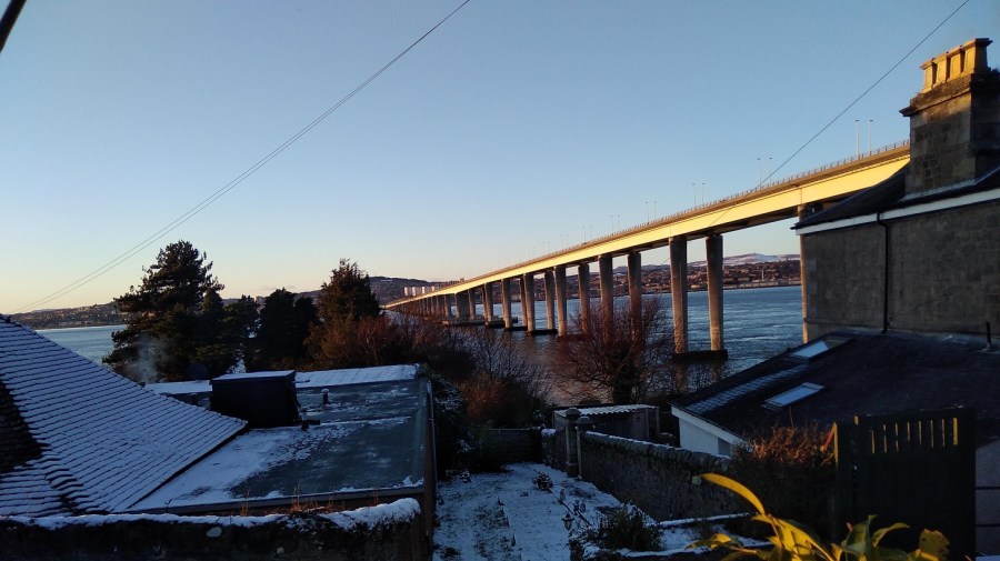
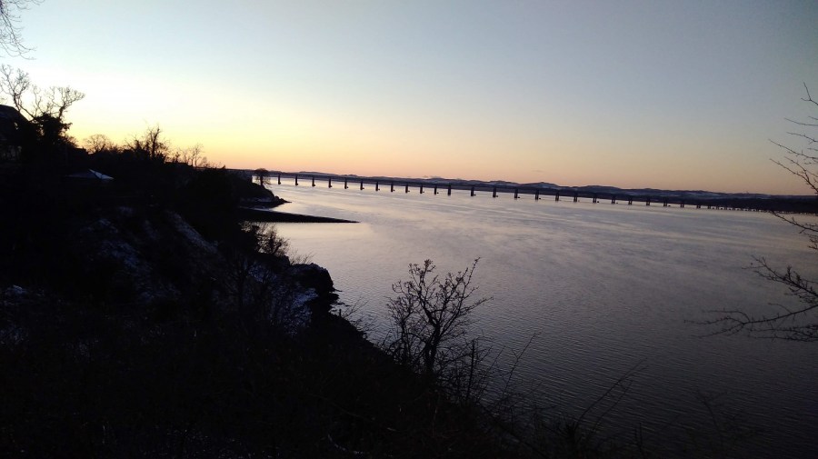
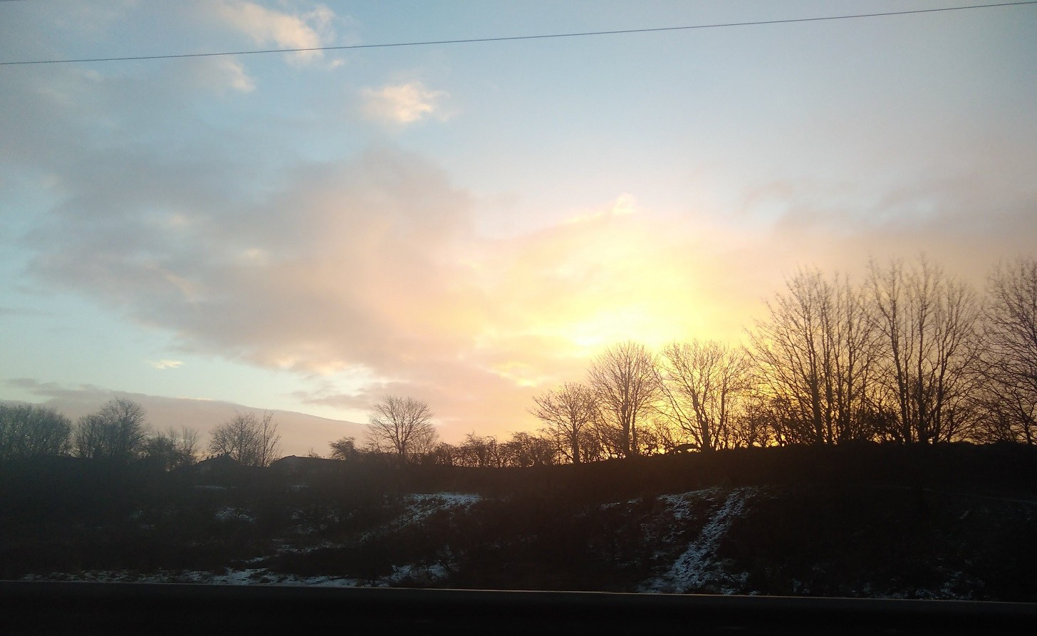
Crossing the Tay back to Fife as the sun rose
Unfortunately when I arrived at the St A bus station the bus company no longer operated out of it. I phoned up to find out where I could get the 77 back to the Wormit road, connecting to the ’emergencies’ line and feeling a little guilty as it was not exactly a life and death situation. I was concerned that I would not get to Newburgh before dark. The exceptionally kind man on the phone explained that there never has been a Sunday service of the sort I was waiting for! In the end, on hearing the note of desperation in my voice, he came up with a plan and 5 minutes later a second gentleman appeared in a van to pick me up. He had been called out of his bed to fill in for someone who was sick, left his own car at the depot and was on his way back to get it. He took me along with him!
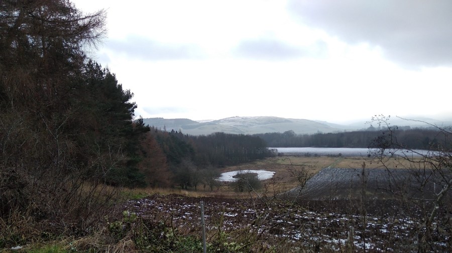
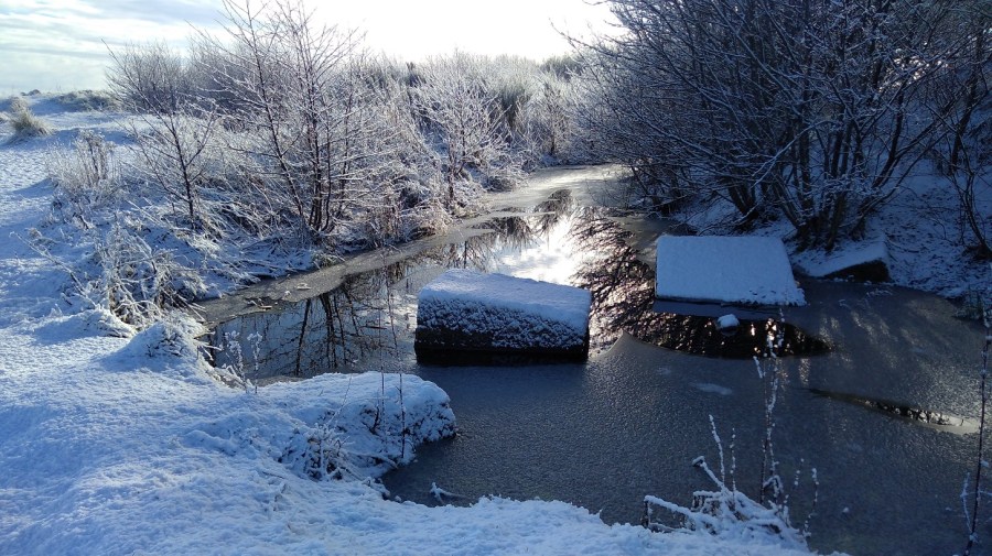
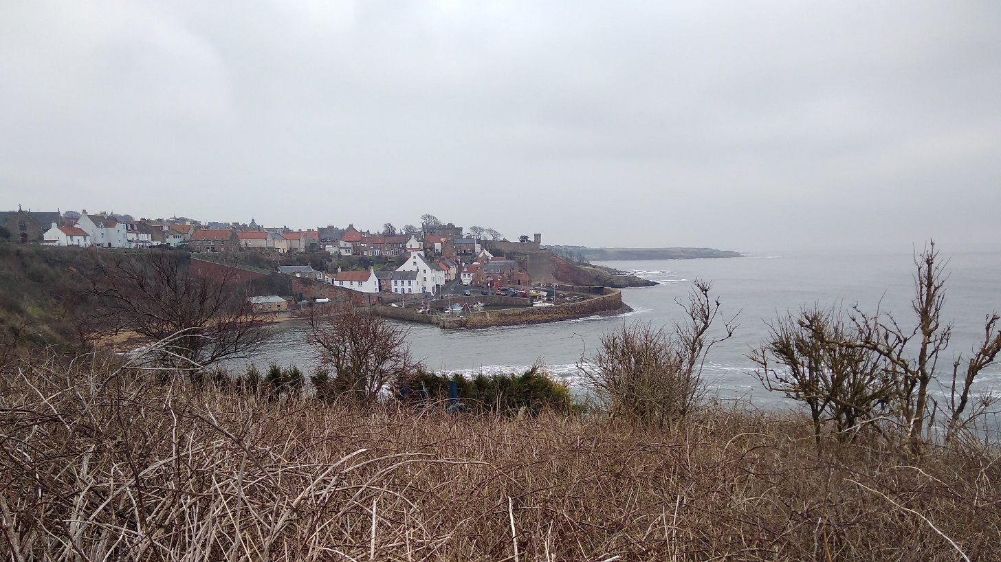
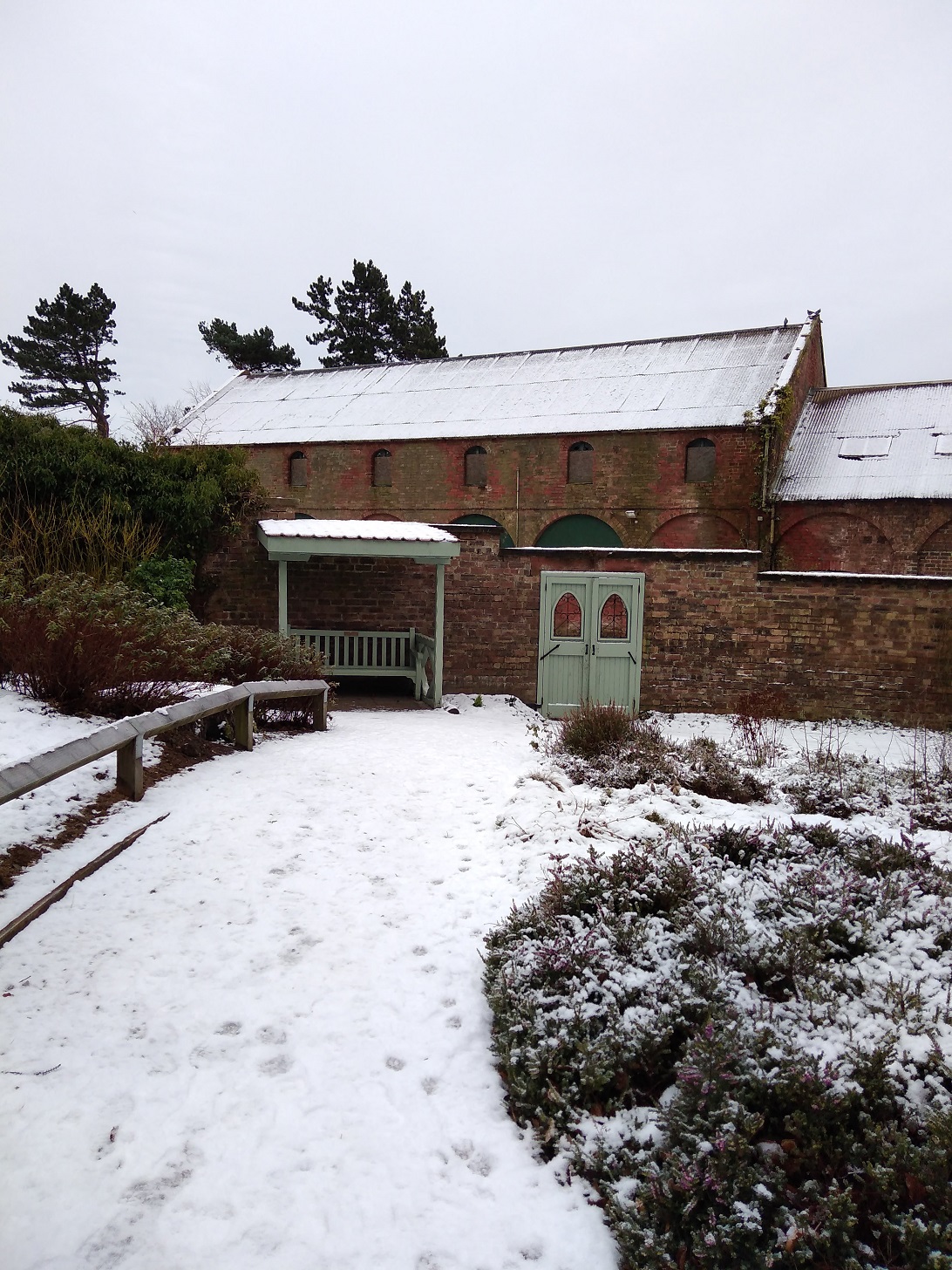
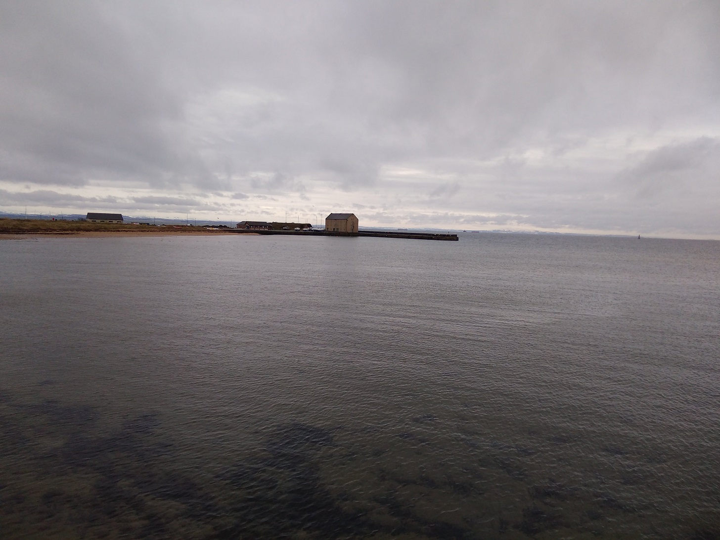
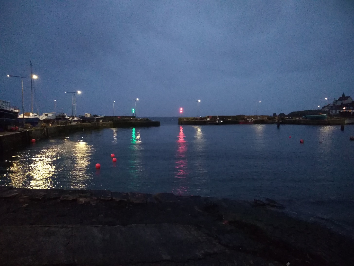
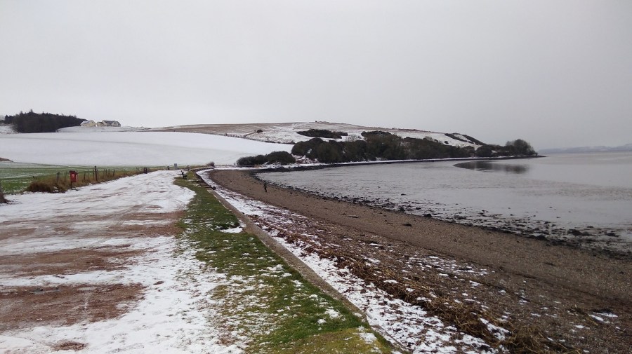
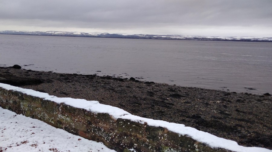
Woodhaven Pier, between Newport and Wormit, River Tay, Scotland
It was half an hour’s walk from Woodhaven to Wormit, first along the B946 (a residential connecting road where the pavement was all slippery from the snow which had hardened into ice overnight)……
The air was very clear as I looked across someone’s wintry garden to Dundee, Scotland
….then taking a right onto Bay Road…..
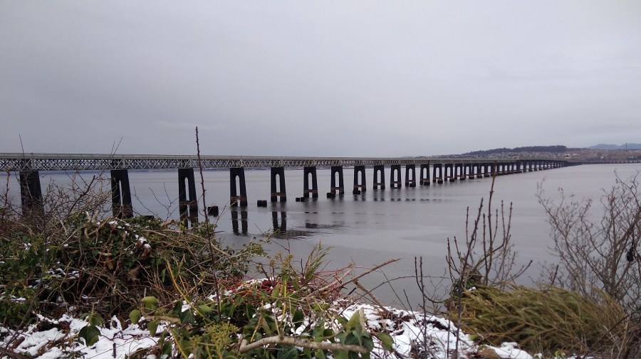
Tay Rail Bridge
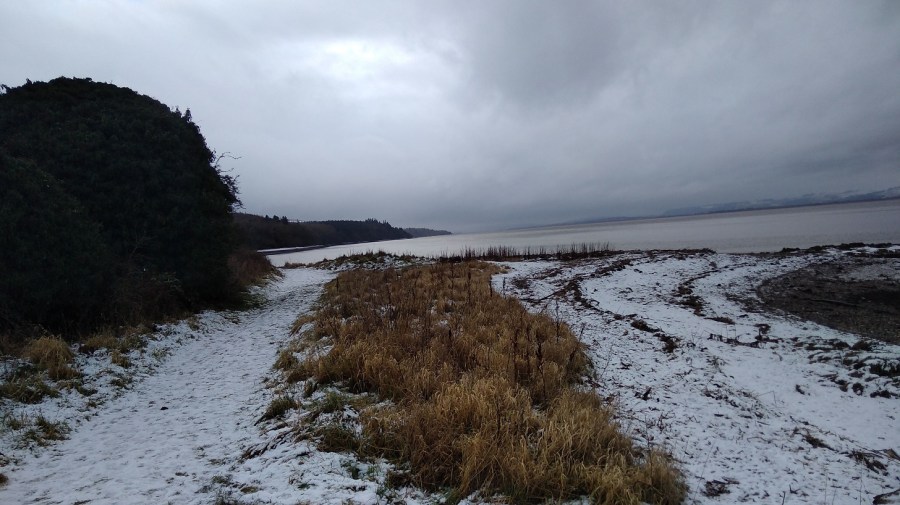
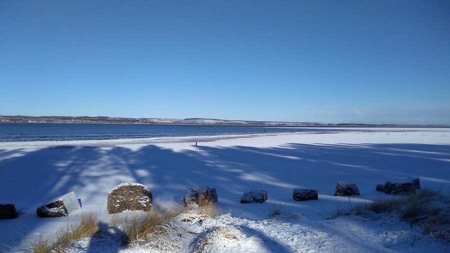
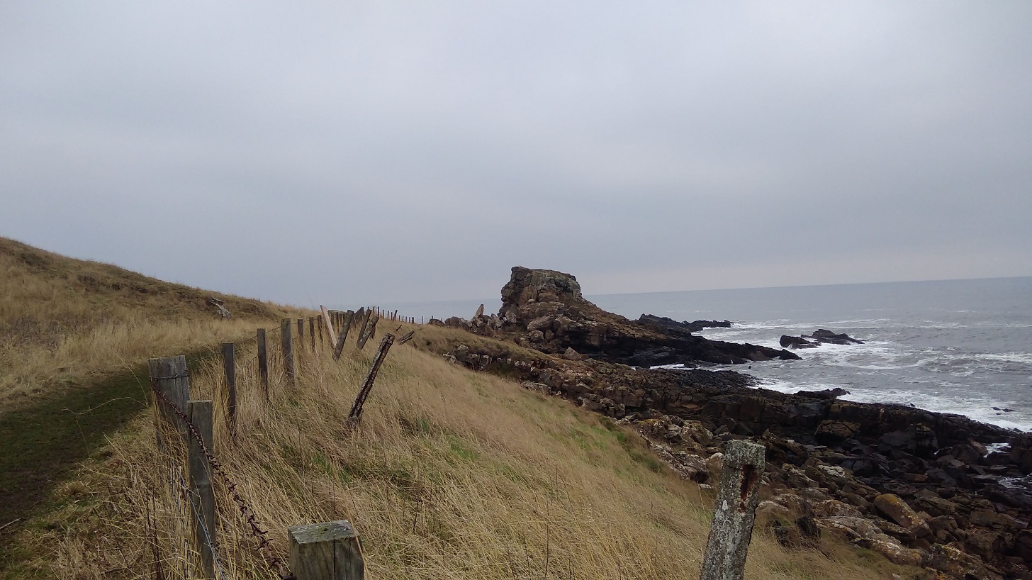
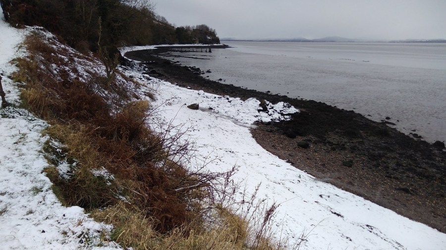
….bypassing Wormit proper and heading straight to the beach where the FCP runs across the strand for a bit.
I could see where I would be walking, Wormit Bay, Fife, Scotland
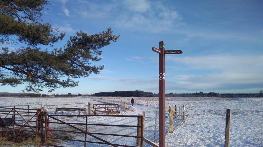
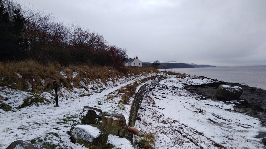
Wormit to Creich
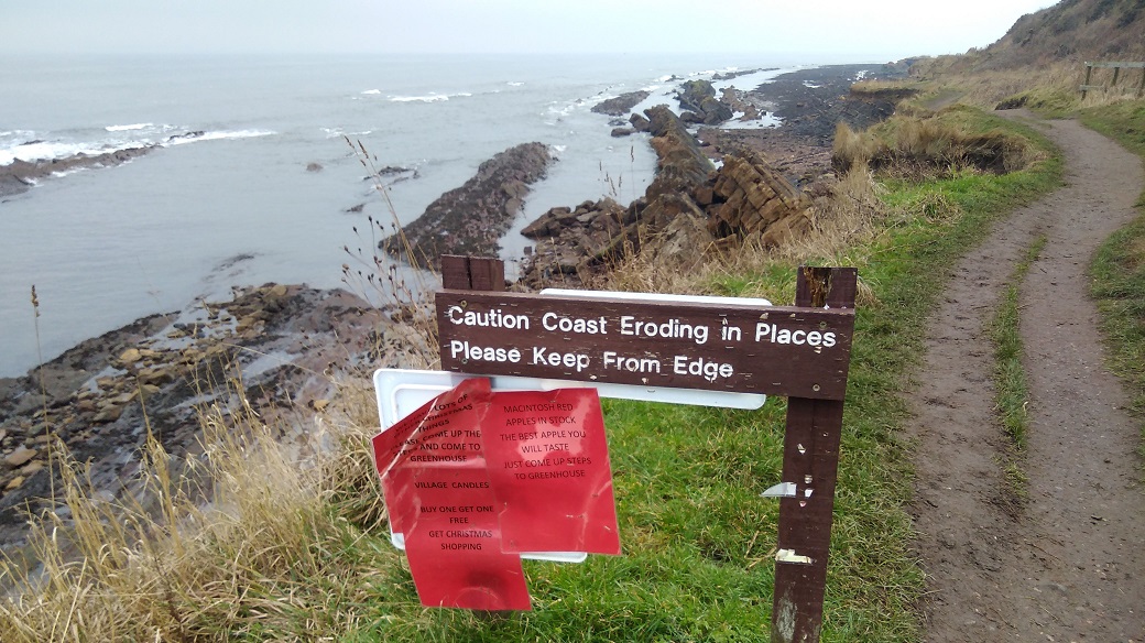
It took half an hour to get to the start of this stage, so yesterday would have been exactly 7 hours if I had finished and today I must add an extra 30 minutes to the walk if I am to reach the final ending point in Newburgh.
It was raining / snowing – a dull, grey day.
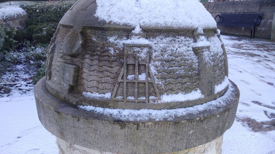
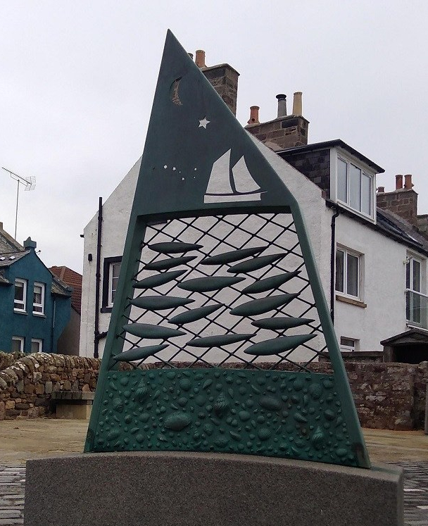
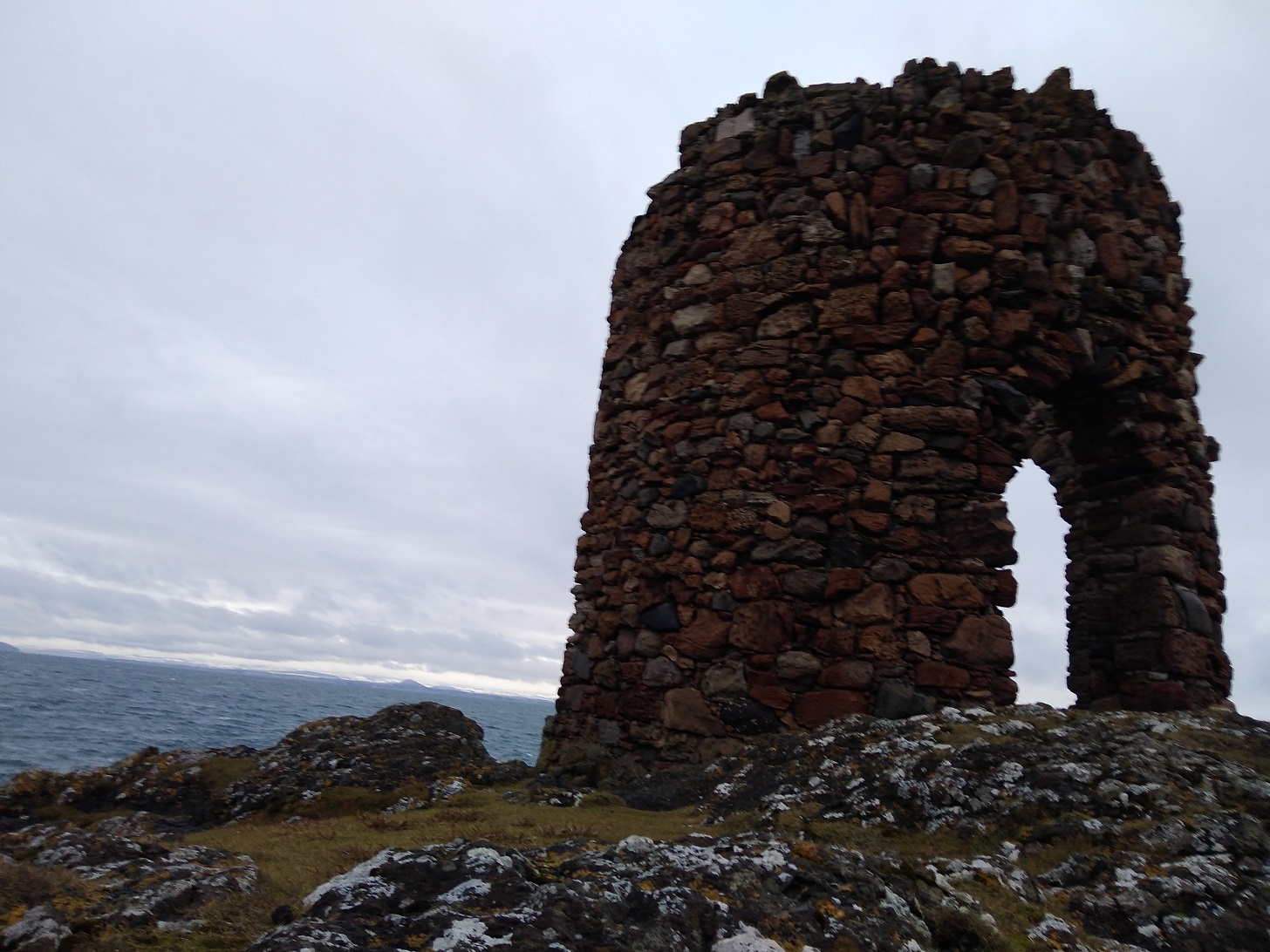
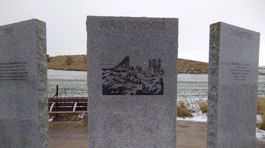
Tay Rail Bridge Memorial at Wormit Bay
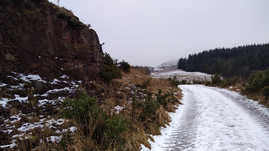
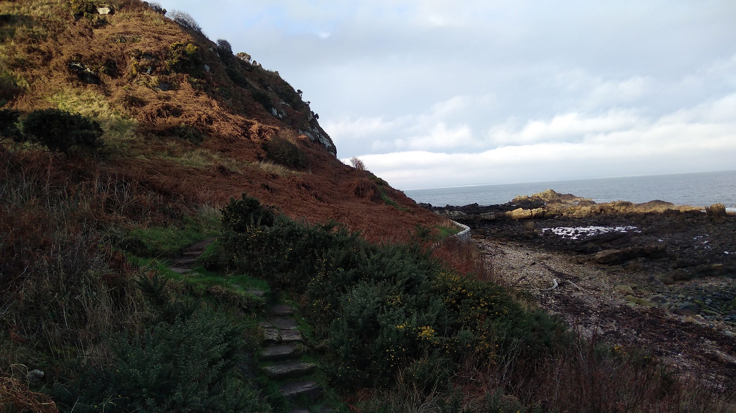
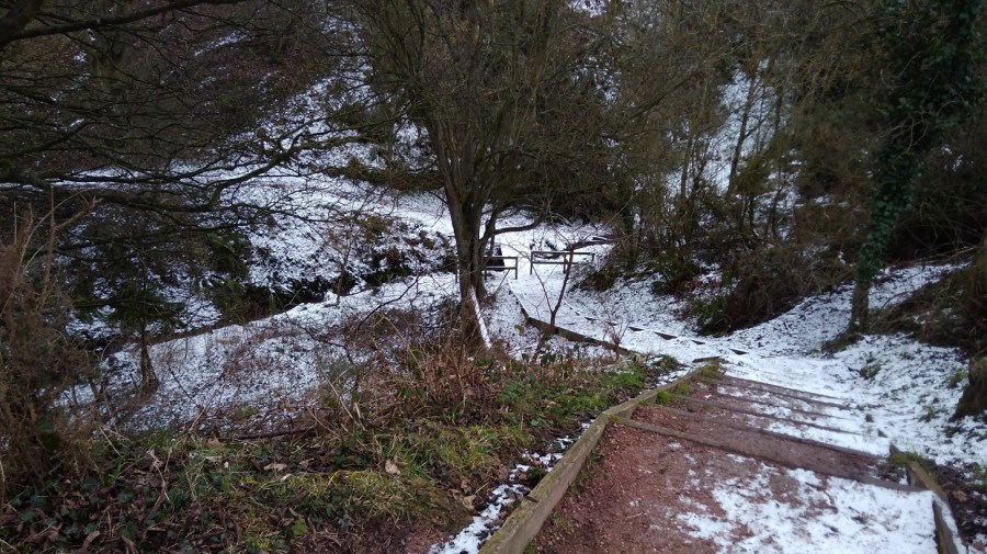
The local lady was right that I was due for a climb, despite the way it appeared on the map. She said she had avoided it because it was so slidey underfoot. I passed through the metal gates to keep the cattle in, and further on I appreciated the landlocked wooden seal sculpture.
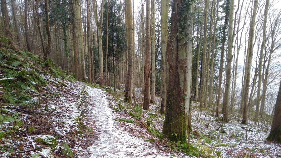
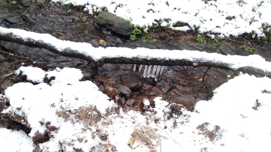
Looking down onto the watersideIcicles in the dellsThe path wound through woods away from the coast, up and down steps and across wee burnsThen it opened out – the arable fields were slopes of white and the copses made of bare twigs
Catkins dangled olive green, and other peoples’ footsteps showed me the way.
Drawn to making more of my marks in the snow – the dynamic relationship between the elements of fire and water, sun and ice, passion and reflectionStripes of muted greys: snow, stone wall, shingle, the estuary and the white covered hills of Tayside in the distanceThere were occassional dwellings along the way. I saw no-one
There was a quiet, gentle lapping of waves on the shore as I went between two houses.
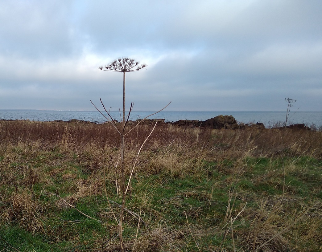
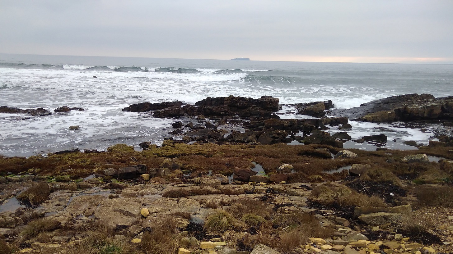
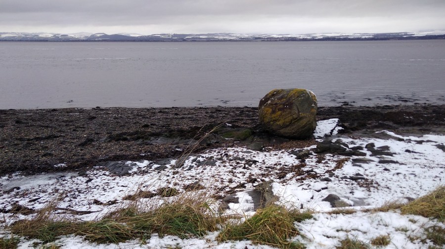
A massive boulder covered in gorse-yellow lichen on the half-white beach. The rest was grey. A flock of oyster catchers whizzed past, low to the water, followed by a loner, white stripes flashing to match the snow
A flying oyster catcher, Wikipedia.
Near here were plaques with children’s poems about the sea on them: I liked, ‘River lying patient and flat’
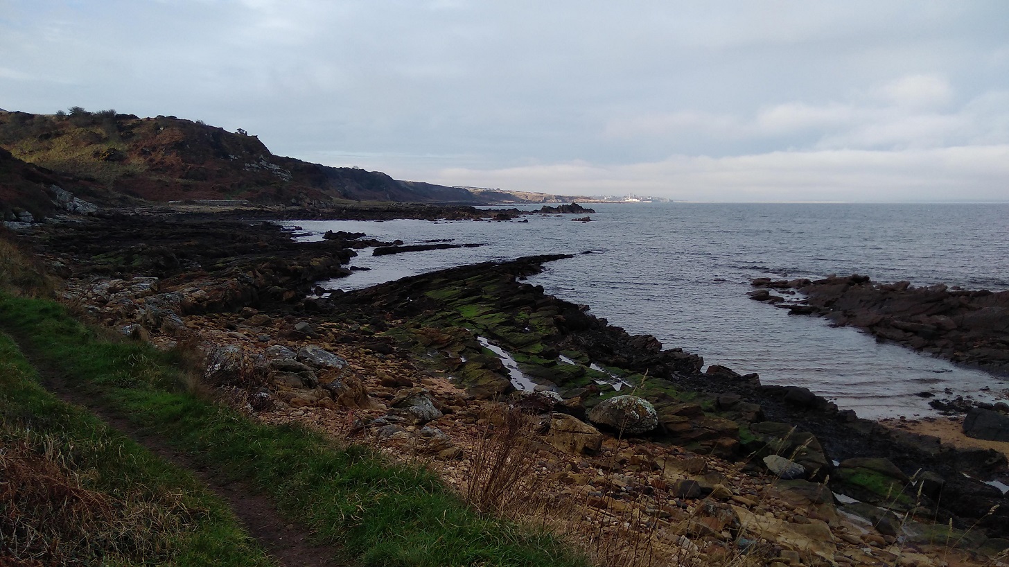
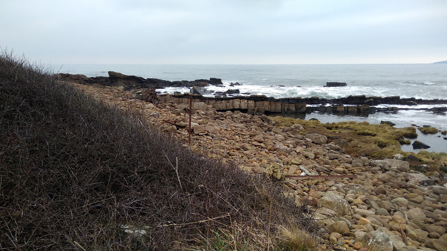
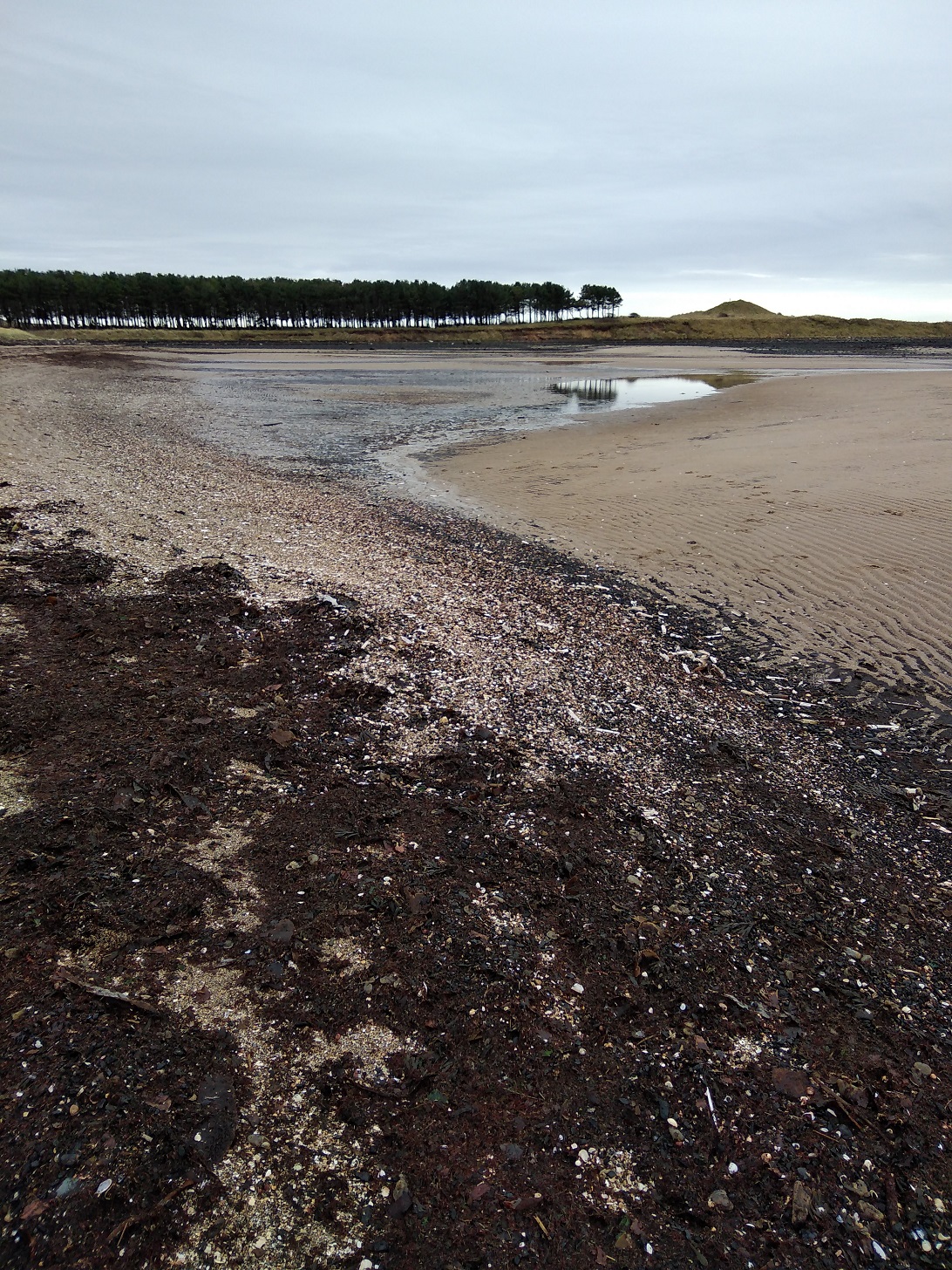
There is a stretch of stony beach at Balmerino – unusual for the FCP. I checked with three extremely well armed fishermen and yes, for sure it was along here and then through the woods. It was a great curving bay of bleak beauty.
Two little girls in their pink all-in-one ski suits pottered with their parents
I missed Balmerino Abbey which was marked on the map – it must have been inland, off the path.
At 11.30 I was having a lovely, peaceful, early lunch with my back against a gorgeous trunk with ivy vines twining up it, when the sounds of a boisterous group signalled they were clearly approaching from whence I had come. Surely they would have caught me with my knickers down had I followed the call of nature, so I didn’t do that! I hastily moved on and almost immediately passed another group going in the opposite direction. This pretty stretch is obviously popular for Sunday morning walking.
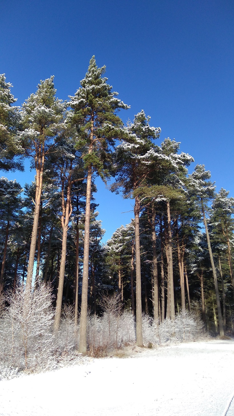
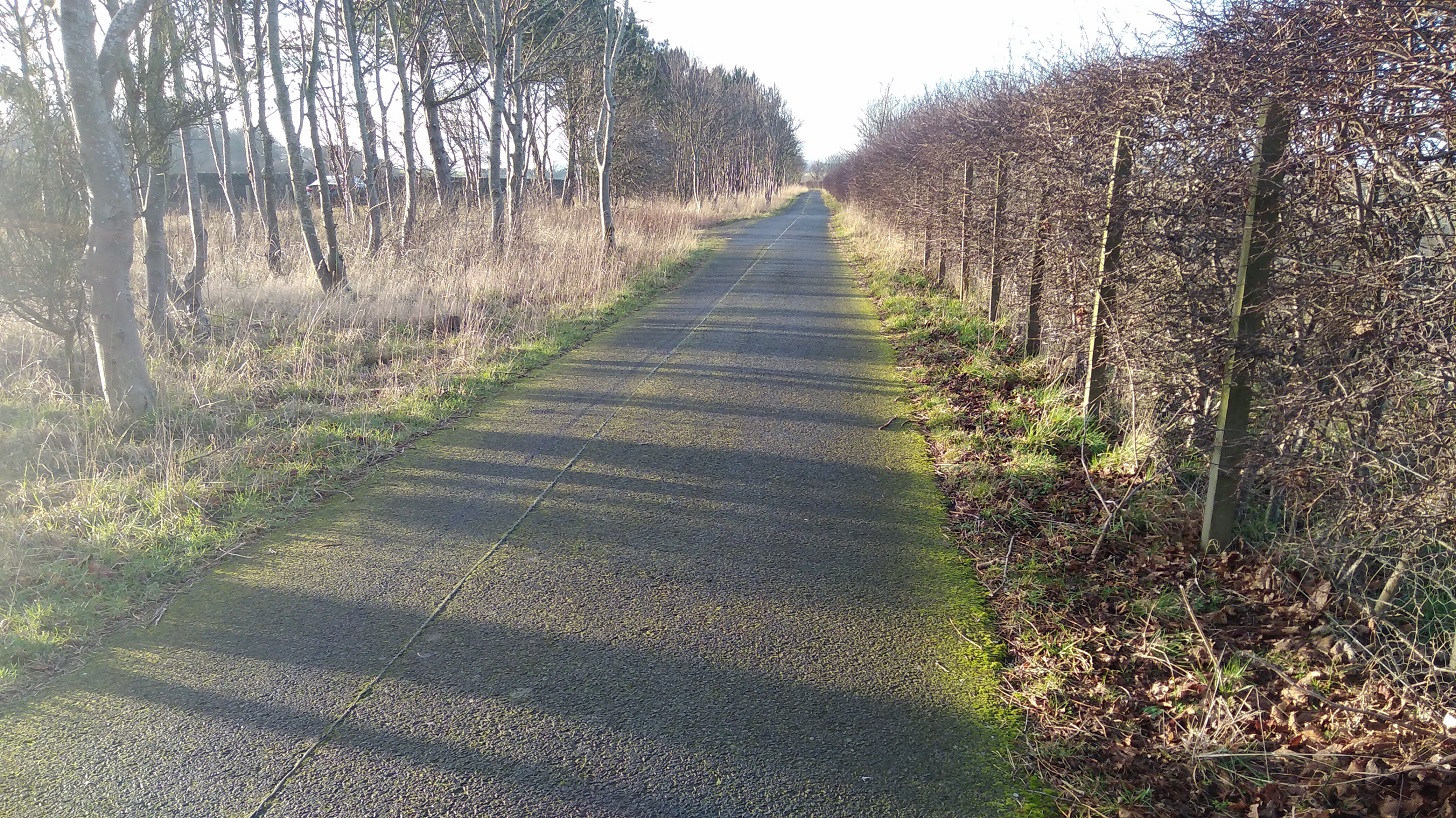
The Fife Coastal Path between Wormit and Newburgh, February 2019
My thighs were tight and stiff this morning after yesterday, and I could feel the effects of carrying the heavy pack such a long way.
Leaving the water behind, I started on the long, steep and icy uphill part. I realised that perhaps the official website meant 3 plus 5 hours not 3 to 5 hours, and I worried that I would not make it before dark. I was not sure what to do, so I picked up pace.
Up high and with a right turn I was on hard ground which was much quicker to walk on, near a residential area. I was trying to remember to keep my eyes open for the signs which are always harder to see in this type of situation.
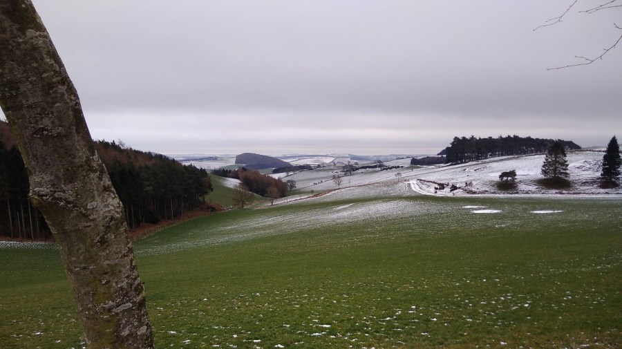
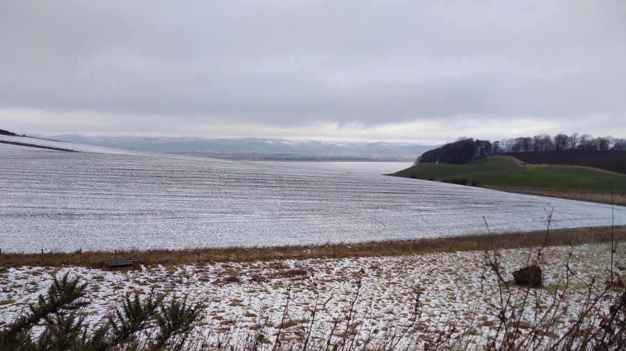
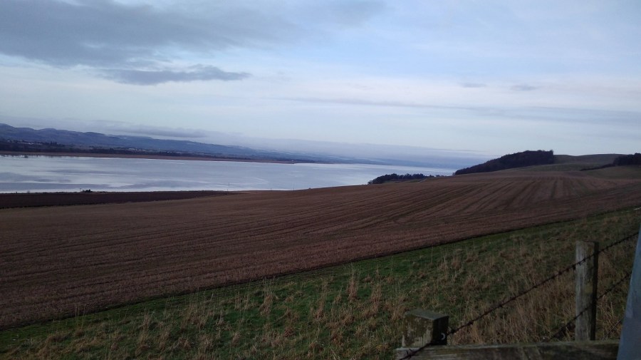
The hard climb rewarded this view – there are not many wide open vistas like this on the FCP
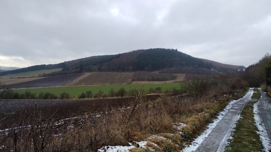
I passed places with names like Hazelton Walls, Creich and Pittachope (perhaps meaning ‘farm of the willow-place’). Black Craig Hill (203 m) was on the right.
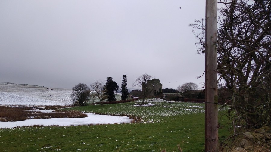
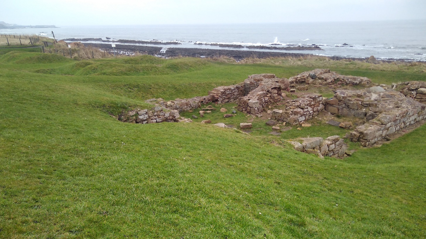
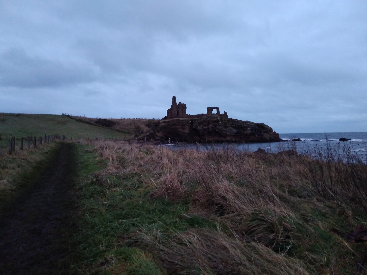
Ruined castle at Creich, Fife
Pittachope to Glenduckie
At 1.30 I was hauling myself gradually up a rural road with the cold wind on my cheeks. There was good visibility but with damp and wet in the air. It was a bit of a plod but I was focusing more on the moment than the future.
Then I took the left off the road to a steeper incline, passing a bearded man who cheerfully greeted me. His two boys were brightly clad in winter gear, and all three were pulling scarlet sledges up behind me, to play.
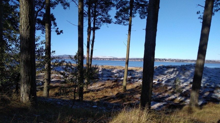
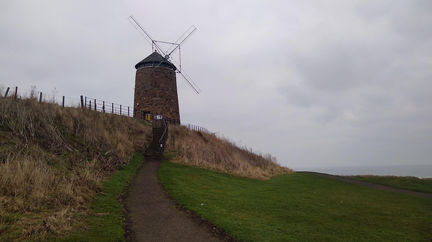
Ahead was Norman’s Law (285 m), the very same which was mentioned in the information I saw yesterday in Tentsmuir Forest. A law in this context, is a round or conical hill, often in isolation. It is at the eastern end of the Ochil Fault and you can walk in this place using the Walk Highlands directions. Also a hill fort site with its neighbour, Glenduckie Hill (what a great name!), you can follow Fifewalking’s instructions here.
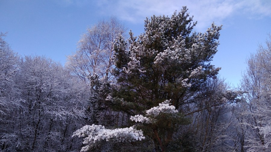
Serious, dark pines and red-brown crags, FCP, Scotland
What with the website duration being erroneous, gates which say ‘push’ when they mean ‘pull’, and these signs which say ‘keep left’ when they mean ‘right’ at the turn – nothing is as it seems – which exactly sums up my life right now!
Looking back I admire the Tay from a height
It was misty at the top of the steep climb. Some of the snow was like soft egg-whites and therefore hard to walk on.
There was a gorgeous smell of burning pine, presumably not a natural occurrence in this icy weather. Maybe, I mused, it was not mist or snow blowing, but the smoke. I thought I was at the top and about to go down at last, but maybe not.
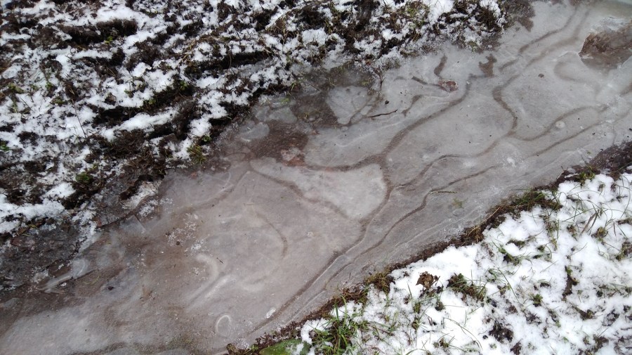
A tree platform had been erected; the puddles were deeply frozen; I spied various animal tracks in the snow as I passed Red Fox Wood
I sat for a cup of tea and meditated for 5 minutes. There was a cave opposite and rustles were coming from it; a bird was making the sound which a dog makes when it has a squeezy, squeaky toy in its mouth. It was a peaceful moment.
I was coming to terms with the fact that there was more climbing ahead which meant views revealing bodies of dusty blue water including one shaped like a bagel somewhere in the vicinity of Blinkbonny (another wonderful place name)Going slowly downhill but there was another challenge ahead: Glenduckie Hill
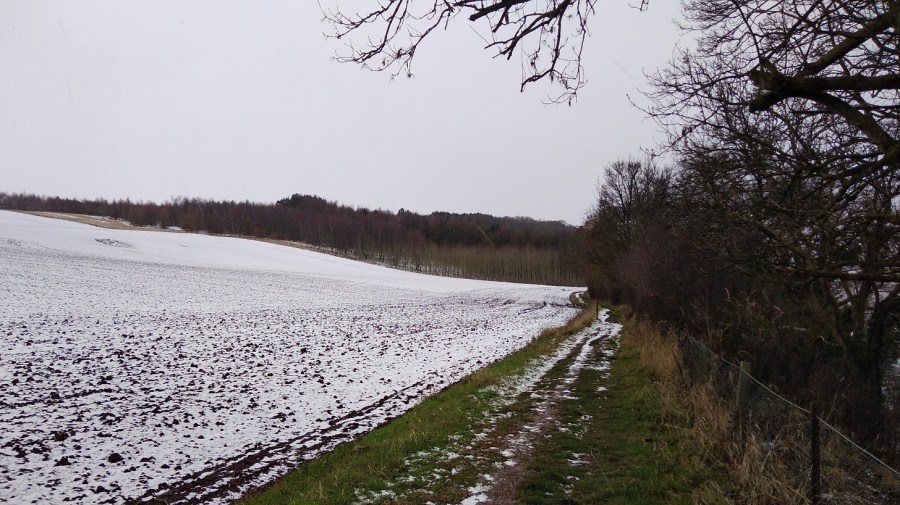
I zig-zagged around farmer’s fields – cows in one, sheep in another. It was 14.45 and the sun had come out.
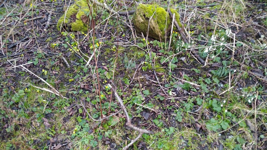
A brief lowland patch, past attractive cottages, well-loved gardens and woodland, nurtured sunshine anemones and snowdrops with their heads swaying from side to side in the breeze
Glenduckie was indeed an even steeper trawl uphill, albeit not to the actual summit. The path curved round and round, and up, and then there was a tiny slope down before another arduous climb.
I felt totally exhausted, but stopping meant that starting was well nigh impossible. It was still frozen underfoot – an icy rockscape and, beyond, windswept sheep.
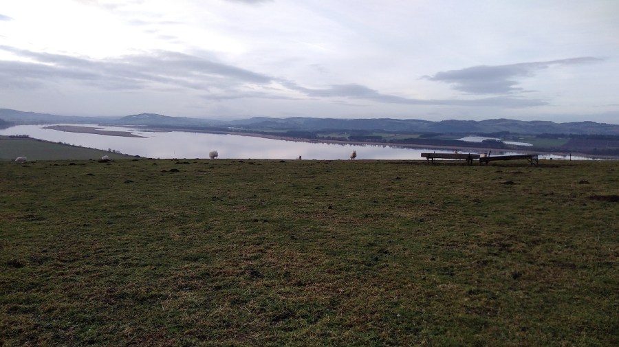
With great views of the mouth of the Tay Estuary, Fife
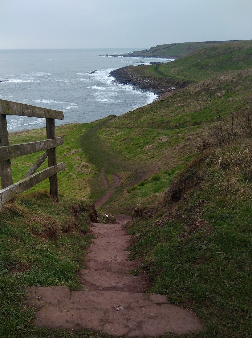
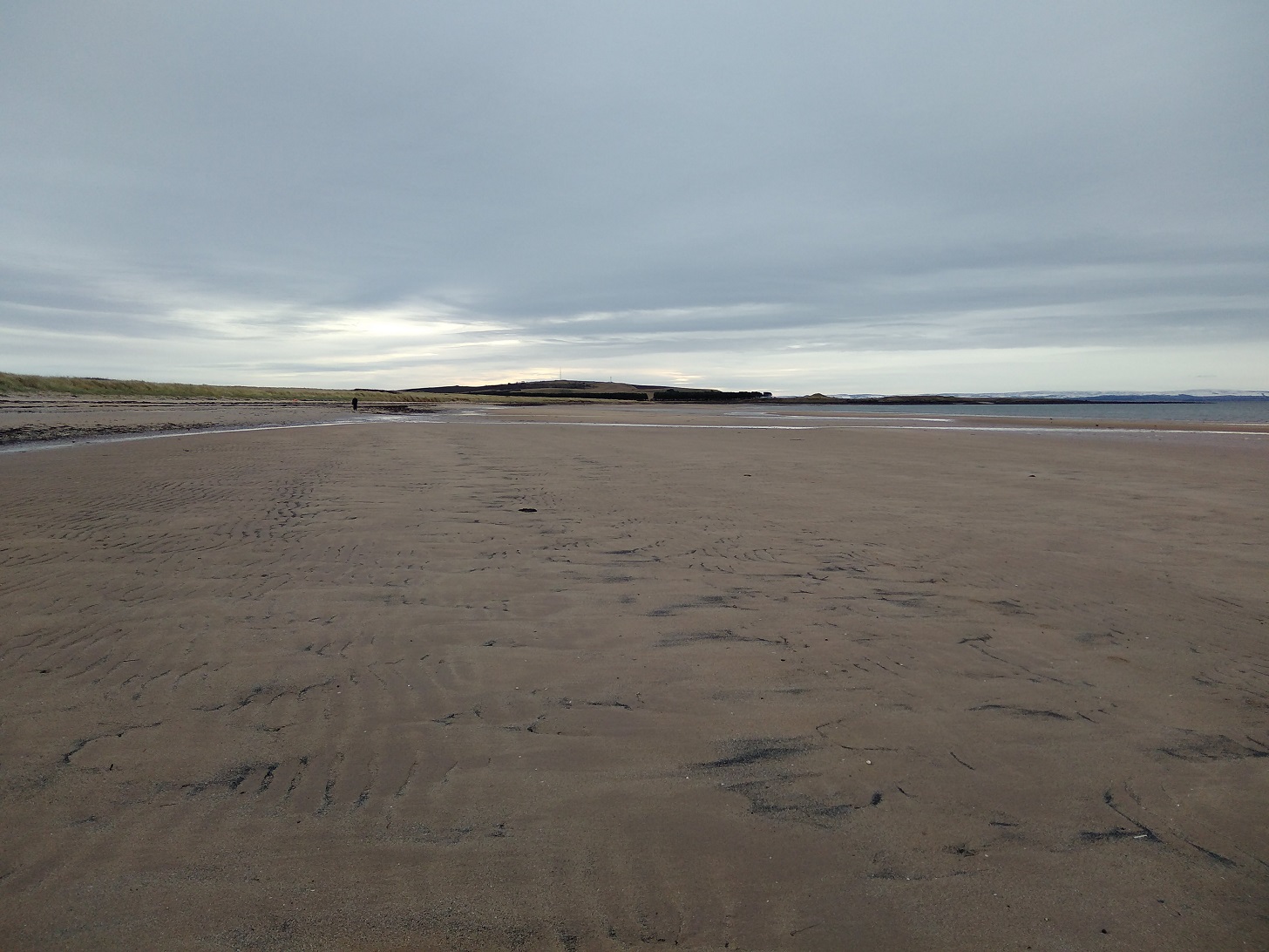
The approach to Newburgh
A steady descent, bumpy and slippery, meant I could see what I assumed was Newburgh in the distance for a long time – tantalising!
Lindores Hill (172 m) was on my left and to the right the estuary looked wonderful. The water was almost completely smooth, like glass. It reflected the tufty grey clouds and already there were the very faint hues of the sunset.
I struggled to stop thinking how tired I was, how much my body hurt, and that I hadn’t understood how long the day was going to be in advance. I spent some time using Clean Language questions to honestly ask myself why I was doing this. I knew I would get there eventually and that I wouldn’t do this again all in one stage. Once started it was tricky to stop, especially as I was so close to the end.
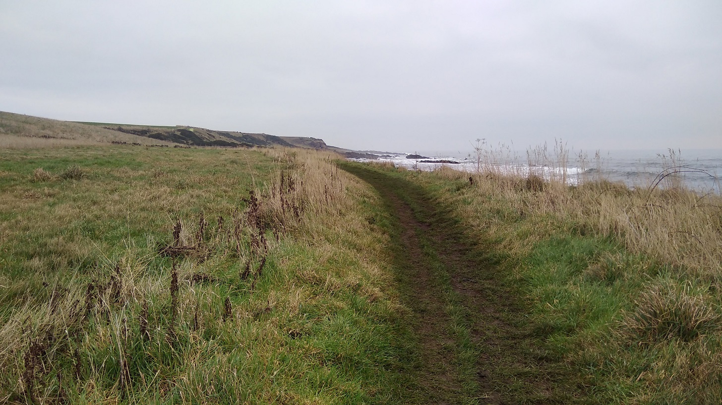
No danger of getting lost on this continual farm track. Or so I thought…
According to the map, at Old Parkhill there should be a right – Newburgh was clearly there, but the sign was to the left, so against my better judgment I took it. Of course it was wrong! I went through one very difficult gate and then straight on where there were lots of roots to negotiate at the bottom of a tree-lined slope. I admit I felt a tad miserable.
I had to climb over two fences. There was a huge hay bale and the barbed wire had been pushed down, suggesting that I wasn’t the first person to make this mistake. I couldn’t get over because I was too short and had the rucksack, so I found another way through.
I was back on the A913, the Abernethy Road, going into Newburgh past the church where the bus I planned to take later rattled past me. I found my way to the water’s edge using google maps as the sun was going down.
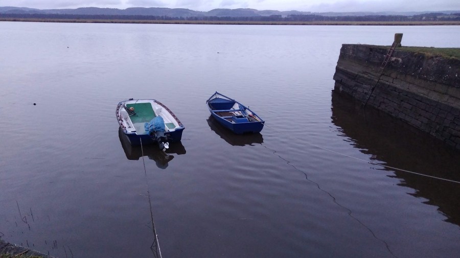
Oil-slick-smooth harbour water and a trek along the front to the park where the FCP ends, Newburgh, Fife
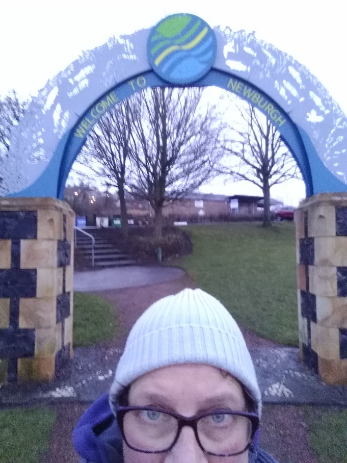
This last trundle seemed very long and the signs were once again poor. A helpful dog walker directed me at the last. Under the arch in Mugdrum Park, Newburgh I went, alone as I started….
Hooray – I had finished. How peculiar I always look in selfies!
From a public sign: ‘The Kings have gone but the kingdom lives on! Locked between the Firths of Forth and Tay, Fife is island-like, resolute and proud. It was the Pictish province of Fibh, last ruled by a king in the 9th century. Today, Fife’s wealth lies in the variety of landscapes, seascapes and townscapes which you can savour. Some say it taks a lang spoon to sup wi a Fifer, but you can be sure of a warm welcome from the people of the Kingdom.’
I went through the car park, took a left down Shuttlefield Street and left again along the High Street, where I found the bus stop by the Co-op supermarket (chocolate was needed). Opposite was The Bear Tavern where I toasted myself with a reviving Famous Grouse (whiskey) at the fabulous price of £1.20. The pub is run by the friendliest of folk and full of locals who were curious to know why I was there.
The 36 bus took me to Glenrothes where I narrowly missed the connection to Edinburgh. Fortunately there was an X54 along soon after at 18.55, and I was back home in Edinburgh around 9pm.
Saturday 2nd February 2019. An extremely challenging day’s hike in the stunning, snowy Fife countryside. 8 hours (probably 6.5 – 7 if I had not got lost) = approximately 30kms (16.5 miles).
Looking back towards Arthurs Seat and the snow covered Pentland Hills
There was snow last night and sleet was still pounding on my window in Edinburgh at 5.30am when the alarm went off. I was worried that I might not be able to make the journey, but I had booked my hostel and completed all the preparations, so I was determined. I did, however, change my mind and decided to take the train which is much quicker (and £2.50 more expensive). This meant I would miss the Guardbridge to Leuchars section (approximately 1 mile).
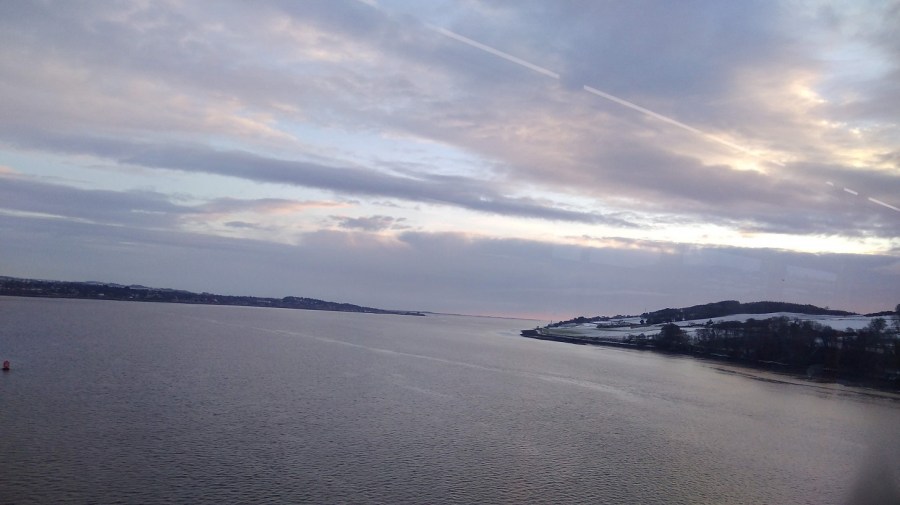
Sunrise over Fife
From the train I watched the sun coming up over the horizon. All the fields were white and the buildings etched with a black line. There were fields of dome-shaped greenhouses, some covered and some simply skeletons in the middle of winter.
At 8.36 I left Leuchars Station. There was a heavy, dull grey cloud cover above, but between that and the ground there were bare branches of trees showing against a delicate bird-egg-blue sky. In that space were horizontal clouds touched with peach, apricot and a darker, bruised blue. The land was glowing white, everywhere was covered in snow, although the roads were clear. Oh! the air smelled so crisp as it passed through my nostrils.
I turned left out of the train station. * Note that on Google Maps, ‘Leuchars Station’ is the Royal Air Force (RAF) Base. Make sure you look for the red train symbol if you are locating the railway station.
Although Leuchars is best known as the RAF base (which probably explains the amount of buses and the cost of the train), there must be others who live here because the out-of-breath man who ran up just as the train was pulling away had a cello with him.
I made my way past extensive barbed wire fences, cars rushing past. There was just one other man walking and he had a white Scottie dog. (I have called my Scottish blogs Walking Without A Dog because although I do not have one, it sometimes seems as if everyone else does).
Part of the Leuchars RAF Base, Fife, Scotland
I was setting off walking again and my tummy, which had been all excited for the previous two hours, turned over. My nose was sniffly from the cold. I found that I didn’t know which way to look when crossing the road, a throw back to all the hiking I have done on the continent! Here the temperature was a mere one degrees.
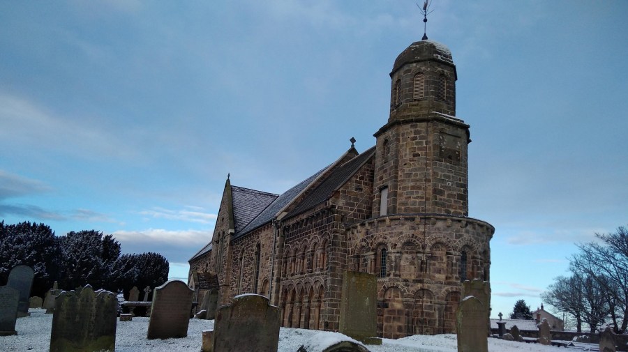
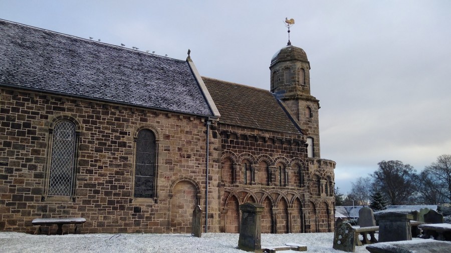
I was following signs to the Fife Coastal path (FCP) which took me by the road. On the right is a cluster of shops (a Spar supermarket with a butcher’s shop opposite) and a sign off to the left for it, but I recommend taking the left which goes steeply uphill for a few minutes to the beautiful Medieval church of St Athernase.
The Romanesque architecture (known in the British Isles as Norman) of St Athernase, a Church of Scotland with fine blind arched features and an half-round apse from 12th centuryNotice the weather vane – a golden cockerel
As usual it is hard to know where to find the way as you exit a town. There were clear signs for the cycle path and various ones for the FCP, but it was hard to know if they were for the cars or hikers. I headed off down School Hill / Pitlethie Road, hoping that was right. A merry hello was exchanged with two women. When I passed a slow lady with a stick afterwards which reminded me of my patients at the hospice, I felt grateful that I could walk.
As I started getting into my stride and the town started to peter out, the sun was out and the birds were singing. More and more of the sky was blue. My shadow was so long that my head was right over the other side of the road on a field looking very funny. Past Castleknowe housing estate and Pitlethie House on the left, I understood why people wear gaiters because the snow was going down the back of my heel, inbetween my boot and foot which very chilly. A blackbird was foraging in the snow.
Pitlethie House
Although I knew I was heading out of town in the right general direction and knew where the sea was, there were no official indications (a sure sign that I wasn’t right!) I was on a country road now with no pavements, but with fields on both sides and well shaved hedges in blobs – thorny and prickly with flat tops. Some of the tree trunks were going off at a very acute angles implying how strong the wind could be here. I could see the forest in the distance.
Not the FCP one but still, a sign!
Then I turned right to cross on a path between the fields, heading towards the coast. There was incredibly bright sun on my right, making the snow sparkle, and lots of footprints and bike tracks on the snow ahead of me, even though it was only 9am.
I heard shots off to the left – hunting or soldiers practicing maybe? It was bumpy and the ground was ice hard underneath so my feet crunched.
Ducks majestically swam up a very narrow, but totally still, irrigation channel. Each individual blade of grass was carrying its own load of snow, the upper ones melting in the sun
There were engine sounds emanating from somewhere. It was deserted. A tower in the distance was topped with a slowly turning satellite; cubes of houses with pointy rooves were covered in snow; tractor tyre grooves were clear; and shadows far, far longer than the height of the trees themselves.
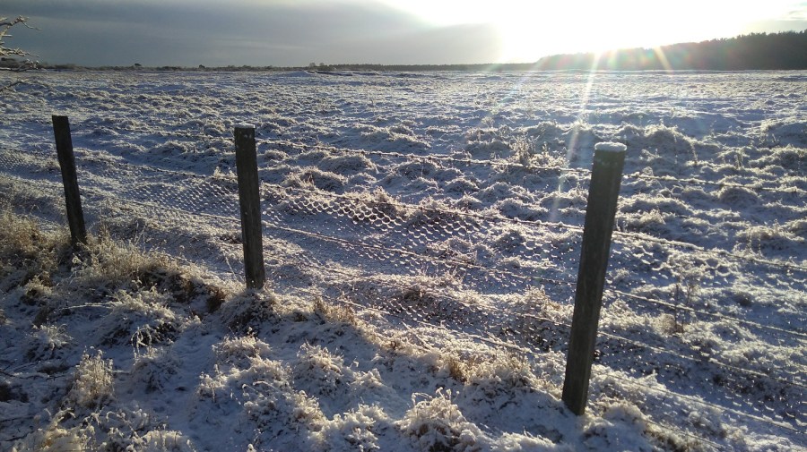
Rabbit foot prints and a fence where the snow has settled on the pattern of the wire making it look like honeycomb
A helicopter came loudly into view as I turned the corner and passed between pretty Scots pines and snow-covered gorse. I took my gloves off. Yellow flowers showed through where the sun had exposed them; and the silverbirch trunks matched the fields behind.
I needed a pee, but was sure I would be seen by surveillance given the nearness of the Base. When it became imperative, I imagined the soldiers having a laugh at the sight of me on camera. I left no trace.
Chaffinches sat on hawthorn bushes, tweeting and then swooping from top of bush to top of bush just ahead of me. There were sparrows too, and beehives on my left in a little clearing. The tree trunks were are all intertwining and covered in yellow lichen, positively glowing, one with its seedpods drooping and shiny.
My attention was attracted to the barbed wire strip at the top of the fence where each of the barbs had little piles of snow on them, softening the sharpness and making them look like embroidery, like a row of stitching with cotton knots at regular intervals.
Shush shush as I walked, a crunch at the end of each step as my toe pushed down into the packed snow. There was a constant sound of distant shooting and I realised that I was skirting the Base. I turned right at the farmhouse with the red door and went through a gate (remembering to shut it after me). There was a miniature thicket of trees which the sun didn’t reach so it was immediately cold, but not for long.
Then I was on the proper FCP with the correct signs. A gentleman dressed all in dark colours gave me a nice smile as he held the gate open and then briskly strode off with his head down.
Rejoining the FCP
Over a bed of pine cones I went, reflecting that that must have been some sort of detour I had taken. The FCP website said to allow 7 hours for this walk so even though some of it would have been from Guardbridge to where I started, nevertheless I didn’t really want to do any extra.
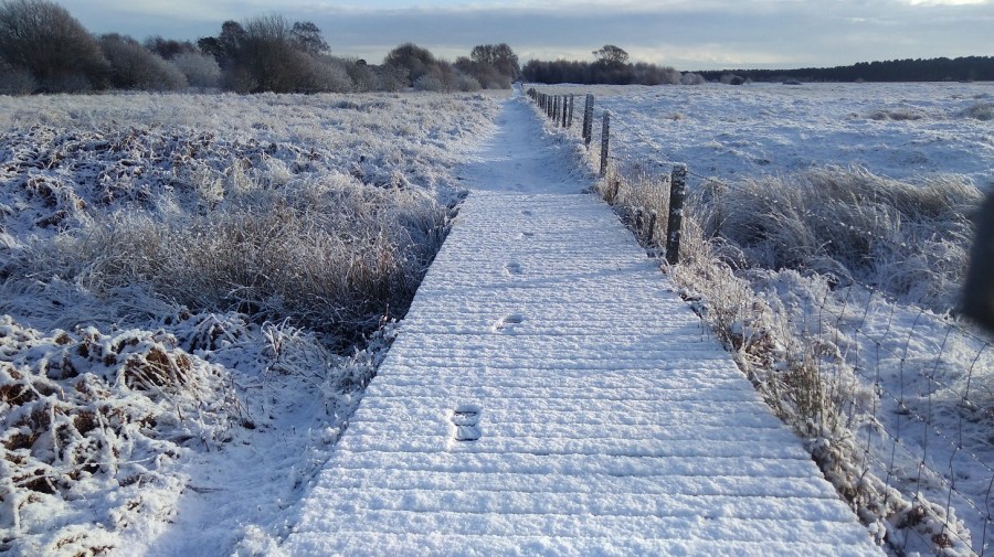
My walking pole got temporarily stuck between the planks of the boardwalk but I was still glad that I had bought it with me this weekend! Fife Coastal Path, Scotland
I took a sharp left which was signposted. There were two gates – the first said push but you had to pull! I was heading towards the trees and hills covered in snow, but away from where I thought the coast was – the cold breeze on my left cheek helped me to orientate myself.
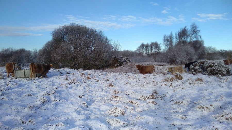
A sign warned of wild stock, and huge piles of manure testified to this – Highland Cattle with glorious horns were lowing loudly while they walked towards me, covered in blankets of snow
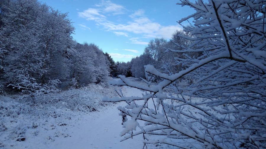
Up and down and curving around went the path. Only one set of footprints were ahead of me now, with a dog. I took two steps for every one of his! The path twisted and turned, slippery and very uneven. Everything was so very beautiful, clad in white. The big trees were not covered in snow the same way as the small ones and the bushes were. There are fallen-down logs and the oh-so-delicate grasses carried their heavy loads – tilting and drooping with the weight of it all.
I amused myself with the tracks in the snow – the guy I fancied I was following seemed to have lost his dog – hmm interesting! It was useful to have the prints as it meant that I could see where the deep parts were.
The path wound between pine trees with various types of cones, rounder ones on the branches and long, thin ones on the ground.
See how the sun shines off the snowy ground even at 10am!
‘There are two species of native conifer tree that produce cones: Scots pine and common juniper. The non-native black pine can also be found in the UK. All of these trees have different shaped pine cones and will hold on to the cones for different lengths of time.’From The Woodland Trust. The red squirrels love to eat them!
The deciduous trees are white, the evergreens sprinkled
The snow got thicker and there were two sets of dog paws, or maybe another sort of animal trails alongside the man’s now – it must be very interesting to be able to read them properly.
Bracken stalks cracked over from the weight of the snow. Black broom pods showed up starkly against the white.
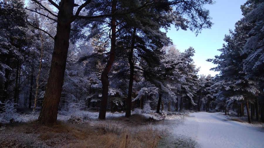
The smell had changed from the one of snowy air and open ground to one of pine, and yes, it looked just like a Christmas Card!
I had a very quick stop – standing because there was nowhere to sit – for some absolutely delicious, warm jasmine tea. My pack was heavier than normal as I had bought enough food with me to last until Sunday night (two days). All I could think was, oh it is so beautiful!
There were mini pine trees growing between the massive trunks and because they were covered in snow they were lit up and my eye was drawn to them, back and back, layer upon layer of undergrowth where there were tiny, fine branches and twigs. In some places there was no snow, and it looked bright green, marvellous next to the white. As I walked, the snow fell from the trees down the back of my neck while at the same time my feet were tossing up snow which was going down my ankles. Brrr – cold!
I came to some sort of crossroads where there was a man with a bouncy spaniel, ears flying as he enjoyed the snow. I had a happy feeling and a sense of something, a sort of dropping down into my belly and a deep breath, like a much heavier lump, a weight. I was going along a road now, past the Polish Camp Road, and the signs seemed to be going straight on. There were cycles and cars ahead driving past. A woman with two great dogs assured me, yes, I was on the right track.
Beech woods now, a line of them and the smell had changed again, a different woody one. There were straplings, all bronzed and covered by the blanched quilt. Walking on the new snow rather than the slippy, packed stuff, I saw a light ahead like a fairy bower – silver and bright enticing me onwards.
Down a dip I tripped and went over on the same ankle I had sprained slightly in my Argentine Tango class a few nights ago. I felt it ricochet right through my system up to my neck, but thankfully there was no pain as I walked on.
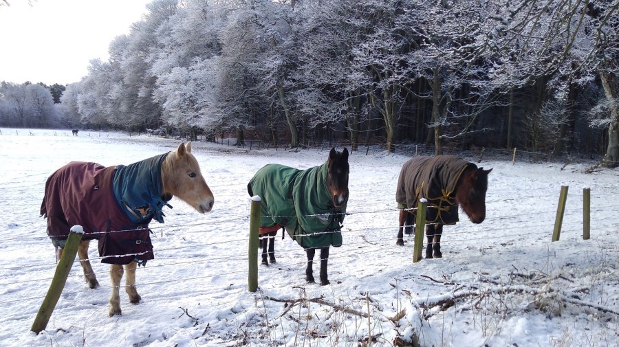
The horses come to the fence to greet me and I scrape some grass to feed them
When I came to the Kinshaldy Riding Stables three more horses were being led by a man with a little dog who had an overcoat on. A series of paddocks each had another horse in and children looked as if they were running just for the joy of it.
At 10.45am I was at the Tentsmuir National Park Road, the edge of the Nature Reserve. Today I was recording on my phone, experimenting with the idea of a podcast. In fact, unable to splice and mix, I transcribed them later at home. The sound of my heavy breathing on the recordings was off-putting apart from anything else! (It is not as easy as typing notes which can then be cut and pasted into WordPress. Maybe I could find an app which I can speak into which will transform that into the written word?)
Trunks looking black against the white backdrop
Of course the last time I was walking in the snow was in Greece in November where I was looking after horses.
Creak creak went my boots on the snow when suddenly, there was The Crêpe Shack looking most incongruous after miles of nothing but gorgeous natural landscape. It was shut. There was also a playpark and picnic benches, so I sat down to have my elevenses. I was starving!
Traipsing between the dunes with a fuller stomach, I could not find any signs. I was pretty sure that in a few minutes I would see the sea and Kinshaldy beach so simply set off in that direction.
The entrance to the car park and picnic area by Kinshaldy Beach and the Tentsmuir National Park, Fife
I get so fed up when I have to retrace my tracks, especially as deep snow is such hard work with a rucksack on. The path was not over the sand dunes (as the man with the horses had said), but back through the car park with spaces for coaches and where there are more playparks (so it is obviously very busy in the summer). I wiped away the snow and there was the sign I was looking for – heading back into the forest.
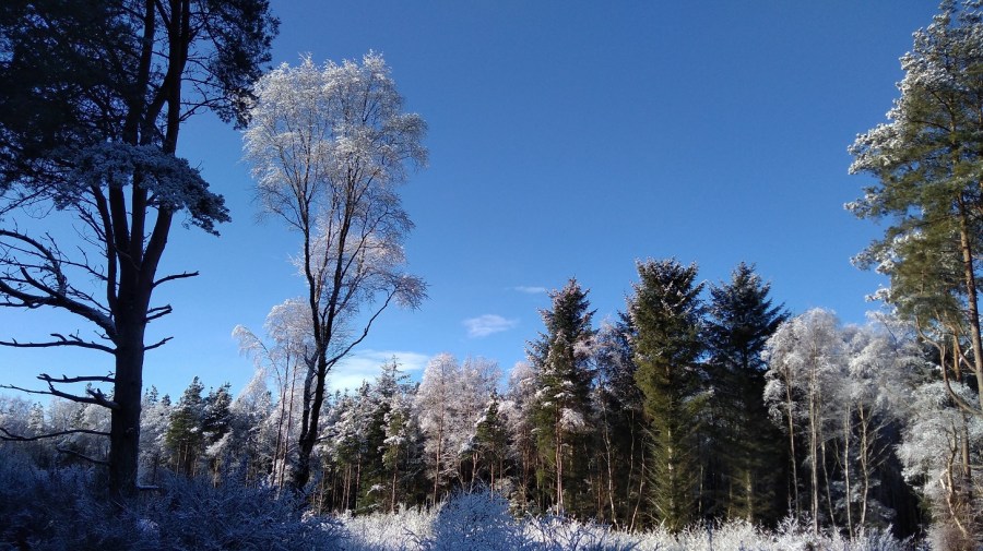
The snow was twice as deep: an inch (2 cms) rather than a half – solid and scrunchy. There was a sky blue as blue could be.
When I had stood up after my snack, I had a dizzy spell which was a first. The whole world span just like my clients described it to me, and the back of my left knee hurt.
This sort of scene is the reason why I walk in these places!
The birds were tweet tweeting high up in the pines. Four or five bikes had gone ahead of me, and some people with dogs. When I looked closely at the trees, it didn’t really look like they were covered in icing sugar but with dust, the same way that really thick dust clings to every surface, all the twists and turns of something, like some sort of growth. Some looked like cauliflower heads, white like they say people’s hair sometimes turns overnight from shock.
I was thinking that this must be an old forest because there was no evidence of tree felling. Gradations of vegetation: from the little tufts of grass at the path edges, to the taller ones just behind, then the saplings, which were in front of the medium sized trees, and behind them the absolute giants. All were different textures, some more vertical, others more horizontal, with the vista occasionally broken by waterways.
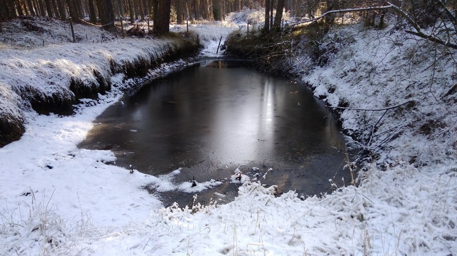
Frozen pond
It was unspeakably beautiful in the brilliant sunshine against the blue sky with no-one around – just amazing.
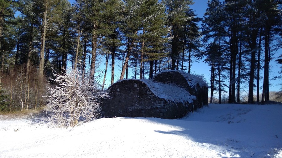
The aptly named Ice House originally built in 1852 for keeping ice to freeze the salmon from the River Tay. The ice was taken from local ponds (as above). Layers of heather or straw were used to pack around it ,providing insulation like a deep-freeze. The salmon was shipped to the south
When I stopped and stood still there were only two sounds: distant waves that could have been traffic; and a sort of moaning, groaning, almost a woolf-type sound, but not at all scary. The latter was very difficult to reproduce and as I stood still it stopped. There were some logs which had been recently cut down in that part – I could smell the newly cut wood.
There were also paths off to the right at intervals, for access to the sea, but most of them were closed for building works.
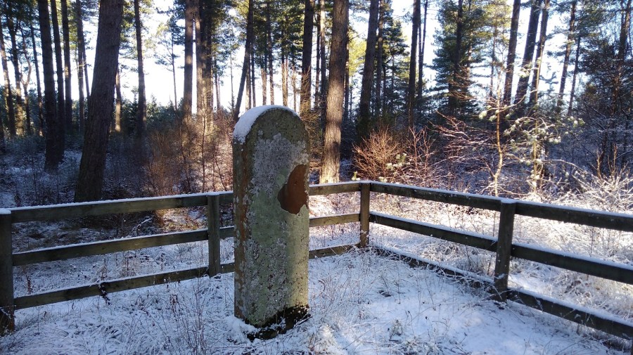
The March Stone erected as a boundary marker for fishing rights in 1764. The word March denotes an area of land on the border, and this March was between the Shanwell and Old Muirs salmon fishing, making a straight line from Old Norman’s Law (a hill) which though it seemed ever so far away I was to find myself climbing the next day!
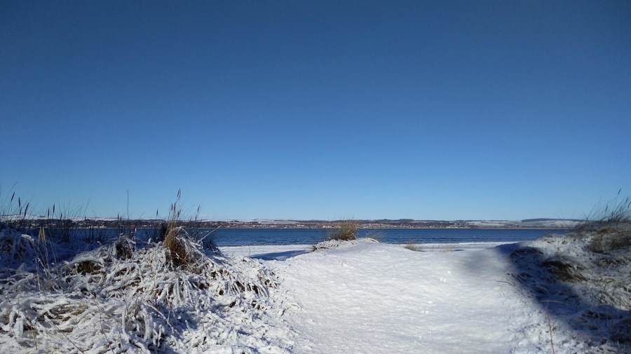
Then wow! Once again I emerged from a long wander through samey landscape, lulled with the regularity of putting one foot in front of another, and suddenly was out of the trees. There was the matching blue water – I had reached Tentsmuir Point at the edge of the promontory where the land turns around the estuary of the River Tay. I stopped to admire the city of Dundee spread out on the opposite bank.
Spectacular isn’t it!There is something surprising about sand covered with snow somehow
There seemed to be a area of ice where the land met the sea, and a sort of fence going out at right angles into the water. There were very gentle waves. Two gulls as white as the snow were catching the sun nearby, and hundreds more were floating miles away.
I walked on: a wee pond opaque with ice; thoughts of past love; a train trundling by; and guns sounding. I was at right angles to the point and it was so icy that my pole clattered. I was tired and my feet were aching, although my knee wasn’t. My eyelid did the annoying fluttering thing it used to when I was a teenager. Ploughing on, I heard pee por pee por pee por – thin bird calls, and the almost-sound of snow falling.
Really I should have known and stopped, because if there were no signs I must be wrong. And I was
There were signs every now and then for the cycle path and forest trails but not for the FCP. A cyclist and women were coming towards me in pairs with hounds. I took a minute’s turn through the heather onto a hillock to get a view of the Tay . It was littered with gulls, and I admired the hills and wind turbines on Tayside. It was almost midday, so more melting was going on.
To get a view of the TaySnow on the hills opposite
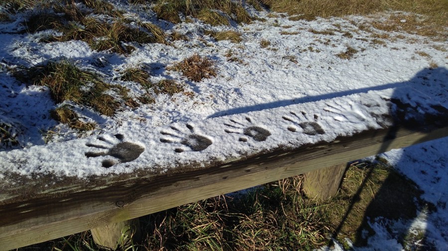
As I made hand prints in the snow I remembered a TV programme about the Pech Merle in Cabrerets in France perhaps 16,000 to 25,000 BC. Someone recreated them (maybe made by women), and they analysed why people were drawn to make these marks.
Making my mark
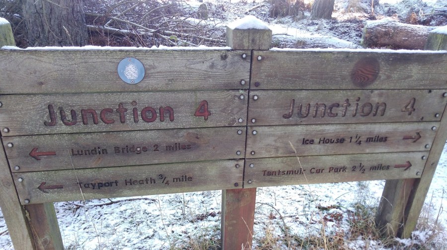
It wasn’t easy to locate the signs. Here was Tayport Heath at the edge of the forest and I was coming up to Lundin Bridge – a map helped me to get my bearings. After another tea break I picked up speed, when a sudden lick on my left hand made me look down and there was a young brown greyhound. Bounding beside her mistress was a much older wolfhound with glassy eyes who was more afraid of me than me of him. They were easily overtaking me so I must have been going slowly, what with the rucksack and it being my fifth hour.
As the dogs receded into the distance, they were growling and playfighting. There was a horrible smell of chemical manure.
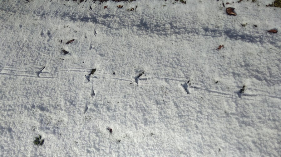
Bird tracks
I found myself at houses and ponds and when I looked at the map I was right in the middle of the forest again. There were no signs and when I asked three men, they confirmed I was a long way away from where I was meant to be. I took a right, following their instructions, and came to a dead end with clear signs saying Private. I went left and the snow got deeper and deeper, my feet plunging down. At a gate I was unsure if I should go through. Away from any sort of path, I was only just able to negotiate and it was really hard going. Swearing away I realised I had done an enormous loop – extra trekking – and as a result I was tired and fed up. It was frustrating to the point of tears.
I was lost until I came across these signs
After my mini drama I spoke to Isobel on the phone by chance which gave me some perspective. I made my way out of the forest and into Tayport, stopping a woman and her bewildered daughter for directions, which were sound. I found a cafe very close to the sea (look left as you approach!) and fell in through the door to the amusement of a couple who wanted to know everything about what I was doing and why. Good question.
Detail of the fishermen’s monument, close to The Harbour Cafe in Tayport.
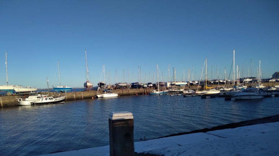
The Harbour Cafe was started 6 years ago as part of Tayport Community Enterprise. It is broadly run by volunteers and is amazing! It is just set back from the bijou working harbour which looked great in the sun when I emerged a while later, refreshed, to continue my walk.
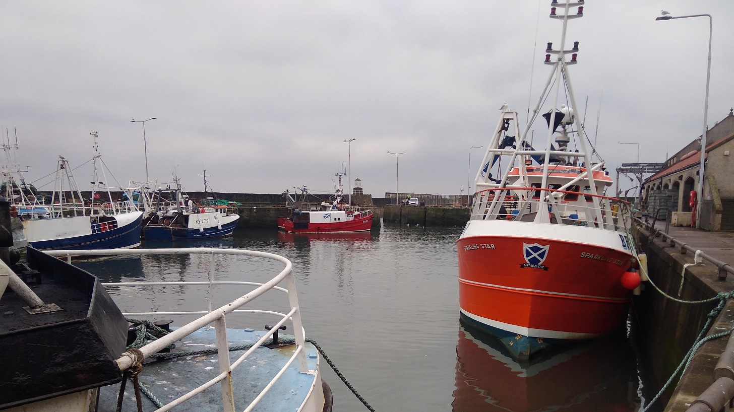
Tayport Harbour, Fife, Scotland
I went along the disused railway line. Right down by the water’s edge, a good way away from me, there was a strip of green where the snow had melted. A row of orangey grasses was punctuated occasionally by a single tree and this strip of sunlit green was absolutely beautiful in the evening sunshine. The bridge was in full view, cars whizzing past and lots of industrial buildings on the opposite side.
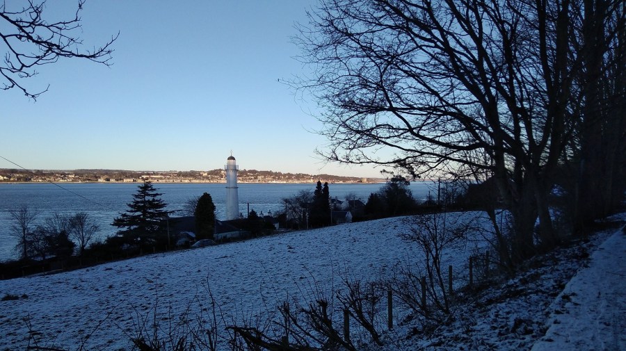
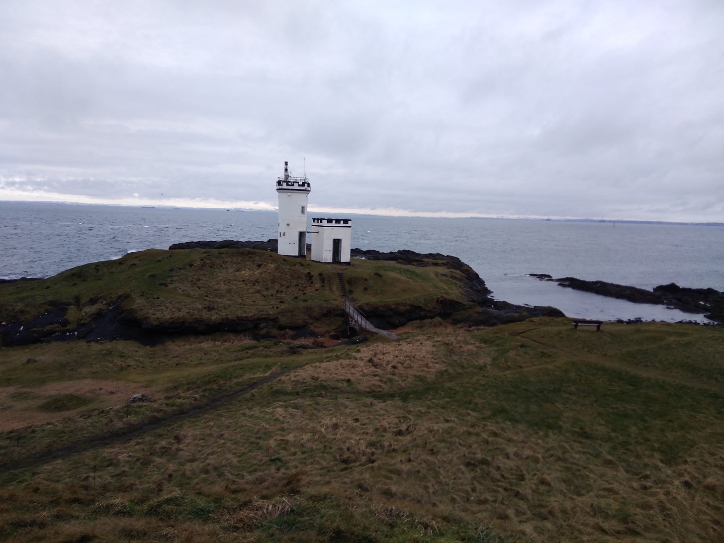
Looking past the lighthouse, across the River Tay to Dundee, Scotland
I had pain in my right hip – first time for ages – and sore feet. Overall, though, I was feeling much more balanced.
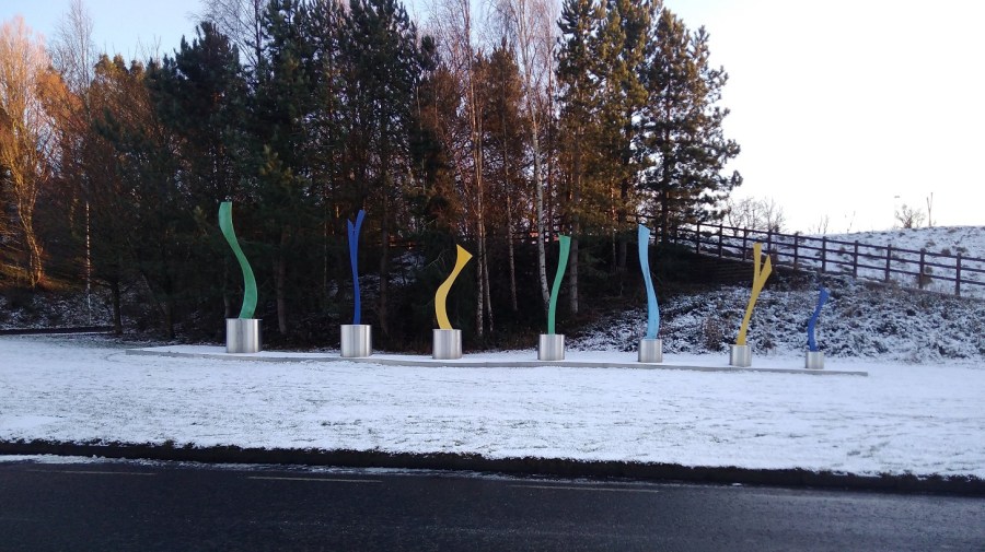
Modern sculpture by the entrance to the Tay Bridge, Fife, Scotland
Luckily I am separated from the road by a stone wall. There was a wren looping from fence post to fence post almost letting me catch up with her, causing me to smile. Wren song.
An hour’s walk to Newport, I went under the bridge. Weirdly, there were also signs up to the bridge – I didn’t know why unless it was for the view.
The Tay (Road) Bridge still catching the sun although the rest was now in shadow, Scotland
Around a white golden orb that is the sun, almost directly ahead of me most of the time. preparing to sink below the hills which are tapering down into the Tay Firth. A lot of conurbation ahead which could be Newport or Wormit (the end), but I suspected the former. I was trying not to think about the end at this stage other than planning to be in bed for a long period of time when I got there!
The elegant architecture of the ferry terminal for the ‘Fifies’ (what Dundonians called the ferries), Newport-on-Tay, Scotland
‘In 1715 a new pier and inn were built, the work being funded by the Guilds of Dundee which resulted in the settlement being called “New Dundee”. Thomas Telford built a new harbour in the 1820s, and the town expanded and grew into a commuter suburb of Dundee as the prosperous jute manufacturers, industrialists and the middle and upper working class of Dundee established fashionable residences in Newport.’ from Wikipedia
It was very, very beautiful. The water was shimmering and trembling. There was a long line of gold cast by the sun and the completely clear sky was amazing and impossible to capture on my camera.
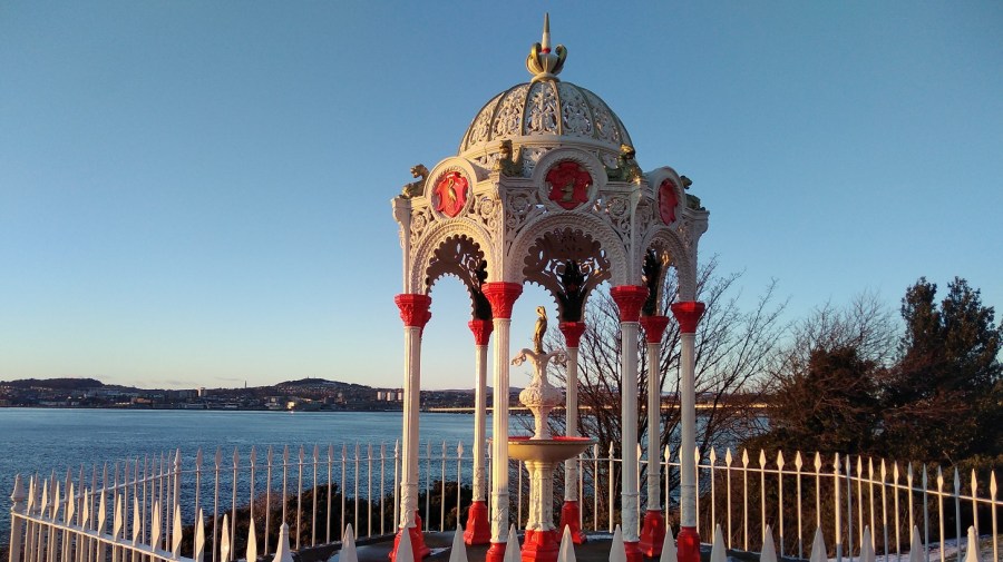
This elaborate structure has golden herons, River Tay, Scotland
At 5pm the sun had all but gone down and I was probably 5/10 minutes short of where I should have ended, but it was very nearly dark and I knew a bus was due. I had been checking every stop as I walked through the residential area, all on pavement, amusing myself by looking at the gardens and architecture.
Right on the main road from Newport to Wormit were impressive homes with a view across the water, Scotland
‘Beautiful Railway Bridge of the Silvery Tay! I hope that God will protect all passengers By night and by day, And that no accident will befall them while crossing…’ From The Railway Bridge of the Silvery Tay
‘But when the train came near to Wormit Bay, Boreas he did loud and angry bray, And shook the central girders of the Bridge of Tay On the last Sabbath day of 1879, Which will be remember’d for a very long time.’ From The Tay Bridge Disaster
A last sight of the Tay (Rail) Bridge before sunset. The original bridge which collapsed in 1879 six months after it was opened, with the loss of all 75 passengers and crew and was immortalised in William McGonagall’s poems (‘a notoriously unskilled Scottish poet’ Wikipedia
Aahh – I sat down at last on the 92A bus from Southport Road, near Woodhaven to go back to St Andrews. The bus driver was really sweet: I was the only person on the bus and he explained that although it doesn’t go the bus station anymore, he would take me to the end of the route in the town, wait 3 minutes and then drop me off where I wanted to go.
It was only a short stumble to the hostel where I had booked a bunk a week of so earlier but when I arrived it was unavailable – there was some sort of booking mix-up which he said had happened before. I was more than crest fallen when he explained that I would have to go to Dundee to get a similar priced bunk – St Andrews is an extremely expensive place – but happy that he allowed me to use the facilities and have a hot shower.
I took another bus to Dundee and stayed in the Backpackers Hostel there instead.
I am not exactly following the Fife Coastal Path (FCP) official map, partly because the daylight is too short to get to the starting place and walk the distance before it gets dark, and partly because of accommodation and transport difficulties. Judging by the website, the FCP people are guessing that folk will be doing it by car, although how they get back to their vehicles I don’t know unless someone picks them up at the end of each stage. I know one long-suffering wife who, together with friends, has been supporting her husband to walk around the whole coast of Scotland by ferrying him from Edinburgh, so perhaps this is more common than I thought! Be warned that although there are good places to stay if you look carefully, it requires quite some research and flexibility to do this.
Due east of Cambo Estate, Fife
I recently came across a woman who pitched her tent approximately half way along the path and went back and forth with her car, so that’s another way of doing it, but it will still require the taking of buses and taxis of course. Here is her blog.
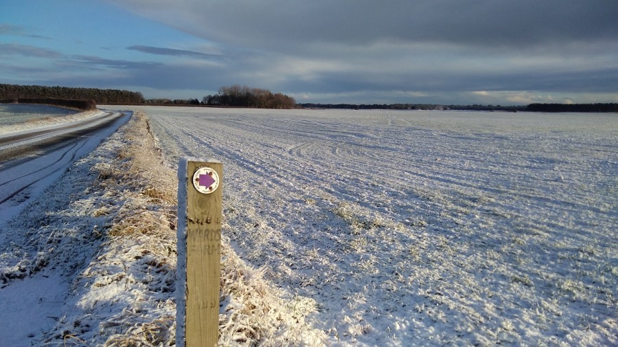
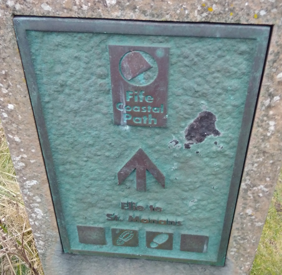
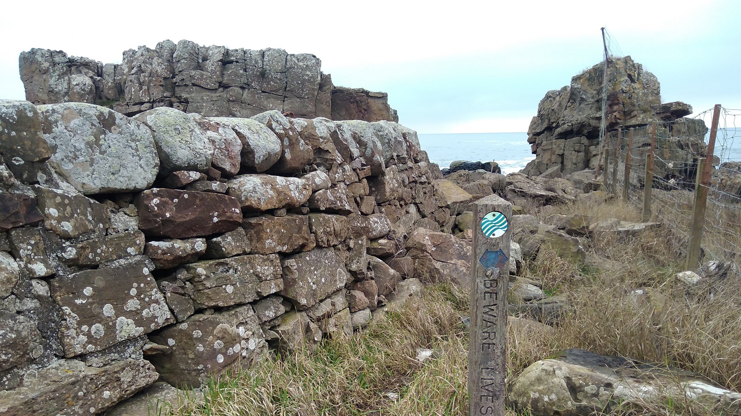
A Fife Coastal Path sign
I retraced my steps by taking the early Sunday morning bus from Anstruther leaving the hostel at 8.30am in the dark and waving goodbye to my dormitory companion who was making shorter stages. I watched her setting off with her head torch along the section I had taken the previous day.
Half an hour later I was set down close to the Cambo Estate entrance (the cafe opens at 10am), a place I would like to visit some time, and regained the Fife Coastal Path from the main road which took 20 minutes, passing the darkened kitchen window where the kind woman had directed me 15 hours before. From there I completed the final part of the previous day: Cambo Sands to the Kingsbarns car park (where there are facilities: picnic benches and toilets). There were people asleep in their camper vans and lots of dog walkers, even though it was not yet 9am on a Sunday morning). There were signs to The Cheesy Shack, but I could not see it!
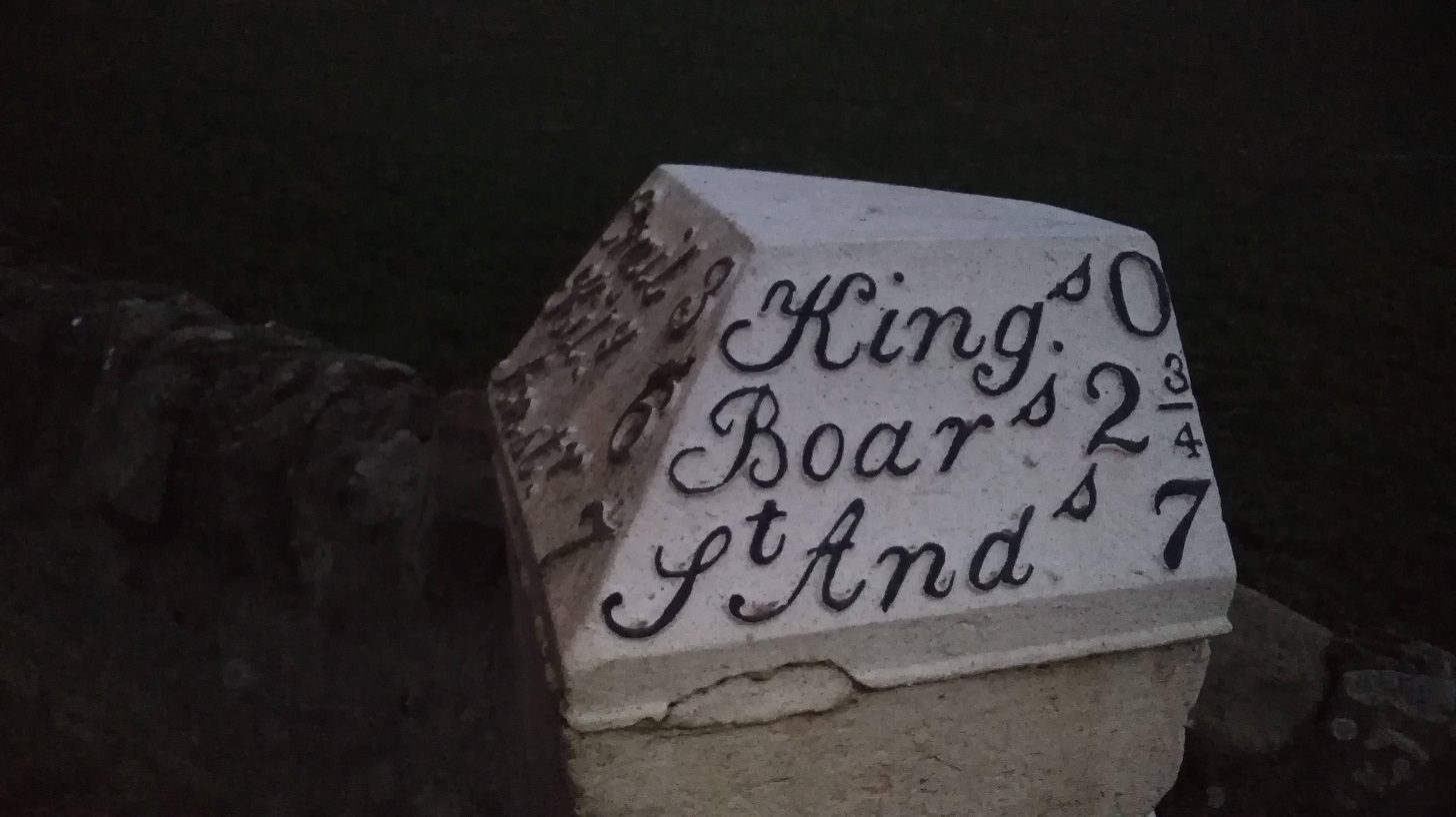
Kingsbarns to Boarhills (around 1.5 hours)
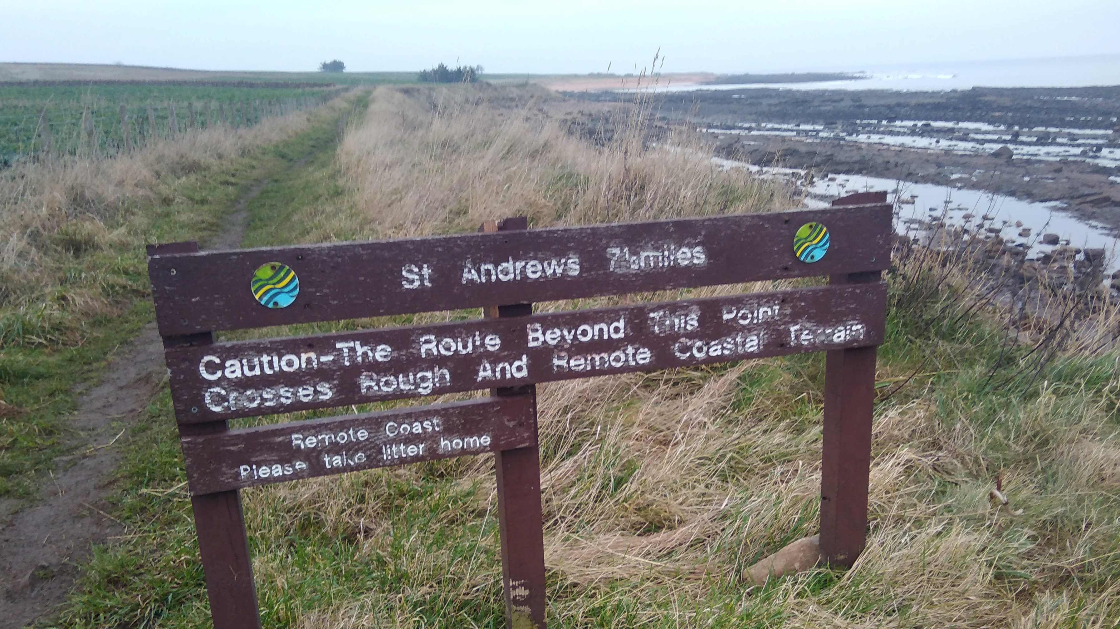
I knew from the instructions that today ‘may be the roughest part of the whole route’, and that it ‘should only be walked at low tide’, so I was against the clock which caused some stress, day light being at a minimum in February and the high tide being around 1pm.
It was definitely colder than the day before, maybe because it was earlier or maybe because there was a slight breeze coming towards me. I could see my breath. It was brighter than Saturday with lots of cloud, but also an area of pale blue showing inbetween.
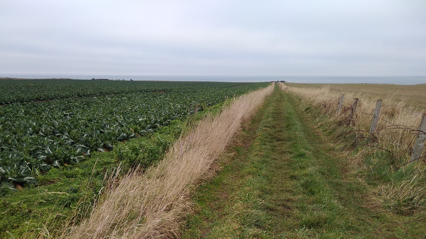
The first thing I passed was a warning of remote bumpy landscape beside a field with a very strong smell of brassicas which overwhelmed the sea scent.
Past the place of no return?
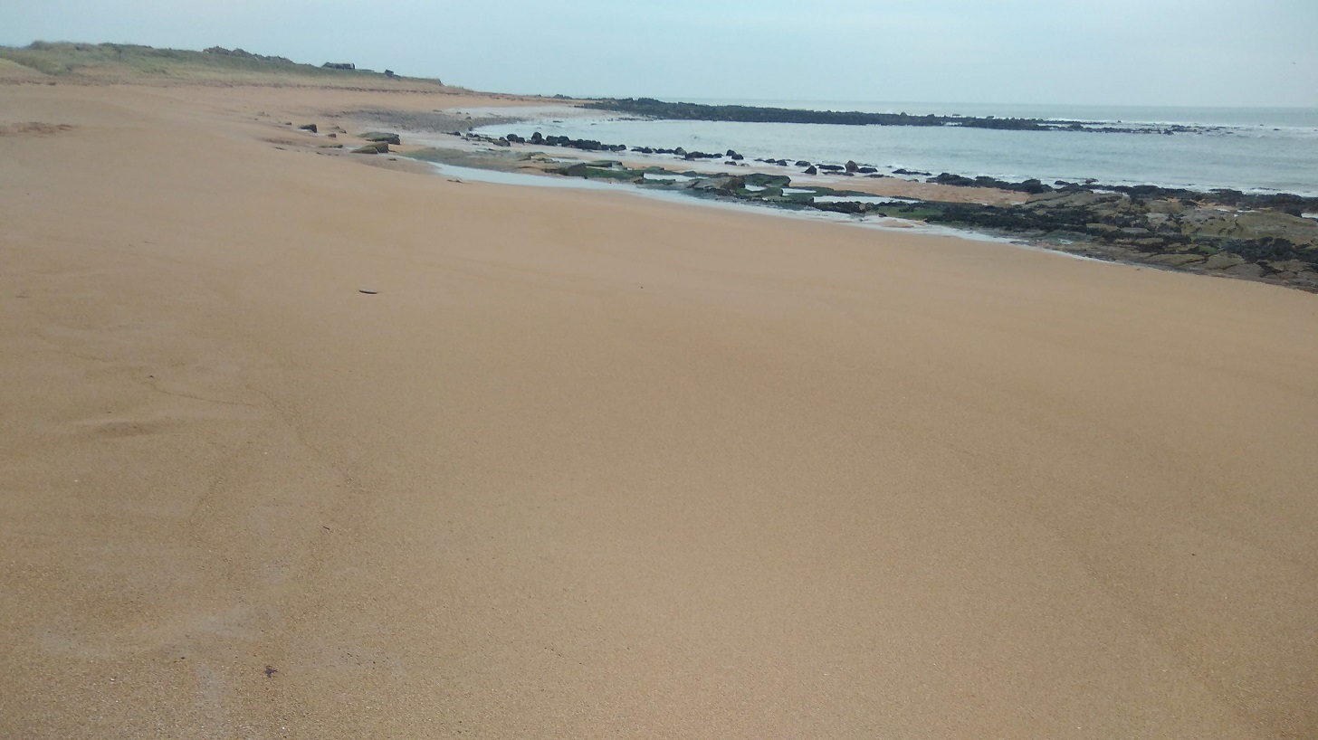
Another golf course and golden sands stretched as far as the eye could see. So far it was low tide, thank goodness, which was what I was going to need to manage the next part. There were little pillar-box-red poles all the way along, perhaps showing where you can get down to the beach.
The sheer sands near Babbet Ness, Fife
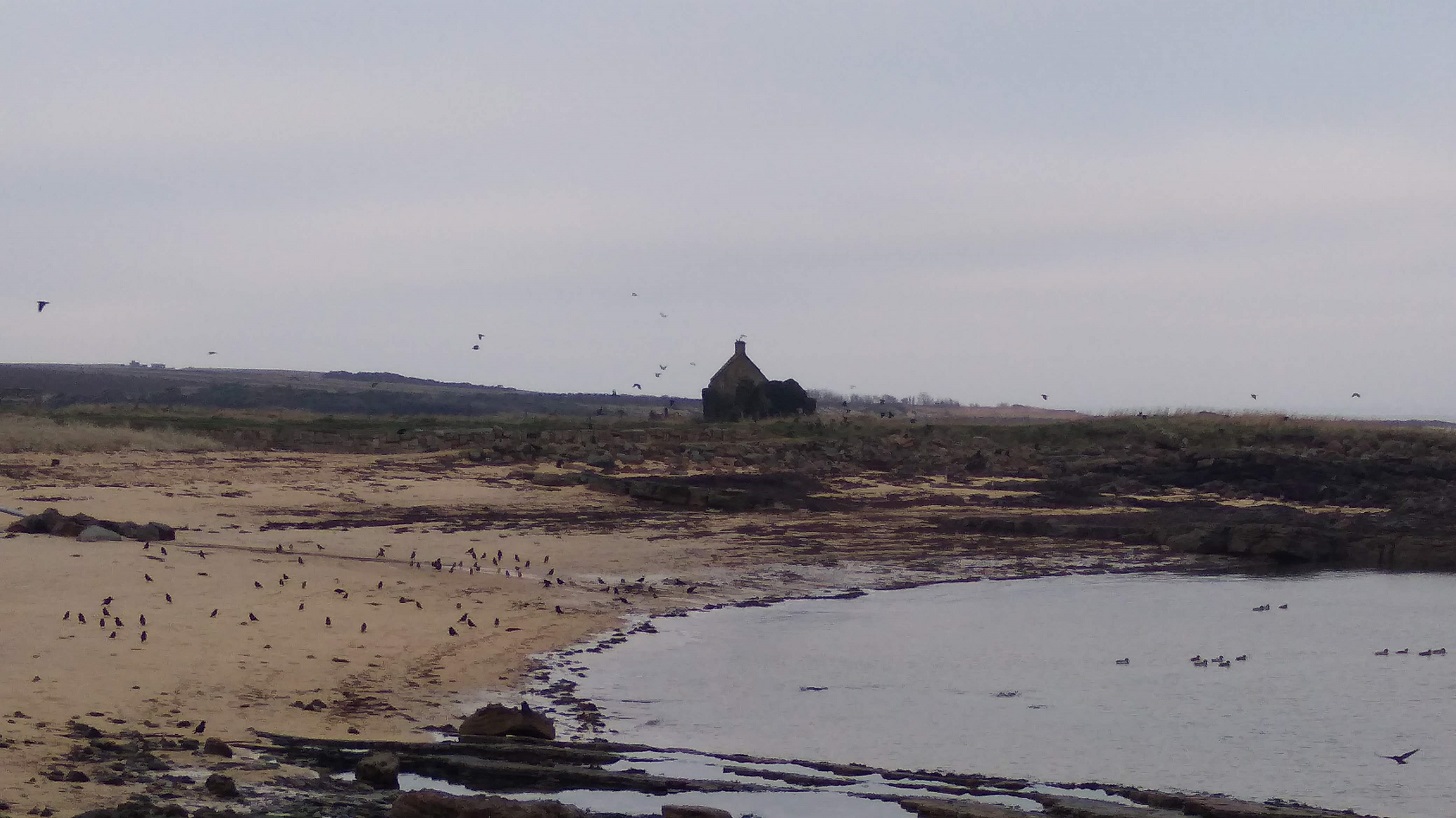
It was hard going as they warned it would be, especially on the sand, beautiful though it was in colour and smooth surface. People and dogs had been there ahead of me. Then back on the scrubby grassland beside the shore, the path was very uneven. The water in my bottle was almost too icy for me to drink which showed how cold it was. Just to think that when most of us are in our cosy houses in cities and villages, the birds and cattle are here all through the night wheeping away, floating on the waves and managing the elements, whatever the weather!
Flocks and flocks of black birds, alighting and taking off, swooping around, fighting and jostling to find their place, mostly on walls, fence posts, electrical wires and strand
Inland
There was a detour inland to Boarhills where I crossed the Kenly Water – a well-kept path beside mossy boulders where water bumbled over stones. It was well signposted across a metal bridge, and then there was a tarmac farm road followed by an equally long, straight grassy way heading back to the shore.
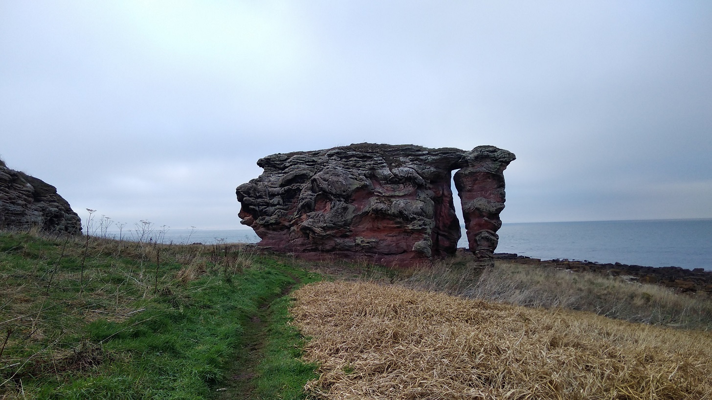
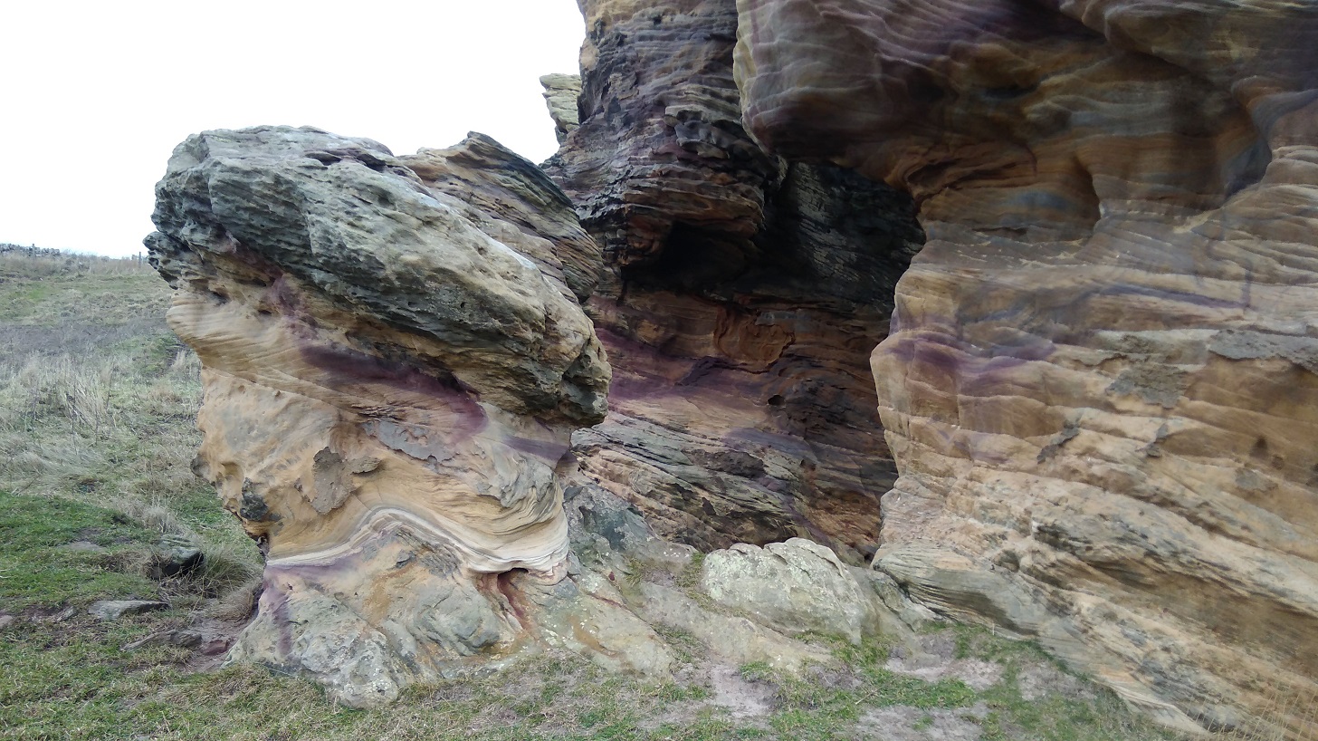
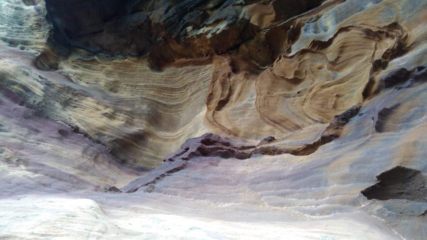
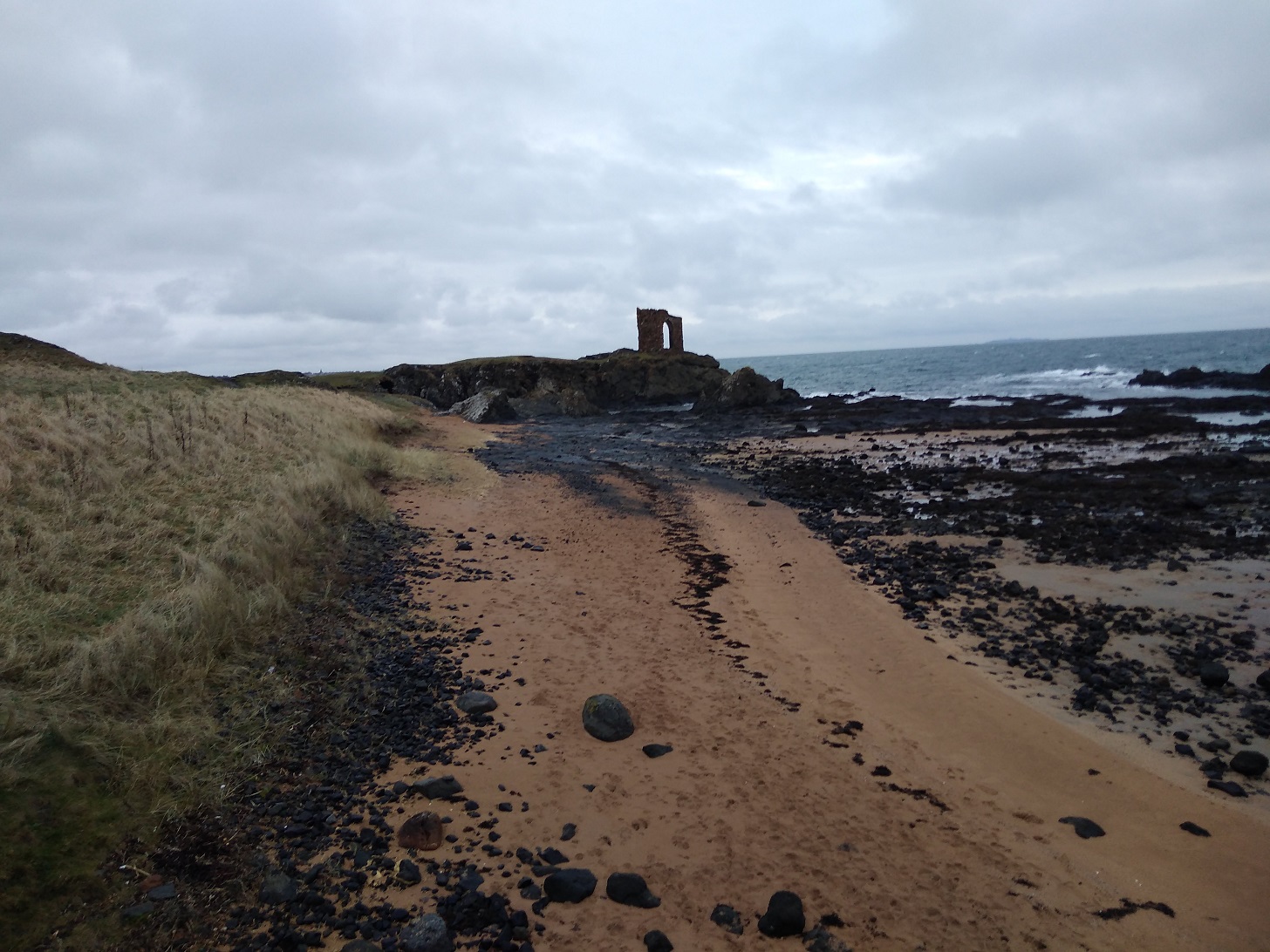
Next was a further geological treat: Buddo Rock, a stack of pink sandstone with a muted rainbow of organic colours and weathered into fascinating shapes and spaces.
Though time was galloping along, I had to stay a while and explore the nooks and crannies, gasp at the intricate patterns which had developed over centuries.
The Baddo Rock in the deserted landscape where I was surprised by another photographer
It is gentle land, unassuming and quiet, seeing to itself. Nature and birds are simply doing their thing – a situation which allowed me to think about what I wanted and do what I wanted because it didn’t care.
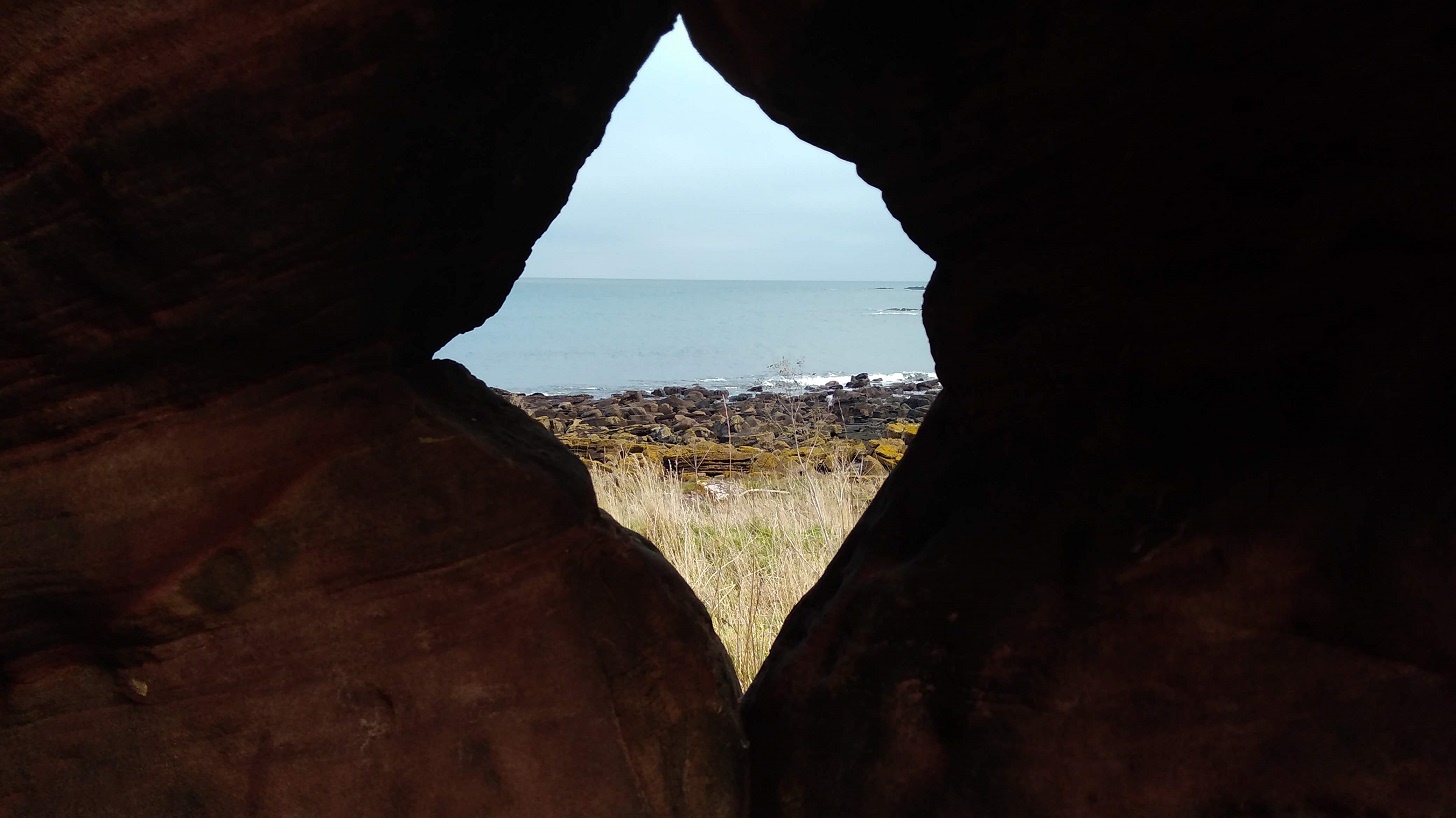
View through the rocks, Fife
Gorse and lichen, a matching yellow, were situated amongst twisted shrubs which were sharp and almost bare of leaves. I padded along soft paths at the sides of which the sun lit up swathes of bright beige grasses with lavender coloured seedheads. Drystone walls cut into the shoreline at right angles and the sea turned alternate shades of baby blue and slate grey depending on the cloud movement.
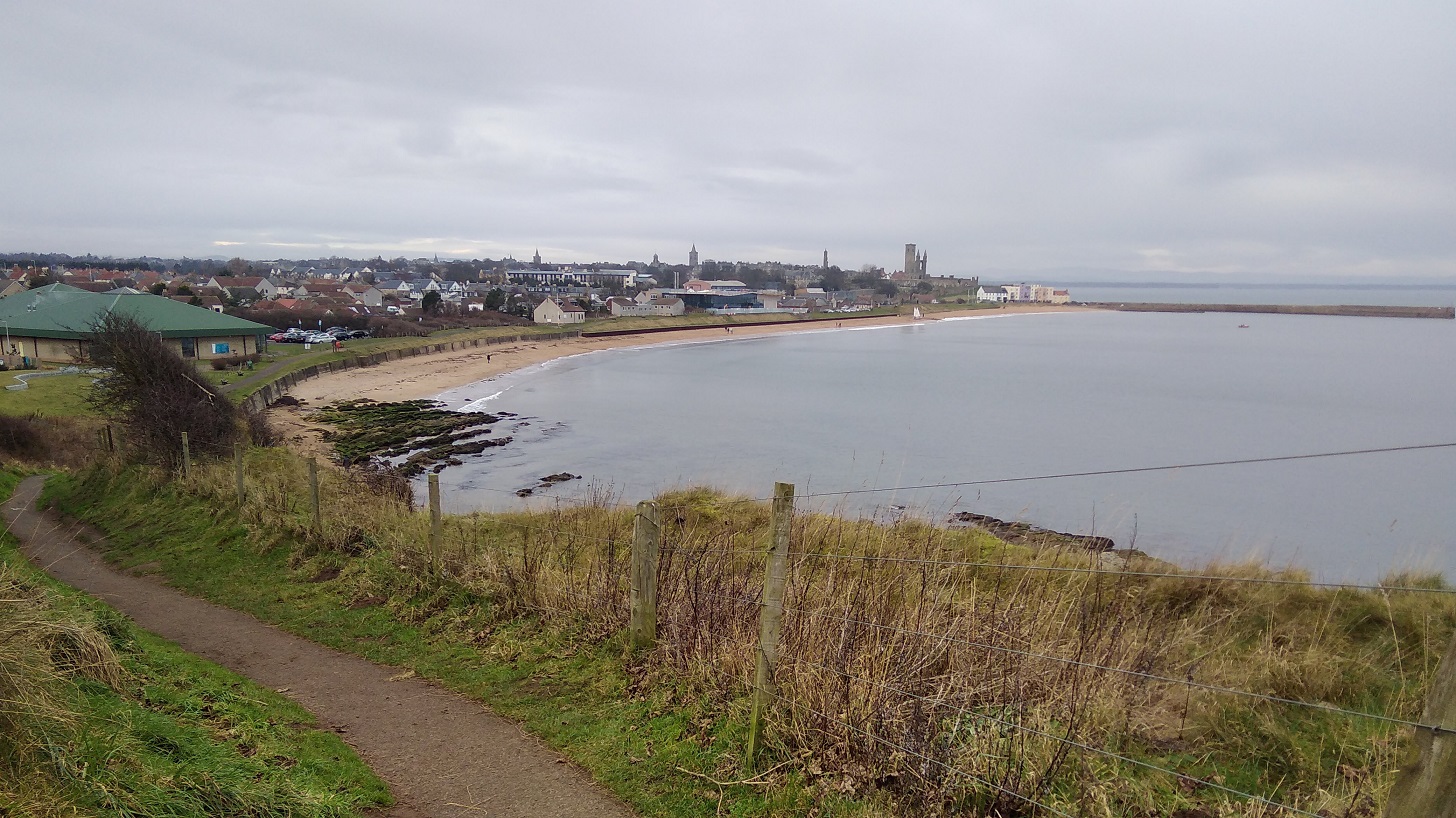
St Andrews started to show, glowing in the distance while the coast behind me, when I turned round, was gloomy
Up and down tons of steps, it was very steep and hard work. Then back on the shore before climbing again. Fife Coastal Path
A jogger ran past. A man was doing a pee, very embarrassed as he spied me.
The sun went in and there was a definite sense that the rain might be coming on, then it cleared
There were more walkers than I had seen before on any of the FCP – there’s nothing like the Real Tough Part for attracting lots of folk! Both enthusiastic and uninformed walkers were there, I would have said, given what they were wearing on their feet. It sure was tricky in places: steep like a roller coaster, and a real scramble up jaggedy rocks at others. The water came very close, even before the tide turned, but I didn’t get my feet wet!
In one place there was a thin plank, the width of one foot, over a narrow chasm and a couple were in front of me. The man went first with the dog and held it as it growled at me. As I passed I heard him murmuring, ‘mummy’s coming, mummy’s coming’ as the woman with beautiful makeup stood still and wondered if she wanted to cross. She took her time – there was no other way.
There was a white bit of plastic to step onto but my short legs couldn’t reach it! Precarious with a rucksack
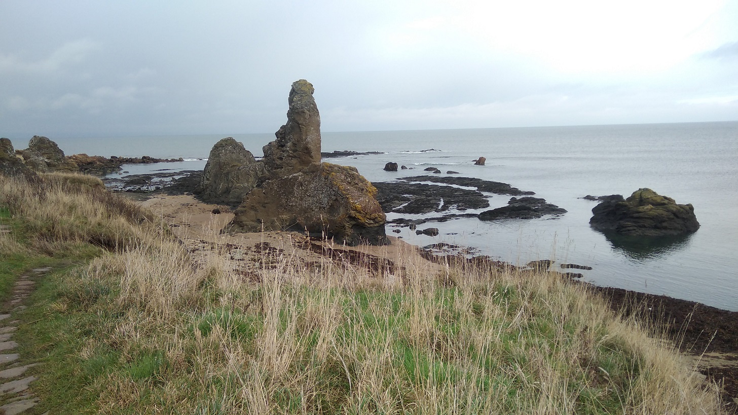
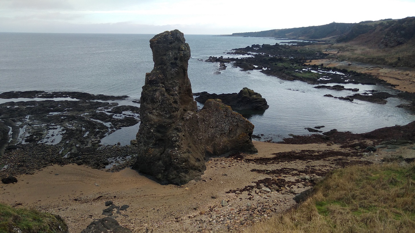
Further along was the Rock and Spindle – an eye-catching, rather thrusting geological feature standing separate from the crowd just off the main shore.
Stones are set into the grass for climbing – sometimes with wooden hand rails and sometimes not. Pointing to the skies is the Rock and Spindle. See how the sea has eroded the land making semi-circular furrows which fill with water around it
The Rock and Spindle closer up. Walking on pebbles, squelchy and noisy
St Andrews
High up on Kinkell Ness I stopped to ask directions from a very tall gentleman in an orange top with a beard with a petite woman and labrador beside him. Yes! 15 minutes over the high ground, he assured me, and I would be in St Andrews – I had done it, with a real sense of elation. I even laughed as the rain came down!
St Andrews at last!
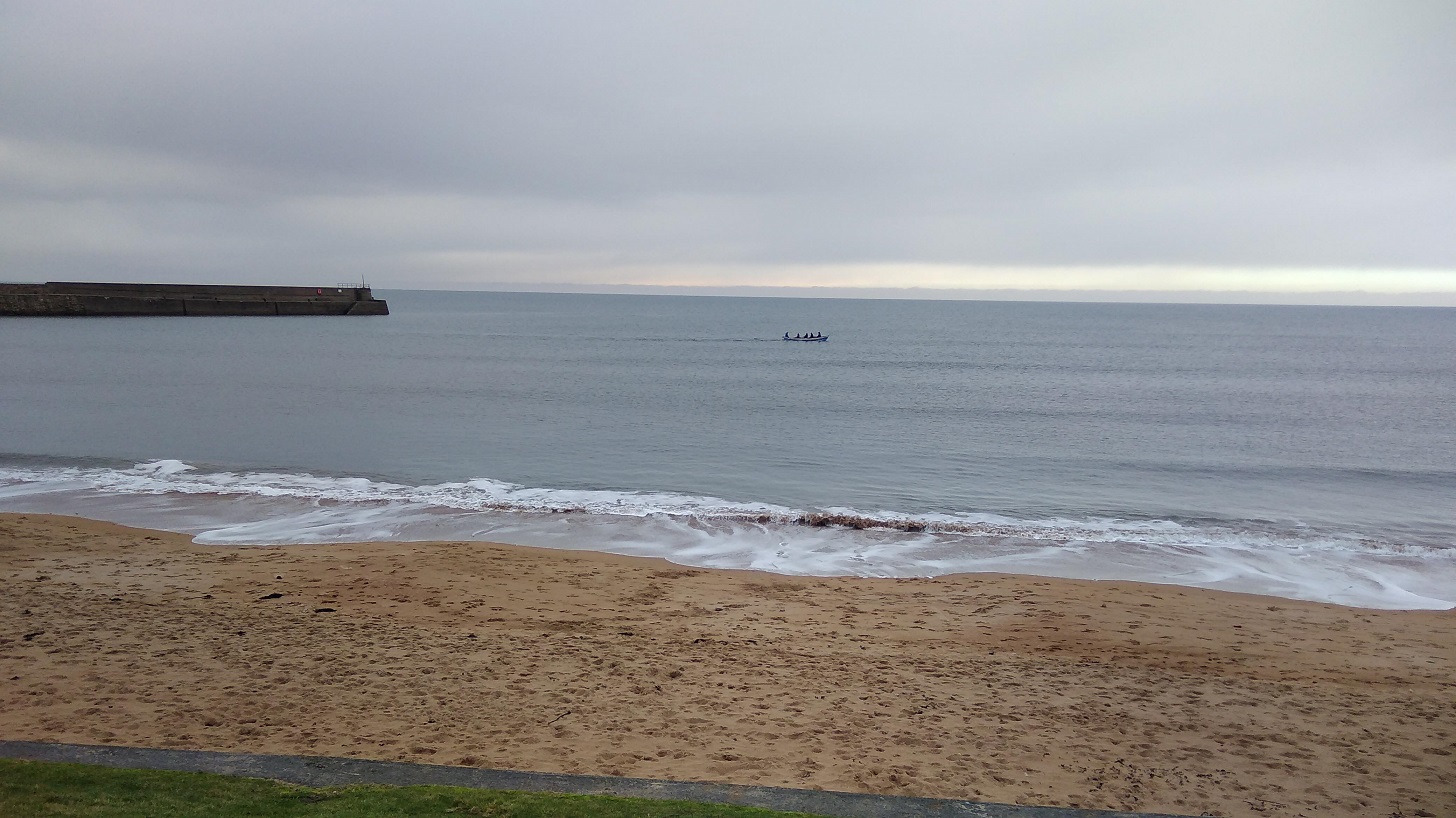
I heard children and looked down the steep cliffs to the beach, but no, it was a trick of sound over water – about 8 of them were in a boat out in the bay.
East Sands, St Andrews
The astonishing thing is that you do actually get there, however exhausted your muscles are, Mine were all tense and brittle from yesterday’s exertion. On the East Sand, people wore trainers and sauntered with coffees, barking dogs and there were four white sails in the harbour.
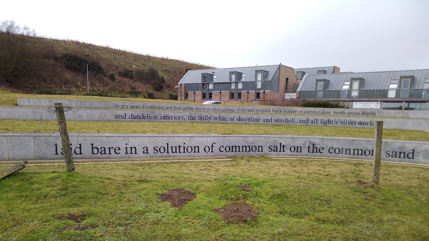
Jacob Polley’s poem, East Sands, Salt Prints winner of the TS Eliot Award for Poetry at East Shore, St Andrews
Reads, ‘to pry apart a sunbeam and find yellow like imperfect gilding, violet and purplish black laquer of a lobster claw, bottle-green depths and dandelion interiors, the frilly white of shoreline and seashell, and all light’s silverwork laid bare in a solution of common salt on the common sand.’
What did I find surrounded by a small crowd but the Cheesy Shack which I had seen advertised back at Kingsbarns Car Park!
There is the option here to carry on around the cliffs and past St Andrews Castle, or turn inland through the city. I did the latter. It was a bit of a walk as there are only a few places where you can cross the Kinness Burn and take the Pends into the city. I was pretty wet now and needed shelter.
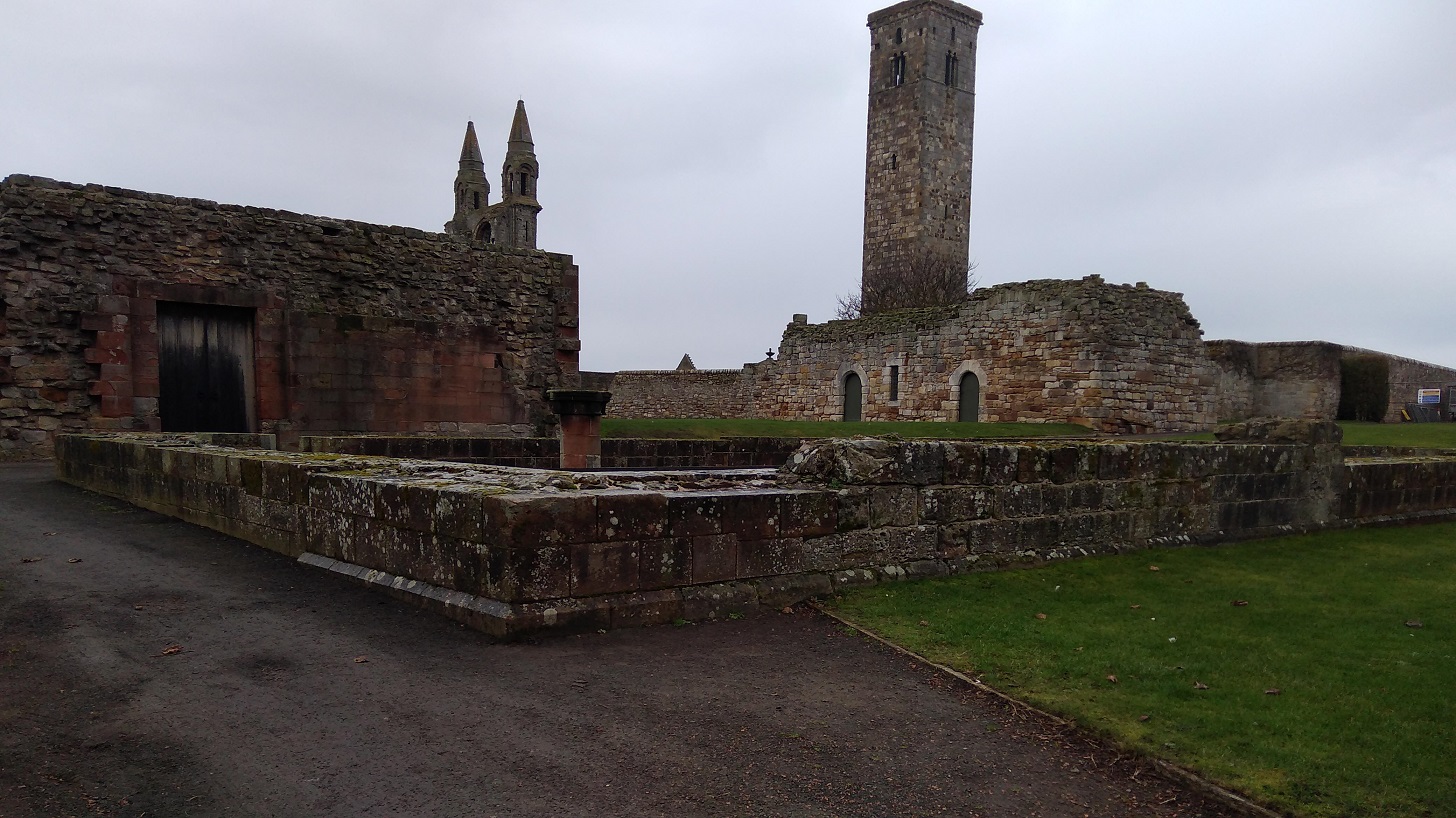
The Kirkheugh remains are near the Church of St Mary on the Rocks and St Andrews Cathedral on my right as I left the sea behind me
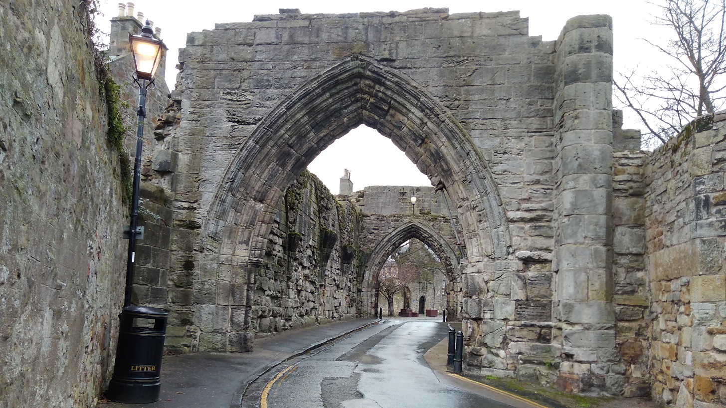
Under the arch of the St Andrews Cathedral Priory Gatehouse – Medieval ruins
I took a left along South Street to find somewhere to find hot food and somewhere to recharge my phone. The soup was spicy and warm at the North Point Cafe, an unsophisticated wee place where the staff were attentive.
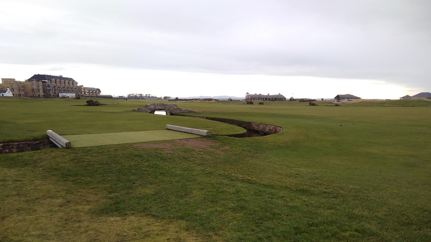
Be very careful when picking up a path leaving a town – it is always one of the most difficult things on a trail like this. There is a massive and most famous golf course on the edge of St Andrews and in many places it is uncrossable, so do not skirt the sea (where the toilets were closed) or you will have a very long walk!
I eventually found my way into the club house and the receptionists were kind and let me use their sumptuous facilities!
The St Andrews Old Course where the famous golfers play, with the Old Course Hotel on the left, in front of which the cycle path and the FCP runs to Leuchars
If you too stopped here for lunch here is my advice: find the main road A91 out of the city (the continuation of North street), direction: northwards. Alternatively you could ask for the Old Course if you dare (it is assumed you know where it is, as it is so well known!). Keep to the left of it ie do not follow the coast road through the car park (West Sands Road) even though it does say coastal walk, but instead head for the enormous hotel and the facade which is facing away from the sea, inland. You are looking for the tree-lined North Sea Cycle Path which goes to the left of the Tom Morris Building (turf on the roof).
This straight path takes you from St A to Leuchars, the next village, and tracks the main road
It was a long haul on hard ground after such a challenging day and there is little to entertain you but traffic noise. I changed into my other shoes, but it felt like I was wearing slippers and my feet were sore. You could always take the bus as they are frequent and cheap.
On the right is a Nature Reserve, close to Guardbridge and the mouth of the River Eden. Arable land (blackcurrants?) and pastures where sheep crop
The evening light was low and the industrial warehouses and hills covered in snow in the distance were lit up
I was very tired and looking for the Guardbridge Hotel when I saw that I could get the X59 bus back to Edinburgh. I stopped and waited on the same side of the road where I had been walking until a local bus stopped and said I was on the wrong side!
Ten minutes later I was hurtling back across Fife, taking the route through Glenrothes towards the Forth Road Bridge and home in the dark. I hadn’t made it to Leuchars, the end of the day’s walk, but then again I had started at Kingsbarns instead of Cambo Sands.
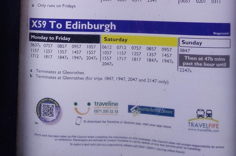
I have been reliably informed that Traveline (see the phone number at the bottom of the photo) is an excellent resource for buses all over Scotland.
After last weekend’s walk on the Berwickshire Coastal Path I was aware of the short day-light at this time of year, so I set out in the dark with a rucksack that I found upstairs looking like it had never been used, telling myself:
It’s going to be harder than you think it’s going to be
You never know what’s going to happen
Slowly the sky lightened as I trundled through the countryside on the train from Edinburgh to Kirkcaldy, a blue glow over the misty fields. My phone registered one degrees.
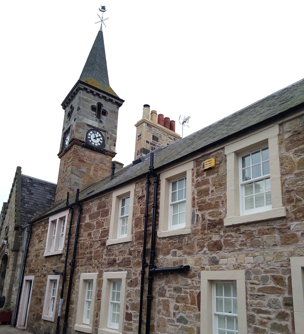
The majestic Adam Smith Theatre, Kirkcaldy, Fife
The X60 Stagecoach from Bennochy Road (close to Kirkcaldy railway station) dropped me off by the entrance to the Holiday Park with its puffin sign on the outside of St Monans and the memorial to George Hutchison 1945-90.
Time flies, Shadows fall, Love is forever, Over all.
By 10am I had walked through it and down the steps to the mirror clear water of the salt pans, the mini windmill, and onto the beach.
On the sea side of the Holiday Park, St Monans, Fife
The first of the salt pans where ‘at the end of the 18th century the dirty, smokey process of salt-making went on around the clock’ (public notice), St Monans, Fife
I heard the sea before I saw it as there was no wind. Somebody was ahead of me, somebody behind me.
The windmill, another tangible reminder of the salt production industry, St Monans, Fife
The remains of the St Monans pan houses where 6-8 tons of coal was needed to produce 1 ton of salt. Fife
Like last weekend, white waves rolled over themselves, but there were no cliffs just flat, jagged rocks the colour of sandstone. Closer to the water they were black, etched deeply, at right angles to the land making little coves of apricot sand. A yellow gorse bush was tucked under the eroding edge. A pair of mallards drifted, and the air was very still with the smell of smoked fish.
Big white birds perched on the outcrop and, looking closely, almost hidden, black-on-black, large dark ones as well, one standing up and opening its wide wings: cormorants.
Water sliding over the rocks, slippery with weed in shades of teal
The constant sound of the waves as the tide came in
I could see Pittenweem’s orange roofs ahead but it was too early for a stop. I was hoping to find somewhere to buy something to eat later on though, as a picnic with my flask of (not very hot) Jasmine tea.
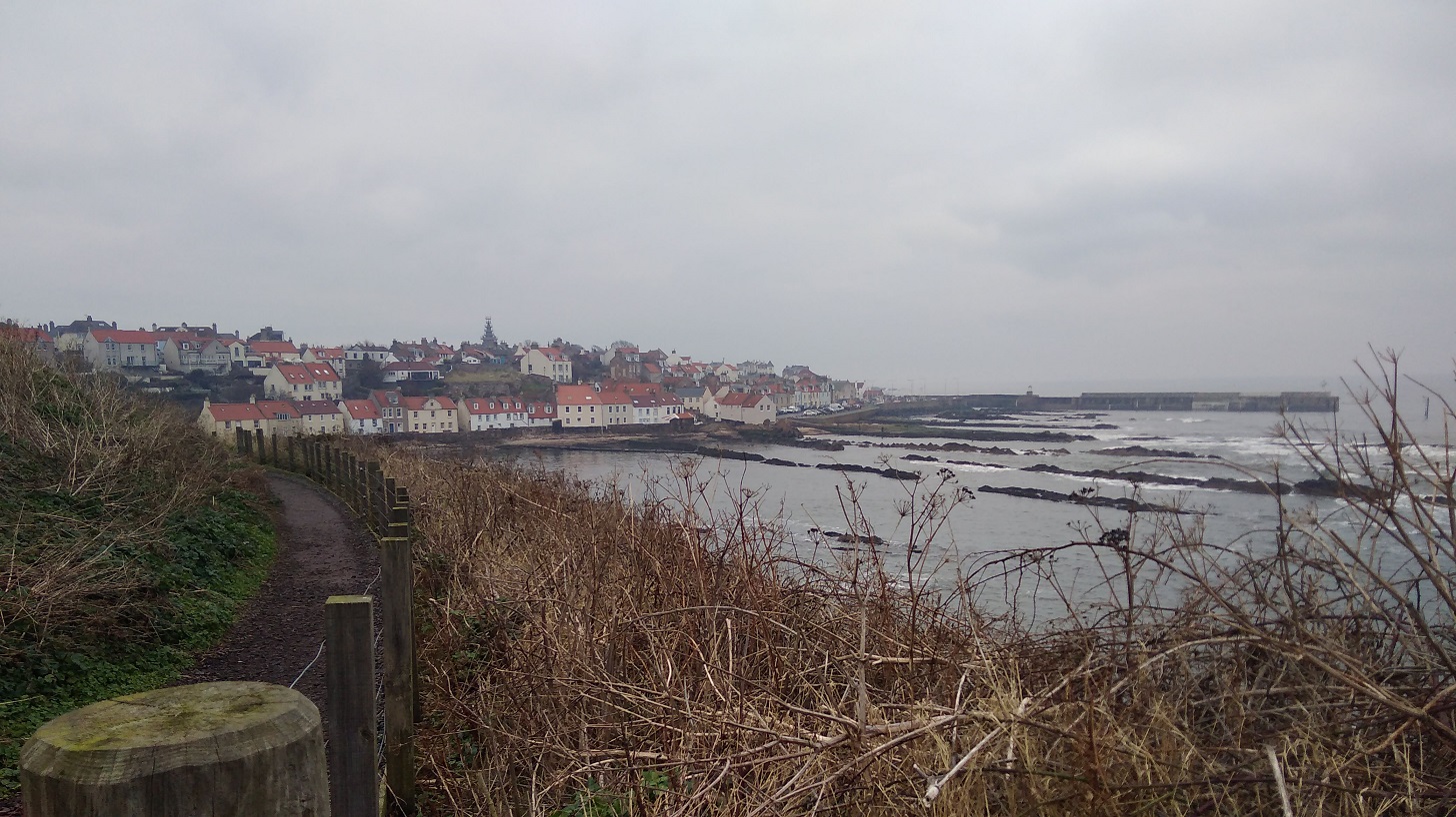
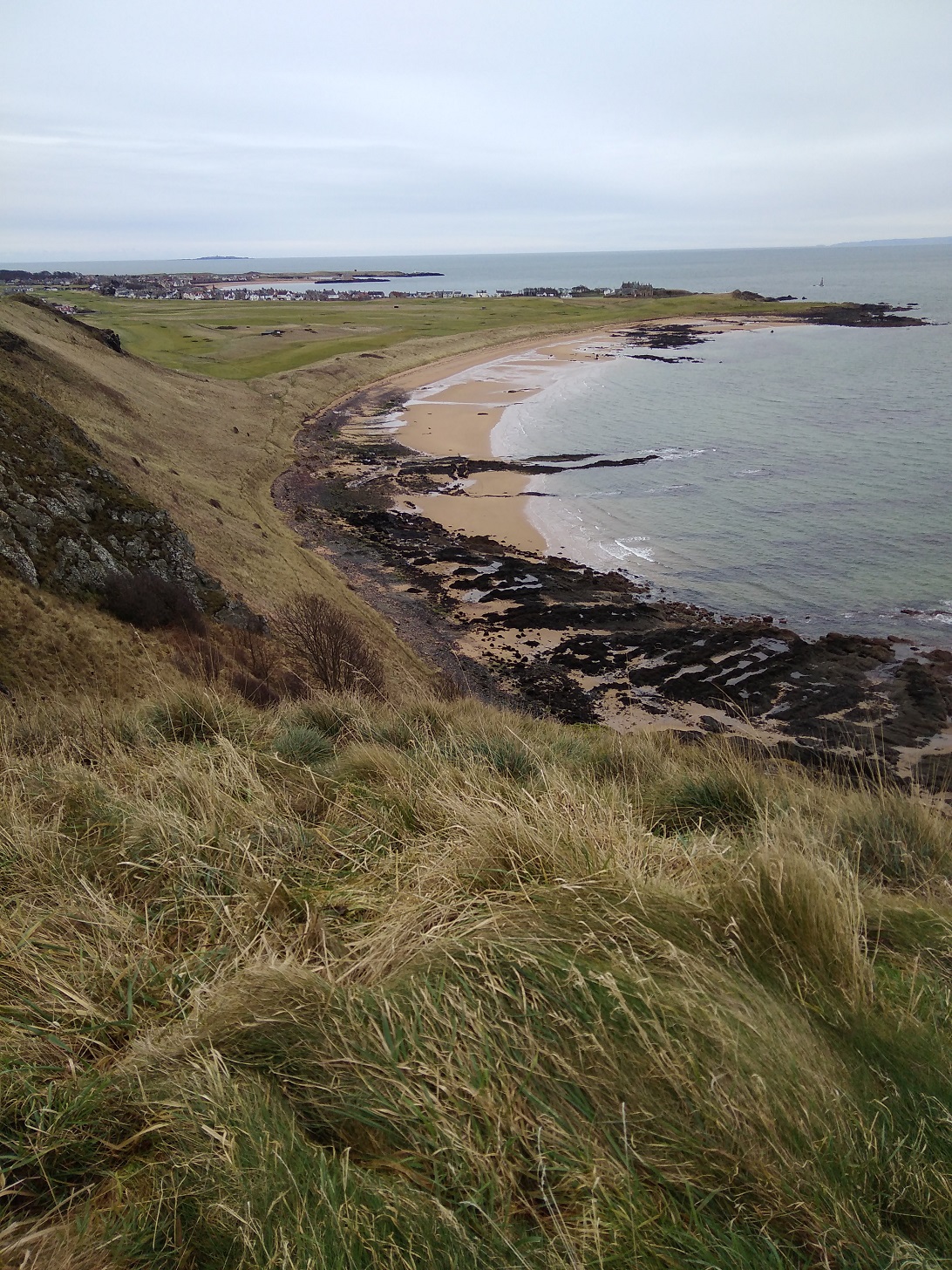
The approaching view of Pittenweem, Fife
A bunch of friendly ladies all dressed in pink and purple left strong wafts of perfume as they chattered by, each saying ‘morning’ to me.
I had expected a cold bright sunny day like yesterday, but it was dull instead so I could not see into the distance and it was warmer as a result.
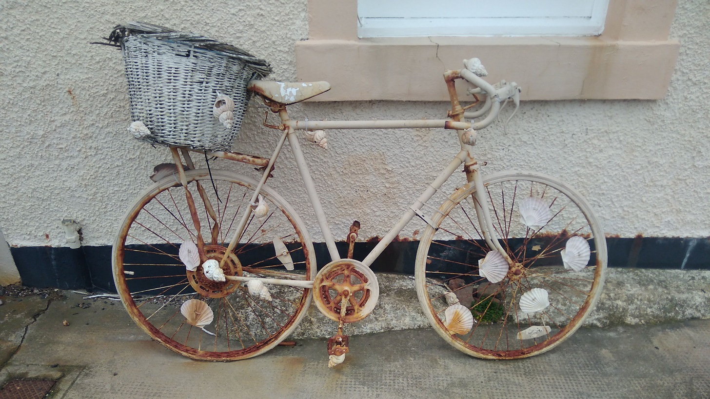
Here the stink of seaweed was palpable and friendly dog walkers were out and about. Pretty cottages, all marled in pale hues – beige, pumpkin, baby blue and the odd lavender – line the harbour. Wood smoke hung in the air and as I passed a bicycle decorated with scallop shells I wondered if it was owned by a fellow camino walker.
In Pittenweem I could have tasted ice cream or supped on fish and chips, drank a dram at the Larachmhor Tavern or admired the arts and antiquities off to the left. Were the toilets open? Yes, and well supplied – warm, light and clean – excellent as public facilities go. What I couldn’t spot was a food shop. Pittenweem is an active harbour, however it being the winter months, the Dory Bistro and Gallery was shut and there were few people around considering it was a Saturday morning.
Pittenweem harbour, Fife
Coming out of the village, I noticed that there were not many wild flowers – one or two orange marigolds (calendula) and a few with tiny dandelion-like heads to a stalk. The path goes along the back of what look like holiday cottages. Here pink mallow in someone’s garden, there a pinky-purple hebe, otherwise not much colour at this time of year.
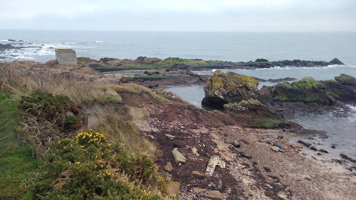
Found poetry: soar alba / free Scotland scrawled in Gaelic, and ‘bee (sic) happy’ written in shells on the rocks
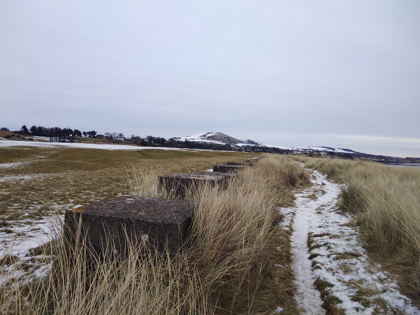
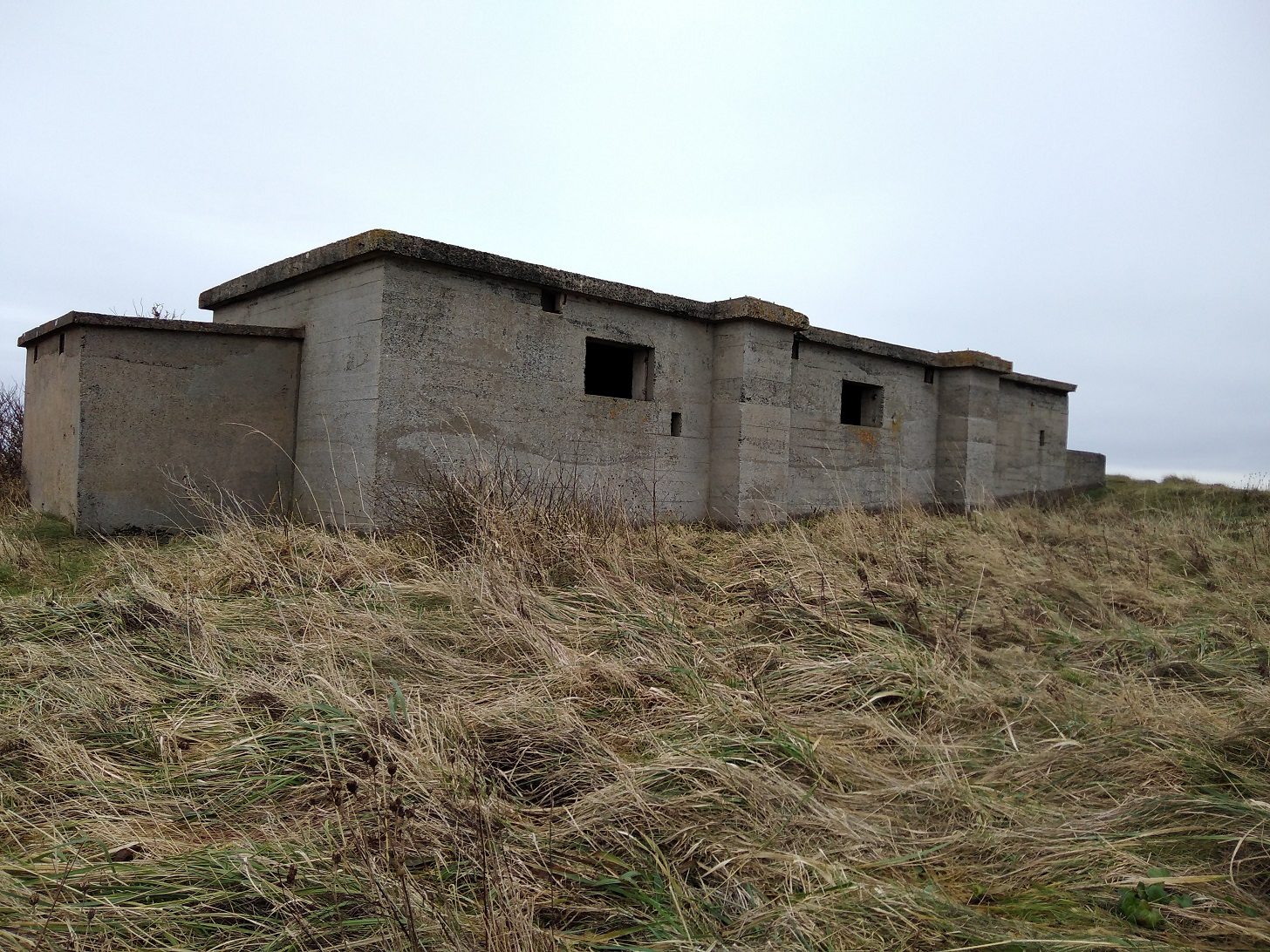
I was walking higher up now above the sea and behind a fence. Down below, right by the shoreline were man-made concrete blocks, presumably the remains of WW2 battlements or look-out towers. On my other side were well manured and beautifully ploughed dark brown fields.
The cropped green of the well manicured links (golf course) contrasted with the improvised yellow lichen of the fence posts.
A cormorant’s proud neck and head were at right angles to its body and suddenly it dove down amongst the tumultuous waves.
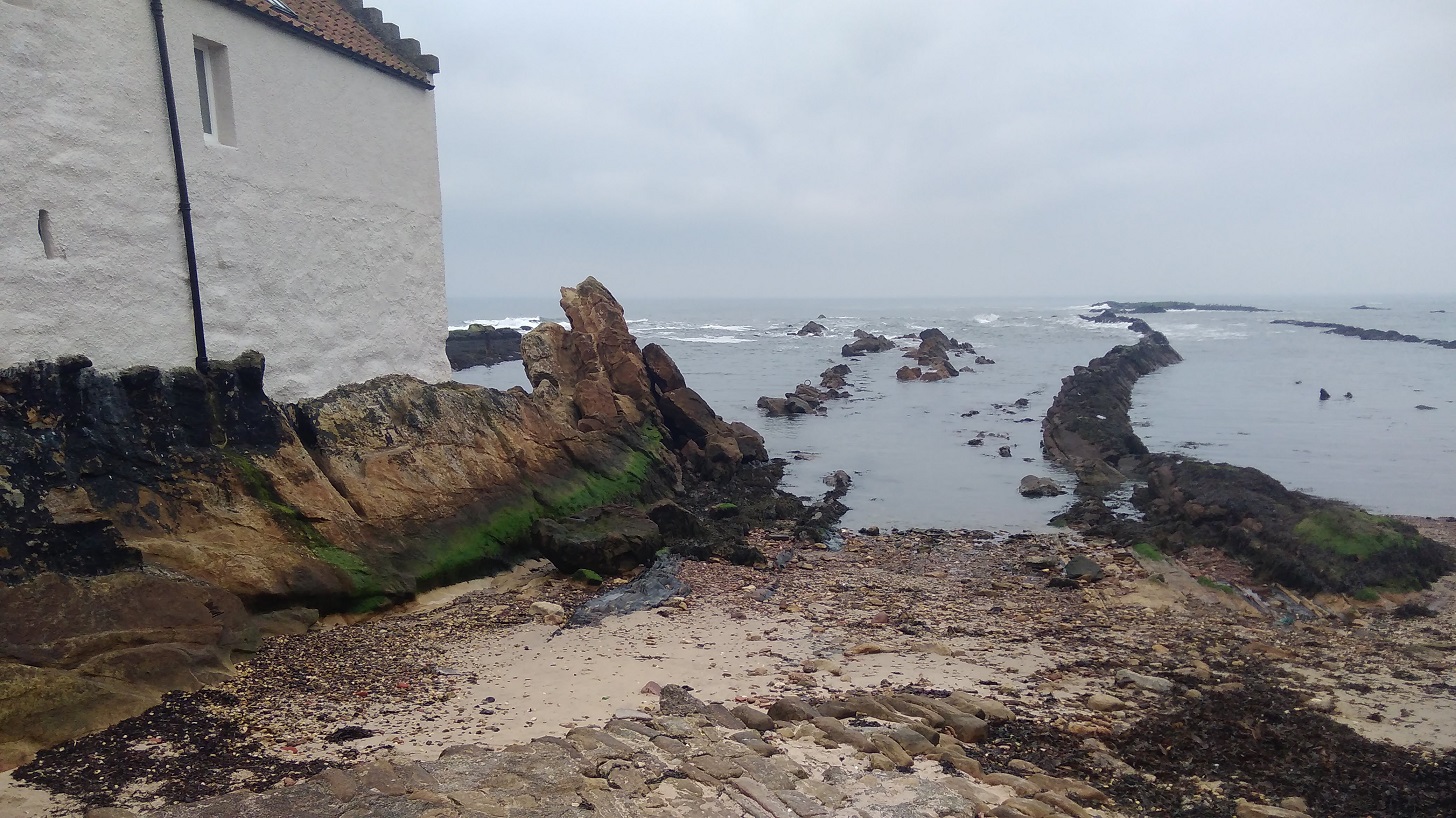
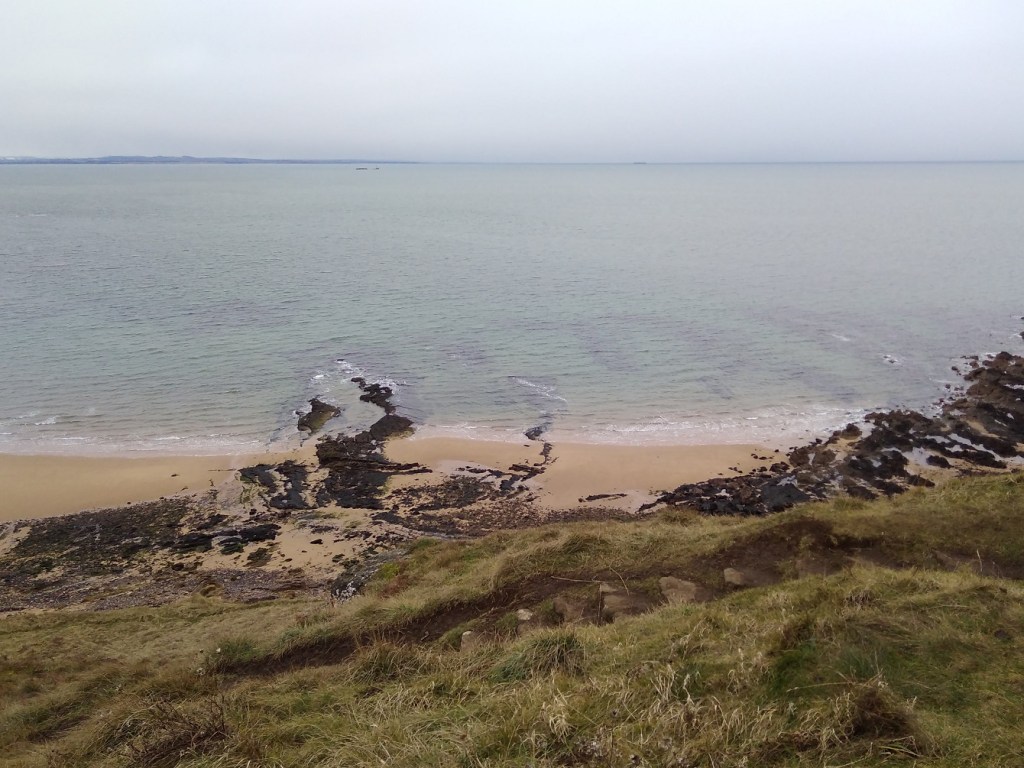
Then I too was right down by the beach, enjoying the lovely gentle colours of the rocks – threads of khaki and caramel with carmine underneath and black above.
Sparrows trotted along with pointy beaks dabbing amongst the blades. A single cormorant flew past, neck reaching, its body the shape of a black cigar remaining dead parallel to the sea, while both black wings flapped up and down simultaneously.
I passed a big group of hikers, some of them properly dressed to tackle the north face of the Eiger. A castellated tower had a list of names below it; a war memorial.
As I entered Anstruther I spotted a street labelled ‘Formerly Witches Wynd’. I thought wryly, that’ll be before they killed them then!
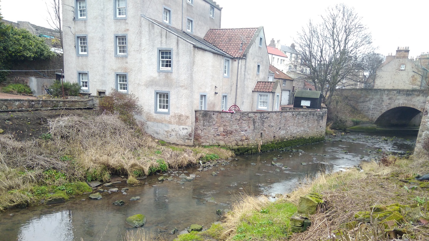
The Dreel Burn, Anstruther, Fife
A nearby sign read: ‘James V travelled incognito through Fife as the ‘Guid Man o’Ballengiech’, coming to the Dreel Burn and fearful of wetting his hose, he was carried across at this point by a stout gaberlunzie (beggar) woman, who was rewarded with the king’s purse.’
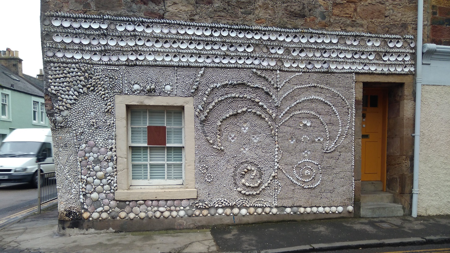
Shell House, Anstruther
Around an extremely sharp and very dangerous bend with no pavement, was more coquille Saint-Jaques decorating a house and the Dreel Halls with a lot to see – the church architecture, its graveyard and various monuments and inscriptions.
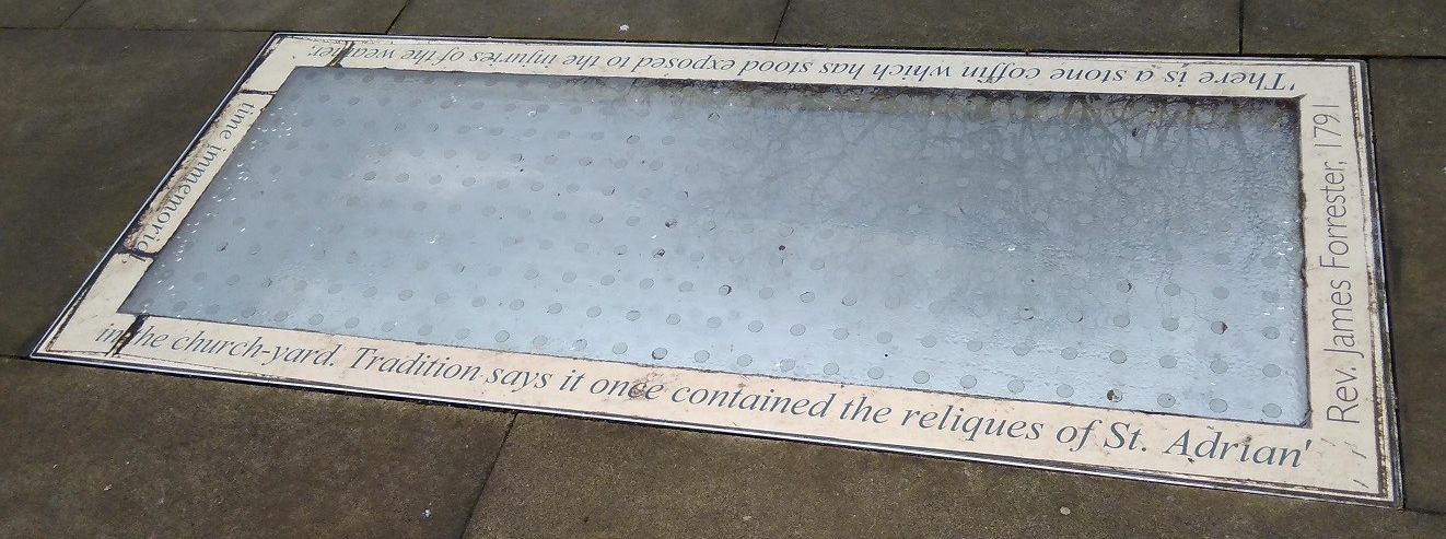
Concealing a casket, Dreel Halls, Anstruther, Fife
Around the glass the inscription reads: There is a stone coffin which has stood exposed to the injuries of the weather in the churchyard. Tradition says it once contained the relics of St Adrian. Time immemorial.
Written on the stone is a poem about God:
‘…He drops into the kirk, and sits as sunlight on a rear pew. It is warm, the sermon’s mighty long. He sucks a mint and dozes…’
Taken from ‘In Anster’, engraved on a stone in the yard, by Andrew Greig, 2013 who grew up in the town.
The path takes walkers into the town but remember to take a right turn at the wee shop, walking between the A & A Stores and The Bank hotel! The path turns quickly to the right down a very narrow wynd back to the sea.
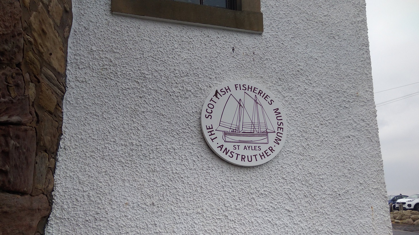
At the harbour there is the ubiquitous fish bar plus a post office, cash point and the Scottish Fisheries Museum (shut but the cafe was open and there were eco toilets that I have never seen before where the water for cleaning your hands fills the cistern after use).
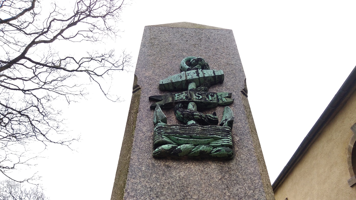
You can learn about the desperate outcome of a collision in 1918 between submarine troops on an exercise who, due to the wartime blackout, collided with minesweepers, leaving 108 dead.
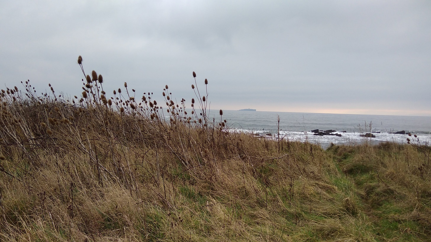
Teasal plants and an orange glow to the horizon where you can see the Island of May
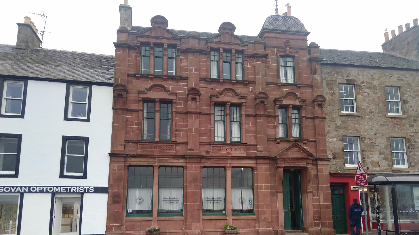
Anstruther is an extensive town made up of 3 or 4 boroughs (depending on which source you consult). It was bustling, and I happily spotted the elegant hostel where I would be spending the night.
The Murray Library Hostel, Anstruther. I gave it 5 stars
Nearby was an artisan bakery where I treated myself to an expensive packet of thick and chunky cheese oatcakes (made, so the board informed, of ‘Anster cheese crafted by Jane Stewart’) which came in very handy for the remainder of the trip (ie I ate them for breakfast, lunch and tea!)
They were also selling traditional Scottish fare!
A wee way along was Cellardyke Harbour (known locally as Skinfast Haven created in 1452) with washing lines beside it. I sat down and supped my tea.
The Plough and the Reaper, Marion Smith. Anstruther, Fife
Cellardyke harbour where there are washing lines to dry your clothes
I sat a while here, looking out to sea and having a snack, Cellardyke, Fife
Oooh weep, oooh weep – big crowds of curlew with their long thin, curvy beaks. A stretch of uneven grassy path and it was definitely sniffly weather. A couple trundled ahead of me; the sea rolled and crashed close to my right shoulder; and then a kissing gate which I really had to squeeze through because I never want to take the rucksack off when I have got it comfy and settled on my back.
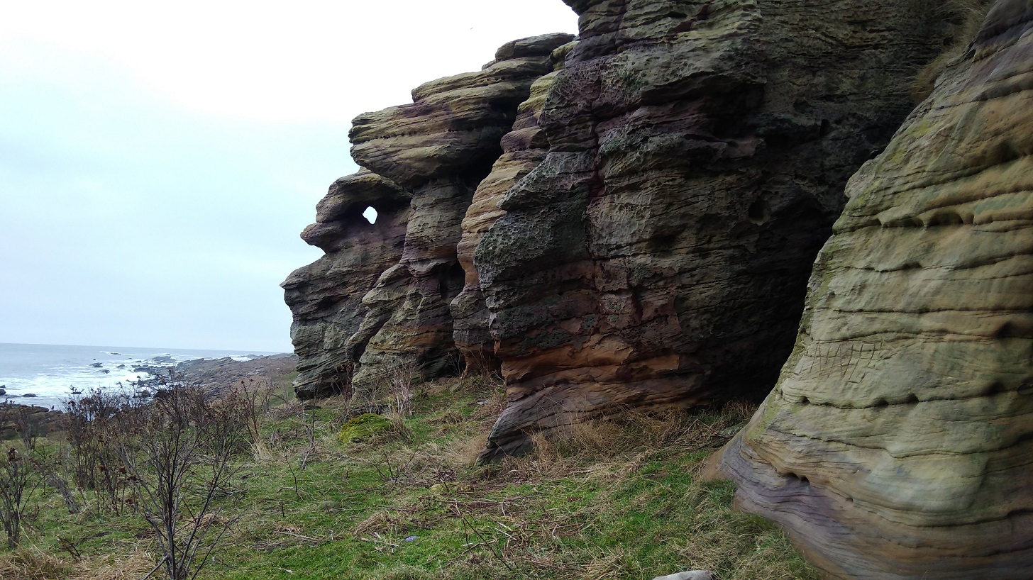
The high point of the day were the rocks. Sandy to the touch and with amazing colours, stripes, indentations, wave patterns and all manner of other shapes that you could make stories up about. I stood underneath them and looked up to the sky and out to the sea. There was something very powerful about the place.
The colours (the camera did not do them justice)…
… and patterns of these rocks amazed me
Partly eroded, they create fantastic shapes, …
… holes and arches to crane through
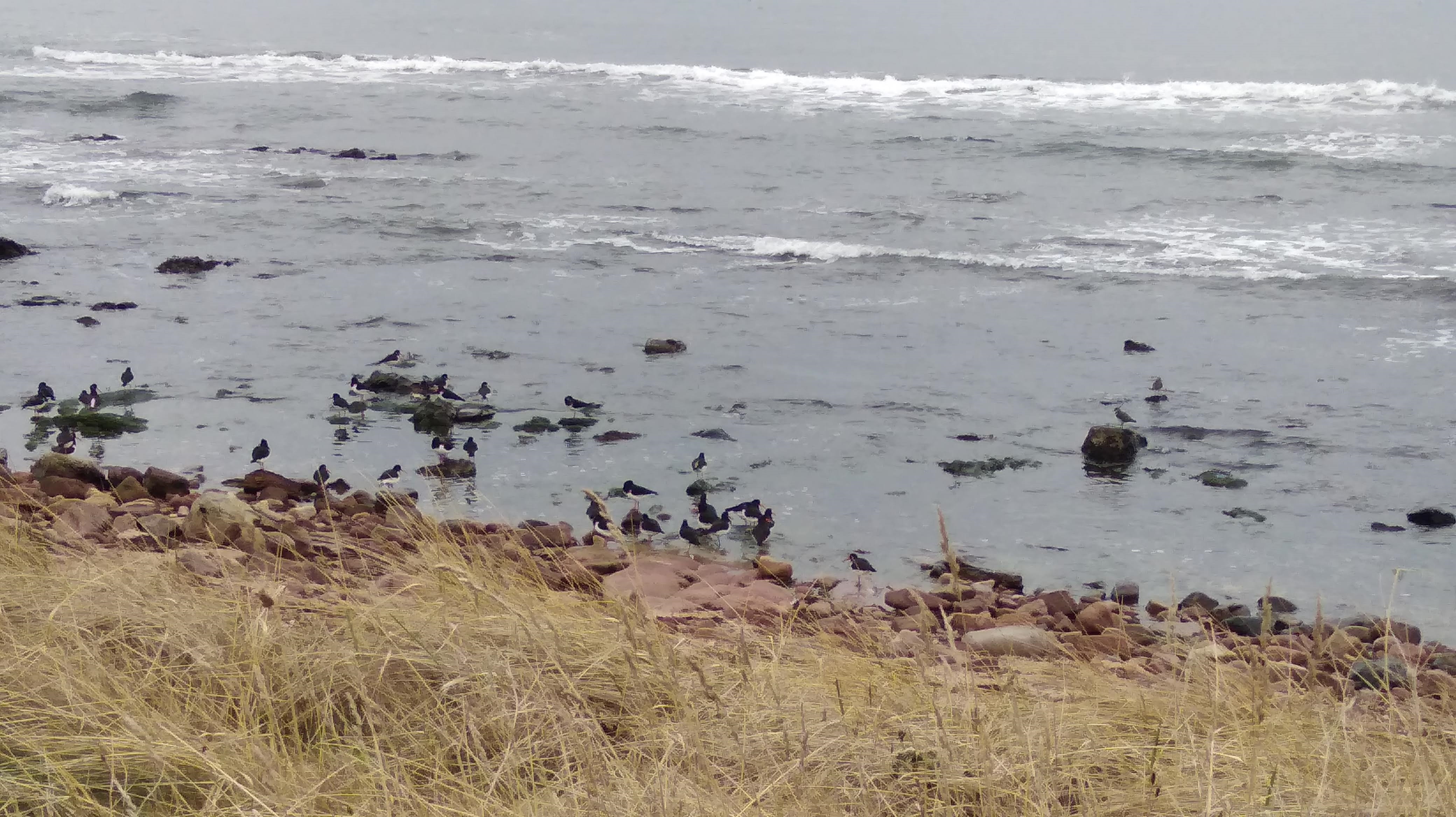
More cormorants seemed mammoths compared to the orange-legged oyster catchers beside them up to their knees at the water’s edge.
Taken with the zoom, this photo is blurred and no cormorants, but you can identify the oyster catchers paddling and, on a rock on the right, a lapwing
The land tapering into the sea in the distance
The Coastal Path sign warns of danger!
Climbing up I snapped a bird in flight – there isn’t much uphill on this stretch
A stony beach meant that the withdrawing waves cause the rocks to clatter against each other and tufty puffs of white foam rise high between rocks. What’s left of the water in the pools had the setting sun reflected in them, even though it looks as though it’s way over to the horizon and nowhere near overhead.
The sea was active, crashing and washing over the rocks
It was 1 o’ clock and I was already starting to feel tired and slightly anxious about the evening, a bit cranky as I came into Crail!
Crail, Fife
I lost the signs and asked a couple who directed me back the way I had come and they recommended the Golf Hotel where I duly stopped for a cup of tea and some ‘rocky road’. Report: very nice waitress, very slow service, not my sort of place.
Once out there was a clear sign downhill to the sea – I must have needed that boost!
Crail coat of arms, Fife. The panel reads. ‘Restored and given new life by The National Trust for Scotland’ but if you search their site they have no results for this village!
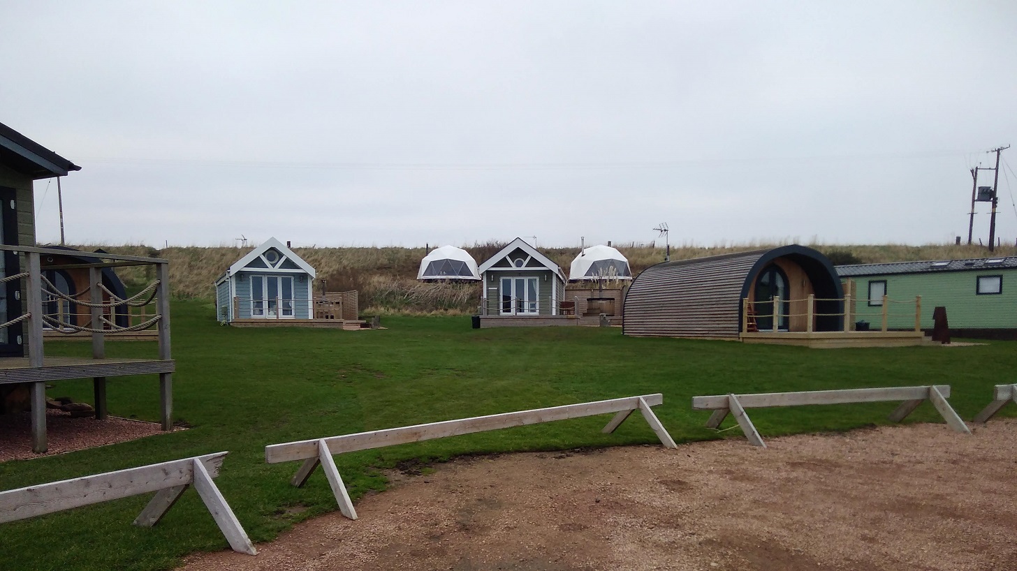
Sauchope Caravan Park, Fife
Roome Bay was next and caravan site #3: Sauchope Links. There is lots of space for visitors with little huts, white yurts with little chimneys coming out of the side and a swimming pool. One larger dwelling had a hot tub on its balcony, and overall it could not be closer to the sea. Like a spotlessly clean small village, everything is well kept and perhaps because only a few are inhabited at this time of year it seemed soulless.
Out to the ocean, I watched while banks of water gathered, dark on the forward slope, white bubbles teetering on the edge before crashing down and running into the bay. Sometimes when you think you get to the top of a mountain it turns out to be a false summit, and this was the same: that long wave was all over until it turned out that it wasn’t and there was another edge, and another beyond that, and…
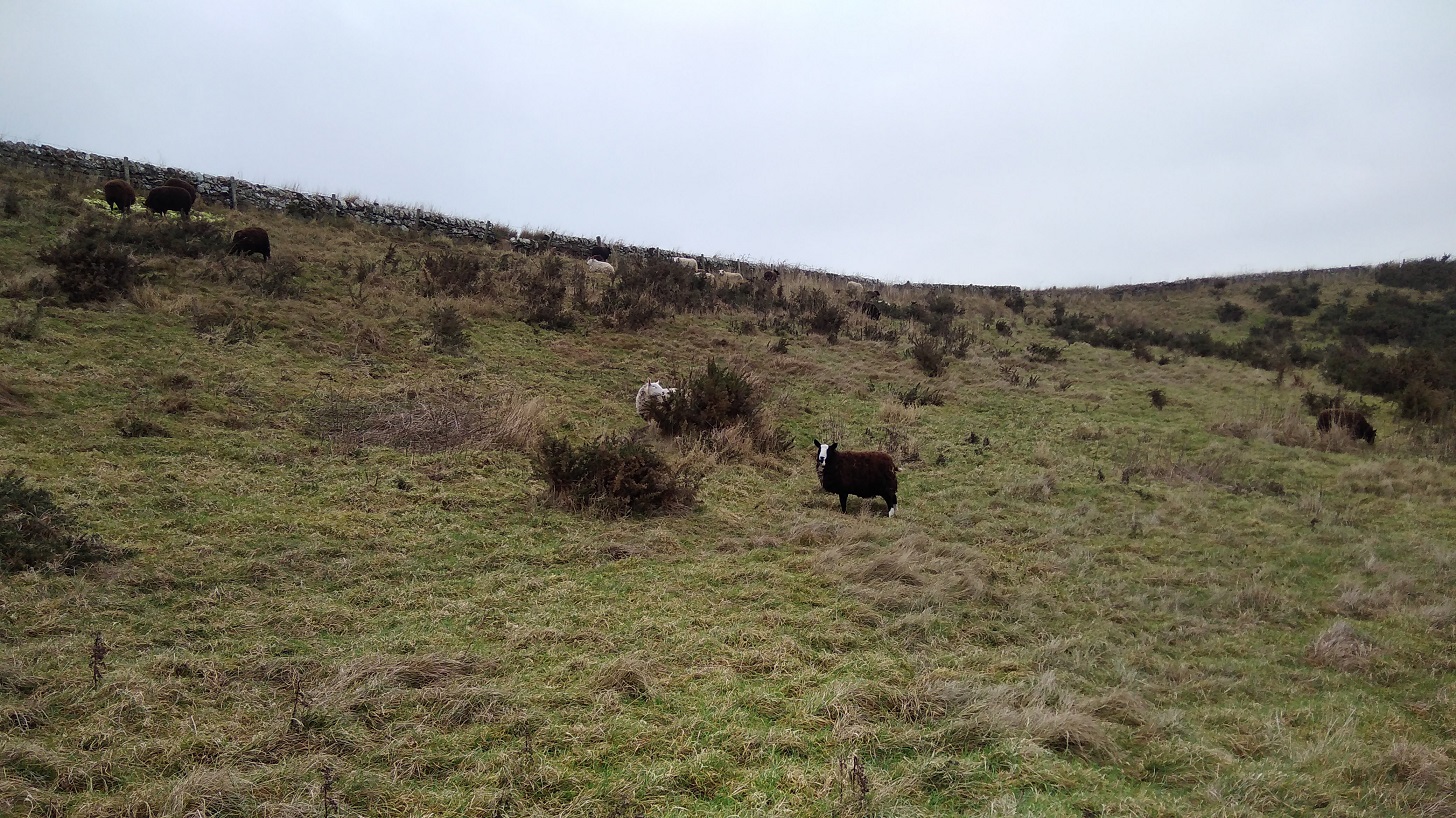
I looked at them and they looked at me!
My attention was attracted by baah and the sheep’s great thick ruffs of coat bunched up around their necks. When they have their heads down it looks as if you might be able to extend them, opening up those folds like a concertina.
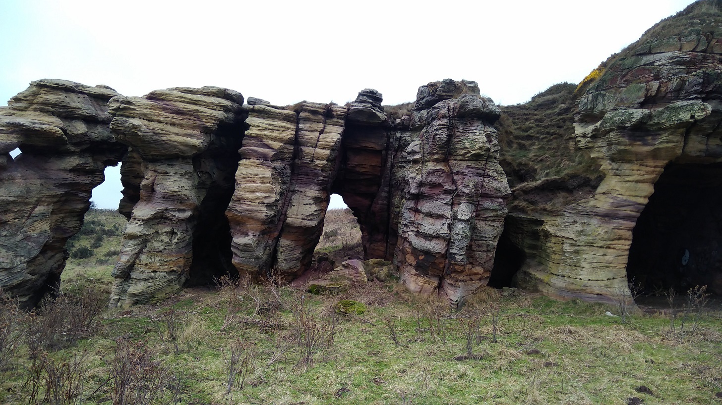
Kilminning Coast Wildlife Reserve, Fife and more rock stacks
Symmetrical square and rectangular chunks lined up in a row
The massive rocks were sometimes triangular but never curved, gravity having squashed down the layers of the land. Even the vertical cuts and breaks were all at right angles.
3pm saw me rounding the tip by the lighthouse and the Fife Ness bird watching hide
A little further on there were some demure cottages, more caravans and golf links. It was darkening now. The birds were in clusters and from a distance they looked as jaggedy as the rocks at very corner, battered by the waves, like dinosaurs’ backs across the peach sand to the sea.
The odd quack came from ducks all settled down comfortably on the pungent seaweed interspersed with a squawk of ravens. As the cormorants were standing with their wings open but there was no sun, I could only conclude that they too were having hot sweats and needing to cool down!
Constantine’s Cave is just here. According to tradition, King Constantine I was killed in this place after a battle with Dubhghall (‘dark foreigners or Danes’) in 874.
I was nervous of being stranded by the sea at night, so I took a left before I got to Cambo Ness. Although Kingsbarns village is covered up by a panel of writing on the Coastal Path map for stage 5, I had researched in advance and knew I could get a bus from there. I found my way across the corner of the golf course and up the beginnings of a small road where I spied a lit window where a woman was washing up. She kindly came to the door and advised me it would be quicker to stay by the sea. However, she is familiar with the area and I was not, so I took off up the farm track, through the yard, and narrowly missed the bus by about 3 minutes as it thundered past on the main A917. Then I had to do what she said I would and walk at the side of a very busy road, initially with no pavement, and into Kingsbarns by the church where I waited nearly half an hour for the 95 bus.
I thought it looked like a member of the KKK!
Back I went to Anstruther and to the Murray House Hostel which I had seen earlier. The French hospitalier was extremely helpful and let me practice my French. The communal rooms are large, and I was put with the other solo woman Coastal Path walker in a 4-bed (usually more expensive) dorm which was very kind. Cost £14 (not including breakfast). I was told that I had to sample the famous fish and chips at the Anstruther Fish Bar and Restaurant which I dutifully did – I gave it 4 stars! The hostel has a very decent kitchen and a supermarket is not far away so there’s no need to eat out. Do book the hostel in advance during this time of year though, as it will open for 2 or more people but may be shut if you turn up on spec.
I had a very good, long sleep to prepare me for an early start to stage 6 the next day.
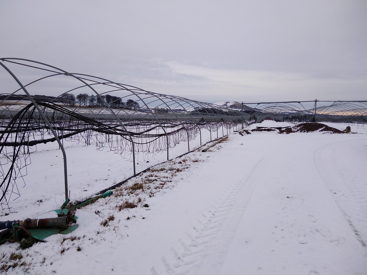
Acres of caravans for the pickers, polytunnels reduced to skeletons
At 9.30am I left my air bnb with numb feet. Snow was on the ground, there was a pink sky, and almost no-one else about.
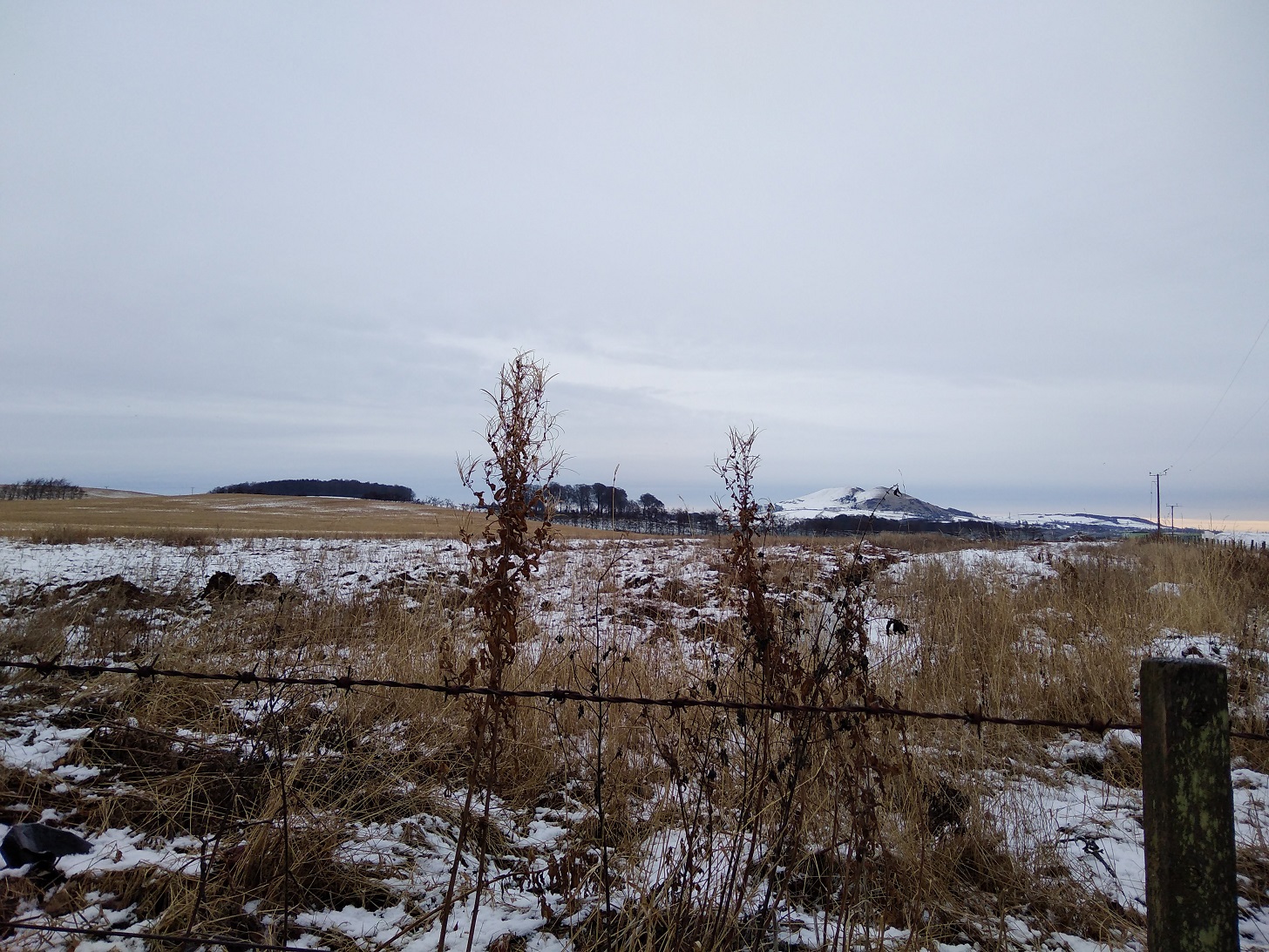
Largo Law now in the morning light
It turns out that Silverburn Park is not a secret Garden as I thought last night!
I walked briskly between ploughed fields towards the sea, across the main road and through the park. Past the sweet wee red brick cottages (not open on Sundays) I went and met the first lot of dog walkers including a woman in high heels with her breakfast hot chocolate.
By time got to the beach (10.15am) my toes were all but thawed but I was walking slower than usual on account of a dodgy left knee. Joggers went past and dogs were constantly barking and disturbing my peace.
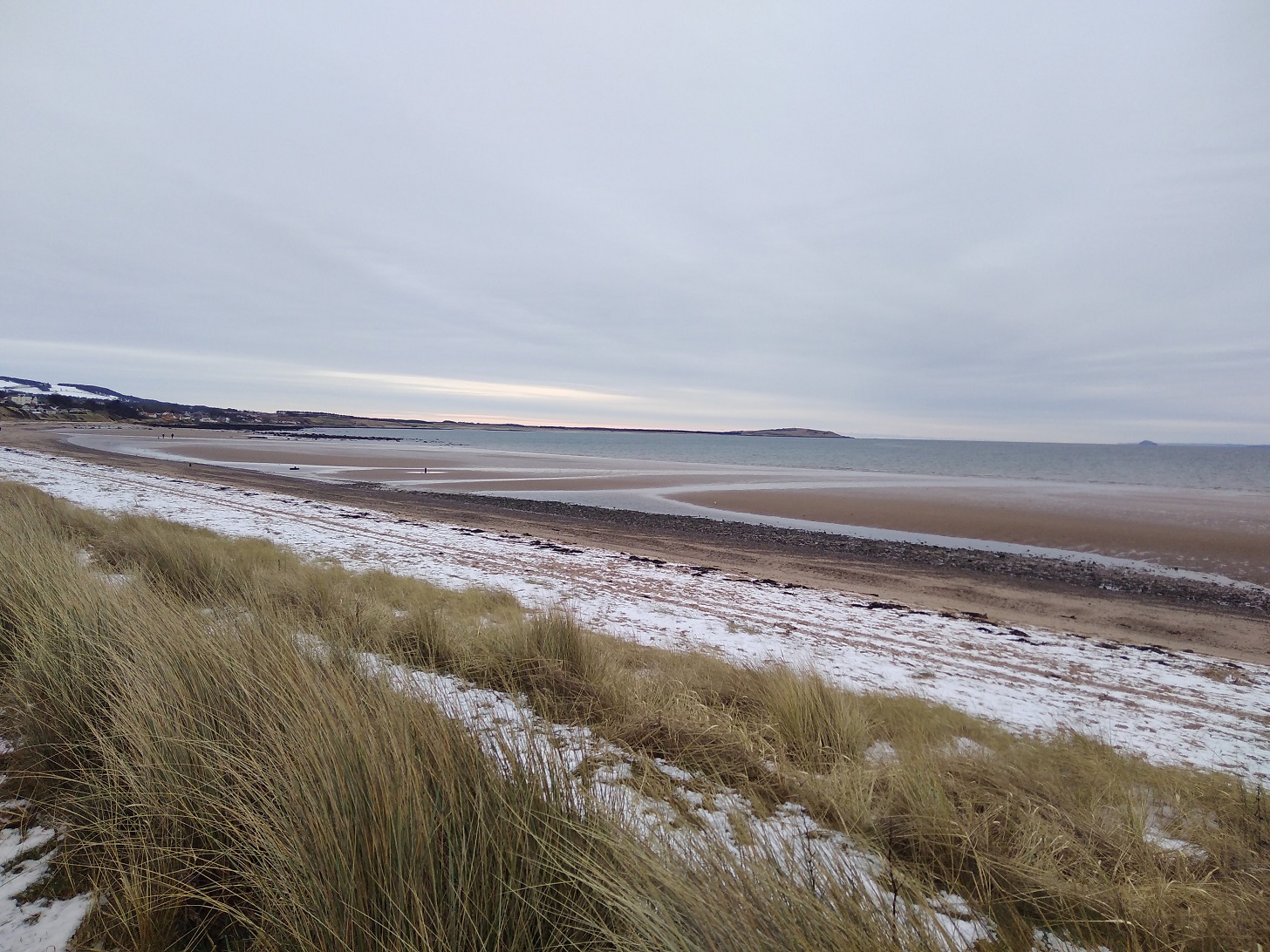
Another of Fife’s sublime beaches
The tide was way out revealing water with a smooth metallic look about it. It was the light catching the shallows sands which was so beautiful. Wind was on my right cheek today, rather than heat, as I made my way eastwards along the coast.
Mountain bikers took the path well trodden. I went across streets which were treacherously icy with puddles deeply frozen, and the only sign of the sun was the pink rim on the eastern horizon.
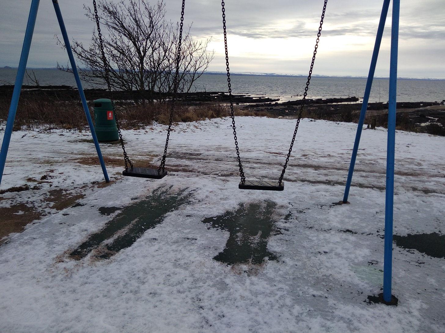
I never pass up a wee swing
As I swung forwards I surveyed the changed shoreline with its diagonal black rocks familiar from stage 2. Then straight on I went, past the orange house where a white-haired saunterer in shorts returned from getting the morning paper. Readers of my blog know that I love my shorts but not in this weather!
Lower Largo
Lower Largo is a very pretty village with brightly painted doors and model yachts in windows.
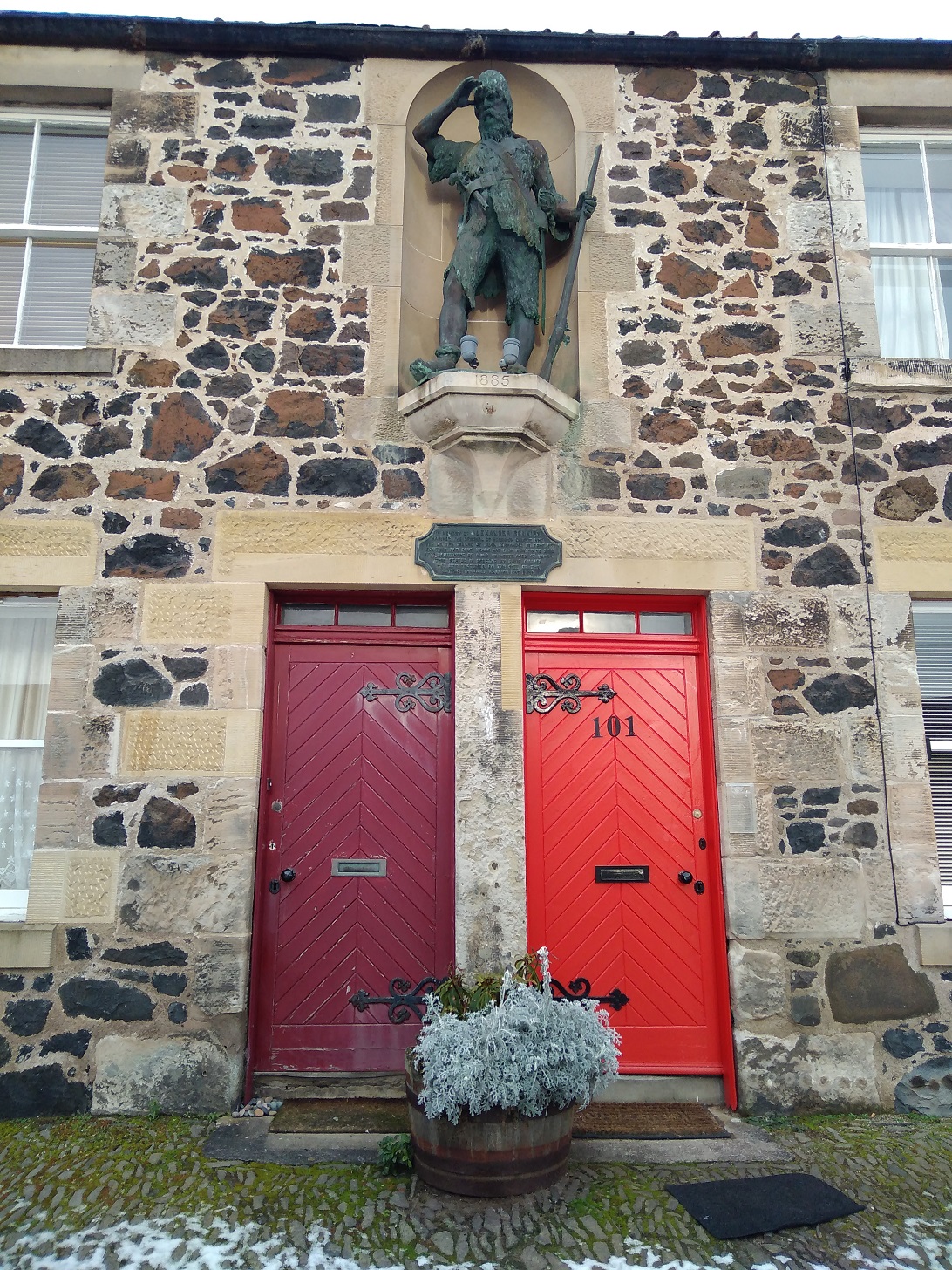
Here is Alexander Selkirk, view haloo! Lower Largo
Alexander Selkirk, mariner, is the original Robinson Crusoe, who lived in solitude on the island of Juan Fernandez for 4 years and 4 months.
It has to be said that it was all a little bleak this morning with only a weak sun.
The Fife Coastal Path
Multi-coloured rocks and bright green pebbles with shiny brown seaweed and opaque glass pieces could be found along the shore. Oyster catchers were peeping and others trilling. A couple held hands and battered shells littered the ground.
It was a hard walk in a good stretch of nature. I saw a couple of thrushes and a tall, friendly man with a ruddy face. His long-legged red setter had a neon tennis ball clamped in its jaws as we crossed the Dumbarnie Links Nature Reserve. Here there were raven-esque, empty mussel caskets (I was directly opposite the town of Musselburgh!) and I felt melancholy.
It was what I call wonky walking where one of my feet is on higher ground than the other. The strand stretched out ahead and while gulls swooped, black and white waders dipped orange beaks.
Berwick Law in East Lothian to the south, was snow covered too. Here was only one other human in sight. There seemed to be miles of those lumpy sea creatures’ corpses, all rubbery, and simply trillions of shells on their way to becoming sand creating quite a different crunch underfoot compared with the ice and snow.
To follow this part of the coastal path, just keep walking along the beach before a long line of dark green trees with appear across your view. Then you will see a sign to the left heralding a change of terrain.
Shell Bay: evergreens signal a change of landscape, Fife Coastal Path
Between bleached grasses, round and over the peedie bridge
Brilliant clear air and the stillest of waters makes for magnificent reflections
A World War II look-out post – what a cold job that must have been!
Up and over the cliffs runs the way, some roughness and muddyness, steep but not very high. Sadly I missed the part where there is a chain to climb up. Apparently people have died so on second thoughts that was probably a good thing, although being me I would have liked the challenge.
Earlsferry Beach, Fife, Scotland
Around 1.30pm I arrived at Elie beach with its yellow brown sand and a headless seal. People were foraging for cockles and a feathered wren hopped by my side.
Cove after cove was made of delicately hued sands
The next urbanisation, Earlsferry, seemed to be a well-to-do area with mansion turrets and BMWs all over the place.
Earlsferry Church, dated 1872, Fife, Scotland
There is a library and care home but no shops or pubs. The sky was fair lowering (getting dark – looks like rain!) and I was getting hungry, so I took a detour until I spied a golf club and the Pavillon Cafe which was busy. What incredible luck as ever!
Inside I not only found warmth, hot victuals and a distinct lack of wind, but I unexpectedly spotted a familiar face. I ordered my food and said ‘Hi’ to a colleague from long ago. We struck up a conversation and with true kindness he and his partner announced that they lived in St Monan’s (my destination) and asked if I would like to stay the night. I gratefully accepted because I had nowhere booked and transport back to Edinburgh from small Fife villages is hard to find on a Sunday evening. I declined a lift though, and made my way back out into the slightly rainy and dull afternoon (3.15pm) with a cosy tummy and glowing heart.
From the evocatively named Ruby Bay (pink sand), Fife, Scotland
The last stretch is full of interest : a lighthouse and a palace, two castles (Newark and St Monans), divers ruins and a famous church (but it was too dark for a photo).
Lady Janet Anstruther’s Tower, Fife, Scotland
With wilder, darkening waves pounding I walked through pinkish bracken and I approached St Monans around the fields, arriving as the day the darkened at 5pm.
What a pretty village! I was really taken with it.
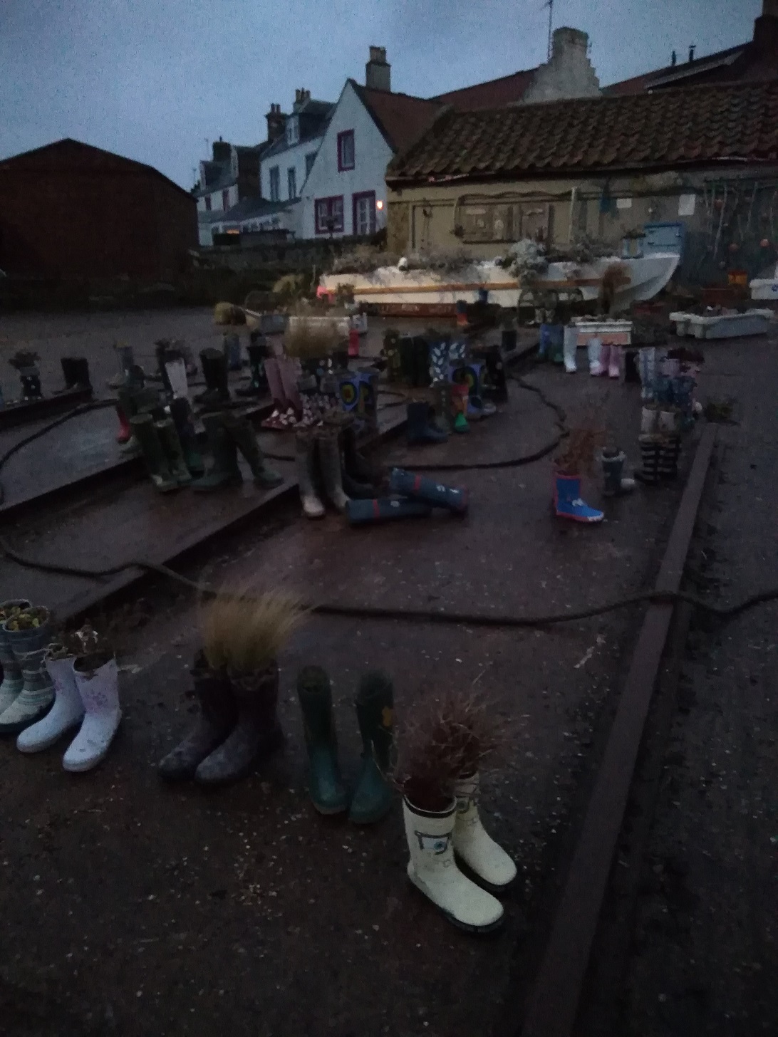
Here is the wellie garden, St Monans, Fife
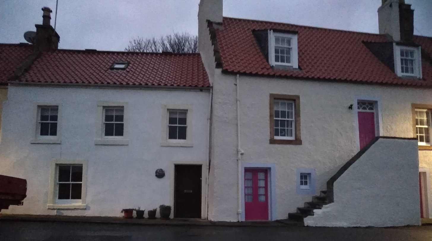
Typical architecture with outside steps up to pink doorwars, St Monans, Fife
My camera cannot cope with the dark, but the colours and reflections were worth reproducing here. St Monans, Fife
I am told that the East Pier Smokehouse is well worth a visit, however it is shut between October and June. There is famous parish church and a Heritage Collection. The hotel I saw was also shut in the winter months so it’s a good thing there are air bnb’s nowadays and Margaret’s sounded great when I made enquiries. I was lucky and stayed with J and J whom I had fortuitously met earlier and had a lovely evening and comfy bed.
I travelled back by car with J to Kirkcaldy station across the flat lands as dawn revealed another wintry sky. Then we got the train to Waverley Station in Edinburgh. To get back to Edinburgh from St Monans by bus would cost £10 with a change at Leven and it takes ages.
Sometimes when I walk I crunch, sometimes my footsteps thud on the grass or whisper on sand. Occasionally there is a rumble of small stones or snap of stick, splinter of ice, even hollow bump into the peat or squelch because of the wetness. These things I notice as I walk the paths of Fife early in the year.


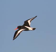 A flying oyster catcher, Wikipedia.