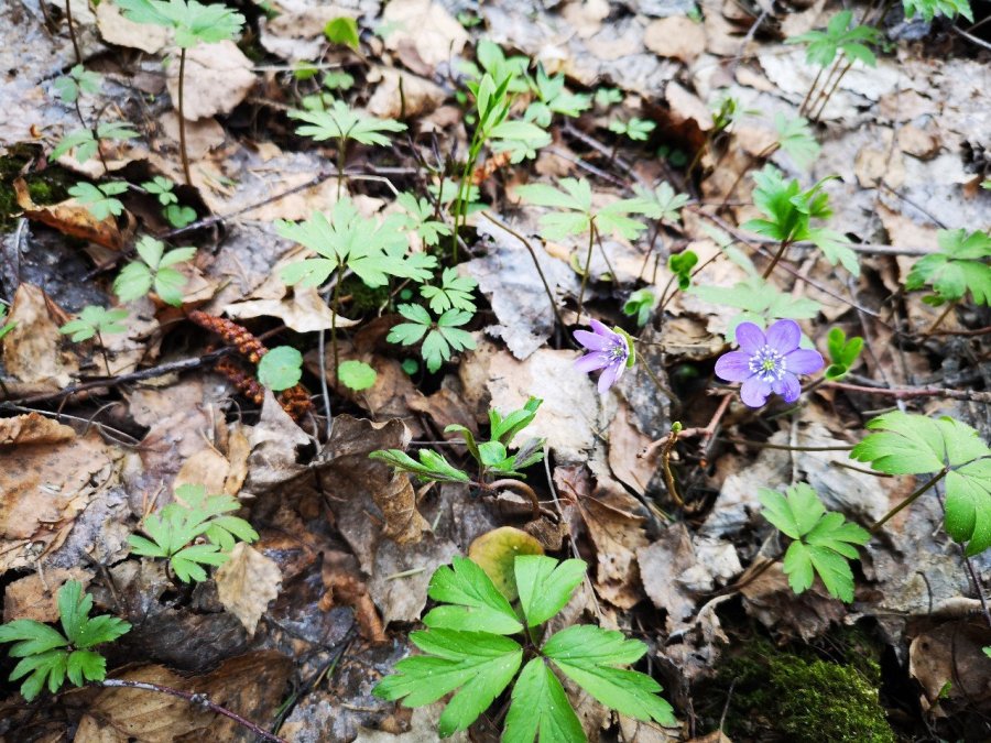
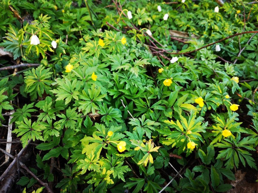
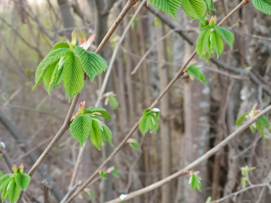
Try listening to native Arvo Pärt’s Spiegel im Spiegel here while you feast your eyes on some of Estonia’s lovelist spring flowers and other natural wonders.
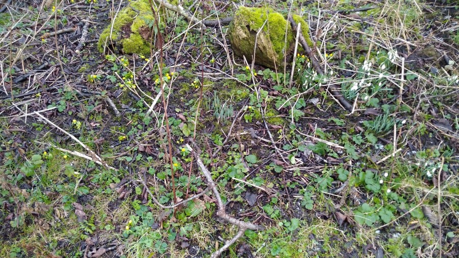
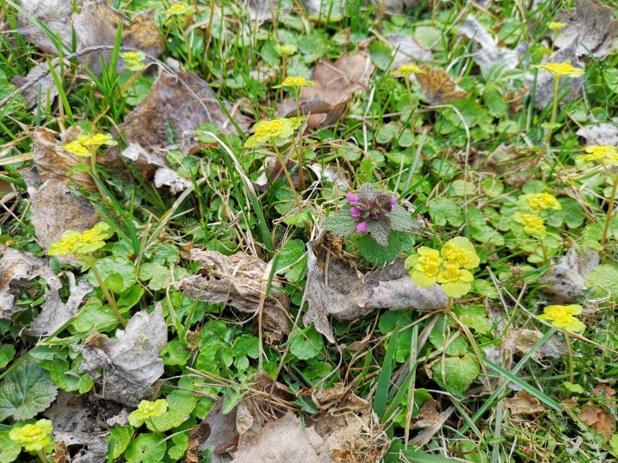
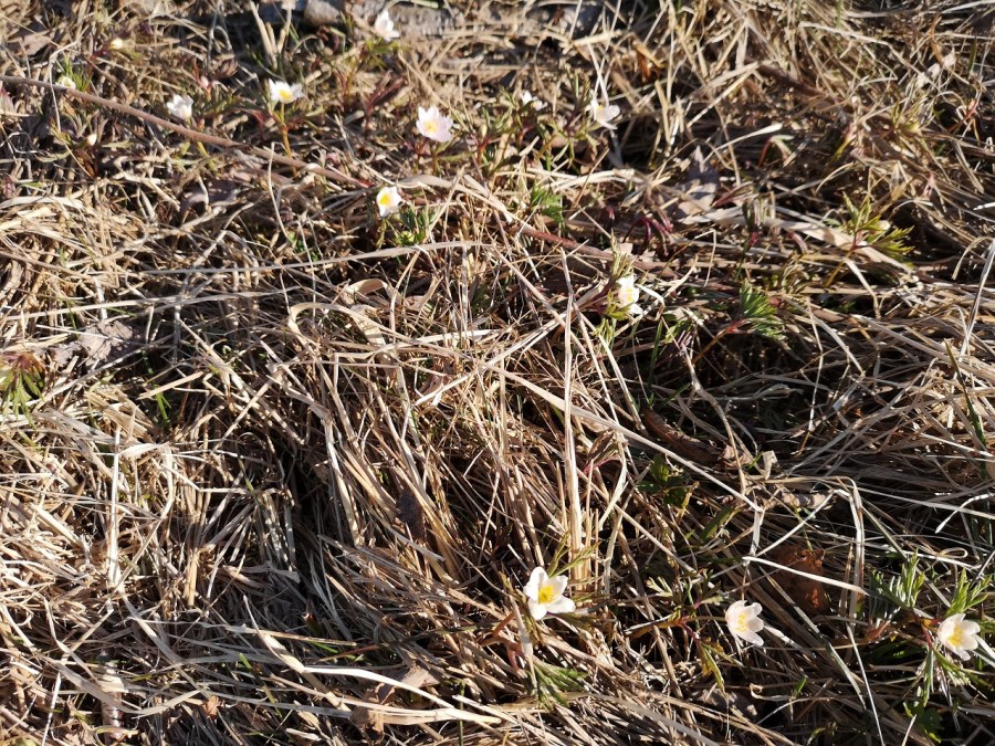
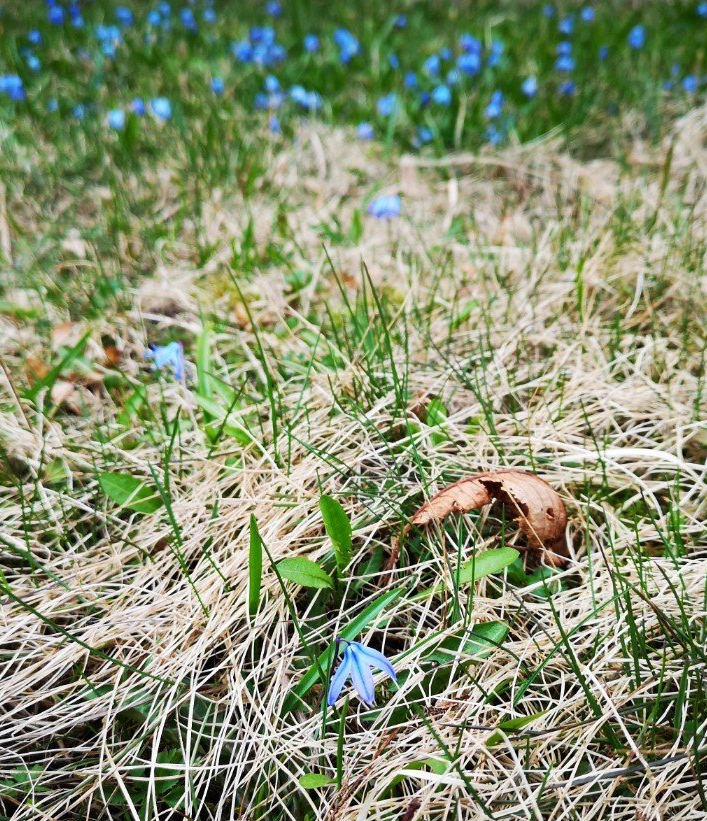
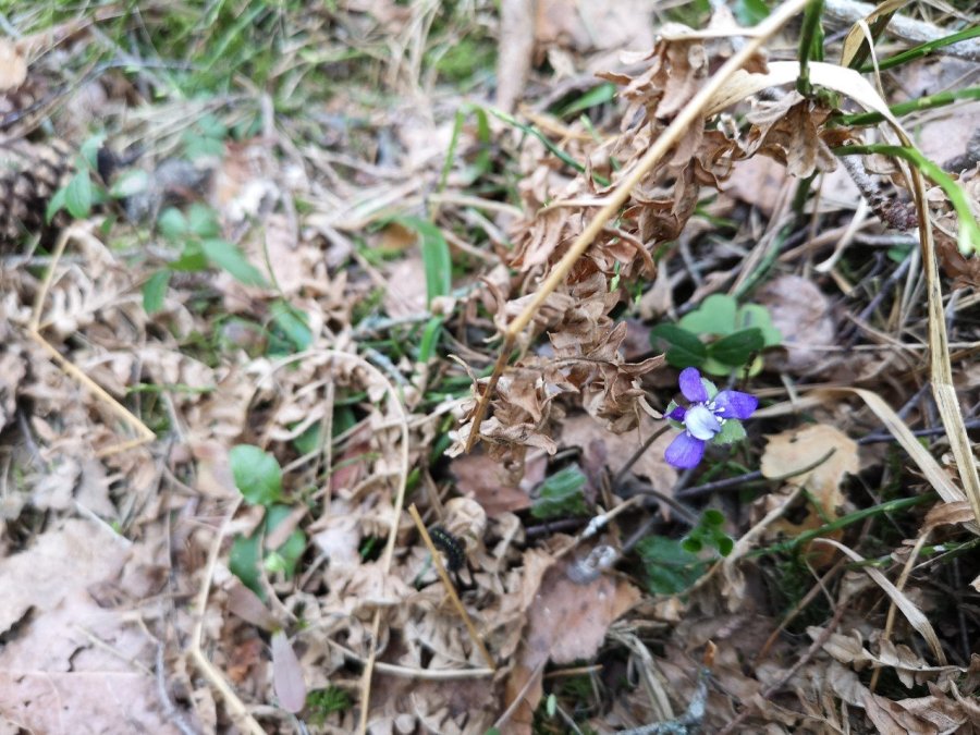
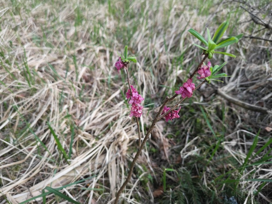
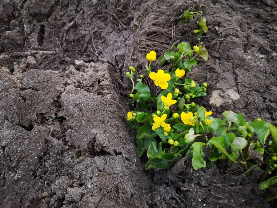
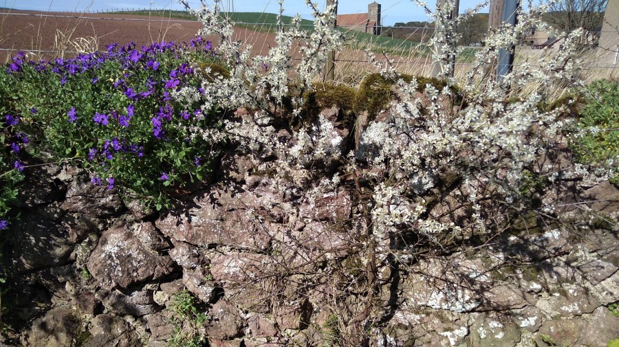
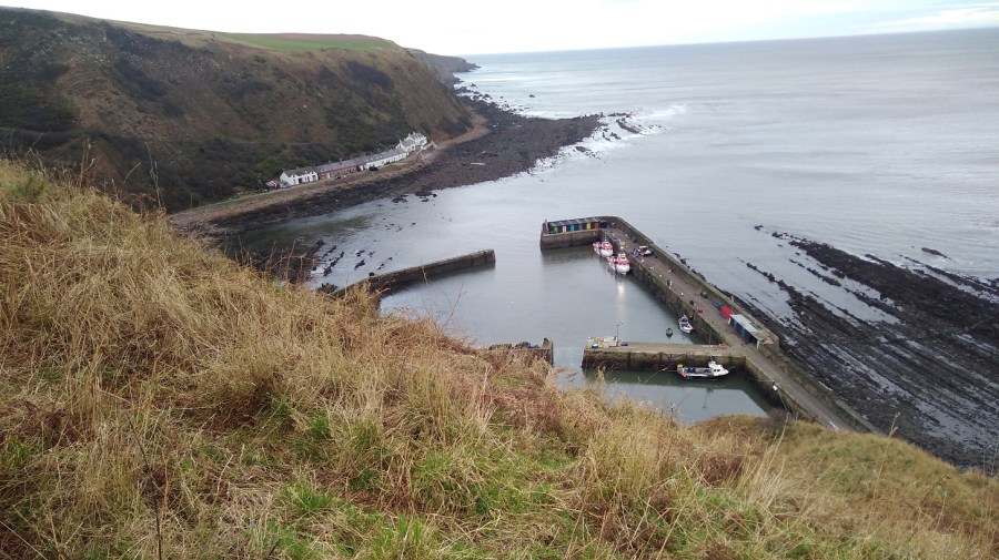
Hepatica nobilis or Blue Flower / liver leaf / crystal wortBlue, white, yellow (alder lily) and purple on the forest floorWood anenomesI cannot find out the name of this flowerEight days of sun and purple violets showing between tree roots amongst the dry crunchy leaves of the winter gone
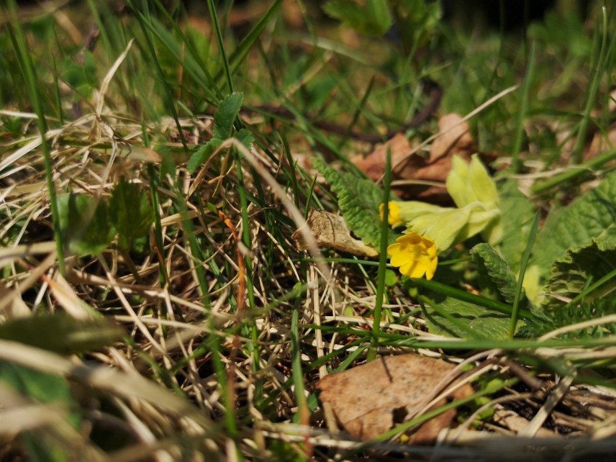
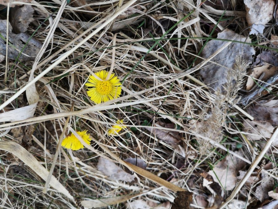
Shy yellow heads: one dandelion-ish, the other cowslip.
Cowslip
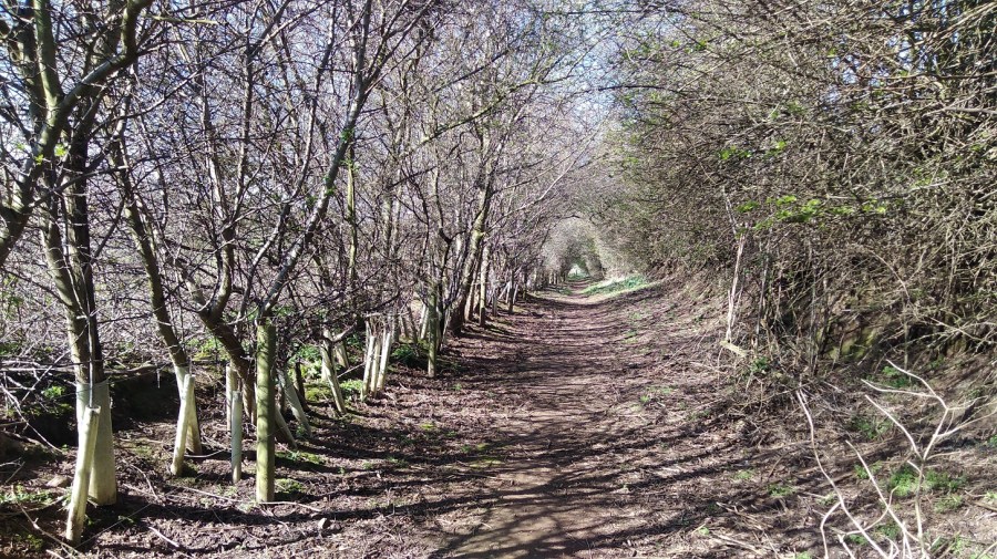
It looksed like iris and wild rose in their infancy along what used to be a path which I followed through the forest, stepping over fallen logs, twigs crackling under foot.
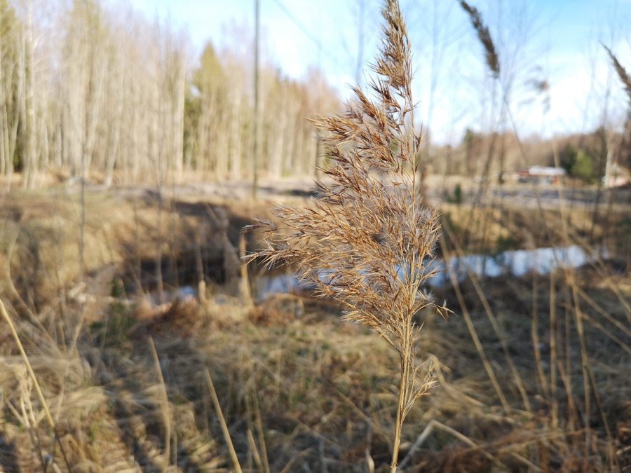
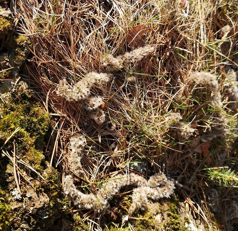
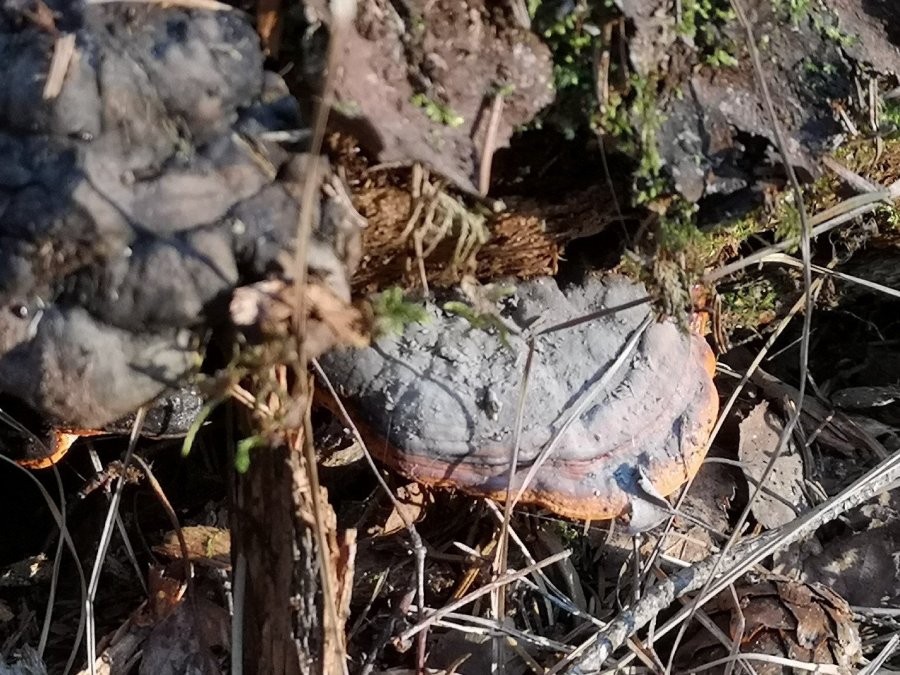
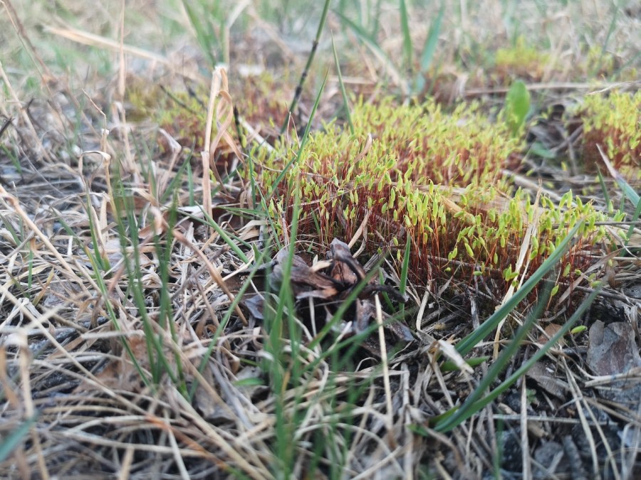
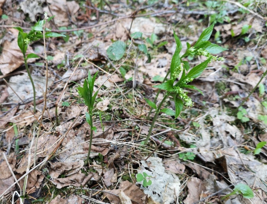
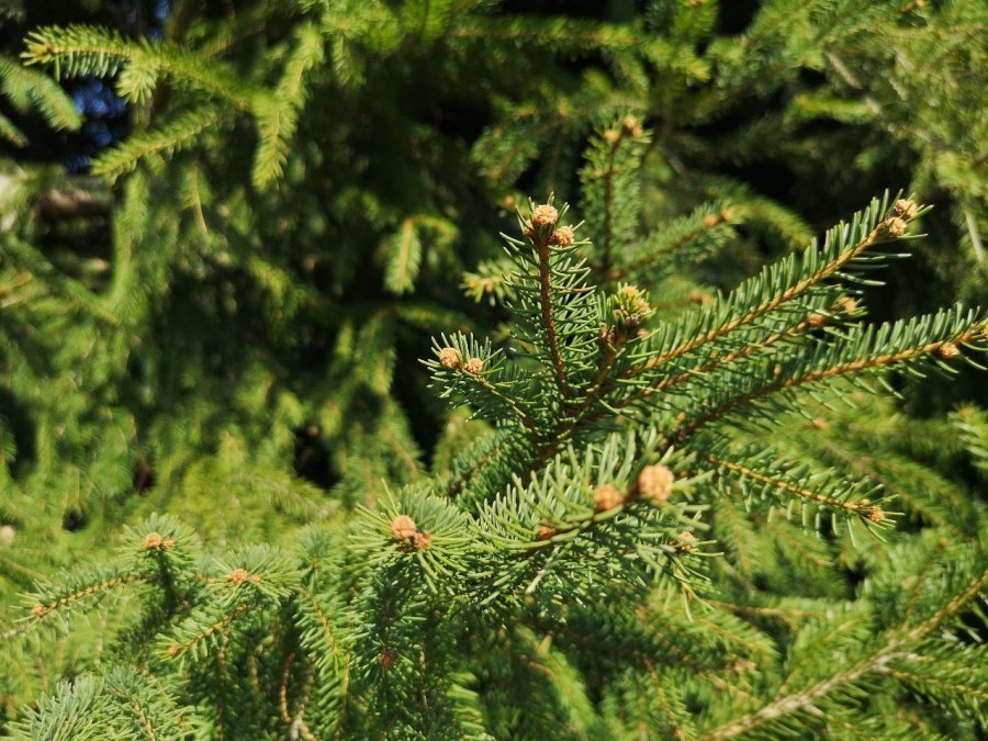
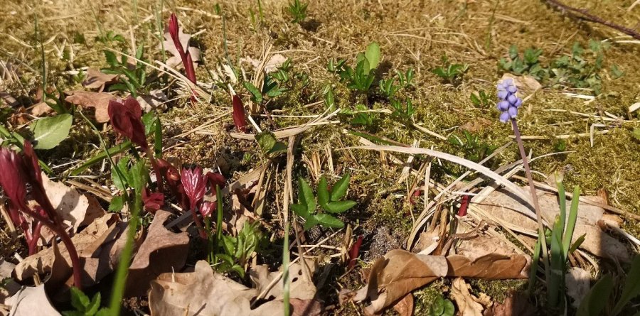
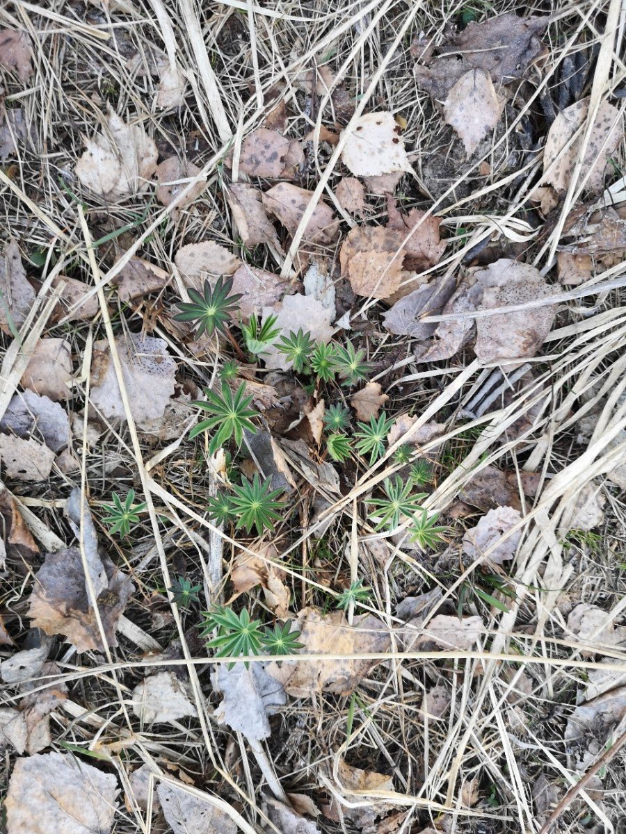
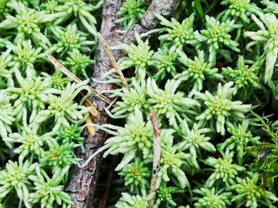
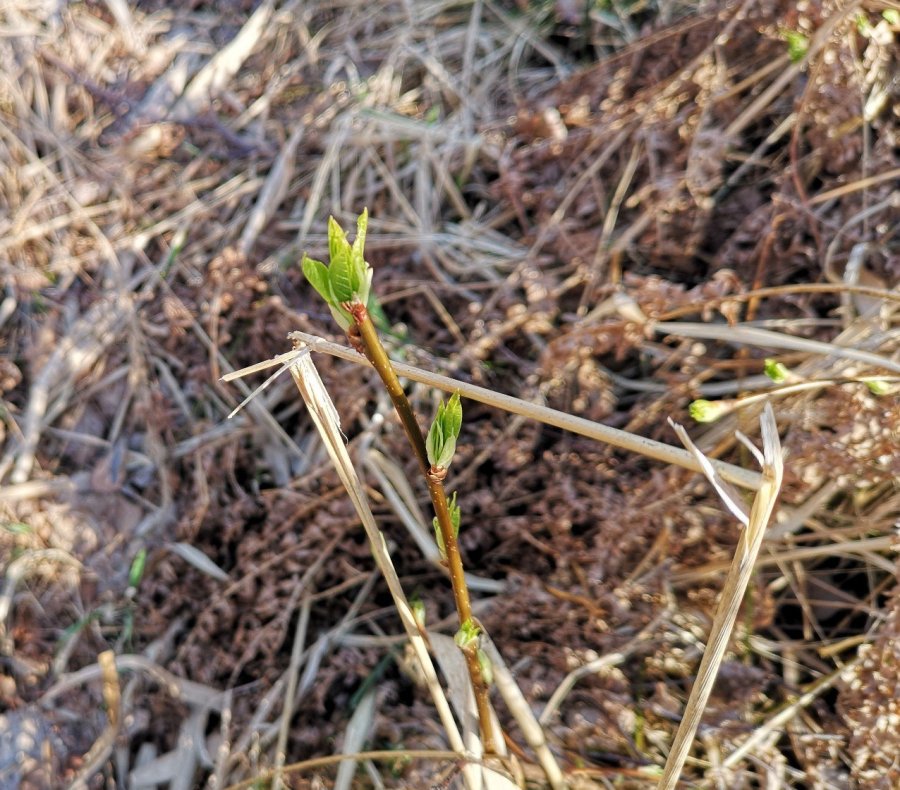
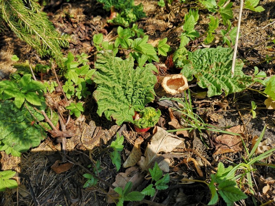
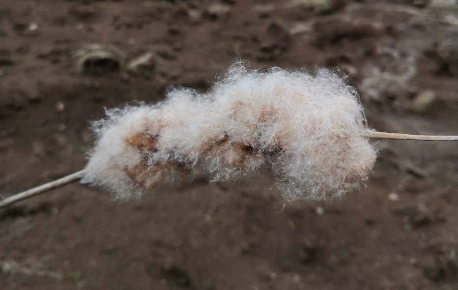
GrassesWiggly, furry catkins which have burst to disseminate their seeds Fungus with orange edging growing on the underside of a fallen log in the forestThe new seed heads of moss growing very close to the groundTiny green seed flowersJust opened today (24.4.19)New firThe only stem of its kind, a one-offGrape hyacinth and burgundy shootsCelandinesStar shaped leaves of lupin amongst the brown winter grassesClose-up of the prettiest moss everBudding leavesThe pink heads of rhubarb just poking throughBy a small lake, bulrushes like popcorn exploded and mimicking candy floss fluffing
Unfortunately I have not managed to identify a lot of these. Please do let me know if you are better on naming than I am. I would be very grateful.
Thanks to this blog for information on the Blue Flower names.
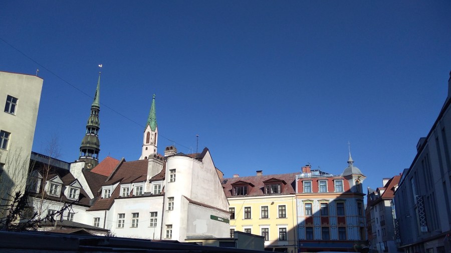
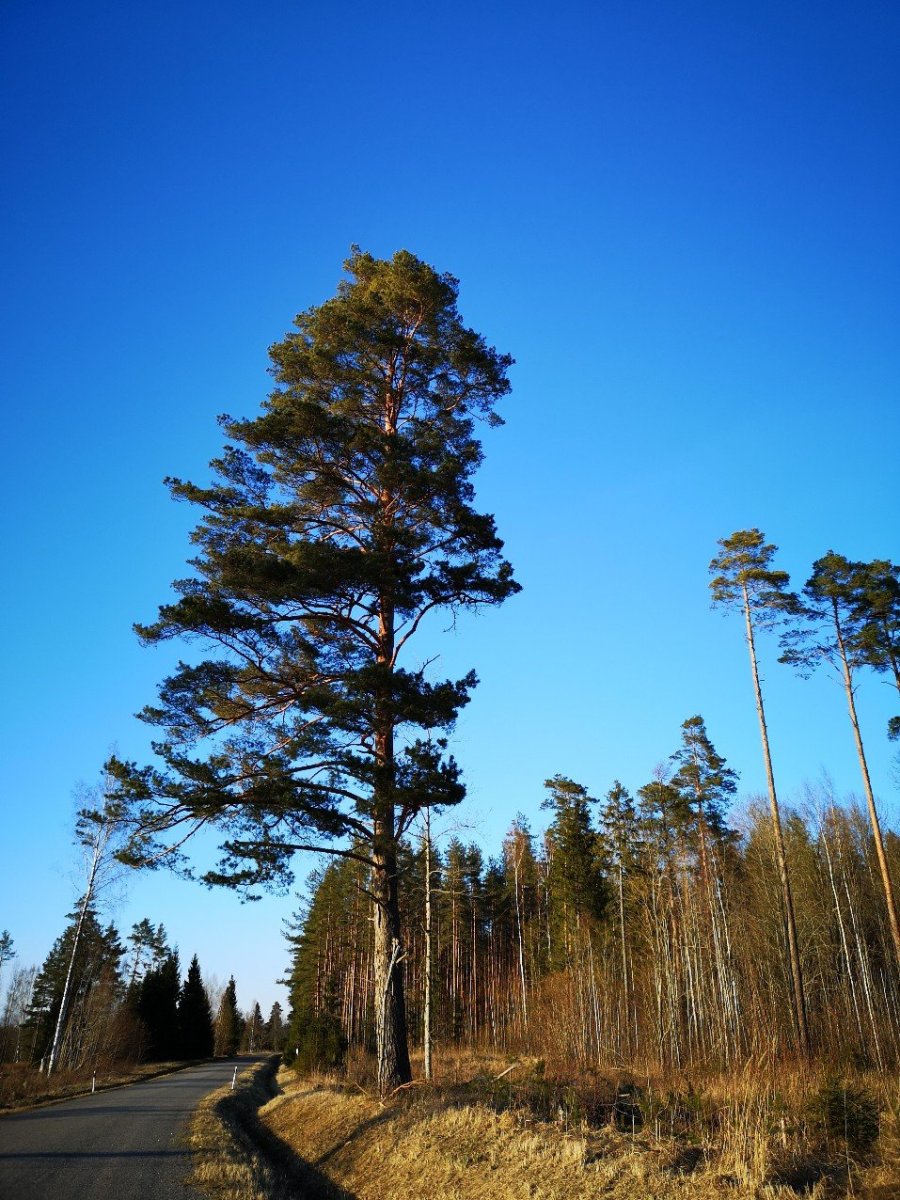
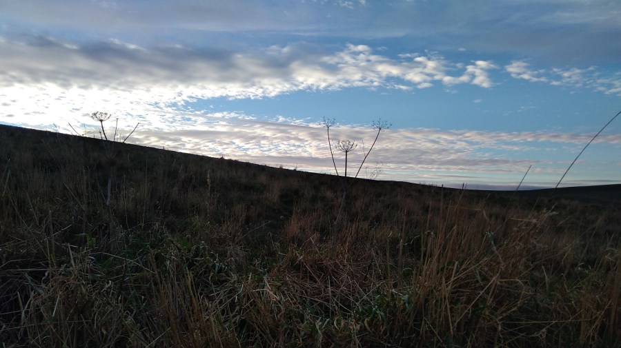
Disclaimer: the sky really was that blue – it wasn’t a fancy camera filter!
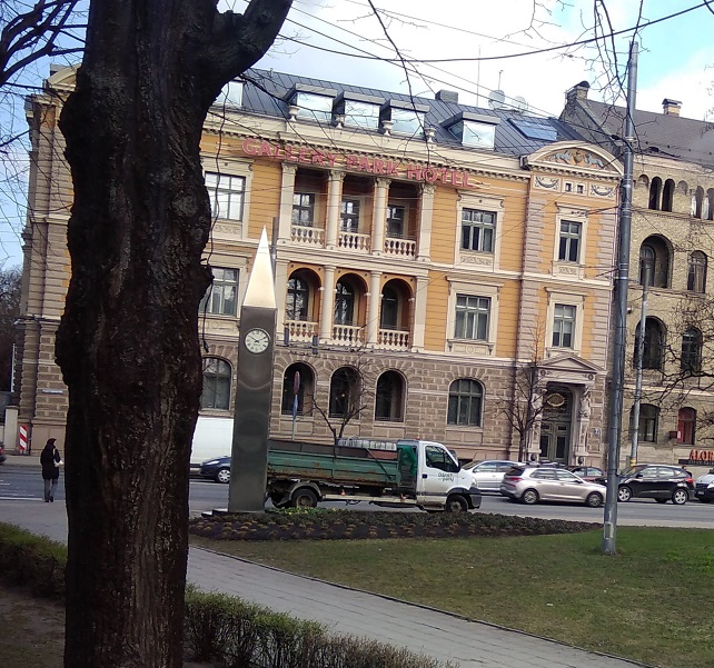
I travelled to Riga in Latvia (one of the 3 Baltic States) by plane from Edinburgh, arriving late on Thursday night.
Early April morning, St Peter’s Spire, Riga, Latvia
I took 22 bus from the airport to the centre and walked through the underpass to the Wicked Weasal Hostel which I highly recommend. It is clean and the staff are really friendly. I was offered a free beer and there’s tea (including green) and coffee in the well stocked kitchen. I was in a shared dorm with a Spanish soldier and ended up reviving my Spanish until late at night as we swapped life stories!
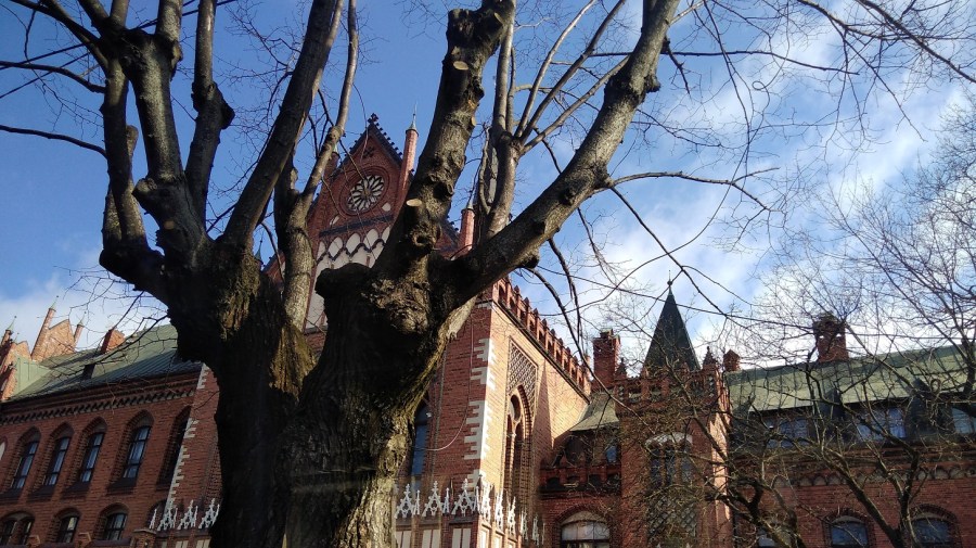
The Art Academy of Latvia, Riga, Latvia
I stayed less than 12 hours so have very few photos to show for it. On the way out I passed the astonishing golden domes of the Riga Nativity of Christ (Russian Orthodox) Cathedral, and the statue of Rainis (Janis Plieksans, a famour Latvian poet, playwright, translator and politician in the Riga Esplanade park.
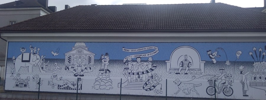
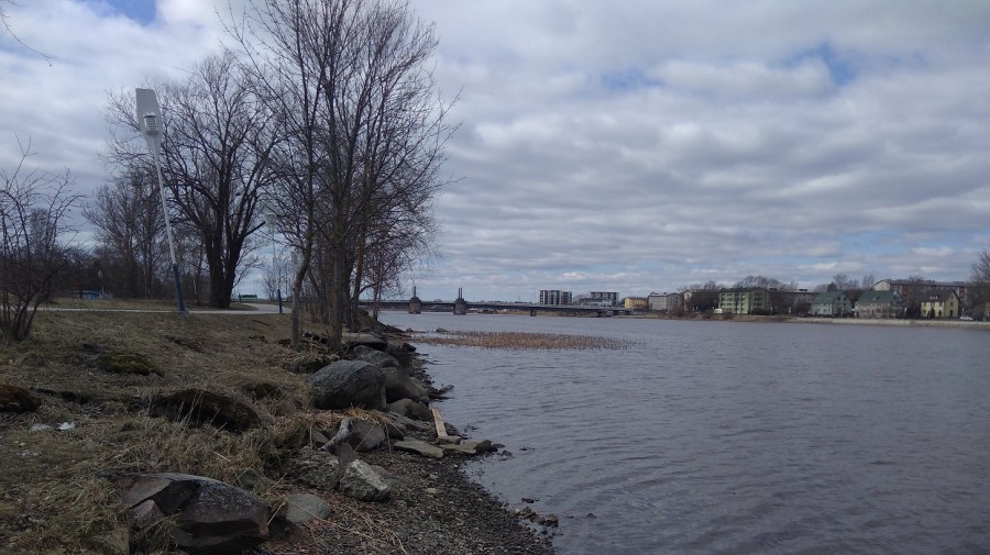
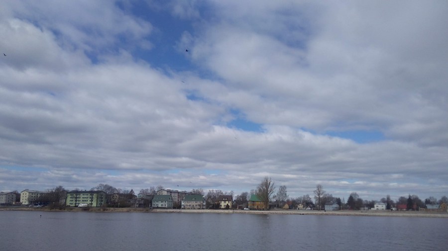
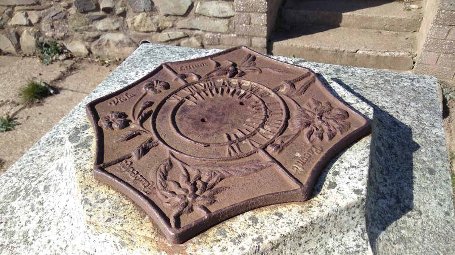
Unusual clock behind the Art Academy, Riga, LatviaMural in the Pärnu bus station, EstoniaPärnu River, Pärnu, EstoniaPärnu River, Pärnu, Estonia
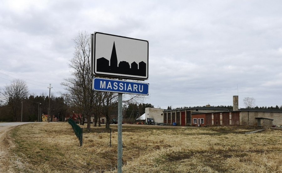
I took two buses that day – one to Pärnu along the main highway, and the other which doubled back south for some of the way and then headed slightly inland to Massiaru – four hours in total.
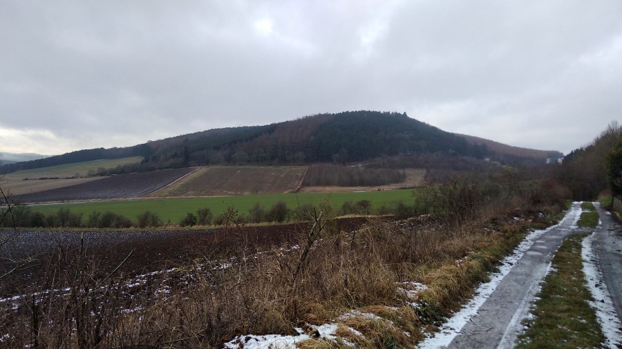
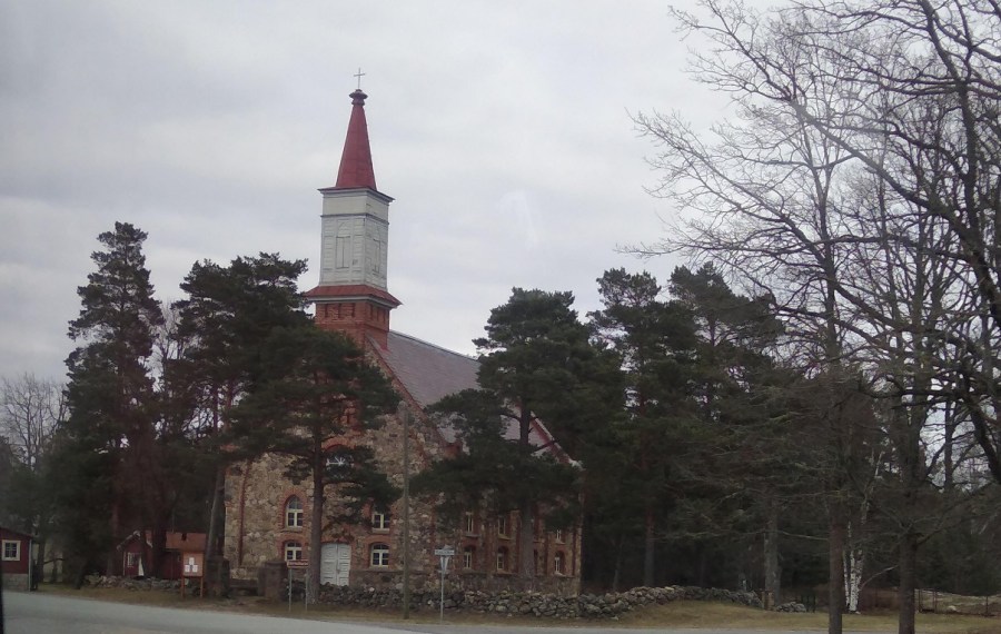
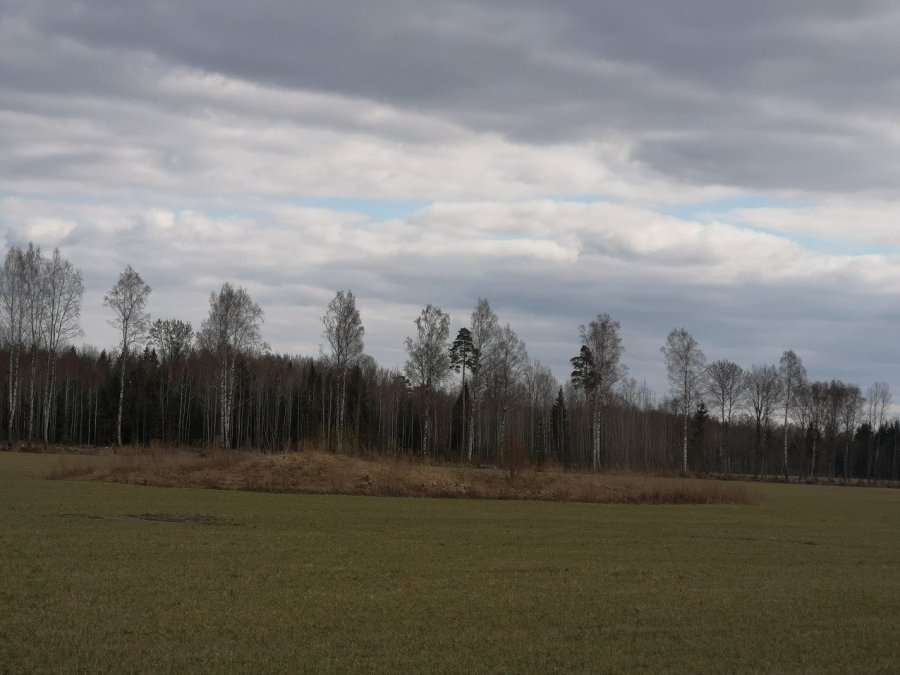
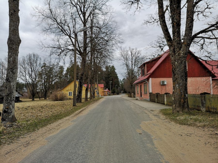
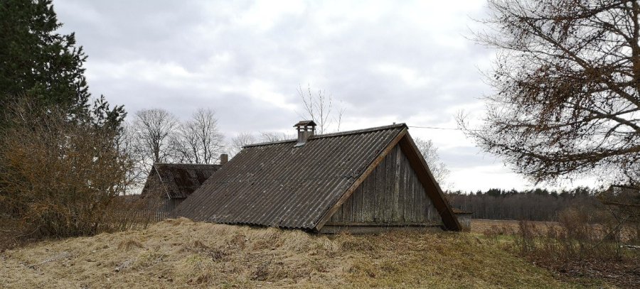
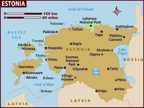
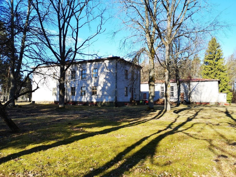
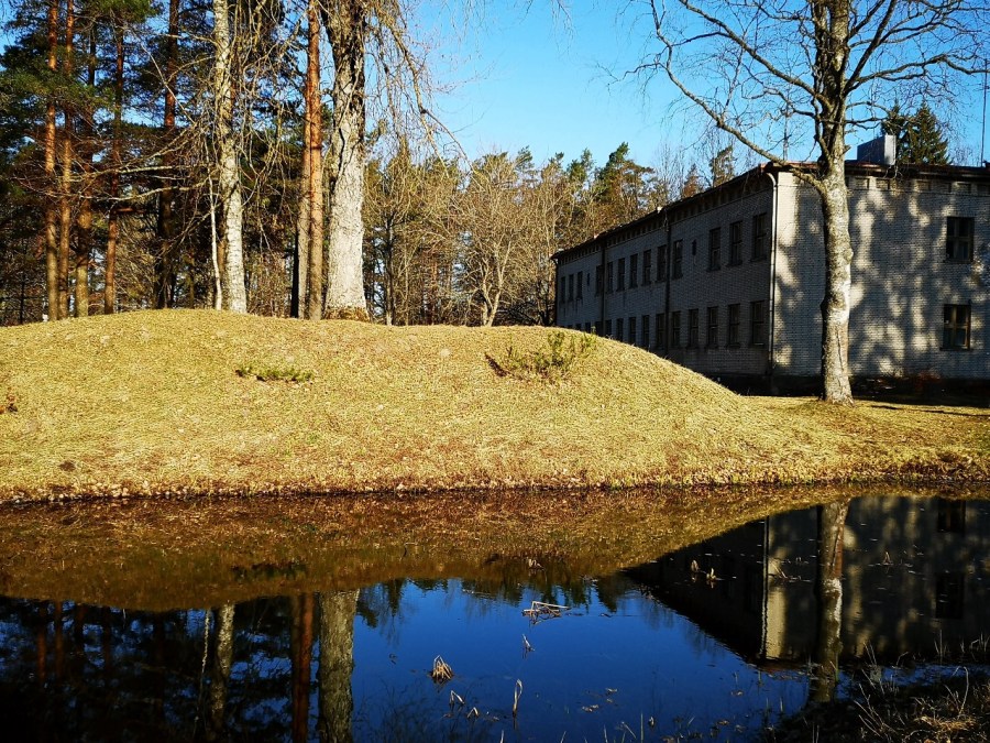
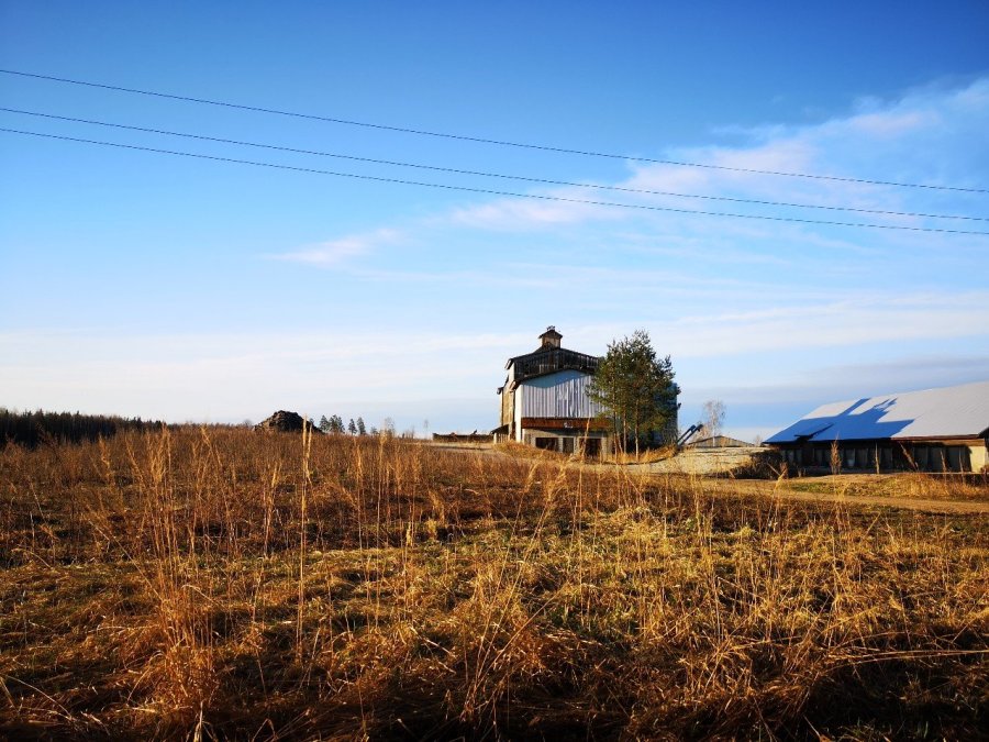
A church I snapped through the bus window on the way – the majority of Estonians say that religion is not important in their lives. The ones who are, are either Christian or OrthodoxThis part of Estonia (south west) is flat and forested. In many places they clear the pines and leave the silver trunks of the birchesEverywhere there are brightly coloured timber houses – pink, yellow and blueMany of the houses have smaller buildings in their gardens which are buried up to the roof on three sidesI am staying in the small village of Massiaru in the Pärnu region of EstoniaRussia is to the east of Estonia, Finland to the north west. I came north from Riga in LatviaIn the old school house, Massiaru, Estonia
Information about Massia, where I stayed
“MASSIA is open for self-directed residencies – at low cost, without a selection process or the pressure to produce outcomes – all year round, and can host up to 40 residents at any one time. Residents are welcome to participate in the collective organisation of MASSIA.
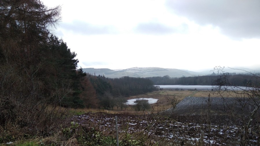
MASSIA is based in the Estonian countryside near the Baltic Sea, about 180 km south of Tallinn and 140 km north of Riga, Latvia. The residency is situated in a heritage school building in a small village surrounded by forests, fields and wetlands. Nigula, one of Estonia’s oldest bog reserves, starts 5km away. In Kabli, 12 kilometres to the west, you will find the long sandy beaches of the Baltic Sea.
The building is surrounded by 2 hectares of garden offering the possibility to engage with natureculture practices. The nearby forests attract mushroom pickers and plant foragers throughout the year. MASSIA also maintains a herb laboratory with an extensive medicinal herb collection and library which are open for study and experimentation.”
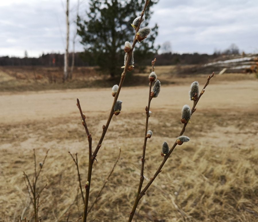
Pussy willow, one of my first successful close-ups enabled by my new phone camera
Every day I walk for a couple of hours – on the first day to the south, then to the north, the west and east. The roads are straight and wide, some dry, grey tarmacked and some stony and pale apricot. It is monotonous walking – mentally relaxing.
I am surrounded by trees including the familiar Scots Pine
Standing amongst them
The patience of trees
The forebearance of trees
The pure being of trees
Do you think the birds tickle them?
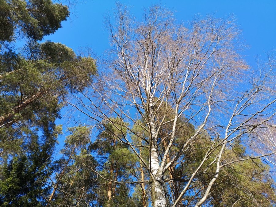
Mostly silver birch and various types of pinesAlso some oaks in the garden which has farm land around it
I find a sunny place in the mornings to do my swinging exercises, T’ai Chi and to ‘Stand Like a Tree’ (a chi gung exercise) for my general health and to counteract the 6-7 hours a day of cerebral work writing hours at my laptop.
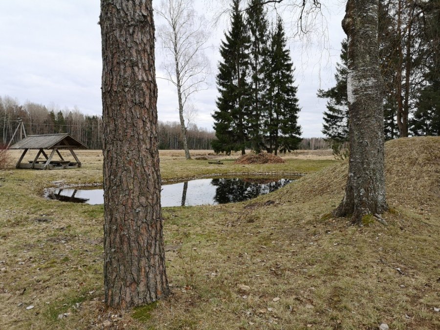
There is a new pond in the garden. The reflection reminded me of a natural green version Dali’s Mae West lips
I sit in the sun to have my lunch, topping up my vitamin D levels after the Scottish winter. In contrast to my trips to Spain in previous years, I have gone back in time coming here, leaving the Spring behind me, but it is getting warmer every day and the plants are shooting nicely.
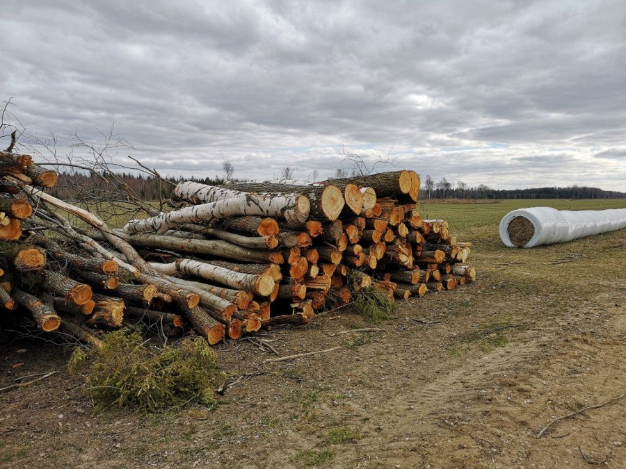
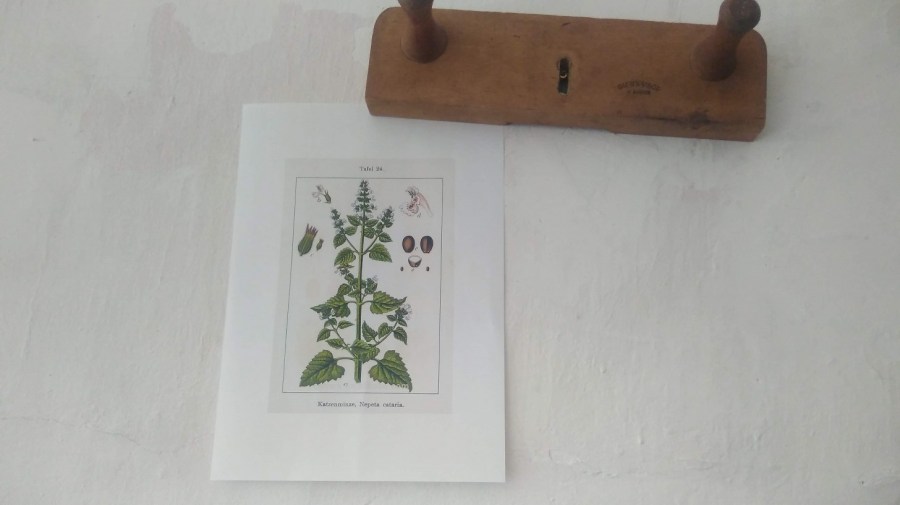
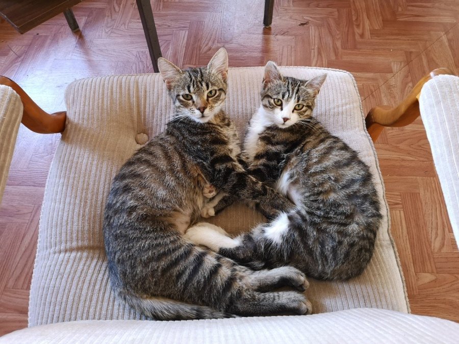
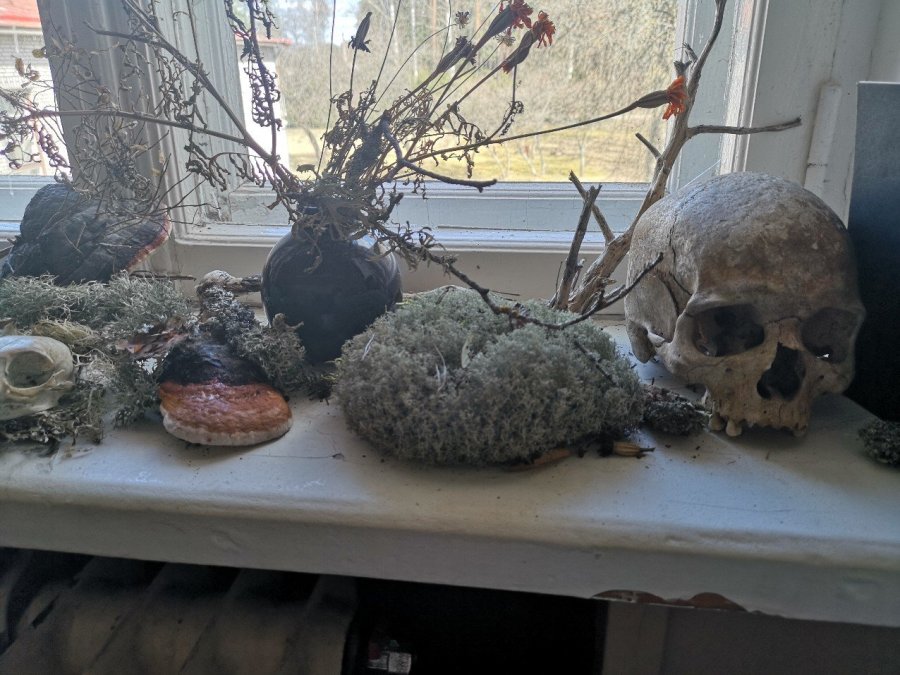
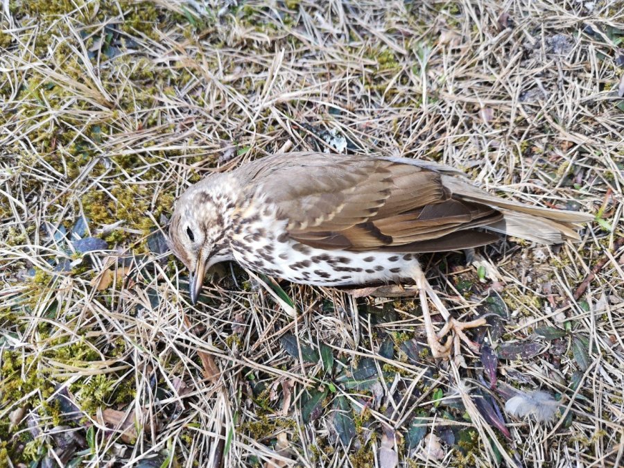
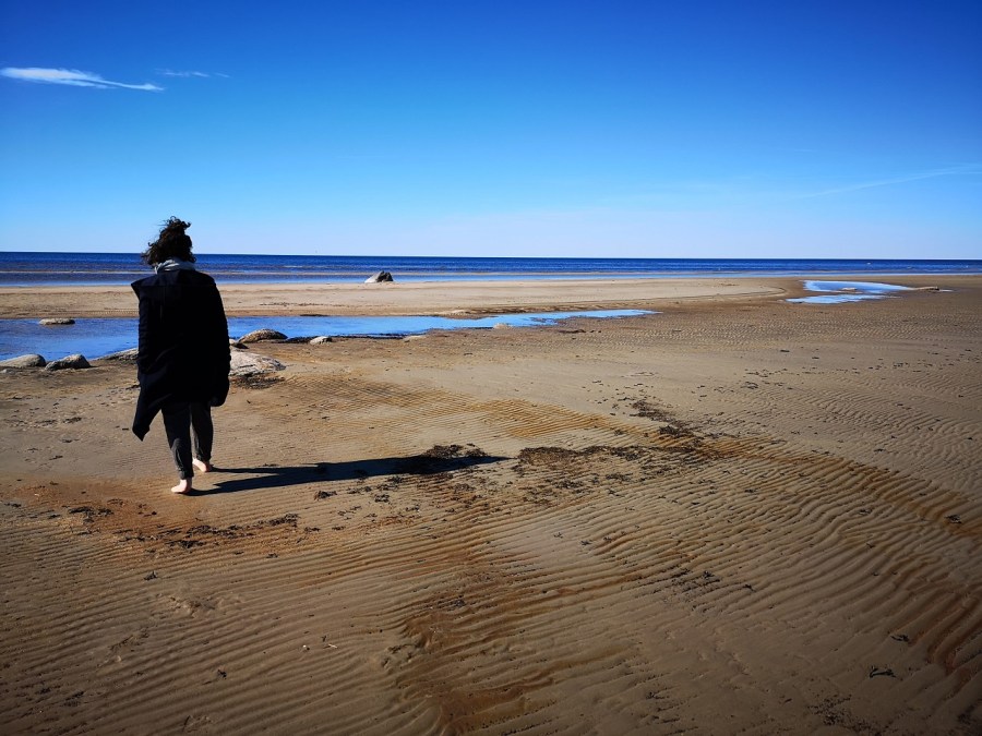
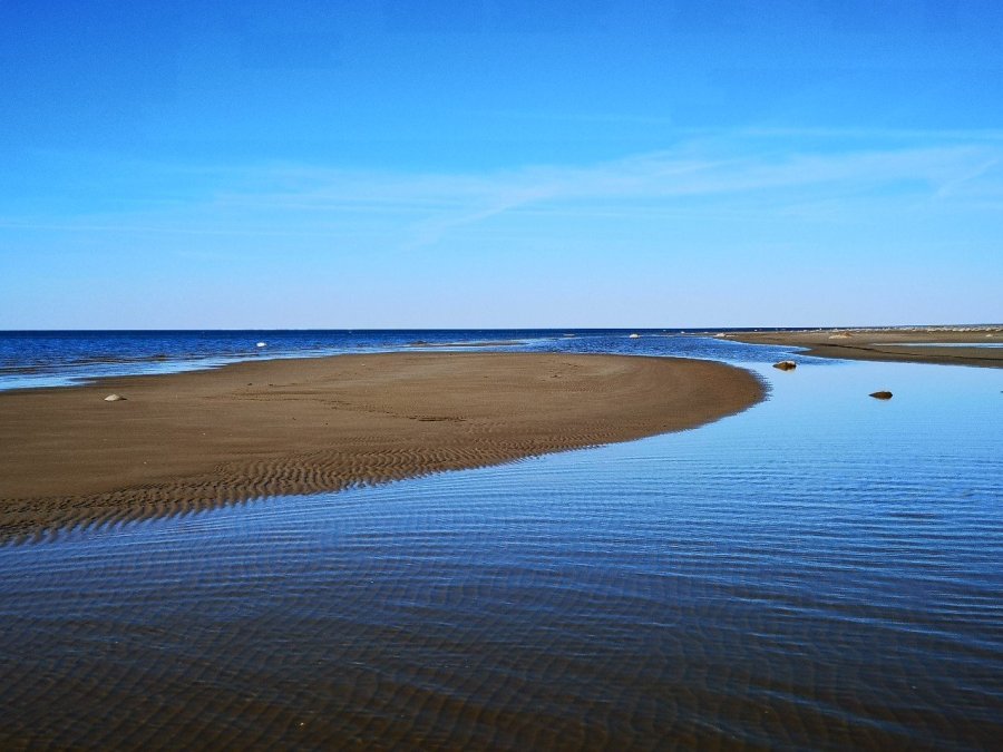
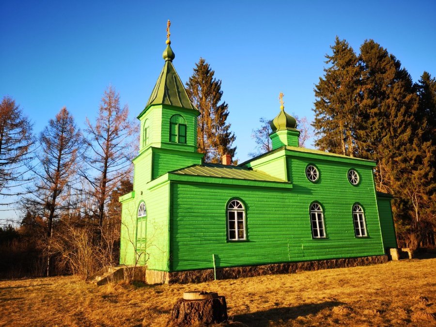
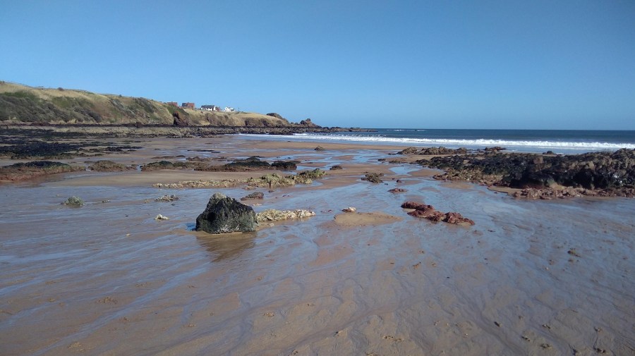
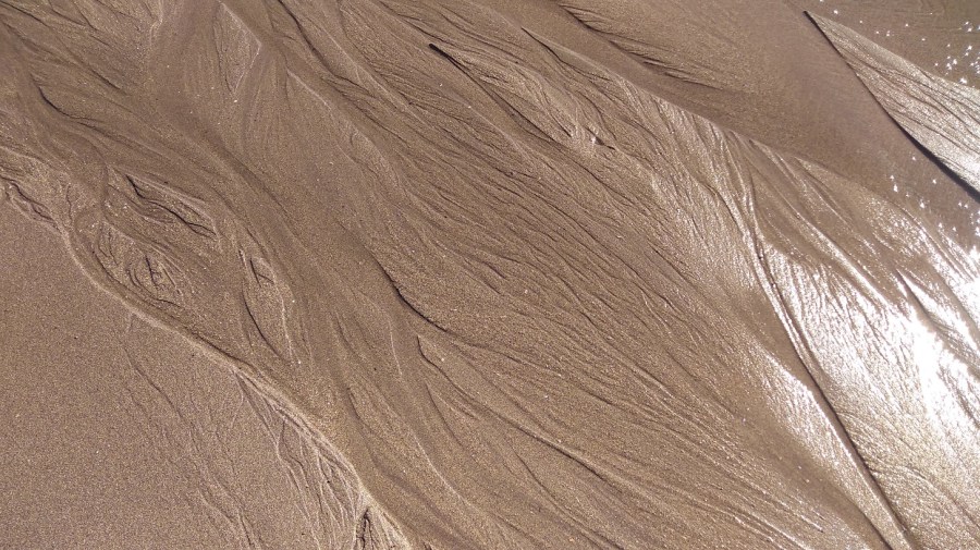
The forests provide for many people’s livelihoods – logging and wood preparation. The hay bales are in long, white plastic covered snakesNearby is an industrial buildingNepeta cataria (catnip). The primary resident is creating an artist’s herb garden – cultivating and planting seeds in hanging trays in the old classrooms, and creating presentations indoors in the bedrooms through the winterHawthorn and Dandelion – 2 more residentsI am writing about death and loss, so this window sill display is most appropriateThis thrush was not killed by the kittens who live here as they were kept in after their operations. A sleek grey lynx was spotted in the field next to the garden that day, but I think it was more likely to be the visiting catBefore they left, M and R took me to the beach on the Baltic Coast near Kabli which has a camp site where the RMK Estonian Hiking Route walkers can stay close to the end of the trekThe patterns in the sand are amongst the most impressive I have seen. Beach, Pärnu Region, EstoniaThis green painted Orthodox church is 3 kms away in the village of Urissaare
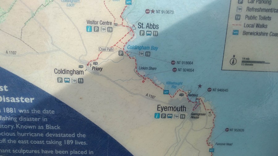
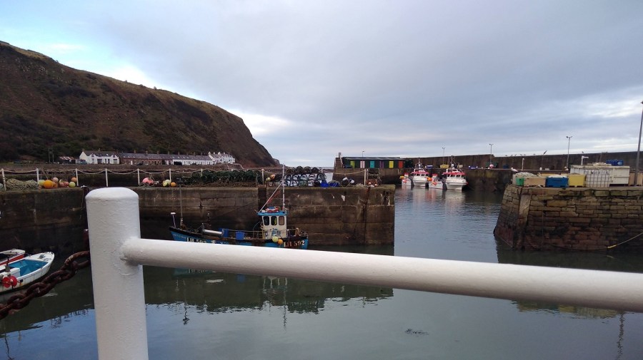
I took the bus from Edinburgh to Eyemouth where I ended the previous stage of the Berwickshire Coastal Path (BCP). From there I walked to St Abbs (6 km, 3.5 miles) going north east wards, and on to St Abbs Head and the lighthouse. Then I hiked back again to get the bus! (The village of Coldingham is 1.5 miles inland). More practicalities are at the end of the blog.
The Journey
As I left Edinburgh (on the 253 bus at 8am), almost everyone else was going to Monday morning work. There were four of us heading eastwards: a cyclist and three walkers including a second solo woman who was consumately prepared (that was when I realised I had left my pole at home!) She was doing walking the BCP over 2 days, for the second time.
Everyone was reading books rather than their phones as we passed through the pretty town of Haddington where children were making their way to school. Even before we drove into Dunbar, the odour from the Belhaven Brewery assailed my nostrils!
The others alighted in the sun at Cockburnspath, near the wee round-towered church, technically the start of the Berwickshire Coastal Path (BCP). I went on to Eyemouth and wondered why I was doing it backwards. It seems to be a habit of mine: reading the Sunday paper from the back to front; starting the Via de la Plata in Santiago de Compostella (rather than in Seville which I did later). What does that say about my personality?
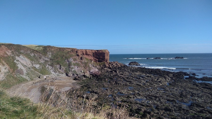
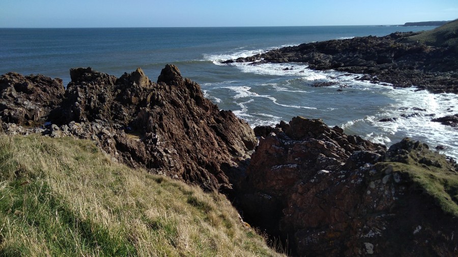
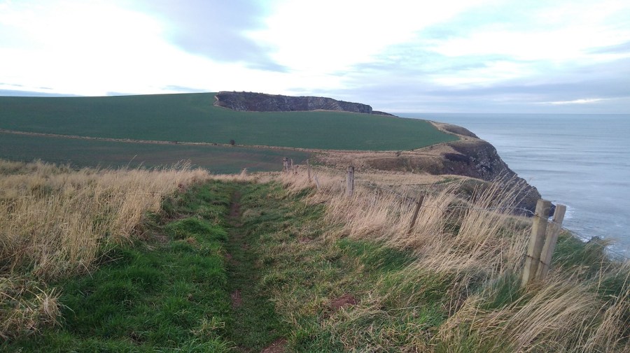
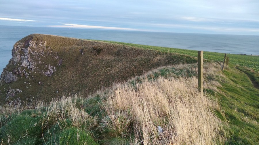
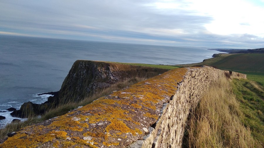
This stretch has the second highest cliffs on the east coast of Britain
Note to those who might want to do this: leaving Eyemouth (10.05am), be careful not to walk along the road as it is a dead end. Instead, go across the sands to the steps and up there are BCP signs. On the beach it was ever so warm, whereas at the top I needed a hat and a hood to keep out the gusts.
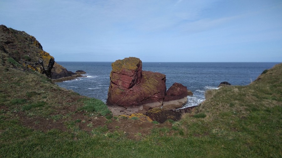
A giant red forehead looks out over Eyemouth Harbour and sands
Eyemouth to Coldingham
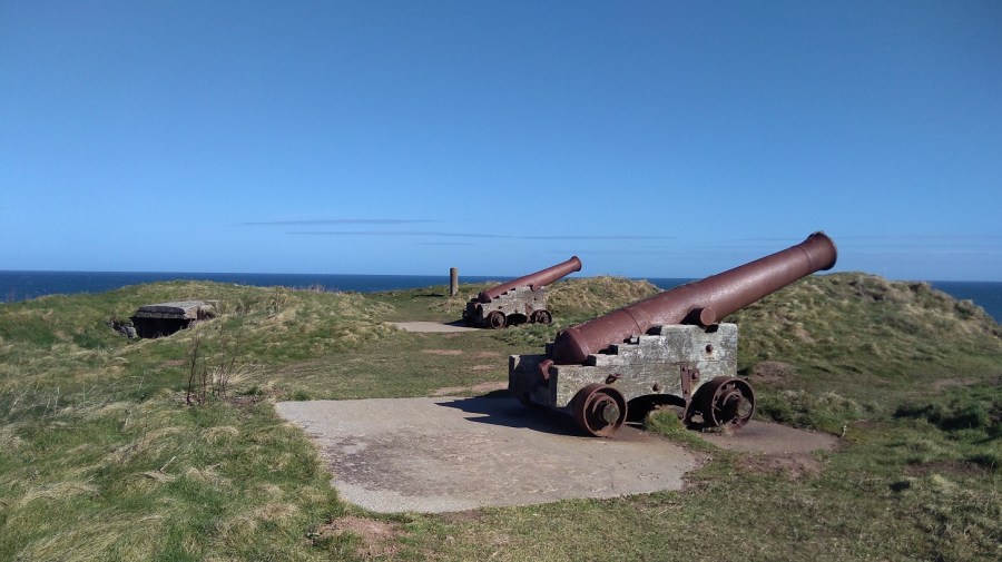
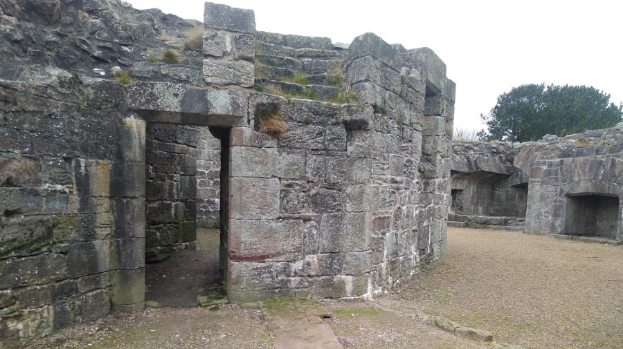
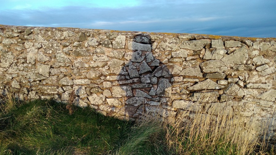
I visited the site of two forts: one English (1547) and the other French (1557), neither of which survived due to changes to the Crown of the day. Guns mark their existence now, facing out to foreign lands – a sign of outmoded protectionism, sadly very present in current foreign policy.
Eyemouth Fort – all grass now apart from the guns, and the stone shelter which you can see on the left. Scottish Borders
I inhaled the smell of brine and sun-warmed turf. The woman walking in the other direction had a north English accent and needed sunglasses it was so bright. We both turned and looked up at the tuneful sound and when I asked her if she knew what it was she said, ‘a type of skyark, I only do generic when it comes to birds.’
Monumental
Immediately there is a caravan park which was inhabited: a black labrador sitting patiently by the door; a woman inside with her hat on. There were daffodils lining the fence and Danger signs (people do disregard these and have serious accidents). Not much further along were lots of memorials – benches, bunches of dead or pretend flowers, and moving inscriptions, perhaps to those whose ashes had been taken by the wind out to sea.
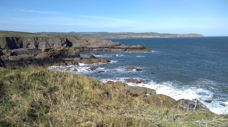
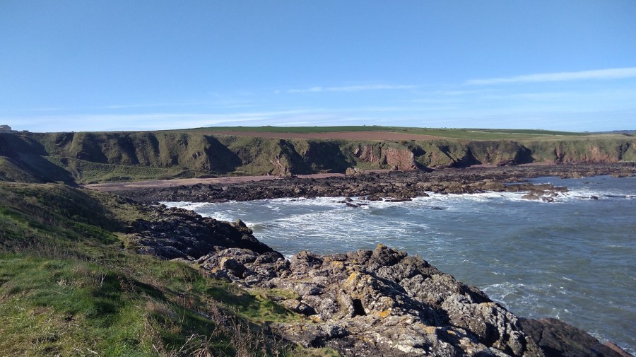
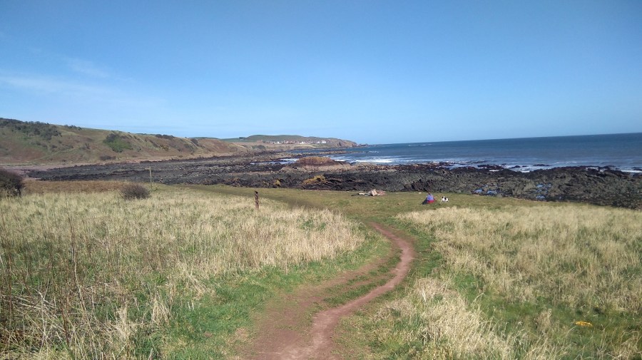
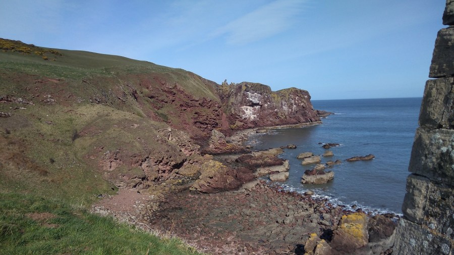
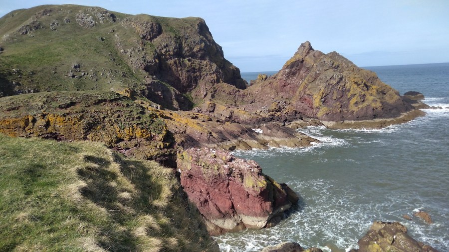
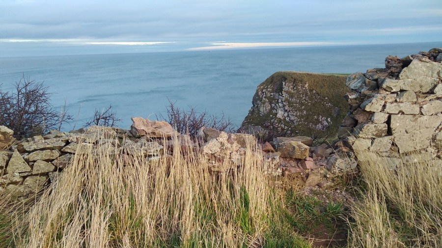
The land juts out into the ocean and there is a wonderful view
Further along was a camper van and a coachload of German tourists, but they didn’t stray far – just had a quick look and then left. Of course there were dog walkers here too, close to the road where they could get easy access. One small hound barked vociferously at me and his owner said it was the rucksacks which set him off!
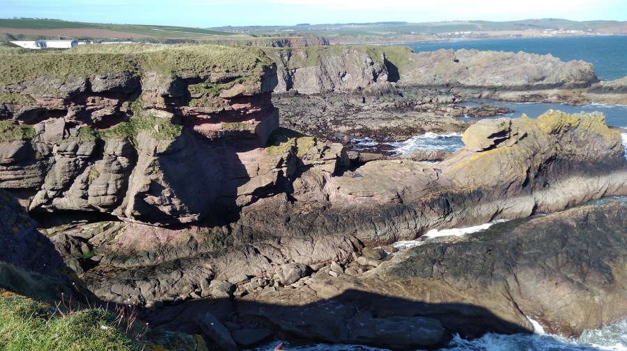
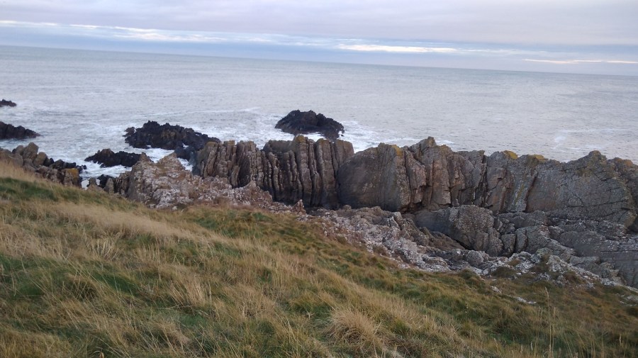
Rock strata of varying hues
The wind was so strong that it moved my camera as I pointed it.
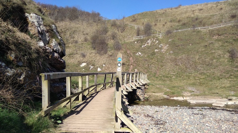
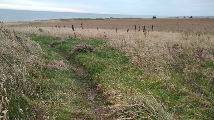
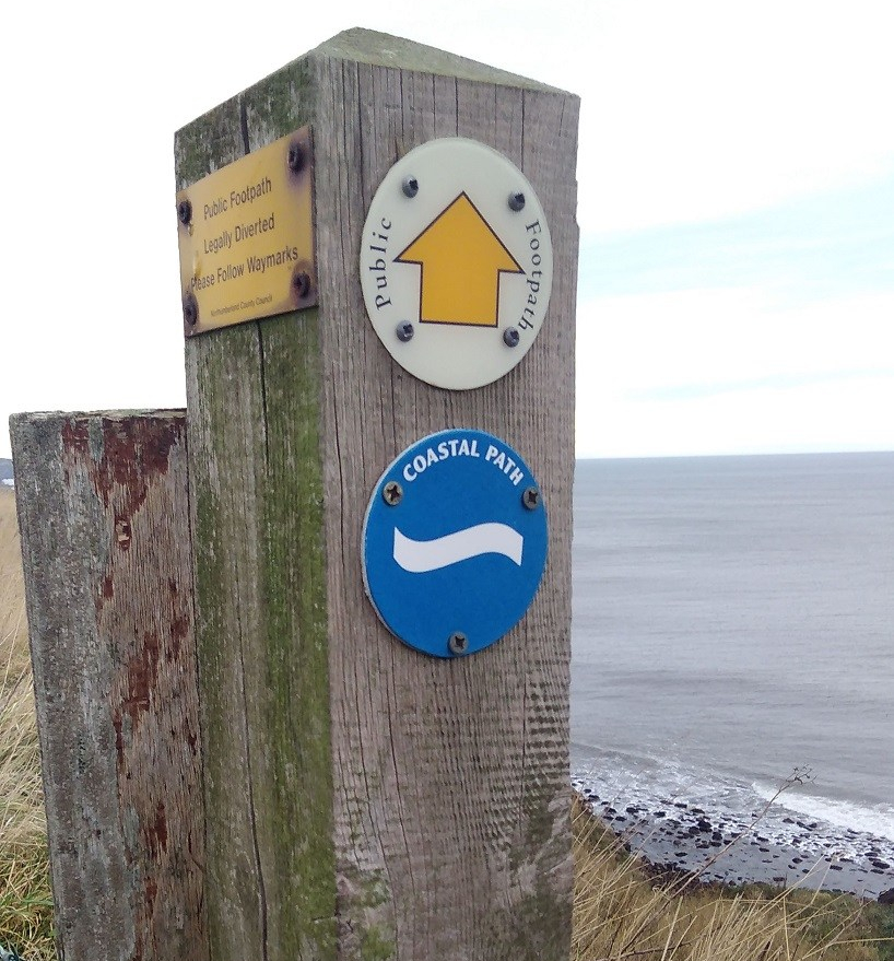
Spectacular landscapeA series of wooden bridges boasting various signs including the BCP one (blue circle with white wave)A freestanding wall of rock on the right and a hard-packed, cracked and curving path to the leftAcross the first wooden bridge the path wound down a river valley to the huge foamy rollers – water reflecting the blue sky in the distance
You could easily miss the tiny sign at the top of an orangy-red clay track to the right, but I had watched a hiker ahead of me turn down, so I knew to look out for it.
A rusty metal drill bit is sticking out of the grass on the left and on the other side, picnicking, sit an Australian woman and her most protective black and white shortie
Just ahead is the sign that you are not advised to take to ‘Coldingham via Fleurs Farm’. There was a woman beachcombing at the next cove which was full of smelly seasweed.
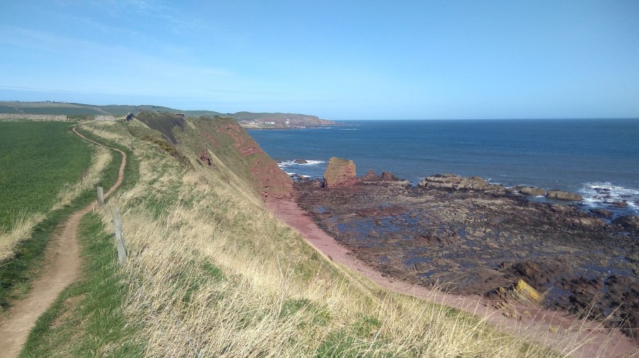
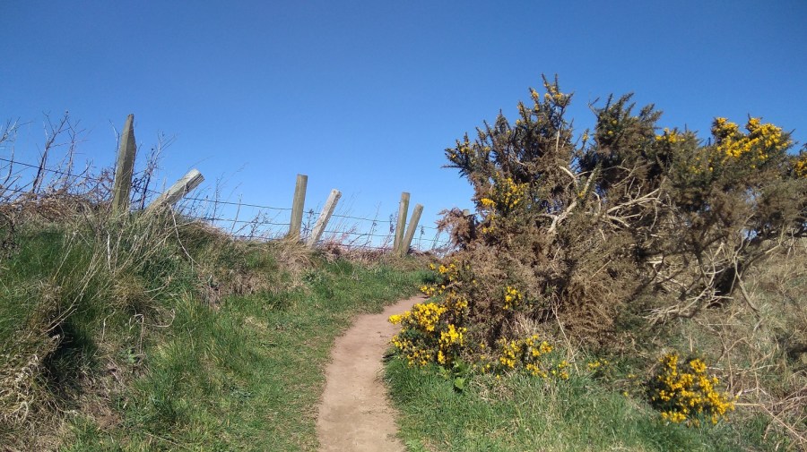
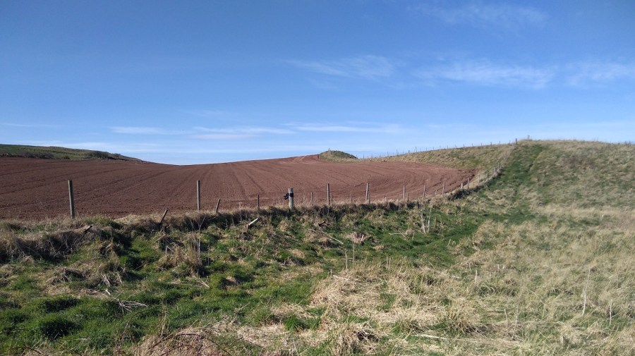
Sunshine flowers – gorse against azure and underneath them hidden blue birdseye (speedwell) to match the skyPurple ploughed fields with very loud birds on the left (the ones which make the sound of unoiled wheels) while the peep peeps of the oyster catchers reached my right ear on the breezesColdingham Bay in the distance
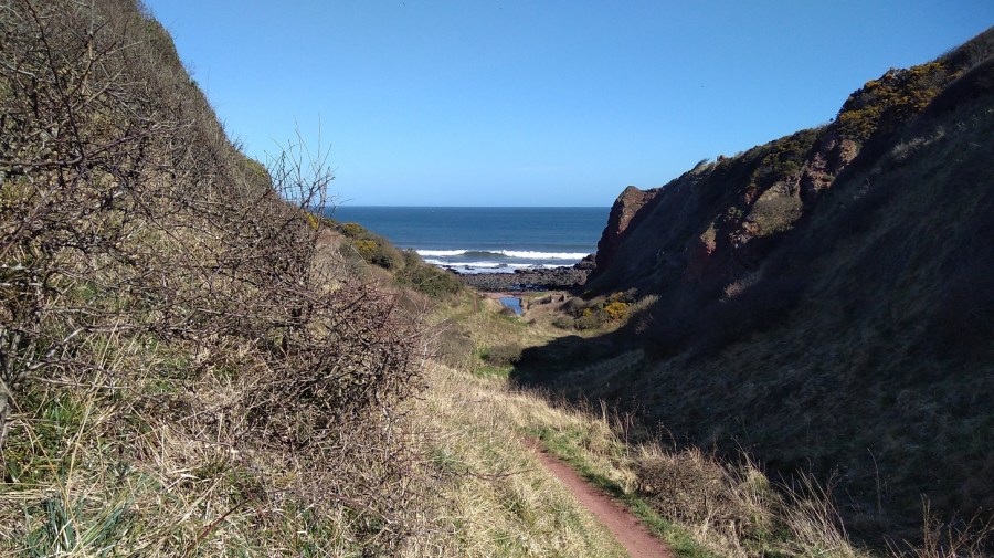
There were violets by the path and the merest hint of primrose scent, taking me back to my childhood when we used to pick them at St Julian’s (Sevenoaks, Kent). Can I pick wildflowers in Britain? Technically yes if you don’t uproot them or take them from an area of Outstanding Natural Beauty, but think carefully first – they don’t last in a vase and do look ever so good in their native surroundings.
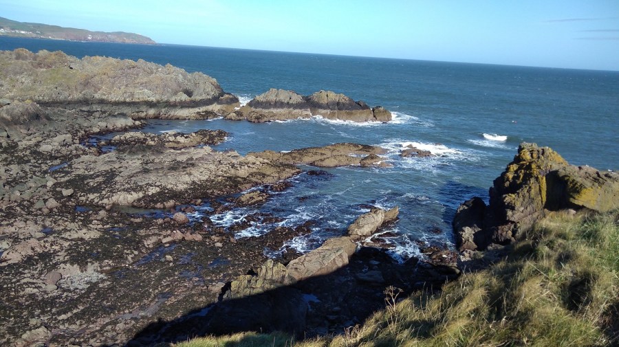
Jagged rocks
The wildflowers were all yellow here (the photo was not good enough to use): celandine, dandelion, daffoldils and gorse.
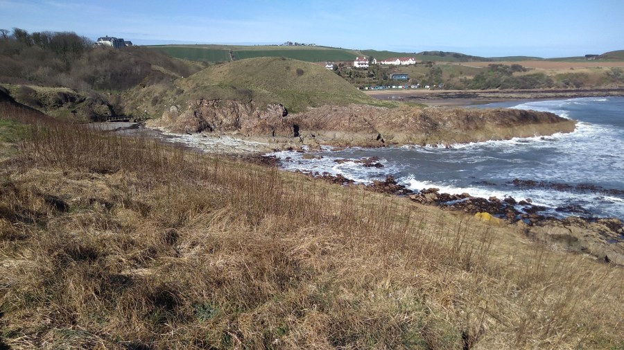
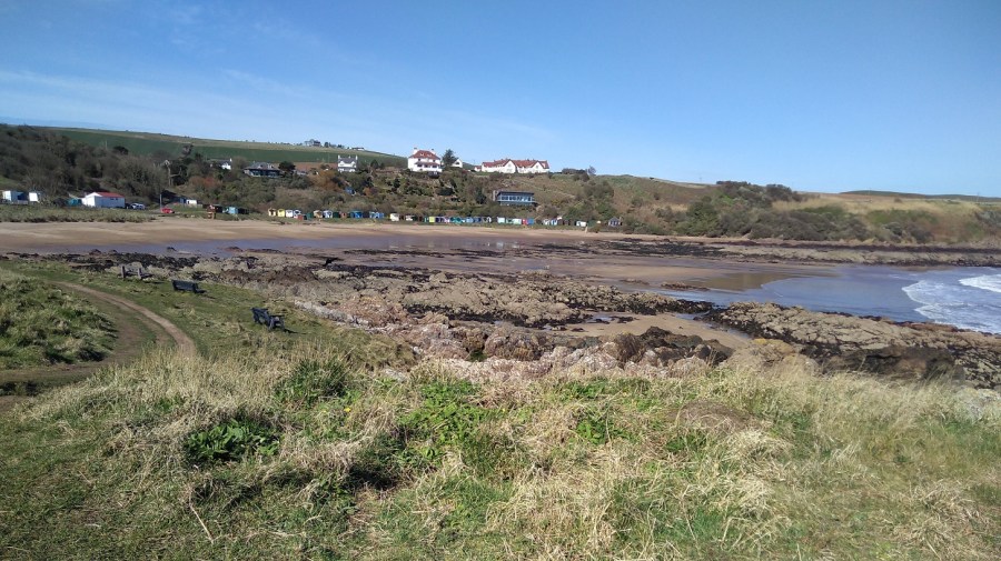
Coldingham
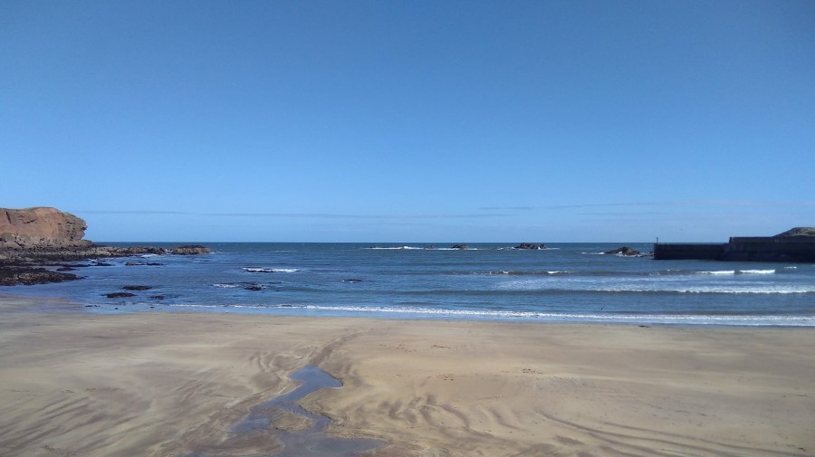
Coldingham Sands (11.30am) with its brightly coloured beach hutsMemories of playing with the children when they were little and them not wanting to get out of the sea “not ever”!Coldingham Sands – a blue flag beachIn Memory of Isabel Cowe , well known business woman and suffragist
Here I saw my first bluebells of 2019 as I climbed very steeply up behind the beach huts and past the bed and breakfast (now a private house) where I stayed for my birthday with Lesley a few years ago.
Easy to miss the mossy sign to the Creel Path off the road – this time I had read the instructions in advance so I knew to go over the stileThe thickets of the Creel Path
At the T junction, the signs point left to Coldingham which this time I did not visit and I therefore missed the Coldingham Priory which was a Benedictine Abbey. There has been Christian worship on the site for over a thousand years and the present Priory Church building includes walls dated to around 1200. The Priory was founded in 1098 by Edgar, King of Scots, son of Queen Margaret (later Saint M) and Malcolm III, after recovering his kingdom from Donald Bane, his uncle, who had usurped it at his father’s death.
The first monastic community consisted of thirty Benedictine monks from Durham until 1590. The original Church, built in Edgar’s time, was destroyed by King John of England in 1216, but was replaced by a greater and more magnificent one, which in turn was largely destroyed in 1545 during the great raid of the Earl of Hertford, which brought ruin also to the abbeys of Kelso, Dryburgh and Melrose. The choir, however, though further damaged by the forces of Oliver Cromwell in 1650, survives and constitutes the present Priory Church.
I passed two other signs indicating that I could have taken earlier ways, but I was pleased to have walked along the famous Creel Path. It is so called because the fishermen used to carry their creels (lobster pots) along here to the beach in days gone by.
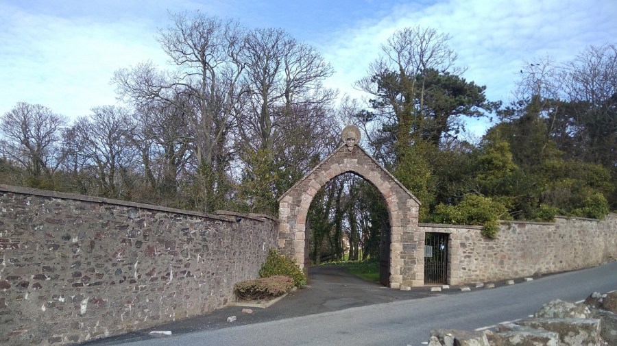
Aubretia and hawthorn as I entered the village of St Abbs (arrival at noon), at the end of the Creel Path
Earlier I spotted the old, brown seed heads of tansy and teasle, but here in the warmth that came off the earth were haphazard flies and in sheltered corners there were the new season’s flowers. What a welcome, bright sight they were attracting the first butterfly I had seen after the long winter. I was about to come across primula and pansies, even white garlic flowers on top of juicy wild garlic stalks. That confirms it, I thought to myself, no argument, Spring is here!
St Abbs
On entry down the hill, there was white washing fluttering in the breeze and a restaurant and visitor centre, both shut of course on account of the time of year.
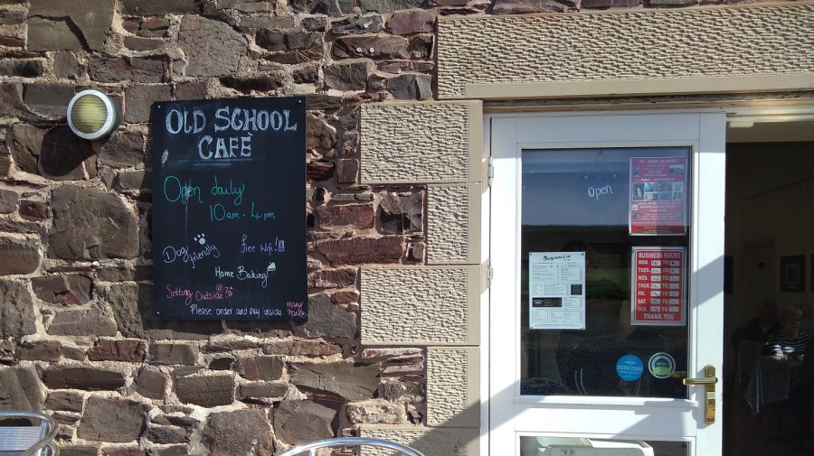
Through the harbour and up the other side, to my delight however, was an old school building with an open cafe. I had a picnic with me, but can never seem to resist a hot cup of tea. The baking (avocado and courgette gluten free cake) was excellent and the staff were all kindness – initially organising a chair and table outside for me and then adding a cosy blanket for warmth. By the way, you can also buy a very pretty, homemade pink magic wand for £3.50 too!
After a break and refreshments in the sun (with wi-fi), I continued along the road and then entered the protected Nature Reserve to the St Abbs lighthouse at St Abbs Head. where I have walked many times before.
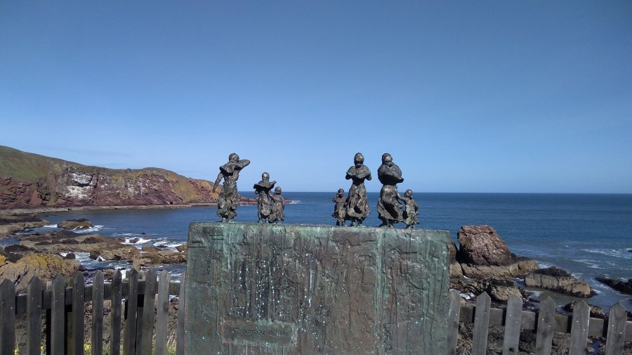
Memorial
These small bronze figures are the wives and children of Charles Purves and brothers William and James Thorburn who were lost in the great storm of 1881 when 189 fishermen lost their lives. The harbour does not belong to the Council but to the local people via the Community Council and a Trust. There is an important Lifeboat Station here, privately funded and independent.
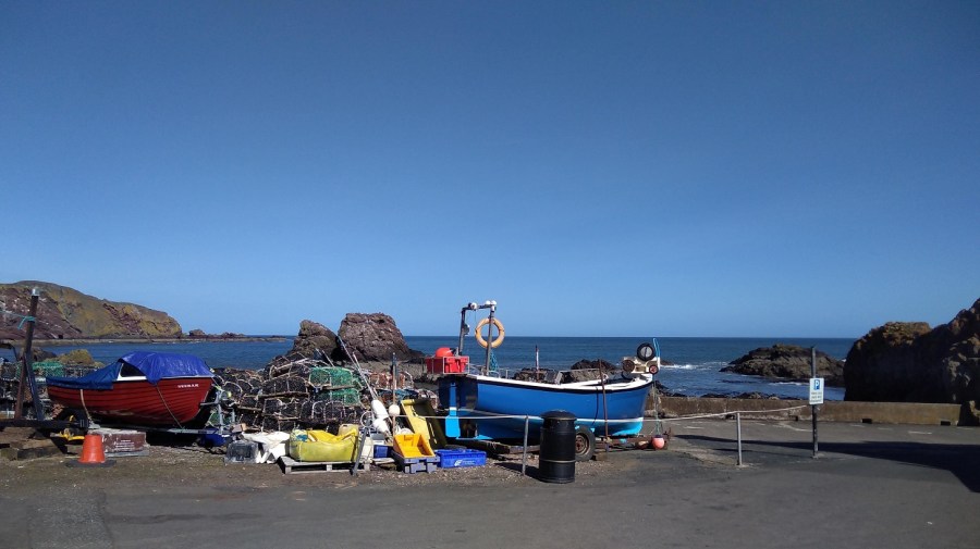
St Abbs harbour
St Abbs with its super clear waters is a favourite place for scuba divers, including beginners. For details of the new bunkhouse, see below.
The Ebba Centre and Old School Café – highly recommended
The cafe is named after Ebba (Ebbe), ‘Mother of Northumbria’, so the signs in the Ebba Centre told me. She was born c. 615 AD, daughter of Aethelfrith the first king of Northumbria and in 643 AD she founded a nunnery nearby which predates the priory mentioned above. Later she was made a saint.
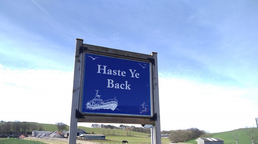
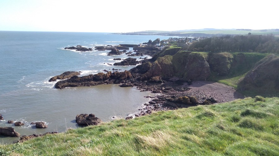
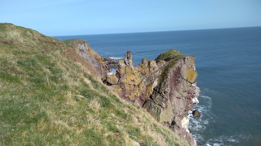
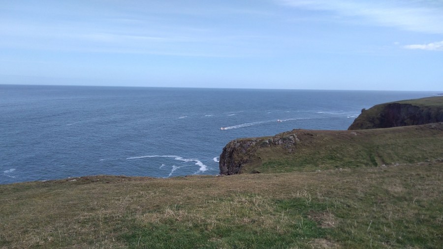
On leaving the village of St Abbs – typical Scottish sentimentThe coastline north of St Abbs has high cliffs and belongs to the National Trust for Scotland. It is a popular tourist area both for bird watchers, wildflower lovers, and hikers
I spent ages admiring the gliding birds with blanched tips to their tail feathers – they seemed effortless. Many were perched on the rocks like tiny pearls in an invisible hairnet. Apart from the bumble bee, everything here was white: feathers and wool, gulls chests, and the foamy most-white of the waves between the rocks.
Looking back towards the village of St Abbs, Scottish Borders
I was reading about Sarah Marquis, a very experienced walker who could smell water when she was hiking in Australia. I believe I could smell the grass happily growing in the sun after being dormant for so long.
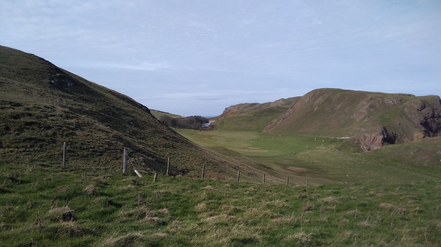
Verdant pastures in the lee of the hill where lambs were supping at troughs, maaa-ing to their mums who were down on their elbows supping the new grass
The path took me around and behind hillocks on the way, but I went up and over them on my return. Once I caught myself avoiding looking – the grandeur of the views, the colours – as if I didn’t know what to do with them they were so wonderful.
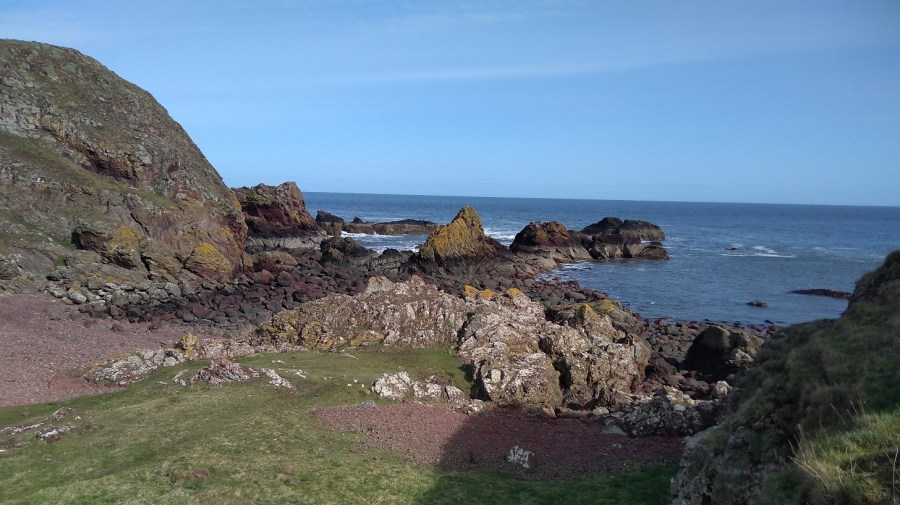
The sun lit up the pink and gold rock formations
Going back I wasn’t the only one out on this beautiful afternoon – I discovered it is quite a busy stretch.
Stacks and white wavesThe sun was already starting to lower throwing blotchy shadows
Gentle paths curve through the spring-green grass, undulating with the landscape – there is some good climbing to strengthen your thighs!
Berwickshre Coastal Path – St Abbs to St Abbs Head part. Coming from the other direction, the stack in the middle looked like a flat cactus
You can spot the Northern Brown Argus butterfly according to the sign, and it’s a bird watchers paradise (guillemots and razorbills, shags and cormorants amongs others). I watched a starling with its petrol green head, perched on a fencepost, feathers disrupted as the wind attempted to dislodge it.
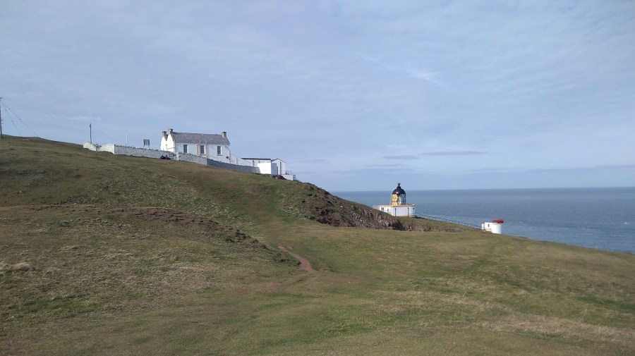
St Abbs Lighthouse
The lighthouse at St Abbs Head
68 Metres above sea level, the lighthouse was built by David and Thomas Stevenson. It is automated now, remotely monitored, so there is no lighthouse keeper. It flashes white every 10 seconds to warn sailors of the rocks below.
My walking future was ahead of me: a tarmaced road between knolls, jagged rocks and chiselled cliffs; the power station with a polluting cloud coming out of its tallest chimney; Berwick Law (a little hill all on its own near North Berwick); Bass Rock (an island off that coast); and Edinburgh beyond.
I went back the same way past this gate with a beatific, female face
Back in the village, I was sitting dozing in the sun when William came up to tell me his life story. At 88 years he has had two sticks and two wives, he told me in his Sussex accent. He was born 2 months after his parents were married, he explained, which was why they left the place of his birth, but later they were forgiven and returned. He was a member of the fire service in both Salisbury and Hereford (both places I have relatives, I said, but he wasn’t really listening!). He was drawn to speak to me with my rucksack beside me because he is a lifelong member of the Berwick Ramblers.
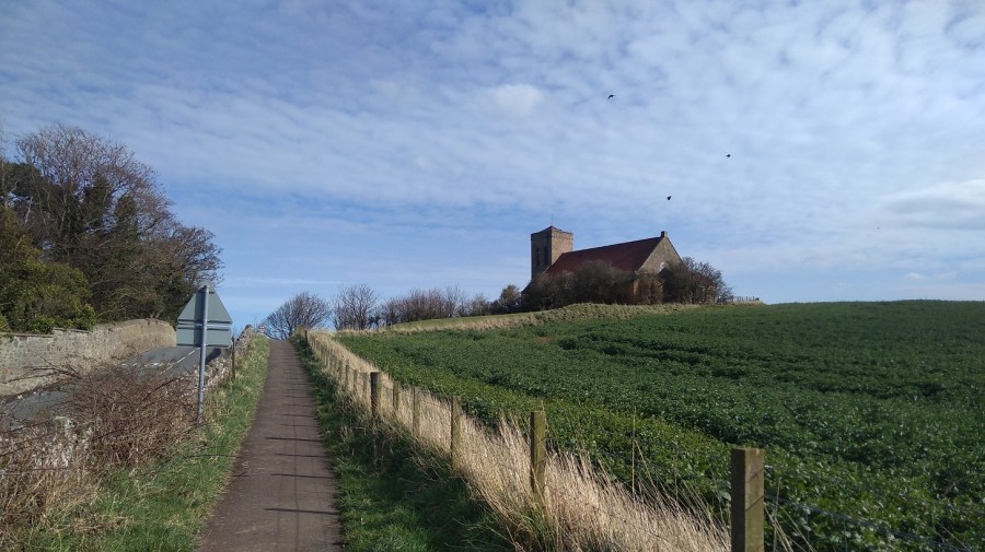
I got a good view of St Abbs church which was beside the cafe where I had rested earlier and which I had also sighted on my initial approach from the Creel Path
After our conversation, the bus came into view and only then did I realise that I barely had any cash. The driver said coins only and waited while I dashed back to the cafe (visit #3 that day) where they gave me £2 (they couldn’t do cash-back) saying I could give it to them another time. What a fantastic gesture!
It was a short day’s walk (4 hours maximum) with quite a lot of climbing. I felt taller and prouder inside and only at the end did I feel a twinge in the instep of my left foot, otherwise no pain or difficulty at all. Less is more!
Practicalities
I advise you to walk in the other direction if you do not have a car and a friendly person to pick you up because there is nowhere to stay at Drylaw, only a car park, and it is too far (29 kms – remember that there are a lot of slopes and hills) to walk from Eyemouth all the way to Cockburnspath.
My timings: 2 hours on the bus from Edinburgh to Eyemouth; 1.5 hours walk to Coldingham Bay; half an hour on to St Abbs Village; 45 minutes to St Abbs Head lighthouse. You could probably do it quicker, but I savoured it all. The 235 bus from St Abbs to Berwick-upon-Tweed takes about half an hour (£3 odd), and the train from Berwick to Edinburgh about 45 minutes.
Remember to check the sunrise and -set, and co-ordinate with travel and walking times if you are also hiking in winter/early spring!
There is almost no accommodation along the path excepting at Berwick-upon-Tweed. If you know of any (other than the bunkhouse below) please do let me know and I will add it to the blog later. Of course if it was summer you could wild camp like Rucksack Rose.
If you are planning to walk this way, I hope you enjoy it as much as I did
For more information about the Berwickshire Coastal Path, please see the excellent leaflet produced by Scottish Borders Council Newtown St Boswells, Melrose TD6 0SA 0300 100 1800 enquiries@scotborders.gov.ukwww.scotborders.gov.uk
Bunkhouse email address: divestabbs@gmail.com (Paul Crowe, skipper of the boat MV> Topline who takes fishermen, tourists and divers out to see the area).
In the middle of winter I headed south on a train to Berwick-upon-Tweed along the coast of East Lothian with the sea on my left. It was just after 9am and I could see brown fields, a slate grey sea, even darker land on the other side of the Firth of Forth and the silhouettes of the trees without their leaves. As it lightened there was more detail: cows in coats; four-by-fours speeding between fields; ruined castles; and low, red-roofed farm buildings. The train was quiet.
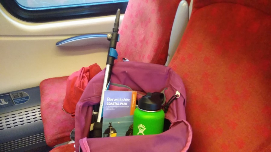
Just a light pack today, including my new flask which Isobel gave me for Xmas
I am hiking part of the Berwickshire Coastal Path (45.5 kms / 28.5 miles in total = a recommended 3 day walk). Berwick upon Tweed is technically in England (although their football team is Scottish!) and my destination is Eyemouth, 17km (11 miles) away.
The fields become green as I travel and on my left is the point of Berwick Law, the only high place in this flat landscape. Combine harvesters are frozen mid field; barrels of wrapped up straw lie waiting; there are borders of louring pines in the distance; and beyond, a complicated sky: wispy dark clouds against a bright blue though pale background and at the same time, little bands of cotton wool balls stretching from east to west.
Found photos of (from top left) Torness Nuclear Power Station, Dunbar Town House, St Abbs Head Lighthouse.
A few golden strips of corn have been left lying in the fields, birds are black shapes in the bright sky, the bare bones of the trees are like hardened and flattened seaweed fans. People were sniffing and blowing their noses all around me.
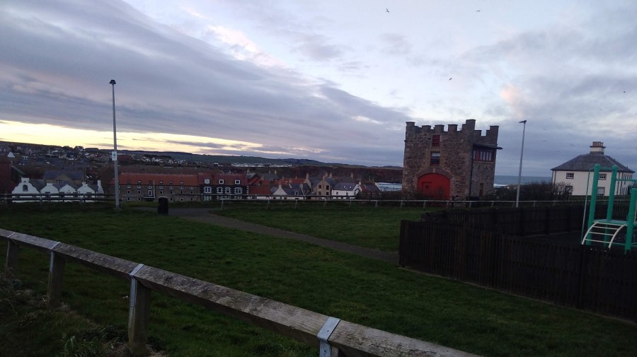
There were acres of half-built houses as I drew near to Dunbar, birthplace of John Muir, friend to all walkers and nature lovers. A small town with the arrow-head tower of the newly-painted-white, 16th century Town House; Saturday people with pushchairs; glimpsing the sea between buildings.
Then once more rolling by the deep chestnut loam, and a more varied landscape. We were edging further from the sea where the iconic Torness nuclear power station like children’s blocks which have been fitted together wrongly. Sheep grazed in miles of brussel sprouts fields; low, dry stone walls divided; and a solo bird perched, waiting for the morning to come. We skimmed past the St Abbs Lighthouse, where I was planning to walk to today (see below).
I could see the path I was going to be walking at the top of the cliffs as they tumbled down to the rocks and the white waves below. Men in red and blue were playing golf, their trolleys angled beside them, pools of sand dipped in the ocean of green turf.
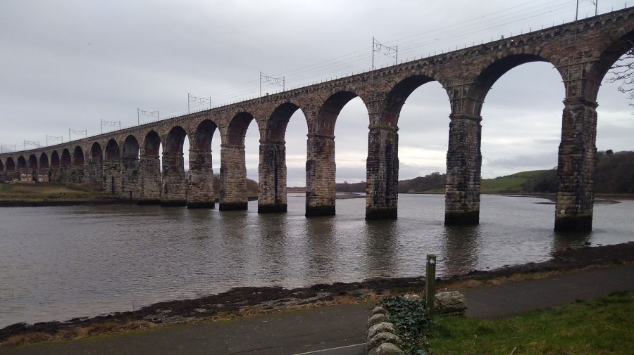
Arriving at Berwick-upon-Tweed stationA detour almost, before I started, through Castlevale Park to the riverside walk, to take a photo of the brick bridge across the River Tweed
As always, it was difficult to find the beginning of the walk, so, here are the directions for you: come out of the station, go up the little slope, turn left and then take the first right.
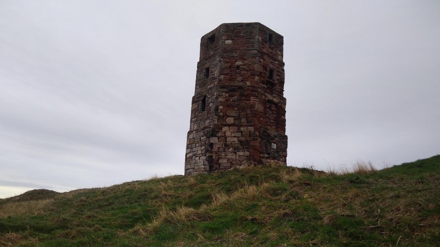
A man with 2 dogs stopped while I was taking a photograph of the Round Bell Tower , not knowing that I was waiting for him to come into shot so that I could include him! He told me that he used to work for the local newspaper and one April Fool’s Day he took a photo of it leaning, said it was toppling over, and published it with the caption, The Leaning Tower of Berwick. Crowds of people came to watch it, he said!
The upright Round Bell Tower, Berwick-upon-Tweed
Next to the tower is Lord’s Mount, Henry VIII’s gun tower (completed in 1542). Its massive wall contains six gun positions and a latrine. The artillery included ‘the falconet’ which fired a solid ball 1000 yards (914 m).
Lord’s Mount, Berwick-upon-Tweed
Before I even got to the sea I lost my pole, which I went back for and luckily found, and a glove which I didn’t.
The Northumberland people I met were lovely and friendly and gave me directions out of the town and onto the path.
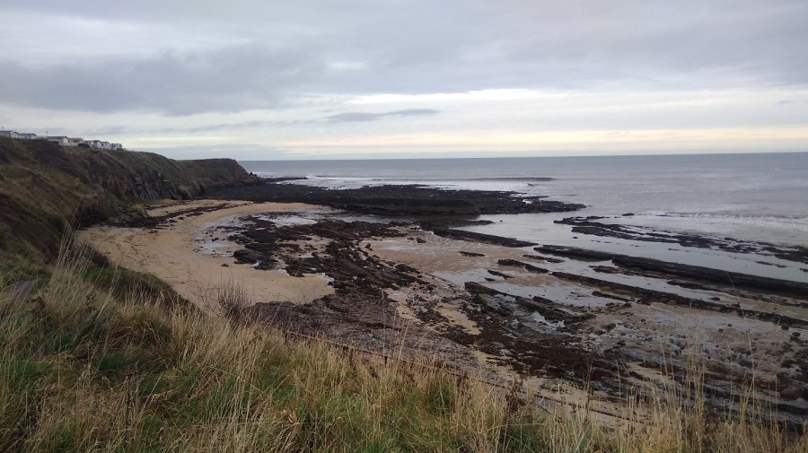
Oyster catchers were wading and ridges of diagonal rocks showed dark against the washed yellow sands. I went down the steps to a tiny cove, and along the well-trodden beach full of footprints and seaweed. There was the sound of trickling water as I made my way up at the other end.
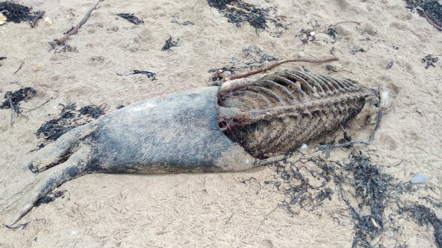
The first bayA dead seal was washed up on the shore. A disturbing, though not an unusual sight
Up above were ranks of holiday caravans where shells had been hung between railings. I could see a red and white lighthouse beacon at the end of the pier in the distance and hear the single, shrill whistle of a bird overhead – just as if he fancied me.
Looking back to the bay, Berwickshire Coastal PathWinter seedheads and kind grass underfoot, the sounds of waves crashing and my Camino shell clinking at the back of me
Immediately I came round to the next bay. It was larger this time with delightfully pig-pink cliffs and tufty tops. The wind was trying to blow the pale, beige stalks seaward. Once again it was just me and another man with his dog. Vestiges of yellow flowered gorse gleamed on the bank opposite.
Clattering seed heads above and the odd flower low down sheltering from the winds; a nettle, some brambles and litters of rubbish
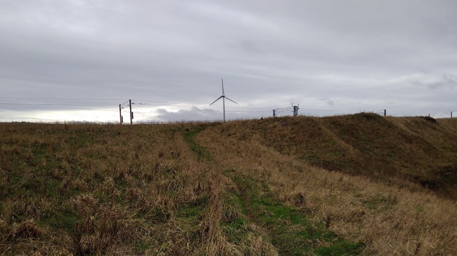
The squawk of the train reminded me that the railway line matches the path to the left, and I was walking between that and the sea.
Wind turbines lazily turned despite the knots, and there were rusty metal steps down to the beachThe path curved round a mixture of natural rock and man-made straight lines with a very enticing cavern underneath
The links (golf course) was on my left; slippy mud down to a little wooden bridge over a trickle of water; the sweet tweet of a leaf shaped bird overhead, its wings fluttering fast. It was a very narrow, windy and uneven part so I was glad that I had found my pole to steady myself – it is definitely not accessible to wheelchairs or baby buggies.
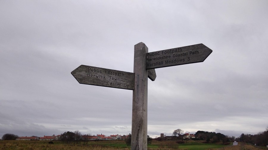
Marshall Meadows, a lovely name – the first signposted stop, 2.5 miles
The path follows the highly eroded coast line in and out; my nose was running, tickling; and my mind returned to other similar trails: Normandy, Brittany, andOrkney.
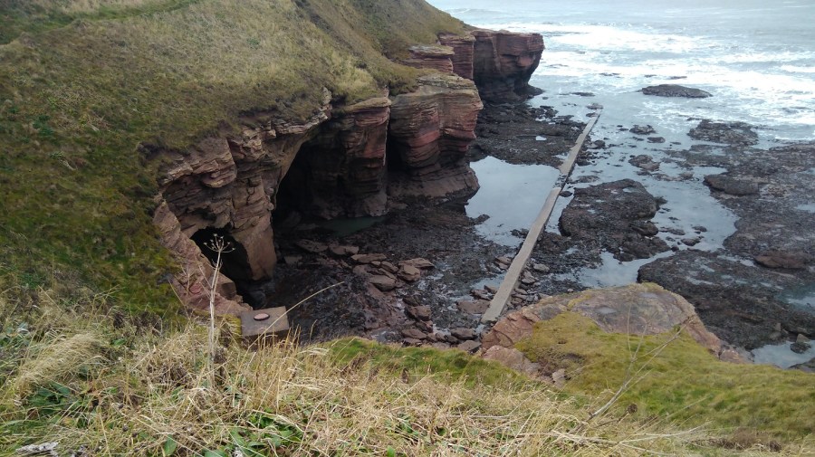
It is an impressive landscape: thin horizontal layers of pink rock, tiny slices but massive boulders. My eyes were getting a welcome break from the computer as I gazed out to sea and admired the hues and cries of this stimulating view and the birds who live here.
The camera is not doing the colour of the rocks justice. They are almost carnation pink, practically unnatural except that they are all real
The sky was opening up; I could identify the peeps of oyster catchers and see sparks of black ravens; I was scanning the sea for any sign of whales. My forehead was cold as I walked straight into the northerly wind. How I appreciated not heaving the heavy rucksack for once.
The upstanding and nearly empty sorrel had turned the same deep chestnut brown of the fields
I only stopped for a couple of minutes for a comfort break and to put some chapstick on my lips, but I was already cold afterwards. There were single, brown birds with long curving beaks (curlews, probably), and others in huge crowds sweeping around in the sky above me, sticking together in formation, communicating wordlessly. I was entranced by these murmurations.
White horses and rolling waves
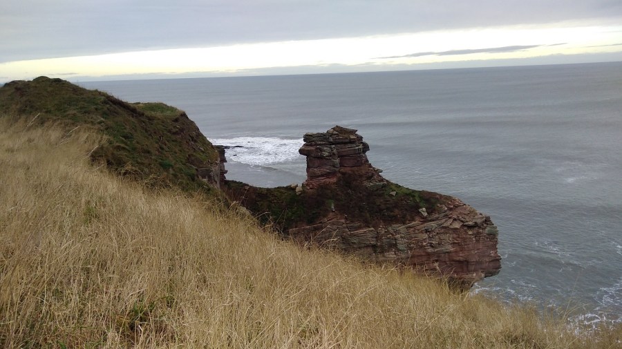
For a moment I wondered why I do this, especially in winter when it is so chilly. Then I looked out to the horizon and saw the world – so much bigger than me, and down at the rocks and the majestic sea stack – the land simply missing between it and the cliff; and it was good to be reminded how small I am.
A sea stack – close-up
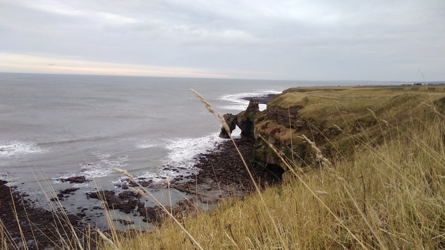
I saw the people in their cars rushing between Edinburgh and Newcastle on the A1, and the high speed train making its way down south to London. Here I was being blown and buffeted by the wind, breathing the fresh air, listening to the natural sounds around, the brushing of my feet as they passed through the grasses, stumbling and toppling over uneven ground which is good for balancing my brain, and looking ahead. Things were coming into perspective.
A natural, geological arch
Up a short wooden ladder, over a stone wall and I discovered I was in a caravan park called Marshall Meadows. Much to my disappointment it was not the pastures I had imagined!
It afforded me a few minutes of shelter away from the sea’s edge and the wind though
Back onto concrete I immediately felt my sore feet and realised I hadn’t been aware of them since the pavements in Berwick.
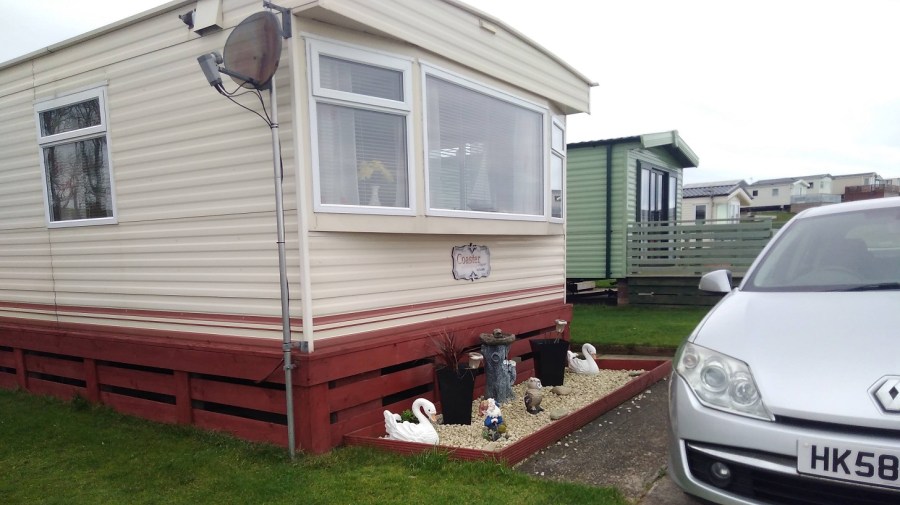
Aah a sign! As I pass through the site, I wonder if the people who hire these caravans realise that their windows will look out onto the railway
By this time I was looking for a place to shelter and sit for a cup of tea and a banana to keep my sugar levels up. I didn’t want to lose my sense of proportion, which has happened in the past.
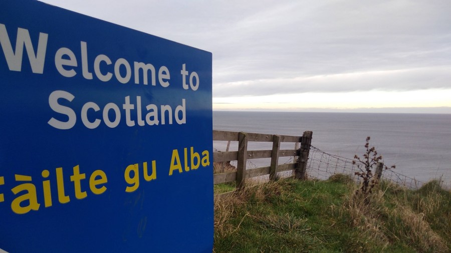
Crossing the border into Scotland (the sign is written in English and Gaelic)
The Cuddy Trail is here. Cuddy is Scots for a donkey and the ‘beasts of burden’ were used to transport coal and fish from the shore to Lamberton and the Great North Road.
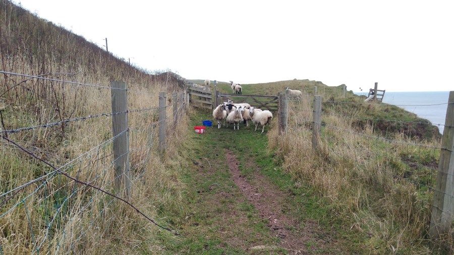
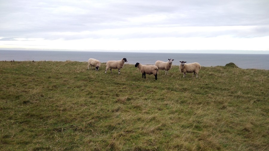
I hastily put my hood back up over my woolly hat and found myself walking between two rows of barbed wire fence by signs saying to clear up your dog poo (it can be poisonous to farm animals)They were scared of me, yet interested. I think they were female sheep because they were multi-tasking: walking, eating and going to the toilet all at the same time!
I had to climb over the gate as the farmer, in his wisdom, had padlocked it shut despite this being a public right of way and well-known footpath.
Then I curved back towards the wild cliff corner and the sound of the crashing water. The wind was causing shadows on the ocean. It had that look about it as if it was rising up to the horizon and down to the beach. It was heaving. The surface colour looked flat and even, until I really paid attention to it. Then I saw the variations of the olive, seaweed and sage green, with slate, business suit, and pewter grays, all edged with white lace and set against a peach sky.
There were lots of helpful signs indicating that badgers, yellow meadow ants and peregrine falcons can be seen here, but not by me. I did get glimpses of the fulmars on the ‘cliffes’, nesting in their flint and white plumage, so far away that all the photos were too blurred to be reproduced.
I was interested in a ruined bothy on the steep slopes which only the sheep could negotiate, and went to the edge to take a photo. That might have been where I mistook my way
Twenty minutes earlier I had passed two men getting out of a car and preparing to surf, clad in black wetsuits with their white boards. I bet they had a good time in those rollers!
It was then that things started to go wrong.
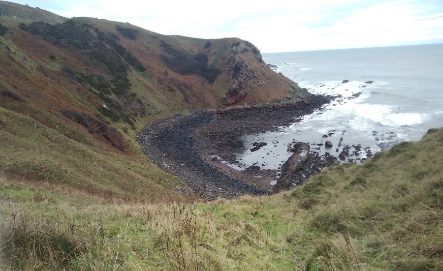
A bowl of dark boulders – I shouldn’t have gone down there!
But I did. I thought, ‘really?’ but I couldn’t see anywhere else to walk as the railway came so close to the edge, so I went anyway.
I skirted the steep slope first of all, grabbing handfuls of grass to stop myself slipping and edging my feet into the side, until it became too hard going. Then I dropped down onto the rocks. They didn’t look too bad from a distance, but they were – it was really hard scrambling over them. I could see a way out on the other side and I still assumed that was the right way. I pushed and tore through the brambly undergrowth, I fell down and got myself back up. I persevered. My pole kept collapsing itself and up at the top was a sheep’s face peering over at me. I could see hoof marks where they obviously managed fine, but I sure was struggling. Was there a way? What could I do?
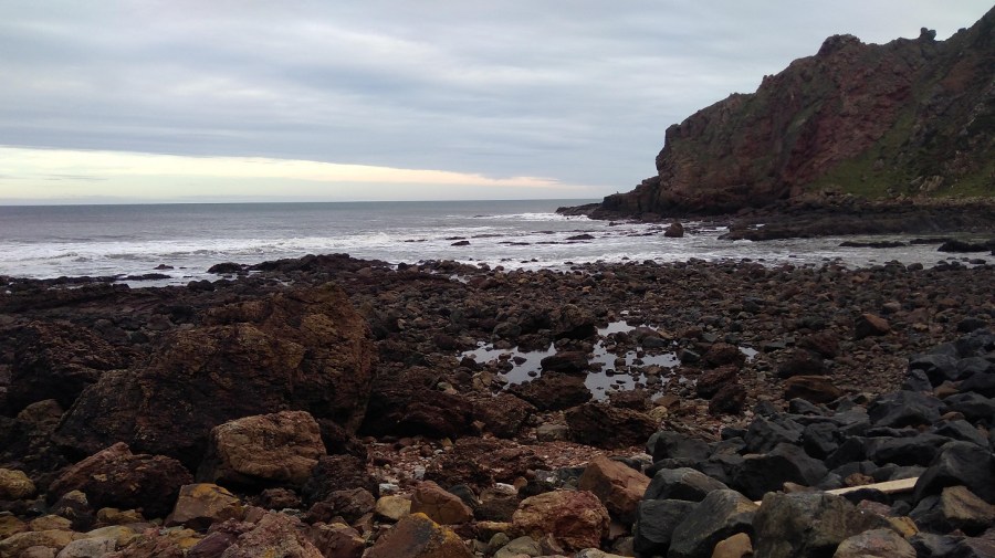
Go back, that’s what! It was impossible. I was very hot and bothered and there was nothing for it but to retrace my steps, which was easier said than done and something I don’t enjoy. I traversed the rocks closer to the sea which were slippery as well as treacherously uneven.
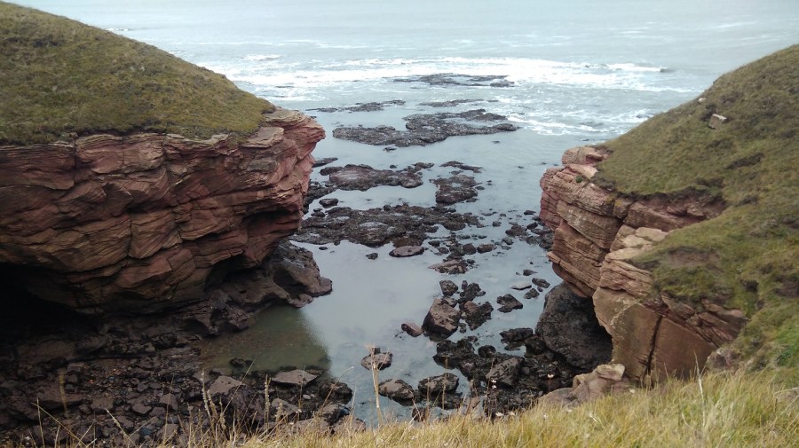
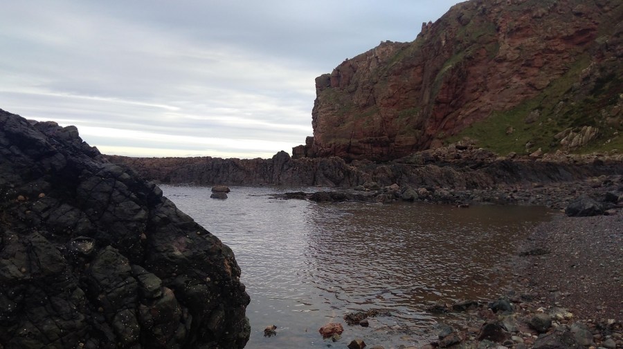
I had completely lost my cool until I came across such a beautiful sight that I just had to stop and breathe.
A calm pool between the jet volcanic rocks and the pink cliff profile
It took a lot of time (perhaps three quarters of an hour) and I used up a great deal of my available energy. And it took quite a bit of serious tramping to get over the anger and frustration of the experience. On the back of the BCP map it says: It may seem unnecessary to provide directions other than saying – walk north or south keeping the sea on your right or left!’ Am I the only person to have missed the most straightforward path?
Slowly I realised I had to relax and get back onto the right path. I had to let it go or I couldn’t enjoy the remainder of the walk, so I focused on anything but my feelings and picked up pace.
In my recording I said that I chose not to walk where two others were, around a field when I could clearly see a short-cut straight across the top of it. I saw the trampled down barbed wire and said to myself, I’m not falling into that trap again!
Next was a straight and concrete side road to Homestead, and I spotted a brightly coloured lifeboat chugging along. When I turned round, there was a deer lolloping in the undergrowth very close by with its beacon of a white tail. It seemed to be rather a special sight. The Medicine Cards say that when deer appears, ‘apply gentleness to your situation.
At 1.50pm, my phone battery was already down to 32% and I quickly came across another conundrum. I took a second wrong turn. This time I crossed a field to the left because it looked as if the alternative went over the edge. It was not clear, so I stood and debated and as the gate was open I chose to go through.
Right to the end of that green field I went, past all the sheep who may well have been watching wisely for all I knew! And then I didn’t know where to go but back – it was a dead end. Never again will I walk without an ordnance survey map, I declare to the sheep!
So I went through the other field (not in a straight line), climbed over a stile, and doubled back (presumably the path avoids the farm land).
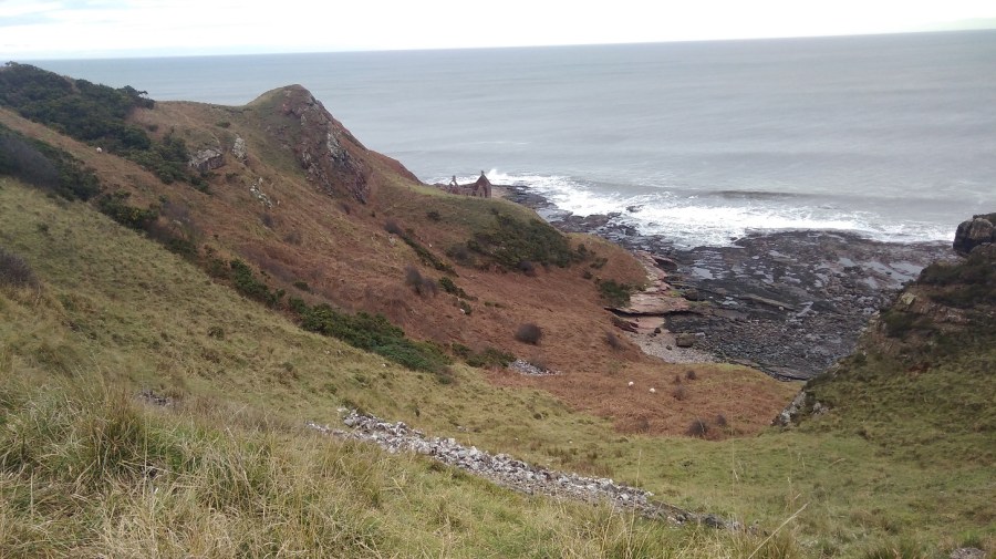
Burnmouth – not a sign of life, not a soul
There was the village of Burnmouth below me at last, tucked under the heights. I zigzagged steeply down in the opposite direction from the yellow arrows, behind the gardens and at last found a BCP sign. Amazing how this often happens at a time when there is absolutely no other possible way anyway! For some reason the walk is not as enjoyable if I am not going in the right direction.
Apparently Burnmouth was ‘once a hotbed of smuggling’ (tea, brandy, silks etc) engendering lively stories from 1780. A pretty but secluded village, it is divided into two halves with a harbour inbetween. Candy coloured cottages seemed to be for visitors. The tide was out leaving streaks of low rocks, as if someone had painted on a glassy surface and the paint had separated unevenly.
Burnmouth from the tops of the cliffs
A man stopped to do up the zip of the woman he was with and my black mood meant I could barely manage to say a friendly hello. My knees hurt going down and my insteps going up. The sign pointed in the direction of two roads, one to the right and the other uphill. I took the path which ran to the right of a dour chapel, curving through woods, over a planked boardwalk, then up a steep hillside with a horrible groaning noise going on – something to do with the fishing in the harbour.
There was a handy bench ‘Dedicated to William Telford, born Burnmouth 1925’ for resting my weary feet and admiring the vista but I was very stiff when I got up. I hadn’t been walking for a month of so and it was showing. I thought I wouldn’t need the chocolate I bought yesterday and wished I hadn’t left it at home.
Blue tits played in the briars, zipping in front of me; silvery green lichen covered the branches. Humbled and cut down, I did not recover quickly. I was reduced to little more than zero miles an hour.
Once up high again and back into the windy onslaught, I needed a hat and two hoods – it was a mere two weeks after the winter solstice.
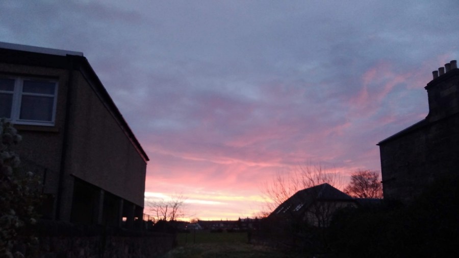
Then, halleluja! the sun started to show its lovely self. 3.15pm. What a wonderful light.
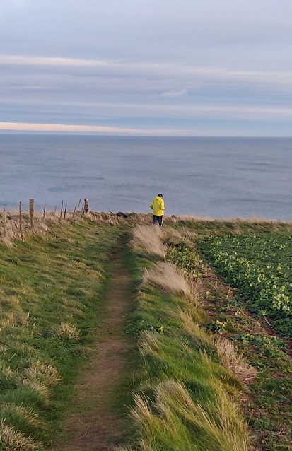
The colours deepened, became lucid and my mood eventually mellowedFaint and fragile fingers against a mackerel skySee how the coastline meanders!The sky and sea got bluer and bluer. There were two options and I went over the wall, hoping it was the right decision. I found myself out of the sun’s warmthSelf-portraitA yellow clad fellow walks southwards – that’s the right idea – wind at the back of him!I simply loved the contrast between the orange lichen on the wall and the blue and green beyondRock macaroonsThe sun was starting to set. I felt chastened, very quiet insideI only got as far as Eyemouth, having lost valuable daylight time going the wrong way and needing to get the bus back
I had to ask for directions from a group of teenagers heading out for some fun, giggling. I wound my way along the jetty and around the end remembering that I was here for my birthday with Lesley in 2016. The wandering geese took no notice. I was aiming for the co-op store at the centre (ye cannae miss the co-op, it’s the biggest building in the toun I was told) and the most helpful girl who checked the bus times on her phone for me – my fingers were too cold to work mine and it was threatening to run out of battery.
I was focused now on getting warm and fed as I always am after a long day’s hike. I had to spend a great deal of time in a Wetherspoons in Berwick until my return train to Edinburgh, but I warmed up and rested my weary limbs.
I didn’t make it to St Abbs so I will have to start next time at Eyemouth and cover that stretch on day 2.
All’s well that ends well! (one of Shakespeare’s ‘problem plays’ from around 1600)
Train: Edinburgh to Berwick upon Tweed (Scotrail £14.60)
Timing: Beware! the official coastal path website says this day’s walking takes 3-5 hours. I defy a human to do it in 3 hours – I think it is a mistake. I am not the quickest walker, but it took me 7 hours with 3 x 15 minute stops and a last minute detour
Overall: I would not recommend that people do this all in one day, especially immediately after the previous stage of the FCP, and with the transport difficulties and wintry conditions
Dundee to Woodhaven via St Andrews
My day began in Dundee where I had unwittingly spent the night. See Leuchars to Wormit for details. I took the earliest 99B bus to St Andrews (8.19) which was straightforward.
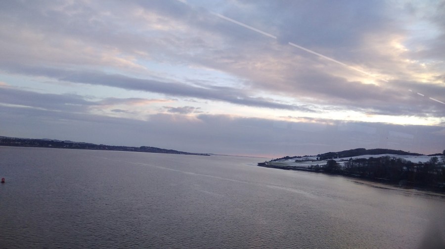
Crossing the Tay back to Fife as the sun rose
Unfortunately when I arrived at the St A bus station the bus company no longer operated out of it. I phoned up to find out where I could get the 77 back to the Wormit road, connecting to the ’emergencies’ line and feeling a little guilty as it was not exactly a life and death situation. I was concerned that I would not get to Newburgh before dark. The exceptionally kind man on the phone explained that there never has been a Sunday service of the sort I was waiting for! In the end, on hearing the note of desperation in my voice, he came up with a plan and 5 minutes later a second gentleman appeared in a van to pick me up. He had been called out of his bed to fill in for someone who was sick, left his own car at the depot and was on his way back to get it. He took me along with him!
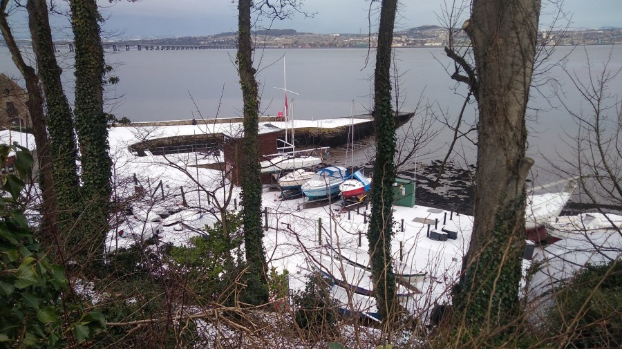
Woodhaven Pier, between Newport and Wormit, River Tay, Scotland
It was half an hour’s walk from Woodhaven to Wormit, first along the B946 (a residential connecting road where the pavement was all slippery from the snow which had hardened into ice overnight)……
The air was very clear as I looked across someone’s wintry garden to Dundee, Scotland
….then taking a right onto Bay Road…..
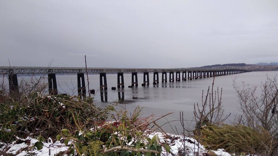
Tay Rail Bridge
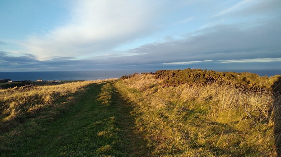
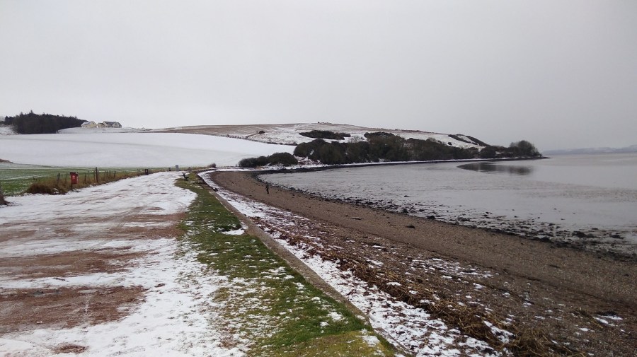
….bypassing Wormit proper and heading straight to the beach where the FCP runs across the strand for a bit.
I could see where I would be walking, Wormit Bay, Fife, Scotland
Wormit to Creich
It took half an hour to get to the start of this stage, so yesterday would have been exactly 7 hours if I had finished and today I must add an extra 30 minutes to the walk if I am to reach the final ending point in Newburgh.
It was raining / snowing – a dull, grey day.
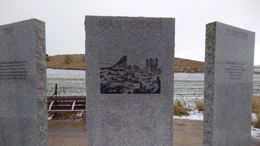
Tay Rail Bridge Memorial at Wormit Bay
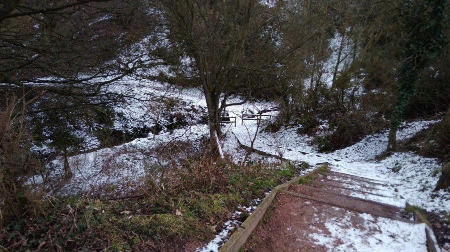
The local lady was right that I was due for a climb, despite the way it appeared on the map. She said she had avoided it because it was so slidey underfoot. I passed through the metal gates to keep the cattle in, and further on I appreciated the landlocked wooden seal sculpture.
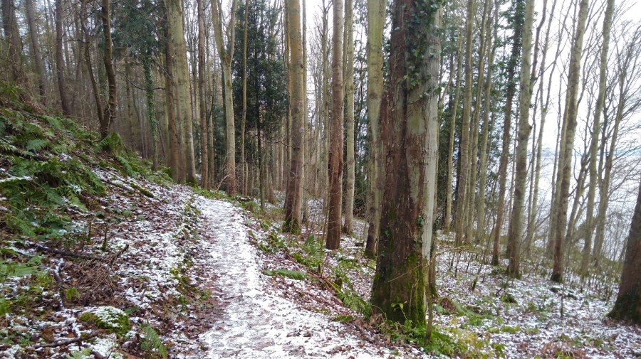
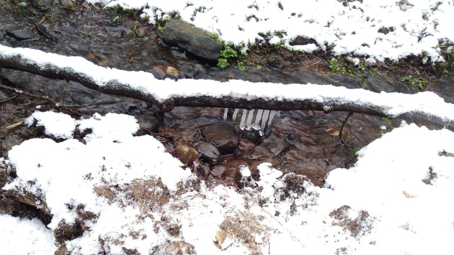
Looking down onto the watersideIcicles in the dellsThe path wound through woods away from the coast, up and down steps and across wee burnsThen it opened out – the arable fields were slopes of white and the copses made of bare twigs
Catkins dangled olive green, and other peoples’ footsteps showed me the way.
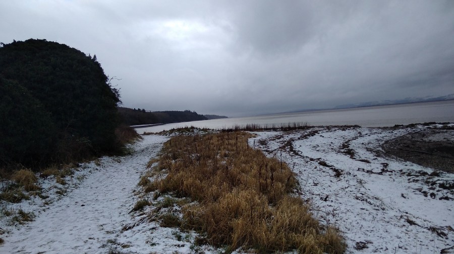
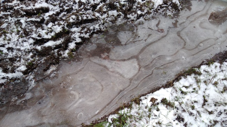
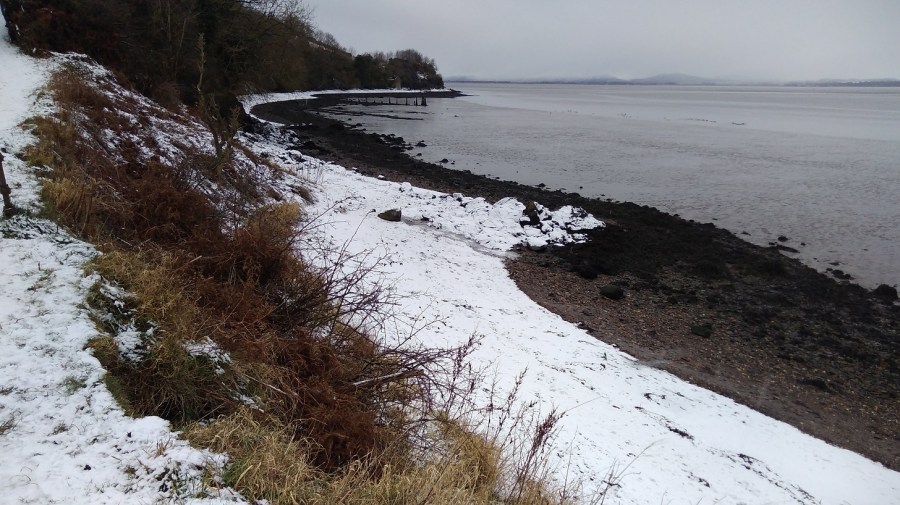
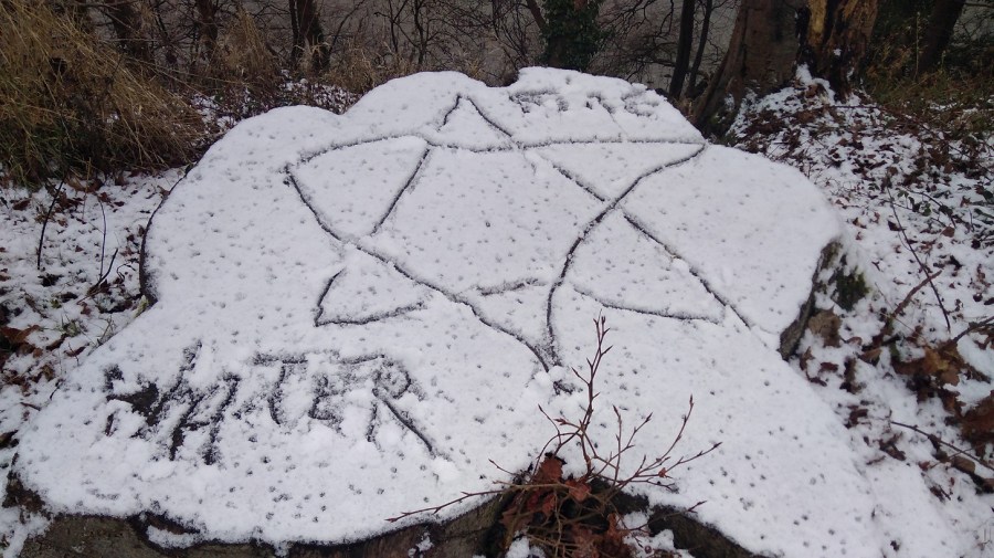
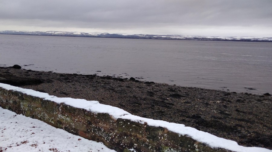
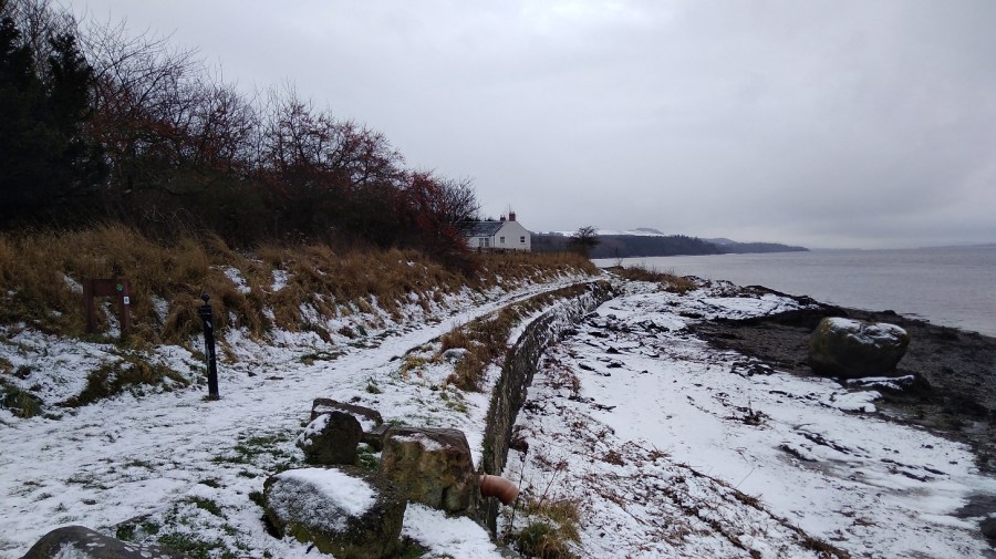
Drawn to making more of my marks in the snow – the dynamic relationship between the elements of fire and water, sun and ice, passion and reflectionStripes of muted greys: snow, stone wall, shingle, the estuary and the white covered hills of Tayside in the distanceThere were occassional dwellings along the way. I saw no-one
There was a quiet, gentle lapping of waves on the shore as I went between two houses.
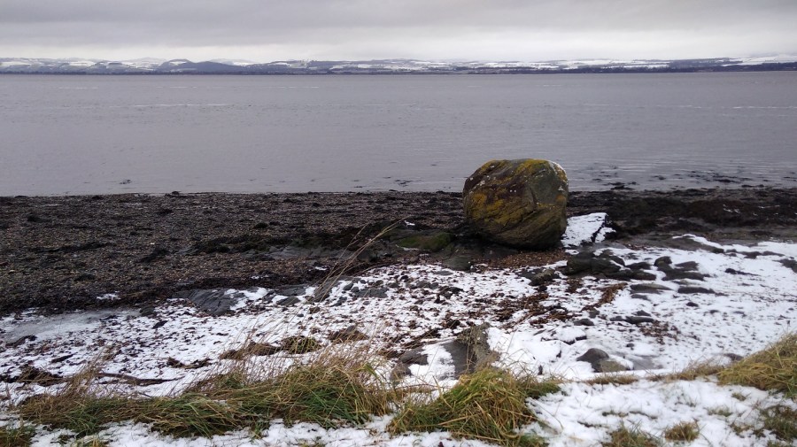
A massive boulder covered in gorse-yellow lichen on the half-white beach. The rest was grey. A flock of oyster catchers whizzed past, low to the water, followed by a loner, white stripes flashing to match the snow
A flying oyster catcher, Wikipedia.
Near here were plaques with children’s poems about the sea on them: I liked, ‘River lying patient and flat’
There is a stretch of stony beach at Balmerino – unusual for the FCP. I checked with three extremely well armed fishermen and yes, for sure it was along here and then through the woods. It was a great curving bay of bleak beauty.
Two little girls in their pink all-in-one ski suits pottered with their parents
I missed Balmerino Abbey which was marked on the map – it must have been inland, off the path.
At 11.30 I was having a lovely, peaceful, early lunch with my back against a gorgeous trunk with ivy vines twining up it, when the sounds of a boisterous group signalled they were clearly approaching from whence I had come. Surely they would have caught me with my knickers down had I followed the call of nature, so I didn’t do that! I hastily moved on and almost immediately passed another group going in the opposite direction. This pretty stretch is obviously popular for Sunday morning walking.
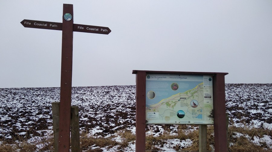
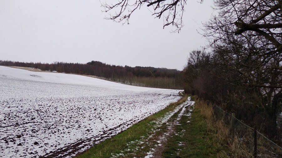
The Fife Coastal Path between Wormit and Newburgh, February 2019
My thighs were tight and stiff this morning after yesterday, and I could feel the effects of carrying the heavy pack such a long way.
Leaving the water behind, I started on the long, steep and icy uphill part. I realised that perhaps the official website meant 3 plus 5 hours not 3 to 5 hours, and I worried that I would not make it before dark. I was not sure what to do, so I picked up pace.
Up high and with a right turn I was on hard ground which was much quicker to walk on, near a residential area. I was trying to remember to keep my eyes open for the signs which are always harder to see in this type of situation.
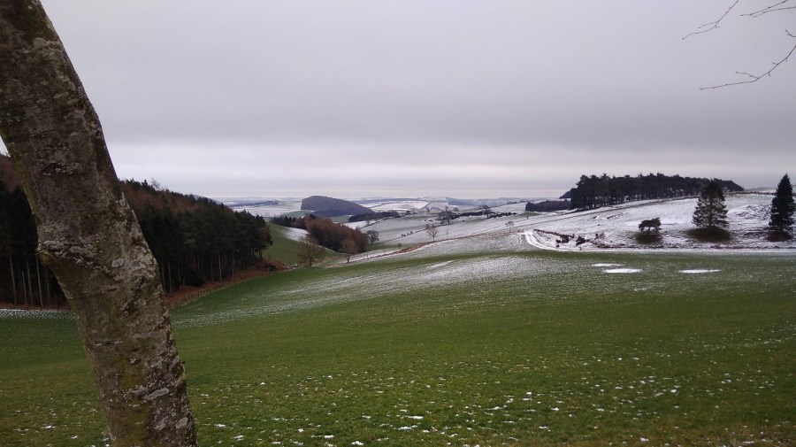
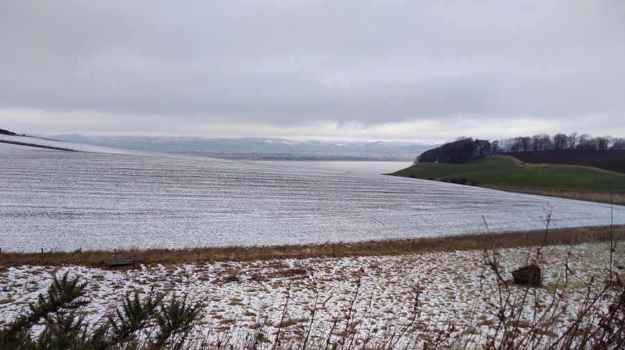
The hard climb rewarded this view – there are not many wide open vistas like this on the FCP
I passed places with names like Hazelton Walls, Creich and Pittachope (perhaps meaning ‘farm of the willow-place’). Black Craig Hill (203 m) was on the right.
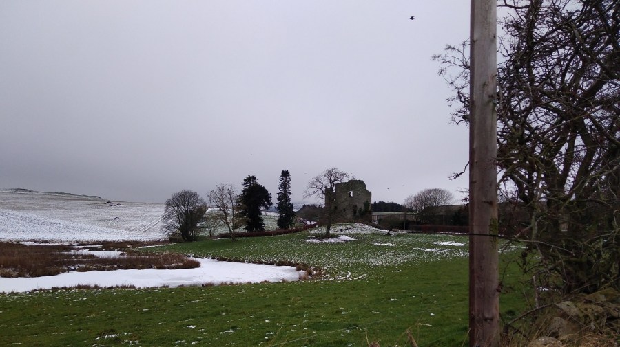
Ruined castle at Creich, Fife
Pittachope to Glenduckie
At 1.30 I was hauling myself gradually up a rural road with the cold wind on my cheeks. There was good visibility but with damp and wet in the air. It was a bit of a plod but I was focusing more on the moment than the future.
Then I took the left off the road to a steeper incline, passing a bearded man who cheerfully greeted me. His two boys were brightly clad in winter gear, and all three were pulling scarlet sledges up behind me, to play.
Ahead was Norman’s Law (285 m), the very same which was mentioned in the information I saw yesterday in Tentsmuir Forest. A law in this context, is a round or conical hill, often in isolation. It is at the eastern end of the Ochil Fault and you can walk in this place using the Walk Highlands directions. Also a hill fort site with its neighbour, Glenduckie Hill (what a great name!), you can follow Fifewalking’s instructions here.
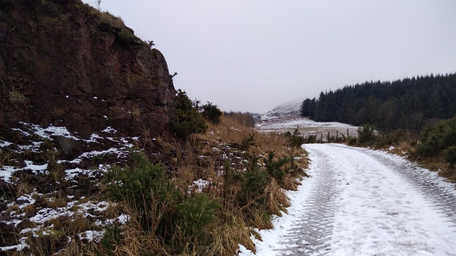
Serious, dark pines and red-brown crags, FCP, Scotland
What with the website duration being erroneous, gates which say ‘push’ when they mean ‘pull’, and these signs which say ‘keep left’ when they mean ‘right’ at the turn – nothing is as it seems – which exactly sums up my life right now!
Looking back I admire the Tay from a height
It was misty at the top of the steep climb. Some of the snow was like soft egg-whites and therefore hard to walk on.
There was a gorgeous smell of burning pine, presumably not a natural occurrence in this icy weather. Maybe, I mused, it was not mist or snow blowing, but the smoke. I thought I was at the top and about to go down at last, but maybe not.
A tree platform had been erected; the puddles were deeply frozen; I spied various animal tracks in the snow as I passed Red Fox Wood
I sat for a cup of tea and meditated for 5 minutes. There was a cave opposite and rustles were coming from it; a bird was making the sound which a dog makes when it has a squeezy, squeaky toy in its mouth. It was a peaceful moment.
I was coming to terms with the fact that there was more climbing ahead which meant views revealing bodies of dusty blue water including one shaped like a bagel somewhere in the vicinity of Blinkbonny (another wonderful place name)Going slowly downhill but there was another challenge ahead: Glenduckie Hill
I zig-zagged around farmer’s fields – cows in one, sheep in another. It was 14.45 and the sun had come out.
A brief lowland patch, past attractive cottages, well-loved gardens and woodland, nurtured sunshine anemones and snowdrops with their heads swaying from side to side in the breeze
Glenduckie was indeed an even steeper trawl uphill, albeit not to the actual summit. The path curved round and round, and up, and then there was a tiny slope down before another arduous climb.
I felt totally exhausted, but stopping meant that starting was well nigh impossible. It was still frozen underfoot – an icy rockscape and, beyond, windswept sheep.
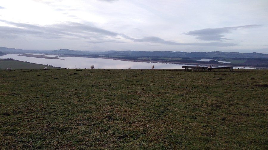
With great views of the mouth of the Tay Estuary, Fife
The approach to Newburgh
A steady descent, bumpy and slippery, meant I could see what I assumed was Newburgh in the distance for a long time – tantalising!
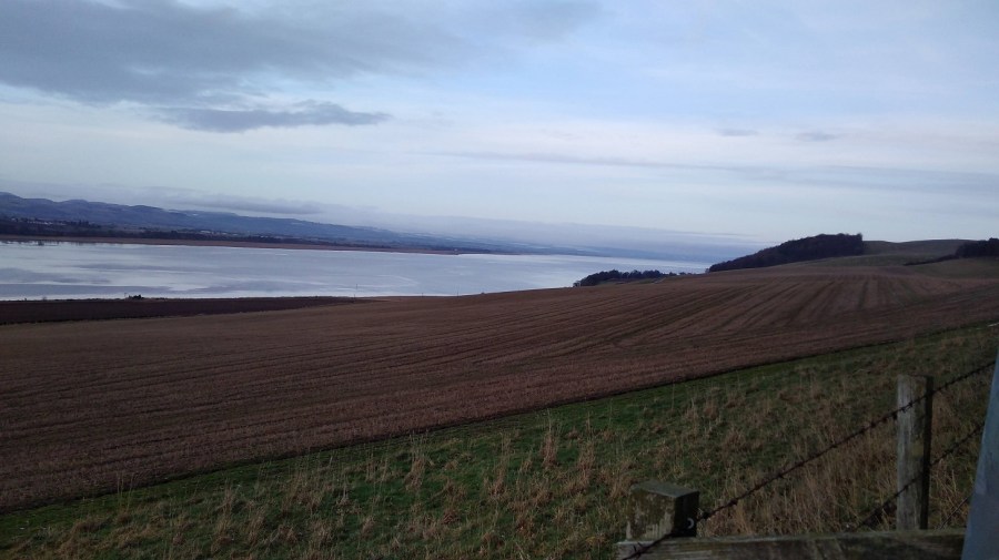
Lindores Hill (172 m) was on my left and to the right the estuary looked wonderful. The water was almost completely smooth, like glass. It reflected the tufty grey clouds and already there were the very faint hues of the sunset.
I struggled to stop thinking how tired I was, how much my body hurt, and that I hadn’t understood how long the day was going to be in advance. I spent some time using Clean Language questions to honestly ask myself why I was doing this. I knew I would get there eventually and that I wouldn’t do this again all in one stage. Once started it was tricky to stop, especially as I was so close to the end.
No danger of getting lost on this continual farm track. Or so I thought…
According to the map, at Old Parkhill there should be a right – Newburgh was clearly there, but the sign was to the left, so against my better judgment I took it. Of course it was wrong! I went through one very difficult gate and then straight on where there were lots of roots to negotiate at the bottom of a tree-lined slope. I admit I felt a tad miserable.
I had to climb over two fences. There was a huge hay bale and the barbed wire had been pushed down, suggesting that I wasn’t the first person to make this mistake. I couldn’t get over because I was too short and had the rucksack, so I found another way through.
I was back on the A913, the Abernethy Road, going into Newburgh past the church where the bus I planned to take later rattled past me. I found my way to the water’s edge using google maps as the sun was going down.
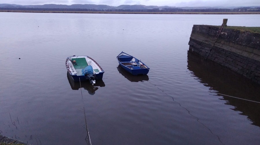
Oil-slick-smooth harbour water and a trek along the front to the park where the FCP ends, Newburgh, Fife
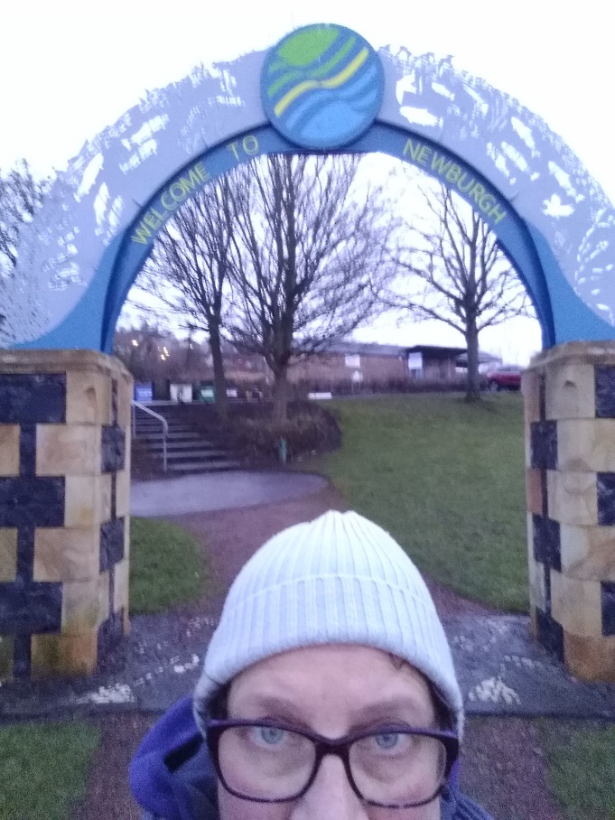
This last trundle seemed very long and the signs were once again poor. A helpful dog walker directed me at the last. Under the arch in Mugdrum Park, Newburgh I went, alone as I started….
Hooray – I had finished. How peculiar I always look in selfies!
From a public sign: ‘The Kings have gone but the kingdom lives on! Locked between the Firths of Forth and Tay, Fife is island-like, resolute and proud. It was the Pictish province of Fibh, last ruled by a king in the 9th century. Today, Fife’s wealth lies in the variety of landscapes, seascapes and townscapes which you can savour. Some say it taks a lang spoon to sup wi a Fifer, but you can be sure of a warm welcome from the people of the Kingdom.’
I went through the car park, took a left down Shuttlefield Street and left again along the High Street, where I found the bus stop by the Co-op supermarket (chocolate was needed). Opposite was The Bear Tavern where I toasted myself with a reviving Famous Grouse (whiskey) at the fabulous price of £1.20. The pub is run by the friendliest of folk and full of locals who were curious to know why I was there.
The 36 bus took me to Glenrothes where I narrowly missed the connection to Edinburgh. Fortunately there was an X54 along soon after at 18.55, and I was back home in Edinburgh around 9pm.


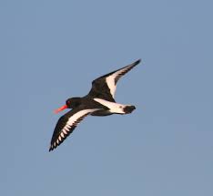 A flying oyster catcher, Wikipedia.