An account of the second part of a circular tour of Leith beginning at Bonnington Toll.
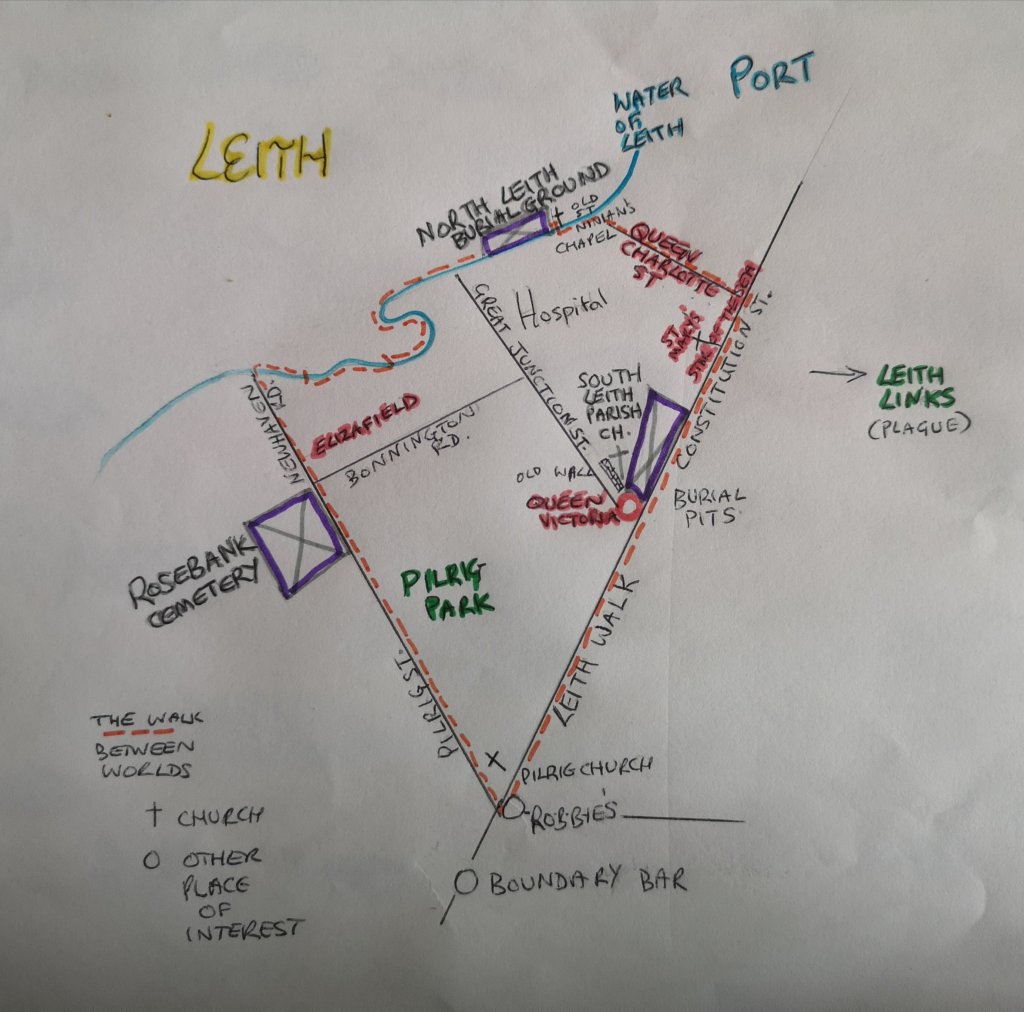
Route Map
Graves often have angels or birds at their tops and a skull and cross bones at their base – symbolising that the body dies but the spirit soars to heaven in the Christian tradition. The way, according to the ancient Chinese, is not so very different. The soul has different aspects to it, two of which are the Po which goes down to the earth at death, and the Hun which rises out of the top of the head and joins our ancestors
Focus on women
I chose to focus on women’s stories during this walk, because, as a woman and a feminist, it is necessary to know about who came before me, I need to know my backstory. I find that it helps me sense my place in the continuum of the generations. Several of these walks took place at the same time as the Audacious Women Festival, whose byline is: ‘Do What You Always Wish You Dared’. I was involved in the 2019 Audacious Women Festival, sitting on a panel which looked at women who travel and move to different countries: how we support ourselves, make friends, manage the language difficulties and so on. That women-only event engendered a lively discussion with the audience, in which women of all ages shared their emigrant and immigrant experiences. My first guided walks was open to men and women, children and dogs, and it was something I was daring myself to do!
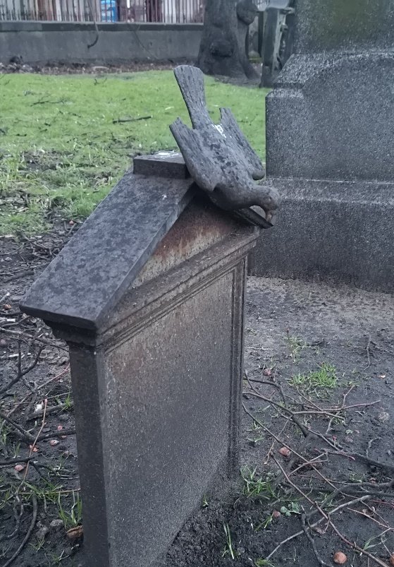
The tools of the leather workers’ trade on a grave stone in North Leith Burial ground, Edinburgh
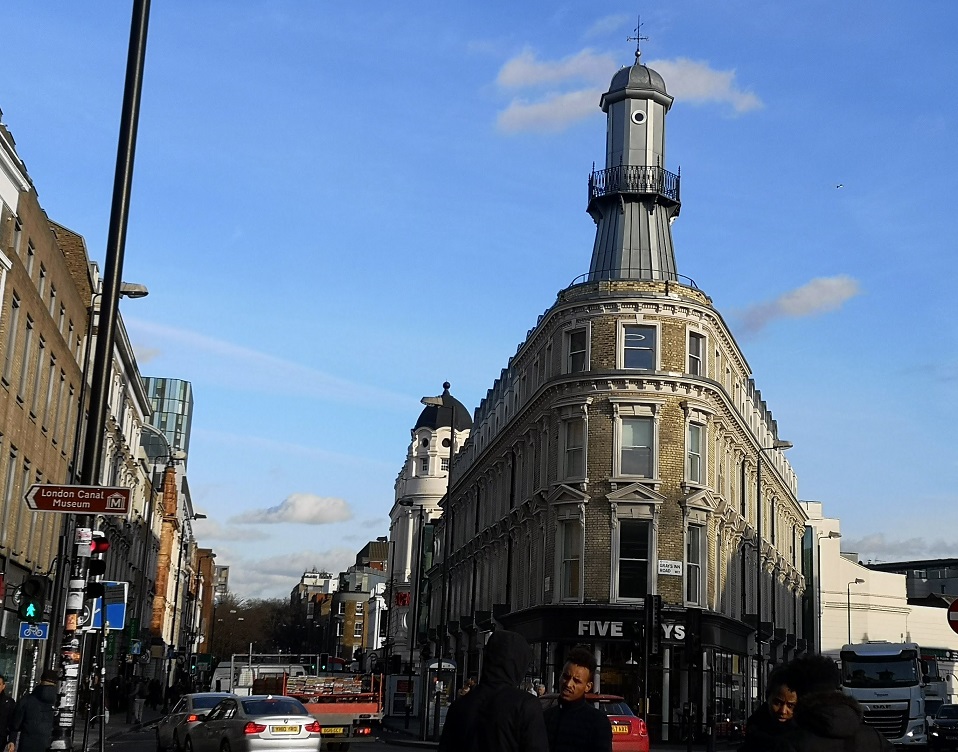
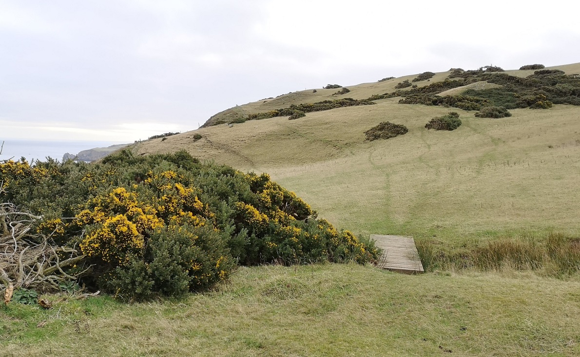
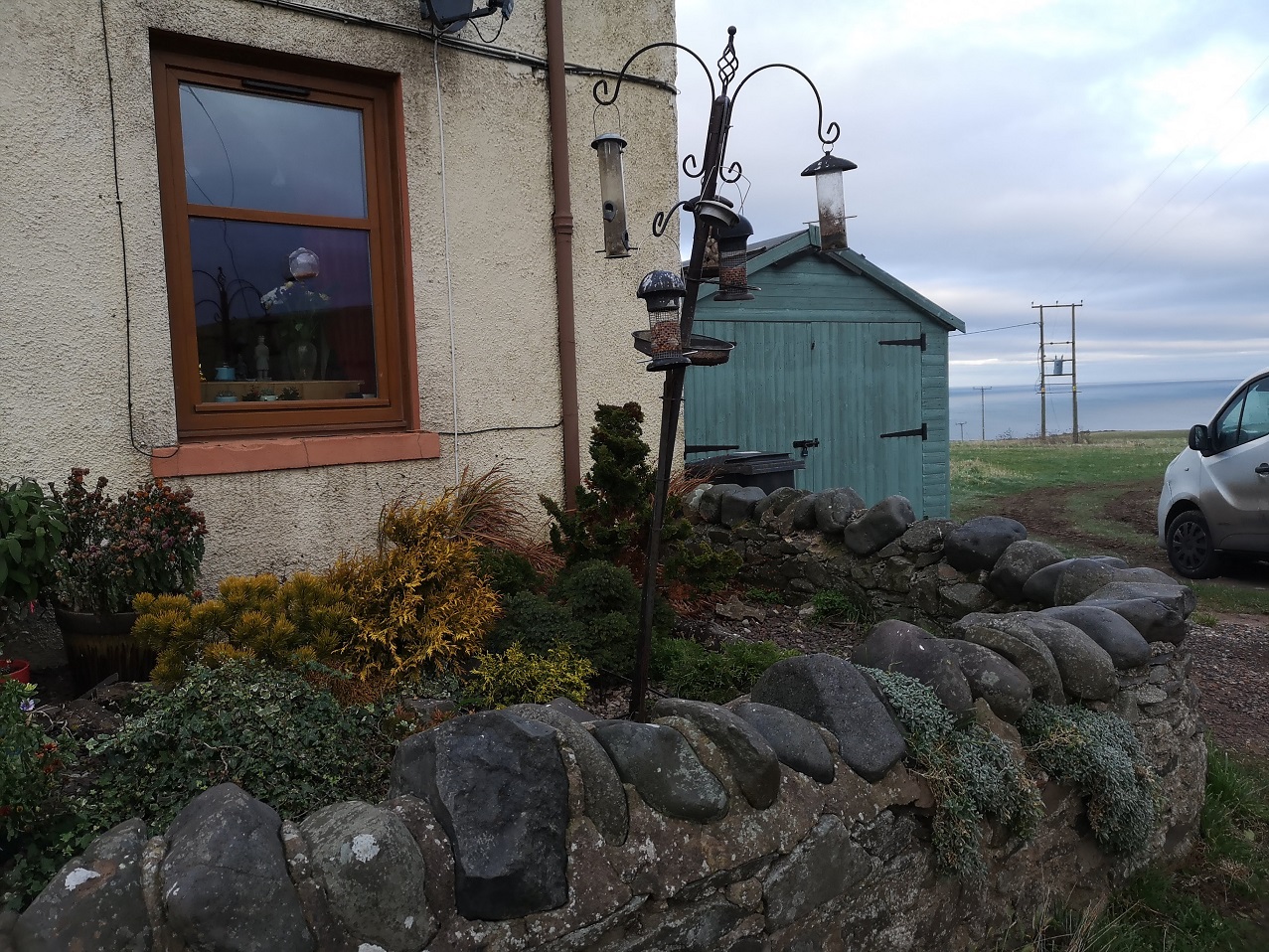
Bonnington
After leaving the Rosebank Cemetery, we cross Bonnington Road, a toll road at the end of the 18th century. We enter into what would have been Bonnytoun (pretty village in Scots), encompassing mills and land which was part of the Barony of Broughton (mentioned in a Royal Charter 1143). Flanking both sides of the road are modern estates as well as the much older red stone Burns Tenements (on the right), which used to be the tannery. We were also going to be seeing the graves of leather workers with their pincer tongs and other tools adorning them in the North Leith Burial Ground, further along the way. Using the power of the Water of Leith, there was a conglomeration of businesses in the Bonnytoun area, and there is one existing mill wheel in the mill lade at Bonnyhaugh Cottages (on the left).
Who was Eliza?
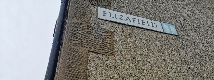
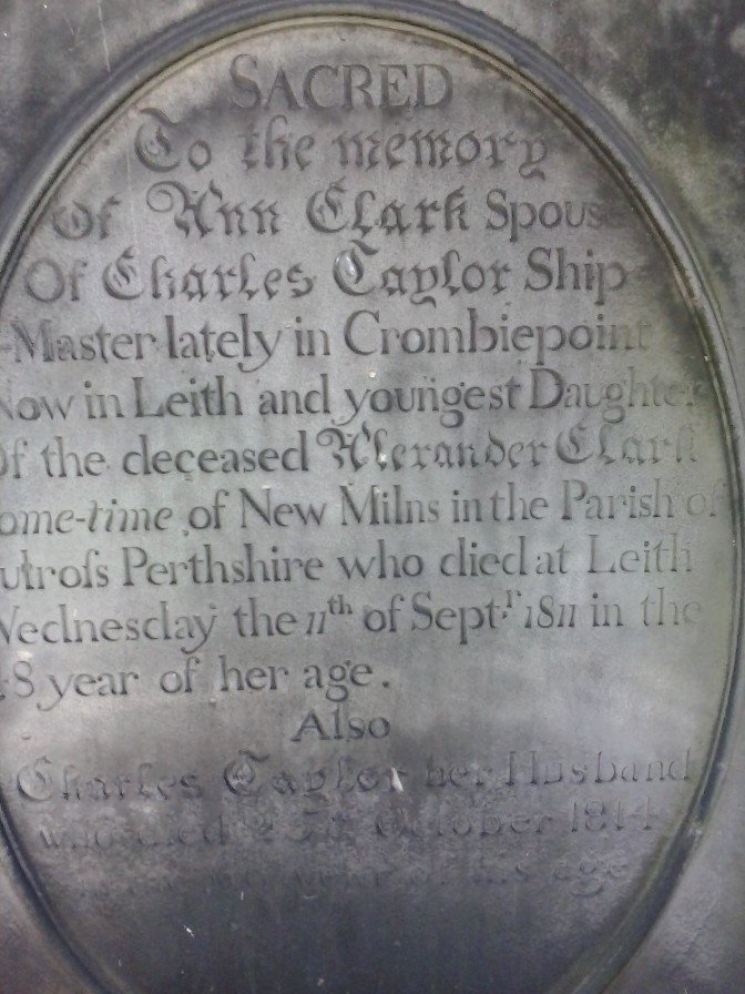
Second on the right is Elizafield, named after Eliza, a native of Leith, and the woman who bore Dr. Robert Grant. I have not been able to find out anything about her and her life. Her story has disappeared, perhaps deemed less important than his despite the fact that he would not exist if it weren’t for her, not least because birthing was such a dangerous task in the 1780’s. Grant was a surgeon and left Leith in his twenties to settle, very successfully, in South Carolina (US) marrying Sarah Foxworth. The rice plantation he established in Georgia (US) was also named Elizafield, and, as was the way then, it only drew the produce and profits it did, due to the female and male slaves who carried out the work: they were, ‘the driving force behind the success of the plantation’. (Amy Hedrick, author on glynngen.com)
Historically it [birth] was thoroughly natural, wholly unmedical, and gravely dangerous. Only from the early eighteenth century did doctors begin getting seriously involved, with obstetrics becoming a medically respectable specialty and a rash of new hospitals being built. Unfortunately, the impact of both was bad. Puerperal, or childbed, fever was a mystery, but both doctors and hospitals made it worse. Wherever the medical men went the disease grew more common, and in their hospitals it was commonest of all.
We turn our backs on Elizafield to view Flaxmill Place. Flax was used to make linen, most of which was exported. It was so successful (employing 10000-12000 workers, many of whom would have been women, although the data is unavailable), that we know the Mills were able to loan Edinburgh Council a great deal of money. The Bonnington Mills, on the banks of the Water of Leith, made woollen cloth as well as linen and much of the wool was produced by women in their own homes nearby. The owners were always aiming to improve profits and cut corners, which resulted in the controversial introduction of Flemish and French workers (accommodated at Little Picardy(ie), the current Picardy Place). The women and girls spun the cambric yarn (for the close-woven, light type of linen), to try and improve the quality of the cloth, but this took away the local jobs.
Persevere – representing Leith
In 1686, the first Parliament of James VII passed an ‘Act for Burying in Scots Linen’, the object of which was to keep the cloth in the country. It was enacted that, “hereafter no corpse of any persons whatsoever shall be buried in any shirt, sheet, or anything else except in plain linen, or cloth of hards, made and spun within the kingdom, without lace or point.” Heavy penalties were attached to breaches of the Act, and it was made the duty of the parish minister to receive, record and produce certificates of the fact that all bodies were buried as directed. On hearing this, we can imagine that the women in the graves we were visiting may have been bound in just such a linen shroud, made right in this place.
Women at work at the Burton’s Biscuit Factory, near Bonnington, Edinburgh
Before the Industrial Revolution, hand spinning had been a widespread female employment. It could take as many as ten spinners to provide one hand-loom weaver with yarn, and men did not spin, so most of the workers in the textile industry were women. The new textile machines of the Industrial Revolution changed that. Wages for hand-spinning fell, and many rural women who had previously spun found themselves unemployed. In a few locations, new cottage industries such as straw-plaiting and lace-making grew and took the place of spinning, but in other locations women remained unemployed.
Joyce Burnett (2008) This webpage has some fascinating pictures of women spinning at home and in the factory
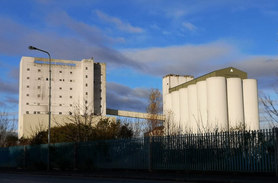
The current Chancelot Mill on Lindsay Road, Edinburgh, Scotland
A little further up the road is the original site of the Chancellot Mill (now on Lindsay Place) and this was where corn was ground into flour (perhaps the reason for those corn cobs on the Persevere flag?) It was steam powered and had an 185 foot high clock tower. Producing 43 sacks an hour (twice the original prediction), it was described as ‘the most handsome flour mill in the world’!
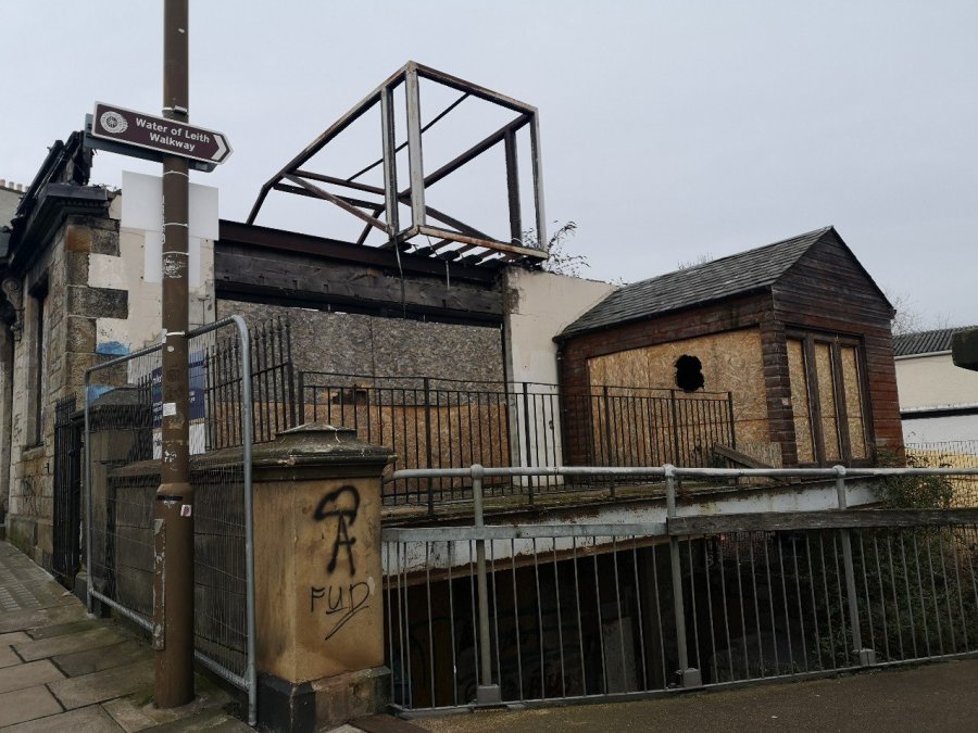
Site of The Bonnington pub, now destroyed several times over, Newhaven Road, Edinburgh
Urban myth
They were growing cannabis in the basement of The Bonnington and it spontaneously combusted in the middle of the night, causing the whole building to burn down. True or false?
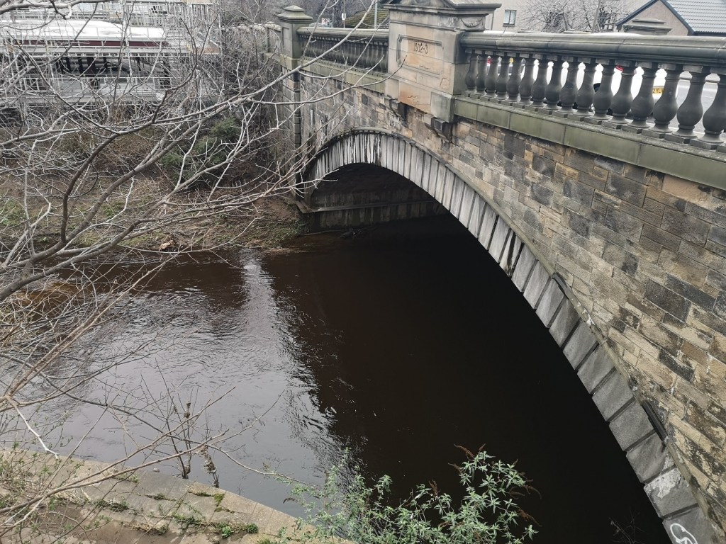
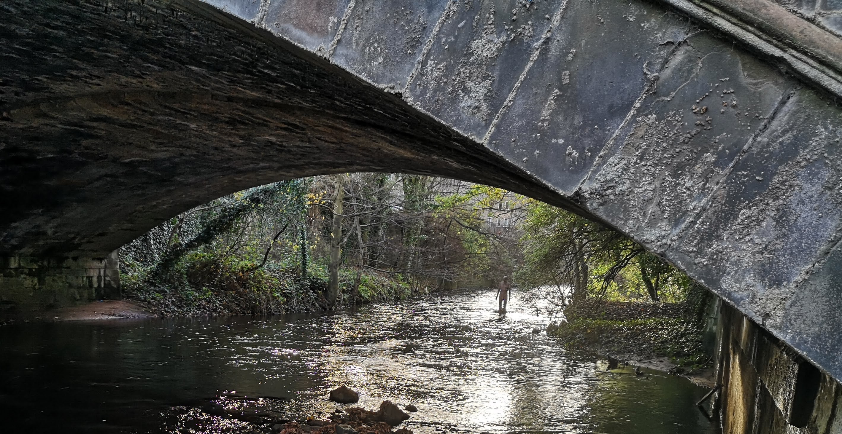
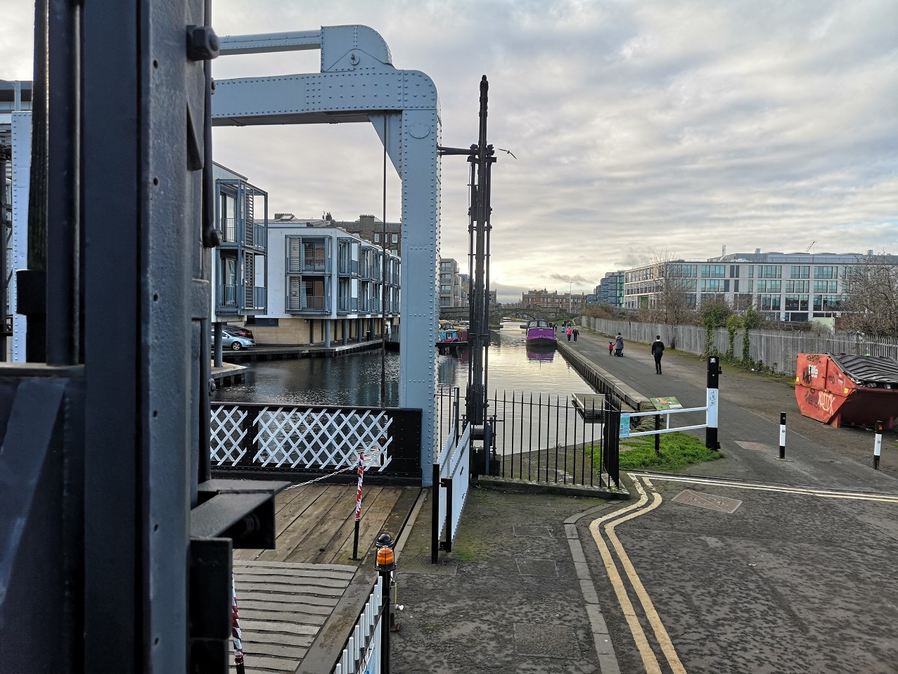
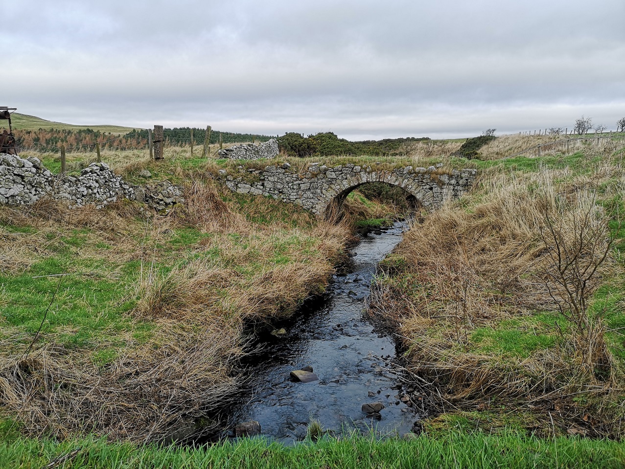
We then started to walk along the edge of a section of the Water of Leith, the border between land and liquid. Bonnington Bridge, Newhaven Road, Edinburgh
Water of Leith
I invite you to look into the water here and think of the phrase ‘time immemorial’. Legally, this refers to the years before 1189, being the date set, in 1275, as the time before which no one could remember, and therefore no legal cases could deal with events before that date. ‘Time out of mind,’ recorded from the fifteenth century, is just the plain English version of the same thing. My information came from here and here.
As we cross Anderson Place, this quote from the Tao Te Ching is one to ponder: “The Master gives herself up to whatever the moment brings. She knows that she is going to die, and she has nothing left to hold on to: no illusions in her mind, no resistances in her body. She doesn’t think about her actions; they flow from the core of her being. She holds nothing back from life; therefore she is ready for death, as a woman is ready for sleep after a good day’s work.” (50)
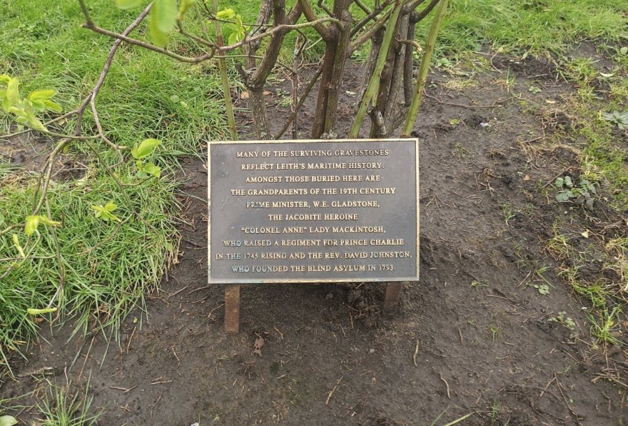
North Leith Burial Ground
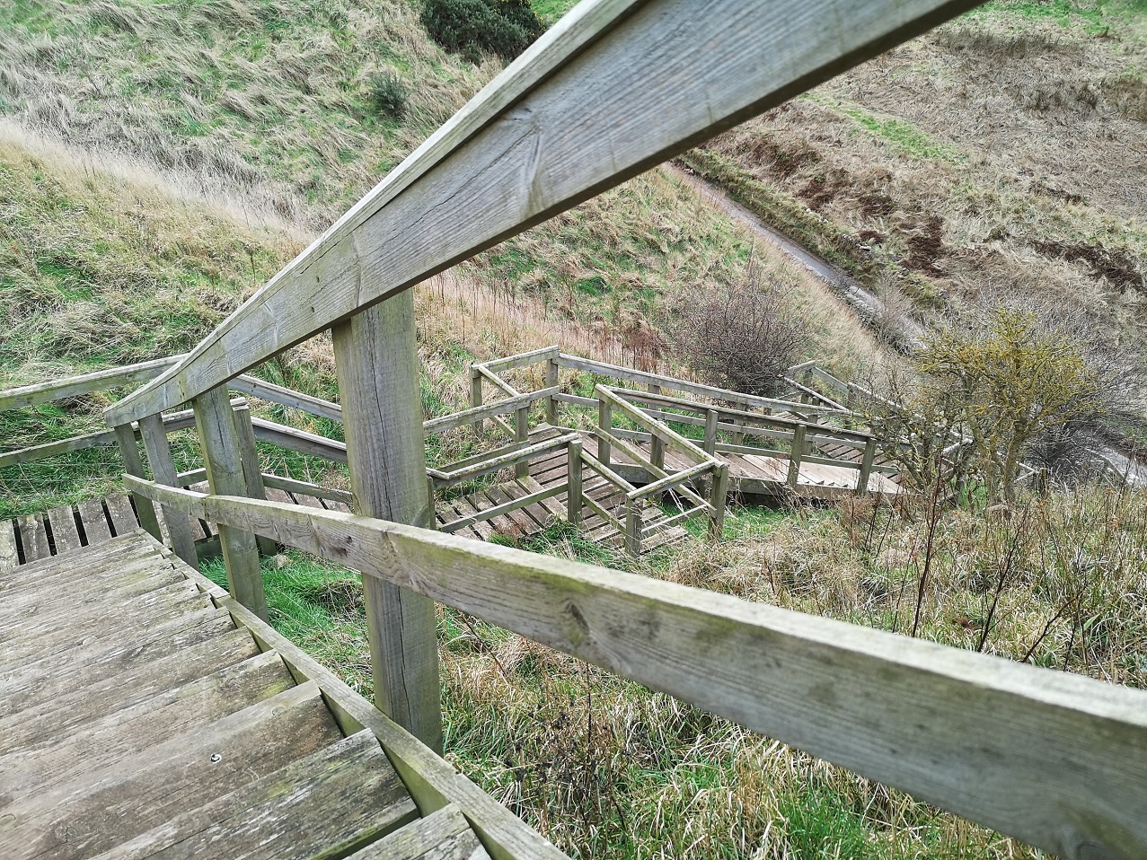
After rounding the corner of the Water of Leith and meeting the confluence of the wonderful network of Edinburgh cycle paths, we mount the steps onto Coburg Street where the North Leith Burial Ground is situated. According to The Spirit of Leithers (a Facebook Group) it is ‘The dead centre of Leith’!
Here is the plaque saying that Lady Mackinstosh is under this ground, but is she?
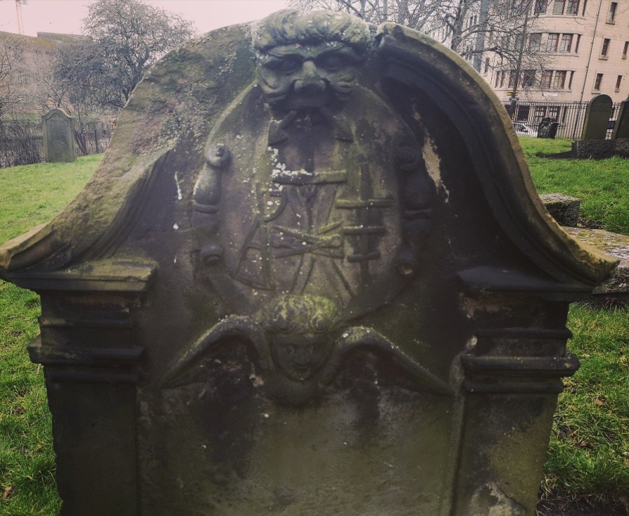
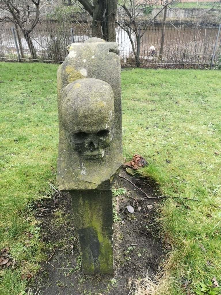
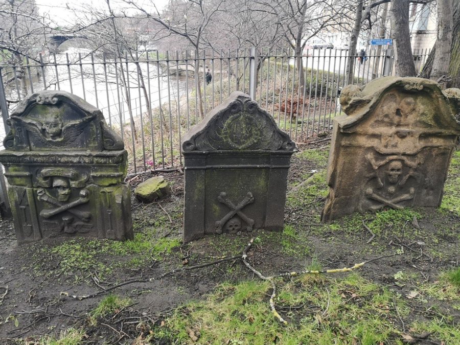
The memorial stones are old (1664 – 1820) and varied. There are grand mausoleums, individual slabs – some half buried and unintelligible – and almost all have engravings worth seeing. This is a good time for a ‘treasure hunt’: search for the grave of Lady Mackintosh; a long bone; angels; and hourglasses (note: some are on their sides and others upstanding, the sands of time sifting down through the narrow neck as life passes by).
The graves are thicker than usual, and this one has a skeleton head on one edge and an angel’s head on the other – death and life, North Leith Burial Ground, Leith
Angel and skull, North Leith Burial Ground, Leith, Scotland
Lady Mackintosh is famous for raising a regiment for Prince Charlie’s 1745 uprising (variously known as the Jacobite, the ’45 rebellion or the ’45). It was an attempt by Charles Edward Stuart to regain the British throne for his father, James Francis Edward Stuart.
In fact Lady Mackintosh is not here – she probably lies under the flats next door! How many people know that they are working or living over the top of dead bodies?
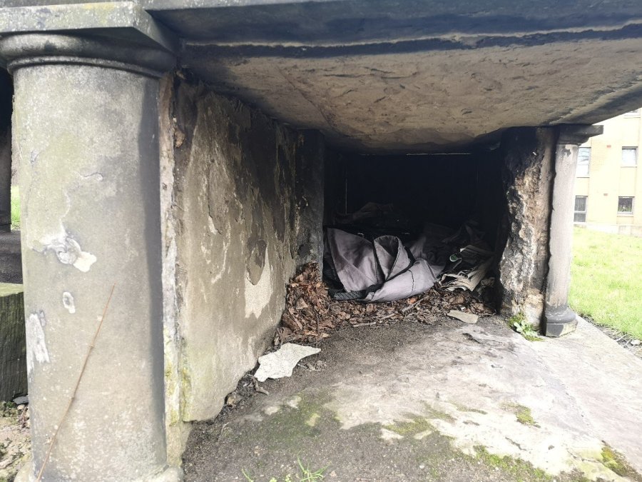
Sadly, it looked as if this was someone’s more contemporary (and probably rather cold) resting place. There are many homeless people who seek shelter in Edinburgh’s graveyards. North Leith Burial Ground, Coburg Street
If you have information about the women who are featured in the walk, have made a similar walk, or would like to share anything about these subjects, please do so in the comments box below.
This is part one of a circular tour of Leith, from Leith Walk to Rosebank Cemetery. Links to parts 2 and 3 are below.
Route Map
Can we ever stop for a moment? No! Time will always turn until we die. Is there ever complete quietness in life? No! But maybe we can quieten. Can we slow down? Well, walking is a good start. It leaves almost no trace and makes little noise. It allows time for thoughts to blow in, and for your footsteps to drown them out again.
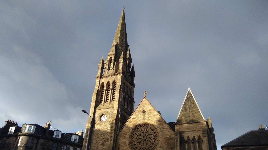
The Parish Church of Pilrig St Paul’s at the corner of Leith Walk and Pilrig Street, close by the old border of Leith and Edinburgh, Scotland
Here, we walk between the worlds of Leith and Edinburgh, connecting with the past by celebrating the ancient Deity of Boundaries (held on the last day of the Roman year) where citizens traditionally process around their land and promote continued peace and stable borders – something I sincerely advocate at this time of disagreement and instability over nationhood.
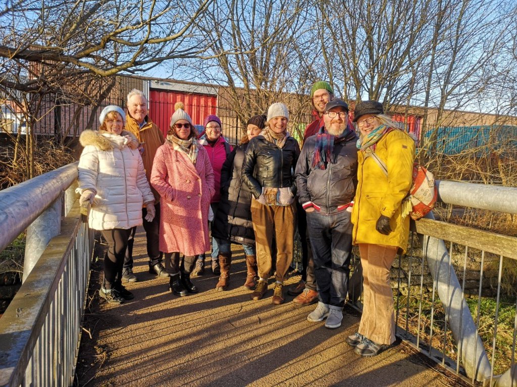
Most of the group who joined me for the walk in Edinburgh, Scotland
Before we set off, we remember the 1920 merging between Leith and Edinburgh which, ‘despite a plebiscite in which the people of Leith voted 26,810 to 4,340 against the merger’ (Wikipedia, Leith) resulted in division and the loss of political identity. This walk initially took place shortly after the initiation of a further detachment, this time of the UK from the rest of Europe, which was initiated by many of those who oppose the separation of Scotland and England.
Unequivocal reminders of our mortality, North Leith Burial Ground, Edinburgh, Scotland
Take a minute to remember, or dedicate this walk to someone you know, because the second aspect of Walking Between Worlds is the acknowledgment that we are all, always, stepping on a tightrope between life and death, never knowing when it will happen.
We will be visiting the graves of notable women in Rosebank Cemetery, North Leith Burial Ground and South Leith Parish Church. I have a special interest in the lives of women who are often forgotten or overlooked, and I want to focus on those who are connected to this area.
The steps we take between an information stop on a guided walk such as this, or when on errands, from one hiatus to the next, are equally, if not more important. They are an opportunity for exchange with others or silent contemplation in the middle of busyness.
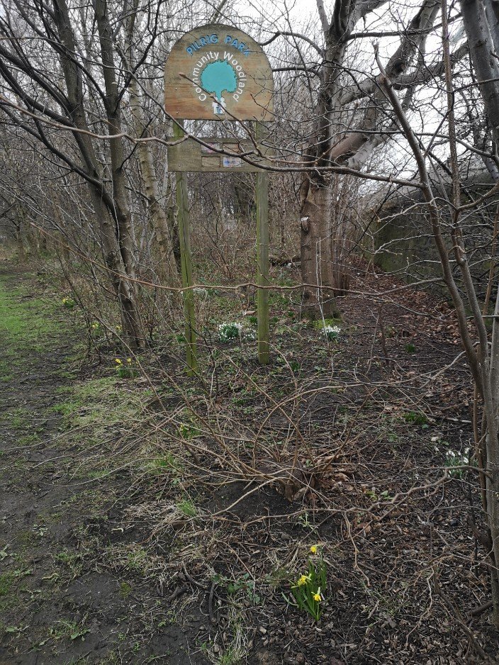
Pilrig Park Community Woodland
We make our way past Pilrig Park. The community woodland was planted by the Friends of Pilrig Park (and supported by Fields in Trust) way back when I had my allotment there and my kids were wee. Years later it is thriving – a lovely spot for hiding and playing in, whether you are human, animal or bird.
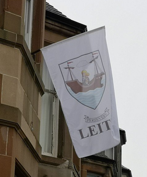
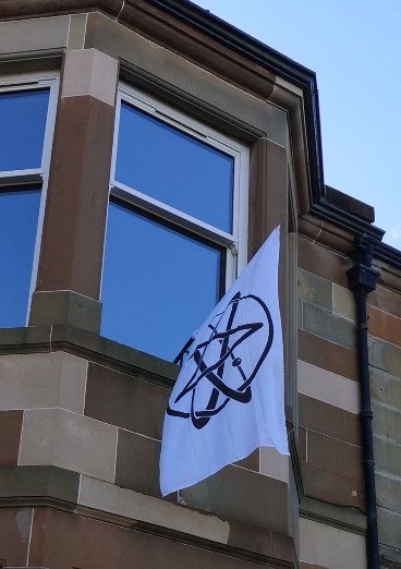
The flag I saw on my walk rekkie – the Leith pennant
Nearly opposite, we make our first stop to note the Leith (with its motto of ‘Persevere’) or other flag which blows from a top window.
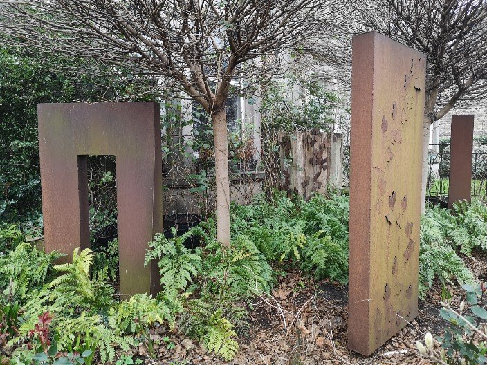
Another one which flies here sometimes – I am told it represent Space Cadets Sculptures in a front garden on Pilrig Street, Edinburgh
At #86 there are metal sculptures worth admiring in the front garden. A gateway (perhaps it is between worlds), and a panel that is the shape of a large gravestone with leaf motifs in relief, are my favourites. I cannot identify the sculptor, and take this opportunity to share that Fi Bailey, an Edinburgh artist, draws our attention to what may be private information which those who are dead or behind closed doors cannot or do not want to disclose. Let’ us focus, then, on what exists before our eyes.
Tip: In the interests of mindfulness and memory, when or if you see something which interests you as you are walking, say it to yourself three times for later. You may still forget, but that doesn’t mean you didn’t see it and that traces of it aren’t going to stay with you, ready to pop up in another moment.
Rosebank Cemetery
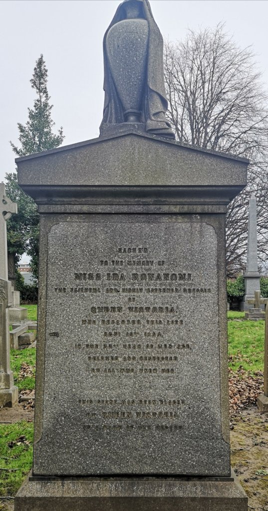
The elegant grave which marks the resting place of Ida Bononomi, 1854, Edinburgh, Scotland
In the same way that there is no night-time dark without a glimmer of light somewhere, so there is no life without some death in it and no death without life. As the bodies in the first graveyard, Rosebank Cemetery, decompose, they become earth and support living things which are in that earth. We, by being interested and remembering those who are interred, raise the dead in a manner of speaking.
We stand in front of the grave of Ida Bononomi (probably Italian). It reads, ‘Sacred to the memory of Miss Ida Bonanomi, the faithful and highly esteemed dresser of Queen Victoria, who departed this life October 15 1854, in the 37th year of her age. Beloved and respected by all who knew her.This stone had been placed by Queen Victoria as a mark of her regard’. Bononomi’s job was a position of extreme intimacy with the monarch.
That Autumn, Ida had travelled with the Queen and stayed with her at Holyrood Palace where the former fell ill. In her journal, the Queen wrote, ‘Saw Sir James Clark, who brought me a telegram with the this sad news that my excellent maid Ida Bononomi, whom I had had to leave at Holyrood as she had become so ill, not having been well at Balmoral before – had died last night. It was a great shock to me, & I was thoroughly upset, for no one, including Sir James had apprehended any immediate danger. She was the kindest, gentlest, best being possible, & such a pleasant servant, so intelligent, so trustworthy & her calm, quiet manner had such a soothing effect, on my often over wrought nerves. To lose her thus, and so far away, surrounded only by strangers is too grievous. Everyone was shocked & grieved, for she was quite adored.’
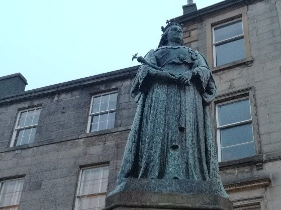
Queen Victoria standing at the foot of Leith Walk. We pass her in our final stage
Queen Victoria liked funerals and had an interest in the protocol of mourning, ‘a mentality as much as a personal observance’ (see below for references). It is known that she recognised the deaths of her housemaids and others with ritual in which other members of the household were require to be involved, and also that she visited this grave six years after Ida died.
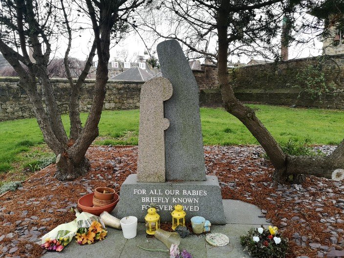
Moving monument to stillborn babies, ‘briefly known, forever loved’ at Rosebank Cemetery, Edinburgh, Scotland
There are, of course, many other graves of interesting women in this cemetery, and there is one which commemorates the stillborn babies who, by Scots law, cannot be cremated and must be buried.
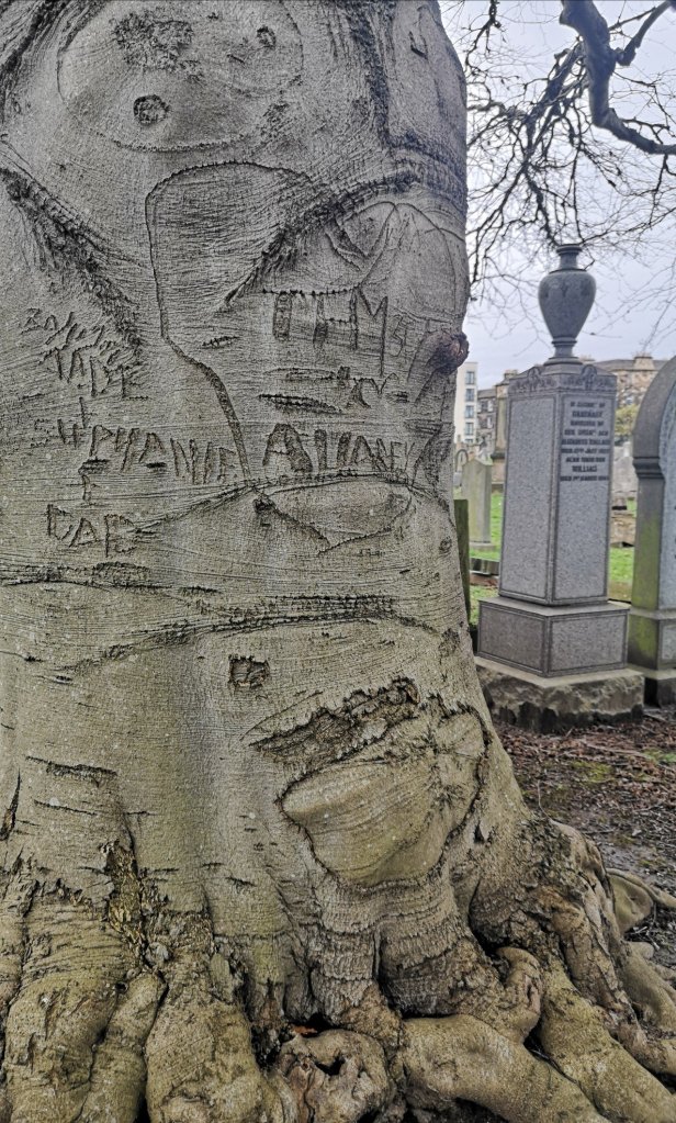
Arboglyphs, tree markings at Rosebank Cemetery, Edinburgh, Scotland
Arboglyphs can be seen at the cemetery and they contrast with the grave inscriptions and, later, the graffiti which we saw beside the river. These different types of markings are official and unofficial, consisting of numbers, letters, words and images cut into or sprayed onto stone or bark with or without permission. They engrave death, and mark political or personal messages, causing us to remember and take note. They sometimes do damage to community surroundings and cause loss of life to the tree, but are always used to communicate and are often enjoyed, even viewed as art.
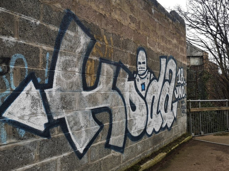
On first sight I thought this graffiti was a skeleton, but it is not. Located beside Bonnington Bridge on Newhaven Road, Edinburgh, Scotland
Introduction to a walk around the Leith boundary, taking in the Rosebank Cemetery, the North Leith Burial Ground, and the streets in between, with information, photos, video, maps and conversation about the wonderful women associated with Leith’s past and contemporary connections.
Home drawn map of the Walking Between Worlds route in Leith One of the Anthony Gormley statues in the Water of Leith over which we walk as part of the tour
(This walk was originally made on foot with a live group in Edinburgh on 23 February 2020, 3pm – sunset (5.30pm). This event has now taken place but it is hoped that there will be more in the future.)
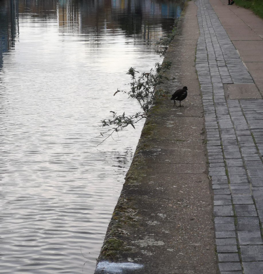
A bird walking between worlds
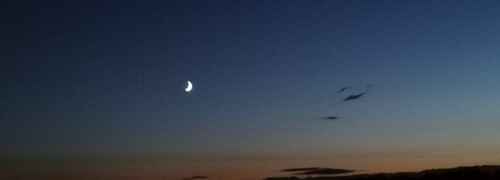
The original tour was a circular one of approx. 2.5 hrs, that meditated on boundaries and borders – between one community of people and another, day and night, life and death and on the cusp of the new moon.
A new(ish) moon
We visit the graves of notable women in Rosebank Cemetery, North Leith Burial Ground and South Leith Parish Church. Briefly, at each stopping place, we face the memorial stones, and learn about their incumbents.
The North Leith Burial Ground is ‘the dead centre of Leith’ according to The Spirit of Leithers
Grave stone, North Leith Burial Ground
The steps we take from one stopping place to the next, are equally, if not more important, so take note of them too. You are invited to walk in memory of loved ones, and to muse on life and mortality. It is an opportunity for exchange and silent contemplation.
Pilrig Church, Leith Walk. At the border between Leith and Edinburgh
The walk starts at the join of Pilrig Street and Leith Walk, opposite the location of the Boundary Bar (now renamed as Bier Hoose) which marked the former border between Leith and Edinburgh, and terminates at Robbies Bar on the corner of Iona St and Leith Walk, more or less opposite the start. There you can find libation and chat about where you have been – both in yourselves and the city.
Lady Mackintosh who raised a regiment for Prince Charlie, was buried in the North Leith Burial Ground, Edinburgh
Always wear hardy shoes or boots for tramping pavements and negotiating sodden grass between stones and at the edge of the Water of Leith.
Psychogeography is ‘The study of the precise laws and specific effects of the geographical environment, consciously organised or not, on the emotions and behaviour of individuals.’
Terminus was one of the really old Roman gods. He didn’t have a statue, he was a stone marker, and his origin was associated with a physical object). He had influence over less physical boundaries too, like that between two months, or between two groups of people. Terminalia is celebrated on the 23rd February which was the last day of the Roman Year, the boundary between two new years.
Women Who Walk
TI am a member of Women Who Walk. This network is for women who use walking in their creative or academic practice, and it includes artists, writers, field historians and archaeologists, psychogeographers, and academics.
I led a series of these walks, in-person and online (for anyone who was ambulant or not, in Edinburgh or not!) including ones that were part of the Audacious Women Festival 2021, Women Who Walk, and Terminalia Festival (2023 and 2021).
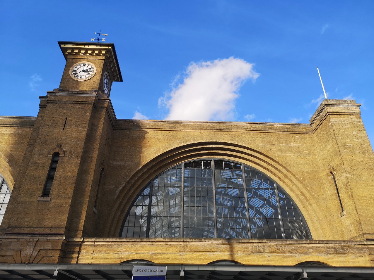
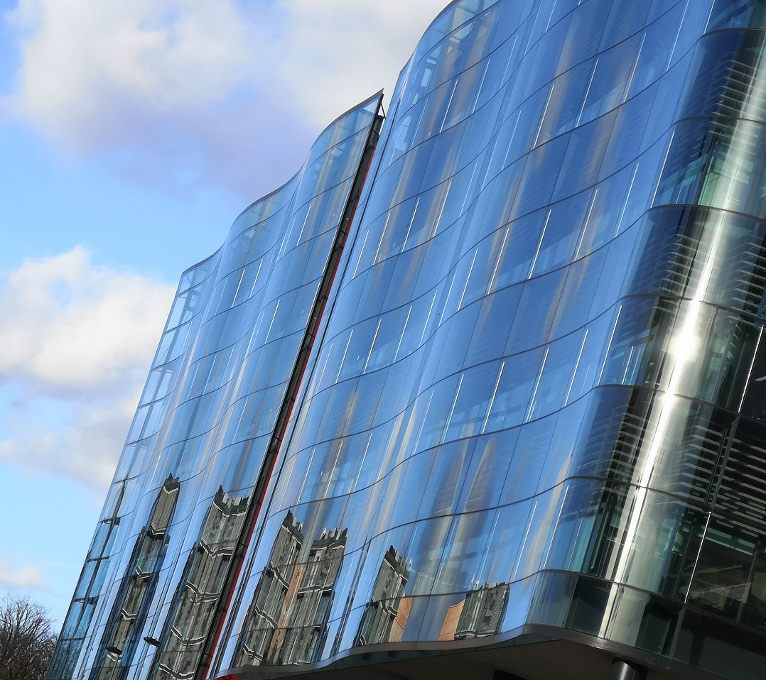
I turned left out of Kings Cross station and left again onto York Way. I was seeking Wharf Road Gardens (connected to Handyside Gardens).
‘The name [King’s Cross] derives from a statue-topped structure erected in 1830 on the junction, or crossroads, between the roads now known as Euston Road, Pentonville Road and Grays Inn Road. The statue, you guessed it, was of a king – King George IV to be precise – who had died that year.’ Culture Trip
Chat on the street, Kings Cross, London
Past Pret with its cucumber hoarding, old buildings and new, a sign for The Guardian newspaper offices (Farringdon Road) advertising ‘Hope is Power’, and King’s Place with its vertical, undulating reflective surfaces.
I cannot resist a reflective surface and tilted, it caught the light better, Kings Cross, London
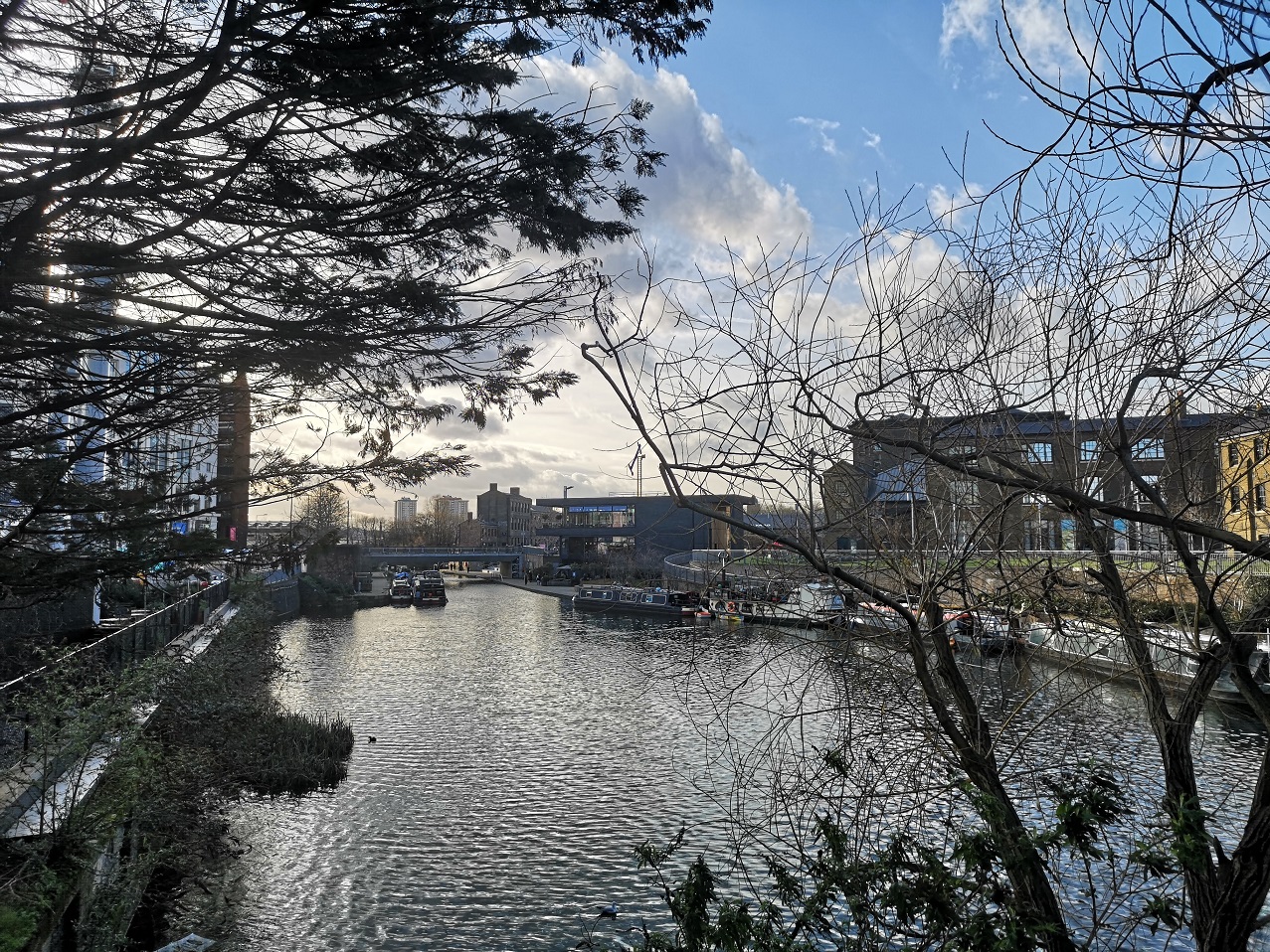
Soon I crossed the Regent’s Canal with its long boats, both residential and for business. Turning left again, I wound between patches of grass and raised beds. Apparently the London Underground trains run a mere 4.5 metres below the surface and so the soil depth is insufficient for planting.
Looking west along the Regent’s Canal from York Way, London
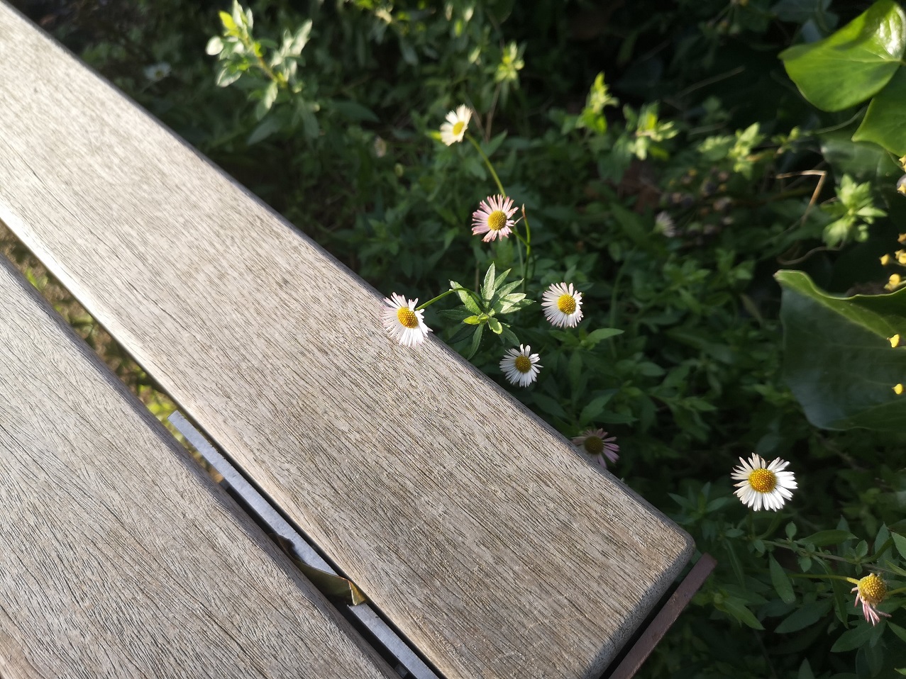
Little daisies opening their hearts to the sun. There were strawberry plants with fruit (honestly) and all manner of sprightly Spring flowers
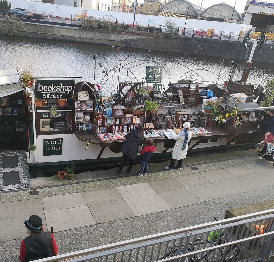
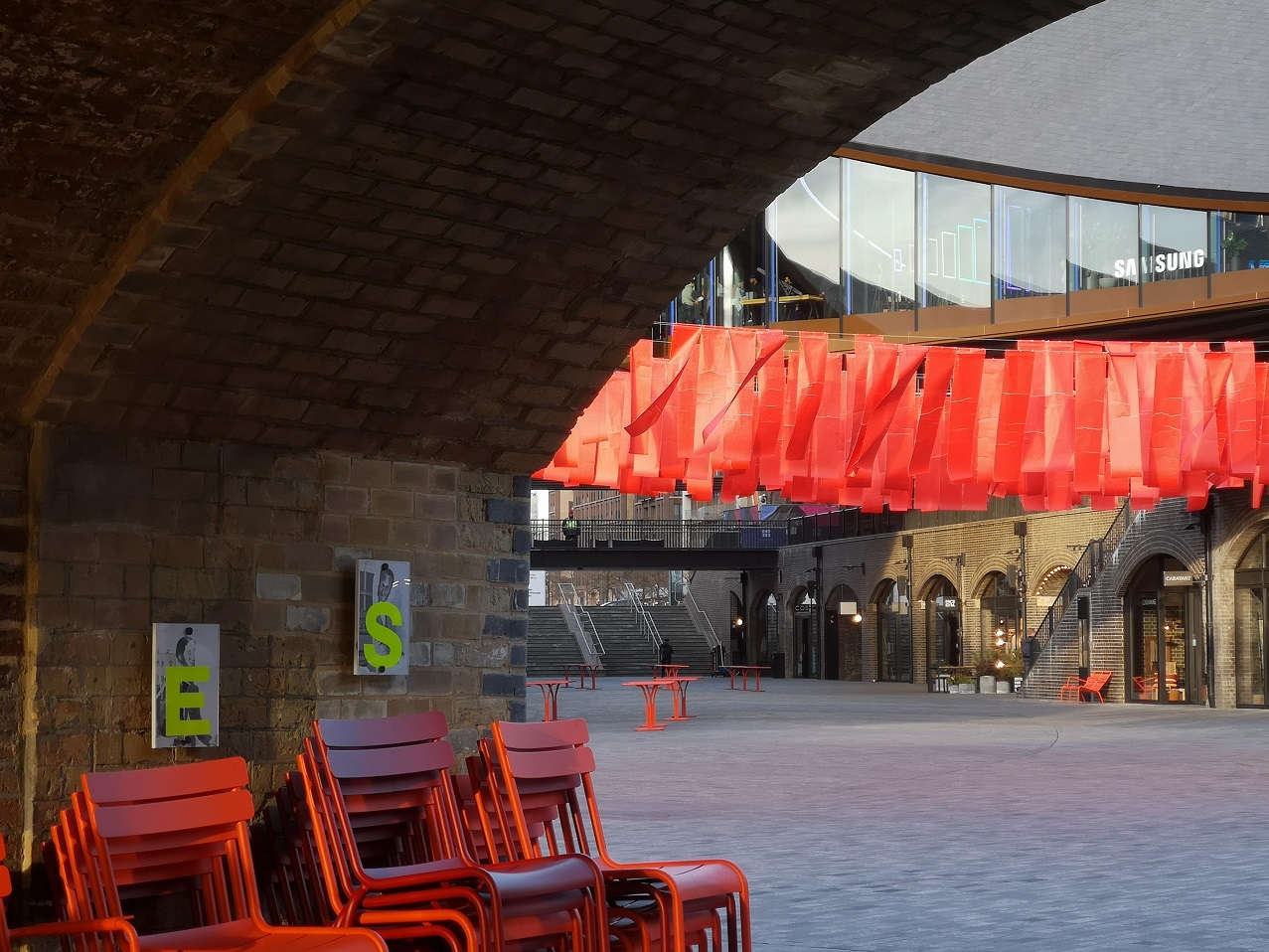
Wharf Gardens incorporates Coal Drop Yard, Granary Square, King’s Boulevard, St Pancras Station and West Handyside Canopy – all very ‘regenerated’ and rather chi-chi. However, I discovered many interesting places, not least the Word on Water bookshop.
Word on the Water Bookboat, Regent’s Canal, King’s Cross, London
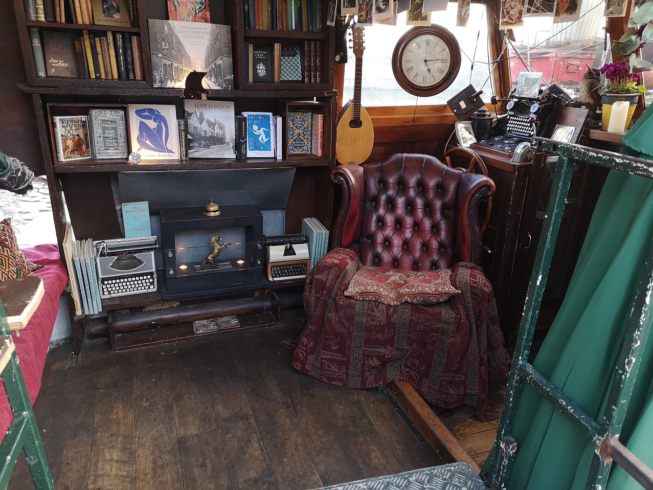
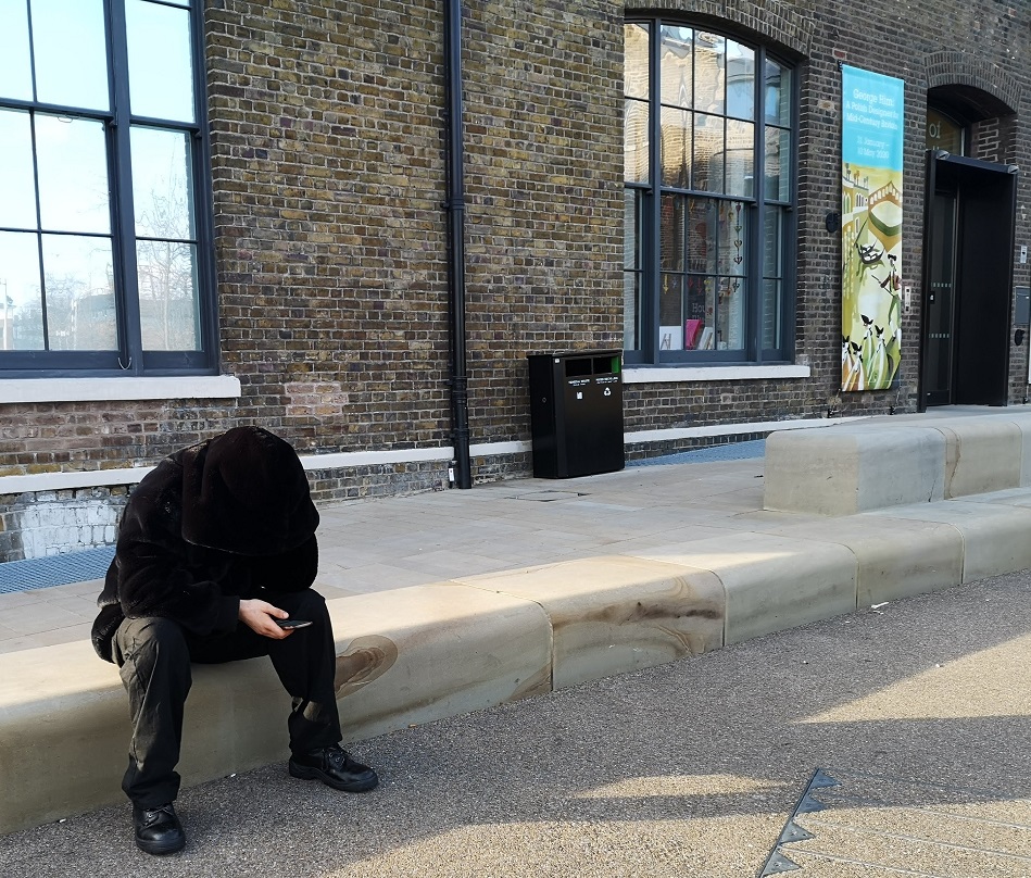
There was a little contretemps – a woman who was not in full control of her behaviour needing a smoke and most insistently tramping through the shop – which the gentleman in the bowler (see above) managed admirably.
Part of the interior of the Word on the Water bookshop, Regent’s Canal, Wharf Road Gardens, London
The House of Illustration was there, with fascinating sounding exhibitions such as W.E.B DuBois Charting Black Lives. Not much further on was Central St Martins (CSM) art school collaborating with Shades of Noir in a window display, impressively focusing on ‘the historical white dominance of institutional ownership of archival material’ within the CSM Museum.
House of Illustration, London
There were people playing table tennis in the massive, roofed community space (I wanted to join in) and Art Fund at the Coal Drops Yard.
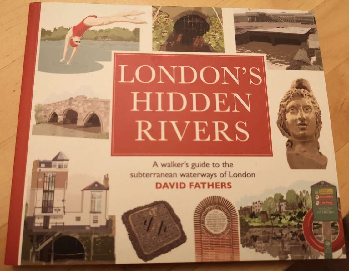
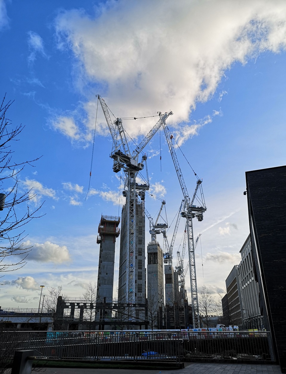
Down by the canal, I bought a book a lovely little book, London’s Hidden Rivers, a walker’s guide to the subterranean waterways of London – the sort of thing I would have liked to write! And admired the cranes against the picturesque sky.
Perhaps the remains of Chinese New Year celebrations – red streamers blowing in the wind
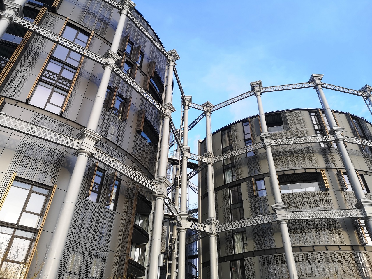
The Canal and River Trust have done a great job of opening up the canal for all of us to enjoy – those walking, jogging, pushing buggies and the school boys smoking joints. Under Somers Town Bridge I trundled with my suitcase, opposite Camley Street Natural Park which I discovered last year (see the link below to an earlier blog, with photos). Past a flight of smart stone steps upon which you could sit and watch the coots and moorhens rush by and up to the St Pancras Lock and Basin, and Gasholder Park, a tremendous new conversion of the disused gasworks.
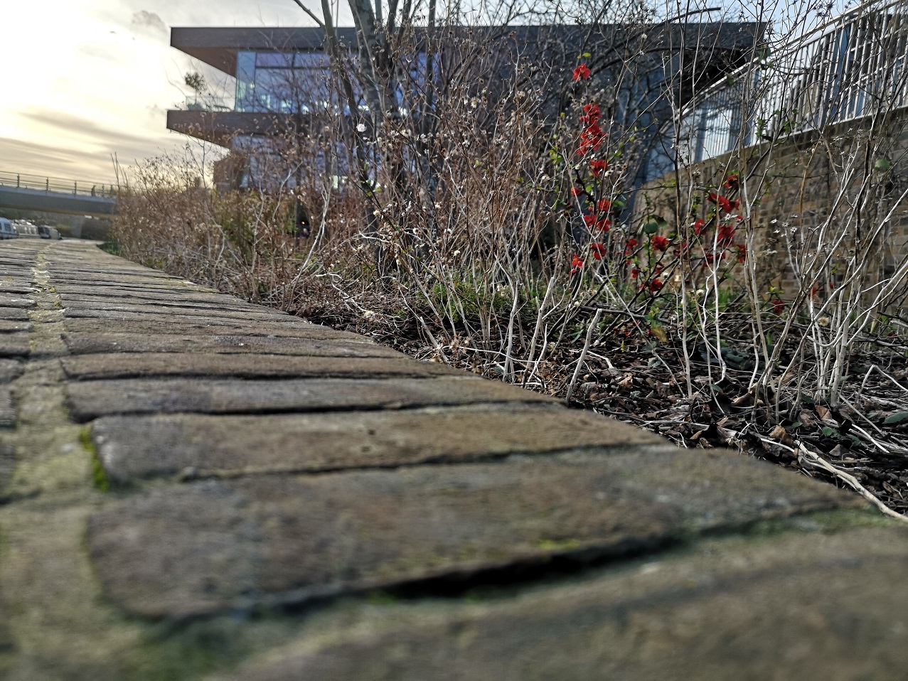
New blooms amidst the remains of last year’s dry stalks, Regent’s Canal, London
A man was putting his back into it, tightening a sheet on the roof of a barge. The vessels were all colours of the rainbow, some more modern than others, one with a bright blue old-fashioned wheel, but no-one was going through the lock as I approached.
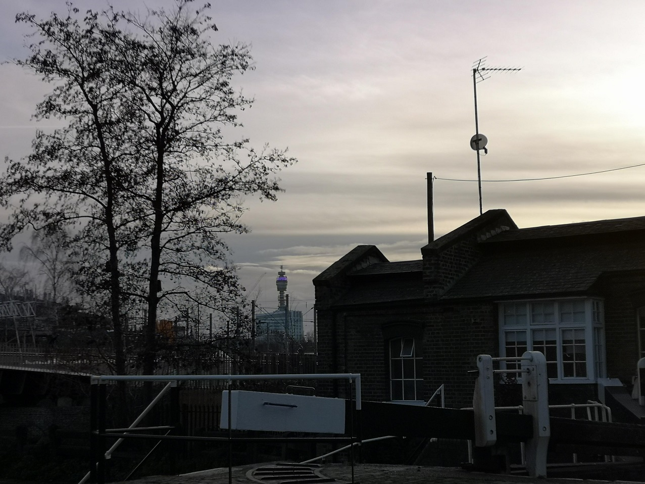
The BT Tower as seen from St Pancras Lock, Regent’s Canal, London
Gasholder Park, Regent’s Canal, London
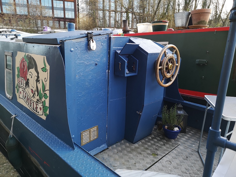
It all reminded me of a recent visit to a friend’s boat for breakfast on the Edinburgh and Glasgow Union Canal, the Leamington Lift Bridge and it’s waterside community, so I had some idea of what was below decks.
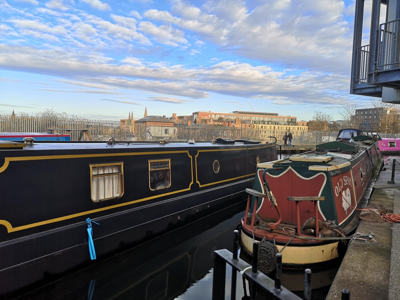
Canal boats, Edinburgh and Glasgow Union Canal
The Leamington Lock, Edinburgh
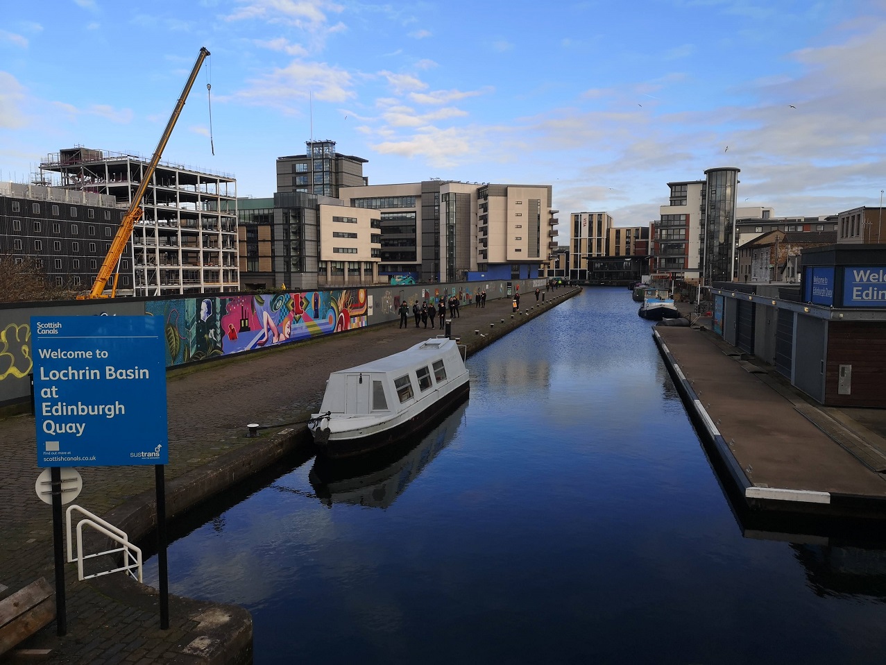
Lochrin Basin, Edinburgh
It is not far from King’s Cross to Camden Town, perhaps 30 minutes if you didn’t stop off and take photos and browse bookshops and generally see the sights, but well worth it on a cold, sunny day. There I picked up the overground to Gunnersbury, ideal for where I was staying that night.
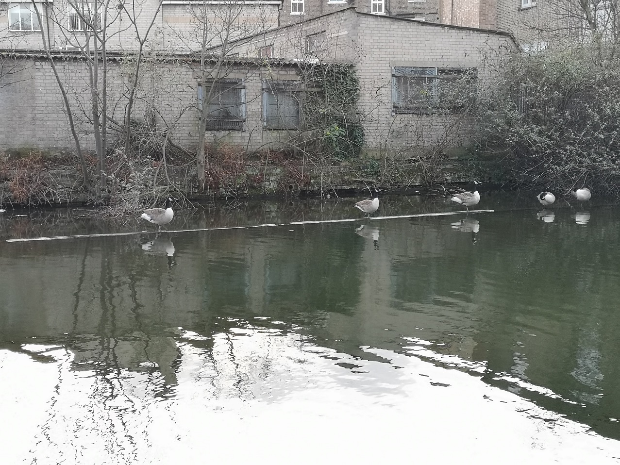
Geese standing on the water, Regent’s Canal, London
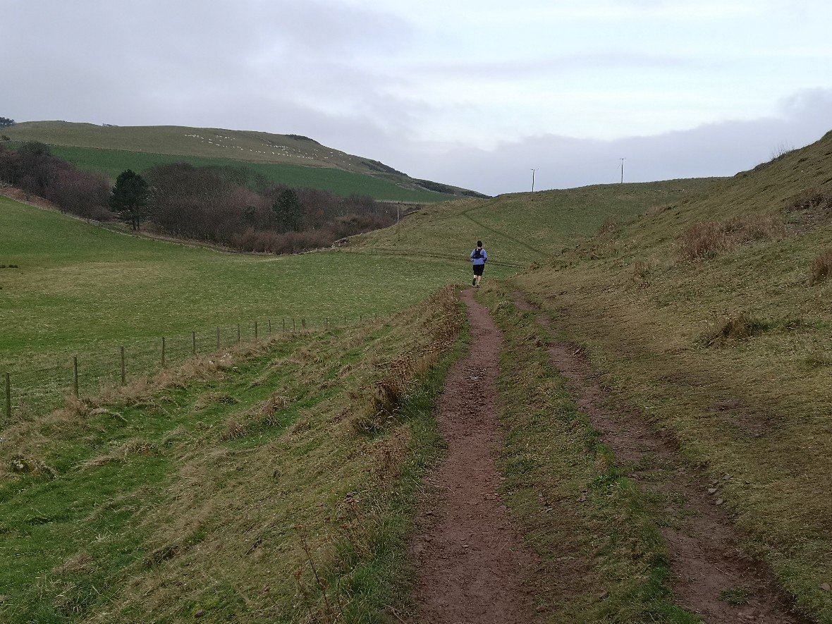
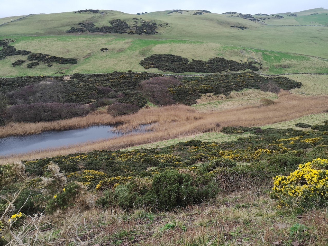
January 2020. The third and final section of the Berwickshire Coastal Path (BCP), Scotland. 25+kms (15.5 miles minimum). There are facilities at the Pease Bay Leisure Park (perhaps 6.5 hours in – the Smugglers Restaurant), otherwise, not until Cockburnspath, unless you count behind-the-bracken as a facility! It is a difficult walk for those who haven’t recently done Scottish cliff walking. Total 7.5 hours.
Berwick-upon-Tweed
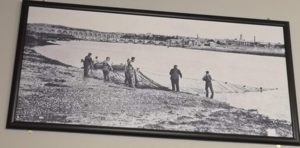
Old photo of fishermen on the River Tweed with the iconic bridge behind them. Berwick-upon-Tweed railway station, England
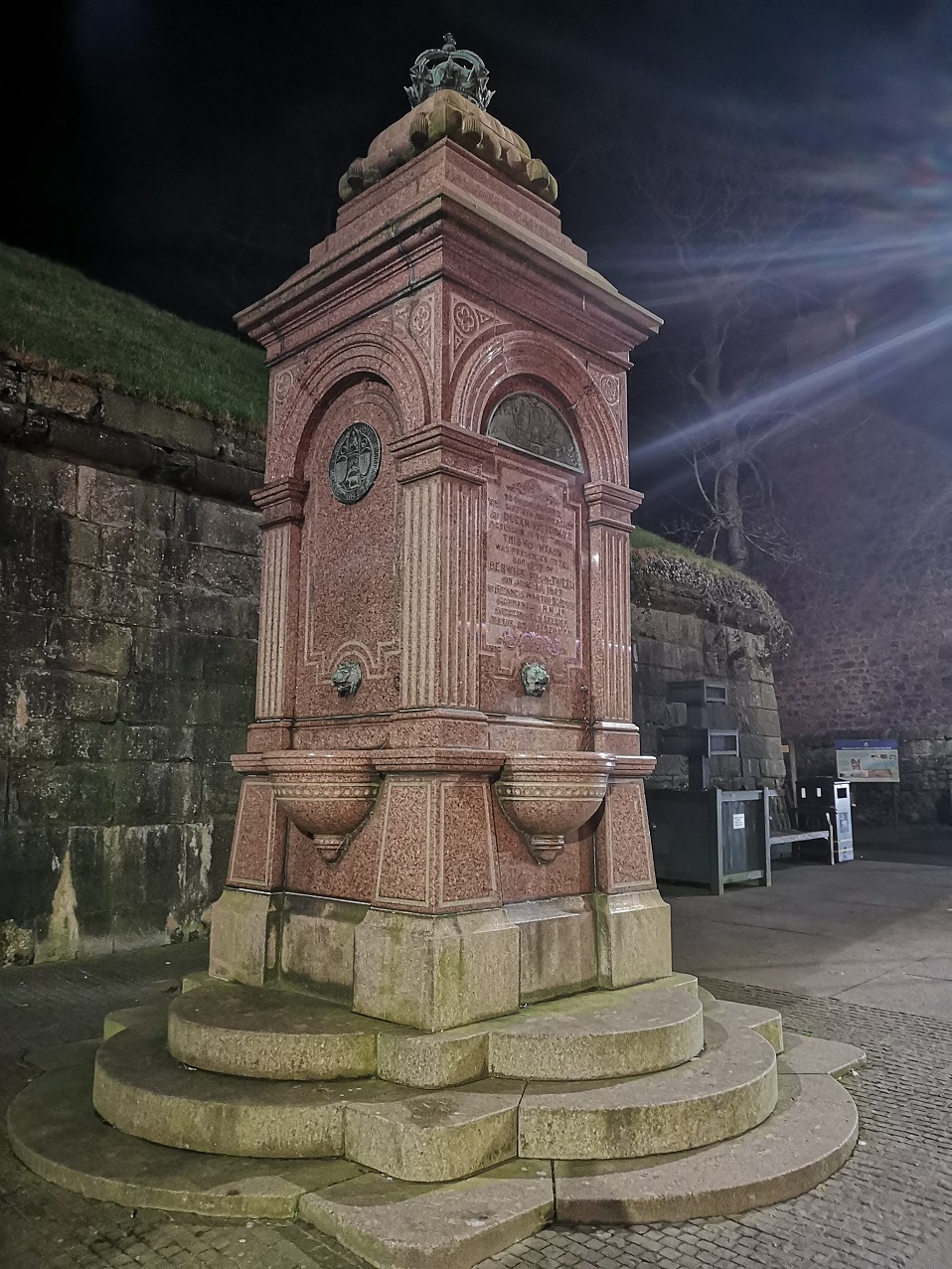
Monument with a coat of arms which has a cow in a gold chain on it, Berwick-upon-Tweed, England
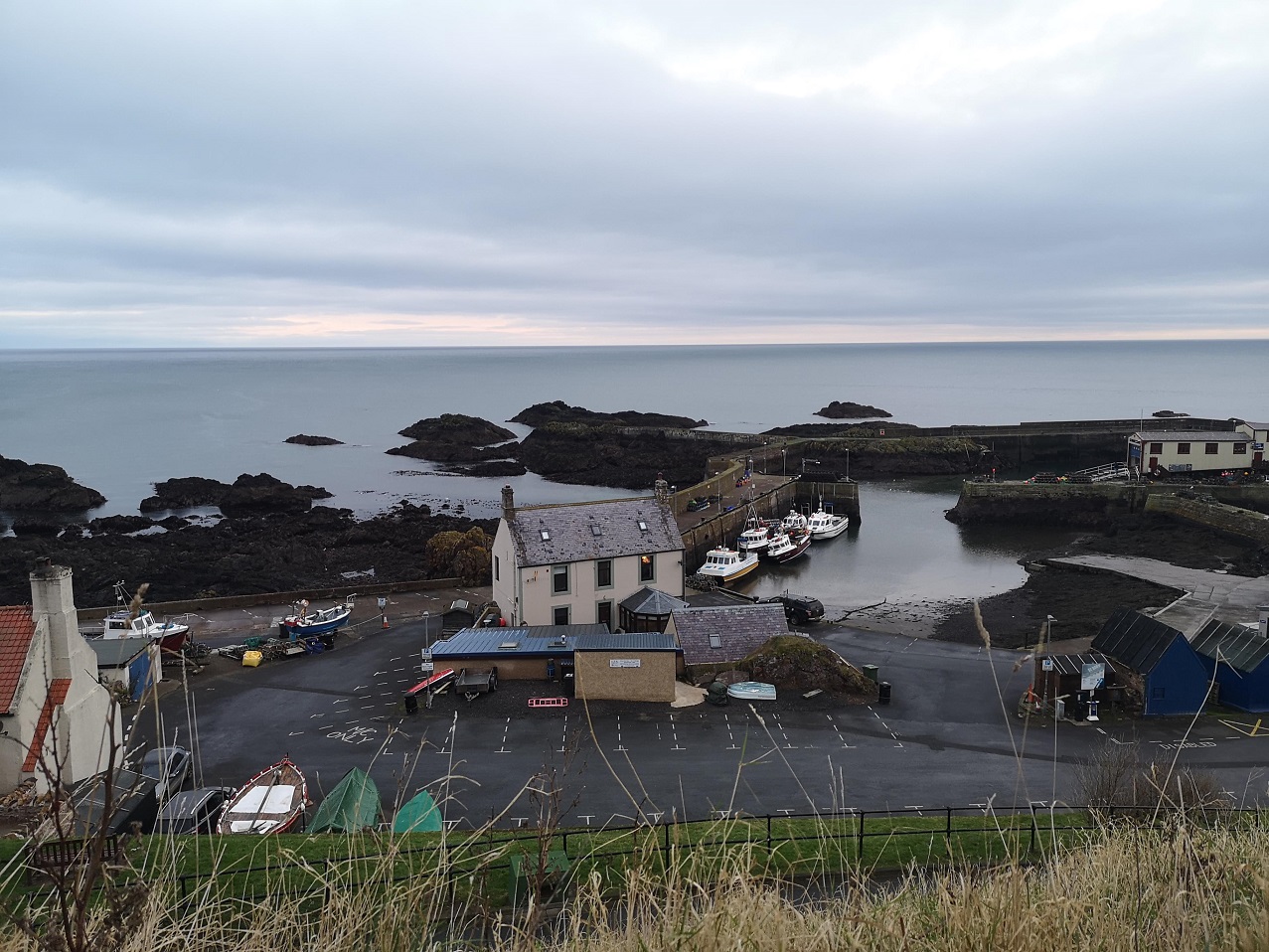
St Abbs
It takes quite a while to get to St Abbs from my home in Edinburgh by public transport (train then local bus), so this time I went the night before and stayed at the Seaview B&B 6, Brierylaw, St Abbs. I highly recommend it. The owners are really friendly and generous with their time, and they went out of their way to make me comfortable (I had a luxurious bath), and ensure I was well-fed.
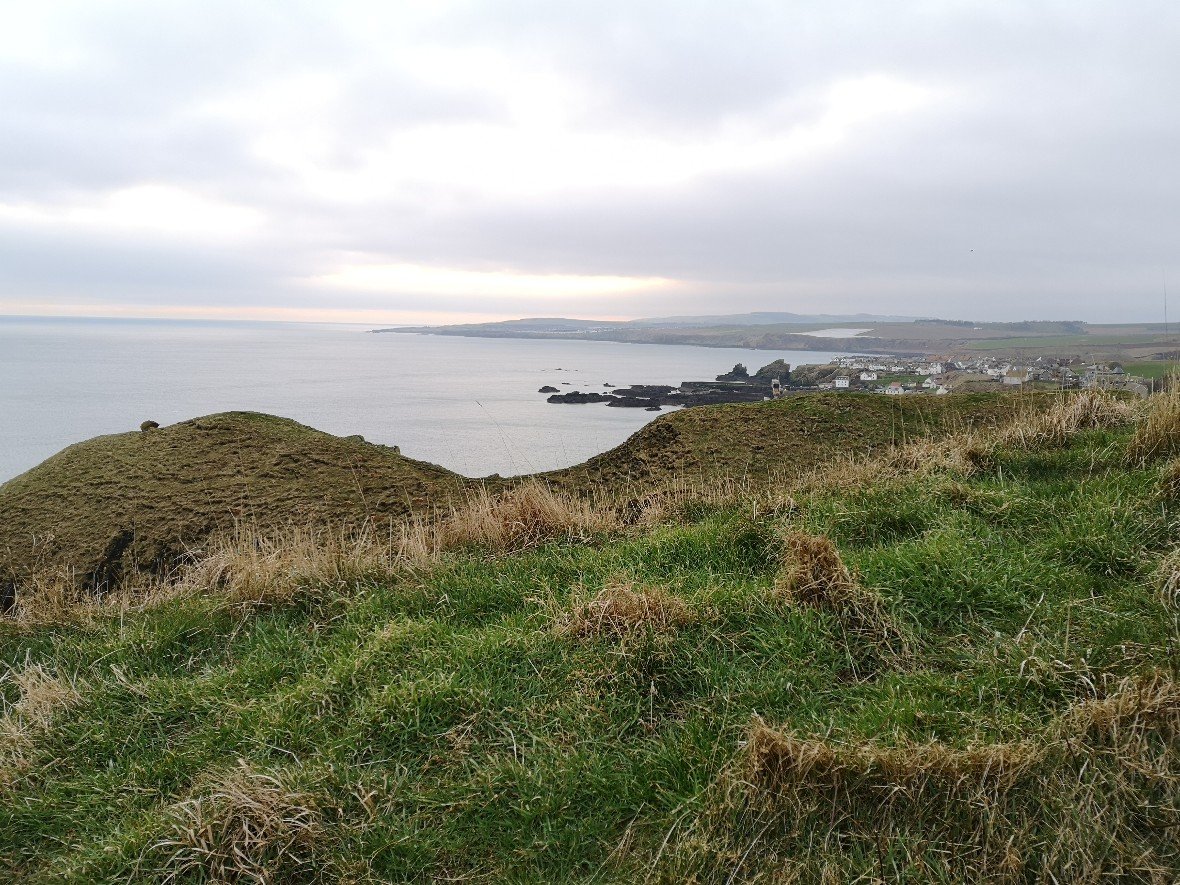
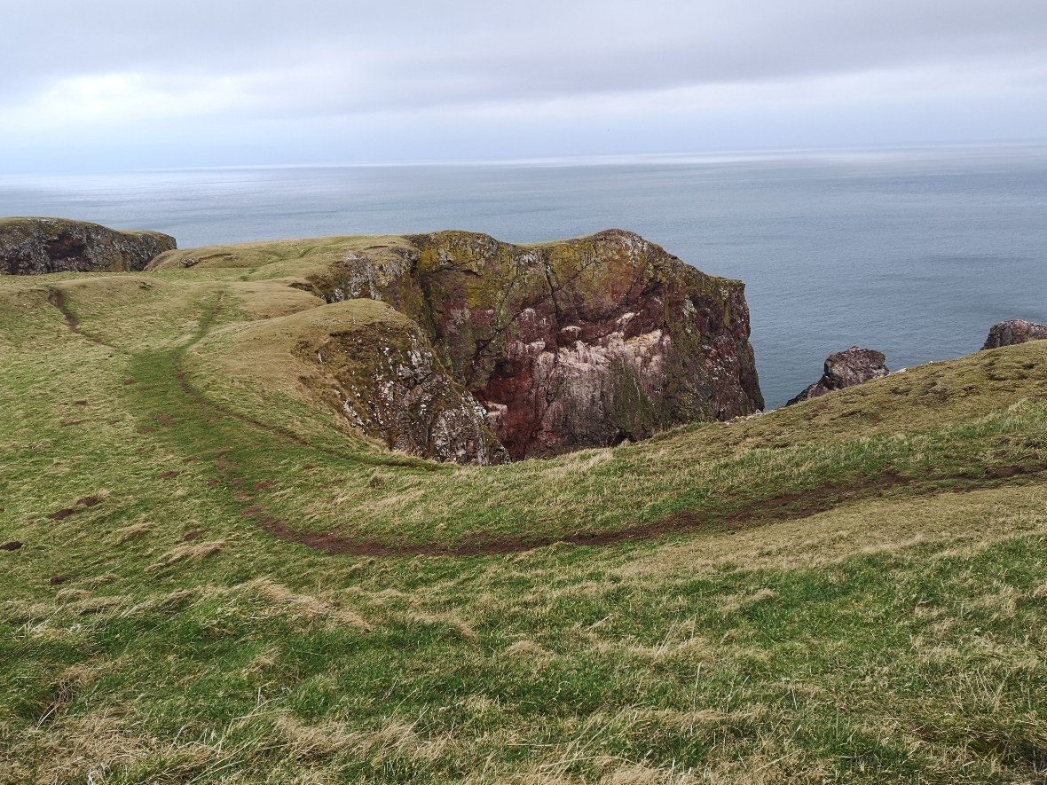
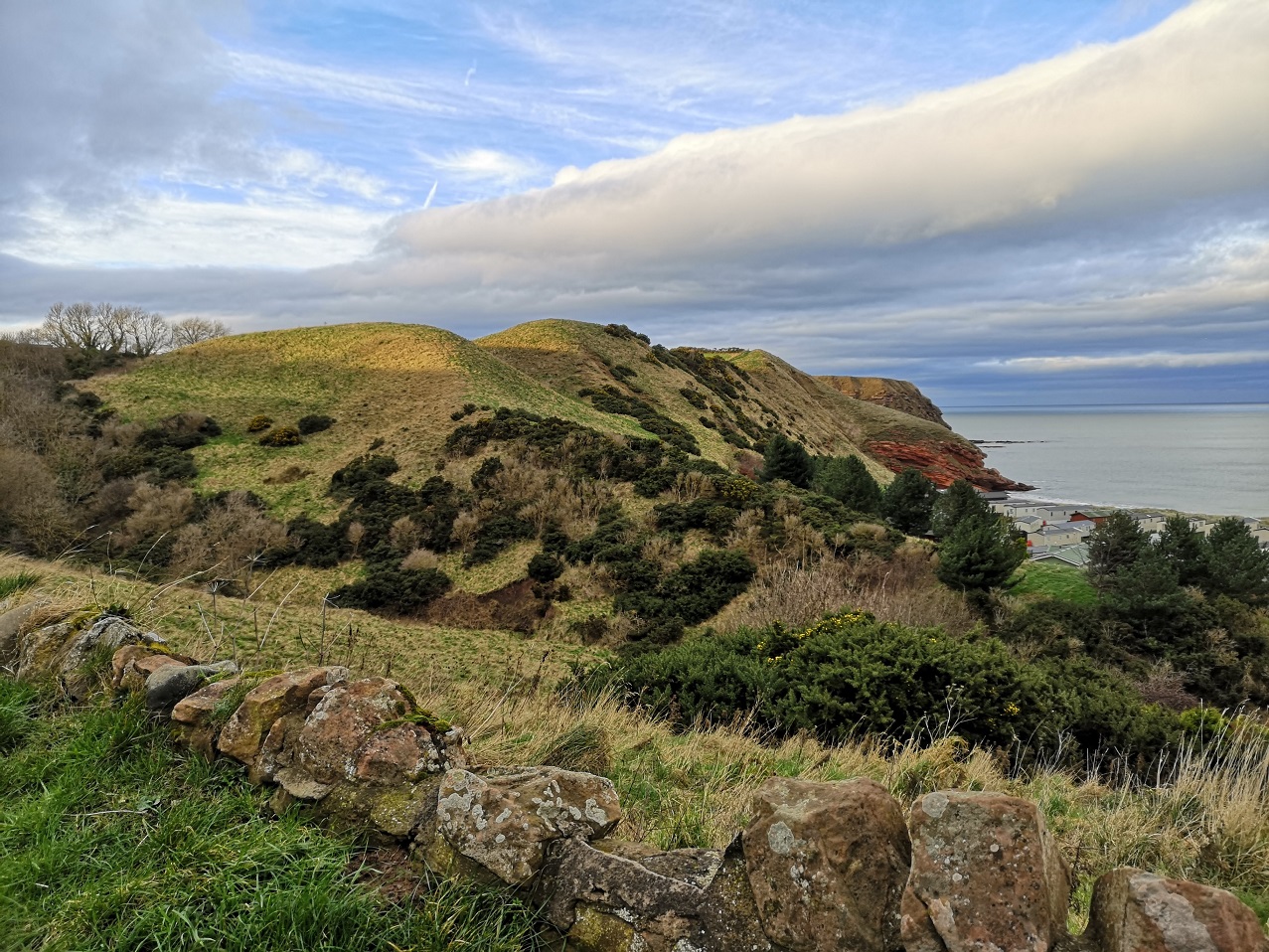
St Abbs over the undulating hills, Berwickshire Coastal Path, Scotland
Maps and interesting facts
I took photos of the Ordnance survey (OS) Explorer map 346 entitled Berwick-upon-Tweed, Eyemouth, Cockburns Path etc, before I left my accommodation.
I left at 8.30am and walked the St Abbs to St Abbs Head path again. The National Nature Reserve is a paradise for birdwatchers, hikers and great fun for tiring out children. I scouted round the first little mound to save my legs at this early stage and remembered nuggets of information I gleaned from the Ruth and Barry at Seaview:
that the guillemots are starting to return from their winter sojourn
that, ‘St Abb’s Head is carved almost entirely out of lavas, which are flows of molten rock across the earth’s surface. These lavas were sticky and flowed slowly because they are composed of a silica-rich rock called andesite (named after the Andes Mountains).’ from the Edinburgh Geological Society pdf
that the sea cleanses west-east along the coast making for the calm waters which delight scuba divers.
I saw two joggers and a birder, but no hikers during the whole day, Berwickshire Coastal Path, Scotland
This is a walk with wild and varied terrain
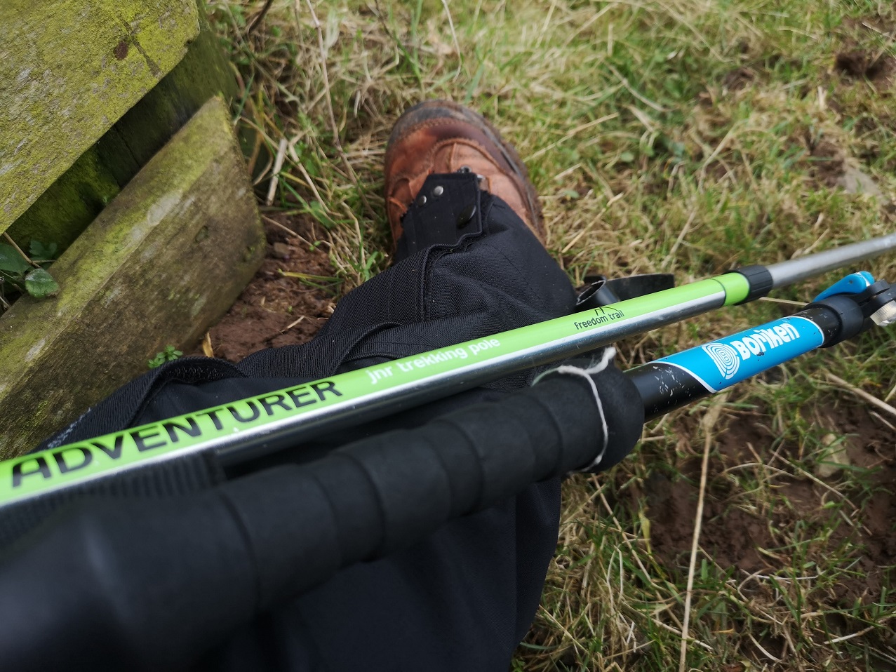
Then the first climb: I had to stop several times because I was so unused to it; I realised that my poles were uneven (one for a child and the other more sturdy, for adults), and the new gaiters which were discovered in the back of one of mum’s cupboards had long straps which are supposed to be trimmed before using – they kept getting in the way. I could feel a headche looming (a reminder to drink water regularly as I hike), and the cold wind was at the nape of my neck. I was mighty glad for the rucksack protecting my kidneys – it would have been freezing if I hadn’t been properly dressed. Let’s hope, I thought to myself, that it’s 8 and not 10 hours as some of my treks have been. It looked so easy on the map!
I am so grateful for my decent boots, mismatched walking batons and new gore-tex gaiters (waterproof material which you wrap around the lower legs to stop mud and water entering over the edge of boots or up the bottom of trousers). They still had the security tag on them which Barry kindly released me from before I left). Berwickshire Coastal Path, Scotland
Berwickshire Coastal Path, Scotland
I could feel Xmas, heavy and bulky around my waist. Wow! was it hard work up and down what I discovered were the highest cliffs in Berwickshire. Overhead, pairs of birds were chasing each other, long-necked with a wide wingspan.
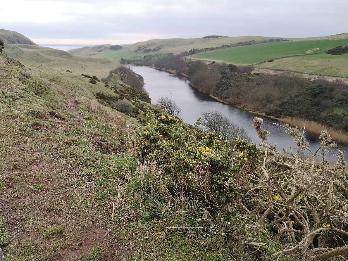
Mire Loch and the North Sea in the distance, Berwickshire Coastal Path, Scotland
Mire Loch and the yellow gorse, Berwickshire Coastal Path, Scotland
The closer I got to the water, the louder the seabirds and the wind. The white sky was dissected by the trail of a plane, and I had forgotten the red, the pink-burgundy-purple of the land round here. ‘Between each lava flow there is commonly a reddened zone, because the lava may have been weathered for hundreds of years in a subtropical climate until the next lava covers it’ (Edinburgh Geological Society pdf as above).
Going downhill on the road, the silence descended and the view opened up again, Berwickshire Coastal Path, Scotland
Gorgeous Geology
Sniffing on account of the cold wind, I came to my first path dilemma – do I go by the road or off to the right? There was no sign. I chose the road, but was very unsure and got into a bit of a (short-lived) state about it, trying to look at the photos I had taken of the OS map without my phone being blown out of my hands, and comparing them to the insubstantial BCP leaflet while the wind was coming towards me like nothing on earth. There was a sign further on, so the road was the correct course of action.
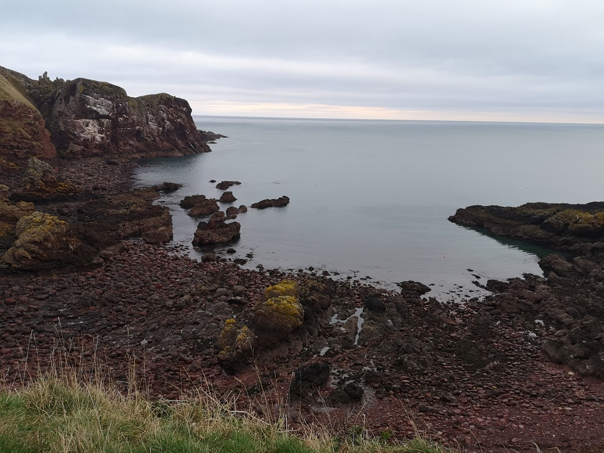
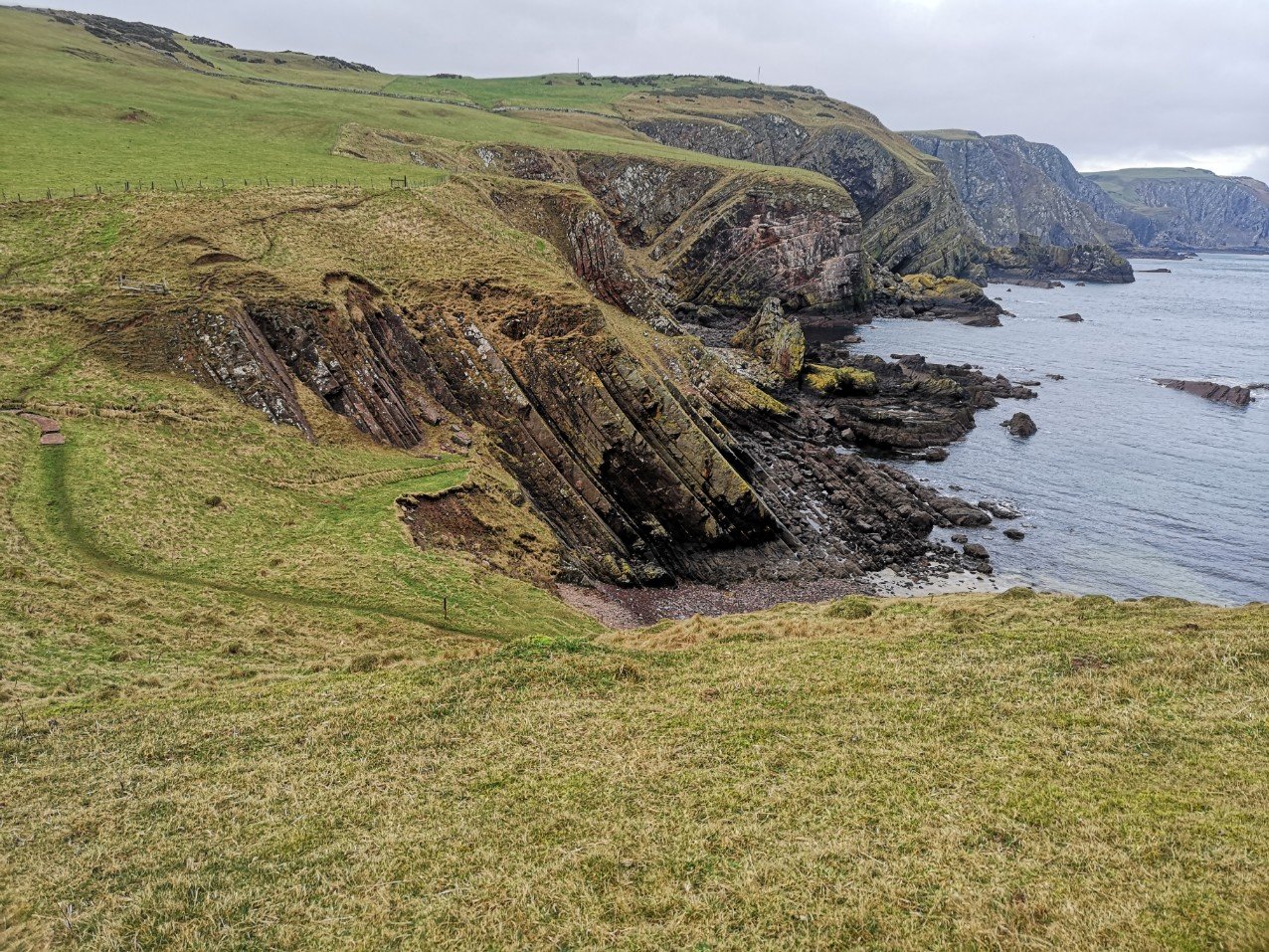
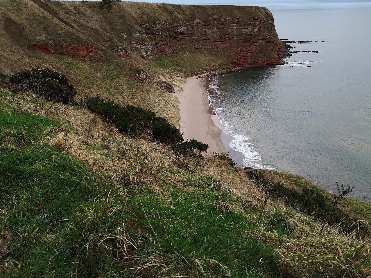
When I rounded the headland to be faced with this bay, I was astonished to remember reading someone who said he hadn’t noticed the strata of rock, Berwickshire Coastal Path, Scotland
The second female runner, red faced, grinned as she ran on, then stopped to hold open the gate for me. As she disappeared into the distance, I was left with the sound of the waves. I adore the quiet.
My poles stuck into the soft, brown clay which soon changed to clods around the edge of a field where cattle had clearly been. The cow pats had orange fungus (pezizales) on them and there were great clumps of shiny, black pastilles, deer droppings.
It struck me how little I know about so many jobs: diving, fishing, farming, lighthouse keeping, all of which I depend on. Such things I mused as I walked.
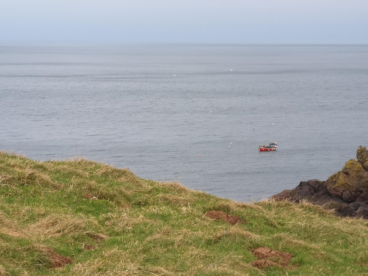
In the distance, a single fisherman in his orange all-in-one suit was chugging along at the same time as laying his nets. He was followed by squawking, white birds. Berwickshire Coastal Path, Scotland
I heard the birds going sweeeak, squweeeak, sqweeeak, sqweeeak, sqweeeak, tda, tda, tda very fast!
I, on the other hand, was going so, so slowly and feeling incredibly unfit, breathing heavily on the ascents – great exercise for inner and outer health. As I paced, I could feel my heart sighing. My head was still zizzy and a bit anxious, but I could also actually feel myself grounding, as if lead was working its way down my legs which of course made them feel altogether too heavy to climb hills. My system was settling. The intense breathing had cleared away some of what was clogging my lungs; the bowel clearing which went on an hour after starting, resulted in a very easy sensation in my abdomen. This was good for me.
Cliffs, stiles and wind turbines
What sort of terrain was it? Two stiles, a little burn, up a very steep bit, over a stone wall, ribboned white, and through a gate with a metal spike to shut again after me – I struggled with it. More stout stiles, wind turbines and wet burns (where your water bottle might fall out of its pouch, getting muddy even around the lip under the lid), even more stiles (too high for short legs), curving round contours and up more slopes – pwhew!
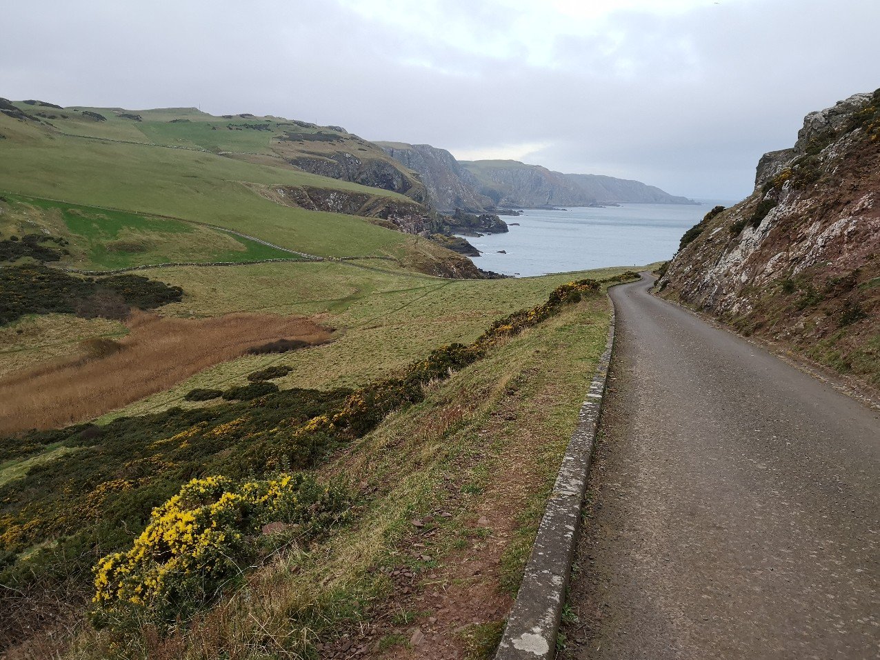
After the highest cliffs (the Tun Law Forts) and the two admiralty poles (to measure nautical miles), the path hugs the coast (I went inland by mistake). The sea was all glassy, rippling gently in the wind. The wind was incredibly heavy up here, but down at the sea it looked magical. The path is sometimes dizzingly close to the edge of steep gorges with white foam at the bottom. The gorse was olive green from a distance, and their glorious sunshine flowers matched the yellow arrows.
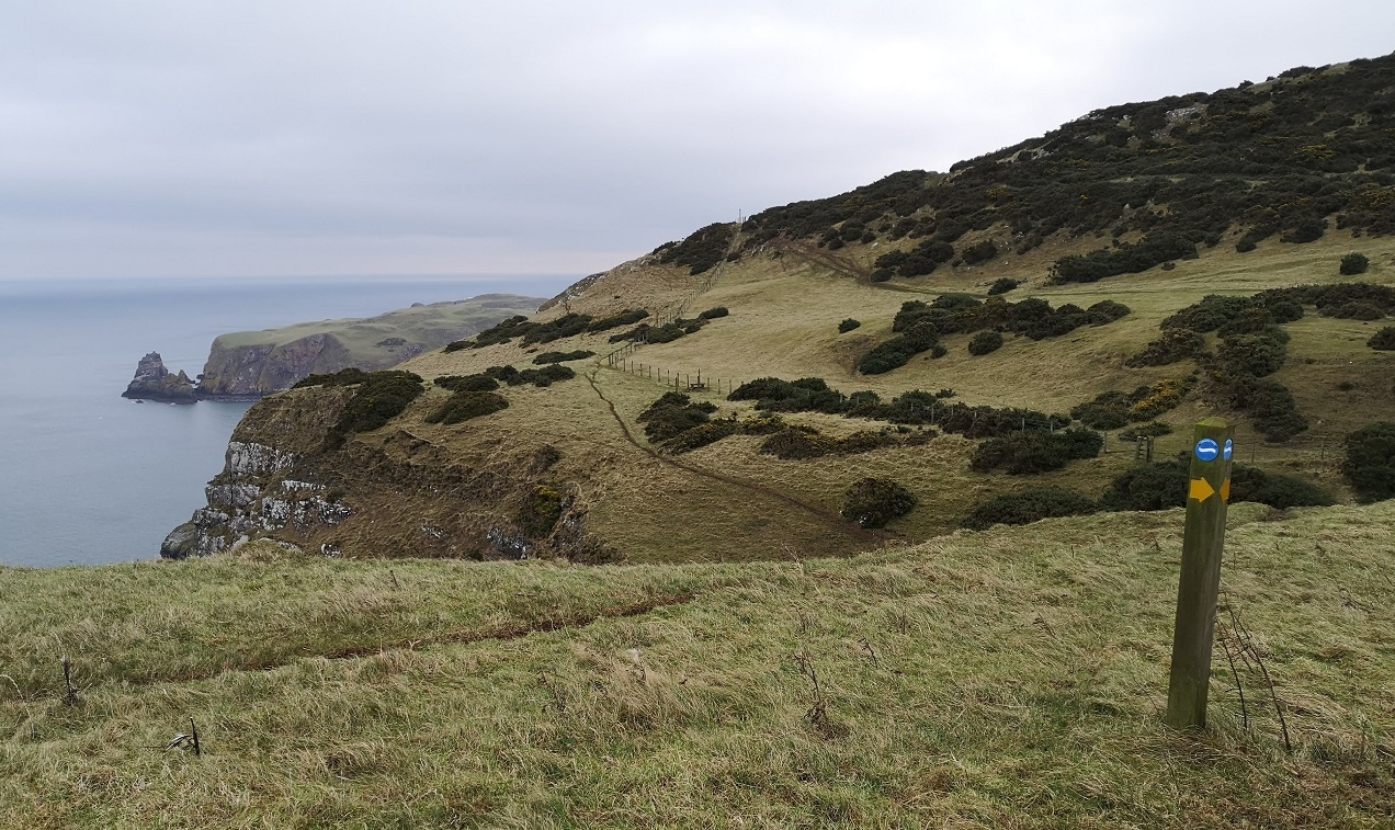
The stunning landscape of the Berwickshire Coastal Path is, generally, well signposted. I was warned by two sources that it is easy to get lost – maybe my several years of experience paid off, because I only went off-course for a sum of 10 minutes or so over the day. Here you can see the various possibilities which converge at one point
Then there was a beautiful flat stretch: Small brown birds were tweeting. They appeared and disappeared like helicopters doing vertical take-off and landing practice (skylarks?). I couldn’t see any dolphins or whales, which I always wish I could, but then I realised how lucky I am to see seals almost every day outside my house. Gulls with black wing tips were gliding over the sea. There were feathered swarms, like bees, inland over the sheep-filled fields.
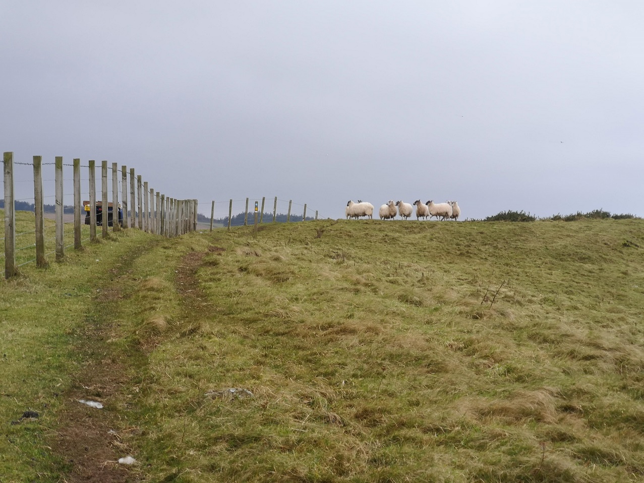
I heard the sound of a quad bike before I saw it, like the brrr you do with your lips, spitting saliva a bitty, to make a baby laugh. Then I saw a man holding back a collie dog with great difficulty. He gestured and spoke, but the wind stopped me from hearing what he said. I got the gist and waited. They were driving the escaped sheep back up the cliff and we all had to be very careful in case they panicked and rushed in the wrong direction, to their death.
This was my first ‘proper’ walk after injuring my left foot on the Portuguese Camino. It had taken months to heal and I was nervous about future walks, but I became more confident as the day progressed. My ankles felt weak – that was the lack of Scottish hill walking practice – and so I was careful to place my feet flat where possible, which sometimes hard on the side of these hills.
The fawn-deer-brown bracken was lying almost flattened to the ground after winter storms. Berwickshire Coastal Path, Scotland
Higher and higher, I looked back at the most wonderful rocks which angled down and reached their guano covered fingers into the sea, some with athritic knuckles all jagged as if they had rough skin.
Berwickshire Coastal Path, Scotland
More sheep
For the first time I saw sheep head-butting each other, their hind legs sort of bouncing off the ground as they did it. As soon as I stopped to watch, though, they stopped too, like embarrassed teenagers caught doing something they shouldn’t be – it was so funny.
Three hours in and the ground was flatter – forest and fence, new coppice of some type of pine. Ditches full of rainwater were squidgy to negotiate. There was not much sign of a path here until the next metal fence and a gully with thorn trees, inland.
On this walk, you just keep on going and you eventually get there. I arrived at Dowlaw (say doolaw) farmhouse at 12 noon – 3.5 hours exactly which was good going given that the time for this stage was listed as 3.5 – 4 hours. As you approach the dwelling, remember to turn right through a small copse, do not take the left at the farm machinery.
The half way mark – Dowlaw
I lay down and rested out of the howling wind for a few minutes, but it was very wet. I had been hearing a conversation going on beyond my left shoulder which when I stopped I couldn’t identify the origin of. Slowly I realised it was the wind turbines turning, chatting away to themselves.
I followed the road and then left it as the map showed, perhaps too early, because there was a dearth of signs. I traversed grass with almost no noticeable track to speak of. Yes, the signs were unclear, seeming to point across more moorland, but I was unsure. There was a car with its engine running, a solo man in it, a big screen on his dashboard that he was watching, despite facing out to sea.
I was very, very tired by this time, so I was glad that it was more level, overall, on this final stretch. I was amongst the sheep, passing through gate after gate, and molehills were everywhere. It must all be taken carefully – the route twists and turns, over waterways and round field corners. When you doubt that you are on the right track because you come to a junction where there are options, scan far, far ahead into the distance looking for a small pole with a yellow arrow and a blue and white sign to guide you.
Torness shining in the distant sun, Berwickshire Coastal Path, Scotland
Next was a farm yard with very pretty, nervous calves inside a barn, and three barking dogs, enclosed. Crows lined up on the telegraph wire. A sheep with a horrible rasping cough was on my left. It was if something had gone down the wrong way, most distressing. In the road in front of me were two running, waddling birds (game birds? I did hear shooting earlier). Every now and then they took off, their wings whirring as fast as those of flies. More cottages were ahead and smaller, brown birds with white tail feathers twittered away. They looped horizontally in and out of the hedgrows as if they were hanging the decorations.
Flora and fauna -Old Cambus
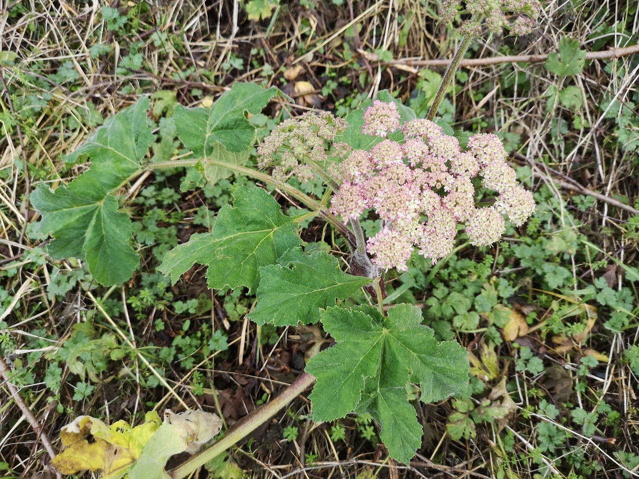
My eye was drawn to the catkins flibbaling in the wind, snowdrops harbouring under a stone ledge, pussywillow shining white, and hogweed/cow parsnip in flower. Thoughts flitted in and out about a book I was recently given: Melissa Harrison’s Rain. I wasn’t sure about it at the beginning, but it was starting to grow on me – four, easy essays written about seasonal walks in different parts of England, all about rain and the effects it has on animals and the earth – interesting facts, well written. I wondered to myself if she learned from books / the internet or if it was local lore from people she had spoken to along the way.
‘Here and there hazels have produced their yellow catkins; there are hips bright as blood, too, and beside the path a straggle of field mustard, most likely a farmland escapee…’
This was Old Cambus and I went straight on, as far as the T-junction, and there I thought I must be wrong. I was right! Retracing my footsteps (right hip and soles sore from road walking) I asked a woman getting into a car and she pointed me to the seagreen shed. I had to go past the garden with the tin / metal sculptures of a sheep and a pelican.
Turn right at this cottage, walk straight down the left hand side of the field and then, although it is counter-intuitive, turn right (do not go across the farmyard full of wood even though there is a sign pointing left there). Berwickshire Coastal Path, Scotland
So, now I was going back in the opposite direction (sea on my left) to another sign in the corner of the field. Then, straight downhill (not left) towards the sea. There was a ruin up ahead.
The ruin seen from the other side. The day was brightening as it came to its end. Berwickshire Coastal Path, Scotland
Siccar Point
Although the path goes inland here, I was able to get a photo, later, looking back towards the famous Siccar Point or Hutton’s Unconformity.
Siccar Point or Hutton’s Unconformity, of immense geological interest, Berwickshire Coastal Path, Scotland
‘In 1788, James Hutton first discovered Siccar Point, and understood its significance. It is by far the most spectacular of several unconformities that he discovered in Scotland, and very important in helping Hutton to explain his ideas about the processes of the Earth.’
‘At Siccar Point, nearly vertical sedimentary rocks of Silurian age – greywacke sandstones and mudstones – are covered unconformably by a younger sequence of red sandstone and breccia.’ The Geological Society
‘Hutton used Siccar Point to demonstrate the cycle of deposition, folding, erosion and further deposition that the unconformity represents. He understood the implication of unconformities in the evidence that they provided for the enormity of geological time and the antiquity of planet Earth, in contrast to the biblical teaching of the creation of the Earth.’
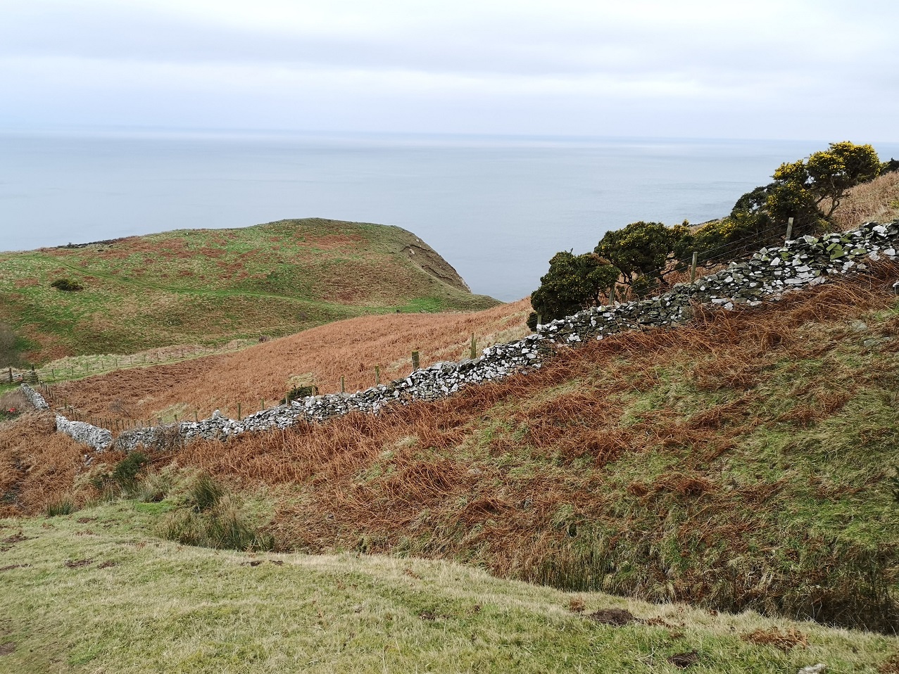
Over a cattle grid I traipsed, and took a right with lots of signposts giving mileages to Cockburnspath which turned out to be erroneous, but kept me forging forwards at the time. A long stretch along the edge of a fence was very steep with very little space to walk.
Pease Bay
There was Pease Bay ahead – how did they ever get planning permission to fill the bay like that with caravans? Berwickshire Coastal Path, Scotland
I sat for five minutes and ate some sugary snacks before stumbling down a long flight of wooden steps to Pease Bay, Berwickshire Coastal Path, Scotland
Up a very steep road on the other side, past some houses, I joined the very end of the Southern Upland Way (which starts at Portpatrick, south western Scotland 214 miles / 344kms). More tough steps, this time, up.
Crossing a burn with little waterfalls on a boardwalk, I came across a sweet bay which could not be reached except by boat.
Beach cusps – scallop-shaped patterns made by the sea at the edge of the shore where waves have collapsed into a thin bore. Berwickshire Coastal Path, Scotland
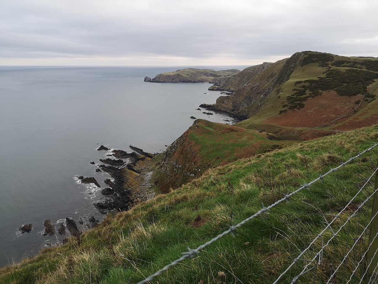
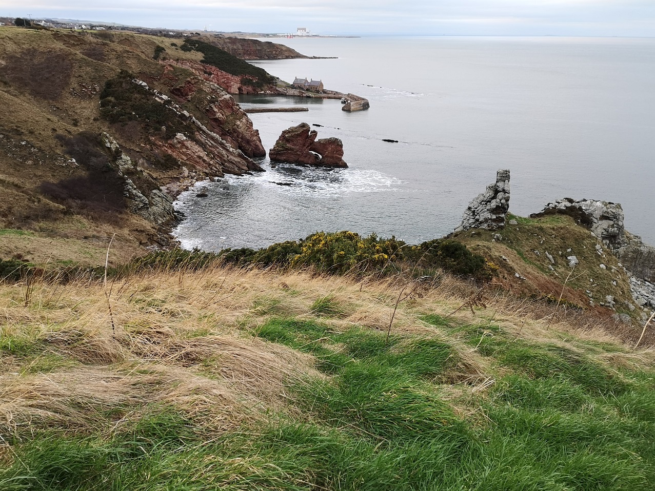
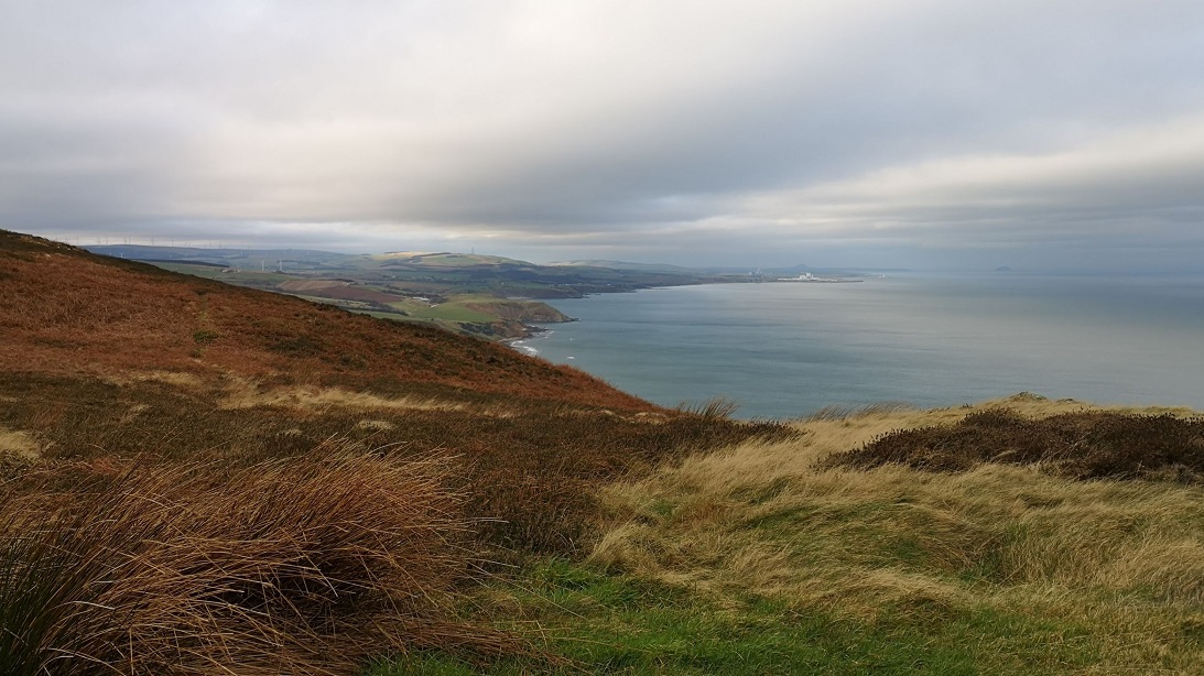
The complicated coastline of Berwickshire with the picturesque houses of Cove and Torness Power Station in the distance, looking towards Edinburgh, Scotland
Cove and Cockburnspath
At Cove, there are caves in the red rock and stacks to rival Orkney’s. Striated rock comes down into the water. I spied a single cormorant on a rock with another swimming towards it out at sea. A solitary, brown, fluffy caterpillar was at my feet.
On one side a man mended his car, on the other, a funny dog jumped off the ground in his enthusiasm to be petted – cute or what! Berwickshire Coastal Path, Scotland
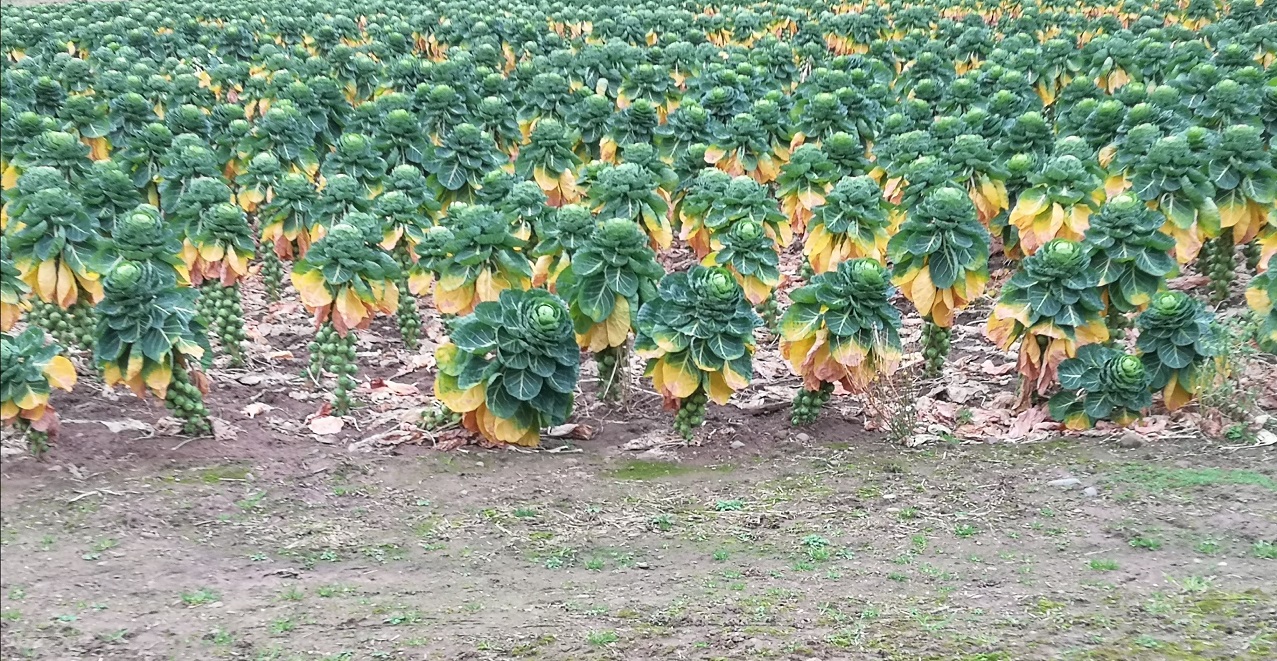
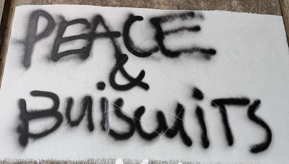
Past a field of prize-winning sprouts, this stretch is noisy with motorway traffic and, as I passed under the railway, yet another train sped across. I viewed the peace and biscuits graffiti which was exactly as ‘Ettrick Shepherd’ on the Walk Highlands website stated (long distance walks / Berwickshire Coastal Path / St Abbs to Cockburnspath). I am indebted to him for his account, which I read before I walked.
Never mind the spelling, it’s the sentiment which counts! Berwickshire Coastal Path coming into Cockburnspath at the end – hooray! Scotland
I arrived at Cockburnspath at 4pm, before it was dark. To get the bus back to Edinburgh, you need the stop on the Bowling Club side of the road. It turned out I could have got the 4pm bus, but I went for a celebratory cup of tea at the post office and village shop (which very sadly closes in 5 weeks due to bereavement) and so, missed it. I waited over an hour, regaled by very loud rock music coming from the house nearby, as it got darker. My right cheek was glowing hot from walking all day, much of it with the wind in my face. Thankfully, it’s a nice old fashioned bus stop with a covered wooden seat but, being wet throughout from the sweat of the walk, I chilled very quickly and so snuck behind and changed into dry clothes from the day before.