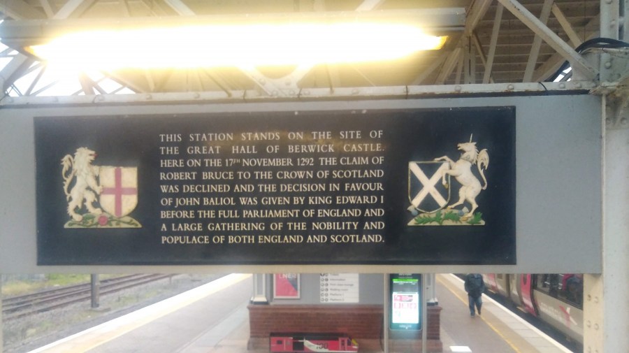
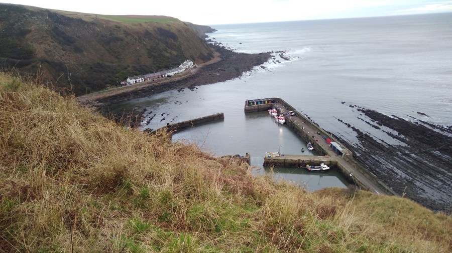
Camino Portuguese da Costa – Days 7 and 8, September 25th – 27th 2019
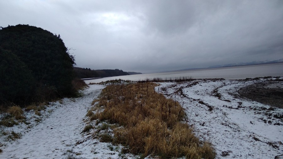
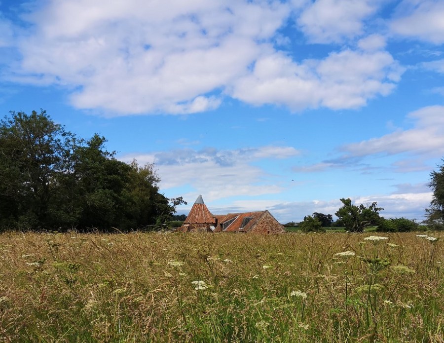
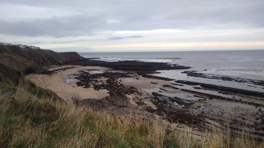
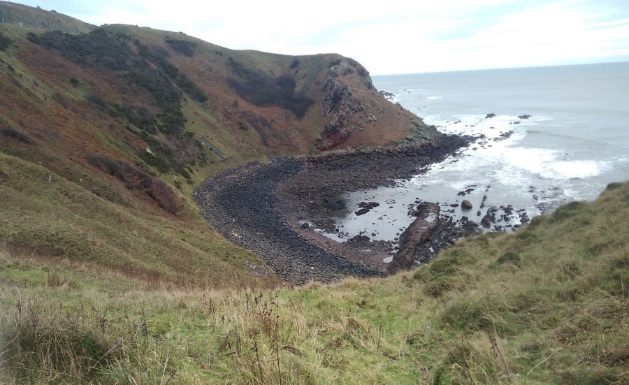
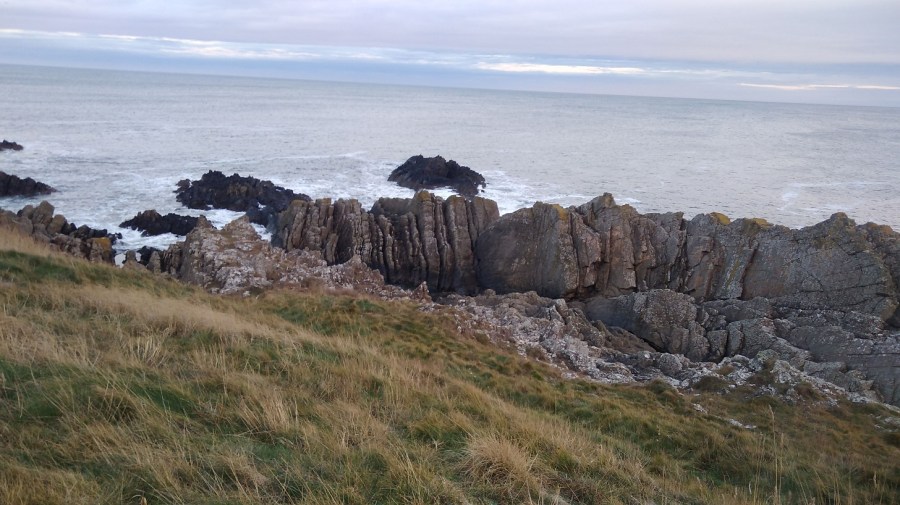
La Guarda / A Guarda, Galicia, Spain
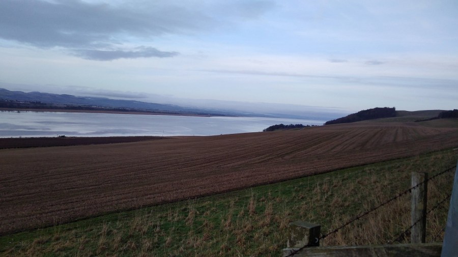
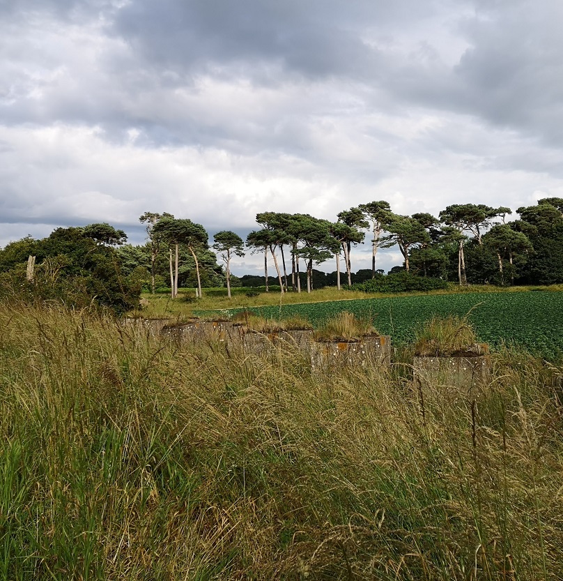
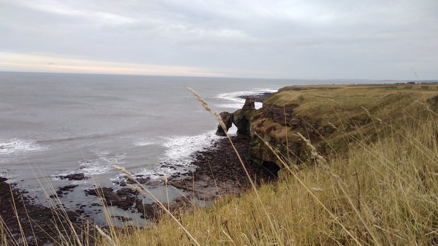
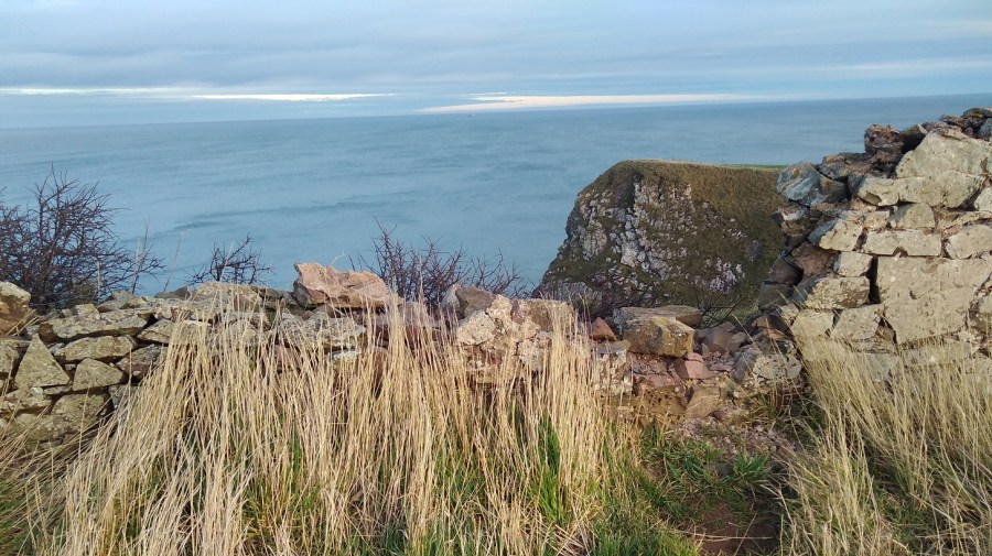
La Guarda is in Spain, even though it is a town on the Portuguese Camino. I was happy to be back in Galicia, one of my favourite parts of Spain. I should have liked to see the Celtic hill fort and village of Castro de Santa Trega which connects with Scottish history (I live in Edinburgh) on the top of the hill that La Guarda sits beside, but I was not comfortably ambulant.
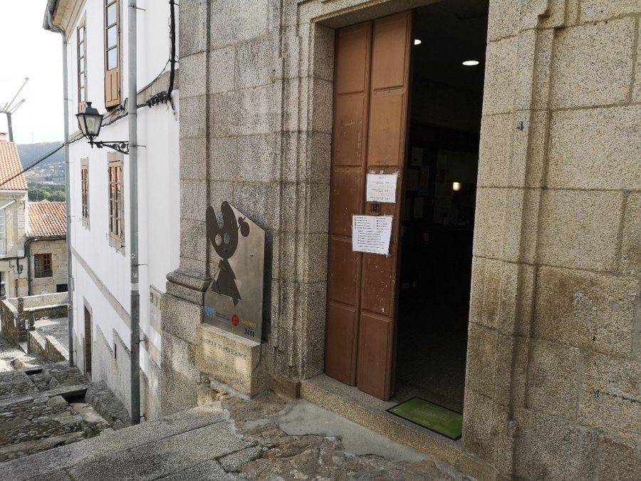
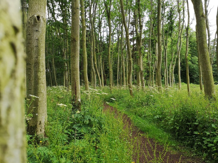
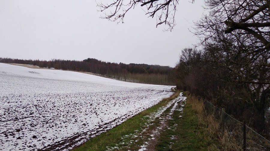
In the morning, I walked a short way (30 minutes, 2 kilometers) from the Albergue Municipal in La Guarda where I had spent the night, to visit the churches, but it was a strain and took me much longer than it should have. As a result of the pain in my foot, I decided to turn back and take a different route.
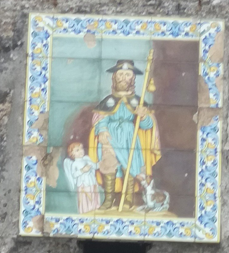
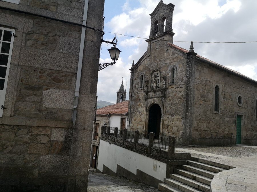
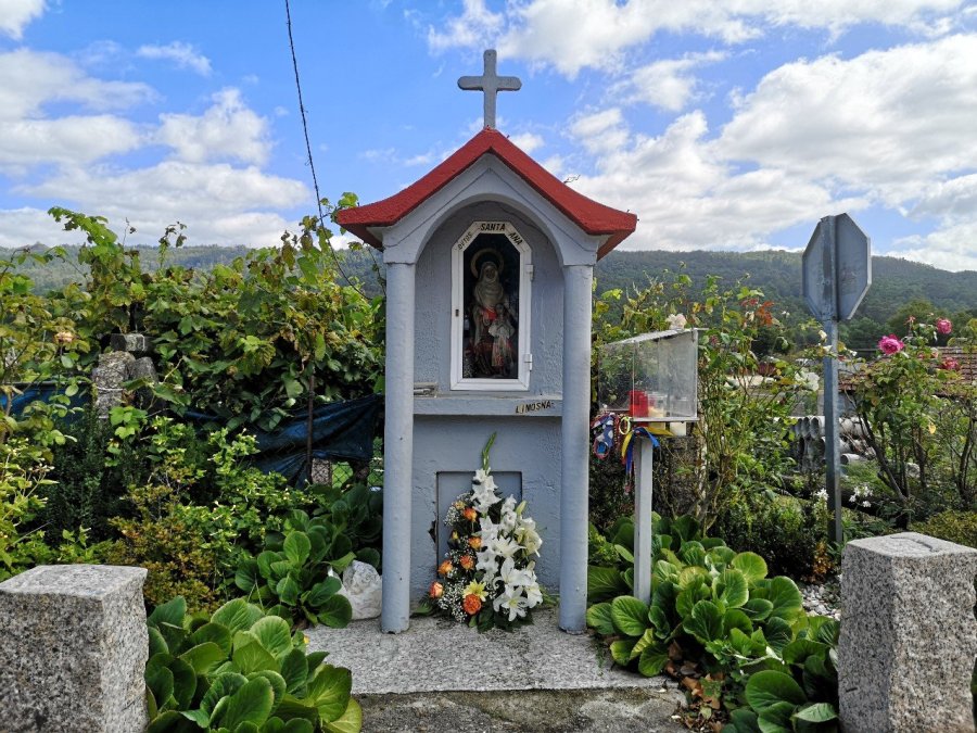
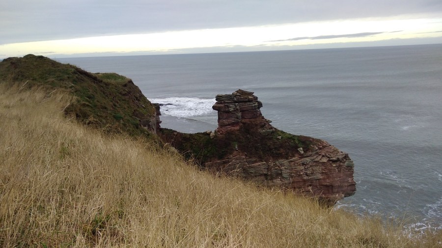
Santuario de San Roque, Parroquia de Salcidos with Saint James in the frontSt James carrying his crook with wearing his hat with the camino shell on it. Also with an angel and a dog. Apologies for the quality of the photo, but I thought they were charming tiles
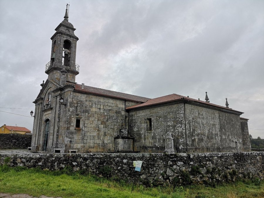
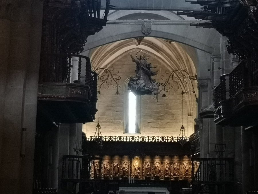
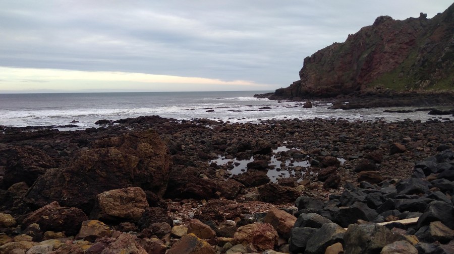
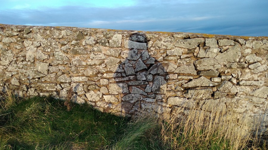
The two churches (above and below) are almost next to each other and I was the only one there. A few people were on their way to work and school, on the main road, and the churches were closed as they always are unless there is a service on. However, I admired their grandeur and solidity, the Santuario de San Roque having seen many pilgrims over the centuries.
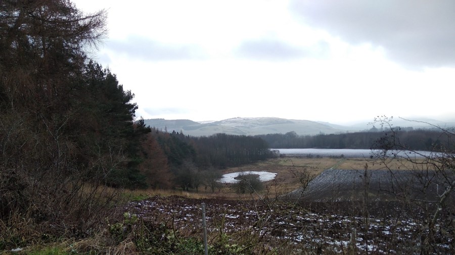
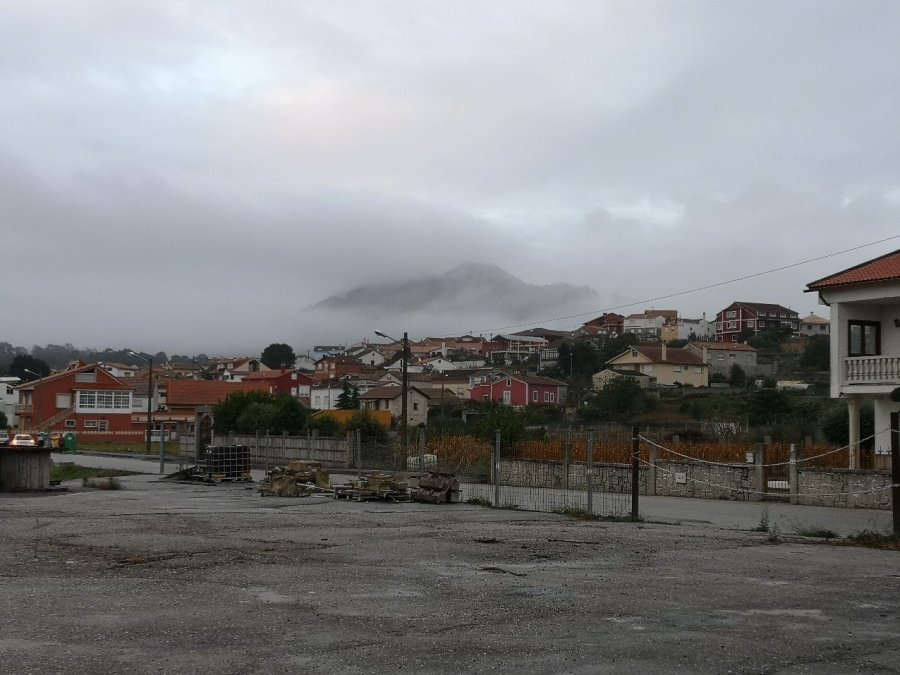
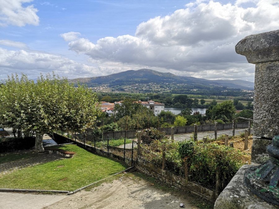
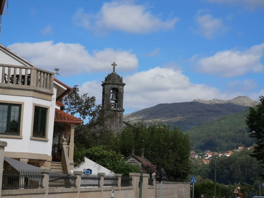
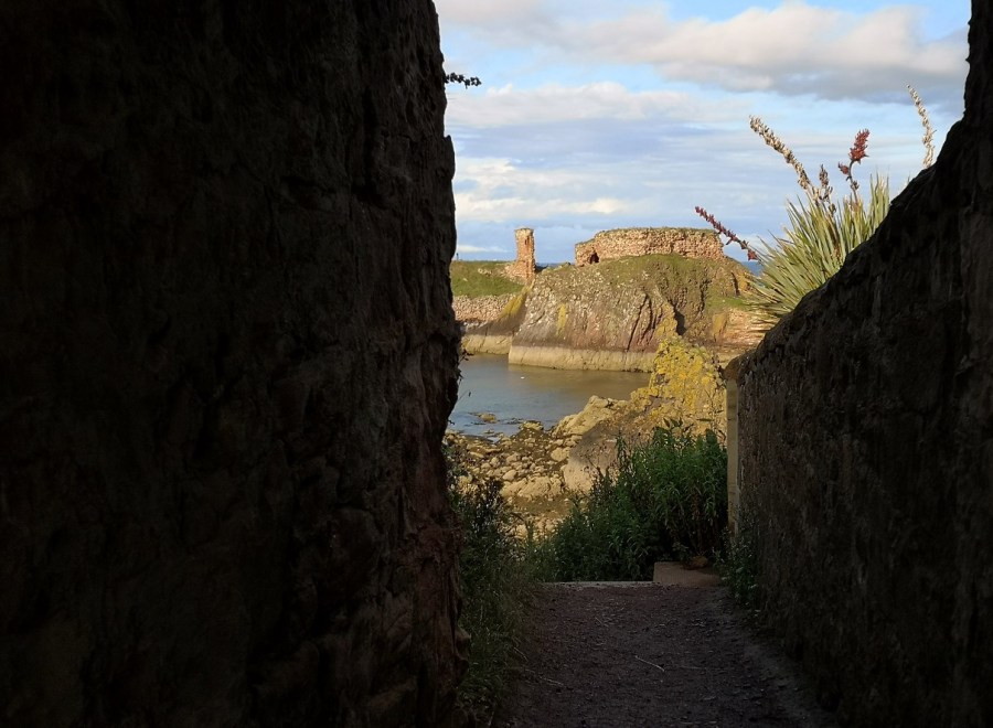
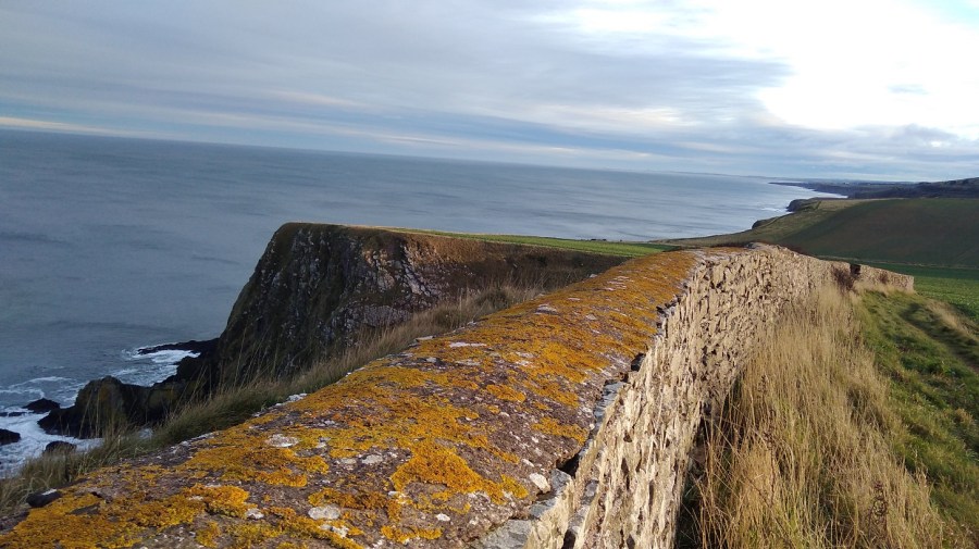
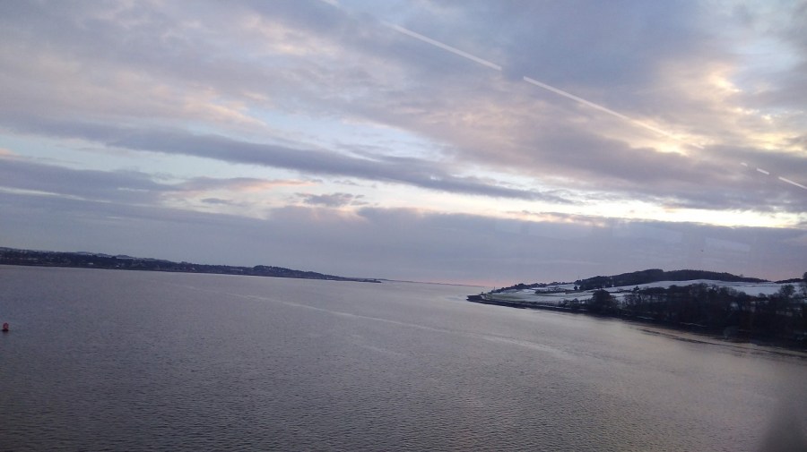
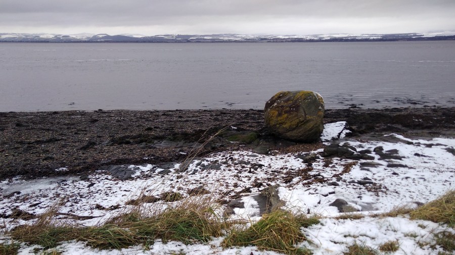
Igrexa Parroquial de San Lorenzo de Salcidos, PortugalThe mountain was just visible above the clouds as I looked from Salcidos, a borough of La Guarda, Spain
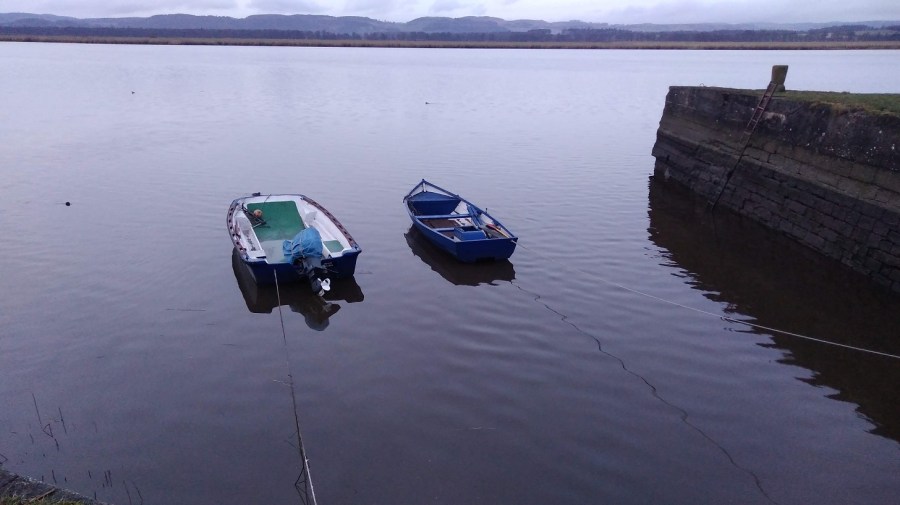
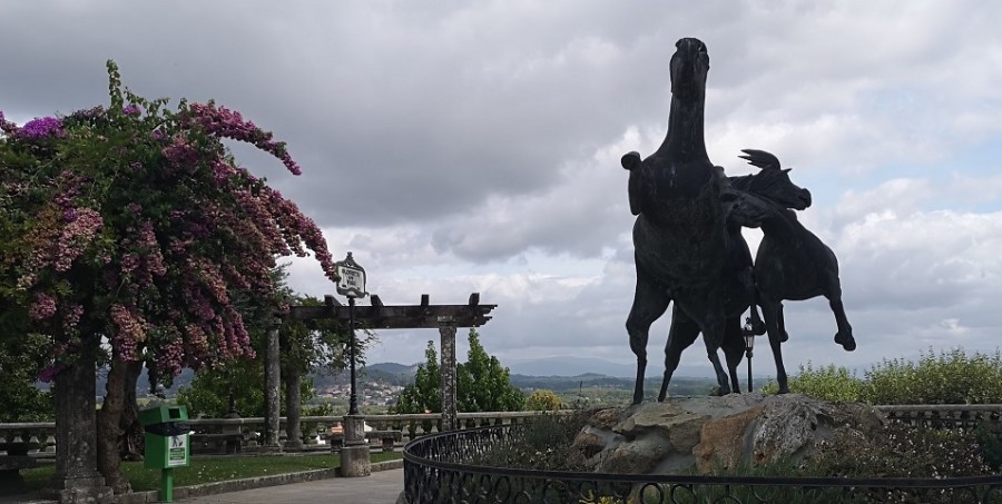
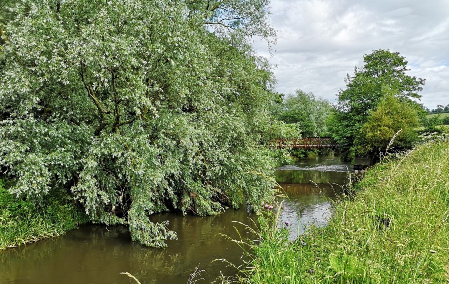
Then I rested for 20 minutes and took the bus. It runs from Salcidos to Tui (get off / on near Repsol gas station (estacion de servicio) on N-550) regularly and takes around an hour. This was the second day that I could not walk, something that had, thankfully, never happened to me before, and it was very hard to accept. The journey took me through urban areas with grey stone buildings boasting elegant balustrades around the windows, along the northern side of the River Miño, and deposited me opposite some public gardens bright with bougainvillea and sporting a grand metal statue of cantering horses, the Monumento al Caballo Salvaje.
Monumento al Caballo Salvaje (wild horses monument) in the park, Glorieta de Vigo, Tui, Spain
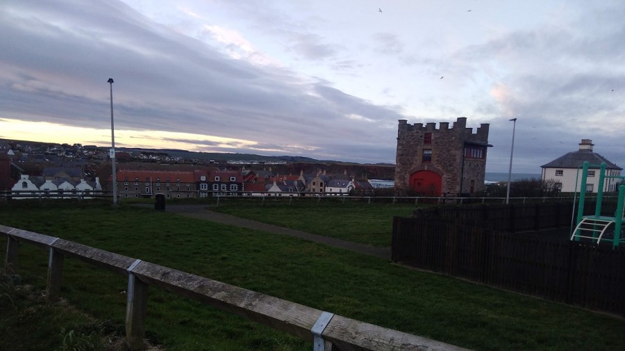
Tui
Tui is a busy city, full of hustle and bustle and with all facilities you could possible need. There is an excellent market, with cafes and shops galore. Not far from the Albergue is a friendly eating place / hostel (Albergue Ideas Peregrinas – not the cheapest, but with a European atmosphere and great, healthy breakfasts, including vegan food), and that is opposite one selling crêpes, and so on…! All tastes are catered for and many people holiday here even if they are not hiking. There is an extensive Natural Park to the north west with hills, Monte Aloia, for excellent views of Baiona, Vigo and the whole region.
I picked up a copy of Jim Crace’s The Melody in the hostel the night before and made the most of my enforced resting time to have a good read. Described as a meditation on grief, it connects with all my recent writing on the subject – there’s no such thing as a coincidence!
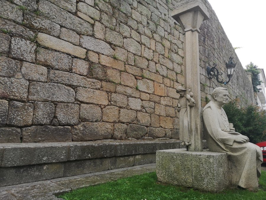
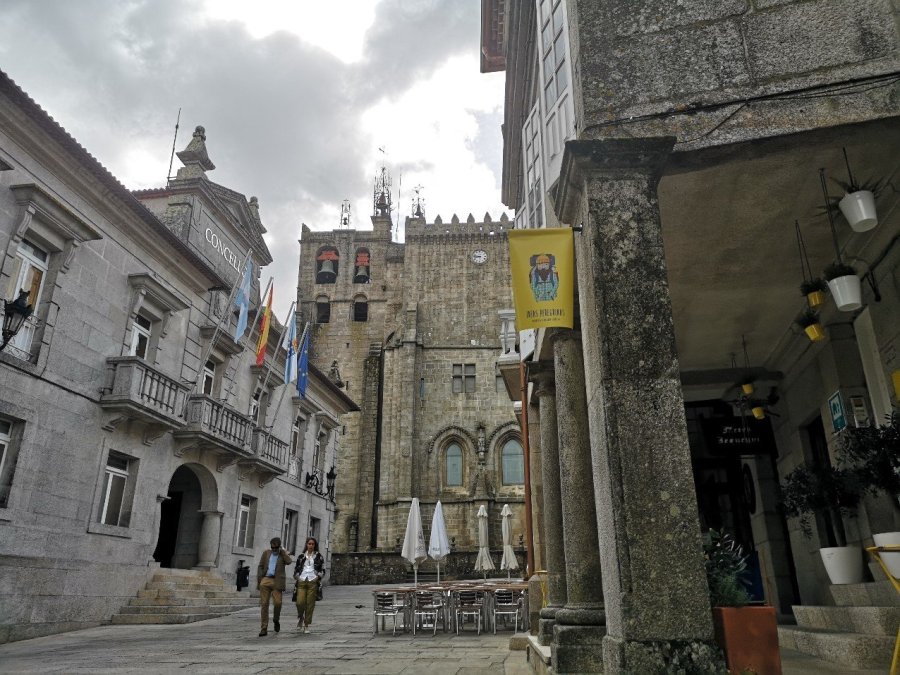
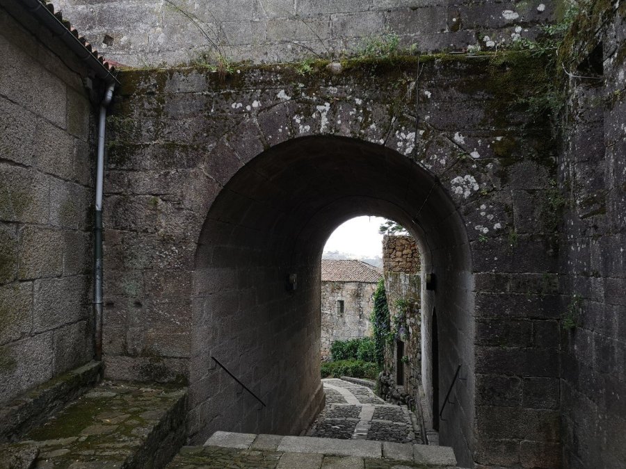
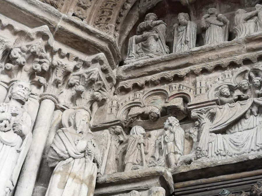
See St James peeking out from behind the column where Arzobispo (Archbishp) Lago Gonzalez (1865-1925) sits. His high cheekbones and benign expression make him look as if he is listening to a child telling him a story.The location of the Albergue de Peregrinos is magnificent with views from the rocky hill across the river Miño and hills of northern PortugalThe Capela da Misericordia is right next door and only slightly uphill (Rua Parroco Rodriguez Vazquez) from the Albergue de Peregrinos. Situated at the back of the Santa Maria Cathedral of Tui, it is simpler and almost unadorned. SpainThe hostel is wonderfully situated in this historic city. Elegant cafes are to the right of the Plaza da Concello, opposite the Concelo (the government offices of the social security finance department) and the Police. The side of the Santa Maria Cathedral is in the middle (in the background) and just past the flags, on the left and down the steps is the Albergue de Peregrinos, Tui, SpainThrough and archway in the eleventh century city walls you can see the old Roman street which predates it, giving a sense of the elevation of the town, Tui, SpainEntrance to the Albergue de Peregrinos with the typical Galician government, metal sign of a cartoon-type pilgrim with her water gourd over her shoulder, Tui, Spain
I was early into the town from La Guarda and encountered a difficulty: the hospitalera behind the reception at the hostel was talking animatedly to a gentleman who was lounging nearby. On seeing me, she launched into an attack on pilgrims who pretend to be walking, but actually must have come by public transport because they would never, otherwise, have arrived by this time. She laughed, he laughed, they compared notes and got increasingly irate about such behaviour.
I was dying to get the weight off my back and feet, and trying to explain in Spanish that I had not done this before, but had no choice with my foot pain. She ridiculed me and said I shouldn’t be carrying such a heavy load. It was most upsetting and as I became distressed she started to shout, saying that she wasn’t being nasty, just that ….
It is true that the municipal Xunta (the Galician council) albergues are for the pilgrims and that, increasingly, people are either not carrying their own packs or are taking buses and trains some or all of the way. It may have been an external voice, too, uttering the very words which I was hearing inside my head, and been part of my having to come to terms with being human and not always strong. Anyway, I said I would go away and then she started calming down and took me through the familiar process: passport check, credential stamp, payment (cash), and bedding. I was shaken.
It is a large hostel with solid wooden bunks. Although there is a sitting area where you can eat inside at the back, the kitchen is across the little garden and so I sat there for my tea as the sun set and it cooled down.
I delighted in the little face peering over as if she was having a chat with what look like two shepherds (there is a lamb at the feet of the right hand character). Catedral (cathedral) Santa María, Tui, Spain
You can see the beautiful cloisters and internal gardens of the Santa María Cathedral de Tui in the photos on their website.
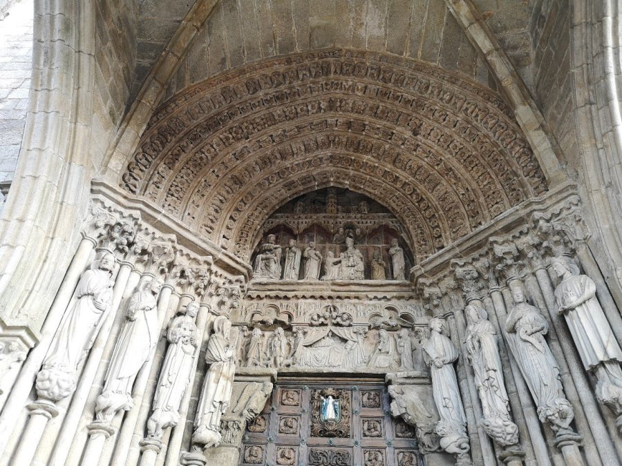
The very grand entrance to the Santa Maria Cathedral on San Fernando Square, Tui, Spain
The tourist information is also in San Fernando Square and the staff are extremely helpful and kind there.
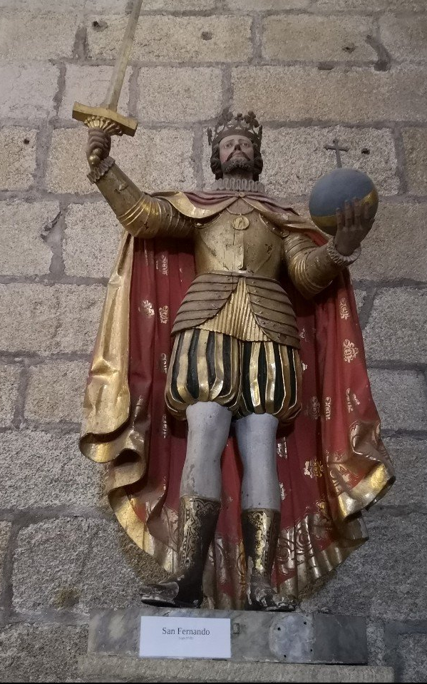
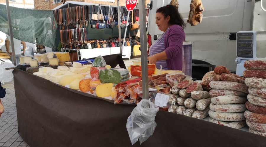
The seventeenth century, richly attired King Fernando carrying a sword and globe with a cross on it representing the might of the expansion of his Catholic empire around the worldThe Virgin with a halo of golden stars, robes flying and cherubs dangling in the interior of the Cathedral Santa María, Tui, SpainMarket stall with salami and cheese – local products of the area, Tui, Spain
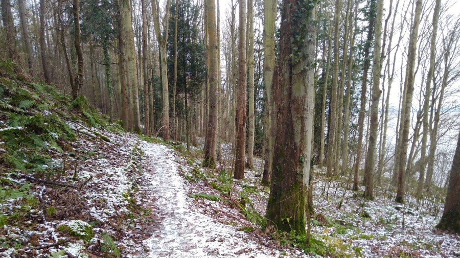
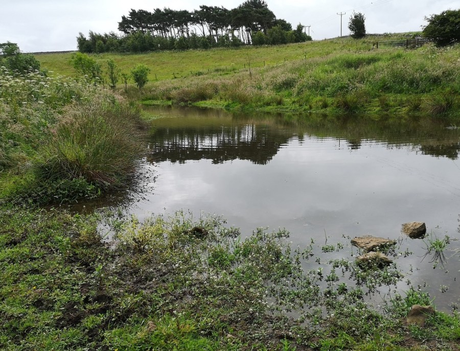
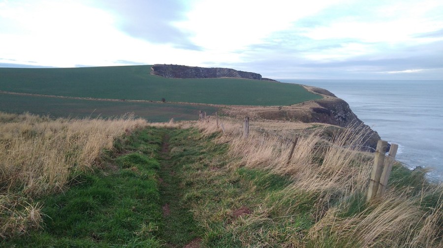
Tui to Mos
It is 25 kilometers to Mos and even though I had rested up for 2 days (well, a lot less walking than usual), it was too far, so I took a bus part of the way and trekked the rest (only 8 kilometers) to see whether I could manage. It was such a beautiful day and I was so happy to be on my feet again under the blue sky.
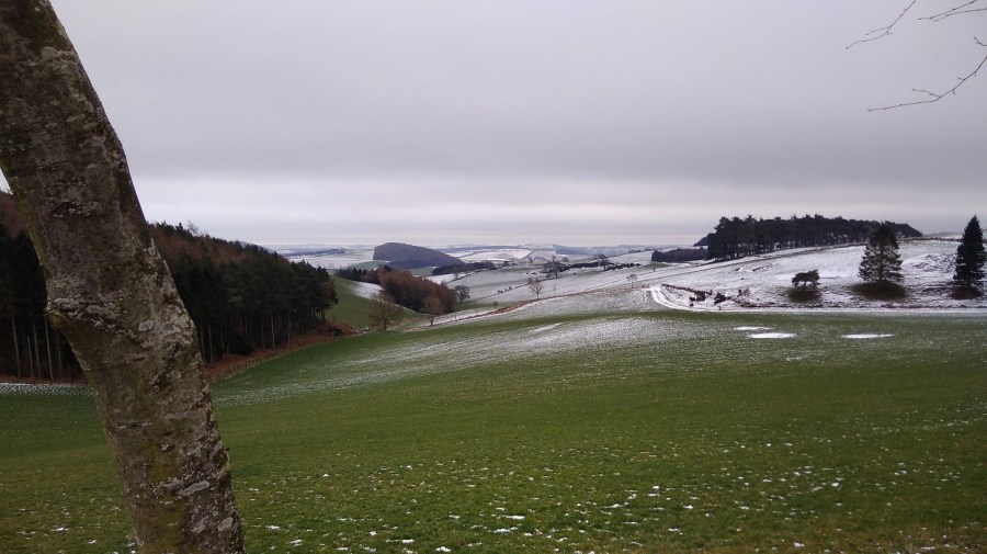
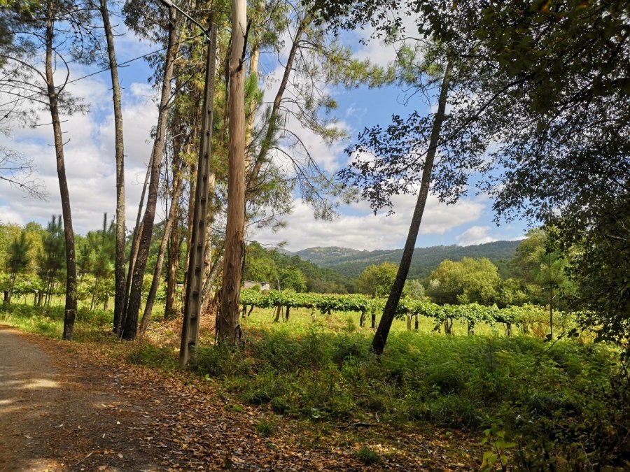
Vines loaded with dusky black jewels are spied between tall, thin trunks with mountains in the distance
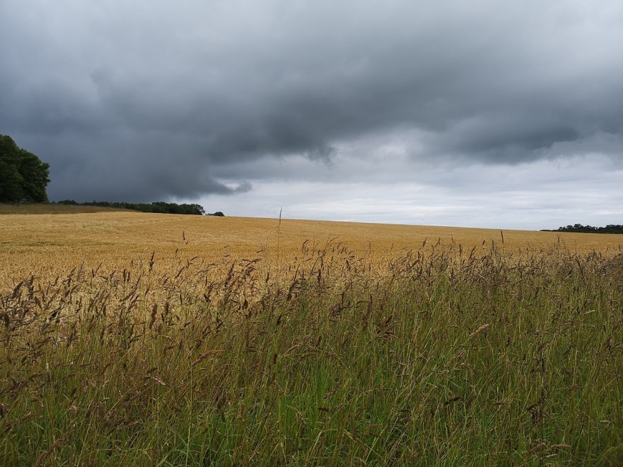
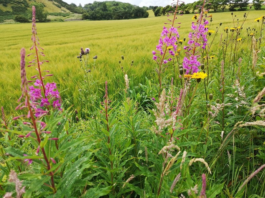
I am walking along the Via Romana XIX linking Braga and Astorga, enjoying listening to the birds and smelling the countryside after being in towns for the last few days. Sometimes the signs are hidden amongst pink roses. In the distance the open fields are empty now after harvest.
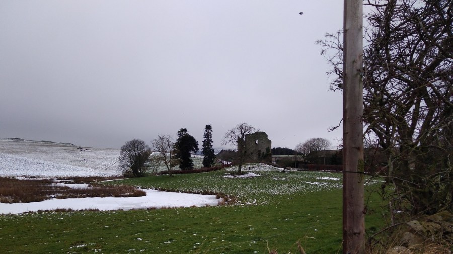
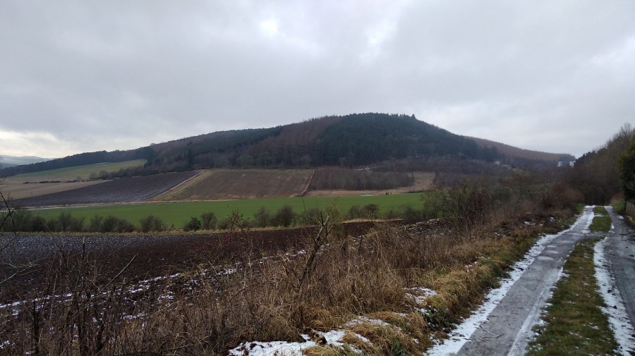
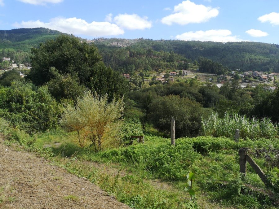
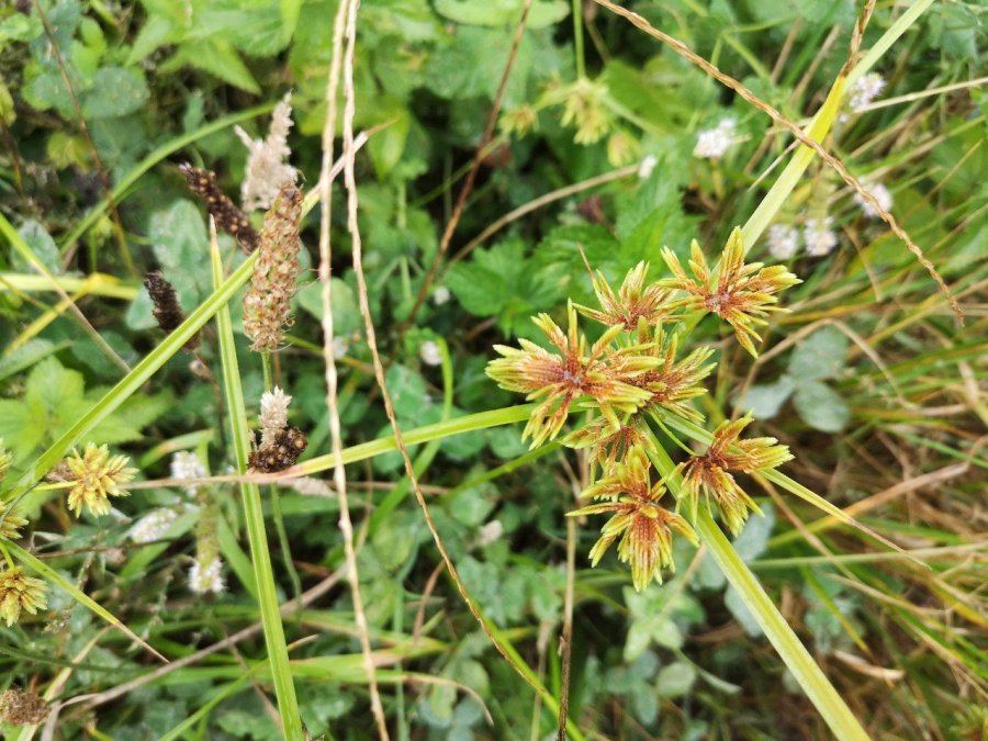
Ferns and lush farmland. The Mos population is spread across the region, with no one major centre. It is at a relatively high altitude commanding open viewsThis quiet area has a respectful energy about it with fresh lillies and roses decorating this wayside shrineBelltower of the Iglesia (church) Santa Eulalia. Nearby there is a very tall column with a crucified Christ at the top. It is a well-to-do area in places with carefully kept gardens (white camelias were spotted) and expensive cars, not like some parts of Galicia on the Camino FrancesBeautiful tall flatsedge, nutgrass or umbrella sedge (Cyperus eragostis)
There is a native, milky coloured drink called horchata de chufa or horchata de Valencia which is the region where I first came across it. It is made from the tubers of the nutsedge (not the type in the photo above). (Thank you to floral_uk on the ‘name that plant’ forum of houzz.com for this information). It is similar to a Mexican version except that the latter is made from rice, not this sedge.
Mos, Galicia (Redondela Region)
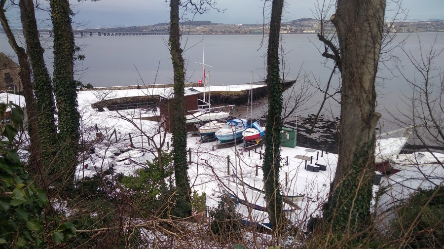
I stayed at the Casa Blanca hostel near the Santa Baia church where I sat in the evening. The albergue is new with a bar that serves ice cream and snacks, and there is a restaurant oppostite which cooks wonderful Padron peppers and does breakfast as well as evening meals. The accommodation is in a separate building and all are situated on quite a hill. There is a coin-operated washing machine and I shared a load with others after much negotiation, however there is not enough room to hang the clothes to dry outside and, anyway, it was already cold at night so my things had to come in at bed time to avoid being damp by morning.
I went up looking for a fruit and veg shop. Instead, I saw a man on the top of a ladder picking grapes who told me I had gone in the wrong direction. On the way back down a woman pulled up in her car and spoke to me in French. She took me through to the back of her gradmother’s house (derelict) into the stepped garden full of fruit trees and picked figs. We stood and chatted over these juicy fruits and then she introduced me to her husband. He filled my shopping bag with massive bunches of black grapes for sharing with the other pilgrims back at the hostel. I laid them on large fig leaves in the self-catering kitchens for folk to help themselves.
A walk from North Berwick to Dunbar, part of the John Muir Way, East Lothian. July 13th 2019. 30 kms / 18.6 miles
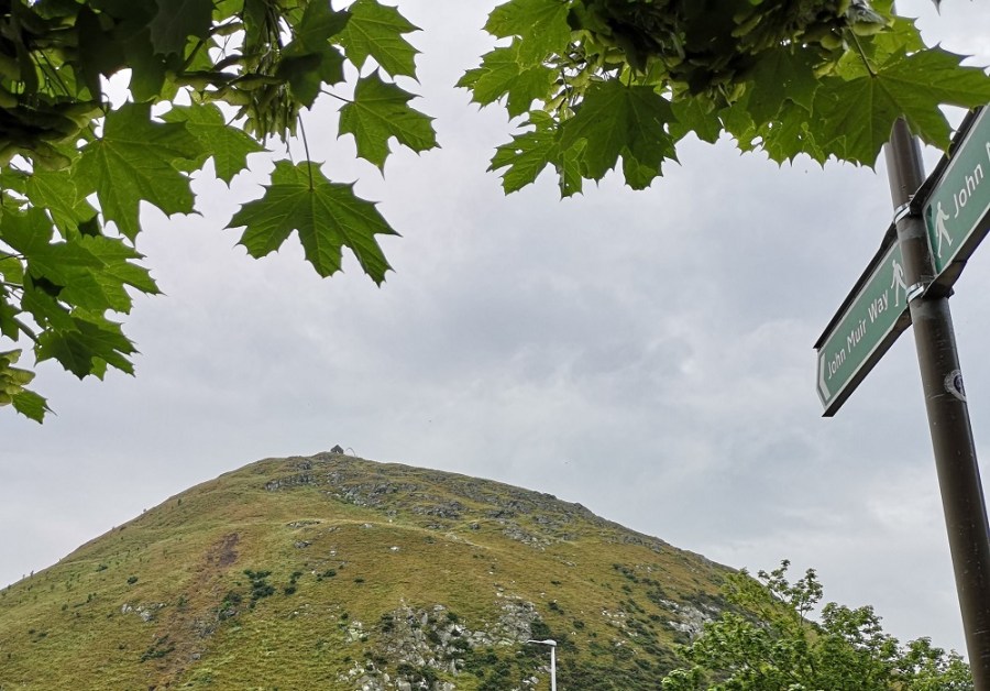
The mound of Berwick Law. You can just see the chapel and the famous herringbone on the summit
I remembered: the binoculars – definitely worth taking because East Lothian is a birdwatcher’s paradise. I saw 5 spoonbills through a kind man’s telescope (he had to lower it considerably so I could see, which was sweet of him). They looked like huge fluffy white poodoodles (or whatever they are called), with Edward Lear beaks (you know how he made drawings of amalgamated animals and kitchen utensils!) Also my walking baton pole which came in handy for the mud caused by the torrential rain. I forgot: tissues / toilet paper and my mobile phone charger – when will I learn? I lost: my sun hat. Twice. Once a motorist stopped and rolled his window down so I went back quite a long way to get it – all run over it was with muddy tyre marks. I wore it when the sun came out and then lost it again. Never to be found – not by me anyway.
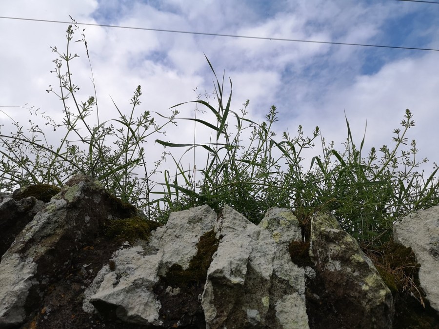
Pool at the foot of Berwick Law, near North Berwick, East Lothian, ScotlandA rather picturesque Wall I thoughtLooking through the gap in a stone wall to the wheat beyond
I had not done a long-distance walk for a long time and I managed to get quite stressed to start with, meaning that more little things went wrong, until… I got into the first green part and the butterflies (some chocolate brown and others white – twice one kissed me on the cheek) were playing, and the raindrops sat bulbous on the bramble flowers catching the glint of the sun, and I got bitten by black and white flying beasties. I was back!
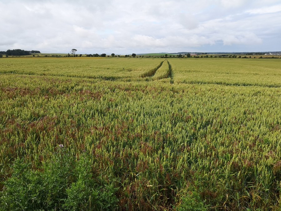
Arable fields, East Lothian, Scotland
The man in a green National Trust for Scotland t shirt said ‘Lady on a mission’ as I swung through the gate and skirted around Berwick Law. I have been up to the top in the past and it’s well worth it, but today I was headed south through meadows and woods, around fields and coastline – it was delightful.
I smiled out loud as I made my way through an ash wood, all smooth, straight, pale trunks
Two runners in electric blue went jogging slowly past, having a laugh. Several jaunty ladies wished me good day, and I rather rashly added to my brief conversation with a hiker going in the opposite direction, that at least it had not rained.
The very definition of a lowering sky!
I squelched along a narrow way with piles of horse manure and single tyre marks which suggested other users I thankfully did not meet. When it rained I was on a long farm track which quickly became two channels of fast flowing water. There was a section which reminded me of a Kent walk, because it had serious new, silver metal fences on each side, and one smelly uphill section through the Drylaw Composting site where I discovered a make-shift children’s play area.
cof
cof
There was the unmistakable sound of a wild bee swarm several times along the way, and the hideous screech of racing cars around East Linton. One blissful result of the downpour was that they stopped, although they restarted when the sun reappeared.
Half way I stopped for refreshments at Smeaton Nursery where there is a gallery and shop. Helen Gray is the Smeaton Estate Artist
There are lots of plants, a Victorian tea room (soup, salads, cream teas, delicious looking cakes), and a gallery shop selling all manner of paintings, cards and gifts. The staff were particularly friendly and helpful while I dried off a little in the sun – boots off and not so waterproofs laid out on the table.
The mature trees of Smeaton Nursery grounds where there are woods, a lake and pony arenaPreston Mill reminding me of a disused oast house in YaldingStunning weeping willows along the River Tyne outside East Linton
You could be forgiven for thinking there was no bee or butterfly problems if you saw the number of them I did on this walk. There is a beautiful long stretch along the river where comfrey grows in abundance and the sliver green fronds of the willows dip into the water.
Bridge over the River Tyne
There were so many wild flowers I lost count: chamomile with green orbs which had lost their white petals – not just short stalked, but long and waving in the breeze;
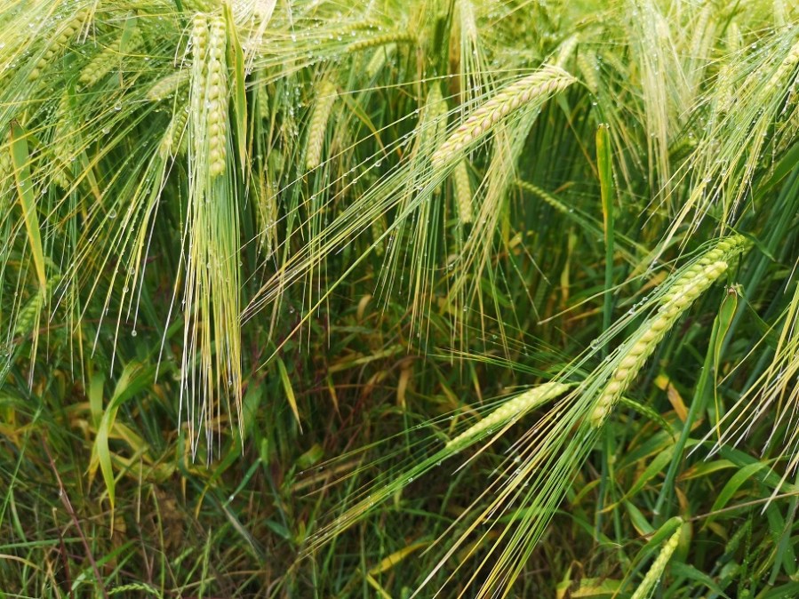
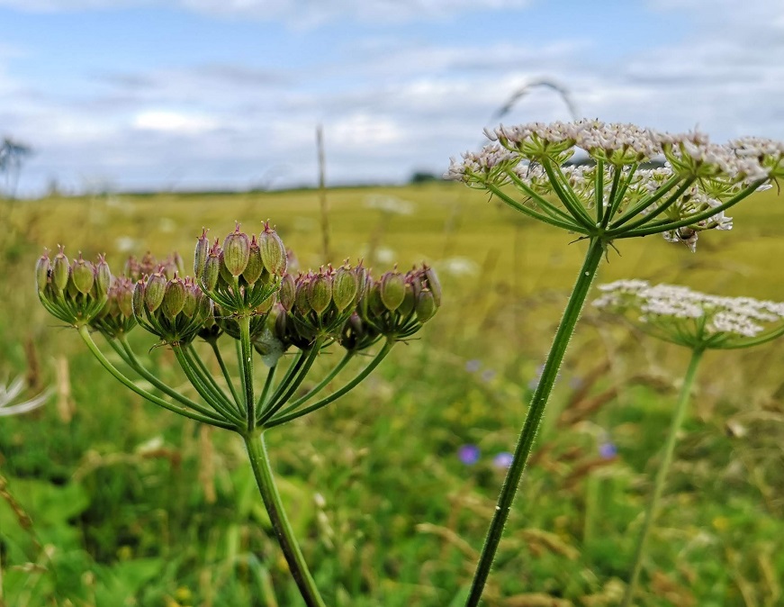
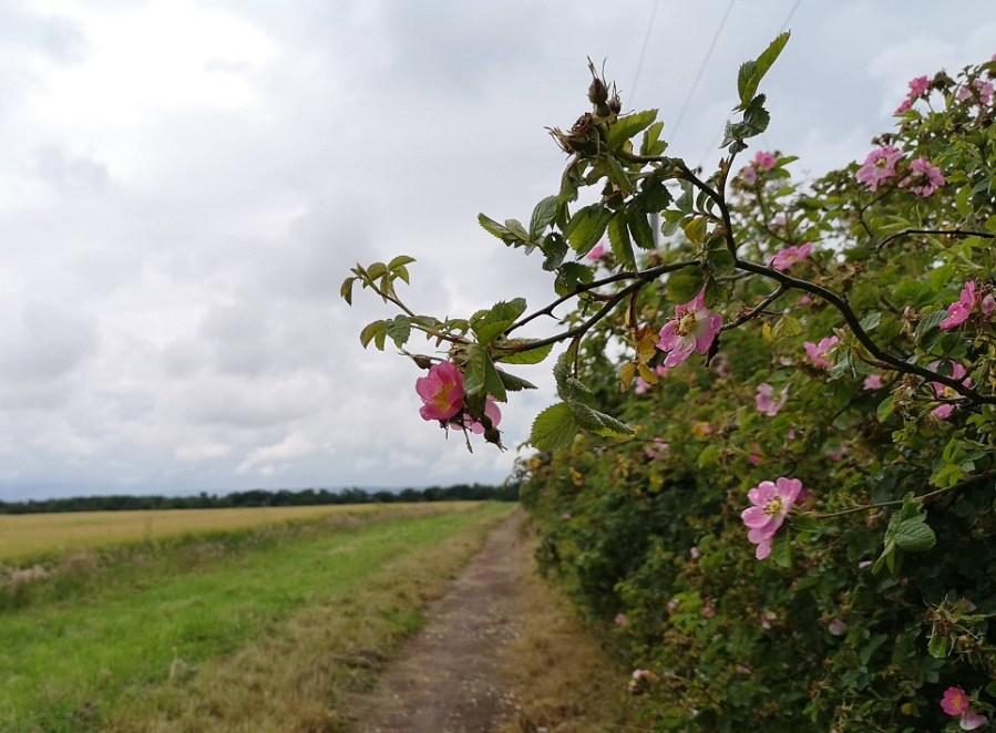
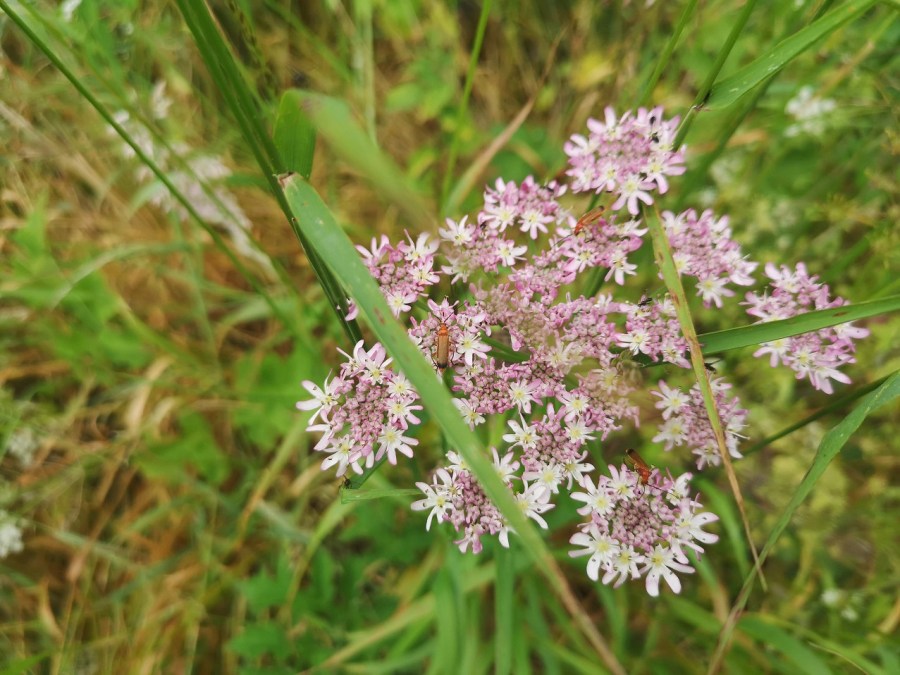
elder flowers practically turning into berries as I passed; ripe cow parsley covered with Comon Red Soldier Beetles; ox eye daisies amongst the fields of bearded barley; brilliant scarlet poppies in the hedgerows; and miles of roses, sweet secented and in a variety of firey colours.
Wild flowersPink rose bay willowherb contrasting with yellow ray flowersBarley tickling the groundCowparsleyDog roses in the hedgrows
As well as the spoonbills (above), there was a buttercup headed yellow hammer bathing in a puddle, gaggles of very excited sparrows with their wings all a flutter near the horse paddock, and a piebald square tailed kite sailing overhead.
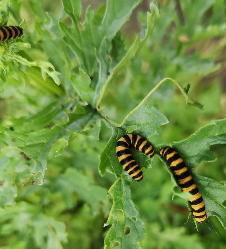
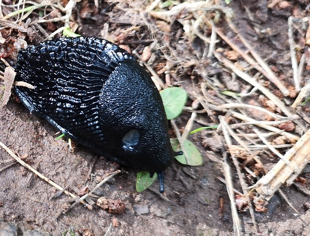
Caterpillars having a feast – there were about 20 on this one plantSquelchy slug – one of the biggest ever – seen in the dappled woods opposite the East Links Family Park where there were emus grazing alongside llamas and donkeysRed beetles on cow parsley
The more you walk the better it is because there are so many memories of other treks gone by, people met, places visited. The first black raven crawed and reminded me of Orkney. The second clearly warned me of the coming shower, which I promptly ignored and so got very quickly wet through. I was still damp 4 hours later when I marched into Dunbar.
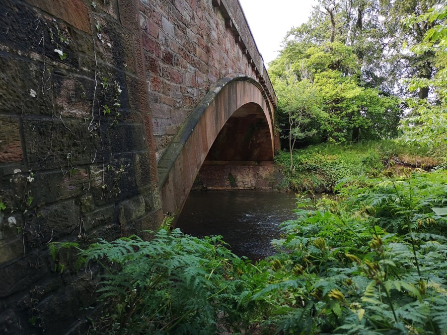
Old stone bridge over the River Tyne, East Lothian, Scotland
There are three bays at the end of the day: the flat wetlands of Tyninghame, the red sandstone stacks of Belhaven (not to mention the real ale, the yellow house, and the John Muir Country Park with its caravans and little swan lake), and finally around the golf links I went barefoot to the gull studded cliffs of Dunbar itself.
The distinctive Scots Pines of Tyninghame Bay, East Lothian, ScotlandCreek at Tyninghame BayBass Rock and Tyninghame Bay, East Lothian, ScotlandBelhaven Bay, East Lothian, ScotlandComing through the arch into Dunbar Bay, East Lothian, ScotlandThe man himself – John Muir, featured in Dunbar Bay, East Lothian, Scotland
It’s a hedgrow and fields walk
Its a meadows walk
Its a skirting round the hills and not going up walk
It’s a coast to coast walk with arable land in between
It’s a walk full of wild roses,
A very well signposted walk
While the birds call all you have to do….. is walk!
Practicalities
I arrived at North Berwick around 11.30am, and in Dunbar 7 and a half hours later, with an hour’s stop and an extra 2 kms in the middle to and from the Smeaton Nursery tea rooms off the main route. I was reliably informed that the tea room at Tyninghame is also lovely.
I took the train from Edinburgh to North Berwick with Scotrail (who very kindly refinded my fare to Dunbar which I made by mistake – thank you). It took 45 minutes and cost £7 single. I might have rather annoyed the gentleman in a cravat opposite, but had lovely chat with a Northern Irish dog walker from Glasgow on his way to follow Mcllroy round the golf course.
Walk from the station in NB to Lady Jane Road, turn right up it and after a few minutes on the right you will find the John Muir Walkway signs. Alternatively start at the Seabird Centre and walk through Lodge Grounds by St Andrews Well. There is a lot to see in NB.
My return was by bus from Dunar on the Edinburgh Express which leaves at 29 minutes past each hour on a Saturday afternoon / evening and costs £5.70. It takes an hour, leaves from the high Street, and doesn’t put you down at the bus station but at Waverley Railway Station, Edinburgh.
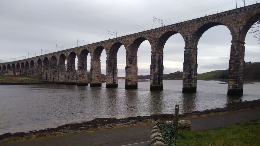
In the middle of winter I headed south on a train to Berwick-upon-Tweed along the coast of East Lothian with the sea on my left. It was just after 9am and I could see brown fields, a slate grey sea, even darker land on the other side of the Firth of Forth and the silhouettes of the trees without their leaves. As it lightened there was more detail: cows in coats; four-by-fours speeding between fields; ruined castles; and low, red-roofed farm buildings. The train was quiet.
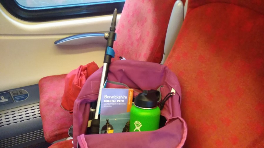
Just a light pack today, including my new flask which Isobel gave me for Xmas
I am hiking part of the Berwickshire Coastal Path (45.5 kms / 28.5 miles in total = a recommended 3 day walk). Berwick upon Tweed is technically in England (although their football team is Scottish!) and my destination is Eyemouth, 17km (11 miles) away.
The fields become green as I travel and on my left is the point of Berwick Law, the only high place in this flat landscape. Combine harvesters are frozen mid field; barrels of wrapped up straw lie waiting; there are borders of louring pines in the distance; and beyond, a complicated sky: wispy dark clouds against a bright blue though pale background and at the same time, little bands of cotton wool balls stretching from east to west.
Found photos of (from top left) Torness Nuclear Power Station, Dunbar Town House, St Abbs Head Lighthouse.
A few golden strips of corn have been left lying in the fields, birds are black shapes in the bright sky, the bare bones of the trees are like hardened and flattened seaweed fans. People were sniffing and blowing their noses all around me.
There were acres of half-built houses as I drew near to Dunbar, birthplace of John Muir, friend to all walkers and nature lovers. A small town with the arrow-head tower of the newly-painted-white, 16th century Town House; Saturday people with pushchairs; glimpsing the sea between buildings.
Then once more rolling by the deep chestnut loam, and a more varied landscape. We were edging further from the sea where the iconic Torness nuclear power station like children’s blocks which have been fitted together wrongly. Sheep grazed in miles of brussel sprouts fields; low, dry stone walls divided; and a solo bird perched, waiting for the morning to come. We skimmed past the St Abbs Lighthouse, where I was planning to walk to today (see below).
I could see the path I was going to be walking at the top of the cliffs as they tumbled down to the rocks and the white waves below. Men in red and blue were playing golf, their trolleys angled beside them, pools of sand dipped in the ocean of green turf.
Arriving at Berwick-upon-Tweed stationA detour almost, before I started, through Castlevale Park to the riverside walk, to take a photo of the brick bridge across the River Tweed
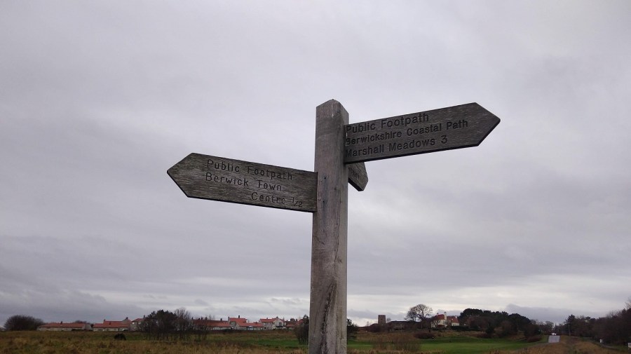
As always, it was difficult to find the beginning of the walk, so, here are the directions for you: come out of the station, go up the little slope, turn left and then take the first right.
A man with 2 dogs stopped while I was taking a photograph of the Round Bell Tower , not knowing that I was waiting for him to come into shot so that I could include him! He told me that he used to work for the local newspaper and one April Fool’s Day he took a photo of it leaning, said it was toppling over, and published it with the caption, The Leaning Tower of Berwick. Crowds of people came to watch it, he said!
The upright Round Bell Tower, Berwick-upon-Tweed
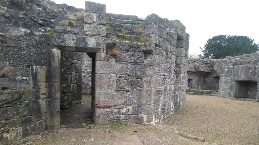
Next to the tower is Lord’s Mount, Henry VIII’s gun tower (completed in 1542). Its massive wall contains six gun positions and a latrine. The artillery included ‘the falconet’ which fired a solid ball 1000 yards (914 m).
Lord’s Mount, Berwick-upon-Tweed
Before I even got to the sea I lost my pole, which I went back for and luckily found, and a glove which I didn’t.
The Northumberland people I met were lovely and friendly and gave me directions out of the town and onto the path.
Oyster catchers were wading and ridges of diagonal rocks showed dark against the washed yellow sands. I went down the steps to a tiny cove, and along the well-trodden beach full of footprints and seaweed. There was the sound of trickling water as I made my way up at the other end.
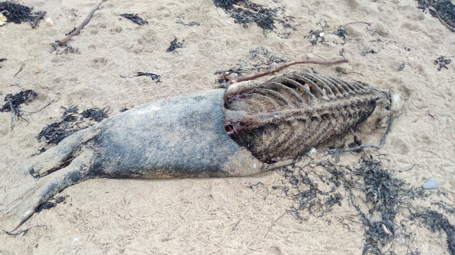
The first bayA dead seal was washed up on the shore. A disturbing, though not an unusual sight
Up above were ranks of holiday caravans where shells had been hung between railings. I could see a red and white lighthouse beacon at the end of the pier in the distance and hear the single, shrill whistle of a bird overhead – just as if he fancied me.
Looking back to the bay, Berwickshire Coastal PathWinter seedheads and kind grass underfoot, the sounds of waves crashing and my Camino shell clinking at the back of me
Immediately I came round to the next bay. It was larger this time with delightfully pig-pink cliffs and tufty tops. The wind was trying to blow the pale, beige stalks seaward. Once again it was just me and another man with his dog. Vestiges of yellow flowered gorse gleamed on the bank opposite.
Clattering seed heads above and the odd flower low down sheltering from the winds; a nettle, some brambles and litters of rubbish
The squawk of the train reminded me that the railway line matches the path to the left, and I was walking between that and the sea.
Wind turbines lazily turned despite the knots, and there were rusty metal steps down to the beachThe path curved round a mixture of natural rock and man-made straight lines with a very enticing cavern underneath
The links (golf course) was on my left; slippy mud down to a little wooden bridge over a trickle of water; the sweet tweet of a leaf shaped bird overhead, its wings fluttering fast. It was a very narrow, windy and uneven part so I was glad that I had found my pole to steady myself – it is definitely not accessible to wheelchairs or baby buggies.
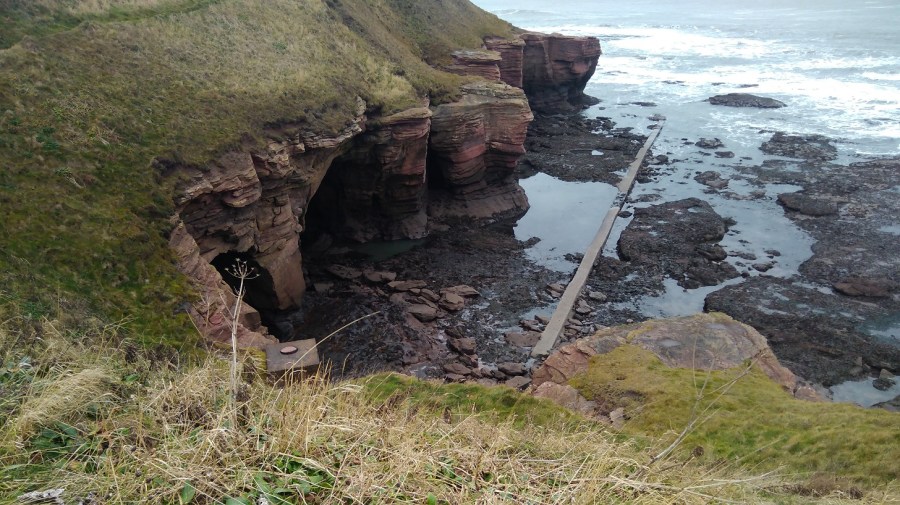
Marshall Meadows, a lovely name – the first signposted stop, 2.5 miles
The path follows the highly eroded coast line in and out; my nose was running, tickling; and my mind returned to other similar trails: Normandy, Brittany, andOrkney.
It is an impressive landscape: thin horizontal layers of pink rock, tiny slices but massive boulders. My eyes were getting a welcome break from the computer as I gazed out to sea and admired the hues and cries of this stimulating view and the birds who live here.
The camera is not doing the colour of the rocks justice. They are almost carnation pink, practically unnatural except that they are all real
The sky was opening up; I could identify the peeps of oyster catchers and see sparks of black ravens; I was scanning the sea for any sign of whales. My forehead was cold as I walked straight into the northerly wind. How I appreciated not heaving the heavy rucksack for once.
The upstanding and nearly empty sorrel had turned the same deep chestnut brown of the fields
I only stopped for a couple of minutes for a comfort break and to put some chapstick on my lips, but I was already cold afterwards. There were single, brown birds with long curving beaks (curlews, probably), and others in huge crowds sweeping around in the sky above me, sticking together in formation, communicating wordlessly. I was entranced by these murmurations.
White horses and rolling waves
For a moment I wondered why I do this, especially in winter when it is so chilly. Then I looked out to the horizon and saw the world – so much bigger than me, and down at the rocks and the majestic sea stack – the land simply missing between it and the cliff; and it was good to be reminded how small I am.
A sea stack – close-up
I saw the people in their cars rushing between Edinburgh and Newcastle on the A1, and the high speed train making its way down south to London. Here I was being blown and buffeted by the wind, breathing the fresh air, listening to the natural sounds around, the brushing of my feet as they passed through the grasses, stumbling and toppling over uneven ground which is good for balancing my brain, and looking ahead. Things were coming into perspective.
A natural, geological arch
Up a short wooden ladder, over a stone wall and I discovered I was in a caravan park called Marshall Meadows. Much to my disappointment it was not the pastures I had imagined!
It afforded me a few minutes of shelter away from the sea’s edge and the wind though
Back onto concrete I immediately felt my sore feet and realised I hadn’t been aware of them since the pavements in Berwick.
Aah a sign! As I pass through the site, I wonder if the people who hire these caravans realise that their windows will look out onto the railway
By this time I was looking for a place to shelter and sit for a cup of tea and a banana to keep my sugar levels up. I didn’t want to lose my sense of proportion, which has happened in the past.
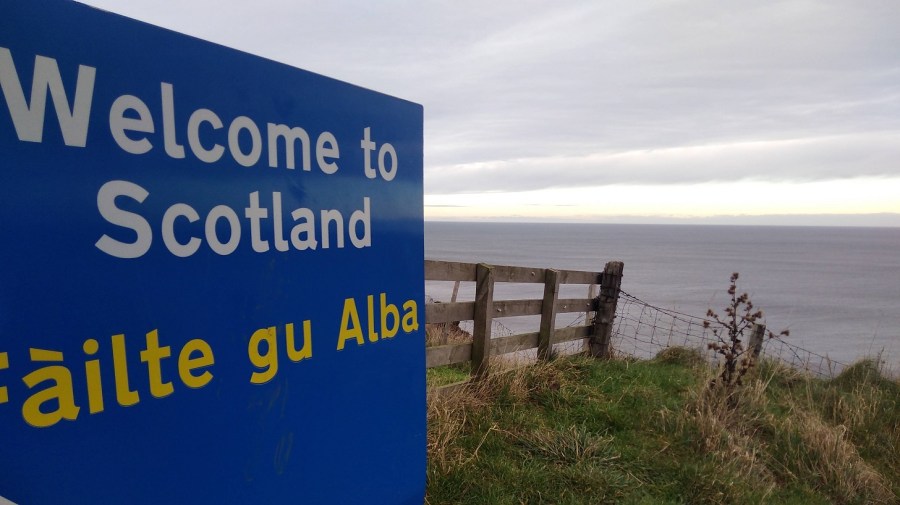
Crossing the border into Scotland (the sign is written in English and Gaelic)
The Cuddy Trail is here. Cuddy is Scots for a donkey and the ‘beasts of burden’ were used to transport coal and fish from the shore to Lamberton and the Great North Road.
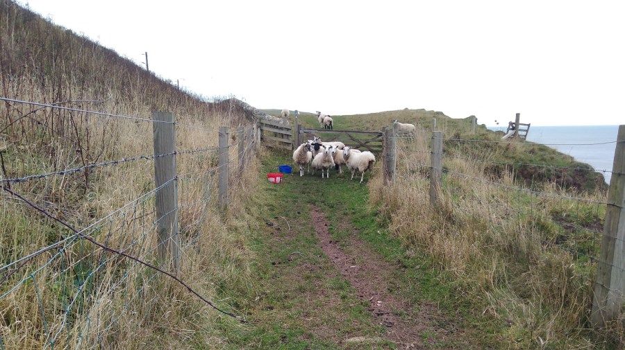
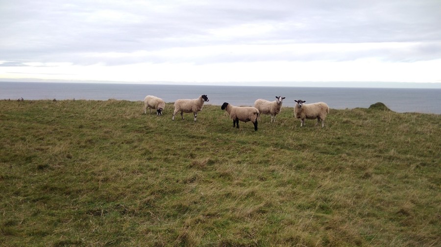
I hastily put my hood back up over my woolly hat and found myself walking between two rows of barbed wire fence by signs saying to clear up your dog poo (it can be poisonous to farm animals)They were scared of me, yet interested. I think they were female sheep because they were multi-tasking: walking, eating and going to the toilet all at the same time!
I had to climb over the gate as the farmer, in his wisdom, had padlocked it shut despite this being a public right of way and well-known footpath.
Then I curved back towards the wild cliff corner and the sound of the crashing water. The wind was causing shadows on the ocean. It had that look about it as if it was rising up to the horizon and down to the beach. It was heaving. The surface colour looked flat and even, until I really paid attention to it. Then I saw the variations of the olive, seaweed and sage green, with slate, business suit, and pewter grays, all edged with white lace and set against a peach sky.
There were lots of helpful signs indicating that badgers, yellow meadow ants and peregrine falcons can be seen here, but not by me. I did get glimpses of the fulmars on the ‘cliffes’, nesting in their flint and white plumage, so far away that all the photos were too blurred to be reproduced.
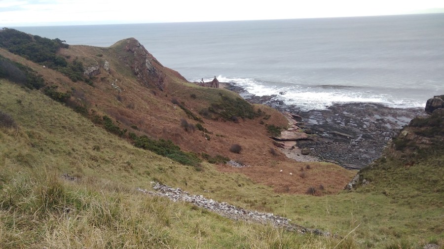
I was interested in a ruined bothy on the steep slopes which only the sheep could negotiate, and went to the edge to take a photo. That might have been where I mistook my way
Twenty minutes earlier I had passed two men getting out of a car and preparing to surf, clad in black wetsuits with their white boards. I bet they had a good time in those rollers!
It was then that things started to go wrong.
A bowl of dark boulders – I shouldn’t have gone down there!
But I did. I thought, ‘really?’ but I couldn’t see anywhere else to walk as the railway came so close to the edge, so I went anyway.
I skirted the steep slope first of all, grabbing handfuls of grass to stop myself slipping and edging my feet into the side, until it became too hard going. Then I dropped down onto the rocks. They didn’t look too bad from a distance, but they were – it was really hard scrambling over them. I could see a way out on the other side and I still assumed that was the right way. I pushed and tore through the brambly undergrowth, I fell down and got myself back up. I persevered. My pole kept collapsing itself and up at the top was a sheep’s face peering over at me. I could see hoof marks where they obviously managed fine, but I sure was struggling. Was there a way? What could I do?
Go back, that’s what! It was impossible. I was very hot and bothered and there was nothing for it but to retrace my steps, which was easier said than done and something I don’t enjoy. I traversed the rocks closer to the sea which were slippery as well as treacherously uneven.
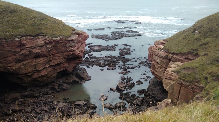
I had completely lost my cool until I came across such a beautiful sight that I just had to stop and breathe.
A calm pool between the jet volcanic rocks and the pink cliff profile
It took a lot of time (perhaps three quarters of an hour) and I used up a great deal of my available energy. And it took quite a bit of serious tramping to get over the anger and frustration of the experience. On the back of the BCP map it says: It may seem unnecessary to provide directions other than saying – walk north or south keeping the sea on your right or left!’ Am I the only person to have missed the most straightforward path?
Slowly I realised I had to relax and get back onto the right path. I had to let it go or I couldn’t enjoy the remainder of the walk, so I focused on anything but my feelings and picked up pace.
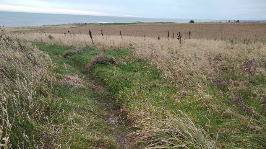
In my recording I said that I chose not to walk where two others were, around a field when I could clearly see a short-cut straight across the top of it. I saw the trampled down barbed wire and said to myself, I’m not falling into that trap again!
Next was a straight and concrete side road to Homestead, and I spotted a brightly coloured lifeboat chugging along. When I turned round, there was a deer lolloping in the undergrowth very close by with its beacon of a white tail. It seemed to be rather a special sight. The Medicine Cards say that when deer appears, ‘apply gentleness to your situation.
At 1.50pm, my phone battery was already down to 32% and I quickly came across another conundrum. I took a second wrong turn. This time I crossed a field to the left because it looked as if the alternative went over the edge. It was not clear, so I stood and debated and as the gate was open I chose to go through.
Right to the end of that green field I went, past all the sheep who may well have been watching wisely for all I knew! And then I didn’t know where to go but back – it was a dead end. Never again will I walk without an ordnance survey map, I declare to the sheep!
So I went through the other field (not in a straight line), climbed over a stile, and doubled back (presumably the path avoids the farm land).
Burnmouth – not a sign of life, not a soul
There was the village of Burnmouth below me at last, tucked under the heights. I zigzagged steeply down in the opposite direction from the yellow arrows, behind the gardens and at last found a BCP sign. Amazing how this often happens at a time when there is absolutely no other possible way anyway! For some reason the walk is not as enjoyable if I am not going in the right direction.
Apparently Burnmouth was ‘once a hotbed of smuggling’ (tea, brandy, silks etc) engendering lively stories from 1780. A pretty but secluded village, it is divided into two halves with a harbour inbetween. Candy coloured cottages seemed to be for visitors. The tide was out leaving streaks of low rocks, as if someone had painted on a glassy surface and the paint had separated unevenly.
Burnmouth from the tops of the cliffs
A man stopped to do up the zip of the woman he was with and my black mood meant I could barely manage to say a friendly hello. My knees hurt going down and my insteps going up. The sign pointed in the direction of two roads, one to the right and the other uphill. I took the path which ran to the right of a dour chapel, curving through woods, over a planked boardwalk, then up a steep hillside with a horrible groaning noise going on – something to do with the fishing in the harbour.
There was a handy bench ‘Dedicated to William Telford, born Burnmouth 1925’ for resting my weary feet and admiring the vista but I was very stiff when I got up. I hadn’t been walking for a month of so and it was showing. I thought I wouldn’t need the chocolate I bought yesterday and wished I hadn’t left it at home.
Blue tits played in the briars, zipping in front of me; silvery green lichen covered the branches. Humbled and cut down, I did not recover quickly. I was reduced to little more than zero miles an hour.
Once up high again and back into the windy onslaught, I needed a hat and two hoods – it was a mere two weeks after the winter solstice.
Then, halleluja! the sun started to show its lovely self. 3.15pm. What a wonderful light.
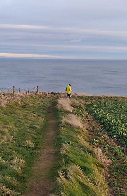
The colours deepened, became lucid and my mood eventually mellowedFaint and fragile fingers against a mackerel skySee how the coastline meanders!The sky and sea got bluer and bluer. There were two options and I went over the wall, hoping it was the right decision. I found myself out of the sun’s warmthSelf-portraitA yellow clad fellow walks southwards – that’s the right idea – wind at the back of him!I simply loved the contrast between the orange lichen on the wall and the blue and green beyondRock macaroonsThe sun was starting to set. I felt chastened, very quiet insideI only got as far as Eyemouth, having lost valuable daylight time going the wrong way and needing to get the bus back
I had to ask for directions from a group of teenagers heading out for some fun, giggling. I wound my way along the jetty and around the end remembering that I was here for my birthday with Lesley in 2016. The wandering geese took no notice. I was aiming for the co-op store at the centre (ye cannae miss the co-op, it’s the biggest building in the toun I was told) and the most helpful girl who checked the bus times on her phone for me – my fingers were too cold to work mine and it was threatening to run out of battery.
I was focused now on getting warm and fed as I always am after a long day’s hike. I had to spend a great deal of time in a Wetherspoons in Berwick until my return train to Edinburgh, but I warmed up and rested my weary limbs.
I didn’t make it to St Abbs so I will have to start next time at Eyemouth and cover that stretch on day 2.
All’s well that ends well! (one of Shakespeare’s ‘problem plays’ from around 1600)
Train: Edinburgh to Berwick upon Tweed (Scotrail £14.60)
Timing: Beware! the official coastal path website says this day’s walking takes 3-5 hours. I defy a human to do it in 3 hours – I think it is a mistake. I am not the quickest walker, but it took me 7 hours with 3 x 15 minute stops and a last minute detour
Overall: I would not recommend that people do this all in one day, especially immediately after the previous stage of the FCP, and with the transport difficulties and wintry conditions
Dundee to Woodhaven via St Andrews
My day began in Dundee where I had unwittingly spent the night. See Leuchars to Wormit for details. I took the earliest 99B bus to St Andrews (8.19) which was straightforward.
Crossing the Tay back to Fife as the sun rose
Unfortunately when I arrived at the St A bus station the bus company no longer operated out of it. I phoned up to find out where I could get the 77 back to the Wormit road, connecting to the ’emergencies’ line and feeling a little guilty as it was not exactly a life and death situation. I was concerned that I would not get to Newburgh before dark. The exceptionally kind man on the phone explained that there never has been a Sunday service of the sort I was waiting for! In the end, on hearing the note of desperation in my voice, he came up with a plan and 5 minutes later a second gentleman appeared in a van to pick me up. He had been called out of his bed to fill in for someone who was sick, left his own car at the depot and was on his way back to get it. He took me along with him!
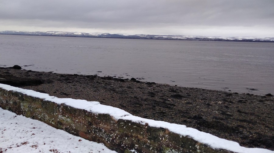
Woodhaven Pier, between Newport and Wormit, River Tay, Scotland
It was half an hour’s walk from Woodhaven to Wormit, first along the B946 (a residential connecting road where the pavement was all slippery from the snow which had hardened into ice overnight)……
The air was very clear as I looked across someone’s wintry garden to Dundee, Scotland
….then taking a right onto Bay Road…..
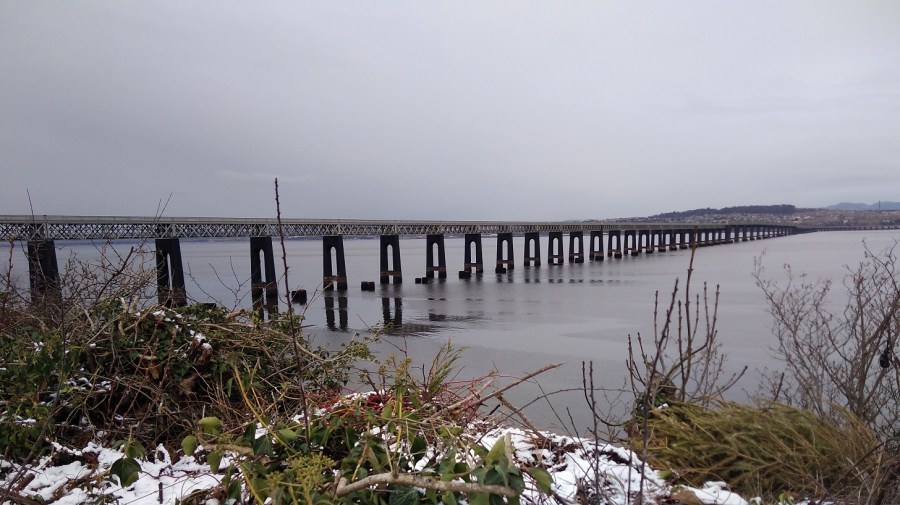
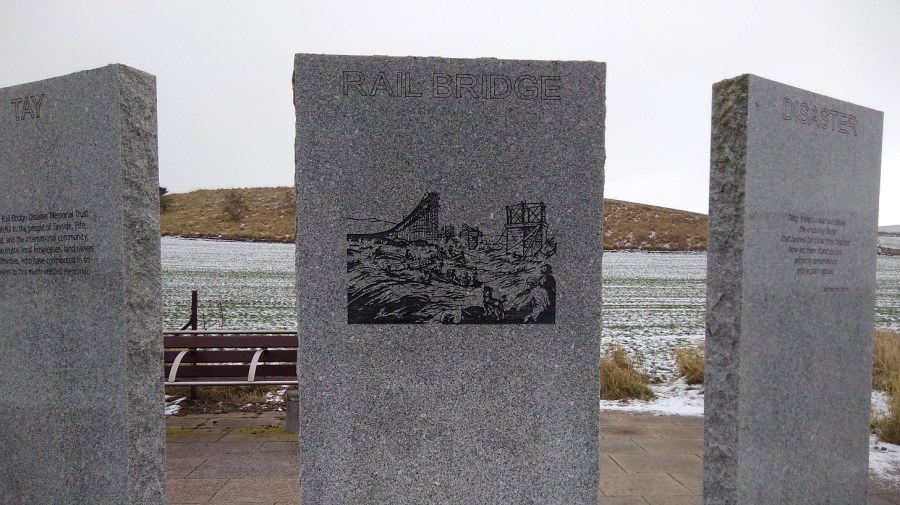
Tay Rail Bridge
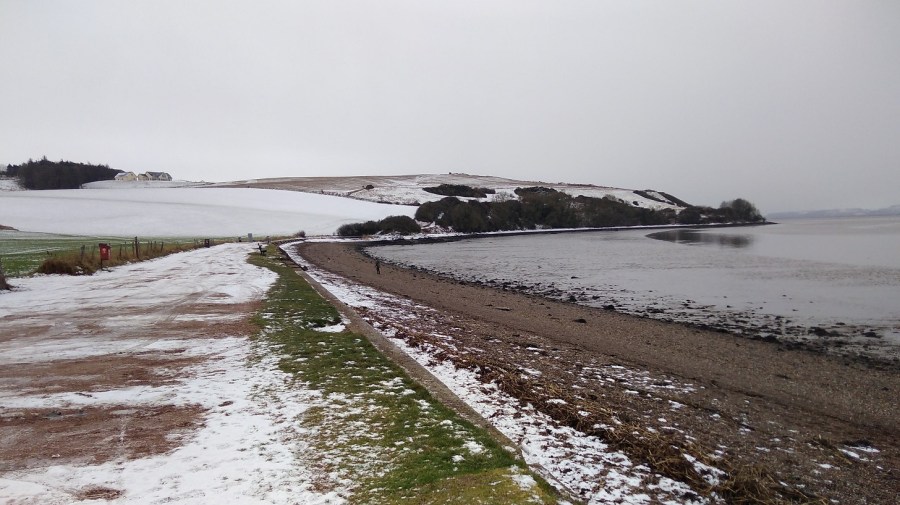
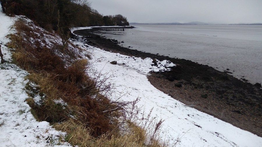
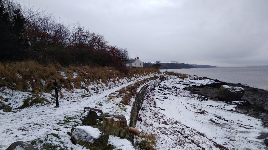
….bypassing Wormit proper and heading straight to the beach where the FCP runs across the strand for a bit.
I could see where I would be walking, Wormit Bay, Fife, Scotland
Wormit to Creich
It took half an hour to get to the start of this stage, so yesterday would have been exactly 7 hours if I had finished and today I must add an extra 30 minutes to the walk if I am to reach the final ending point in Newburgh.
It was raining / snowing – a dull, grey day.
Tay Rail Bridge Memorial at Wormit Bay
The local lady was right that I was due for a climb, despite the way it appeared on the map. She said she had avoided it because it was so slidey underfoot. I passed through the metal gates to keep the cattle in, and further on I appreciated the landlocked wooden seal sculpture.
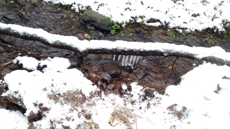
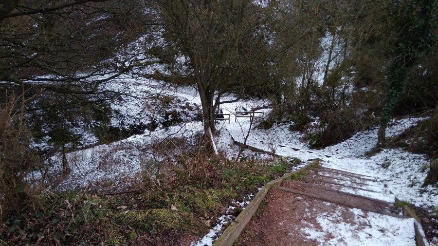
Looking down onto the watersideIcicles in the dellsThe path wound through woods away from the coast, up and down steps and across wee burnsThen it opened out – the arable fields were slopes of white and the copses made of bare twigs
Catkins dangled olive green, and other peoples’ footsteps showed me the way.
Drawn to making more of my marks in the snow – the dynamic relationship between the elements of fire and water, sun and ice, passion and reflectionStripes of muted greys: snow, stone wall, shingle, the estuary and the white covered hills of Tayside in the distanceThere were occassional dwellings along the way. I saw no-one
There was a quiet, gentle lapping of waves on the shore as I went between two houses.
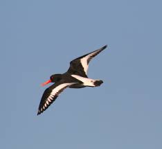
A massive boulder covered in gorse-yellow lichen on the half-white beach. The rest was grey. A flock of oyster catchers whizzed past, low to the water, followed by a loner, white stripes flashing to match the snow
A flying oyster catcher, Wikipedia.
Near here were plaques with children’s poems about the sea on them: I liked, ‘River lying patient and flat’
There is a stretch of stony beach at Balmerino – unusual for the FCP. I checked with three extremely well armed fishermen and yes, for sure it was along here and then through the woods. It was a great curving bay of bleak beauty.
Two little girls in their pink all-in-one ski suits pottered with their parents
I missed Balmerino Abbey which was marked on the map – it must have been inland, off the path.
At 11.30 I was having a lovely, peaceful, early lunch with my back against a gorgeous trunk with ivy vines twining up it, when the sounds of a boisterous group signalled they were clearly approaching from whence I had come. Surely they would have caught me with my knickers down had I followed the call of nature, so I didn’t do that! I hastily moved on and almost immediately passed another group going in the opposite direction. This pretty stretch is obviously popular for Sunday morning walking.
The Fife Coastal Path between Wormit and Newburgh, February 2019
My thighs were tight and stiff this morning after yesterday, and I could feel the effects of carrying the heavy pack such a long way.
Leaving the water behind, I started on the long, steep and icy uphill part. I realised that perhaps the official website meant 3 plus 5 hours not 3 to 5 hours, and I worried that I would not make it before dark. I was not sure what to do, so I picked up pace.
Up high and with a right turn I was on hard ground which was much quicker to walk on, near a residential area. I was trying to remember to keep my eyes open for the signs which are always harder to see in this type of situation.
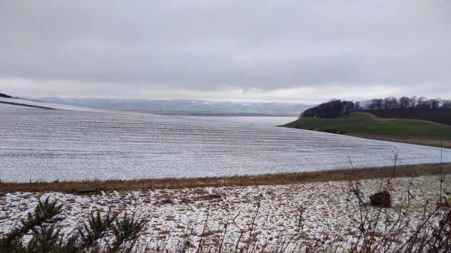
The hard climb rewarded this view – there are not many wide open vistas like this on the FCP
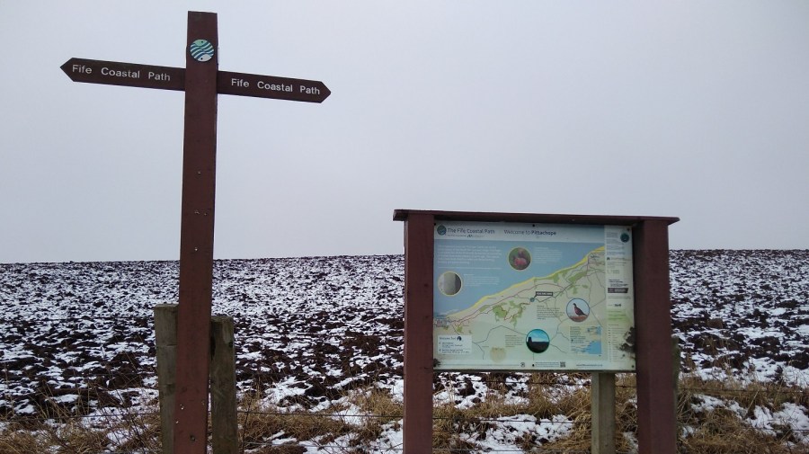
I passed places with names like Hazelton Walls, Creich and Pittachope (perhaps meaning ‘farm of the willow-place’). Black Craig Hill (203 m) was on the right.
Ruined castle at Creich, Fife
Pittachope to Glenduckie
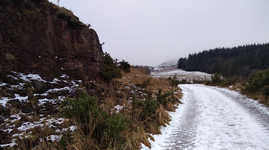
At 1.30 I was hauling myself gradually up a rural road with the cold wind on my cheeks. There was good visibility but with damp and wet in the air. It was a bit of a plod but I was focusing more on the moment than the future.
Then I took the left off the road to a steeper incline, passing a bearded man who cheerfully greeted me. His two boys were brightly clad in winter gear, and all three were pulling scarlet sledges up behind me, to play.
Ahead was Norman’s Law (285 m), the very same which was mentioned in the information I saw yesterday in Tentsmuir Forest. A law in this context, is a round or conical hill, often in isolation. It is at the eastern end of the Ochil Fault and you can walk in this place using the Walk Highlands directions. Also a hill fort site with its neighbour, Glenduckie Hill (what a great name!), you can follow Fifewalking’s instructions here.
Serious, dark pines and red-brown crags, FCP, Scotland
What with the website duration being erroneous, gates which say ‘push’ when they mean ‘pull’, and these signs which say ‘keep left’ when they mean ‘right’ at the turn – nothing is as it seems – which exactly sums up my life right now!
Looking back I admire the Tay from a height
It was misty at the top of the steep climb. Some of the snow was like soft egg-whites and therefore hard to walk on.
There was a gorgeous smell of burning pine, presumably not a natural occurrence in this icy weather. Maybe, I mused, it was not mist or snow blowing, but the smoke. I thought I was at the top and about to go down at last, but maybe not.
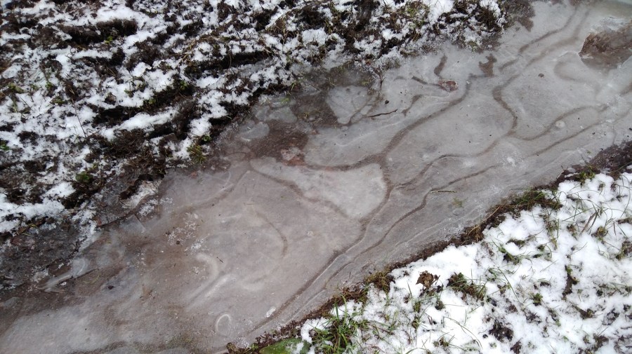
A tree platform had been erected; the puddles were deeply frozen; I spied various animal tracks in the snow as I passed Red Fox Wood
I sat for a cup of tea and meditated for 5 minutes. There was a cave opposite and rustles were coming from it; a bird was making the sound which a dog makes when it has a squeezy, squeaky toy in its mouth. It was a peaceful moment.
I was coming to terms with the fact that there was more climbing ahead which meant views revealing bodies of dusty blue water including one shaped like a bagel somewhere in the vicinity of Blinkbonny (another wonderful place name)Going slowly downhill but there was another challenge ahead: Glenduckie Hill
I zig-zagged around farmer’s fields – cows in one, sheep in another. It was 14.45 and the sun had come out.
A brief lowland patch, past attractive cottages, well-loved gardens and woodland, nurtured sunshine anemones and snowdrops with their heads swaying from side to side in the breeze
Glenduckie was indeed an even steeper trawl uphill, albeit not to the actual summit. The path curved round and round, and up, and then there was a tiny slope down before another arduous climb.
I felt totally exhausted, but stopping meant that starting was well nigh impossible. It was still frozen underfoot – an icy rockscape and, beyond, windswept sheep.
With great views of the mouth of the Tay Estuary, Fife
The approach to Newburgh
A steady descent, bumpy and slippery, meant I could see what I assumed was Newburgh in the distance for a long time – tantalising!
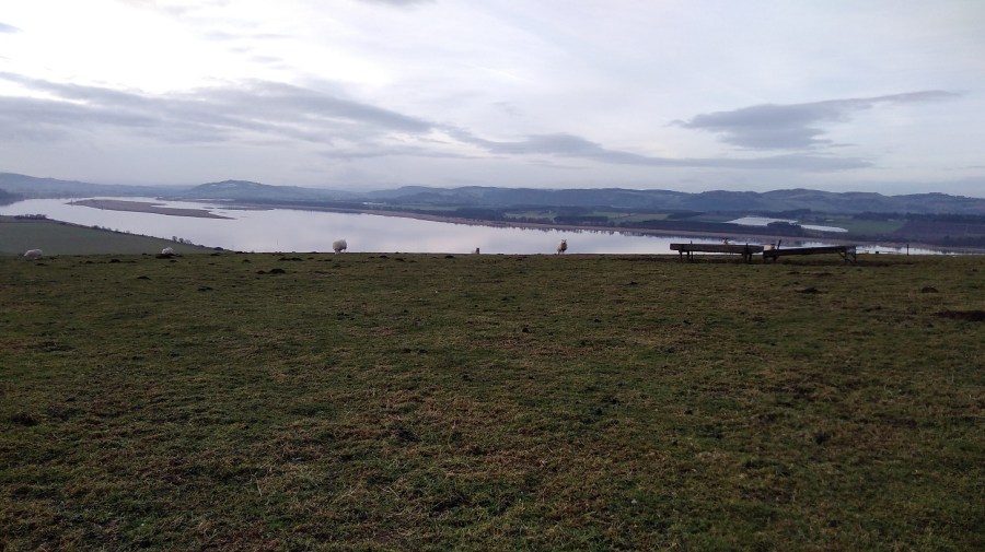
Lindores Hill (172 m) was on my left and to the right the estuary looked wonderful. The water was almost completely smooth, like glass. It reflected the tufty grey clouds and already there were the very faint hues of the sunset.
I struggled to stop thinking how tired I was, how much my body hurt, and that I hadn’t understood how long the day was going to be in advance. I spent some time using Clean Language questions to honestly ask myself why I was doing this. I knew I would get there eventually and that I wouldn’t do this again all in one stage. Once started it was tricky to stop, especially as I was so close to the end.
No danger of getting lost on this continual farm track. Or so I thought…
According to the map, at Old Parkhill there should be a right – Newburgh was clearly there, but the sign was to the left, so against my better judgment I took it. Of course it was wrong! I went through one very difficult gate and then straight on where there were lots of roots to negotiate at the bottom of a tree-lined slope. I admit I felt a tad miserable.
I had to climb over two fences. There was a huge hay bale and the barbed wire had been pushed down, suggesting that I wasn’t the first person to make this mistake. I couldn’t get over because I was too short and had the rucksack, so I found another way through.
I was back on the A913, the Abernethy Road, going into Newburgh past the church where the bus I planned to take later rattled past me. I found my way to the water’s edge using google maps as the sun was going down.
Oil-slick-smooth harbour water and a trek along the front to the park where the FCP ends, Newburgh, Fife
This last trundle seemed very long and the signs were once again poor. A helpful dog walker directed me at the last. Under the arch in Mugdrum Park, Newburgh I went, alone as I started….
Hooray – I had finished. How peculiar I always look in selfies!
From a public sign: ‘The Kings have gone but the kingdom lives on! Locked between the Firths of Forth and Tay, Fife is island-like, resolute and proud. It was the Pictish province of Fibh, last ruled by a king in the 9th century. Today, Fife’s wealth lies in the variety of landscapes, seascapes and townscapes which you can savour. Some say it taks a lang spoon to sup wi a Fifer, but you can be sure of a warm welcome from the people of the Kingdom.’
I went through the car park, took a left down Shuttlefield Street and left again along the High Street, where I found the bus stop by the Co-op supermarket (chocolate was needed). Opposite was The Bear Tavern where I toasted myself with a reviving Famous Grouse (whiskey) at the fabulous price of £1.20. The pub is run by the friendliest of folk and full of locals who were curious to know why I was there.
The 36 bus took me to Glenrothes where I narrowly missed the connection to Edinburgh. Fortunately there was an X54 along soon after at 18.55, and I was back home in Edinburgh around 9pm.
Reflecting is a vital part of taking a walk. It helps to embed or integrate the walking experiences – where I have been, and what I have learned – in the hope that any changes wrought will last.
Most of all, though, I failed to comprehend that the best things in life aren’t things that are visibly sexy on the surface. They don’t scream for attention, and they rarely invite adrenaline. Rather they come from quiet commitment, respectful engagement, and a love of something greater than yourself.
Before a sitting meditation I start by acknowledging or noting any issues which are bothering me, either to clear my mind, to problem-solve, or create focus. Then I try to simply sit. I have been doing that for years. As a result I sometimes come up with creative ideas, solutions and greater understanding, or at the very least a recognition of patterns of behaviour.
Walking is a kind of meditation and the more I walk pilgrimage, the more I realise that simply doing it: starting, trekking, and managing to complete, I’m learning what I need to.
I have habits that I try to pretend aren’t there most of the time. However, when walking a pilgrimage they come to the fore. It’s in the planning and facing of the realities of the land and the practicalities of accommodation and food that I am brough face to face with myself.
Is walking pilgrimage synonymous with being religious?
I do not follow a recognised religion. I was christened into the Church of England by my parents and had to learn tracts of the bible overnight for reciting in primary school the next day. Joining in assembly every morning at secondary school was obligatory, and I sang and read lessons during services; went on a Sunday School holiday; and spent years in the Girl Guides where Christianity was important.
I was steeped in it – the tenets seem to be in my soul (or perhaps in my cells). When I was learning to speak, religion provided me with a moral and ethical language, and I have discovered that it’s hard to shrug off.
Maybe I’m on a mission to get rid of the destructive part of what I was taught in those early years. I was encouraged to feel guilty, it was assumed that I had Original Sin, and I was told that I was bad in my core as were all other humans. Perhaps I now take ecumenical walks to give myself the time to recognise the impact of this and to let go of what seem now to be unhelpful lessons.
I do visit churches sometimes and I certainly respect believers, but I do not take communion. I have read widely, listened, and discussed religion with friends, but I cannot follow a Faith which seems to exclude or criticise people for being the way they are or believing what they do.
Historically, pilgrimage was a religious practice, so it’s not surprising that people keep asking me why I walk pilgrimage.
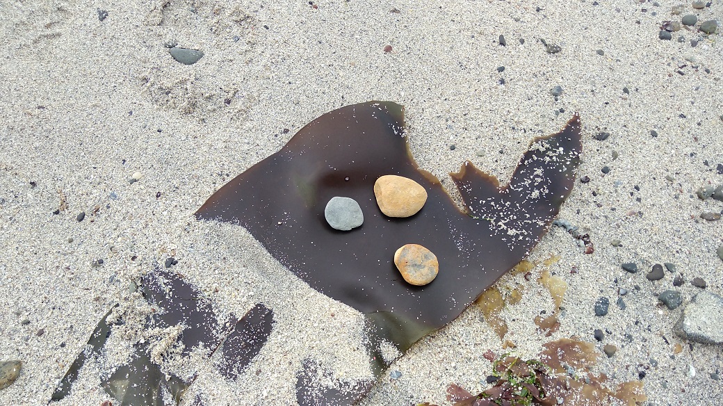
The three stones I found on Evie beach at the start of the St Magnus Way
Why pilgrimage?
For me, pilgrimage is more than a long-distance walk. It’s a walk with the added zizz of a specific intention, held to, and later reflected on. I’m walking in the fotsteps of others who were seeking enlightenment. Made with awareness and respect for tradition, there’s an in-built beginning, middle, and end, and it’s a project all in itself.
“The present, the present. It never stops, no matter how weary you get. It comes unstintingly, as a river does, and if you aren’t careful, you’ll be swept off your feet.”
Olivia Laing, To The River (p111)
Spirit, soul and understanding
In Chinese Medicine I was delighted to learn that there are a number of different ways to describe the spirit or soul. In Icelandic there are more words for snow than we have in English; in the Orient the parts of ourselves which relate to spirituality, to nature or to our innate relationship with other people are as important as our physical and mental aspects. Although the spirit is amorphous, hard to define, it is something I have a tangible sense of, particularly when I walk in nature. Although sometimes I am content to ‘be’, at other times I become curious and try to understand this puzzle.
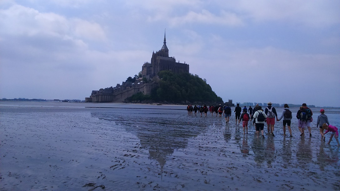
When I sit and meditate in my Shiatsu room in Edinburgh I can simultaneously be in Tibet or Japan or China. I don’t know why that is or how it happens and so I ponder on these things as I walk. I privately thought that at least one explanation was that I was a nun and a monk in former lives. It’s the best explanation I could come up with. The feeling I had, for example, when I crossed the sands, barefoot, to Mont Saint Michel was real – I ‘knew’ I had walked there before.
Walking across the sands to Mont Saint Michel, France May 2017
What is ‘knowing’?
We have discovered in the last 100 years or so that our physical cells destruct and reconstruct, so the ones I have now shouldn’t be the same ones I had when I was a baby, never mind the ones my mother or grandmother had. And yet we know that we share genetic material.
There is a theory that there is a collective knowledge which accumulates from the generations which came before. It could be this wisdom which tells me where to go to find what I seek, and what has got me here in the first place. However, current scientific methodology and outcomes deny me entry into this collective unconscious. It insists that I enter through the portal of logic and I am not sure that logic is the right way into that sort of understanding.
I have an intrinsic sense of the English phrase, ‘I know it in my bones’. My bones are made up of cells and that genetic material, yet in every text I read about pilgrimage something inside me recognises it. I seem to share the centuries of that collective knowledge, it is familiar.
There is my DNA and my body. There are my mind and my thoughts. There is my self, my soul, my spirit. In my work and my walking I am enquiring into the connections and (re)discovering dissociations between these.
It’s all about love
The more I listen to myself as I traipse, and the more I hear my clients in the Shiatsu room, the more I think that what we all seek is the connection to LOVE. It sounds like a familiar new-age thing to say, it’s straight out of the ‘all you need is ….’ 1960s, but I keep coming back to it.
I have a hunger for that ‘something for which we search’, and I know it isn’t just me, because when I tell folk what I do, they say, ‘Oh, I wish I could do that’ or, ‘I have wanted to do that for ages’. Or maybe they too have already started!
I seem to be part of a contemporary pilgrimage movement in which it is possible that we are seeking ways to integrate, comprehend and connect our-selves, personally and in community.
Pilgrims walking the Via de la Plata, Spain; Tourists flocking to the Sacre Coeur in Paris, France.
Restlessness
In addition to all this, I notice a compunction to move on, to save my soul, to find and to seek. The ‘thing’ I am looking for is at the same time inside me right now and just ahead of me. It is that towards which I reach or walk. It isn’t new. Everything I have done in my life so far is part of this instinctive movement towards being purer, ironing out the creases. That’s what I believe we are all doing wherever we are.
I know that inside me lies this knowledge, just as tangibly as I know my organs are there. I recognise that I am part of a continuum, a humanity of seekers. What is necessary is the time and space to better hear what is happening, and that is hard to find when I am at home looking after people and my surroundings, doing what most of us do in our adult Western lives.
The answer, it seems, lies in introspection. Without trying to be precious, I go quietly back inside myself when I walk, to hear the still, small voice.
Nan Shepherd wrote ‘These moments come… most of all after hours of steady walking, with the long rhythm of motion sustained until motion is felt, not merely known by the brain, as the “still centre” of being…
And so it appears I am descended from the ascetics and hermits of my history. I’m reborn into the liberated 21st century. I am, at one and the same time, part of a shared community – walkers and pilgrims, fellow monks and nuns, a group with shared values – and I am alone to ponder.
Some things are proving intractable and I expect that’s why I have to keep on doing it!


")


 A flying oyster catcher, Wikipedia.