
I am walking the St Magnus Way on Orkney, and this is one of the blog series – 21 – 30 May 2018. Below, you can find links to all the others (introduction, transport, accommodation, resources etc). The overall walk is 55 miles (88.5 kms) over 5 days plus a visit to the island of Egilsay where St Magnus was said to have been murdered and, initially, buried.
Signposts
If, like me, you are used to finding the yellow Spanish Camino Santiago de Compostella arrows, then you will:
a. be at an advantage – you know that it is important to slow down at junctions or if you get that funny feeling you might have gone the wrong way, and really scout around for the sign. You know to look in unusual places, and that they will not always be at the same height as you, or immediately obvious.
b. On the other hand you will be at a disadvantage – yellow shows up better than the more environmentally friendly St Magnus Way black and white signs on wooden posts. You will expect lots of guidance (eg through a wood where the path twists and turns and there are tributaries (as it were)) and that is not the case here – on the whole one must follow what seems to be the main way. (This is certainly my experience with many other pilgrimages, not just this one. The Via Sacra signs were really hard to find, whereas the Fife Coastal Path is great).
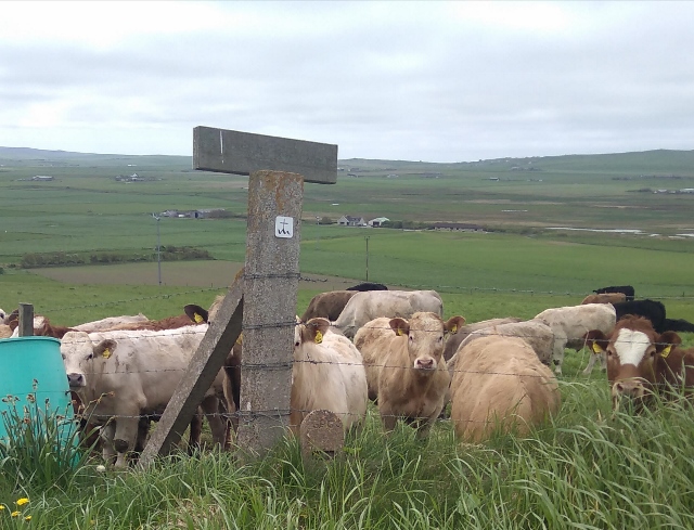
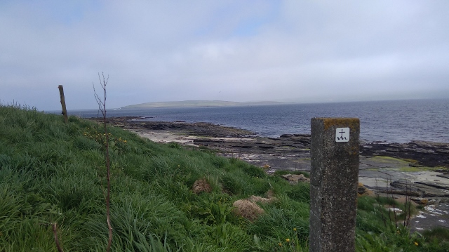
The signs are sometimes before a junction, sometimes at it, and sometimes afterwards.
I believe they were positioned by people taller than me, so for example if the next one is over a hill, a taller person may be able to stand with her back at the previous one and see the following, but not always.
In fact, now I am on this subject, the stepping stones which have been helpfully laid over burns and bogs are also very far away from each other – perhaps at the correct distance for the average male stride – but not mine, not with a rucksack anyway. In these cases I took a deep breath and leapt!
Bluetooth
There is a system of Bluetooth waymarks provided by the Pilgrimage organisers, with information so that when you walk you use your phone to connect and can listen as you go. I would have loved to try it but the system was down when I was there. Of course you would need a smart phone with that capacity to use this facility. I don’t know how long the recordings are, but don’t forget that you would also want headphones.
Many people love music or podcasts as they walk. Personally, I like the sounds around me and in addition there’s always plenty going on in my head! I have tried but I always give up quickly as I feel cut off from my surroundings.
Route descriptions
There is no guide book as yet, although the organisers of the Pilgrimage are in the process of producing one which will be great I am sure.
They do already provide Route Descriptions on their website and these were updated and published on 30 May 2018 after I returned home. They are generally of a very high standard. I suggest you print them out and laminate them before you leave in case of emergencies. I know this sounds a bit geeky but you never know what might happen, especially with technology.
There are also documents, audio recordings, videos, photos and all manner of amazingly useful and interesting resources on the St Magnus Way website.
Compass / maps
A compass comes highly recommended (make sure you know how to use it!) because north, south-east etc are used in the St M Way directions. I planned to use the one on my phone, not imagining that the phone would be virtually unusuable.
You can download Route Maps from the St M Way website.
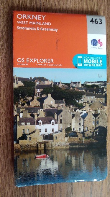
I would also suggest bringing an Ordnance Survey (OS) map so that you can see where the St M Way Route Description landmarks are. The mast on Keelylang for example, is listed on the Route Description for Finstown to Orphir as a way of orientating yourself. It is on Googlemaps but not the St M Route Map. Kebro is on the St M Route Map but not on Googlemaps. Both are on the OS map 463 which has most of the West Mainland on it, but not Kirkwall, so for the hard part of the final day’s walk you will need to carry a second map. You can buy maps at Rae’s Paper Shop in Stromness and in Kirkwall.
Finstown to Orphir Route Description
Whichever map you use, you need to know the direction you are physically pointing towards (see compass above) otherwise it’s almost no use knowing where the place you are searching for is on the map anyway!
Please note that if you have the facilities, know how and space on your phone, there are gpx connections on the official site. I suspect, from looking at other websites and talking to some (mostly male, it has to be said) hikers, that using technology is the thing to do, but I am a trifle old fashioned in this respect so you would be better looking elsewhere for that information (though there is a helpful quote below). I think you have to spend more on your mobile phone than I do to be able to use it all. There is of course the argument that a pilgrimage is a place of silence and self-reflection and we all know that technology isn’t always helpful with that; then again, getting lost is a bummer.
In any discussion of routes, navigation or GPS devices, you have probably seen people mentioning ‘GPX files’. GPX is shorthand for GPS eXchange Format and is a type of file that’s really helpful to anyone who loves the outdoors, and is the most popular way of saving and exchanging routes. Ordnance Survey Blog
Tetanus
Be sensible and check if your tetanus jab is up-to-date before you go hiking! I was so careful, doing everything slowly, but my foot slipped down a hole I couldn’t see and the barb from the wire was too close. I had tea tree essential oil with me which is a serious antiseptic and so I wapped that on immediately, repeating several times a day for the next few days and I was fine. Check the symptoms of tetanus.
Cold at night
It’s hard to imagine it can be so cold at night in a tent in May when the day-time temperatures are so moderate, but it can, so you have been warned! See Resources – what I took with me (link below). Weather, Kirkwall
Links:
Accommodation – where I stayed
Resources – what I took with me
Resources – shops, cafes, pubs etc
Finding your way

3 thoughts on “St Magnus Way – finding your way etc.”