St Magnus Way – the last two days

The last day on Orkney (Kirkwall)

I am walking the St Magnus Way on Orkney, and this is one of the blog series – 29th May 2018. At the bottom of this post you can find links to all the others (introduction, transport, accommodation, resources etc). The overall walk is 55 miles (88.5 kms) over 5 days plus a visit to the island of Egilsay where St Magnus was said to have been murdered and, initially, buried.

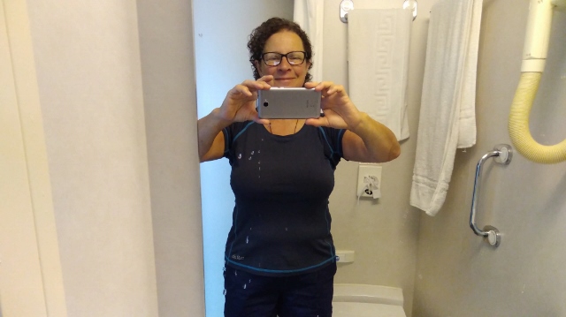
On this, my last day on the island, I woke up in a bed instead of a tent, which was novel! It’s amazing how quickly you get used to something new. My hosts were most hospitable. It was a house full of books, toys, antiques, bric-a-brac, smiles and shyness.

The St Magnus story tapestry, St Magnus Cathedral, Kirkwall, Orkney

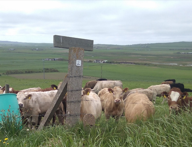
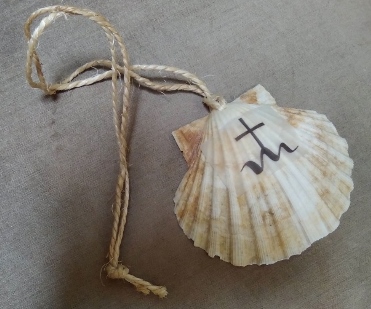
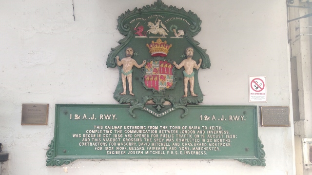
After giving Shiatsu, I made my way into the city to revisit the St Magnus Cathedral and other sights. I was given my prize shell but could not discover how many other backpackers from outside Orkney had managed the whole walk as there are no records.

IMG_20180529_123954 (640x359) (2)

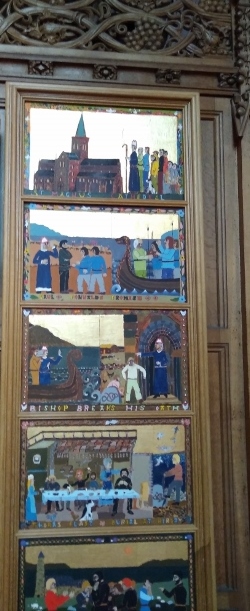
There is a gorgeous stained glass window by Crear McCartney from 1987 (unfortunately the photos didn’t come out well). It depicts St Magnus’s pilgrimage to the Holy Land and includes a crucifix from Trondheim, Norway. I also found the sheela-na-gig in the chapel at the far end (a squatting female figure), the green man and the Marwicks’s Hole where women who were accused of witchcraft were sometimes held.

IMG_20180529_151116 (640x359)
It was another wonderful beach afternoon with sand of luxurious softness and a diamante sea. Scapa Bay, Orkney.

An artist survives on the beauty that surrounds her.

Winifred Milius Lubell, political graphic artist and book illustrator.

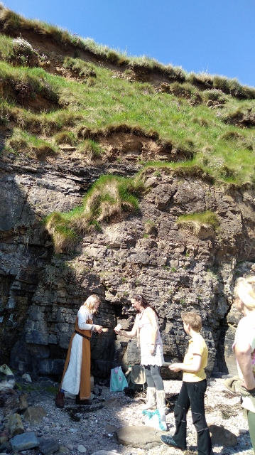
My afternoon treat was to go on the very first Viking Hiking trip with Ragnhild and Mark. We gathered at the Tourist iCentre (ie information bureau) next to the bus station and wound our way through the city, stopping to view and learn about some of its highlights.

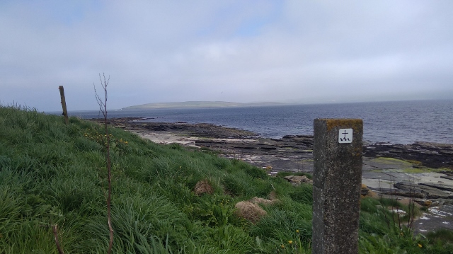
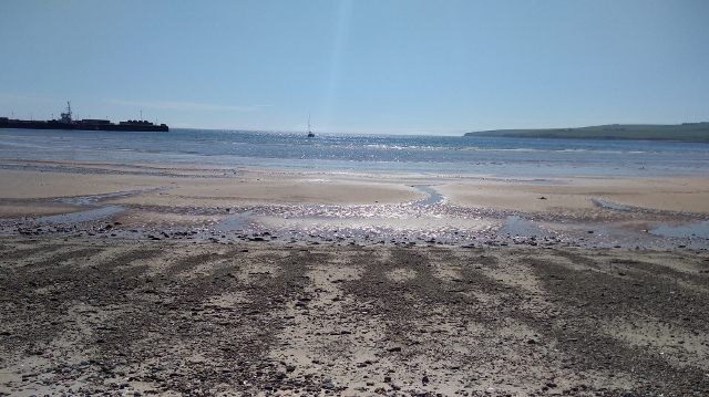
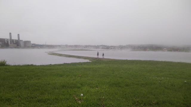
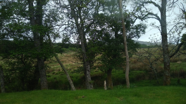
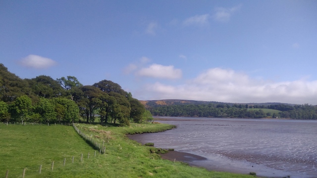
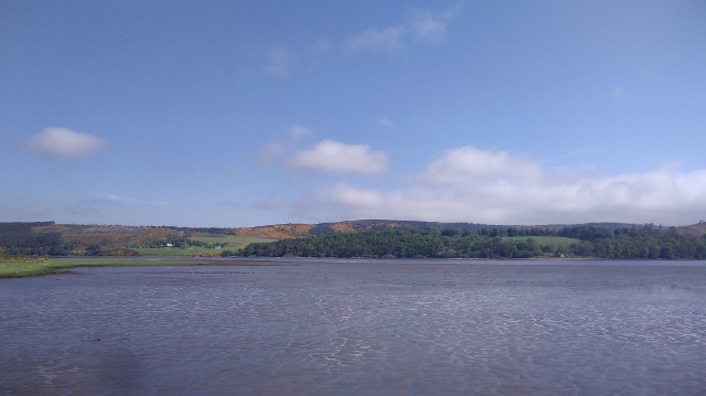
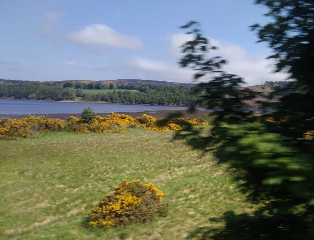
Then we meandered towards Scapa Bay (the largest natural harbour in the Northern Hemisphere) from whence I had come the previous afternoon. Back past the hospital, once again around the roundabout, and along the Cantit Trail. I retraced my footsteps across the strand westwards. This time I had a fully charged phone and could take as many photos as I wanted.

Mark holds out a Viking horn for the Orkney beer.

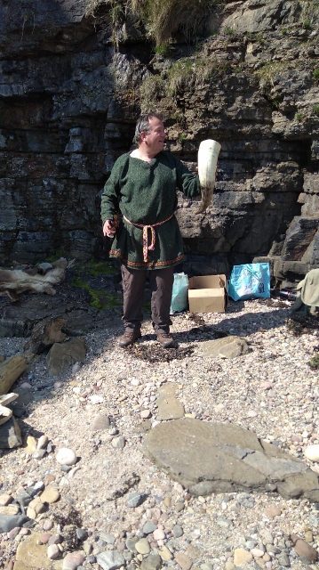
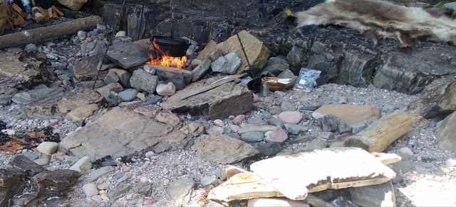
It was the first time I had sampled Viking food around a live fire, and I enjoyed being regaled with stories inspired by the Orkneyinga saga, amongst other sources. Ragnhild, being Norwegian as well as a scholar and qualified tour guide, was most entertaining and knowledgeable, able to answer any questions we cared to throw at her.

Ragnhild in her Viking costume, with other members of the group. We mixed, formed and cooked bannocks from peas, barley meal, honey, salt and of course sand to suit all tastes!

We churned the butter to spread, and ate our broth with horn spoons. It being the first one, I was in the company of a hotelier, various newspaper and on-line reporters, adults and children. We were all very impressed and the others vowed to display leaflets and publish articles etc. It was live streamed on Facebook!

There was singing and dancing around the fire under the cliffs.

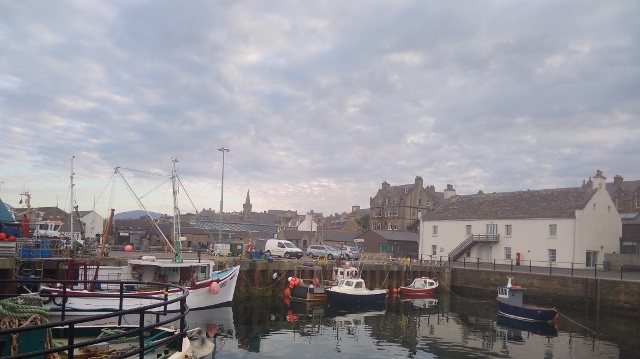
After another delicious meal at their home, Christopher took me through the balmy evening to Stromness, where I was able to pick up my phone charger from The Ferry Inn where the kind woman I met on day 1 had left it for me.

The Peedie Sea (Kirkwall, Orkney) had ethereal steam lifting off it.

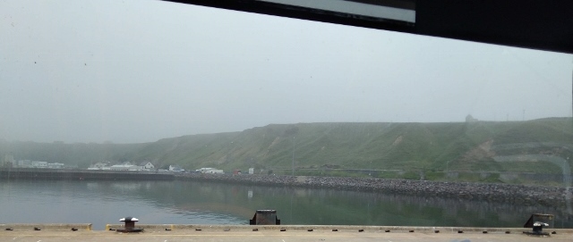
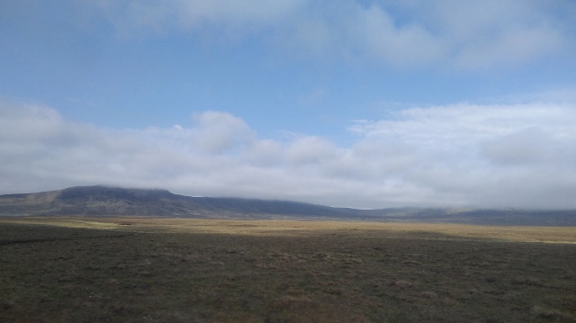
After that we drove through heavy fog before arriving into Stromness under a bright sky 25 minutes (14 miles / 22.5 kms) away. The weather is always a good topic of conversation with the British and those on Orkney were no exception, but it really depended on personality: when the fog was down someone would tell me, ‘it’ll be bound to lift soon’, another, ‘it won’t lift today’, and a third, ‘it might lift though’. Overall, I had the most sun anyone could ever expect on these islands for my pilgrimage, and felt duly lucky.

Stromness Harbour, Orkney. I remembered seeing a seal’s head in the limpid sea here the first time I came.

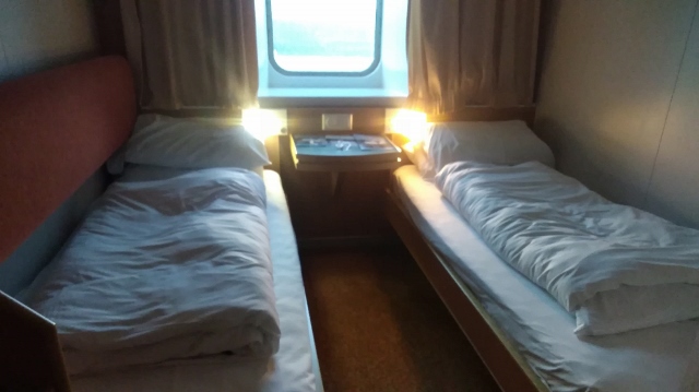
A gin and tonic later, I boarded the Northlink ferry where I found my two-person birth empty – which I was pleased to say it remained. There was a salon with all manner of snacks and drinks, books and magazines to entertain the 12 of us, and then I happily took to my bed for some note writing and reflection.

Ferry cabin, Stromness Harbour.
Happy and quite tanned after my lovely walk, despite the latitude.

The overnight ticket includes an all-you-can-eat breakfast which carried me right through to Edinburgh, eight hours later!

Travelling home

Arriving in Scotland / on the mainland – at Scrabster Ferry terminal.

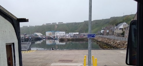
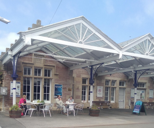
We docked at Scrabster and I jumped on the bus to Thurso, just five minutes along the road.

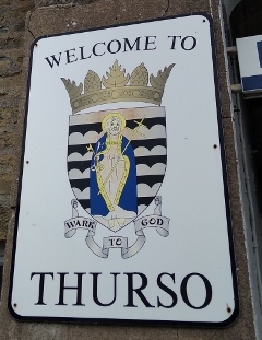
I wasn’t sure how to get to the station and so made an enquiry of someone passing. Like several others, he offered me a lift, telling me, while we drove, how he had moved from the east end of London some years ago to take a small holding, and now dealed in 4 by 4 cars.

Through the rectangular window – trees again!
Hilltops in the cloud.
Not nearly as bleak as the Orkney moorland.

Although I arrived hours early because of taking the overnight ferry, I decided to chance it and leaped onto the first arrival. All went smoothly, no-one looked at my ticket and told me I was on the wrong train. The scenery was stunning of course, and as the sun still shone, I could snap away to my heart’s content.

Such blue!
Contrasting with the yellow gorse.
Murals at Invergordon Station – very original.
The elegant arches of Dingwall Station where you can take refreshments at Tina’s Tearoom.
Dingwall and Strathpeffer Free Church, The Mallard Bar, and perhaps a mosque with the crescent on top of the building on the left.

As we waited beside the platform in Dingwall, the guard explained that there must be another, more important train on the line which had priority over us, ‘like a nuclear warhead or The Flying Scotsman’, he said. None of us were sure what to make of this.

Meanwhile, the man across the aisle kept calling the woman beside him, ‘pet’, even though they didn’t know each other; someone ripped their velcro; another rummaged in her bag; and the woman in the cerise T-shirt cleaned the tables at Tina’s. As the power surged on and off, my screen failed so I could see green bubbles alternating with the picture of my daughters; we disagreed about the new Murder On The Orient Express film; we waited.

Then the energy of the other train hit us and we gave a great shudder. Yes, it was The Flying Scotsman with its smart burgundy livery and glimpses of crisp white table linen at high speed. Too fast to snap it.

Actually after that we were delayed some more before the perfect spire against the baby blue sky shifted sideways, and it was all white hawthorn and green hills once more.

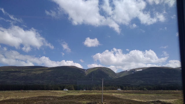
I changed trains at Inverness and the run through the Cairngorms was, if possible, even more impressive. My newly met companion from Elgin, on hearing my tale of woe, insisted on trying her charger with my phone, and it worked: she was right, it was the charger that was the problem, not the phone. Whew – that was one extra dreaded visit to the Three shop on Princes Street I could avoid!

The Coat of Arms at Inverness Station. But why are the men naked except for fig leaves?

As the afternoon wore on, it became very hot and crowded and I started to write, but the thoughts came too fast for my typing. I became feared that I would never manage to write it all up the way I wanted to, in the book I had so easily envisaged while I was walking. How strange to be sitting all day and hurtling through the landscape so fast. I slept.

In the end I was able to return in record time, and in all, four hours earlier than planned. As this was my fifth trip, knew to expect a period of adjustment after the intensity of being away. I knew I would be grateful to see my daughter, and sleep in my own bed with the cat purring on top; and also that this writing would give me a focus to bridge the gap to what I still call, ‘normal life’.

Links:

Introduction

Transport – how I got there

Accommodation – where I stayed

Day 2 – Evie to Birsay

Day 3 – Birsay to Dounby

Day 4 – Dounby to Finstown

Day 5 – Finstown to Orphir

Day 6 – Orphir to Kirkwall

Resources – what I took with me

The Last Day

Resources – shops, cafes, pubs etc

Finding your way

Reflection

St Magnus Way – finding your way etc.

I am walking the St Magnus Way on Orkney, and this is one of the blog series – 21 – 30  May 2018. Below, you can find links to all the others (introduction, transport, accommodation, resources etc). The overall walk is 55 miles (88.5 kms) over 5 days plus a visit to the island of Egilsay where St Magnus was said to have been murdered and, initially, buried.

yellow arrow etc438175402..jpg
Spanish camino yellow arrows and other signposts.


Signposts

If, like me, you are used to finding the yellow Spanish Camino Santiago de Compostella arrows, then you will:

a. be at an advantage – you know that it is important to slow down at junctions or if you get that funny feeling you might have gone the wrong way, and really scout around for the sign. You know to look in unusual places, and that they will not always be at the same height as you, or immediately obvious.

b. On the other hand you will be at a disadvantage – yellow shows up better than the more environmentally friendly St Magnus Way black and white signs on wooden posts. You will expect lots of guidance (eg through a wood where the path twists and turns and there are tributaries (as it were)) and that is not the case here – on the whole one must follow what seems to be the main way. (This is certainly my experience with many other pilgrimages, not just this one. The Via Sacra signs were really hard to find, whereas the Fife Coastal Path is great).

IMG_20180530_070345 (640x489)

The signs are sometimes before a junction, sometimes at it, and sometimes afterwards.

I believe they were positioned by people taller than me, so for example if the next one is over a hill, a taller person may be able to stand with her back at the previous one and see the following, but not always.

In fact, now I am on this subject, the stepping stones which have been helpfully laid over burns and bogs are also very far away from each other – perhaps at the correct distance for the average male stride – but not mine, not with a rucksack anyway. In these cases I took a deep breath and leapt!

Bluetooth

There is a system of Bluetooth waymarks provided by the Pilgrimage organisers, with information so that when you walk you use your phone to connect and can listen as you go. I would have loved to try it but the system was down when I was there. Of course you would need a smart phone with that capacity to use this facility. I don’t know how long the recordings are, but don’t forget that you would also want headphones.

Many people love music or podcasts as they walk. Personally, I like the sounds around me and in addition there’s always plenty going on in my head! I have tried but I always give up quickly as I feel cut off from my surroundings.

Route descriptions

There is no guide book as yet, although the organisers of the Pilgrimage are in the process of producing one which will be great I am sure.

They do already provide Route Descriptions on their website and these were updated and published on 30 May 2018 after I returned home. They are generally of a very high standard. I suggest you print them out and laminate them before you leave in case of emergencies. I know this sounds a bit geeky but you never know what might happen, especially with technology.

There are also documents, audio recordings, videos, photos and all manner of amazingly useful and interesting resources on the St Magnus Way website.

wp-15332019007911130998.jpg

Compass / maps

A compass comes highly recommended (make sure you know how to use it!) because north, south-east etc are used in the St M Way directions. I planned to use the one on my phone, not imagining that the phone would be virtually unusuable.

You can download Route Maps from the St M Way website.

I would also suggest bringing an Ordnance Survey (OS) map so that you can see where the St M Way Route Description landmarks are. The mast on Keelylang for example, is listed on the Route Description for Finstown to Orphir as a way of orientating yourself. It is on Googlemaps but not the St M Route Map. Kebro is on the St M Route Map but not on Googlemaps. Both are on the OS map 463 which has most of the West Mainland on it, but not Kirkwall, so for the hard part of the final day’s walk you will need to carry a second map. You can buy maps at Rae’s Paper Shop in Stromness and in Kirkwall.

Finstown to Orphir Route Description

Whichever map you use, you need to know the direction you are physically pointing towards (see compass above) otherwise it’s almost no use knowing where the place you are searching for is on the map anyway!

Please note that if you have the facilities, know how and space on your phone, there are gpx connections on the official site. I suspect, from looking at other websites and talking to some (mostly male, it has to be said) hikers, that using technology is the thing to do, but I am a trifle old fashioned in this respect so you would be better looking elsewhere for that information (though there is a helpful quote below). I think you have to spend more on your mobile phone than I do to be able to use it all. There is of course the argument that a pilgrimage is a place of silence and self-reflection and we all know that technology isn’t always helpful with that; then again, getting lost is a bummer.

In any discussion of routes, navigation or GPS devices, you have probably seen people mentioning ‘GPX files’. GPX is shorthand for GPS eXchange Format and is a type of file that’s really helpful to anyone who loves the outdoors, and is the most popular way of saving and exchanging routes. Ordnance Survey Blog

Tetanus

Be sensible and check if your tetanus jab is up-to-date before you go hiking! I was so careful, doing everything slowly, but my foot slipped down a hole I couldn’t see and the barb from the wire was too close. I had tea tree essential oil with me which is a serious antiseptic and so I wapped that on immediately, repeating several times a day for the next few days and I was fine. Check the symptoms of tetanus.

IMG_20180524_101408 (640x359)

Cold at night

It’s hard to imagine it can be so cold at night in a tent in May when the day-time temperatures are so moderate, but it can, so you have been warned! See Resources – what I took with me (link below). Weather, Kirkwall

Links:

Introduction

Day 1 – Egilsay

Day 2 – Evie to Birsay

Day 3 – Birsay to Dounby

Day 4 – Dounby to Finstown

Day 5 – Finstown to Orphir

Day 6 – Orphir to Kirkwall

The Last Two Days

Accommodation – where I stayed

Transport – how I got there

Resources – what I took with me

Resources – shops, cafes, pubs etc

Finding your way

Reflection