Walking the Algarve Coast

From Albufeira to Portimao, November 2019

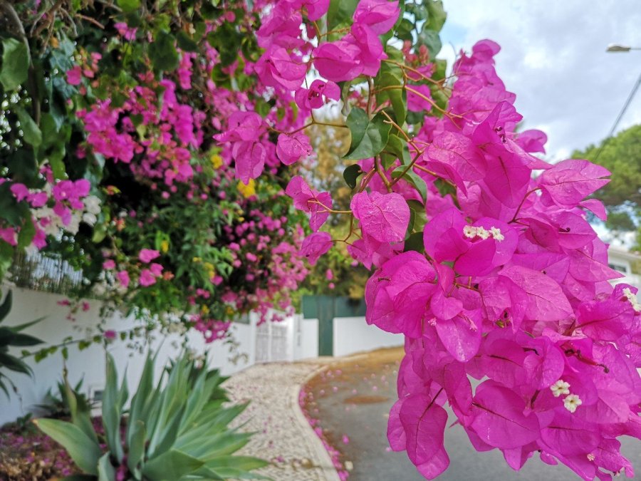
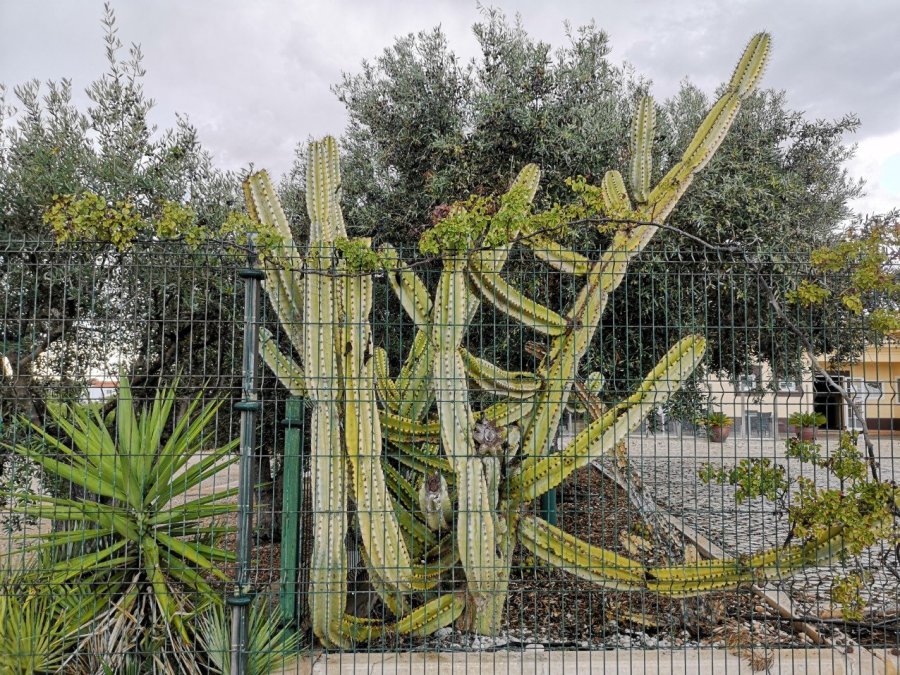
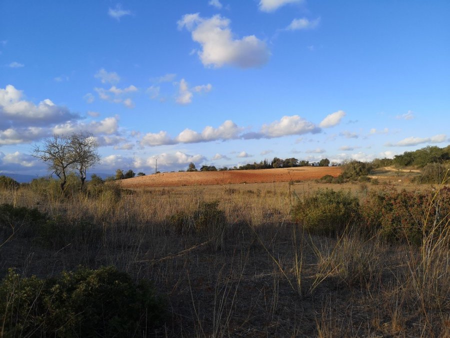
The south coast of Portugal is absolutely stunning and I highly recommend it. There are some very built up areas and busy beaches because it is so popular with tourists (especially British and German), but the sections inbetween are amazing and very unpopulated.
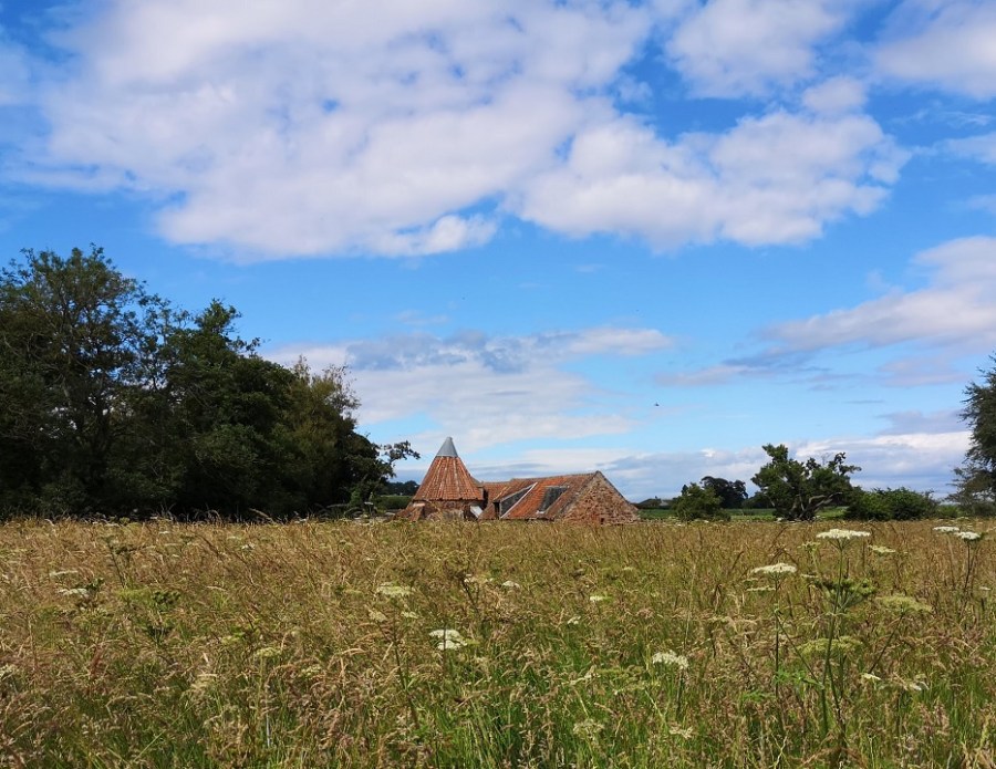
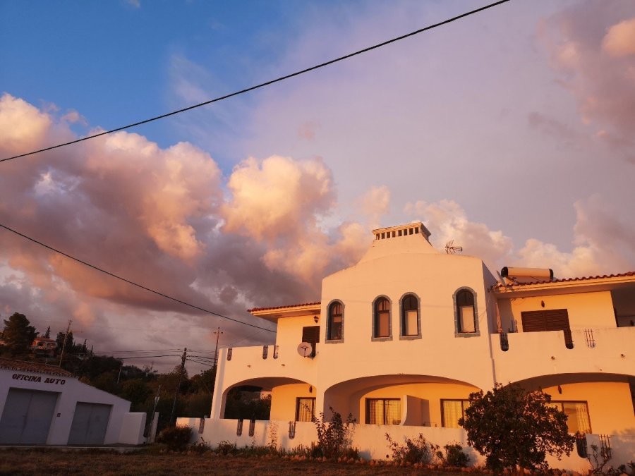
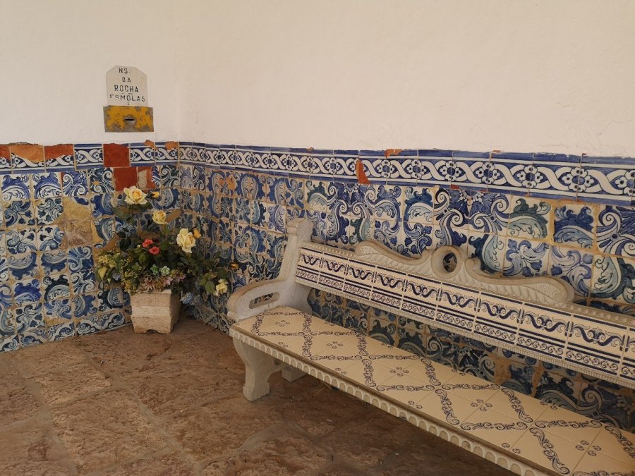
wp-15743533344833101741861731527422.jpg

Albufeira

I arrived in Albufeira by bus (Terminal Rodovario de Albufeira, just off Estr. de Vale de Pedras) from the airport. This was actually no mean feat, as the Rede Expressos poster information at the bus stop is erroneous. Rede Expressos is the national bus company and is usually an extremely good service (on time, efficient online booking system) which I used many other times with no trouble. I recommend that you use their website rather than written information, as it is up to date. However, do not allow your phone to translate it into English as it translates the place names which are also real words such as Sal from Alcacer do Sal meaning salt and Pias (a small town in the south east) meaning sinks! This makes it very hard for non Portuguese speakers to find where they are going.

IMG_20191021_111314

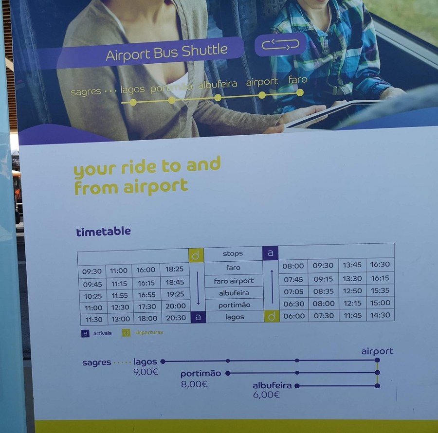
This is the correct information, as of November 2019

When I arrived, I walked into the town which took 30 minutes. The road takes you past Lidl and other stores. I went in briefly, but it was so similar to home, that I resolved to shop locally and left immediately.

Albufeira is not peaceful and quiet…
Although if you leave the main square and walk steeply unhill, there are some lovely spots

The Orange Terrace Hostel (Rue Padre semedo do Azevedo 24, 8200-167 through booking.com) provided everything I needed, including breakfast. There were some great people there and a delightful terrace! Cost 16 euros.

This is the town’s beach , Praia do Peneco (it has an elevator down to it) – a glorious stretch of sand which was not busy in November

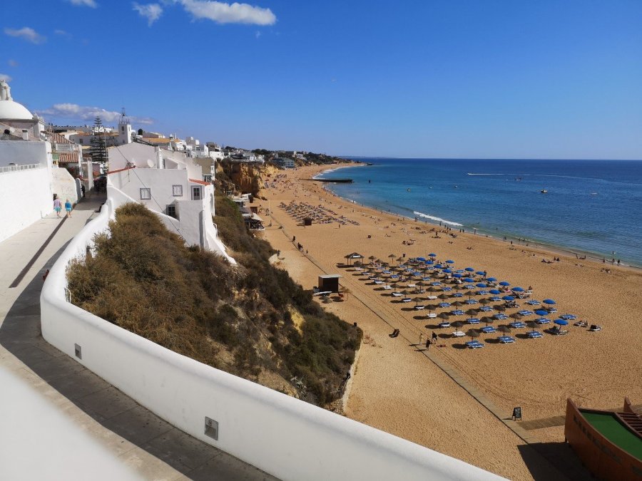
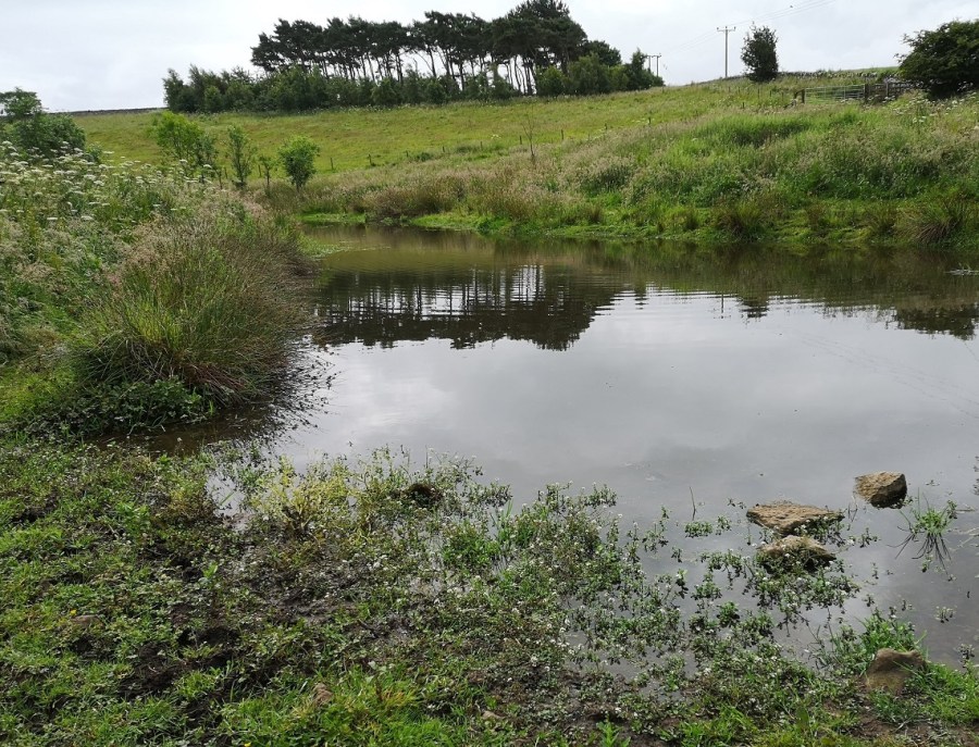
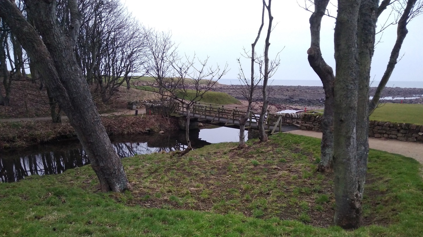
I hung out in a little municipal park with a sort of modern pond and benches overlooking the main strand, and shopped at a little shop at the top of the hostel street for bread and other provisions – very cheap.

wp-15743408955803983590483403575883.jpg
Past the marina and another whole holiday village area on the way out

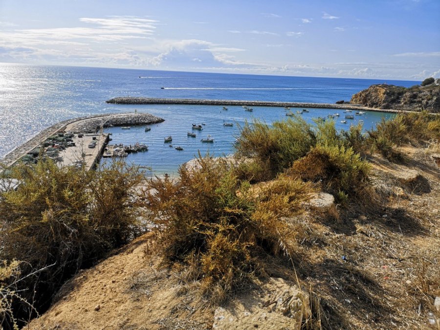
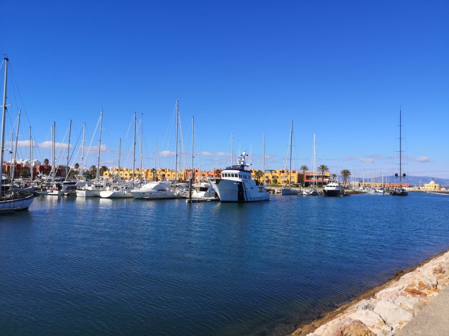
A man was jumping from an enormous height into a big net when I went past the marina – the sort of things some people do for fun.

wp-15743408955266338114989108030135.jpg
Pastel coloured accommodation
wp-15743408954548277147858116353141.jpg
Views across the Atlantic Ocean
wp-15743408953869098235292021481868.jpg
I walked some of the way the next day with this fellow from Germany

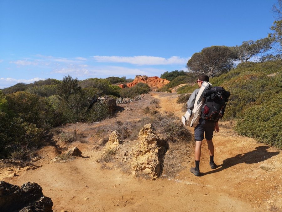
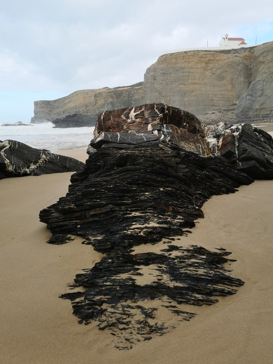
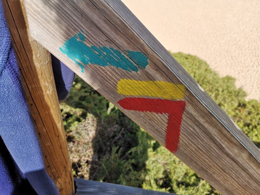
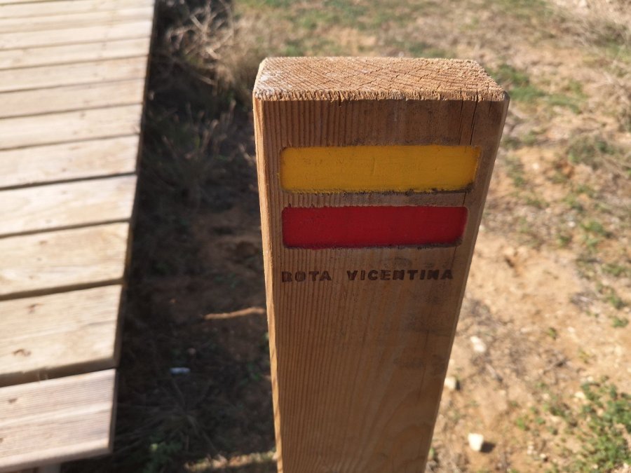
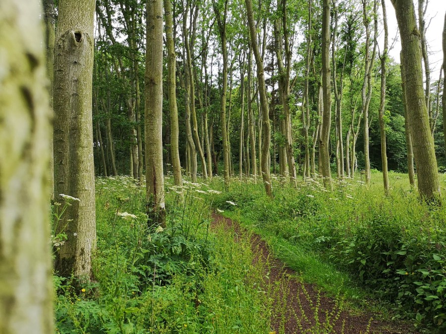
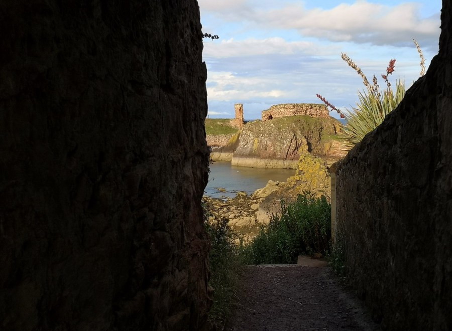
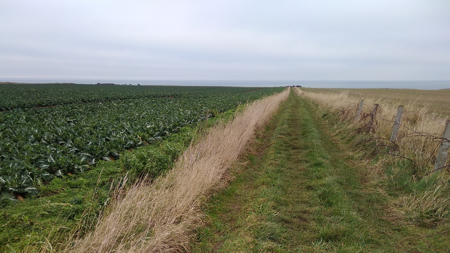
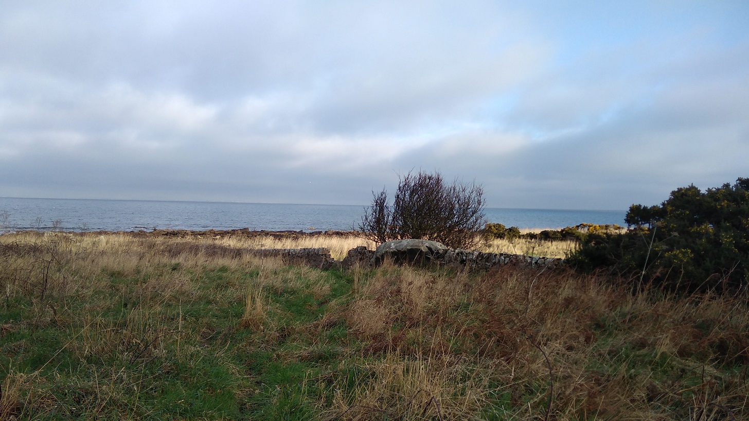
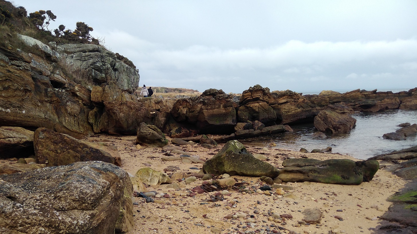
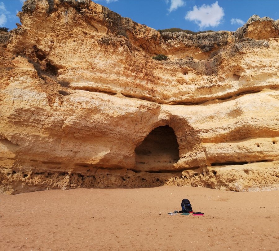
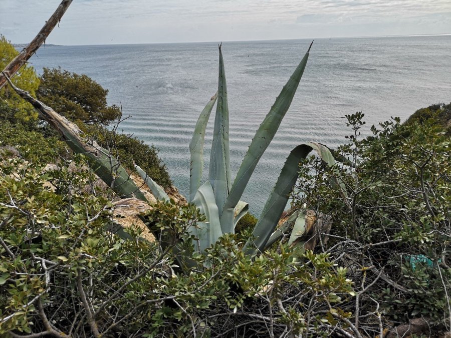
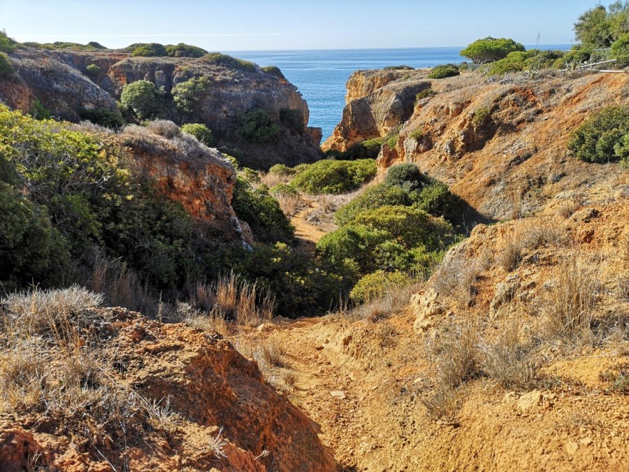
I did not follow a trail, but instead either ‘followed my nose’ or changed my google maps into the satellite setting where you can see all the tiny paths on the cliffs .

wp-1574340895314712055916446429108.jpg

rhdr
Looking down there are rocks of all shapes and sizes
wp-15743413734038191881368332984118.jpg
The colour of the landscape is orange and red
wp-15743408951653565671073885471285.jpg
One of two people on each of the smaller beaches
wp-15743408949408186619586652490206.jpg
Isn’t it beautiful!

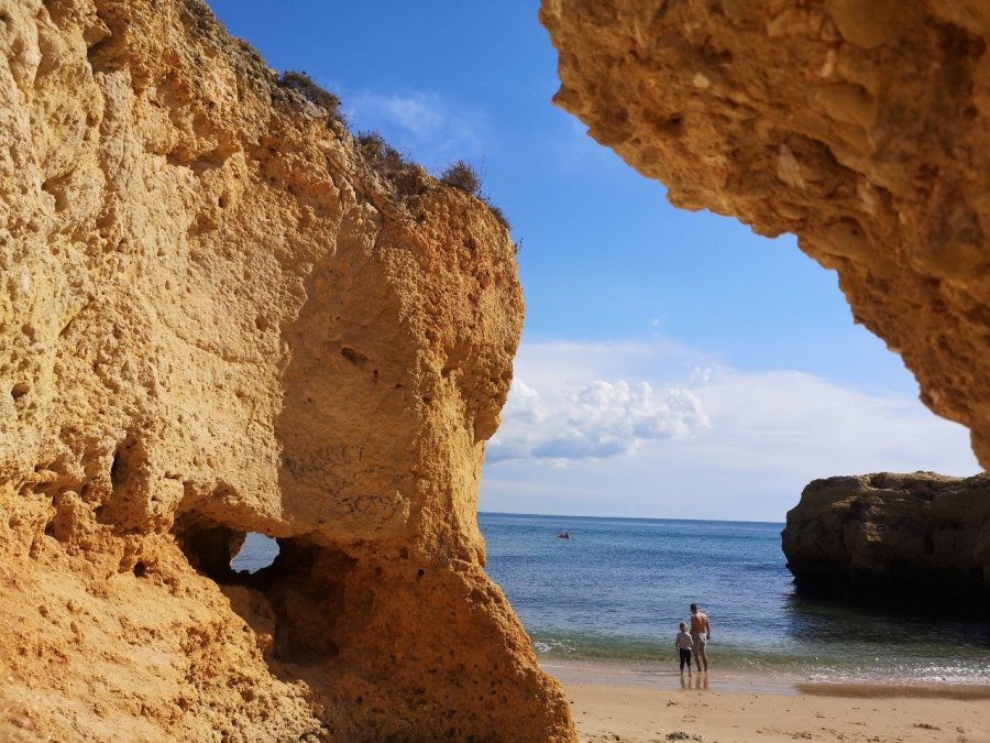
At one point I got rather lost in a maze of villas, trying to take a short cut as it was very hot and I knew there was a beach coming up where I could take my boots off and have a swim.

wp-15743413731648231212839382569318.jpg
Coelho Beach (praia) named after the famous writer Paul Coelho. There is a film about the Camino de Santiago and him on this page

Then it poured with rained and I spent a good hour with a green tea in the restaurant. Most people seem to eat big meals at these places so they are not really suitable for a cake and a cuppa, although in this case it was after lunch and they were very friendly (as they all always were).

wp-15743408947659064656729964408892.jpg
Then the sun came out again and I enjoyed the local flowers
wp-15743408946954400697475965374363.jpg
Bougainvillea
wp-15743408946193706921222013360689.jpg
The juxtaposition of colours always gives me joy
wp-15743408944595333003271897472621.jpg
The oranges were not ready yet
wp-15743413730988194201514852195974.jpg
When it rained again towards the end of the day, I took refuge in a disused shack. I could smell the sweetest aroma (perhaps released by the wet) and then saw it was this shrub
wp-15743413730245416839622163650515.jpg
Giant cacti
wp-15743413729542009821631950509675.jpg
And pink Prickly Pears

Patroves

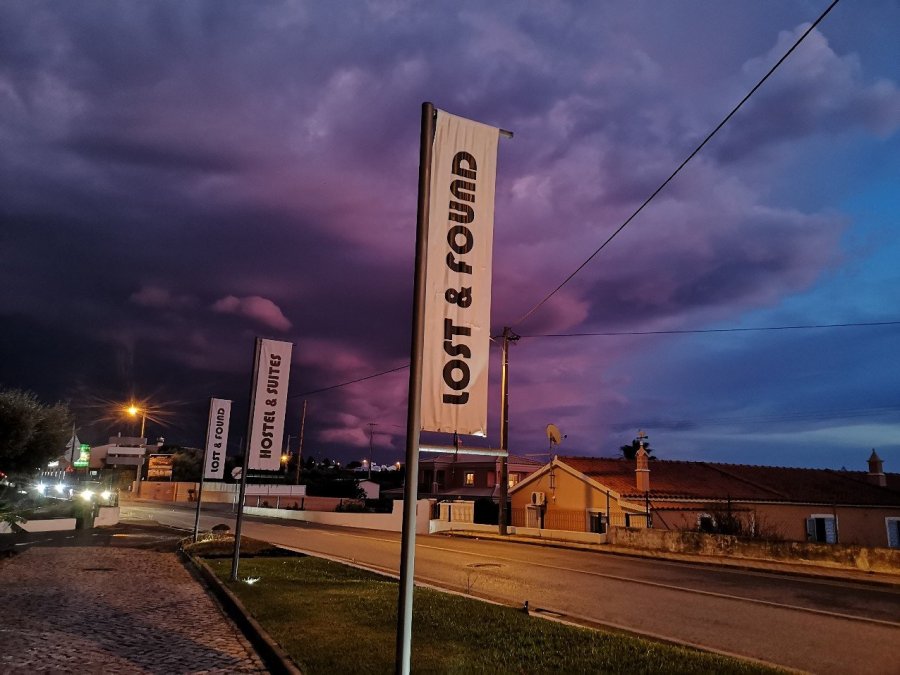
I stayed at the Lost and Found hostel that night (more of a motel on a busy road, but it had a pretty courtyard where I could do my morning Tai Chi, an amazing kitchen and it was scrupulously clean. There were two supermarkets nearby, with ATMs for getting money out.

wp-15743413728347124228355213312867.jpg
The Lost and Found hostel, Patroves, Portugal
wp-15743413727571942824214162361081.jpg
The courtyard of the Lost and Found hostel, Patroves (a little inland), Portugal

I used booking.com again for this. Cost: 15 euros for a bunk in a dorm of four with a spacious shower room and toilet en suite. I shared with a Spanish man of few words, and had a good chat over supper in the kitchen with another who told me about the family restaurant near Granada where he works.

wp-15743413726967745629362706380699.jpg
I ate these little fruit, feijoa from Azerbaijan, which I had bought a few days previously. They were divine
wp-15743413728998149261380019783248.jpg
A moody sky as the sun set with thunder and lightening, but no more rain

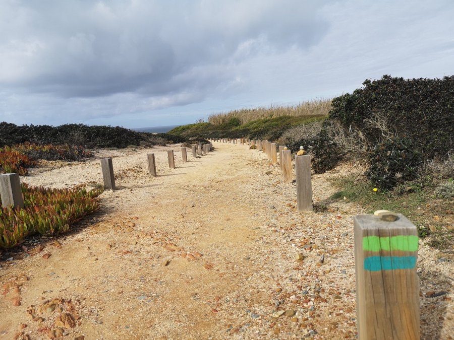
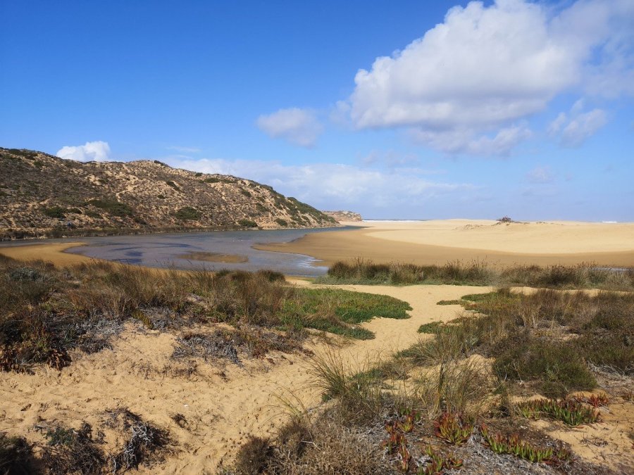
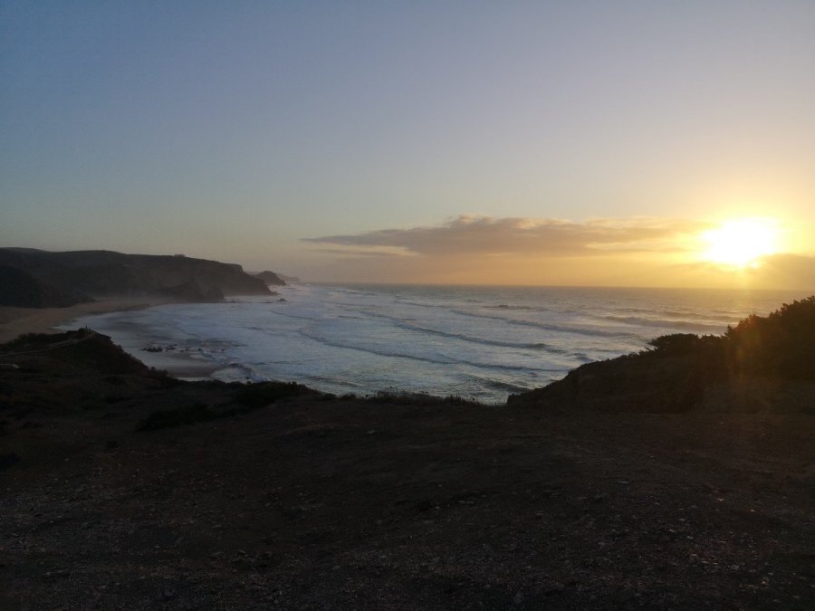
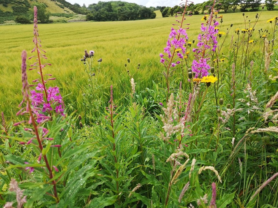
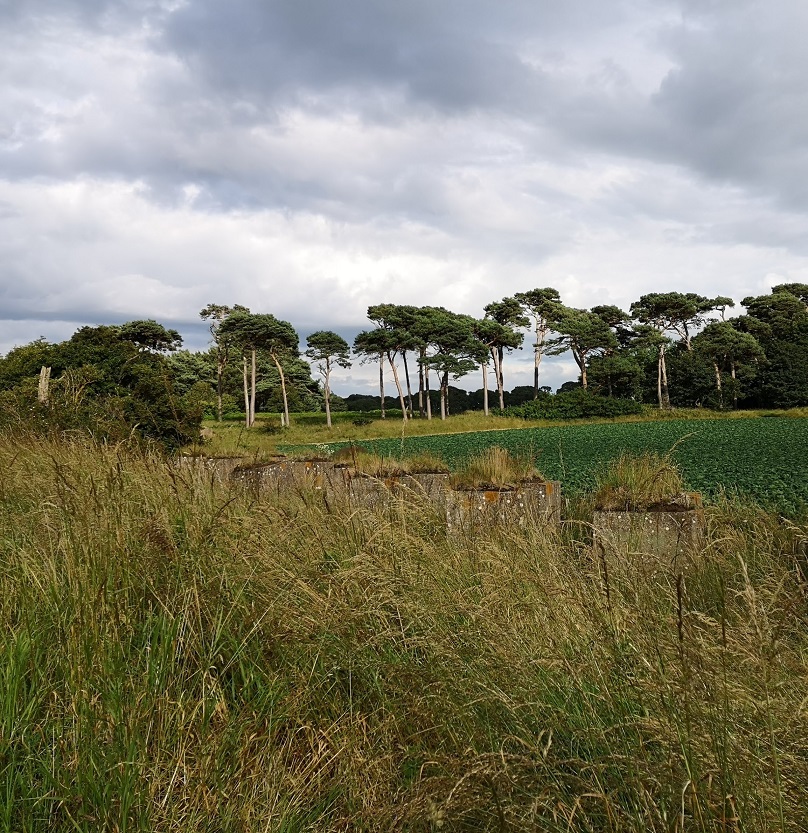
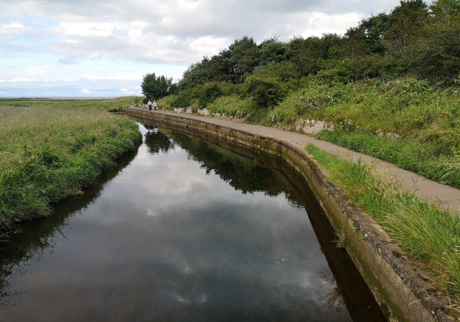
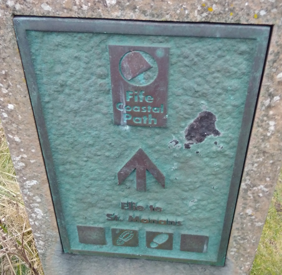
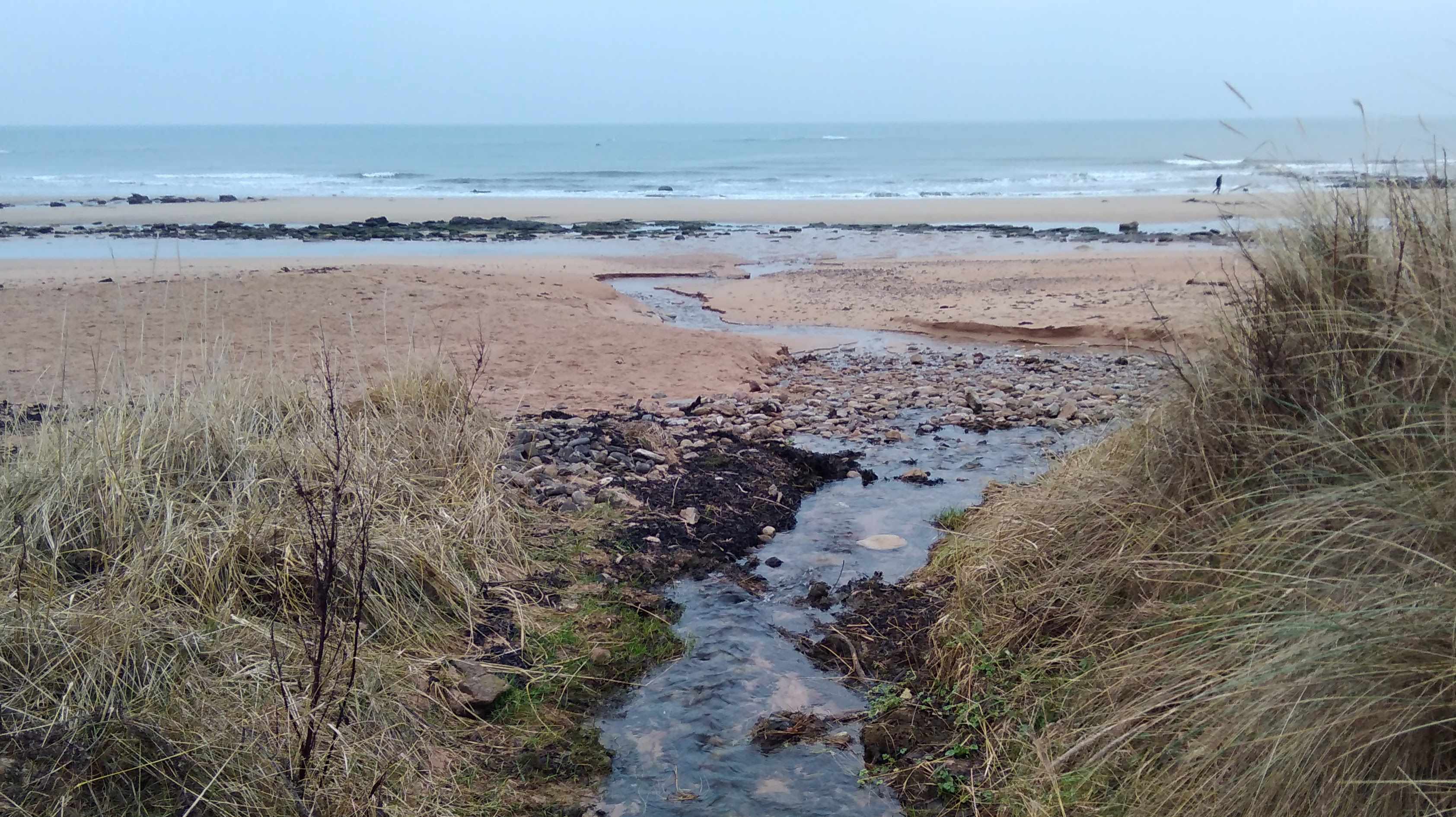
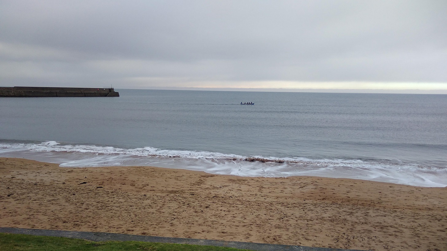
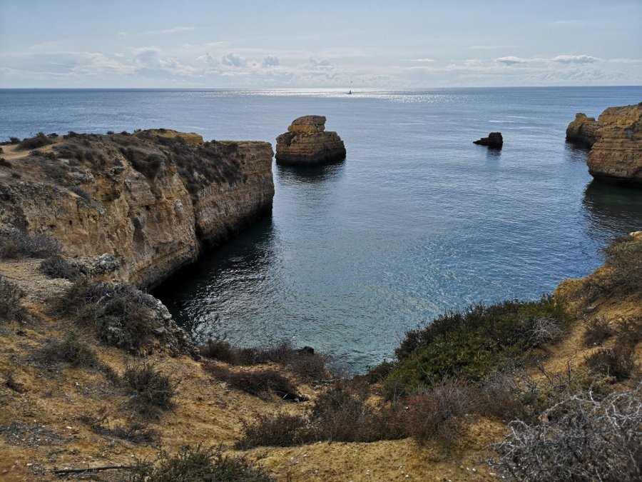
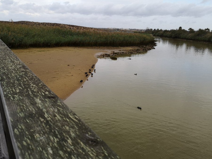
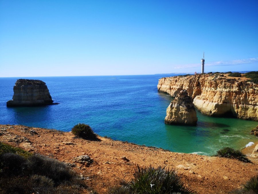
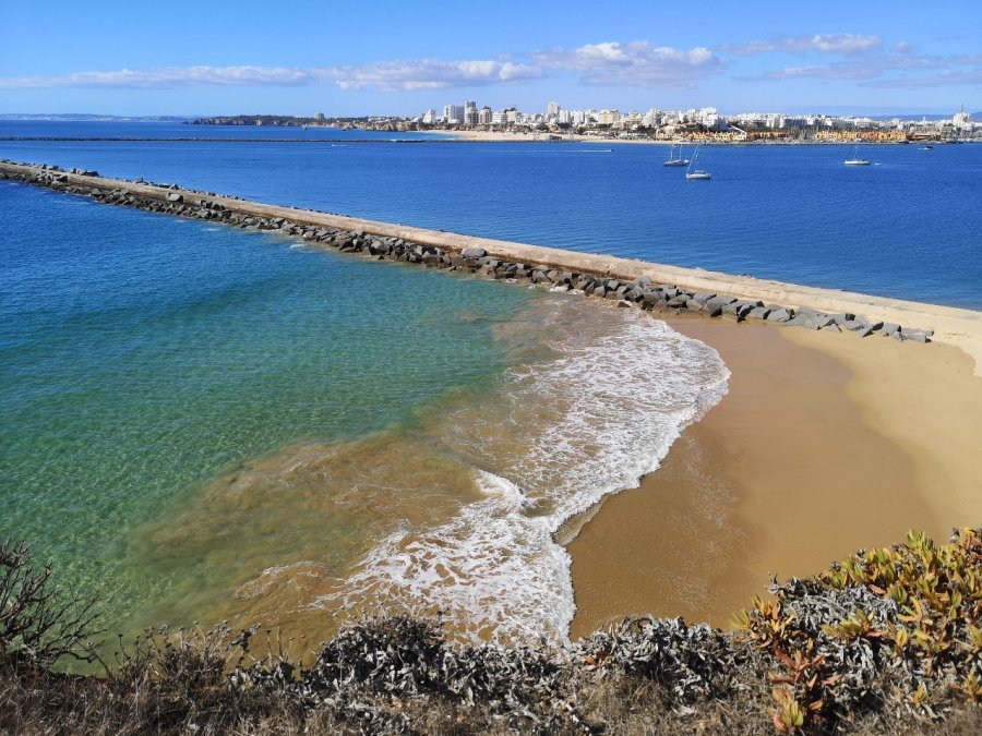
The next day I made my way through Sesmarias to Praia de Gale and thence Praia dos Salgados. There are many sections of boardwalks (like the Camino Portugal de la Costa in the north) and they often traverse through protected natural areas where there are birds (egrets, for example), plants and animals of interest.

wp-1574341372626438699591495033526.jpg
Boardwalks to stop erosion and make walking easier
wp-15743413725627792665588390251879.jpg
Water birds (coots) are protected here
wp-15743413725041658461216139684111.jpg
A flock of goats being led to pasture through the car park
wp-15743413724322590376972400870039.jpg
Towards Armacao de Pera

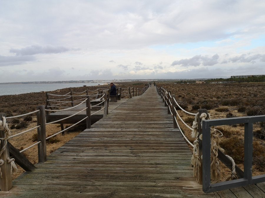
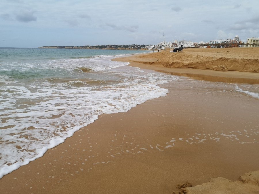
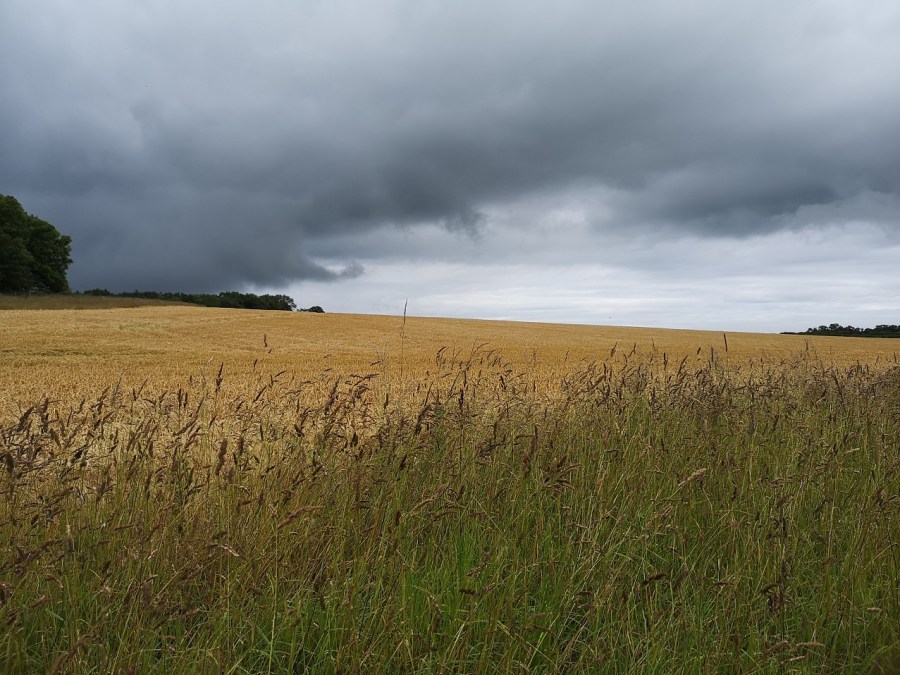
It is basically one beach along the length of this part of Portugal.

wp-1574341372148374577191305863433.jpg
Even the dead leaves made quite a picture against a blue sky and in contrast to the flowers and grasses
wp-15743413720634525300612439994819.jpg
Giant Aloe Vera overlooking the sea

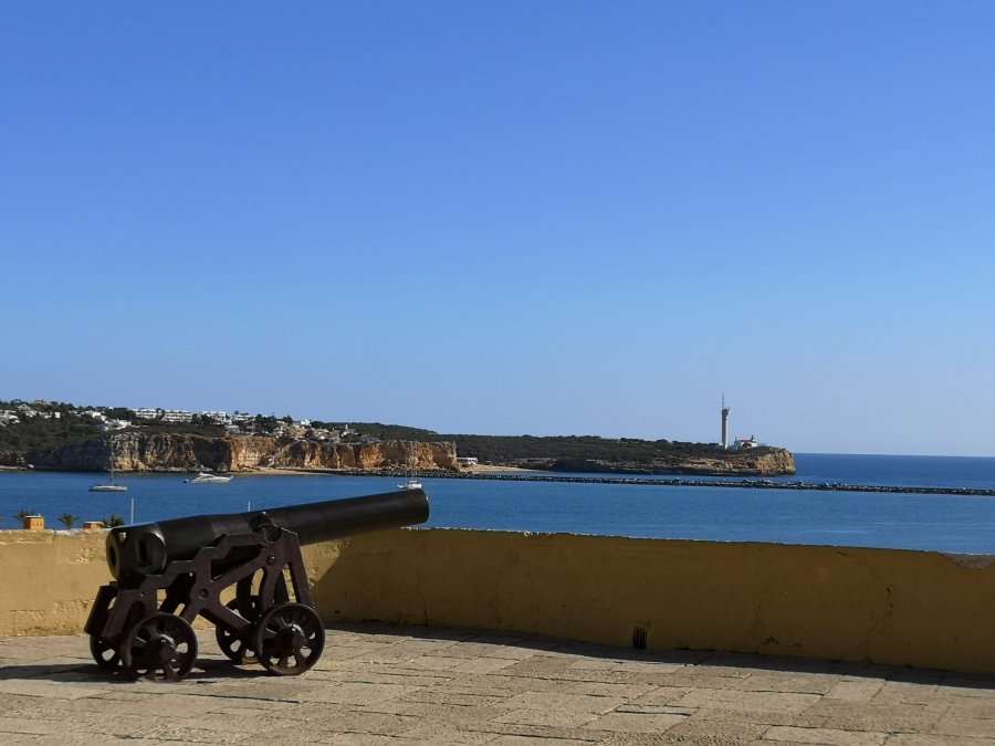
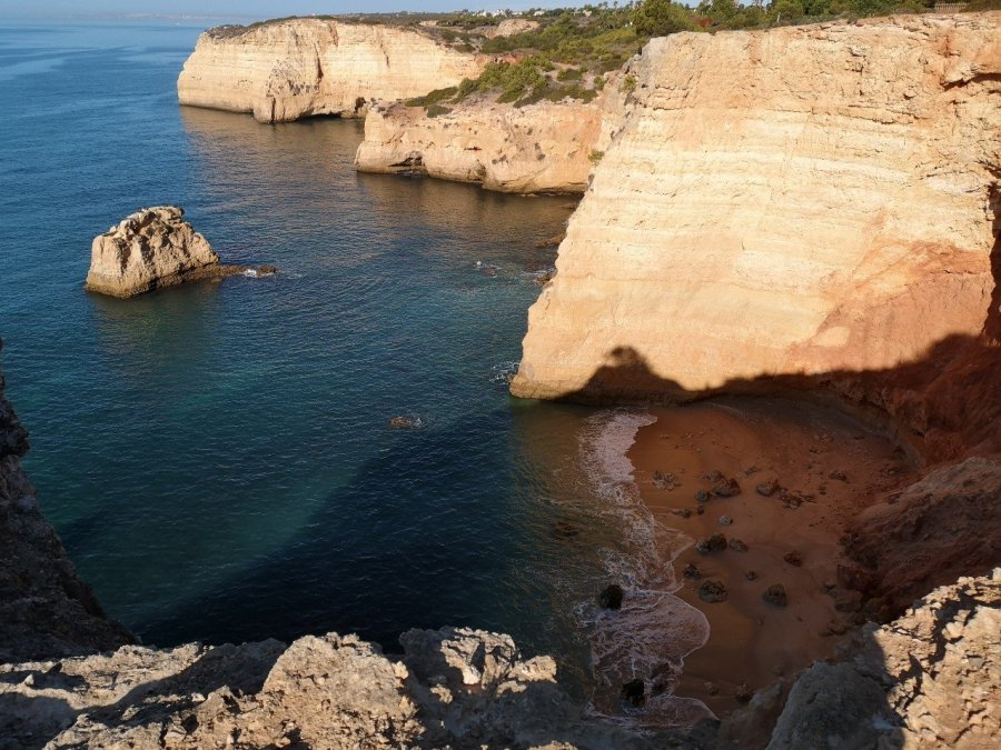
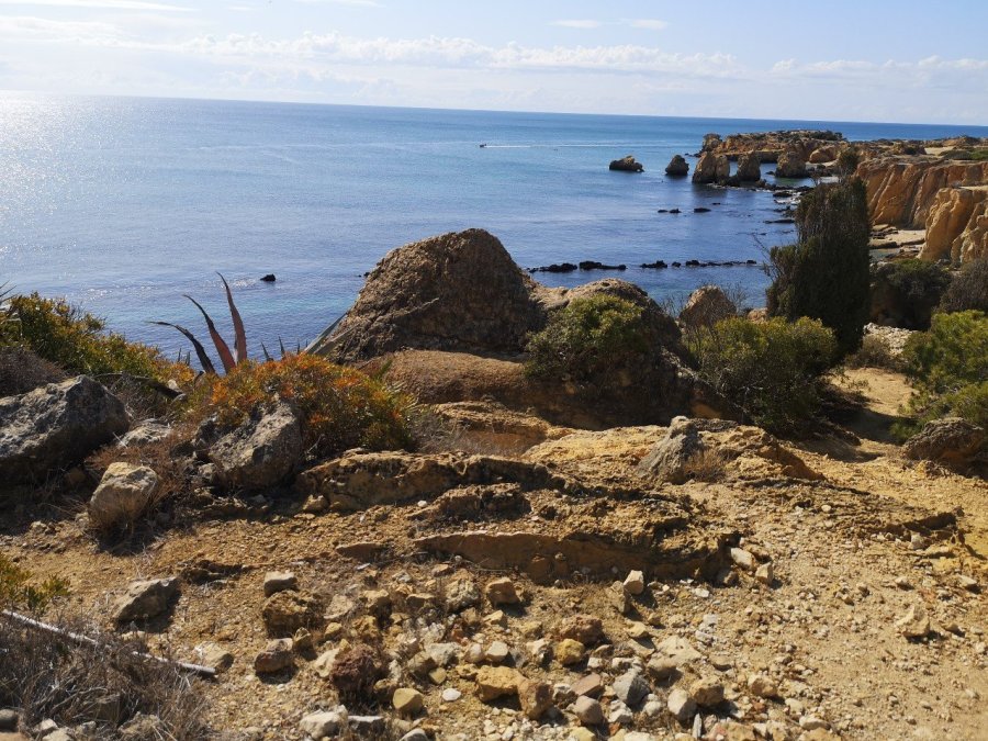
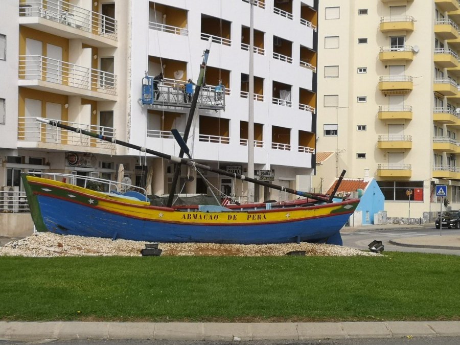
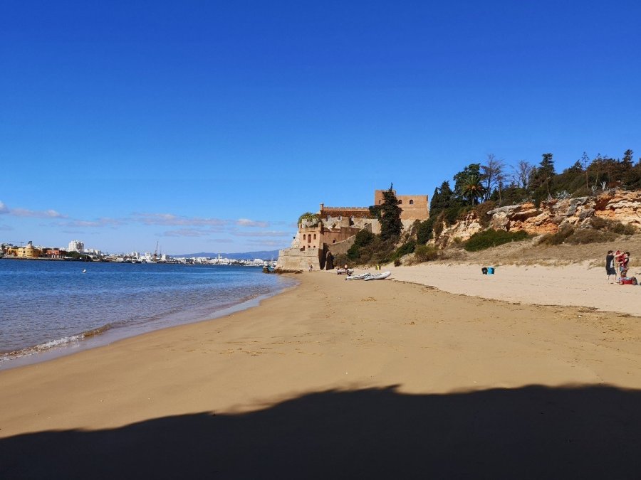
Wide open sandy paths run amongst still-green undergrowth. Inlets and lagoons, sand banks with fishermen and high-rise, white-washed apartments in the distance: Armacao de Pera, where there is a fortress, and knowledgeable staff at the tourist information. Here I stopped to buy a pastel de nata (Portuguese custard tart) for my elevenses.

wp-15743413723692441963924618708682.jpg

wp-15743413722942159608561761943708.jpg

wp-15743413722203287847548940196800.jpg
More beautiful coves as I walked on

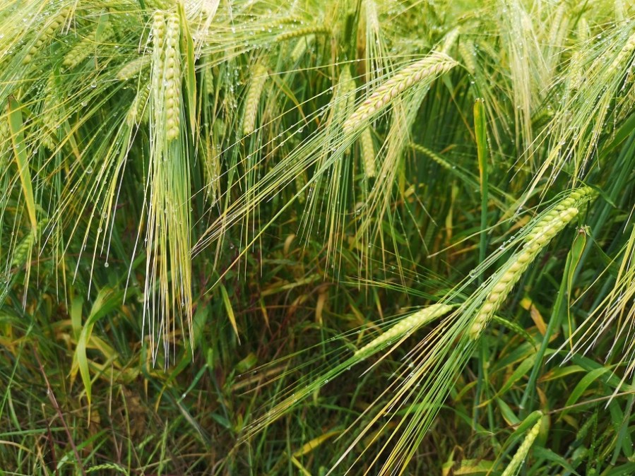
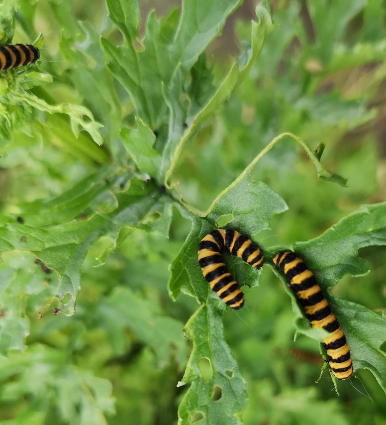
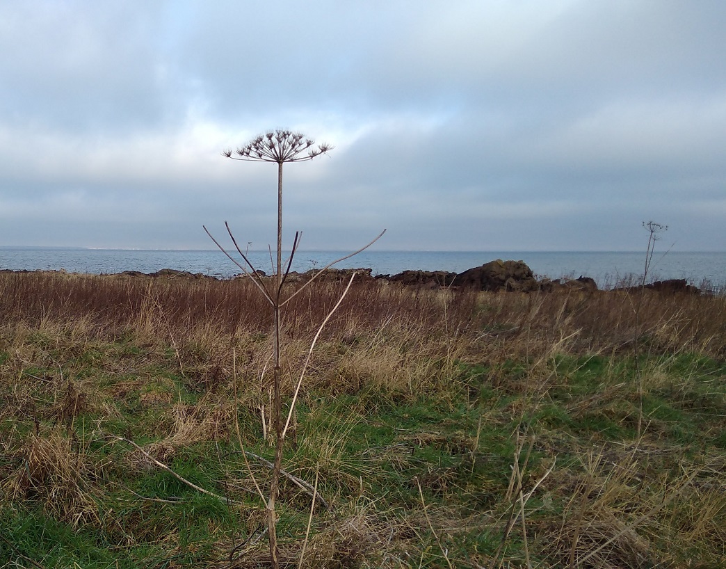
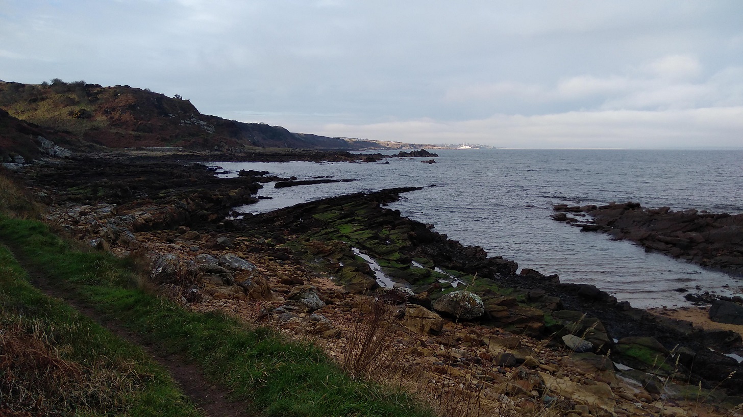
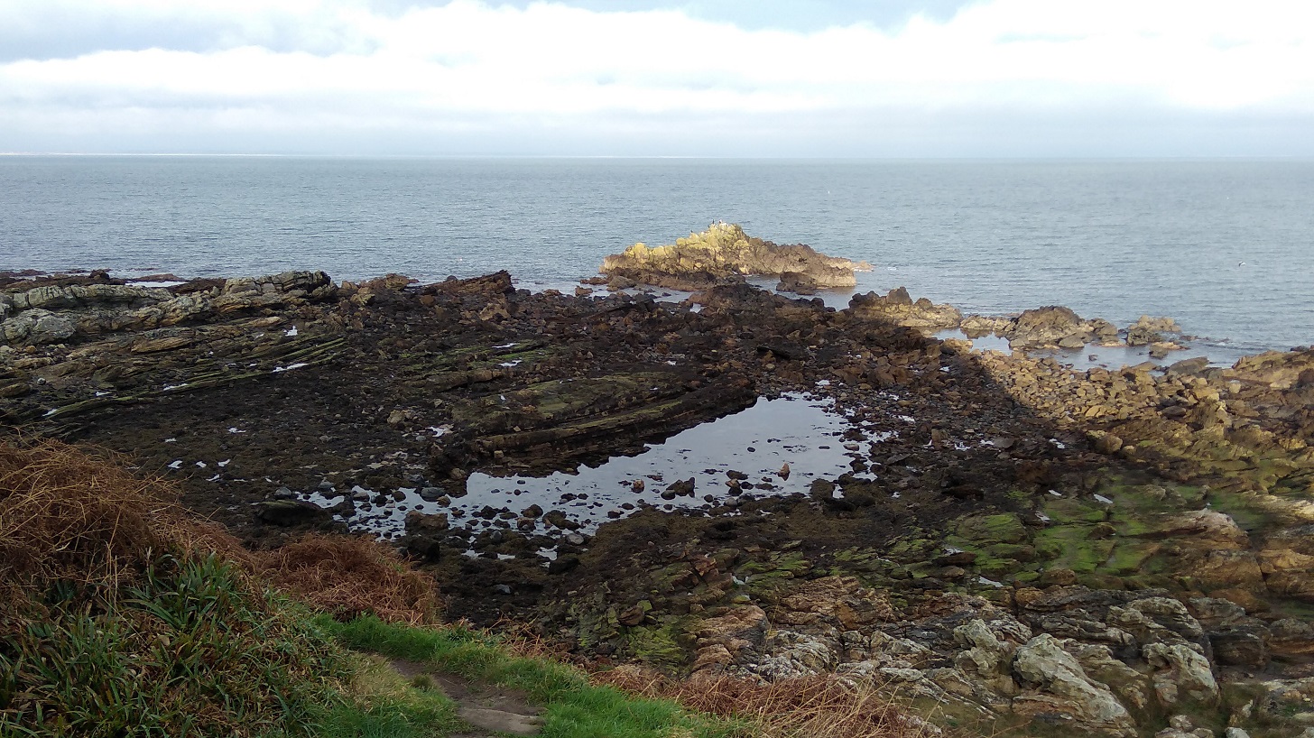
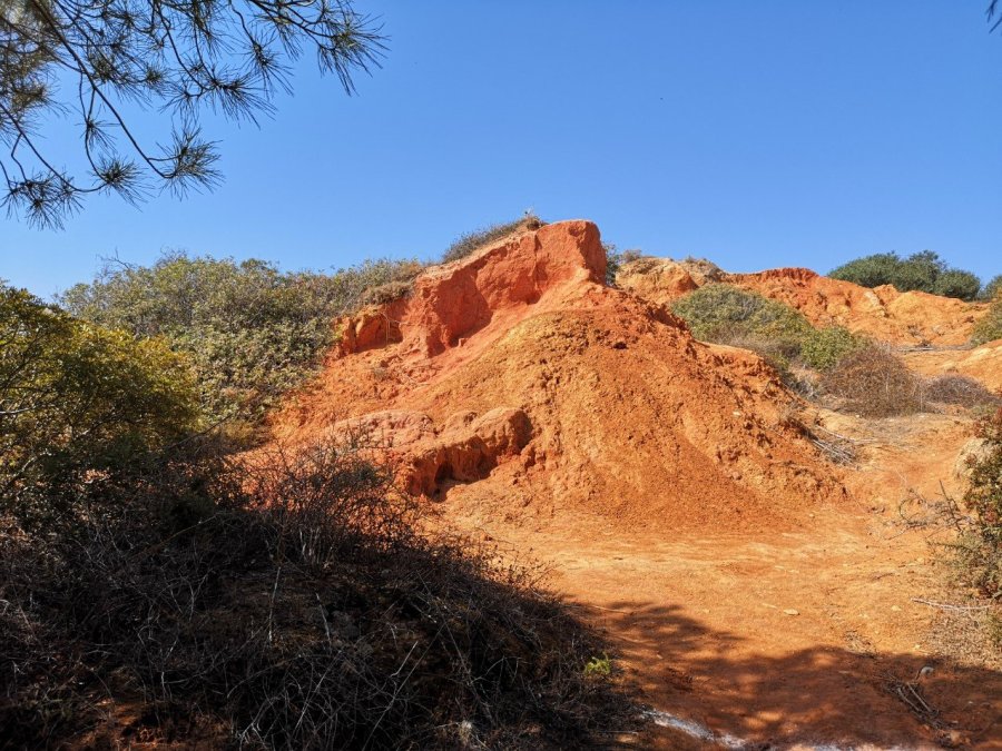
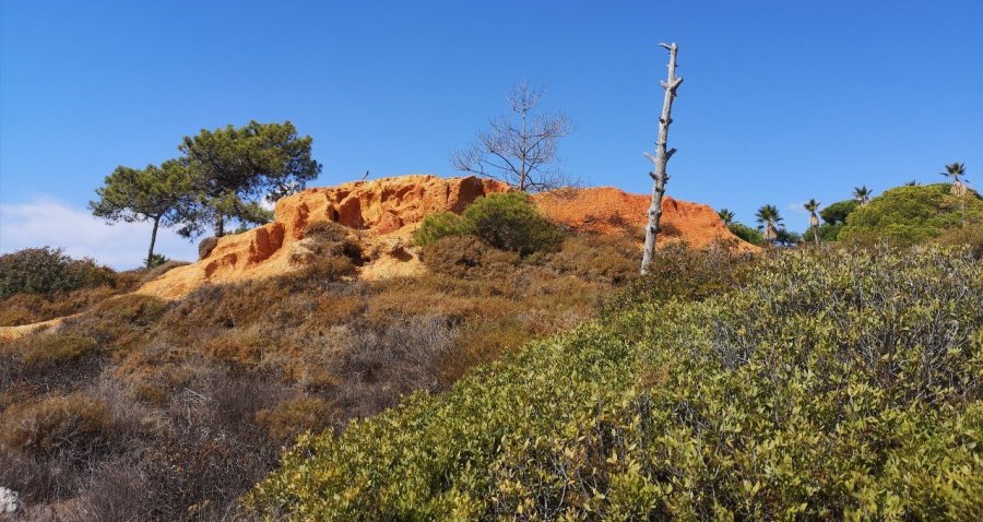
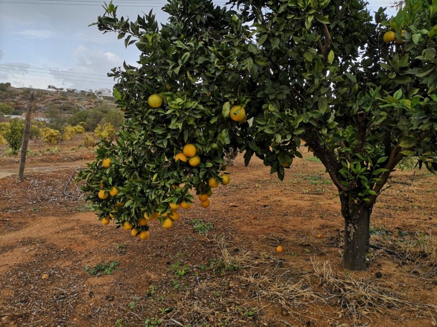
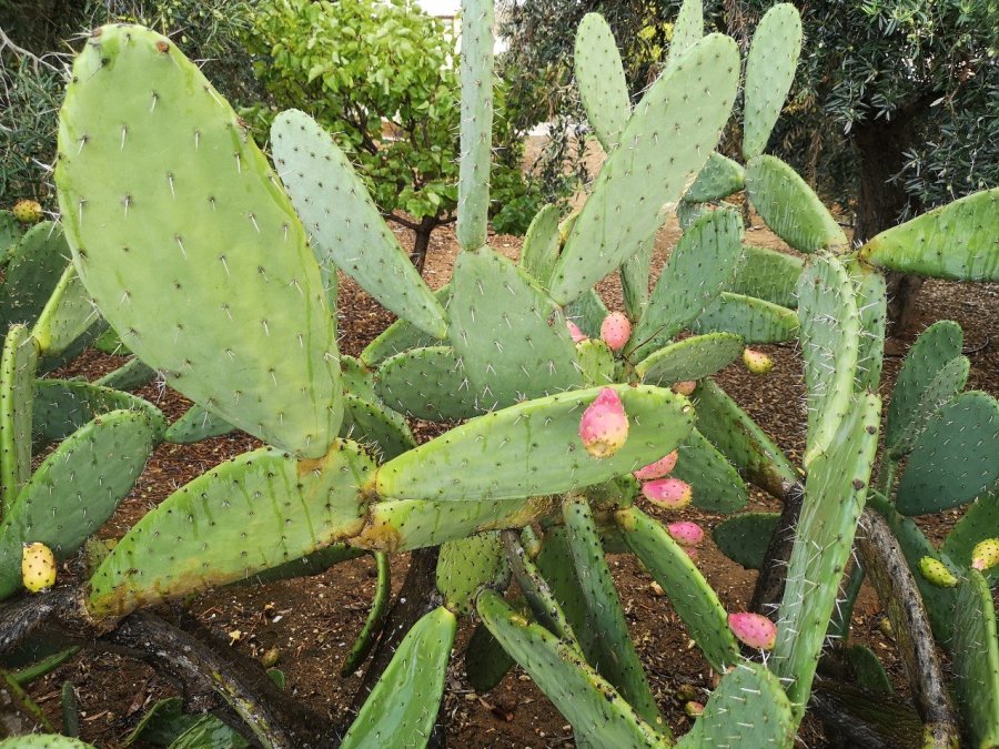
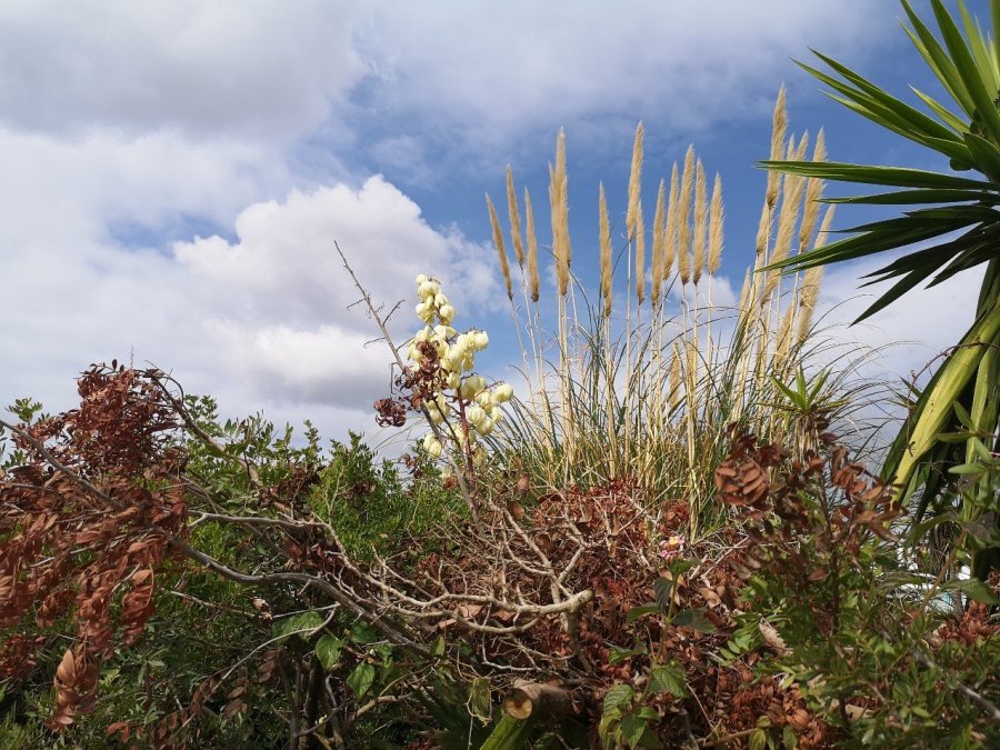
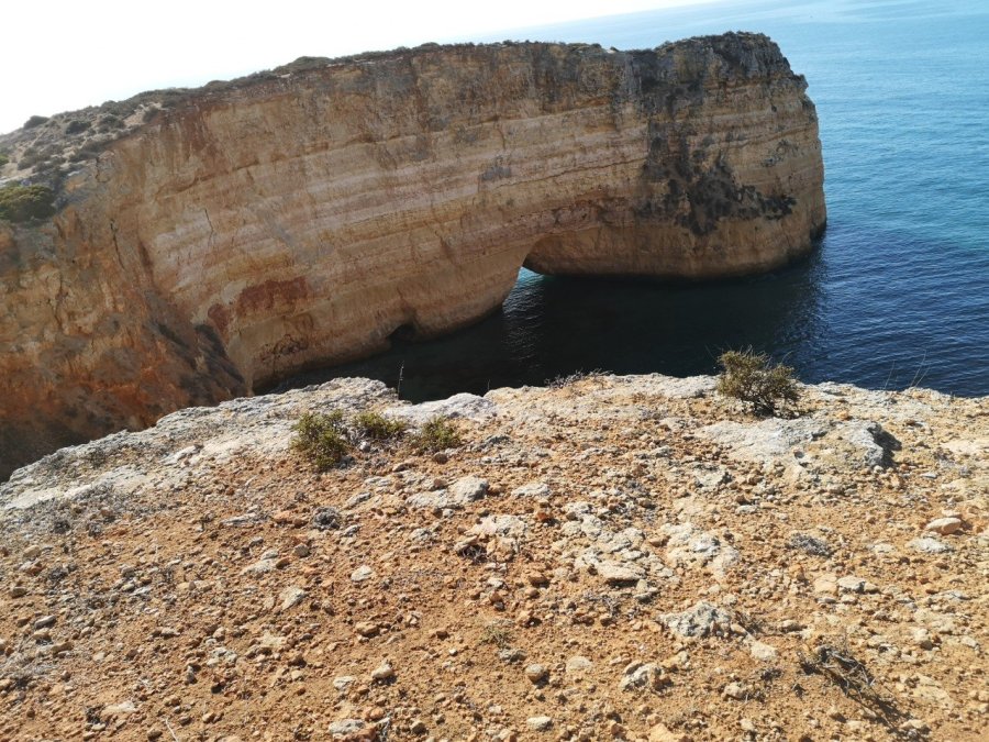
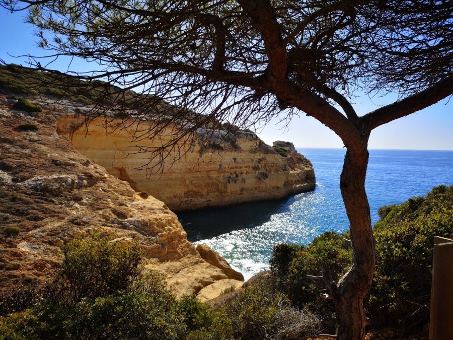
My way wound through spiky bushes, and always the sea was on my left, sometimes edged with swans. Brown and cream butterflies were warming their wings on hot stones which had been whitened by the sun, parched roots were exposed and soft pine needles lay everywhere, yellow-green at this late time of year. There were grand palm trees and lemons hung on branches of shiny leaves in Carvalho’s garden (I’m told he is a famous footballer). His property sits above a beach which is named after him. 

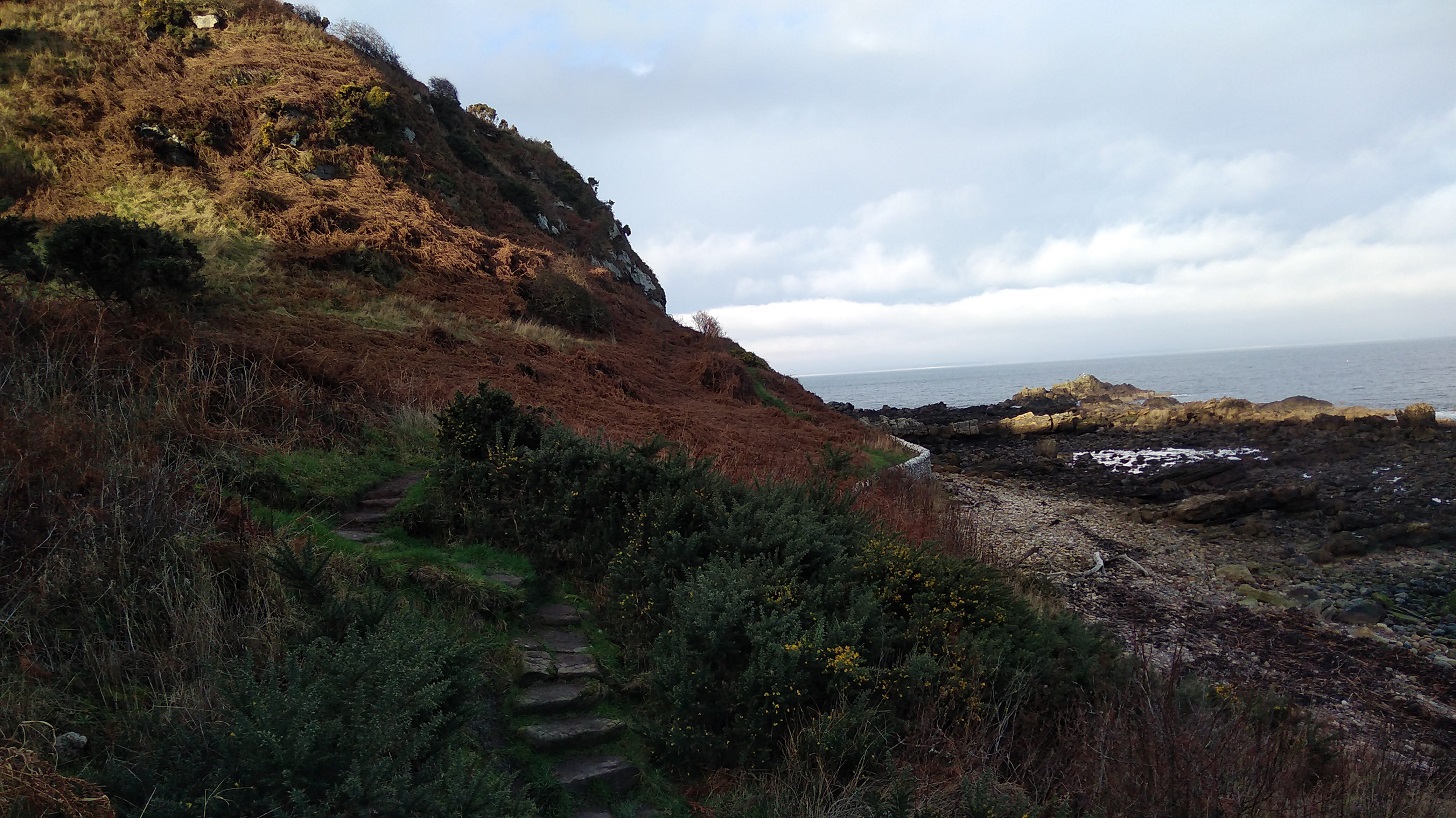
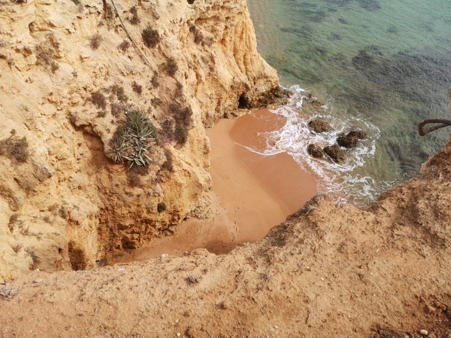
At this point on the coastal path, I took a wrong turn and went down to the sea which meant that, of course, I had to go back up again – about 150 steps – hard work with the rucksack in the sun.

wp-15743523833473897122213244449624.jpg
Praia das Escaleiras is aptly named – it means Beach of the Steps

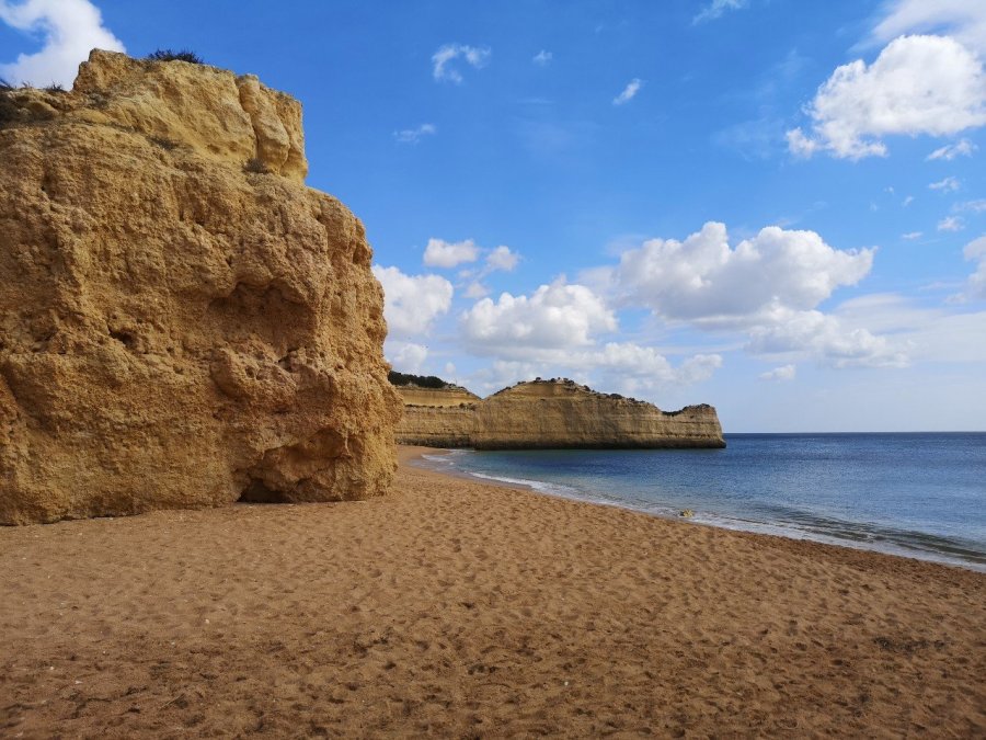
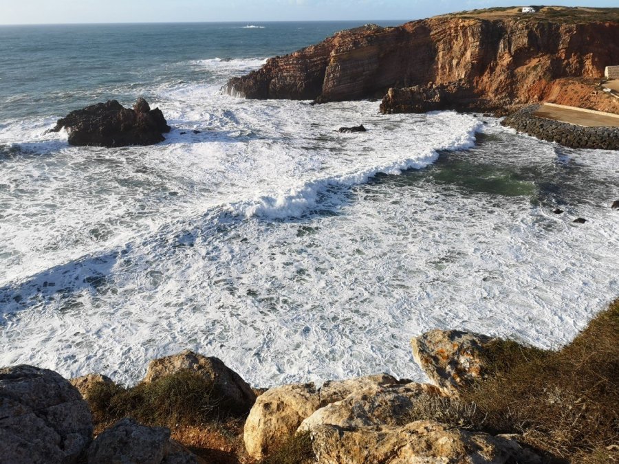
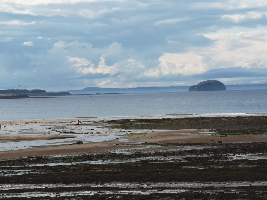
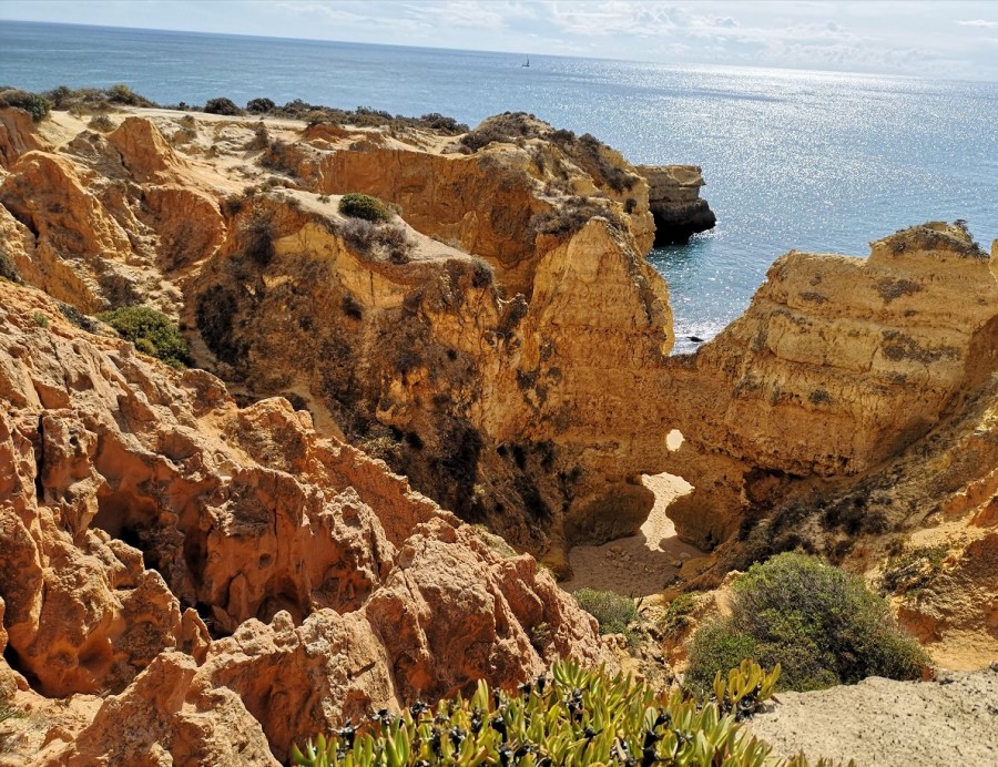
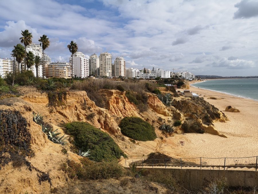
There are high class resorts with grounds kept fresh from constant watering all along here, and the most spectacular beaches.

wp-15743533351403839415165554542737.jpg
Here I found a Coqulle Saint Jaques shell, symbol of the Caminos which are walks which end at Santiago de Compostella in Spain
wp-15743533350888036659472851252017.jpg
Ermida de Nossa Senora da Rocha (Our Lady of the Rock), Porches, Portugal
wp-1574353335024621709971084406258.jpg
Porch of the Ermida (hermitage) de Nossa Senora da Rocha (Our Lady of the Rock), Porches, Portugal

A woman tending a clothes stall helpfullly pointed me towards the right bus stop, where I waited for a bus to take me to my lodgings. It had taken me longer than I had expected and I was reliably informed (by the surfing dude in the wooden cabin on the beach) that I would not make it by dark. He was right.

wp-15743533349624340997902383992485.jpg
Typical, open countryside of this part of Portugal, November 2019

This took me to perhaps the most disappointing hostel of my whole trip – Hostel Carvoeiro (see below). It promised a garden, but was separated into various areas which all seemd private or had a vehicle of one sort or another in them. The kitchen and dorm was open-plan. The hospitalero was not around once I had booked in, and there was one other person who seemed to be a long-term lodger, a chef in a local cafe. It being cold at night at this time of year, even in the Algarve, I prepared my tea on a temporary stove in the one mug that I could find, and huddled until the morning.
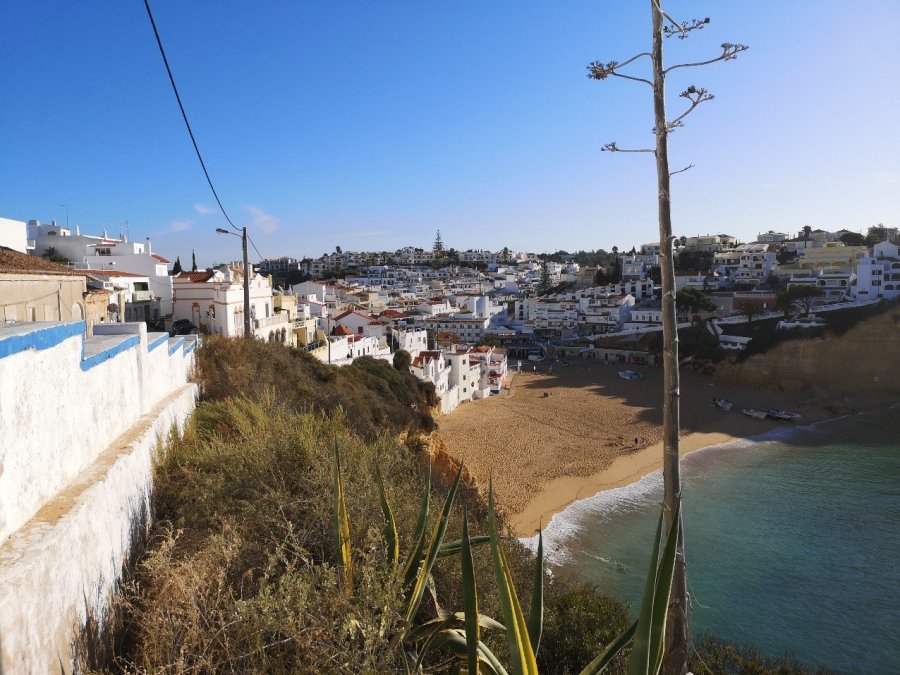
Carvoieiro

wp-15743533348845598964047386695122.jpg
This is the Hostel Carvoeiro sign. The owner obligingly gave me a lift into the village in the morning, but I would not recommend staying there

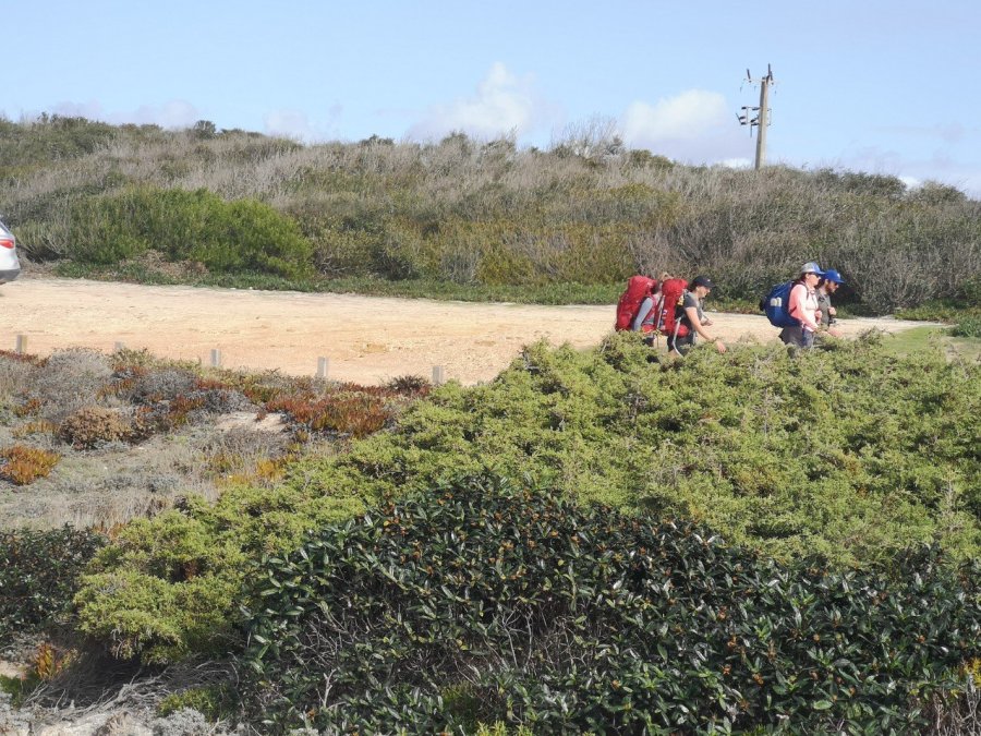
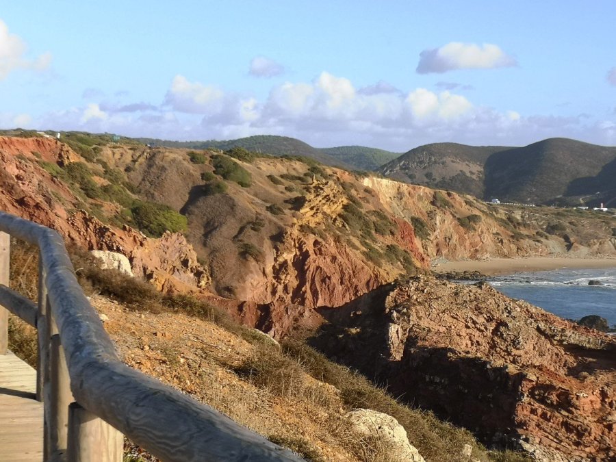
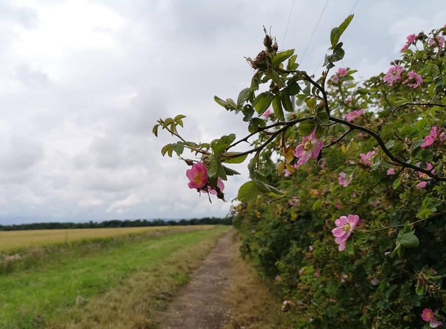
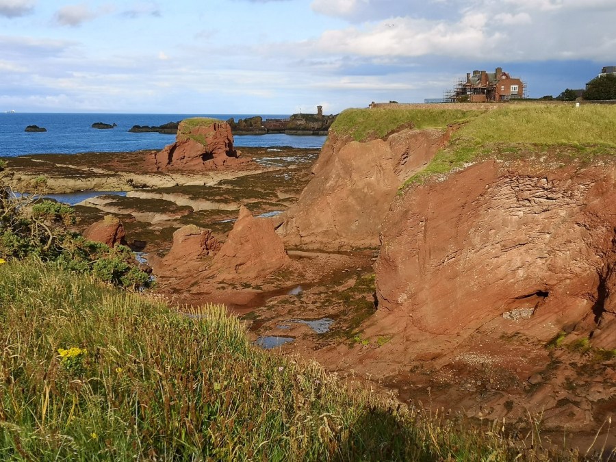
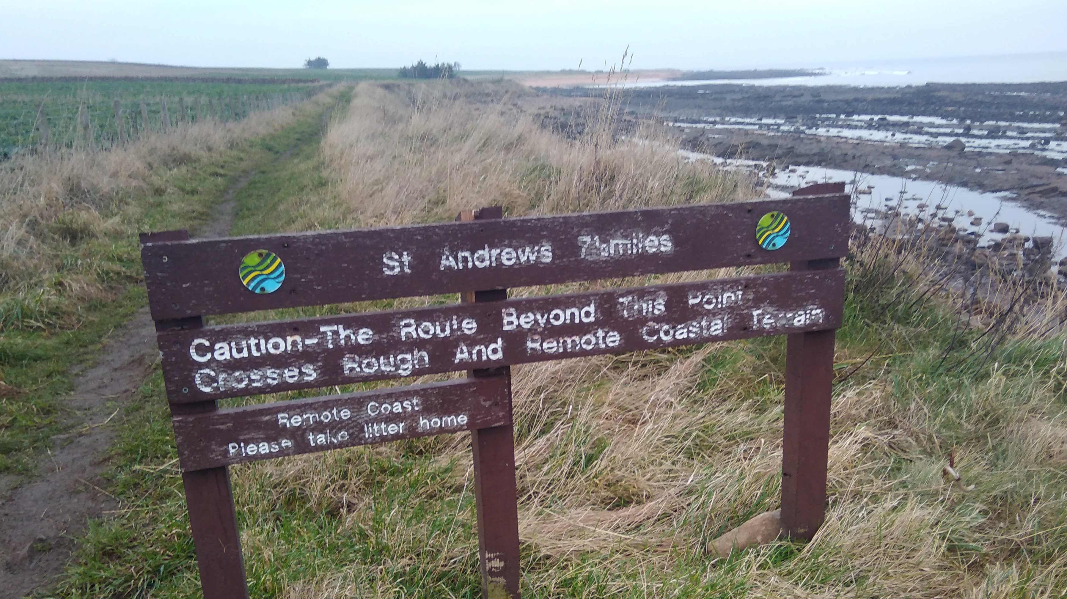
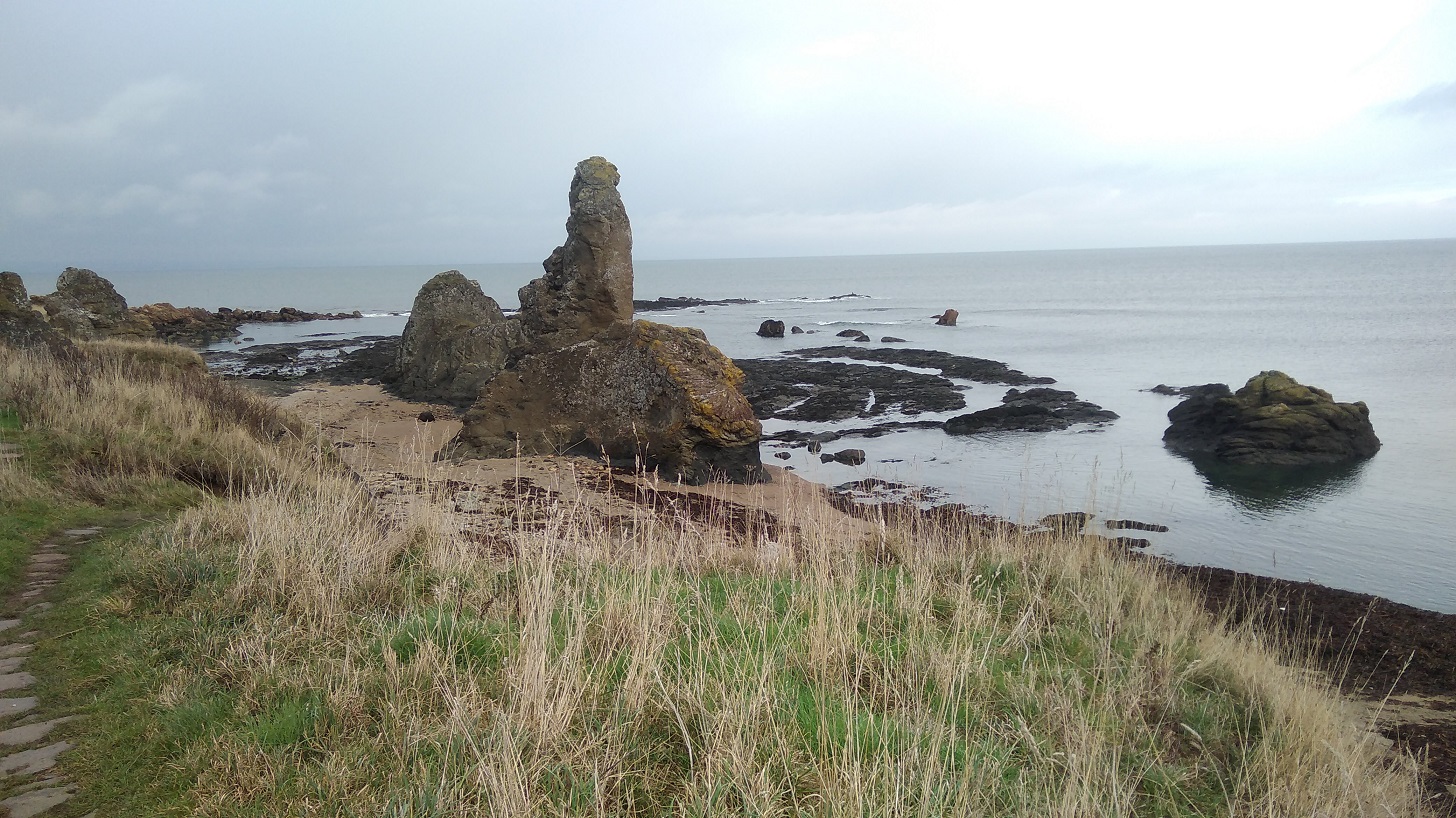
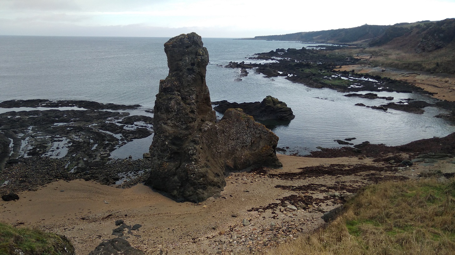
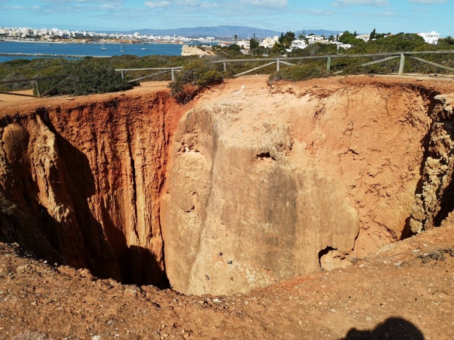
Once again I had been staying a little way inland, and so had a short walk to the start of the Caminho das Promontorios (Trail of the Headlands). The route was harder to find and I lost my way several times, once bringing me to tears of frustration as I wandered around in circles. In the end I simply waited until someone else came along – a man who continued to look back afterwards, to check that I was still following. It was quite a long way, but really lovely scenery, and there were lots of day-hikers going one way without rucksacks and getting a taxi back.

wp-15743533347623609268157963912169.jpg
Carvoeiro beach. The small boats were leaving early to pick up tourists and take them to the famous Carvoeiro caves nearby
wp-15743533347022136729707033608711.jpg
Leaving Carvoeiro

wp-15743533346318889253866756964297.jpg

wp-15743533342866283179022583443685.jpg
The striations of the fabulous rocks
wp-15743533342081268848716600968422.jpg
Dusty paths lead to secluded beaches
wp-15743533341298203658459001876287.jpg
Glittering water and winter trees
wp-157435333398942253200826221156.jpg
At Rei das Praias, I lay out my swimming costume and towel to dry and then forgot to collect them before leaving

I phoned the bar that night and asked if anyone lived in Portimao where I was staying, hoping to avoid losing them altogether, or having to walk back. I was lucky. A few calls and days later, I arranged to meet someone who gave me my costume back, though never the travel towel which D had kindly bought for me from Germany. I managed without one for the remainder of my trip (three and a half weeks), and was very grateful indeed for everyone’s kindness.

wp-15743533339245274707317882510453.jpg
Aquamarine seas and the Farol (means lighthouse) da Ponta de Altar on the next headland. The rocks out at sea are important breeding sites for egrets

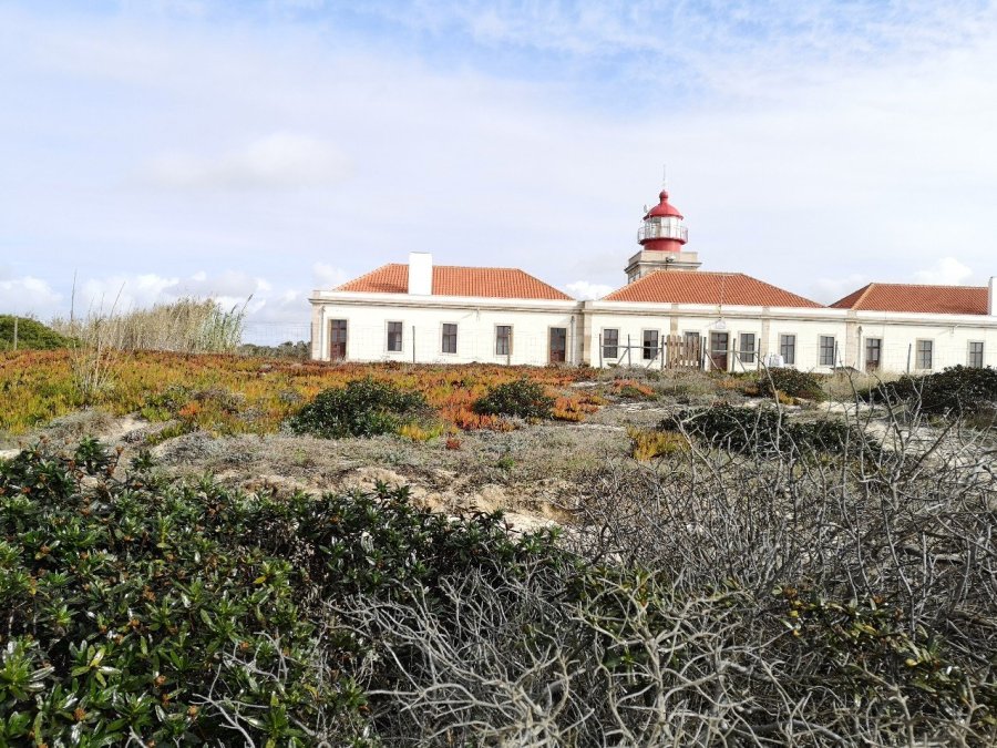
Link to the Lighthouses of Southern Portugal page.

wp-15743533338482743736698423049696.jpg
There are huge holes in the limestone cliffs around here.
A fossil of a camino shell. I saw many similar ones along this coast
wp-15743533340684893600996228532962.jpg
17th century Torre da Lapa, Ferragudo

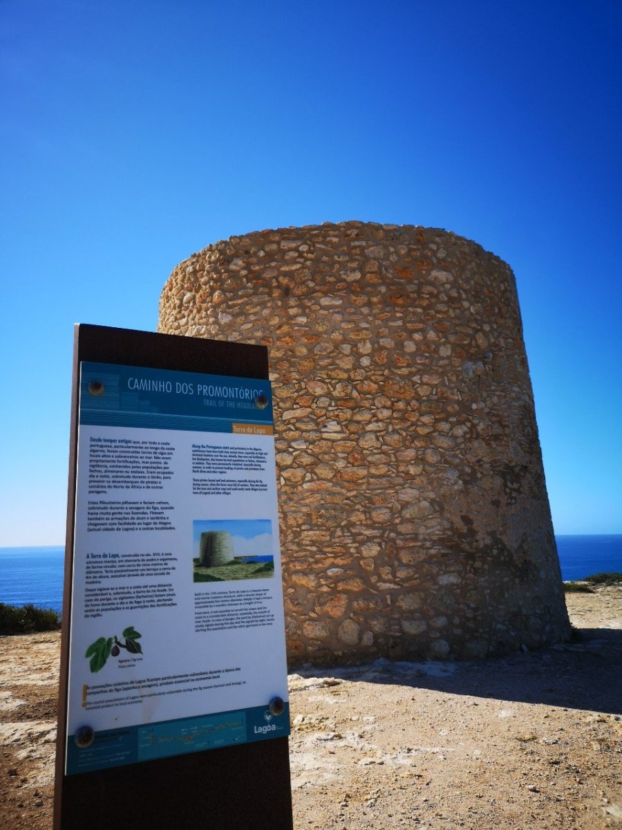
In the past, smoke and fire signals were set by day and night, respectively, to warn the populace of danger.

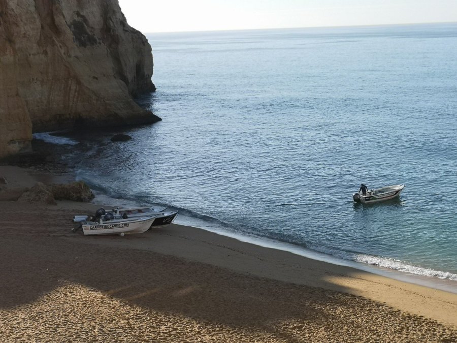
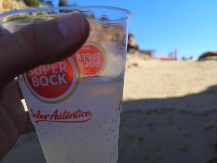
From the Farol da Ponta do Altar, I made my way around the promontory towards Portimao and as there was still a long way to go, I took a water taxi. While I waited on the beach, I bought a cool and most welcome drink.

wp-15743533337792769705185428094986.jpg
Praia da Angrinha, looking across to Portimao – another place that is extremely built-up and busy
wp-157435333364864207497071511178.jpg
Popular Portuguese beer cup (I had mineral water)
wp-15743533337158302434611054509906.jpg
Castelo de Sao Joao do Arade

Portimao

When I read the small print for the Plaza Real by Atlantichotels which I had booked (again through booking.com), it said I had to leave a deposit of 200 euros which I have never had to do before. Despite my best efforts to contact both booking and the hotel, I could not get it waived and was rather nervous in the run up as I didn’t carry that sort of cash. However I needn’t have worried: the kind receptionist explained that they do not take it off the card nor need cash, just that they take details in case you make a mess in the room. It was a bit like hiring a car without paying for third party insurance – slightly nerve-wracking – but then again, I wasn’t planing on having a party.

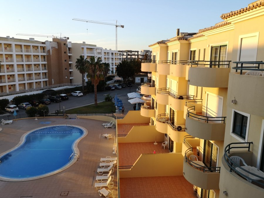
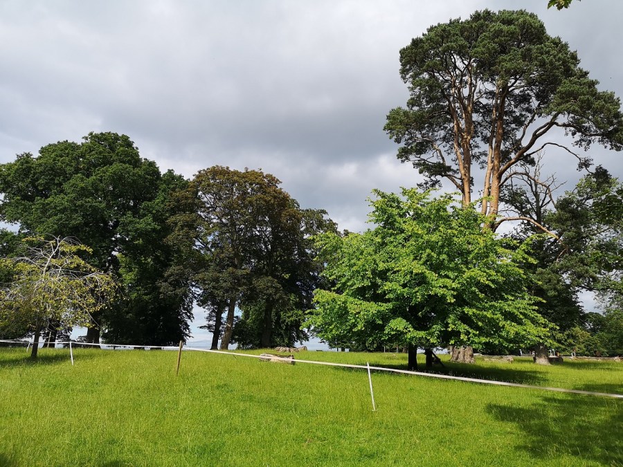
It cost 24.67 euros and I had a whole apartment to myself – 4 rooms! (There was also the use of a pool, but I arrived too late to use it and it was in shadow and therefore cold). The big supermarket is a good walk away (back towards the city), although there are two smaller ones nearby.

The marina at Portimao, Portugal
From the canon in Portimao looking back towards the lighthouse I had walked past earlier that day
Bridge over the River Arade, Portimao
Moorish influenced architecture meets modern designs

Portuguese Walking Routes 1

Early November 2019 and there are lots of hikers on this most beautiful Fisherman’s Trail, the Rota Vicentina along the south western coast of Portugal.

The beach at Zambujeira do Mar

At Cabo Sardao for example, I saw 11 in 5 minutes – in groups of 2, 5 and 4 – something I’m not used to when walking in remote areas alone. A single walker and a pair were spotted this morning on the beach at Zambujeira do Mar. Ranging from German to American, there are walkers’ gatherings in cafes and hostels at the end of each stage, exactly as you would expect on the Camino Frances in Spain.

The Ferrol (lighthouse) at Cabo Sardao

1. Rota Vicentina

The trail runs from Cabo San Vicente to Porto Covo, or vice versa and is 350 kms in total, each stage being around12 to 22 kms in length.

Path on top of the cliffs, close to Almograve

Map of the route

Beach at Carrapateira

The Rota Vicentina consists of two major routes (GR), the Historical Way and the Fishermen’s Trail, which contain 24 circular routes totaling 740 km.

Beach at Carrapateira

You can be creative in choosing your route – trying the whole or part of it – to suit you, your physical capacity, and time availability.

The two grand routes are divided into sections which are varied in length: between 11 and 33 km. If you were to complete all of the sections at the rate of one per day, you would need the same number of days to complete the Rota Vicentina.

Circular Routes are shorter, ranging from 4 to 16 km in length.

Ideally, you would prepare yourself before departure and take water and groceries with you for the day of walking, since not all sections visit places with coffee shops and / or grocery stores.

At most of the start and end of stage points, you will have no problem buying food. Check each village to see what they offer.

The centre of Zambujeira do Mar
Zambujeira do Mar under the moon

Both the Fishermen’s Trail and the Historical Way have clear signs in both directions.

2. Fishermans Trail

Mostly by the sea, the Fishermen’s Trail travels along the paths used by the locals to access the beaches and fishing grounds. It’s a single track, walkable only on foot along the cliffs, with lots of sand, and it is therefore more physically demanding. It’s a challenge, but contact with the wind, the sea, the coastal landscape and the presence of a wild and persistent nature makes it worthwhile.

Official website

I booked it ahead, very easy as the accommodation is all on booking.com, but I didn’t need to. I got the details from the Rota Vicentina website which is very good, but there was more accommodation than was shown on the site and in most places you have a choice of near empty hotels.’ John Hayes

John Hayes Walks website, in English, with accounts of each day in Spring time.

North Berwick to Dunbar

A walk from North Berwick to Dunbar, part of the John Muir Way, East Lothian. July 13th 2019. 30 kms / 18.6 miles

John Muir Way signpost to hill
The mound of Berwick Law. You can just see the chapel and the famous herringbone on the summit

I remembered: the binoculars – definitely worth taking because East Lothian is a birdwatcher’s paradise. I saw 5 spoonbills through a kind man’s telescope (he had to lower it considerably so I could see, which was sweet of him). They looked like huge fluffy white poodoodles (or whatever they are called), with Edward Lear beaks (you know how he made drawings of amalgamated animals and kitchen utensils!) Also my walking baton pole which came in handy for the mud caused by the torrential rain.
I forgot: tissues / toilet paper and my mobile phone charger – when will I learn?
I lost: my sun hat. Twice. Once a motorist stopped and rolled his window down so I went back quite a long way to get it – all run over it was with muddy tyre marks. I wore it when the sun came out and then lost it again. Never to be found – not by me anyway.

Water with trees reflected in it
Pool at the foot of Berwick Law, near North Berwick, East Lothian, Scotland
Blue sky with plants and wall
A rather picturesque Wall I thought
Landscape between the stones
Looking through the gap in a stone wall to the wheat beyond

I had not done a long-distance walk for a long time and I managed to get quite stressed to start with, meaning that more little things went wrong, until… I got into the first green part and the butterflies (some chocolate brown and others white – twice one kissed me on the cheek) were playing, and the raindrops sat bulbous on the bramble flowers catching the glint of the sun, and I got bitten by black and white flying beasties. I was back!

Green fields with tracks through them
Arable fields, East Lothian, Scotland

The man in a green National Trust for Scotland t shirt said ‘Lady on a mission’ as I swung through the gate and skirted around Berwick Law. I have been up to the top in the past and it’s well worth it, but today I was headed south through meadows and woods, around fields and coastline – it was delightful.

tree trunks and grassy path
I smiled out loud as I made my way through an ash wood, all smooth, straight, pale trunks

Two runners in electric blue went jogging slowly past, having a laugh. Several jaunty ladies wished me good day, and I rather rashly added to my brief conversation with a hiker going in the opposite direction, that at least it had not rained.

Dark brooding clouds in East Lothian
The very definition of a lowering sky!

I squelched along a narrow way with piles of horse manure and single tyre marks which suggested other users I thankfully did not meet. When it rained I was on a long farm track which quickly became two channels of fast flowing water. There was a section which reminded me of a Kent walk, because it had serious new, silver metal fences on each side, and one smelly uphill section through the Drylaw Composting site where I discovered a make-shift children’s play area.

There was the unmistakable sound of a wild bee swarm several times along the way, and the hideous screech of racing cars around East Linton. One blissful result of the downpour was that they stopped, although they restarted when the sun reappeared.

Paintings for sale in the gallery
Half way I stopped for refreshments at Smeaton Nursery where there is a gallery and shop. Helen Gray is the Smeaton Estate Artist

There are lots of plants, a Victorian tea room (soup, salads, cream teas, delicious looking cakes), and a gallery shop selling all manner of paintings, cards and gifts. The staff were particularly friendly and helpful while I dried off a little in the sun – boots off and not so waterproofs laid out on the table.

Big old trees
The mature trees of Smeaton Nursery grounds where there are woods, a lake and pony arena
Red brick building seen across a wildflower meadow
Preston Mill reminding me of a disused oast house in Yalding
River reflections with bridge
Stunning weeping willows along the River Tyne outside East Linton

You could be forgiven for thinking there was no bee or butterfly problems if you saw the number of them I did on this walk. There is a beautiful long stretch along the river where comfrey grows in abundance and the sliver green fronds of the willows dip into the water.

Wooden bridge with red metal railings
Bridge over the River Tyne

There were so many wild flowers I lost count: chamomile with green orbs which had lost their white petals – not just short stalked, but long and waving in the breeze;
elder flowers practically turning into berries as I passed; ripe cow parsley covered with Comon Red Soldier Beetles; ox eye daisies amongst the fields of bearded barley; brilliant scarlet poppies in the hedgerows; and miles of roses, sweet secented and in a variety of firey colours.

Pink flowers and green leaves
Wild flowers
wild flowers beside a field
Pink rose bay willowherb contrasting with yellow ray flowers
whisps of barley growing
Barley tickling the ground
Three flowers heads
Cowparsley
North Berwick to Dunbar
Dog roses in the hedgrows

As well as the spoonbills (above), there was a buttercup headed yellow hammer bathing in a puddle, gaggles of very excited sparrows with their wings all a flutter near the horse paddock, and a piebald square tailed kite sailing overhead.

Stripey caterpillars
Caterpillars having a feast – there were about 20 on this one plant
Shiny, black slug crawling
Squelchy slug – one of the biggest ever – seen in the dappled woods opposite the East Links Family Park where there were emus grazing alongside llamas and donkeys
Clusters of wild flowers
Red beetles on cow parsley

The more you walk the better it is because there are so many memories of other treks gone by, people met, places visited. The first black raven crawed and reminded me of Orkney. The second clearly warned me of the coming shower, which I promptly ignored and so got very quickly wet through. I was still damp 4 hours later when I marched into Dunbar.

River flowing under bridge
Old stone bridge over the River Tyne, East Lothian, Scotland

There are three bays at the end of the day: the flat wetlands of Tyninghame, the red sandstone stacks of Belhaven (not to mention the real ale, the yellow house, and the John Muir Country Park with its caravans and little swan lake), and finally around the golf links I went barefoot to the gull studded cliffs of Dunbar itself.

Scots Pine
The distinctive Scots Pines of Tyninghame Bay, East Lothian, Scotland
North Berwick to Dunbar
Creek at Tyninghame Bay
North Berwick to Dunbar
Bass Rock and Tyninghame Bay, East Lothian, Scotland
North Berwick to Dunbar
Belhaven Bay, East Lothian, Scotland
North Berwick to Dunbar
Coming through the arch into Dunbar Bay, East Lothian, Scotland
North Berwick to Dunbar
The man himself – John Muir, featured in Dunbar Bay, East Lothian, Scotland

It’s a hedgrow and fields walk
Its a meadows walk
Its a skirting round the hills and not going up walk
It’s a coast to coast walk with arable land in between
It’s a walk full of wild roses,
A very well signposted walk
While the birds call all you have to do….. is walk!

Practicalities

I arrived at North Berwick around 11.30am, and in Dunbar 7 and a half hours later, with an hour’s stop and an extra 2 kms in the middle to and from the Smeaton Nursery tea rooms off the main route. I was reliably informed that the tea room at Tyninghame is also lovely.

I took the train from Edinburgh to North Berwick with Scotrail (who very kindly refinded my fare to Dunbar which I made by mistake – thank you). It took 45 minutes and cost £7 single. I might have rather annoyed the gentleman in a cravat opposite, but had lovely chat with a Northern Irish dog walker from Glasgow on his way to follow Mcllroy round the golf course.

Walk from the station in NB to Lady Jane Road, turn right up it and after a few minutes on the right you will find the John Muir Walkway signs. Alternatively start at the Seabird Centre and walk through Lodge Grounds by St Andrews Well. There is a lot to see in NB.

My return was by bus from Dunar on the Edinburgh Express which leaves at 29 minutes past each hour on a Saturday afternoon / evening and costs £5.70. It takes an hour, leaves from the high Street, and doesn’t put you down at the bus station but at Waverley Railway Station, Edinburgh.

The John Muir Way

More info about the walk on these two sites

Visit East Lothian

The Independent Walk of the Month

Thanks to Lesley for her local knowledge.

Fife Coastal Path – Kingsbarns to Guardbridge

Sunday 20 January 2019

I am not exactly following the Fife Coastal Path (FCP) official map, partly because the daylight is too short to get to the starting place and walk the distance before it gets dark, and partly because of accommodation and transport difficulties. Judging by the website, the FCP people are guessing that folk will be doing it by car, although how they get back to their vehicles I don’t know unless someone picks them up at the end of each stage. I know one long-suffering wife who, together with friends, has been supporting her husband to walk around the whole coast of Scotland by ferrying him from Edinburgh, so perhaps this is more common than I thought! Be warned that although there are good places to stay if you look carefully, it requires quite some research and flexibility to do this.

IMG_20190120_084433
Due east of Cambo Estate, Fife

I recently came across a woman who pitched her tent approximately half way along the path and went back and forth with her car, so that’s another way of doing it, but it will still require the taking of buses and taxis of course. Here is her blog.

A Fife Coastal Path sign

I retraced my steps by taking the early Sunday morning bus from Anstruther leaving the hostel at 8.30am in the dark and waving goodbye to my dormitory companion who was making shorter stages. I watched her setting off with her head torch along the section I had taken the previous day.

Half an hour later I was set down close to the Cambo Estate entrance (the cafe opens at 10am), a place I would like to visit some time, and regained the Fife Coastal Path from the main road which took 20 minutes, passing the darkened kitchen window  where the kind woman had directed me 15 hours before. From there I completed the final part of the previous day: Cambo Sands to the Kingsbarns car park (where there are facilities: picnic benches and toilets). There were people asleep in their camper vans and lots of dog walkers, even though it was not yet 9am on a Sunday morning). There were signs to The Cheesy Shack, but I could not see it!

Kingsbarns to Boarhills (around 1.5 hours)

I knew from the instructions that today ‘may be the roughest part of the whole route’, and that it ‘should only be walked at low tide’, so I was against the clock which caused some stress, day light being at a minimum in February and the high tide being around 1pm.

It was definitely colder than the day before, maybe because it was earlier or maybe because there was a slight breeze coming towards me. I could see my breath. It was brighter than Saturday with lots of cloud, but also an area of pale blue showing inbetween.

The first thing I passed was a warning of remote bumpy landscape beside a field with a very strong smell of brassicas which overwhelmed the sea scent.

Past the place of no return?

Another golf course and golden sands stretched as far as the eye could see. So far it was low tide, thank goodness, which was what I was going to need to manage the next part. There were little pillar-box-red poles all the way along, perhaps showing where you can get down to the beach.

IMG_20190120_091856
The sheer sands near Babbet Ness, Fife

It was hard going as they warned it would be, especially on the sand, beautiful though it was in colour and smooth surface. People and dogs had been there ahead of me. Then back on the scrubby grassland beside the shore, the path was very uneven. The water in my bottle was almost too icy for me to drink which showed how cold it was. Just to think that when most of us are in our cosy houses in cities and villages, the birds and cattle are here all through the night wheeping away, floating on the waves and managing the elements, whatever the weather!

IMG_20190120_094215
Flocks and flocks of black birds, alighting and taking off, swooping around, fighting and jostling to find their place, mostly on walls, fence posts, electrical wires and strand

Inland

There was a detour inland to Boarhills where I crossed the Kenly Water – a well-kept path beside mossy boulders where water bumbled over stones. It was well signposted across a metal bridge, and then there was a tarmac farm road followed by an equally long, straight grassy way heading back to the shore.

IMG_20190120_102113
The corn bunting or corn dumpling, the Fat Bird of the Barley can be spotted near here. A Red List species, it flocks in winter, fluttering its wings and dangling its legs in its identifiable fashion
IMG_20190120_103657

Boarhills to St Andrews

Next was a further geological treat: Buddo Rock, a stack of pink sandstone with a muted rainbow of organic colours and weathered into fascinating shapes and spaces.

Though time was galloping along, I had to stay a while and explore the nooks and crannies, gasp at the intricate patterns which had developed over centuries.

IMG_20190120_102947
The Baddo Rock in the deserted landscape where I was surprised by another photographer

It is gentle land, unassuming and quiet, seeing to itself. Nature and birds are simply doing their thing – a situation which allowed me to think about what I wanted and do what I wanted because it didn’t care.

IMG_20190120_103112
View through the rocks, Fife

Gorse and lichen, a matching yellow, were situated amongst twisted shrubs which were sharp and almost bare of leaves. I padded along soft paths at the sides of which the sun lit up swathes of bright beige grasses with lavender coloured seedheads. Drystone walls cut into the shoreline at right angles and the sea turned alternate shades of baby blue and slate grey depending on the cloud movement.

glowing grasses
St Andrews in the distance
St Andrews started to show, glowing in the distance while the coast behind me, when I turned round, was gloomy
IMG_20190120_105310
Up and down tons of steps, it was very steep and hard work. Then back on the shore before climbing again. Fife Coastal Path

A jogger ran past. A man was doing a pee, very embarrassed as he spied me.

IMG_20190120_105647
The sun went in and there was a definite sense that the rain might be coming on, then it cleared

There were more walkers than I had seen before on any of the FCP – there’s nothing like the Real Tough Part for attracting lots of folk! Both enthusiastic and uninformed walkers were there, I would have said, given what they were wearing on their feet. It sure was tricky in places: steep like a roller coaster, and a real scramble up jaggedy rocks at others. The water came very close, even before the tide turned, but I didn’t get my feet wet!

In one place there was a thin plank, the width of one foot, over a narrow chasm and a couple were in front of me. The man went first with the dog and held it as it growled at me. As I passed I heard him murmuring, ‘mummy’s coming, mummy’s coming’ as the woman with beautiful makeup stood still and wondered if she wanted to cross. She took her time – there was no other way.

Rocky coastline
There was a white bit of plastic to step onto but my short legs couldn’t reach it! Precarious with a rucksack

Further along was the Rock and Spindle – an eye-catching, rather thrusting geological feature standing separate from the crowd just off the main shore.

IMG_20190120_113019
Stones are set into the grass for climbing – sometimes with wooden hand rails and sometimes not. Pointing to the skies is the Rock and Spindle. See how the sea has eroded the land making semi-circular furrows which fill with water around it
IMG_20190120_113218
The Rock and Spindle closer up. Walking on pebbles, squelchy and noisy

St Andrews

High up on Kinkell Ness I stopped to ask directions from a very tall gentleman in an orange top with a beard with a petite woman and labrador beside him. Yes! 15 minutes over the high ground, he assured me, and I would be in St Andrews – I had done it, with a real sense of elation. I even laughed as the rain came down!

IMG_20190120_120602
St Andrews at last!

I heard children and looked down the steep cliffs to the beach, but no, it was a trick of sound over water – about 8 of them were in a boat out in the bay.

IMG_20190120_121733
East Sands, St Andrews

The astonishing thing is that you do actually get there, however exhausted your muscles are, Mine were all tense and brittle from yesterday’s exertion. On the East Sand, people wore trainers and sauntered with coffees, barking dogs and there were four white sails in the harbour.

IMG_20190120_120841
Jacob Polley’s poem, East Sands, Salt Prints winner of the TS Eliot Award for Poetry at East Shore, St Andrews

Reads, ‘to pry apart a sunbeam and find yellow like imperfect gilding, violet and purplish black laquer of a lobster claw, bottle-green depths and dandelion interiors, the frilly white of shoreline and seashell, and all light’s silverwork laid bare in a solution of common salt on the common sand.’

What did I find surrounded by a small crowd but the Cheesy Shack which I had seen advertised back at Kingsbarns Car Park!

There is the option here to carry on around the cliffs and past St Andrews Castle, or turn inland through the city. I did the latter. It was a bit of a walk as there are only a few places where you can cross the Kinness Burn and take the Pends into the city. I was pretty wet now and needed shelter.

IMG_20190120_122406
The Kirkheugh remains are near the Church of St Mary on the Rocks and St Andrews Cathedral on my right as I left the sea behind me
IMG_20190120_122547
Under the arch of the St Andrews Cathedral Priory Gatehouse – Medieval ruins

I took a left along South Street to find somewhere to find hot food and somewhere to recharge my phone. The soup was spicy and warm at the North Point Cafe, an unsophisticated wee place where the staff were attentive.

Be very careful when picking up a path leaving a town – it is always one of the most difficult things on a trail like this. There is a massive and most famous golf course on the edge of St Andrews and in many places it is uncrossable, so do not skirt the sea (where the toilets were closed) or you will have a very long walk!

I eventually found my way into the club house and the receptionists were kind and let me use their sumptuous facilities!

IMG_20190120_135124
The St Andrews Old Course where the famous golfers play, with the Old Course Hotel on the left, in front of which the cycle path and the FCP runs to Leuchars

If you too stopped here for lunch here is my advice: find the main road A91 out of the city (the continuation of North street), direction: northwards. Alternatively you could ask for the Old Course if you dare (it is assumed you know where it is, as it is so well known!). Keep to the left of it ie do not follow the coast road through the car park (West Sands Road) even though it does say coastal walk, but instead head for the enormous hotel and the facade which is facing away from the sea, inland. You are looking for the tree-lined North Sea Cycle Path which goes to the left of the Tom Morris Building (turf on the roof).

cycle path
This straight path takes you from St A to Leuchars, the next village, and tracks the main road

It was a long haul on hard ground after such a challenging day and there is little to entertain you but traffic noise. I changed into my other shoes, but it felt like I was wearing slippers and my feet were sore. You could always take the bus as they are frequent and cheap.

IMG_20190120_151633
On the right is a Nature Reserve, close to Guardbridge and the mouth of the River Eden. Arable land (blackcurrants?) and pastures where sheep crop
IMG_20190120_153124
The evening light was low and the industrial warehouses and hills covered in snow in the distance were lit up

I was very tired and looking for the Guardbridge Hotel when I saw that I could get the X59 bus back to Edinburgh. I stopped and waited on the same side of the road where I had been walking until a local bus stopped and said I was on the wrong side!

Ten minutes later I was hurtling back across Fife, taking the route through Glenrothes towards the Forth Road Bridge and home in the dark. I hadn’t made it to Leuchars, the end of the day’s walk, but then again I had started at Kingsbarns instead of Cambo Sands.

IMG_20190120_154356
I have been reliably informed that Traveline (see the phone number at the bottom of the photo) is an excellent resource for buses all over Scotland.

You may be interested in:

Walking Scotland’s Coast blog

St Magnus Way – final reflections

St Magnus Way – reflections

Reflecting is a vital part of taking a walk. It helps to embed or integrate the walking experiences – where I have been, and what I have learned – in the hope that any changes wrought will last.

Most of all, though, I failed to comprehend that the best things in life aren’t things that are visibly sexy on the surface. They don’t scream for attention, and they rarely invite adrenaline. Rather they come from quiet commitment, respectful engagement, and a love of something greater than yourself.

Design Luck

Where lies the greatest learning?

Before a sitting meditation I start by acknowledging or noting any issues which are bothering me, either to clear my mind, to problem-solve, or create focus. Then I try to simply sit. I have been doing that for years. As a result I sometimes come up with creative ideas, solutions and greater understanding, or at the very least a recognition of patterns of behaviour.

Walking is a kind of meditation and the more I walk pilgrimage, the more I realise that simply doing it: starting, trekking, and managing to complete, I’m learning what I need to.

I have habits that I try to pretend aren’t there most of the time. However, when walking a pilgrimage they come to the fore. It’s in the planning and facing of the realities of the land and the practicalities of accommodation and food that I am brough face to face with myself.

St Magnus Church, Egilsay © Tamsin Grainger

Is walking pilgrimage synonymous with being religious?

I do not follow a recognised religion. I was christened into the Church of England by my parents and had to learn tracts of the bible overnight for reciting in primary school the next day. Joining in assembly every morning at secondary school was obligatory, and I sang and read lessons during services; went on a Sunday School holiday; and spent years in the Girl Guides where Christianity was important.

I was steeped in it – the tenets seem to be in my soul (or perhaps in my cells). When I was learning to speak, religion provided me with a moral and ethical language, and I have discovered that it’s hard to shrug off.

Maybe I’m on a mission to get rid of the destructive part of what I was taught in those early years. I was encouraged to feel guilty, it was assumed that I had Original Sin, and I was told that I was bad in my core as were all other humans. Perhaps I now take ecumenical walks to give myself the time to recognise the impact of this and to let go of what seem now to be unhelpful lessons.

I do visit churches sometimes and I certainly respect believers, but I do not take communion. I have read widely, listened, and discussed religion with friends, but I cannot follow a Faith which seems to exclude or criticise people for being the way they are or believing what they do.

Historically, pilgrimage was a religious practice, so it’s not surprising that people keep asking me why I walk pilgrimage.

The three stones I found on Evie beach at the start of the St Magnus Way

Why pilgrimage?

For me, pilgrimage is more than a long-distance walk. It’s a walk with the added zizz of a specific intention, held to, and later reflected on. I’m walking in the fotsteps of others who were seeking enlightenment. Made with awareness and respect for tradition, there’s an in-built beginning, middle, and end, and it’s a project all in itself.

“The present, the present. It never stops, no matter how weary you get. It comes unstintingly, as a river does, and if you aren’t careful, you’ll be swept off your feet.”

Olivia Laing, To The River (p111)

Spirit, soul and understanding

In Chinese Medicine I was delighted to learn that there are a number of different ways to describe the spirit or soul. In Icelandic there are more words for snow than we have in English; in the Orient the parts of ourselves which relate to spirituality, to nature or to our innate relationship with other people are as important as our physical and mental aspects. Although the spirit is amorphous, hard to define, it is something I have a tangible sense of, particularly when I walk in nature. Although sometimes I am content to ‘be’, at other times I become curious and try to understand this puzzle.

When I sit and meditate in my Shiatsu room in Edinburgh I can simultaneously be in Tibet or Japan or China. I don’t know why that is or how it happens and so I ponder on these things as I walk. I privately thought that at least one explanation was that I was a nun and a monk in former lives. It’s the best explanation I could come up with. The feeling I had, for example, when I crossed the sands, barefoot, to Mont Saint Michel was real – I ‘knew’ I had walked there before.

walking across the sands to mont saint michel
Walking across the sands to Mont Saint Michel, France May 2017

What is ‘knowing’?

We have discovered in the last 100 years or so that our physical cells destruct and reconstruct, so the ones I have now shouldn’t be the same ones I had when I was a baby, never mind the ones my mother or grandmother had. And yet we know that we share genetic material.

There is a theory that there is a collective knowledge which accumulates from the generations which came before. It could be this wisdom which tells me where to go to find what I seek, and what has got me here in the first place. However, current scientific methodology and outcomes deny me entry into this collective unconscious. It insists that I enter through the portal of logic and I am not sure that logic is the right way into that sort of understanding.

I have an intrinsic sense of the English phrase, ‘I know it in my bones’. My bones are made up of cells and that genetic material, yet in every text I read about pilgrimage something inside me recognises it. I seem to share the centuries of that collective knowledge, it is familiar.

Osteocytes

* . . . live inside the bone and have long branches which allow them to contact each other …https://depts.washington.edu/bonebio/ASBMRed/cells.html

There is my DNA and my body. There are my mind and my thoughts. There is my self, my soul, my spirit. In my work and my walking I am enquiring into the connections and (re)discovering dissociations between these.

It’s all about love

The more I listen to myself as I traipse, and the more I hear my clients in the Shiatsu room, the more I think that what we all seek is the connection to LOVE. It sounds like a familiar new-age thing to say, it’s straight out of the ‘all you need is ….’ 1960s, but I keep coming back to it.

I have a hunger for that ‘something for which we search’, and I know it isn’t just me, because when I tell folk what I do, they say, ‘Oh, I wish I could do that’ or, ‘I have wanted to do that for ages’. Or maybe they too have already started!

I seem to be part of a contemporary pilgrimage movement in which it is possible that we are seeking ways to integrate, comprehend and connect our-selves, personally and in community.

Pilgrims walking the Via de la Plata, Spain; Tourists flocking to the Sacre Coeur in Paris, France.

Restlessness

In addition to all this, I notice a compunction to move on, to save my soul, to find and to seek. The ‘thing’ I am looking for is at the same time inside me right now and just ahead of me. It is that towards which I reach or walk. It isn’t new. Everything I have done in my life so far is part of this instinctive movement towards being purer, ironing out the creases. That’s what I believe we are all doing wherever we are.

I know that inside me lies this knowledge, just as tangibly as I know my organs are there. I recognise that I am part of a continuum, a humanity of seekers. What is necessary is the time and space to better hear what is happening, and that is hard to find when I am at home looking after people and my surroundings, doing what most of us do in our adult Western lives.

The answer, it seems, lies in introspection. Without trying to be precious, I go quietly back inside myself when I walk, to hear the still, small voice.

Nan Shepherd wrote ‘These moments come… most of all after hours of steady walking, with the long rhythm of motion sustained until motion is felt, not merely known by the brain, as the “still centre” of being…

And so it appears I am descended from the ascetics and hermits of my history. I’m reborn into the liberated 21st century. I am, at one and the same time, part of a shared community – walkers and pilgrims, fellow monks and nuns, a group with shared values – and I am alone to ponder.

Some things are proving intractable and I expect that’s why I have to keep on doing it!

scapa beach
Scapa Beach, Kirkwall, Orkney. May 2018

Bone cells https://www.sciencefocus.com/the-human-body/why-cant-bones-grow-back/