Berwickshire Coastal Path: Berwick upon Tweed to Eyemouth

12th January 2019

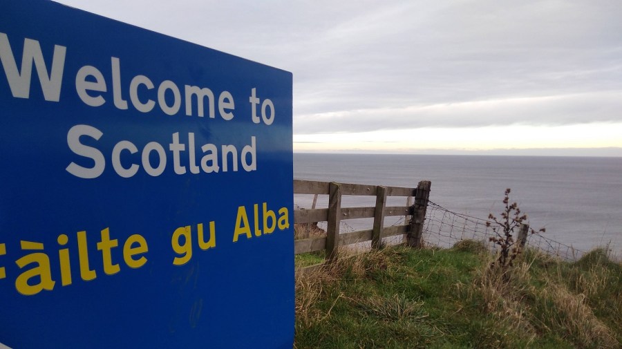
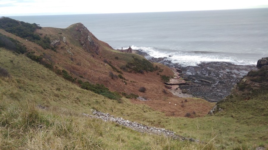
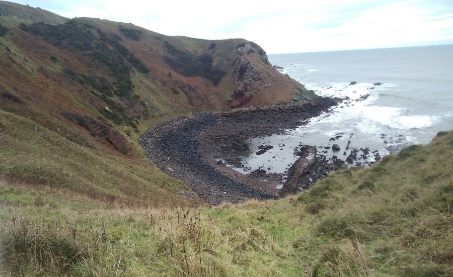
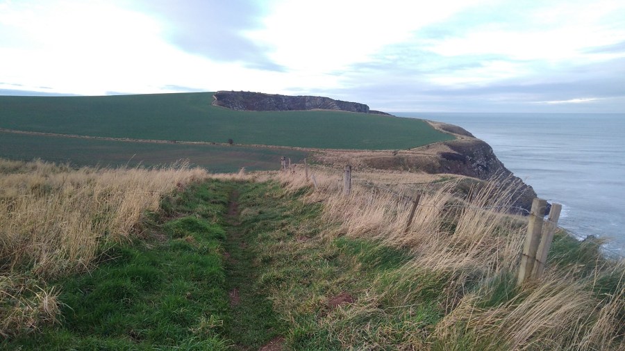
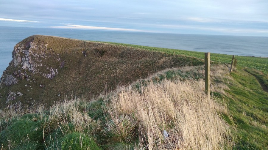
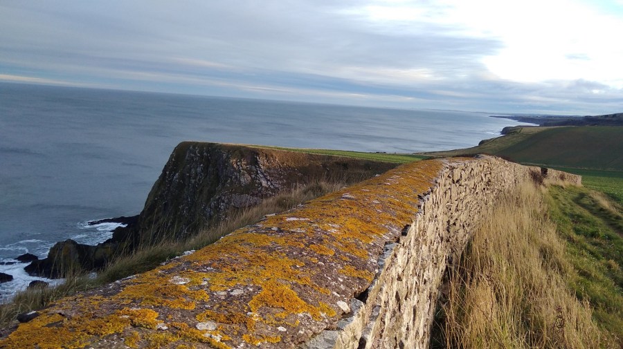
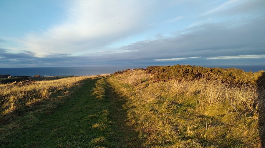
The second highest cliffs on the east coast of Britain are to be found along this path.

It may be that when we no longer know what to do
we have come to our real work,

and that when we no longer know which way to go
we have come to our real journey.

The mind that is not baffled is not employed.

The impeded stream is the one that sings.

by Wendell Berry

IMG_20190112_082111
Sunrise as I waited for the bus in Edinburgh

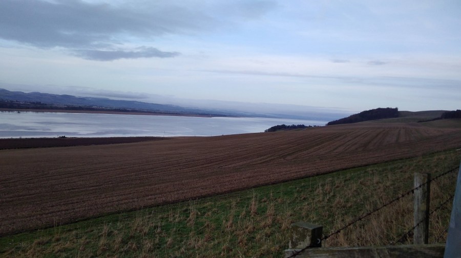
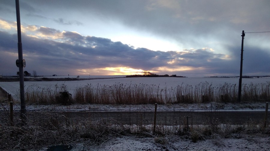
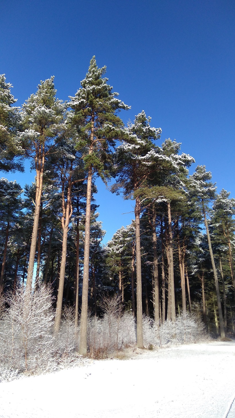
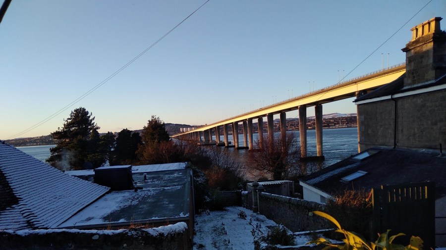
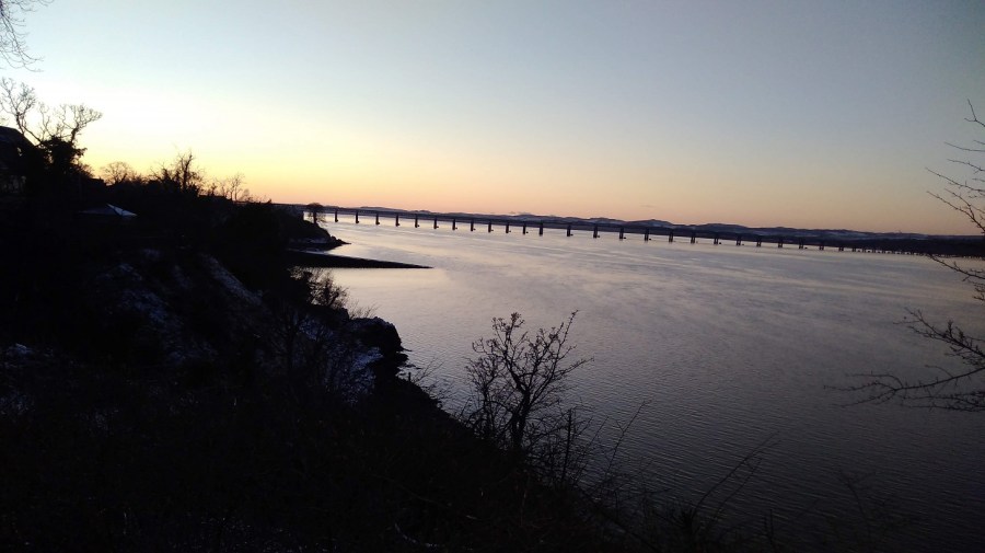
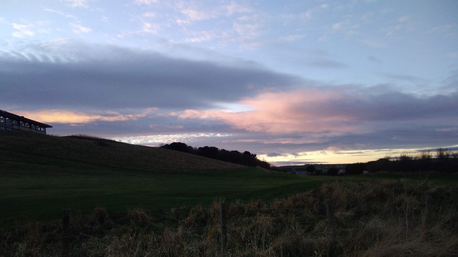
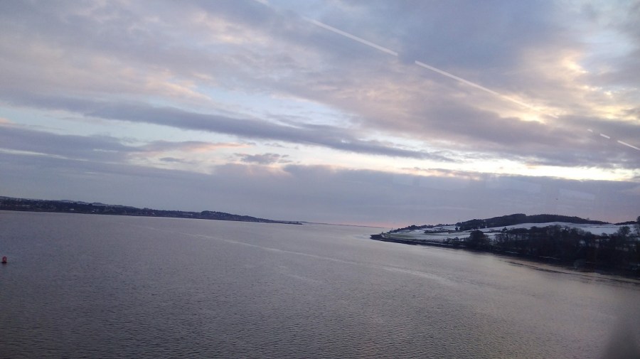
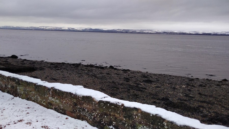
In the middle of winter I headed south on a train to Berwick-upon-Tweed along the coast of East Lothian with the sea on my left. It was just after 9am and I could see brown fields, a slate grey sea, even darker land on the other side of the Firth of Forth and the silhouettes of the trees without their leaves. As it lightened there was more detail: cows in coats; four-by-fours speeding between fields; ruined castles; and low, red-roofed farm buildings. The train was quiet.

IMG_20190112_094201
Just a light pack today, including my new flask which Isobel gave me for Xmas

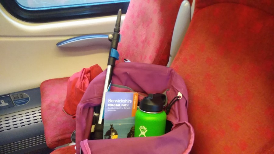
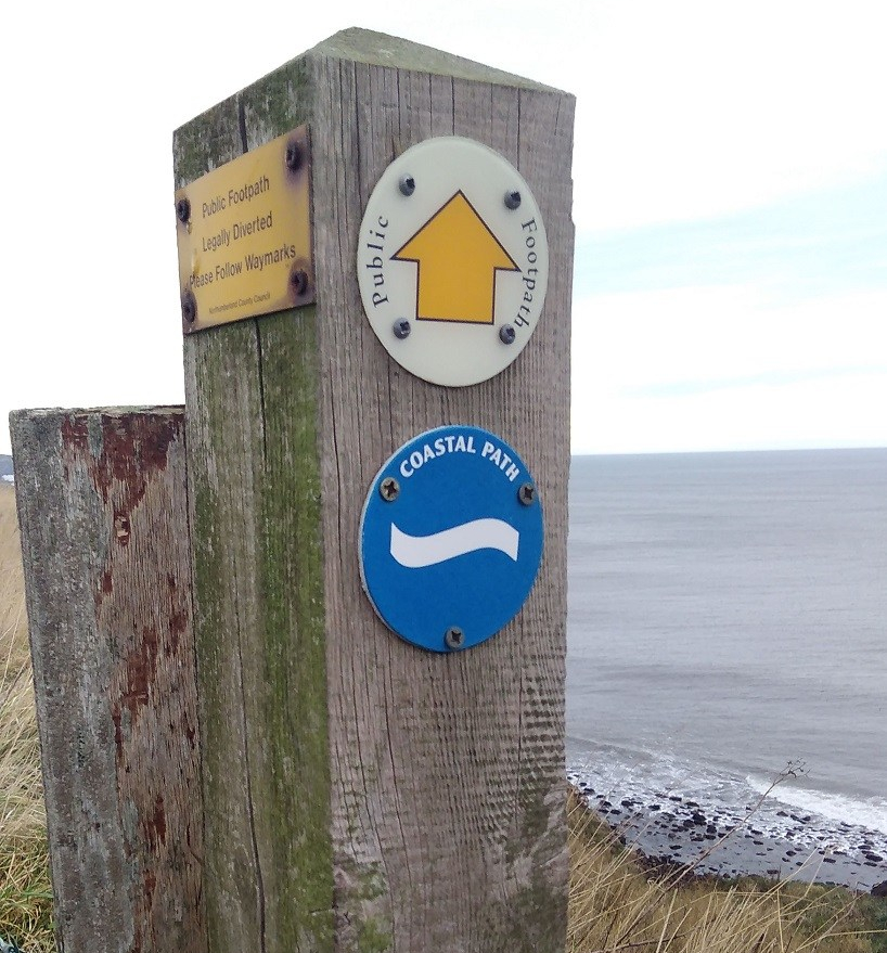
I am hiking part of the Berwickshire Coastal Path (45.5 kms / 28.5 miles in total = a recommended 3 day walk). Berwick upon Tweed is technically in England (although their football team is Scottish!) and my destination is Eyemouth, 17km (11 miles) away.

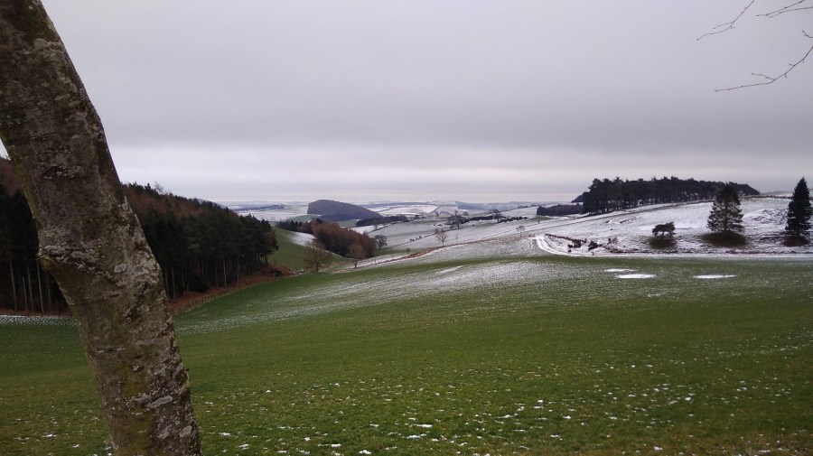
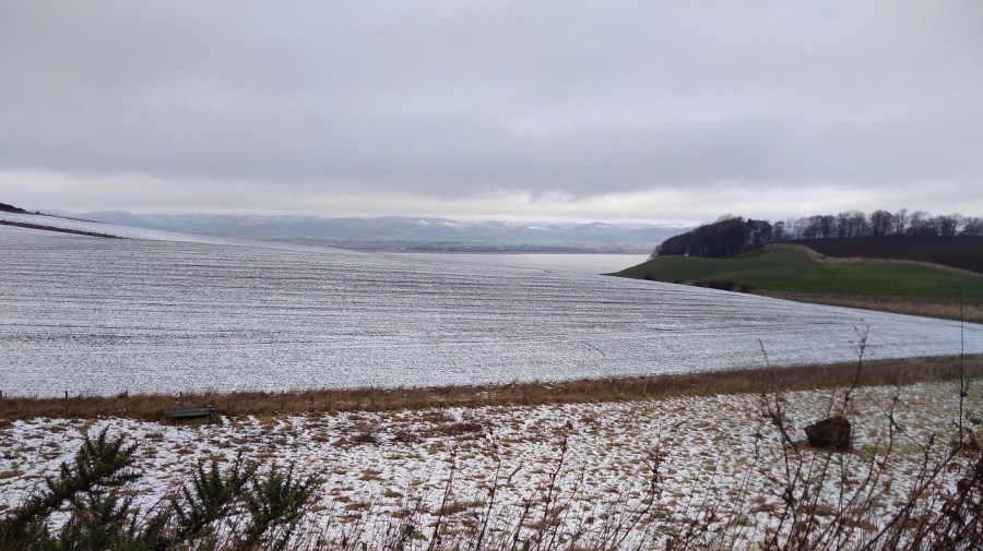
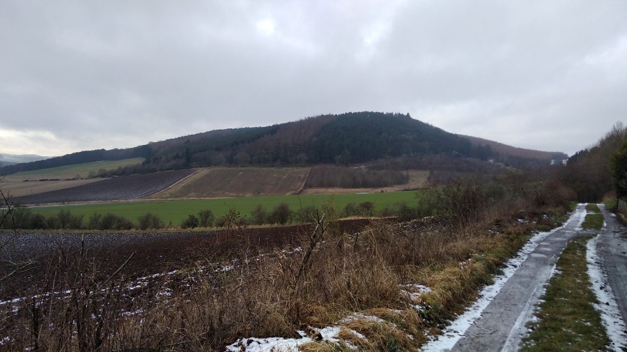
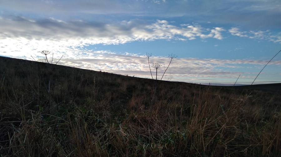
The fields become green as I travel and on my left is the point of Berwick Law, the only high place in this flat landscape. Combine harvesters are frozen mid field; barrels of wrapped up straw lie waiting; there are borders of louring pines in the distance; and beyond, a complicated sky: wispy dark clouds against a bright blue though pale background and at the same time, little bands of cotton wool balls stretching from east to west.

Found photos of (from top left) Torness Nuclear Power Station, Dunbar Town House, St Abbs Head Lighthouse.

A few golden strips of corn have been left lying in the fields, birds are black shapes in the bright sky, the bare bones of the trees are like hardened and flattened seaweed fans. People were sniffing and blowing their noses all around me.

There were acres of half-built houses as I drew near to Dunbar, birthplace of John Muir, friend to all walkers and nature lovers. A small town with the arrow-head tower of the newly-painted-white, 16th century Town House; Saturday people with pushchairs; glimpsing the sea between buildings.

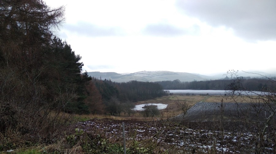
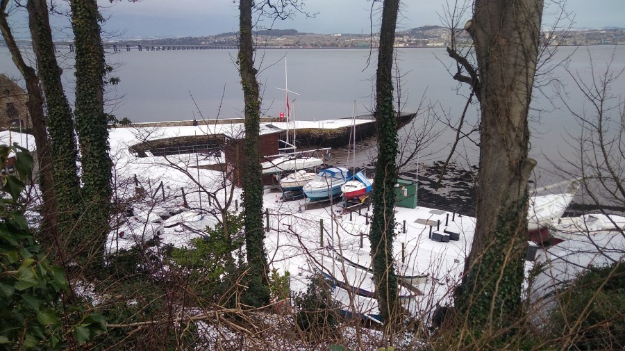
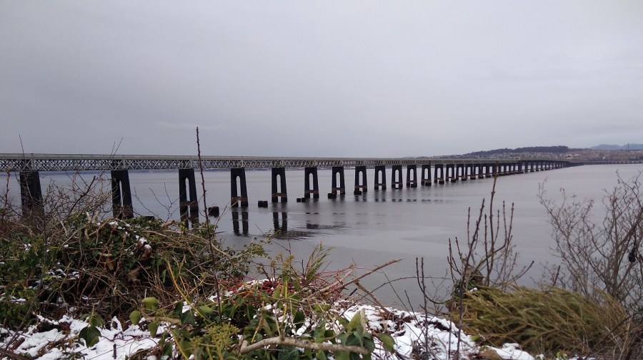
Then once more rolling by the deep chestnut loam, and a more varied landscape. We were edging further from the sea where the iconic Torness nuclear power station like children’s blocks which have been fitted together wrongly. Sheep grazed in miles of brussel sprouts fields; low, dry stone walls divided; and a solo bird perched, waiting for the morning to come. We skimmed past the St Abbs Lighthouse, where I was planning to walk to today (see below).

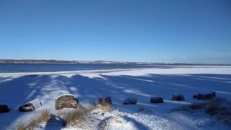
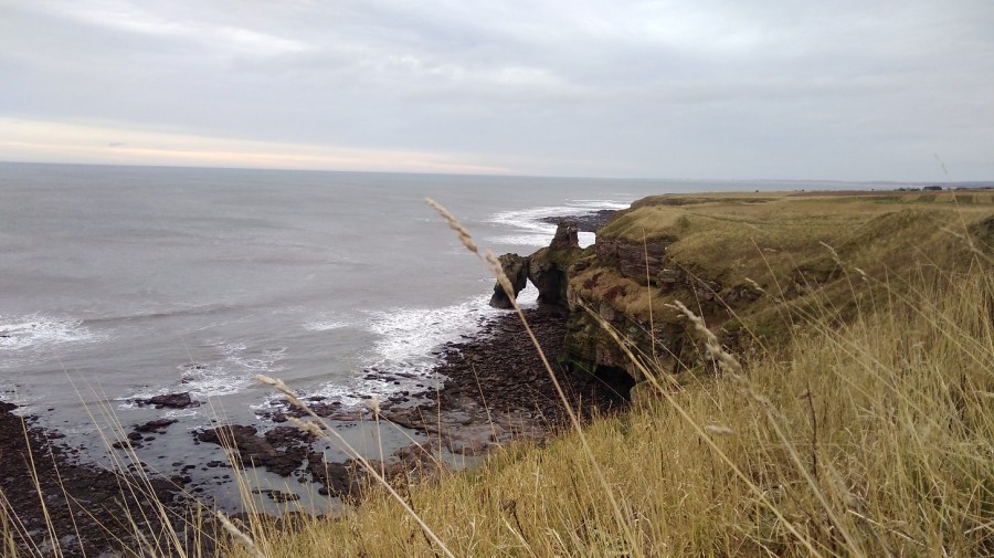
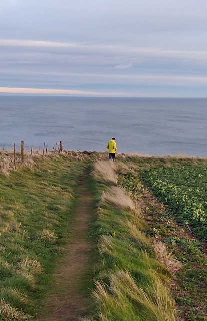
I could see the path I was going to be walking at the top of the cliffs as they tumbled down to the rocks and the white waves below. Men in red and blue were playing golf, their trolleys angled beside them, pools of sand dipped in the ocean of green turf.

IMG_20190112_095143
Arriving at Berwick-upon-Tweed station
IMG_20190112_100117
A detour almost, before I started, through Castlevale Park to the riverside walk, to take a photo of the brick bridge across the River Tweed

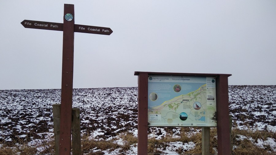
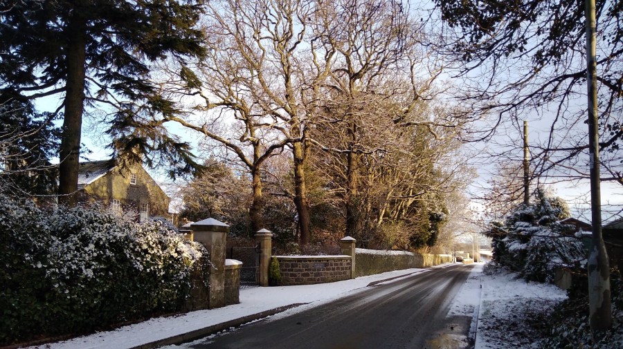
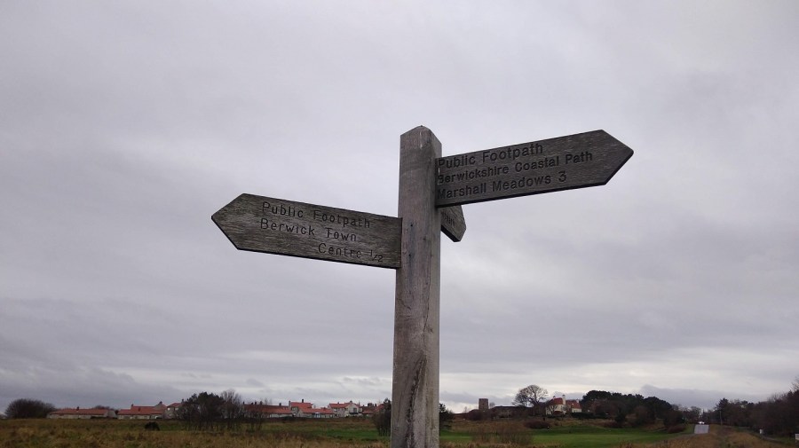
As always, it was difficult to find the beginning of the walk, so, here are the directions for you: come out of the station, go up the little slope, turn left and then take the first right.

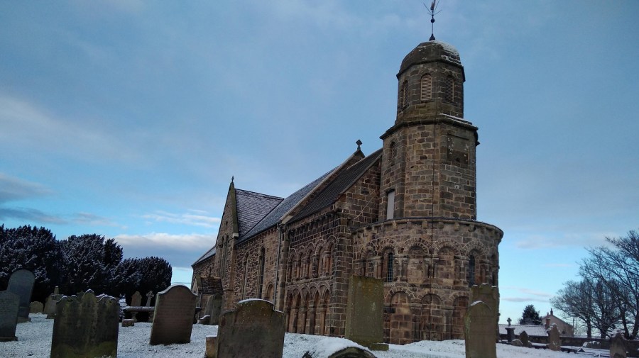
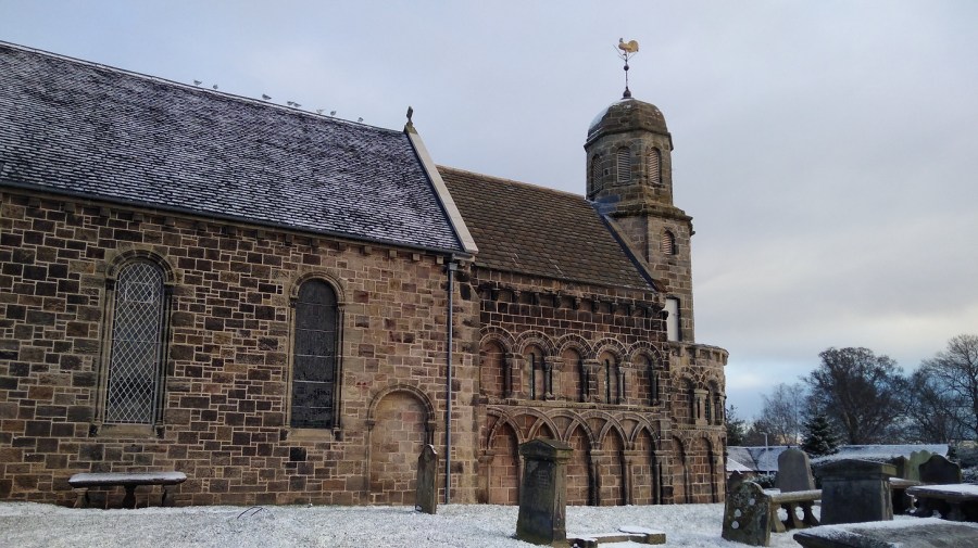
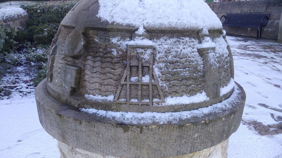
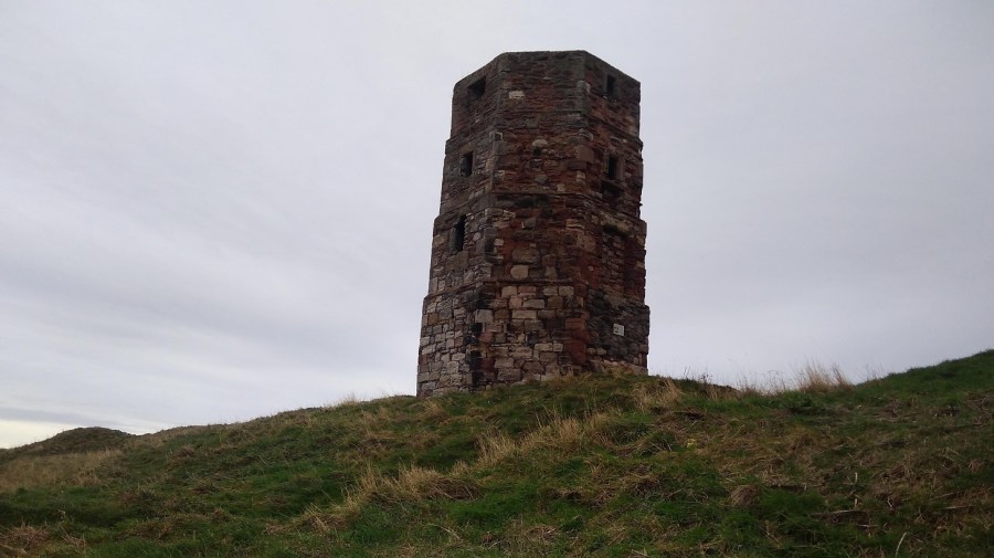
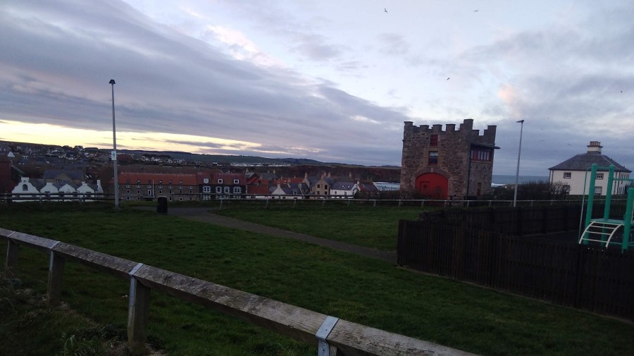
A man with 2 dogs stopped while I was taking a photograph of the Round Bell Tower , not knowing that I was waiting for him to come into shot so that I could include him! He told me that he used to work for the local newspaper and one April Fool’s Day he took a photo of it leaning, said it was toppling over, and published it with the caption, The Leaning Tower of Berwick. Crowds of people came to watch it, he said!

IMG_20190112_101423
The upright Round Bell Tower, Berwick-upon-Tweed

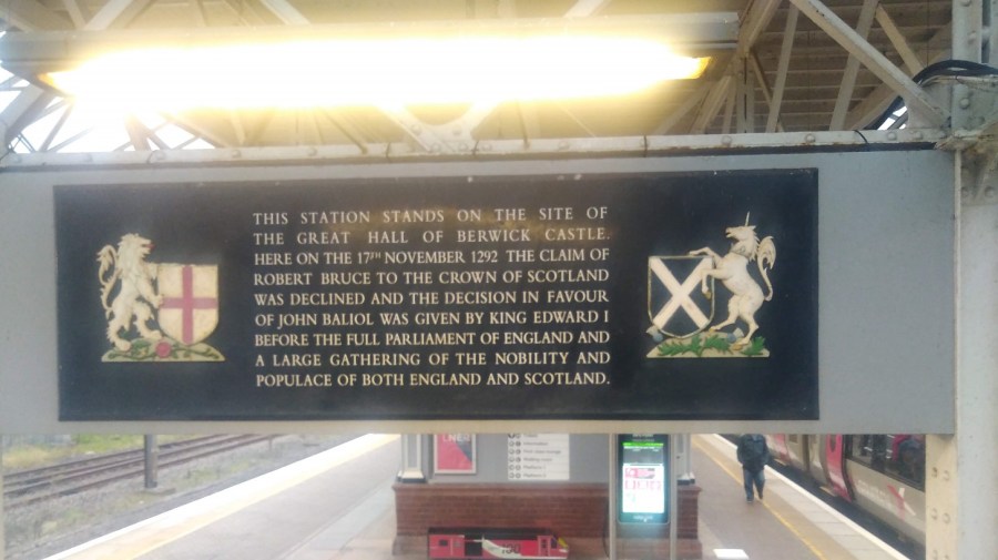
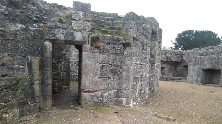
Next to the tower is Lord’s Mount, Henry VIII’s gun tower (completed in 1542). Its massive wall contains six gun positions and a latrine. The artillery included ‘the falconet’ which fired a solid ball 1000 yards (914 m).

IMG_20190112_101905
Lord’s Mount, Berwick-upon-Tweed

Before I even got to the sea I lost my pole, which I went back for and luckily found, and a glove which I didn’t.

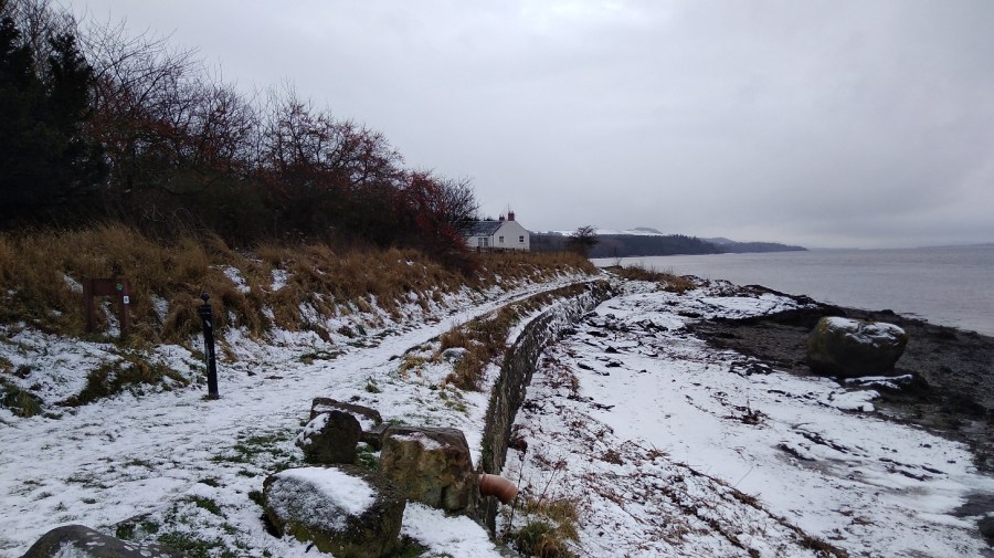
The Northumberland people I met were lovely and friendly and gave me directions out of the town and onto the path.

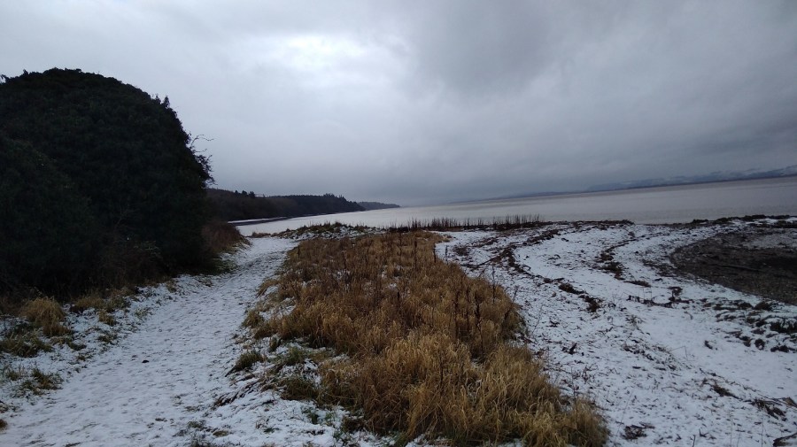
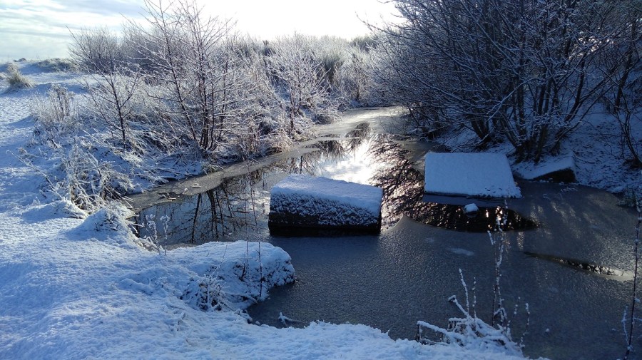
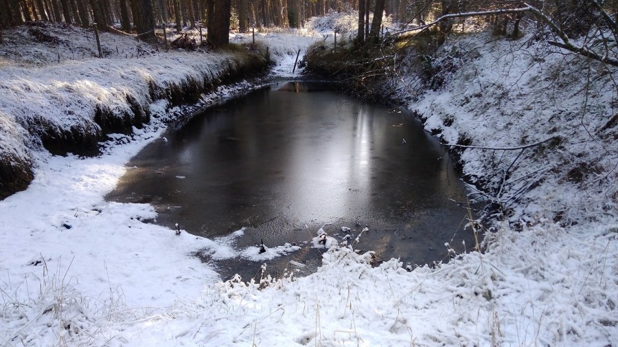
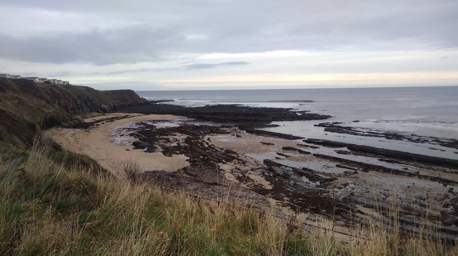
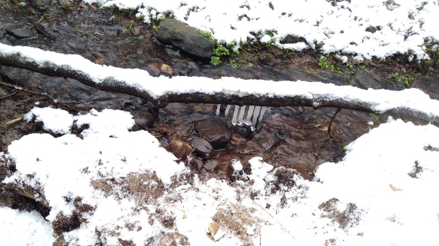
Oyster catchers were wading and ridges of diagonal rocks showed dark against the washed yellow sands. I went down the steps to a tiny cove, and along the well-trodden beach full of footprints and seaweed. There was the sound of trickling water as I made my way up at the other end.

IMG_20190112_103239
The first bay
IMG_20190112_103633
A dead seal was washed up on the shore. A disturbing, though not an unusual sight

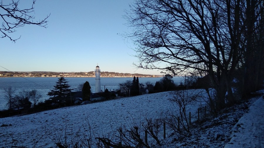
Up above were ranks of holiday caravans where shells had been hung between railings.  I could see a red and white lighthouse beacon at the end of the pier in the distance and hear the single, shrill whistle of a bird overhead – just as if he fancied me.

IMG_20190112_103755
Looking back to the bay, Berwickshire Coastal Path
IMG_20190112_104121
Winter seedheads and kind grass underfoot, the sounds of waves crashing and my Camino shell clinking at the back of me

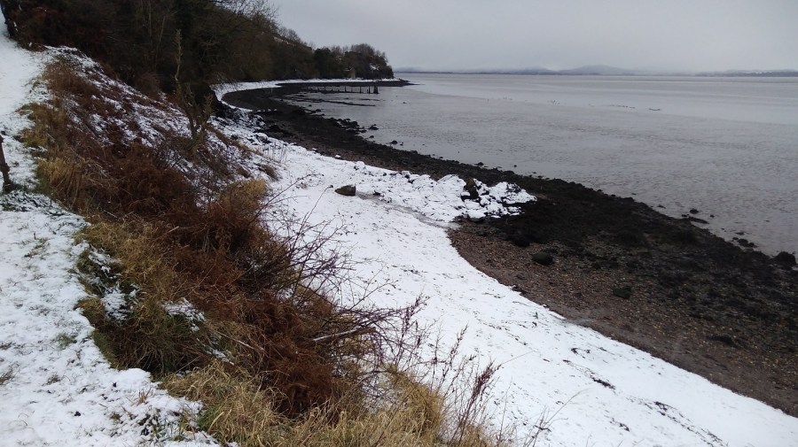
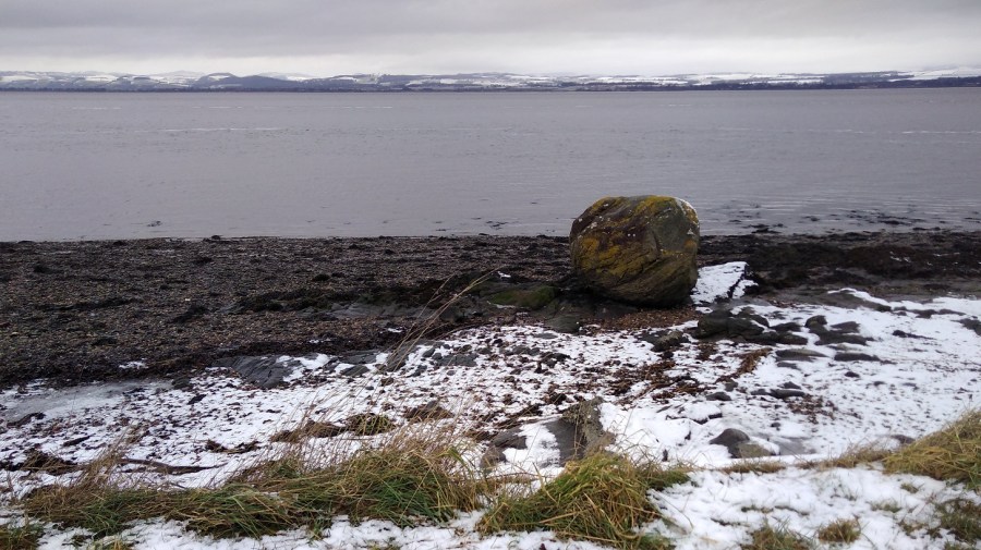
Immediately I came round to the next bay. It was larger this time with delightfully pig-pink cliffs and tufty tops. The wind was trying to blow the pale, beige stalks seaward. Once again it was just me and another man with his dog. Vestiges of yellow flowered gorse gleamed on the bank opposite.

IMG_20190112_104729
Clattering seed heads above and the odd flower low down sheltering from the winds; a nettle, some brambles and litters of rubbish

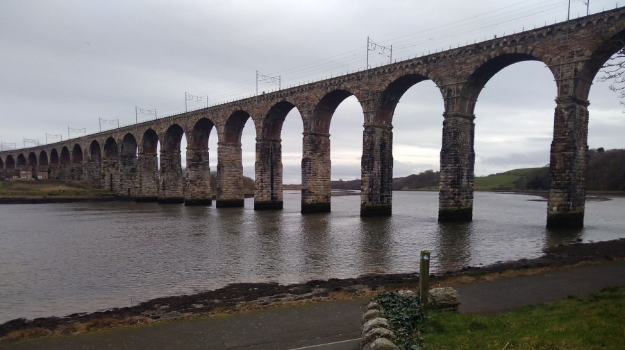
The squawk of the train reminded me that the railway line matches the path to the left, and I was walking between that and the sea.

IMG_20190112_112743
Wind turbines lazily turned despite the knots, and there were rusty metal steps down to the beach
IMG_20190112_105741
The path curved round a mixture of natural rock and man-made straight lines with a very enticing cavern underneath

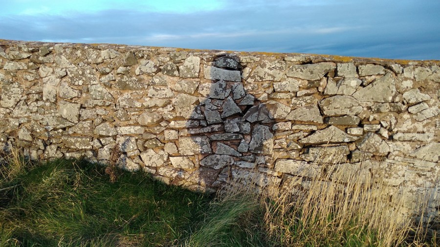
The links (golf course) was on my left; slippy mud down to a little wooden bridge over a trickle of water; the sweet tweet of a leaf shaped bird overhead, its wings fluttering fast. It was a very narrow, windy and uneven part so I was glad that I had found my pole to steady myself – it is definitely not accessible to wheelchairs or baby buggies.

IMG_20190112_103010
Marshall Meadows, a lovely name – the first signposted stop, 2.5 miles

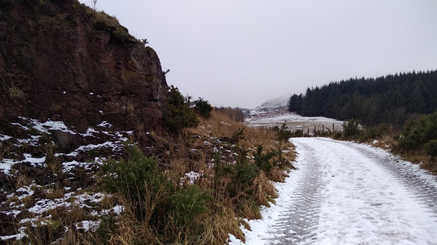
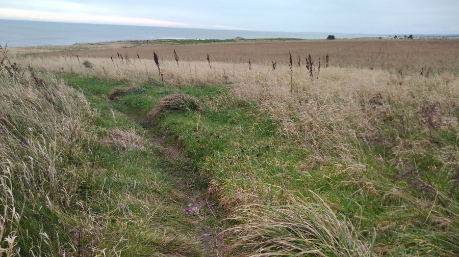
The path follows the highly eroded coast line in and out; my nose was running, tickling; and my mind returned to other similar trails: Normandy,  Brittany, and Orkney.

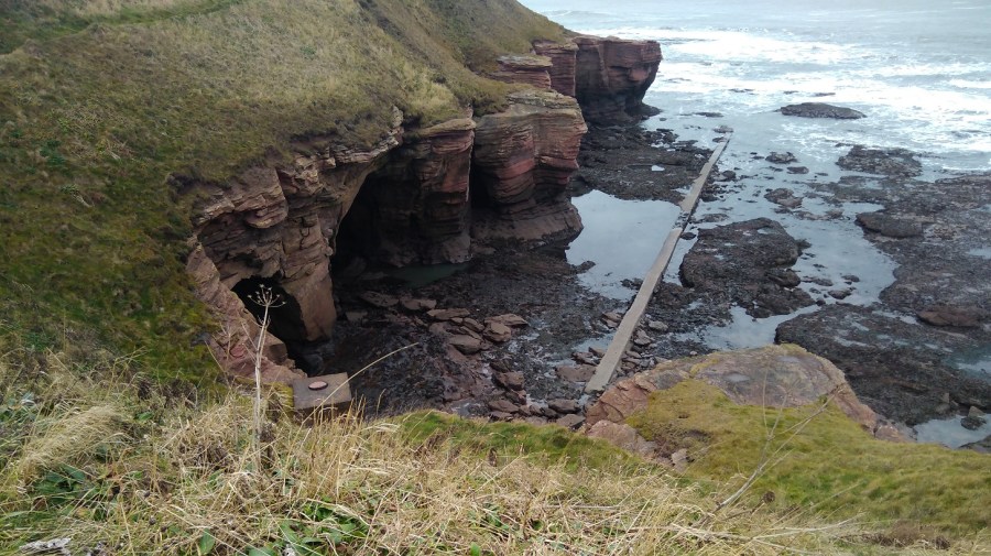
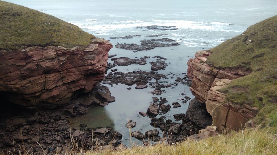
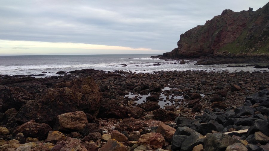
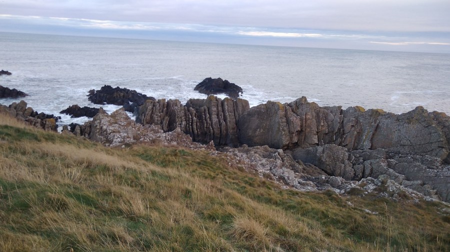
It is an impressive landscape: thin horizontal layers of pink rock, tiny slices but massive boulders. My eyes were getting a welcome break from the computer as I gazed out to sea and admired the hues and cries of this stimulating view and the birds who live here.

IMG_20190112_110237
The camera is not doing the colour of the rocks justice. They are almost carnation pink, practically unnatural except that they are all real

The sky was opening up; I could identify the peeps of oyster catchers and see sparks of black ravens; I was scanning the sea for any sign of whales. My forehead was cold as I walked straight into the northerly wind. How I appreciated not heaving the heavy rucksack for once.

IMG_20190112_110835
The upstanding and nearly empty sorrel had turned the same deep chestnut brown of the fields

I only stopped for a couple of minutes for a comfort break and to put some chapstick on my lips, but I was already cold afterwards. There were single, brown birds with long curving beaks (curlews, probably), and others in huge crowds sweeping around in the sky above me, sticking together in formation, communicating wordlessly. I was entranced by these murmurations.

IMG_20190112_112022
White horses and rolling waves

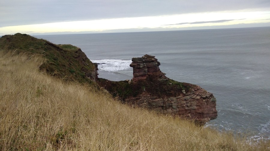
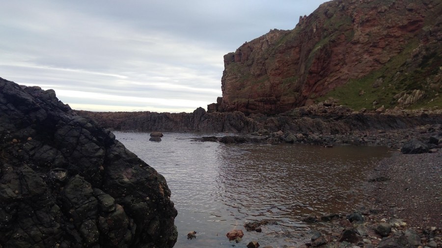
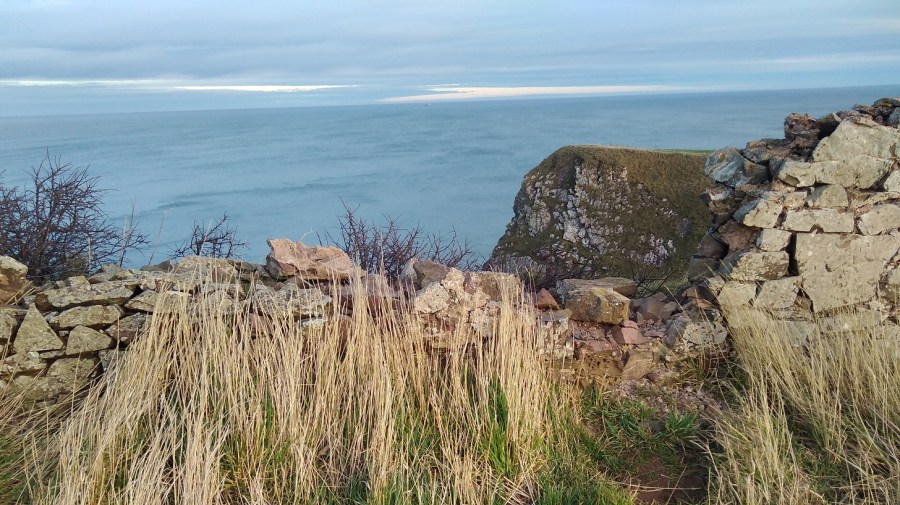
For a moment I wondered why I do this, especially in winter when it is so chilly. Then I looked out to the horizon and saw the world – so much bigger than me, and down at the rocks and the majestic sea stack – the land simply missing between it and the cliff; and it was good to be reminded how small I am.

IMG_20190112_112524
A sea stack – close-up

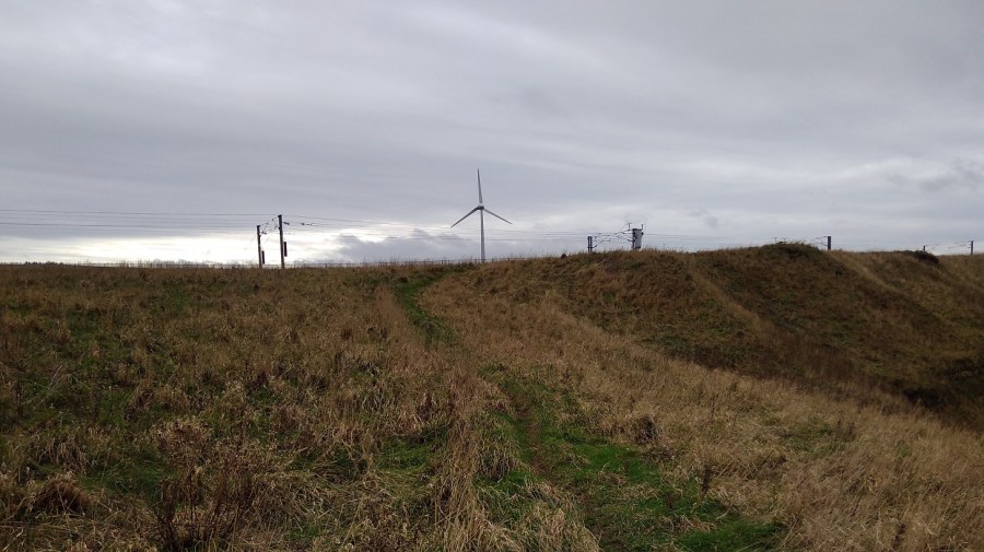
I saw the people in their cars rushing between Edinburgh and Newcastle on the A1, and the high speed train making its way down south to London. Here I was being blown and buffeted by the wind, breathing the fresh air, listening to the natural sounds around, the brushing of my feet as they passed through the grasses, stumbling and toppling over uneven ground which is good for balancing my brain, and looking ahead. Things were coming into perspective.

IMG_20190112_113044
A natural, geological arch

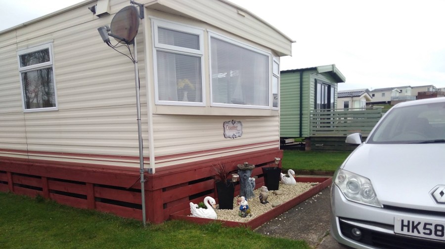
Up a short wooden ladder, over a stone wall and I discovered I was in a caravan park called Marshall Meadows. Much to my disappointment it was not the pastures I had imagined!

IMG_20190112_115401
It afforded me a few minutes of shelter away from the sea’s edge and the wind though

Back onto concrete I immediately felt my sore feet and realised I hadn’t been aware of them since the pavements in Berwick.

IMG_20190112_120426
Aah a sign! As I pass through the site, I wonder if the people who hire these caravans realise that their windows will look out onto the railway

By this time I was looking for a place to shelter and sit for a cup of tea and a banana to keep my sugar levels up. I didn’t want to lose my sense of proportion, which has happened in the past.

IMG_20190112_120829
Crossing the border into Scotland (the sign is written in English and Gaelic)

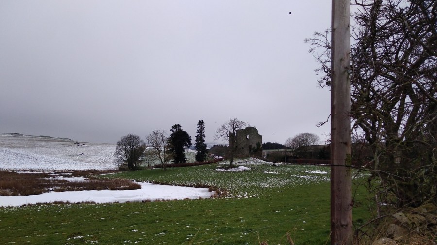
The Cuddy Trail is here. Cuddy is Scots for a donkey and the ‘beasts of burden’ were used to transport coal and fish from the shore to Lamberton and the Great North Road.

IMG_20190112_121359
I hastily put my hood back up over my woolly hat and found myself walking between two rows of barbed wire fence by signs saying to clear up your dog poo (it can be poisonous to farm animals)
IMG_20190112_121631
They were scared of me, yet interested. I think they were female sheep because they were multi-tasking: walking, eating and going to the toilet all at the same time!

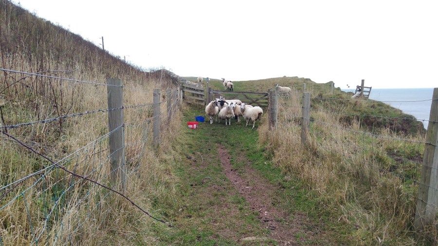
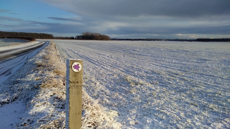
I had to climb over the gate as the farmer, in his wisdom, had padlocked it shut despite this being a public right of way and well-known footpath.

Then I curved back towards the wild cliff corner and the sound of the crashing water. The wind was causing shadows on the ocean. It had that look about it as if it was rising up to the horizon and down to the beach. It was heaving. The surface colour looked flat and even, until I really paid attention to it. Then I saw the variations of the olive, seaweed and sage green, with slate, business suit, and pewter grays, all edged with white lace and set against a peach sky.

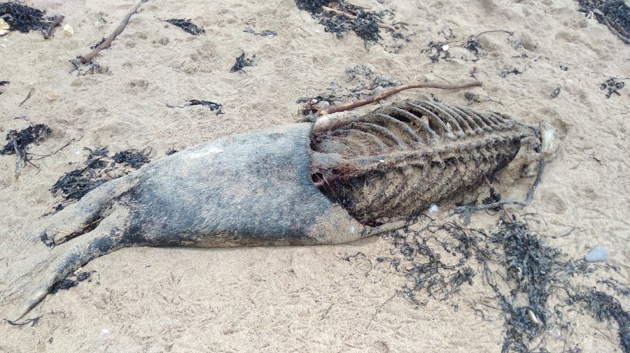
There were lots of helpful signs indicating that badgers, yellow meadow ants and peregrine falcons can be seen here, but not by me. I did get glimpses of the fulmars on the ‘cliffes’, nesting in their flint and white plumage, so far away that all the photos were too blurred to be reproduced.

IMG_20190112_124423
I was interested in a ruined bothy on the steep slopes which only the sheep could negotiate, and went to the edge to take a photo. That might have been where I mistook my way

Twenty minutes earlier I had passed two men getting out of a car and preparing to surf, clad in black wetsuits with their white boards. I bet they had a good time in those rollers!

It was then that things started to go wrong.

IMG_20190112_124909
A bowl of dark boulders – I shouldn’t have gone down there!

But I did. I thought, ‘really?’ but I couldn’t see anywhere else to walk as the railway came so close to the edge, so I went anyway.

I skirted the steep slope first of all, grabbing handfuls of grass to stop myself slipping and edging my feet into the side, until it became too hard going. Then I dropped down onto the rocks. They didn’t look too bad from a distance, but they were – it was really hard scrambling over them. I could see a way out on the other side and I still assumed that was the right way. I pushed and tore through the brambly undergrowth, I fell down and got myself back up. I persevered. My pole kept collapsing itself and up at the top was a sheep’s face peering over at me. I could see hoof marks where they obviously managed fine, but I sure was struggling. Was there a way? What could I do?

IMG_20190112_130345

Go back, that’s what! It was impossible. I was very hot and bothered and there was nothing for it but to retrace my steps, which was easier said than done and something I don’t enjoy. I traversed the rocks closer to the sea which were slippery as well as treacherously uneven.

I had completely lost my cool until I came across such a beautiful sight that I just had to stop and breathe.

IMG_20190112_131952
A calm pool between the jet volcanic rocks and the pink cliff profile

It took a lot of time (perhaps three quarters of an hour) and I used up a great deal of my available energy. And it took quite a bit of serious tramping to get over the anger and frustration of the experience. On the back of the BCP map it says: It may seem unnecessary to provide directions other than saying – walk north or south keeping the sea on your right or left!’ Am I the only person to have missed the most straightforward path?

Slowly I realised I had to relax and get back onto the right path. I had to let it go or I couldn’t enjoy the remainder of the walk, so I focused on anything but my feelings and picked up pace.

In my recording I said that I chose not to walk where two others were, around a field when I could clearly see a short-cut straight across the top of it. I saw the trampled down barbed wire and said to myself, I’m not falling into that trap again!

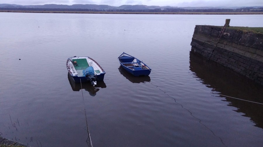
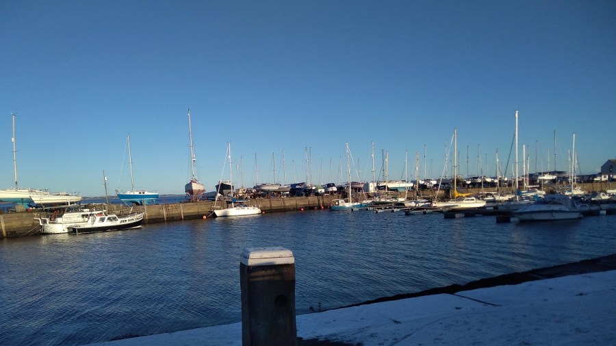
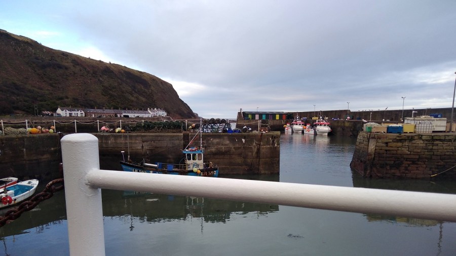
Next was a straight and concrete side road to Homestead, and I spotted a brightly coloured lifeboat chugging along. When I turned round, there was a deer lolloping in the undergrowth very close by with its beacon of a white tail. It seemed to be rather a special sight. The Medicine Cards say that when deer appears, ‘apply gentleness to your situation.

At 1.50pm, my phone battery was already down to 32% and I quickly came across another conundrum. I took a second wrong turn. This time I crossed a field to the left because it looked as if the alternative went over the edge. It was not clear, so I stood and debated and as the gate was open I chose to go through.

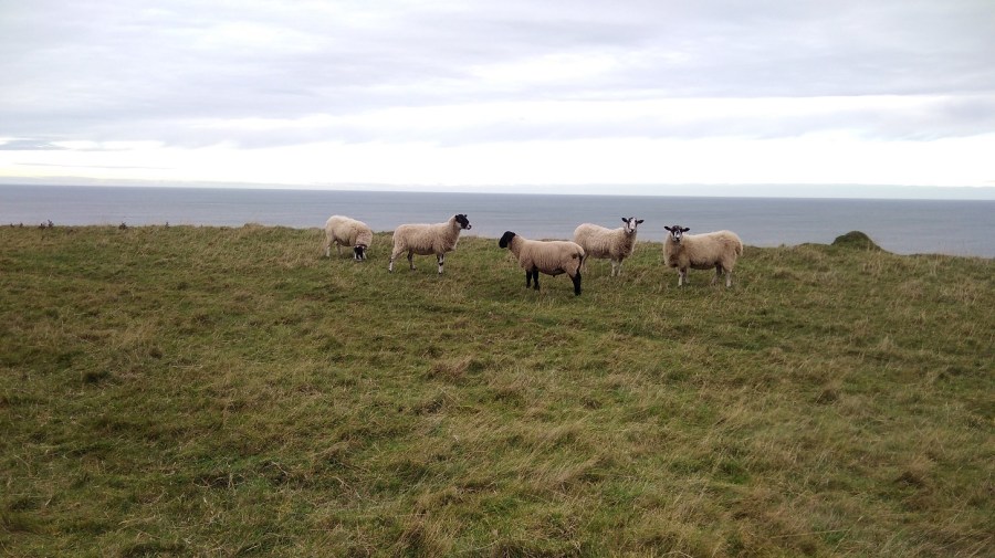
Right to the end of that green field I went, past all the sheep who may well have been watching wisely for all I knew! And then I didn’t know where to go but back – it was a dead end. Never again will I walk without an ordnance survey map, I declare to the sheep!

So I went through the other field (not in a straight line), climbed over a stile, and doubled back (presumably the path avoids the farm land).

IMG_20190112_142425
Burnmouth – not a sign of life, not a soul

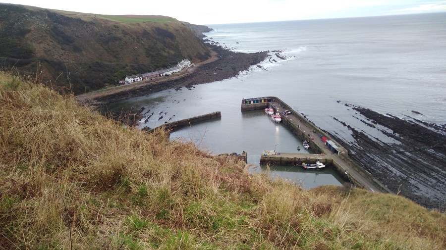
There was the village of Burnmouth below me at last, tucked under the heights. I zigzagged steeply down in the opposite direction from the yellow arrows, behind the gardens and at last found a BCP sign. Amazing how this often happens at a time when there is absolutely no other possible way anyway! For some reason the walk is not as enjoyable if I am not going in the right direction.

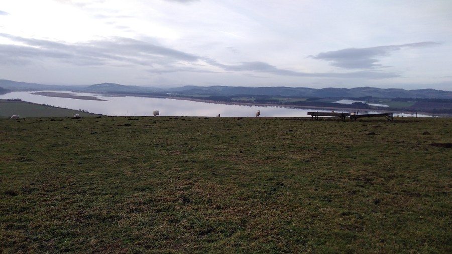
Apparently Burnmouth was ‘once a hotbed of smuggling’ (tea, brandy, silks etc) engendering lively stories from 1780. A pretty but secluded village, it is divided into two halves with a harbour inbetween. Candy coloured cottages seemed to be for visitors. The tide was out leaving streaks of low rocks, as if someone had painted on a glassy surface and the paint had separated unevenly.

Burnmouth
Burnmouth from the tops of the cliffs

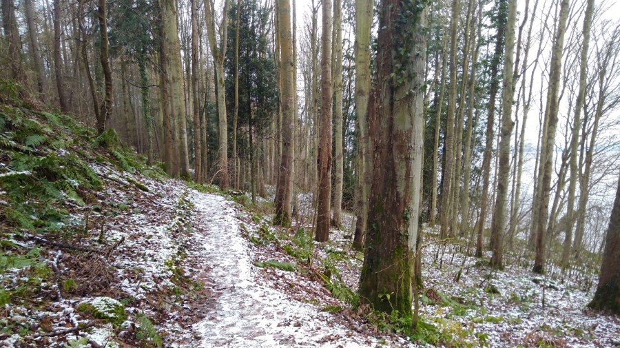
A man stopped to do up the zip of the woman he was with and my black mood meant I could barely manage to say a friendly hello. My knees hurt going down and my insteps going up. The sign pointed in the direction of two roads, one to the right and the other uphill. I took the path which ran to the right of a dour chapel, curving through woods, over a planked boardwalk, then up a steep hillside with a horrible groaning noise going on – something to do with the fishing in the harbour.

There was a handy bench ‘Dedicated to William Telford, born Burnmouth 1925’ for resting my weary feet and admiring the vista but I was very stiff when I got up. I hadn’t been walking for a month of so and it was showing. I thought I wouldn’t need the chocolate I bought yesterday and wished I hadn’t left it at home.

Blue tits played in the briars, zipping in front of me; silvery green lichen covered the branches. Humbled and cut down, I did not recover quickly. I was reduced to little more than zero miles an hour.

Once up high again and back into the windy onslaught, I needed a hat and two hoods – it was a mere two weeks after the winter solstice.

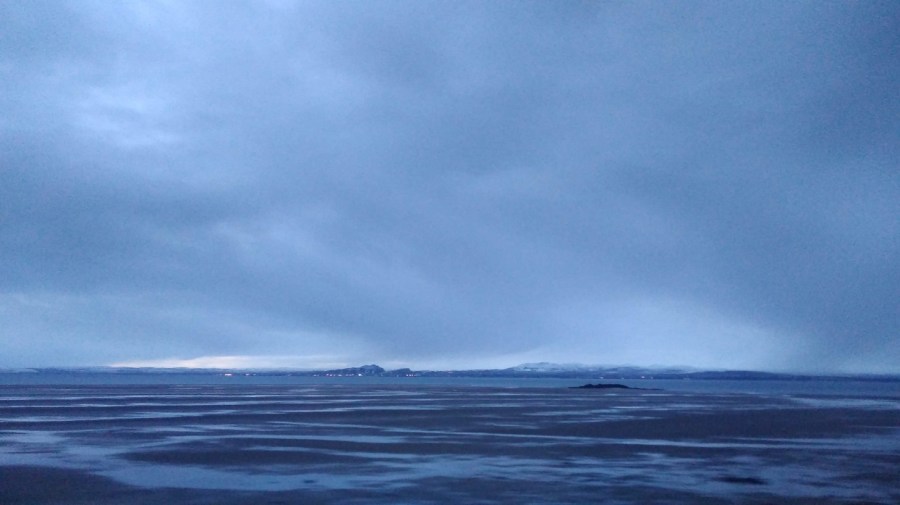
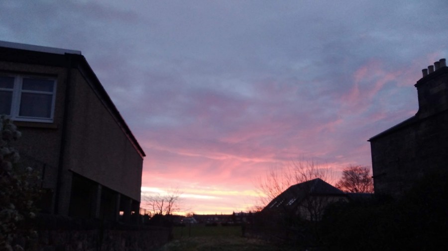
Then, halleluja! the sun started to show its lovely self. 3.15pm. What a wonderful light.

IMG_20190112_150233
The colours deepened, became lucid and my mood eventually mellowed
IMG_20190112_150408
Faint and fragile fingers against a mackerel sky
IMG_20190112_151405
See how the coastline meanders!
IMG_20190112_151459
The sky and sea got bluer and bluer. There were two options and I went over the wall, hoping it was the right decision. I found myself out of the sun’s warmth
IMG_20190112_151640
Self-portrait
IMG_20190114_051409
A yellow clad fellow walks southwards – that’s the right idea – wind at the back of him!
IMG_20190112_151704
I simply loved the contrast between the orange lichen on the wall and the blue and green beyond
IMG_20190112_154155
Rock macaroons
IMG_20190112_154759
The sun was starting to set. I felt chastened, very quiet inside
IMG_20190112_155304
I only got as far as Eyemouth, having lost valuable daylight time going the wrong way and needing to get the bus back

I had to ask for directions from a group of teenagers heading out for some fun, giggling. I wound my way along the jetty and around the end remembering that I was here for my birthday with Lesley in 2016. The wandering geese took no notice. I was aiming for the co-op store at the centre (ye cannae miss the co-op, it’s the biggest building in the toun I was told) and the most helpful girl who checked the bus times on her phone for me – my fingers were too cold to work mine and it was threatening to run out of battery.

I was focused now on getting warm and fed as I always am after a long day’s hike. I had to spend a great deal of time in a Wetherspoons in Berwick until my return train to Edinburgh, but I warmed up and rested my weary limbs.

I didn’t make it to St Abbs so I will have to start next time at Eyemouth and cover that stretch on day 2.

IMG_20190112_152131
All’s well that ends well! (one of Shakespeare’s ‘problem plays’ from around 1600)

Train: Edinburgh to Berwick upon Tweed (Scotrail £14.60)

Fife Coastal Path: Wormit to Newburgh

The final stage of the Fife Coastal Path (FCP)

Date: 3rd February 2019

From / to: Wormit to Newburgh

Distance: 15-18 miles (25-30 kms)

Direction: Walking east to west

Facilities: There are none on this stretch

Timing: Beware! the official coastal path website says this day’s walking takes 3-5 hours. I defy a human to do it in 3 hours – I think it is a mistake. I am not the quickest walker, but it took me 7 hours with 3 x 15 minute stops and a last minute detour

Overall: I would not recommend that people do this all in one day, especially immediately after the previous stage of the FCP, and with the transport difficulties and wintry conditions

Dundee to Woodhaven via St Andrews

My day began in Dundee where I had unwittingly spent the night. See Leuchars to Wormit for details. I took the earliest 99B bus to St Andrews (8.19) which was straightforward.

IMG_20190203_083350
Crossing the Tay back to Fife as the sun rose

Unfortunately when I arrived at the St A bus station the bus company no longer operated out of it. I phoned up to find out where I could get the 77 back to the Wormit road, connecting to the ’emergencies’ line and feeling a little guilty as it was not exactly a life and death situation.  I was concerned that I would not get to Newburgh before dark. The exceptionally kind man on the phone explained that there never has been a Sunday service of the sort I was waiting for! In the end, on hearing the note of desperation in my voice, he came up with a plan and 5 minutes later a second gentleman appeared in a van to pick me up. He had been called out of his bed to fill in for someone who was sick, left his own car at the depot and was on his way back to get it. He took me along with him!

IMG_20190203_094248
Woodhaven Pier, between Newport and Wormit, River Tay, Scotland

It was half an hour’s walk from Woodhaven to Wormit, first along the B946 (a residential connecting road where the pavement was all slippery from the snow which had hardened into ice overnight)……

IMG_20190203_095651
The air was very clear as I looked across someone’s wintry garden to Dundee, Scotland

….then taking a right onto Bay Road…..

IMG_20190203_095848
Tay Rail Bridge

….bypassing Wormit proper and heading straight to the beach where the FCP runs across the strand for a bit.

IMG_20190203_100803
I could see where I would be walking, Wormit Bay, Fife, Scotland

Wormit to Creich

It took half an hour to get to the start of this stage, so yesterday would have been exactly 7 hours if I had finished and today I must add an extra 30 minutes to the walk if I am to reach the final ending point in Newburgh.

It was raining / snowing – a dull, grey day.

IMG_20190203_101147
Tay Rail Bridge Memorial at Wormit Bay

The local lady was right that I was due for a climb, despite the way it appeared on the map. She said she had avoided it because it was so slidey underfoot. I passed through the metal gates to keep the cattle in, and further on I appreciated the landlocked wooden seal sculpture.

IMG_20190203_101705
Looking down onto the waterside
IMG_20190203_103742
Icicles in the dells
IMG_20190203_103906
The path wound through woods away from the coast, up and down steps and across wee burns
IMG_20190203_104102
Then it opened out – the arable fields were slopes of white and the copses made of bare twigs

Catkins dangled olive green, and other peoples’ footsteps showed me the way.

IMG_20190203_105339
Drawn to making more of my marks in the snow – the dynamic relationship between the elements of fire and water, sun and ice, passion and reflection
IMG_20190203_110614
Stripes of muted greys: snow, stone wall, shingle, the estuary and the white covered hills of Tayside in the distance
IMG_20190203_110727
There were occassional dwellings along the way. I saw no-one

There was a quiet, gentle lapping of waves on the shore as I went between two houses.

IMG_20190203_110759
A massive boulder covered in gorse-yellow lichen on the half-white beach. The rest was grey. A flock of oyster catchers whizzed past, low to the water, followed by a loner, white stripes flashing to match the snow

oyster catcher  
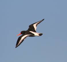
A flying oyster catcher, Wikipedia.

Near here were plaques with children’s poems about the sea on them: I liked, ‘River lying patient and flat’

There is a stretch of stony beach at Balmerino – unusual for the FCP. I checked with three extremely well armed fishermen and yes, for sure it was along here and then through the woods. It was a great curving bay of bleak beauty.

IMG_20190203_111738
Two little girls in their pink all-in-one ski suits pottered with their parents

I missed Balmerino Abbey which was marked on the map – it must have been inland, off the path.

At 11.30 I was having a lovely, peaceful, early lunch with my back against a gorgeous trunk with ivy vines twining up it, when the sounds of a boisterous group signalled they were clearly approaching from whence I had come. Surely they would have caught me with my knickers down had I followed the call of nature, so I didn’t do that! I hastily moved on and almost immediately passed another group going in the opposite direction. This pretty stretch is obviously popular for Sunday morning walking.

IMG_20190203_111812
The Fife Coastal Path between Wormit and Newburgh, February 2019

My thighs were tight and stiff this morning after yesterday, and I could feel the effects of carrying the heavy pack such a long way.

IMG_20190203_115513

Leaving the water behind, I started on the long, steep and icy uphill part. I realised that perhaps the official website meant 3 plus 5 hours not 3 to 5 hours, and I worried that I would not make it before dark. I was not sure what to do, so I picked up pace.

Up high and with a right turn I was on hard ground which was much quicker to walk on, near a residential area. I was trying to remember to keep my eyes open for the signs which are always harder to see in this type of situation.

IMG_20190203_125009
The hard climb rewarded this view – there are not many wide open vistas like this on the FCP

They made me think about hiking the Via Sacra in Austria and of some places I have walked in Switzerland.

I passed places with names like Hazelton Walls, Creich and Pittachope (perhaps meaning ‘farm of the willow-place’). Black Craig Hill (203 m) was on the right.

IMG_20190203_125649
Ruined castle at Creich, Fife

Pittachope to Glenduckie

At 1.30 I was hauling myself gradually up a rural road with the cold wind on my cheeks. There was good visibility but with damp and wet in the air. It was a bit of a plod but I was focusing more on the moment than the future.

IMG_20190203_132506

Then I took the left off the road to a steeper incline, passing a bearded man who cheerfully greeted me. His two boys were brightly clad in winter gear, and all three were pulling scarlet sledges up behind me, to play.

Ahead was Norman’s Law (285 m), the very same which was mentioned in the information I saw yesterday in Tentsmuir Forest. A law in this context, is a round or conical hill, often in isolation. It is at the eastern end of the Ochil Fault and you can walk in this place using the Walk Highlands directions. Also a hill fort site with its neighbour, Glenduckie Hill (what a great name!), you can follow Fifewalking’s instructions here.

IMG_20190203_133033
Serious, dark pines and red-brown crags, FCP, Scotland

What with the website duration being erroneous, gates which say ‘push’ when they mean ‘pull’, and these signs which say ‘keep left’ when they mean ‘right’ at the turn – nothing is as it seems – which exactly sums up my life right now!

IMG_20190203_133001
Looking back I admire the Tay from a height

It was misty at the top of the steep climb. Some of the snow was like soft egg-whites and therefore hard to walk on.

There was a gorgeous smell of burning pine, presumably not a natural occurrence in this icy weather. Maybe, I mused, it was not mist or snow blowing, but the smoke. I thought I was at the top and about to go down at last, but maybe not.

IMG_20190203_135059
A tree platform had been erected; the puddles were deeply frozen; I spied various animal tracks in the snow as I passed Red Fox Wood

I sat for a cup of tea and meditated for 5 minutes. There was a cave opposite and rustles were coming from it; a bird was making the sound which a dog makes when it has a squeezy, squeaky toy in its mouth. It was a peaceful moment.

IMG_20190203_143137
I was coming to terms with the fact that there was more climbing ahead which meant views revealing bodies of dusty blue water including one shaped like a bagel somewhere in the vicinity of Blinkbonny (another wonderful place name)
IMG_20190203_143142
Going slowly downhill but there was another challenge ahead: Glenduckie Hill

I zig-zagged around farmer’s fields – cows in one, sheep in another. It was 14.45 and the sun had come out.

IMG_20190203_143356
A brief lowland patch, past attractive cottages, well-loved gardens and woodland, nurtured sunshine anemones and snowdrops with their heads swaying from side to side in the breeze

Glenduckie was indeed an even steeper trawl uphill, albeit not to the actual summit. The path curved round and round, and up, and then there was a tiny slope down before another arduous climb.

I felt totally exhausted, but stopping meant that starting was well nigh impossible. It was still frozen underfoot – an icy rockscape and, beyond, windswept sheep.

IMG_20190203_154021
With great views of the mouth of the Tay Estuary, Fife

The approach to Newburgh

A steady descent, bumpy and slippery, meant I could see what I assumed was Newburgh in the distance for a long time – tantalising!

Lindores Hill (172 m) was on my left and to the right the estuary looked wonderful. The water was almost completely smooth, like glass. It reflected the tufty grey clouds and already there were the very faint hues of the sunset.

I struggled to stop thinking how tired I was, how much my body hurt, and that I hadn’t understood how long the day was going to be in advance. I spent some time using Clean Language questions to honestly ask myself why I was doing this. I knew I would get there eventually and that I wouldn’t do this again all in one stage. Once started it was tricky to stop, especially as I was so close to the end.

IMG_20190203_160309
No danger of getting lost on this continual farm track. Or so I thought…

According to the map, at Old Parkhill there should be a right – Newburgh was clearly there, but the sign was to the left, so against my better judgment I took it. Of course it was wrong! I went through one very difficult gate and then straight on where there were lots of roots to negotiate at the bottom of a tree-lined slope. I admit I felt a tad miserable.

I had to climb over two fences. There was a huge hay bale and the barbed wire had been pushed down, suggesting that I wasn’t the first person to make this mistake. I couldn’t get over because I was too short and had the rucksack, so I found another way through.

I was back on the A913, the Abernethy Road, going into Newburgh past the church where the bus I planned to take later rattled past me. I found my way to the water’s edge using google maps as the sun was going down.

IMG_20190203_164926
Oil-slick-smooth harbour water and a trek along the front to the park where the FCP ends, Newburgh, Fife

This last trundle seemed very long and the signs were once again poor. A helpful dog walker directed me at the last. Under the arch in Mugdrum Park, Newburgh I went, alone as I started….

the end!
Hooray – I had finished. How peculiar I always look in selfies!

From a public sign: ‘The Kings have gone but the kingdom lives on! Locked between the Firths of Forth and Tay, Fife is island-like, resolute and proud. It was the Pictish province of Fibh, last ruled by a king in the 9th century. Today, Fife’s wealth lies in the variety of landscapes, seascapes and townscapes which you can savour. Some say it taks a lang spoon to sup wi a Fifer, but you can be sure of a warm welcome from the people of the Kingdom.’

I went through the car park, took a left down Shuttlefield Street and left again along the High Street, where I found the bus stop by the Co-op supermarket (chocolate was needed). Opposite was The Bear Tavern where I toasted myself with a reviving Famous Grouse (whiskey) at the fabulous price of £1.20. The pub is run by the friendliest of folk and full of locals who were curious to know why I was there.

The 36 bus took me to Glenrothes where I narrowly missed the connection to Edinburgh. Fortunately there was an X54 along soon after at 18.55, and I was back home in Edinburgh around 9pm.

You may like to know that there is a highly recommended Shiatsu practitioner and yoga teacher (Heidi) in Balmerino.

Fife Coastal Path: Leuchars to Wormit

Saturday 2nd February 2019. An extremely challenging day’s hike in the stunning, snowy Fife countryside. 8 hours (probably 6.5 – 7 if I had not got lost) = approximately 30kms (16.5 miles).

Beware – lots of snowy tree photos ahead!

Two weeks ago I finished at Guardbridge, just outside the town of Leuchars. Today my plan was to get the bus back there from Edinburgh to resume.

IMG_20190202_075551
Looking back towards Arthurs Seat and the snow covered Pentland Hills

There was snow last night and sleet was still pounding on my window in Edinburgh at 5.30am when the alarm went off. I was worried that I might not be able to make the journey, but I had booked my hostel and completed all the preparations, so I was determined. I did, however, change my mind and decided to take the train which is much quicker (and £2.50 more expensive). This meant I would miss the Guardbridge to Leuchars section (approximately 1 mile).

IMG_20190202_083400
Sunrise over Fife

From the train I watched the sun coming up over the horizon. All the fields were white and the buildings etched with a black line. There were fields of dome-shaped greenhouses, some covered and some simply skeletons in the middle of winter.

At 8.36 I left Leuchars Station. There was a heavy, dull grey cloud cover above, but between that and the ground there were bare branches of trees showing against a delicate bird-egg-blue sky. In that space were horizontal clouds touched with peach, apricot and a darker, bruised blue. The land was glowing white, everywhere was covered in snow, although the roads were clear. Oh! the air smelled so crisp as it passed through my nostrils.


br-logo

I turned left out of the train station. * Note that on Google Maps, ‘Leuchars Station’ is the Royal Air Force (RAF) Base. Make sure you look for the red train symbol if you are locating the railway station.


Although Leuchars is best known as the RAF base (which probably explains the amount of buses and the cost of the train), there must be others who live here because the out-of-breath man who ran up just as the train was pulling away had a cello with him.

I made my way past extensive barbed wire fences, cars rushing past. There was just one other man walking and he had a white Scottie dog. (I have called my Scottish blogs Walking Without A Dog because although I do not have one, it sometimes seems as if everyone else does).

IMG_20190202_084349
Part of the Leuchars RAF Base, Fife, Scotland

I was setting off walking again and my tummy, which had been all excited for the previous two hours, turned over. My nose was sniffly from the cold. I found that I didn’t know which way to look when crossing the road, a throw back to all the hiking I have done on the continent! Here the temperature was a mere one degrees.

I was following signs to the Fife Coastal path (FCP) which took me by the road. On the right is a cluster of shops (a Spar supermarket with a butcher’s shop opposite) and a sign off to the left for it, but I recommend taking the left which goes steeply uphill for a few minutes to the beautiful Medieval church of St Athernase.

IMG_20190202_085512
The Romanesque architecture (known in the British Isles as Norman) of St Athernase, a Church of Scotland with fine blind arched features and an half-round apse from 12th century
IMG_20190202_085343
Notice the weather vane – a golden cockerel

As usual it is hard to know where to find the way as you exit a town. There were clear signs for the cycle path and various ones for the FCP, but it was hard to know if they were for the cars or hikers. I headed off down School Hill / Pitlethie Road, hoping that was right. A merry hello was exchanged with two women. When I passed a slow lady with a stick afterwards which reminded me of my patients at the hospice, I felt grateful that I could walk.

As I started getting into my stride and the town started to peter out, the sun was out and the birds were singing. More and more of the sky was blue. My shadow was so long that my head was right over the other side of the road on a field looking very funny. Past Castleknowe housing estate and Pitlethie House on the left, I understood why people wear gaiters because the snow was going down the back of my heel, inbetween my boot and foot which very chilly. A blackbird was foraging in the snow.

IMG_20190202_090617 (1)
Pitlethie House

Although I knew I was heading out of town in the right general direction and knew where the sea was, there were no official indications (a sure sign that I wasn’t right!) I was on a country road now with no pavements, but with fields on both sides and well shaved hedges in blobs – thorny and prickly with flat tops. Some of the tree trunks were going off at a very acute angles implying how strong the wind could be here. I could see the forest in the distance.

IMG_20190202_091207
Not the FCP one but still, a sign!

Then I turned right to cross on a path between the fields, heading towards the coast. There was incredibly bright sun on my right, making the snow sparkle, and lots of footprints and bike tracks on the snow ahead of me, even though it was only 9am.

I heard shots off to the left – hunting or soldiers practicing maybe? It was bumpy and the ground was ice hard underneath so my feet crunched.

IMG_20190202_091540
Ducks majestically swam up a very narrow, but totally still, irrigation channel. Each individual blade of grass was carrying its own load of snow, the upper ones melting in the sun

There were engine sounds emanating from somewhere. It was deserted. A tower in the distance was topped with a slowly turning satellite; cubes of houses with pointy rooves were covered in snow; tractor tyre grooves  were clear; and shadows far, far longer than the height of the trees themselves.

IMG_20190202_092049 (1)
Rabbit foot prints and a fence where the snow has settled on the pattern of the wire making it look like honeycomb

A helicopter came loudly into view as I turned the corner and passed between pretty Scots pines and snow-covered gorse. I took my gloves off. Yellow flowers showed through where the sun had exposed them; and the silverbirch trunks matched the fields behind.

I needed a pee, but was sure I would be seen by surveillance given the nearness of the Base.  When it became imperative, I imagined the soldiers having a laugh at the sight of me on camera. I left no trace.

Chaffinches sat on hawthorn bushes, tweeting and then swooping from top of bush to top of bush just ahead of me. There were sparrows too, and beehives on my left in a little clearing. The tree trunks were are all intertwining and covered in yellow lichen, positively glowing, one with its seedpods drooping and shiny.

My attention was attracted to the barbed wire strip at the top of the fence where each of the barbs had little piles of snow on them, softening the sharpness and making them look like embroidery, like a row of stitching with cotton knots at regular intervals.

Shush shush as I walked, a crunch at the end of each step as my toe pushed down into the packed snow. There was a constant sound of distant shooting and I realised that I was skirting the Base. I turned right at the farmhouse with the red door and went through a gate (remembering to shut it after me). There was a miniature thicket of trees which the sun didn’t reach so it was immediately cold, but not for long.

Then I was on the proper FCP with the correct signs. A gentleman dressed all in dark colours gave me a nice smile as he held the gate open and then briskly strode off with his head down.

IMG_20190202_093945
Rejoining the FCP

Over a bed of pine cones I went, reflecting that that must have been some sort of detour I had taken. The FCP website said to allow 7 hours for this walk so even though some of it would have been from Guardbridge to where I started, nevertheless I didn’t really want to do any extra.

IMG_20190202_094540
My walking pole got temporarily stuck between the planks of the boardwalk but I was still glad that I had bought it with me this weekend! Fife Coastal Path, Scotland

I took a sharp left which was signposted. There were two gates – the first said push but you had to pull! I was heading towards the trees and hills covered in snow, but away from where I thought the coast was – the cold breeze on my left cheek helped me to orientate myself.

IMG_20190202_094923
A sign warned of wild stock, and huge piles of manure testified to this – Highland Cattle with glorious horns were lowing loudly while they walked towards me, covered in blankets of snow

Up and down and curving around went the path. Only one set of footprints were ahead of me now, with a dog. I took two steps for every one of his! The path twisted and turned, slippery and very uneven. Everything was so very beautiful, clad in white.  The big trees were not covered in snow the same way as the small ones and the bushes were. There are fallen-down logs and the oh-so-delicate grasses carried their heavy loads – tilting and drooping with the weight of it all.

IMG_20190202_100354

I amused myself with the tracks in the snow – the guy I fancied I was following seemed to have lost his dog –  hmm interesting! It was useful to have the prints as it meant that I could see where the deep parts were.

The path wound between pine trees with various types of cones, rounder ones on the branches and long, thin ones on the ground.

IMG_20190202_111743
See how the sun shines off the snowy ground even at 10am!

‘There are two species of native conifer tree that produce cones: Scots pine and common juniper. The non-native black pine can also be found in the UK. All of these trees have different shaped pine cones and will hold on to the cones for different lengths of time.’ From The Woodland Trust. The red squirrels love to eat them!

IMG_20190202_100446
The deciduous trees are white, the evergreens sprinkled

The snow got thicker and there were two sets of dog paws, or maybe another sort of animal trails alongside the man’s now – it must be very interesting to be able to read them properly.

Bracken stalks cracked over from the weight of the snow. Black broom pods showed up starkly against the white.

IMG_20190202_100525
The smell had changed from the one of snowy air and open ground to one of pine, and yes, it looked just like a Christmas Card!

I had a very quick stop – standing because there was nowhere to sit – for some absolutely delicious, warm jasmine tea. My pack was heavier than normal as I had bought enough food with me to last until Sunday night (two days). All I could think was, oh it is so beautiful!

There were mini pine trees growing between the massive trunks and because they were covered in snow they were lit up and my eye was drawn to them, back and back, layer upon layer of undergrowth where there were tiny, fine branches and twigs. In some places there was no snow, and it looked bright green, marvellous next to the white. As I walked, the snow fell from the trees down the back of my neck while at the same time my feet were tossing up snow which was going down my ankles. Brrr – cold!

IMG_20190202_102123

I came to some sort of crossroads where there was a man with a bouncy spaniel, ears flying as he enjoyed the snow. I had a happy feeling and a sense of something, a sort of dropping down into my belly and a deep breath, like a much heavier lump, a weight. I was going along a road now, past the Polish Camp Road, and the signs seemed to be going straight on. There were cycles and cars ahead driving past. A woman with two great dogs assured me, yes, I was on the right track.

Beech woods now, a line of them and the smell had changed again, a different woody one. There were straplings, all bronzed and covered by the blanched quilt. Walking on the new snow rather than the slippy, packed stuff, I saw a light ahead like a fairy bower – silver and bright enticing me onwards.

Down a dip I tripped and went over on the same ankle I had sprained slightly in my Argentine Tango class a few nights ago. I felt it ricochet right through my system up to my neck, but thankfully there was no pain as I walked on.

IMG_20190202_103315
The horses come to the fence to greet me and I scrape some grass to feed them

When I came to the Kinshaldy Riding Stables three more horses were being led by a man with a little dog who had an overcoat on. A series of paddocks each had another horse in and children looked as if they were running just for the joy of it.

At 10.45am I was at the Tentsmuir National Park Road, the edge of the Nature Reserve. Today I was recording on my phone, experimenting with the idea of a podcast. In fact, unable to splice and mix, I  transcribed them later at home. The sound of my heavy breathing on the recordings was off-putting apart from anything else! (It is not as easy as typing notes which can then be cut and pasted into WordPress. Maybe I could find an app which I can speak into which will transform that into the written word?)

IMG_20190202_104722
Trunks looking black against the white backdrop

Of course the last time I was walking in the snow was in Greece in November where I was looking after horses.

Creak creak went my boots on the snow when suddenly, there was The Crêpe Shack  looking most incongruous after miles of nothing but gorgeous natural landscape. It was shut. There was also a playpark and picnic benches, so I sat down to have my elevenses. I was starving!

Traipsing between the dunes with a fuller stomach, I could not find any signs. I was pretty sure that in a few minutes I would see the sea and Kinshaldy beach so simply set off in that direction.

IMG_20190202_105245
The entrance to the car park and picnic area by Kinshaldy Beach and the Tentsmuir National Park, Fife

I get so fed up when I have to retrace my tracks, especially as deep snow is such hard work with a rucksack on. The path was not over the sand dunes (as the man with the horses had said), but back through the car park with spaces for coaches and where there are more playparks (so it is obviously very busy in the summer). I wiped away the snow and there was the sign I was looking for – heading back into the forest.

The snow was twice as deep: an inch (2 cms) rather than a half – solid and scrunchy. There was a sky blue as blue could be.

When I had stood up after my snack, I had a dizzy spell which was a first. The whole world span just like my clients described it to me, and the back of my left knee hurt.

IMG_20190202_112259
This sort of scene is the reason why I walk in these places!

The birds were tweet tweeting high up in the pines. Four or five bikes had gone ahead of me, and some people with dogs. When I looked closely at the trees, it didn’t really look like they were covered in icing sugar but with dust, the same way that really thick dust clings to every surface, all the twists and turns of something, like some sort of growth. Some looked like cauliflower heads, white like they say people’s hair sometimes turns overnight from shock.

I was thinking that this must be an old forest because there was no evidence of tree felling. Gradations of vegetation: from the little tufts of grass at the path edges, to the taller ones just behind, then the saplings, which were in front of the medium sized trees, and behind them the absolute giants. All were different textures, some more vertical, others more horizontal, with the vista occasionally broken by waterways.

IMG_20190202_110751
Frozen pond

It was unspeakably beautiful in the brilliant sunshine against the blue sky with no-one around – just amazing.

IMG_20190202_114818
The aptly named Ice House originally built in 1852 for keeping ice to freeze the salmon from the River Tay. The ice was taken from local ponds (as above). Layers of heather or straw were used to pack around it ,providing insulation like a deep-freeze. The salmon was shipped to the south

When I stopped and stood still there were only two sounds: distant waves that could have been traffic; and a sort of moaning, groaning, almost a woolf-type sound, but not at all scary. The latter was very difficult to reproduce and as I stood still it stopped. There were some logs which had been recently cut down in that part – I could smell the newly cut wood.

There were also paths off to the right at intervals, for access to the sea, but most of them were closed for building works.

IMG_20190202_115818
The March Stone erected as a boundary marker for fishing rights in 1764. The word March denotes an area of land on the border, and this March was between the Shanwell and Old Muirs salmon fishing, making a straight line from Old Norman’s Law (a hill) which though it seemed ever so far away I was to find myself climbing the next day!

Then wow! Once again I emerged from a long wander through samey landscape, lulled with the regularity of putting one foot in front of another, and suddenly was out of the trees. There was the matching blue water – I had reached Tentsmuir Point at the edge of the promontory where the land turns around the estuary of the River Tay. I stopped to admire the city of Dundee spread out on the opposite bank.

IMG_20190202_121343
Spectacular isn’t it!
IMG_20190202_121400
There is something surprising about sand covered with snow somehow

There seemed to be a area of ice where the land met the sea, and a sort of fence going out at right angles into the water. There were very gentle waves. Two gulls as white as the snow were catching the sun nearby, and hundreds more were floating miles away.

IMG_20190202_121808

I walked on: a wee pond opaque with ice; thoughts of past love; a train trundling by; and guns sounding. I was at right angles to the point and it was so icy that my pole clattered. I was tired and my feet were aching, although my knee wasn’t. My eyelid did the annoying fluttering thing it used to when I was a teenager. Ploughing on, I heard pee por pee por pee por – thin bird calls, and the almost-sound of snow falling.

IMG_20190202_121618
Really I should have known and stopped, because if there were no signs I must be wrong. And I was

There were signs every now and then for the cycle path and forest trails but not for the FCP. A cyclist and women were coming towards me in pairs with hounds. I took a minute’s turn through the heather onto a hillock to get a view of the Tay . It was littered with gulls, and I admired the hills and wind turbines on Tayside. It was almost midday, so more melting was going on.

IMG_20190202_122436
To get a view of the Tay
IMG_20190202_124654
Snow on the hills opposite

As I made hand prints in the snow I remembered a TV programme about the Pech Merle in Cabrerets in France perhaps 16,000 to 25,000 BC. Someone recreated them (maybe made by women), and they analysed why people were drawn to make these marks.

IMG_20190202_130032
Making my mark

It wasn’t easy to locate the signs. Here was Tayport Heath at the edge of the forest and I was coming up to Lundin Bridge – a map helped me to get my bearings. After another tea break I picked up speed, when a sudden lick on my left hand made me look down and there was a young brown greyhound. Bounding beside her mistress was a much older wolfhound with glassy eyes who was more afraid of me than me of him. They were easily overtaking me so I must have been going slowly, what with the rucksack and it being my fifth hour.

As the dogs receded into the distance, they were growling and playfighting. There was a horrible smell of chemical manure.

IMG_20190202_132757
Bird tracks

I found myself at houses and ponds and when I looked at the map I was right in the middle of the forest again. There were no signs and when I asked three men, they confirmed I was a long way away from where I was meant to be. I took a right, following their instructions, and came to a dead end with clear signs saying Private. I went left and the snow got deeper and deeper, my feet plunging down. At a gate I was unsure if I should go through. Away from any sort of path, I was only just able to negotiate and it was really hard going. Swearing away I realised I had done an enormous loop – extra trekking – and as a result I was tired and fed up. It was frustrating to the point of tears.

IMG_20190202_135916
I was lost until I came across these signs

After my mini drama I spoke to Isobel on the phone by chance which gave me some perspective. I made my way out of the forest and into Tayport, stopping a woman and her bewildered daughter for directions, which were sound. I found a cafe very close to the sea (look left as you approach!) and fell in through the door to the amusement of a couple who wanted to know everything about what I was doing and why. Good question.

IMG_20190202_152146
Detail of the fishermen’s monument, close to The Harbour Cafe in Tayport.

The Harbour Cafe was started 6 years ago as part of Tayport Community Enterprise. It is broadly run by volunteers and is amazing! It is just set back from the bijou working harbour which looked great in the sun when I emerged a while later, refreshed, to continue my walk.

IMG_20190202_152226
Tayport Harbour, Fife, Scotland

I went along the disused railway line. Right down by the water’s edge, a good way away from me, there was a strip of green where the snow had melted. A row of orangey grasses was punctuated occasionally by a single tree and this strip of sunlit green was absolutely beautiful in the evening sunshine. The bridge was in full view, cars whizzing past and lots of industrial buildings on the opposite side.

IMG_20190202_154147
Looking past the lighthouse, across the River Tay to Dundee, Scotland

I had pain in my right hip – first time for ages – and sore feet. Overall, though, I was feeling much more balanced.

IMG_20190202_161002
Modern sculpture by the entrance to the Tay Bridge, Fife, Scotland

Luckily I am separated from the road by a stone wall. There was a wren looping from fence post to fence post almost letting me catch up with her, causing me to smile. Wren song.

An hour’s walk to Newport, I went under the bridge. Weirdly, there were also signs up to the bridge – I didn’t know why unless it was for the view.

IMG_20190202_161459
The Tay (Road) Bridge still catching the sun although the rest was now in shadow, Scotland

Around a white golden orb that is the sun, almost directly ahead of me most of the time. preparing to sink below the hills which are tapering down into the Tay Firth. A lot of conurbation ahead which could be Newport or Wormit (the end), but I suspected the former. I was trying not to think about the end at this stage other than planning to be in bed for a long period of time when I got there!

IMG_20190202_163648
The elegant architecture of the ferry terminal for the ‘Fifies’ (what Dundonians called the ferries), Newport-on-Tay, Scotland

‘In 1715 a new pier and inn were built, the work being funded by the Guilds of Dundee which resulted in the settlement being called “New Dundee”. Thomas Telford built a new harbour in the 1820s, and the town expanded and grew into a commuter suburb of Dundee as the prosperous jute manufacturers, industrialists and the middle and upper working class of Dundee established fashionable residences in Newport.’ from Wikipedia

It was very, very beautiful. The water was shimmering and trembling. There was a long line of gold cast by the sun and the completely clear sky was amazing and impossible to capture on my camera.

IMG_20190202_162423
This elaborate structure has golden herons, River Tay, Scotland

At 5pm the sun had all but gone down and I was probably 5/10 minutes short of where I should have ended, but it was very nearly dark and I knew a bus was due. I had been checking every stop as I walked through the residential area, all on pavement, amusing myself by looking at the gardens and architecture.

IMG_20190202_164707
Right on the main road from Newport to Wormit were impressive homes with a view across the water, Scotland

‘Beautiful Railway Bridge of the Silvery Tay! I hope that God will protect all passengers By night and by day, And that no accident will befall them while crossing…’ From The Railway Bridge of the Silvery Tay

‘But when the train came near to Wormit Bay, Boreas he did loud and angry bray, And shook the central girders of the Bridge of Tay On the last Sabbath day of 1879, Which will be remember’d for a very long time.’ From The Tay Bridge Disaster

IMG_20190202_165148
A last sight of the Tay (Rail) Bridge before sunset. The original bridge which collapsed in 1879 six months after it was opened, with the loss of all 75 passengers and crew and was immortalised in William McGonagall’s poems (‘a notoriously unskilled Scottish poet’ Wikipedia  

Aahh – I sat down at last on the 92A bus from Southport Road, near Woodhaven to go back to St Andrews. The bus driver was really sweet: I was the only person on the bus and he explained that although it doesn’t go the bus station anymore, he would take me to the end of the route in the town, wait 3 minutes and then drop me off where I wanted to go.

It was only a short stumble to the hostel where I had booked a bunk a week of so earlier but when I arrived it was unavailable – there was some sort of booking mix-up which he said had happened before. I was more than crest fallen when he explained that I would have to go to Dundee to get a similar priced bunk – St Andrews is an extremely expensive place – but happy that he allowed me to use the facilities and have a hot shower.

I took another bus to Dundee and stayed in the Backpackers Hostel there instead.