Fife Coastal Path – Kingsbarns to Guardbridge

Sunday 20 January 2019

I am not exactly following the Fife Coastal Path (FCP) official map, partly because the daylight is too short to get to the starting place and walk the distance before it gets dark, and partly because of accommodation and transport difficulties. Judging by the website, the FCP people are guessing that folk will be doing it by car, although how they get back to their vehicles I don’t know unless someone picks them up at the end of each stage. I know one long-suffering wife who, together with friends, has been supporting her husband to walk around the whole coast of Scotland by ferrying him from Edinburgh, so perhaps this is more common than I thought! Be warned that although there are good places to stay if you look carefully, it requires quite some research and flexibility to do this.

IMG_20190120_084433
Due east of Cambo Estate, Fife

I recently came across a woman who pitched her tent approximately half way along the path and went back and forth with her car, so that’s another way of doing it, but it will still require the taking of buses and taxis of course. Here is her blog.

A Fife Coastal Path sign

I retraced my steps by taking the early Sunday morning bus from Anstruther leaving the hostel at 8.30am in the dark and waving goodbye to my dormitory companion who was making shorter stages. I watched her setting off with her head torch along the section I had taken the previous day.

Half an hour later I was set down close to the Cambo Estate entrance (the cafe opens at 10am), a place I would like to visit some time, and regained the Fife Coastal Path from the main road which took 20 minutes, passing the darkened kitchen window  where the kind woman had directed me 15 hours before. From there I completed the final part of the previous day: Cambo Sands to the Kingsbarns car park (where there are facilities: picnic benches and toilets). There were people asleep in their camper vans and lots of dog walkers, even though it was not yet 9am on a Sunday morning). There were signs to The Cheesy Shack, but I could not see it!

IMG_20190120_085535

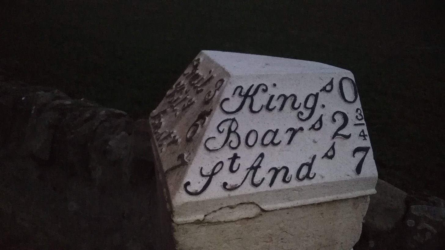
Kingsbarns to Boarhills (around 1.5 hours)

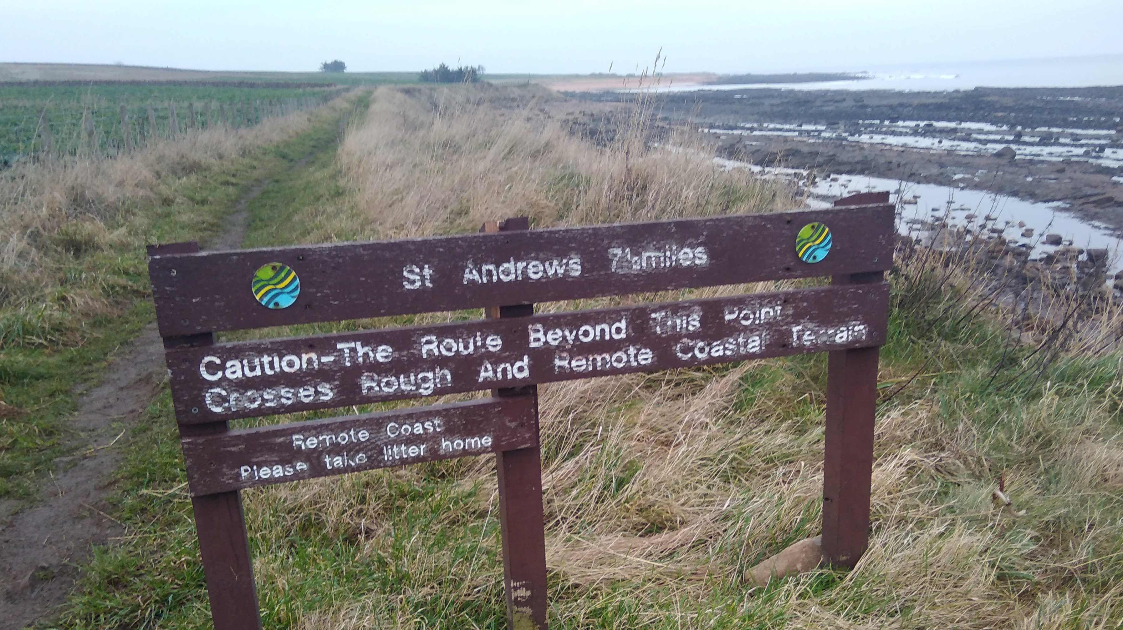
I knew from the instructions that today ‘may be the roughest part of the whole route’, and that it ‘should only be walked at low tide’, so I was against the clock which caused some stress, day light being at a minimum in February and the high tide being around 1pm.

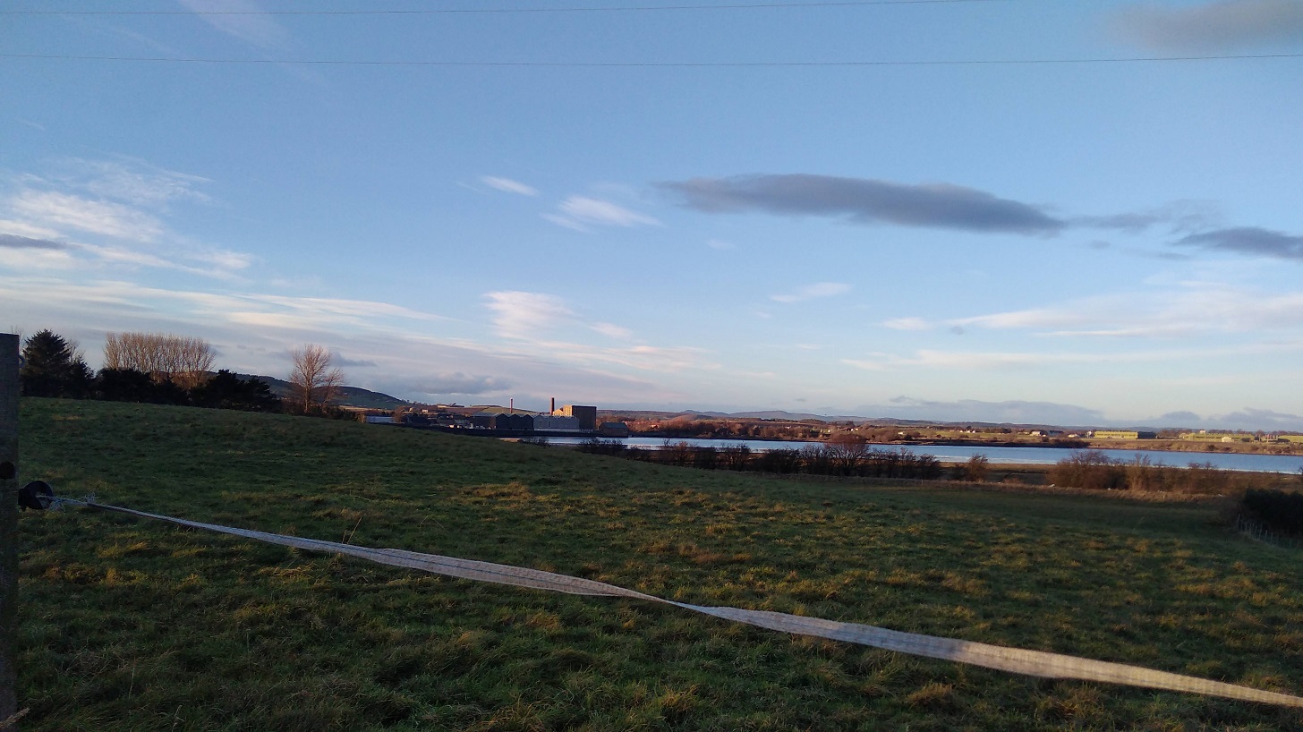
It was definitely colder than the day before, maybe because it was earlier or maybe because there was a slight breeze coming towards me. I could see my breath. It was brighter than Saturday with lots of cloud, but also an area of pale blue showing inbetween.

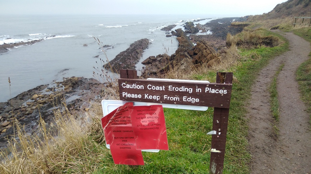
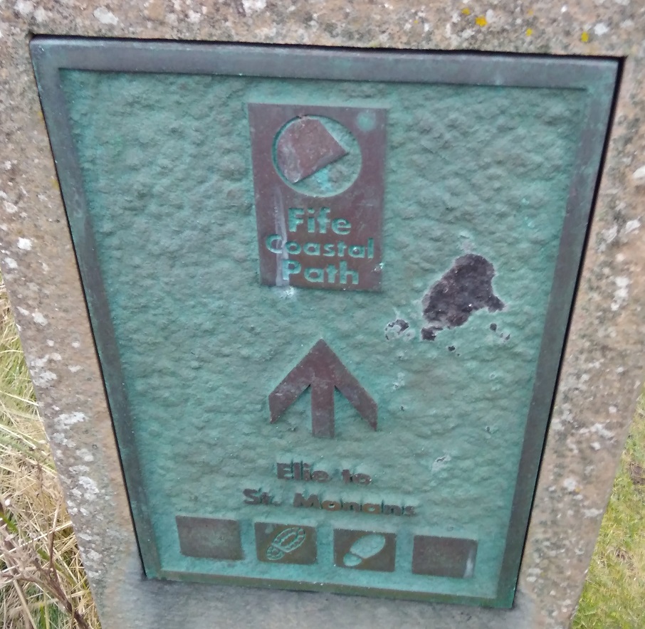
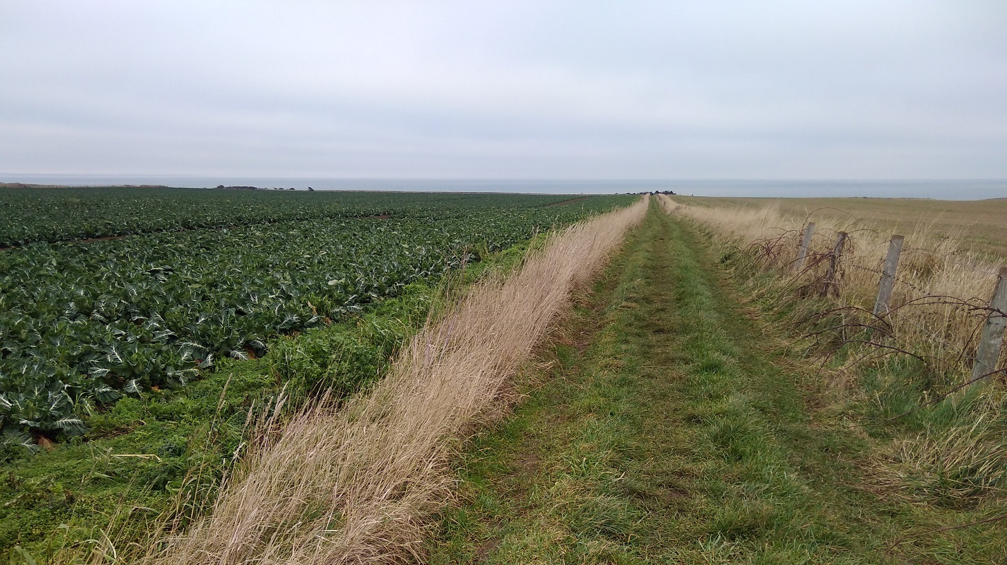
The first thing I passed was a warning of remote bumpy landscape beside a field with a very strong smell of brassicas which overwhelmed the sea scent.
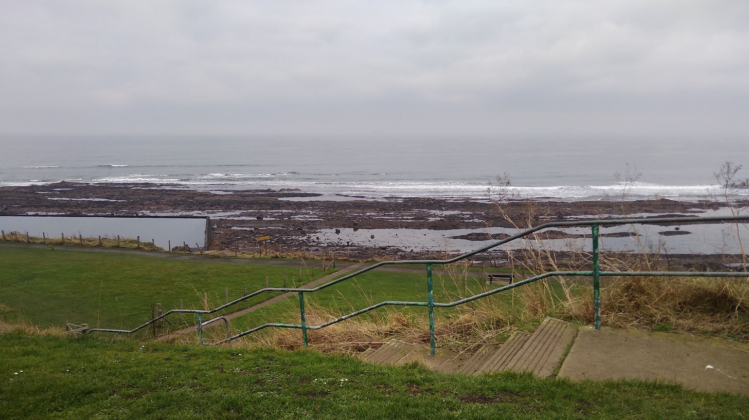
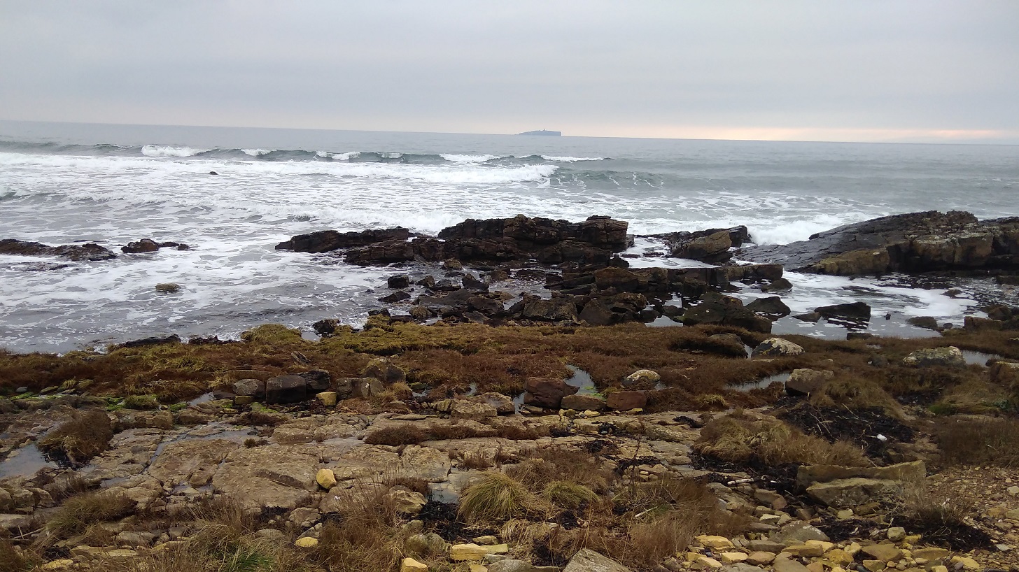
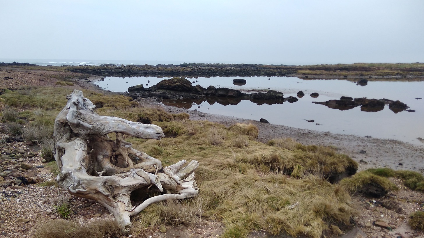
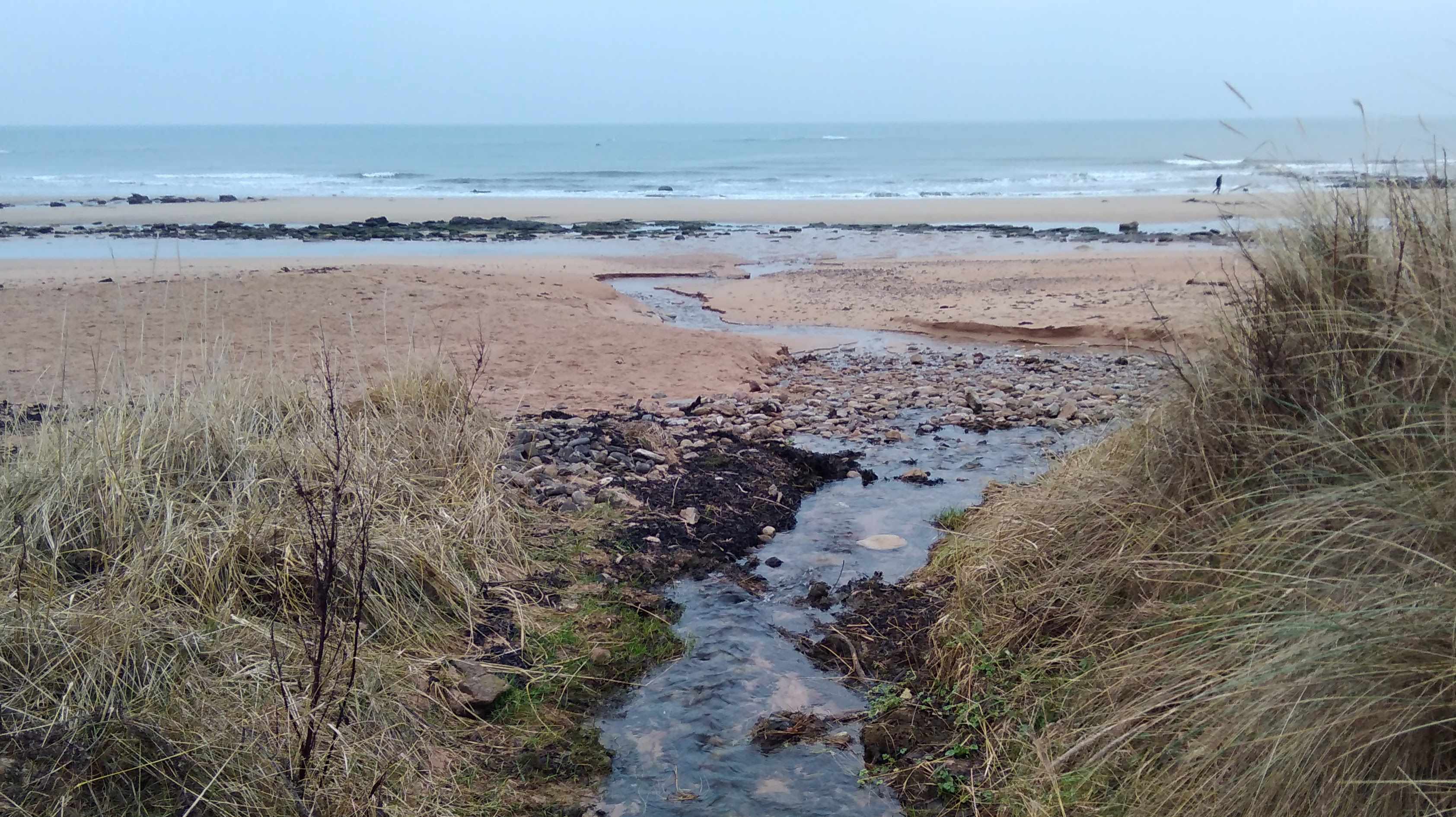
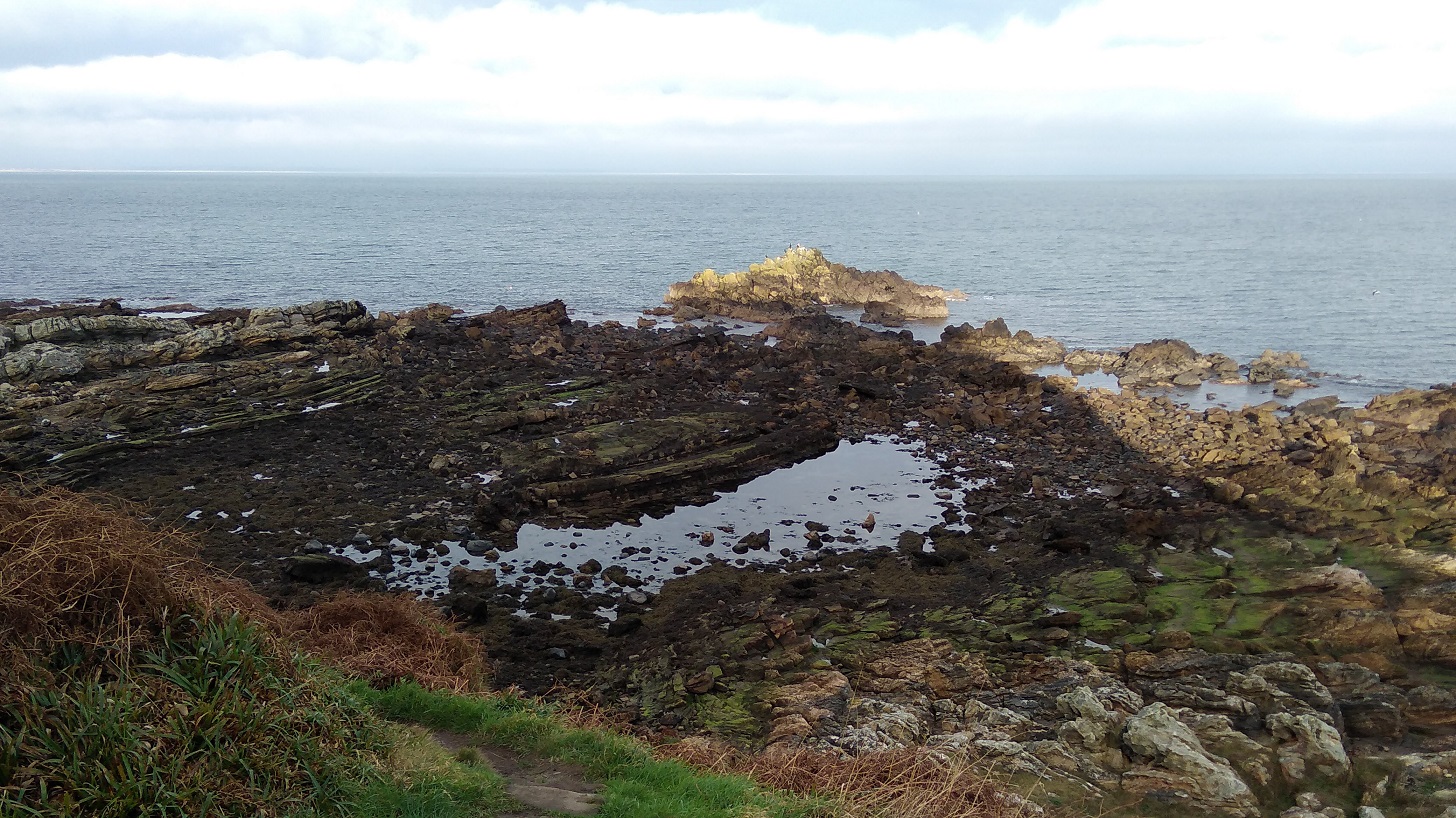
IMG_20190120_091043
Past the place of no return?

Another golf course and stretches of golden sands stretched as far as the eye could see. So far it was low tide, thank goodness, which was what I was going to need to manage the next part. There were little pillar-box-red poles all the way along, perhaps showing where you can get down to the beach.

IMG_20190120_091856
The sheer sands near Babbet Ness, Fife

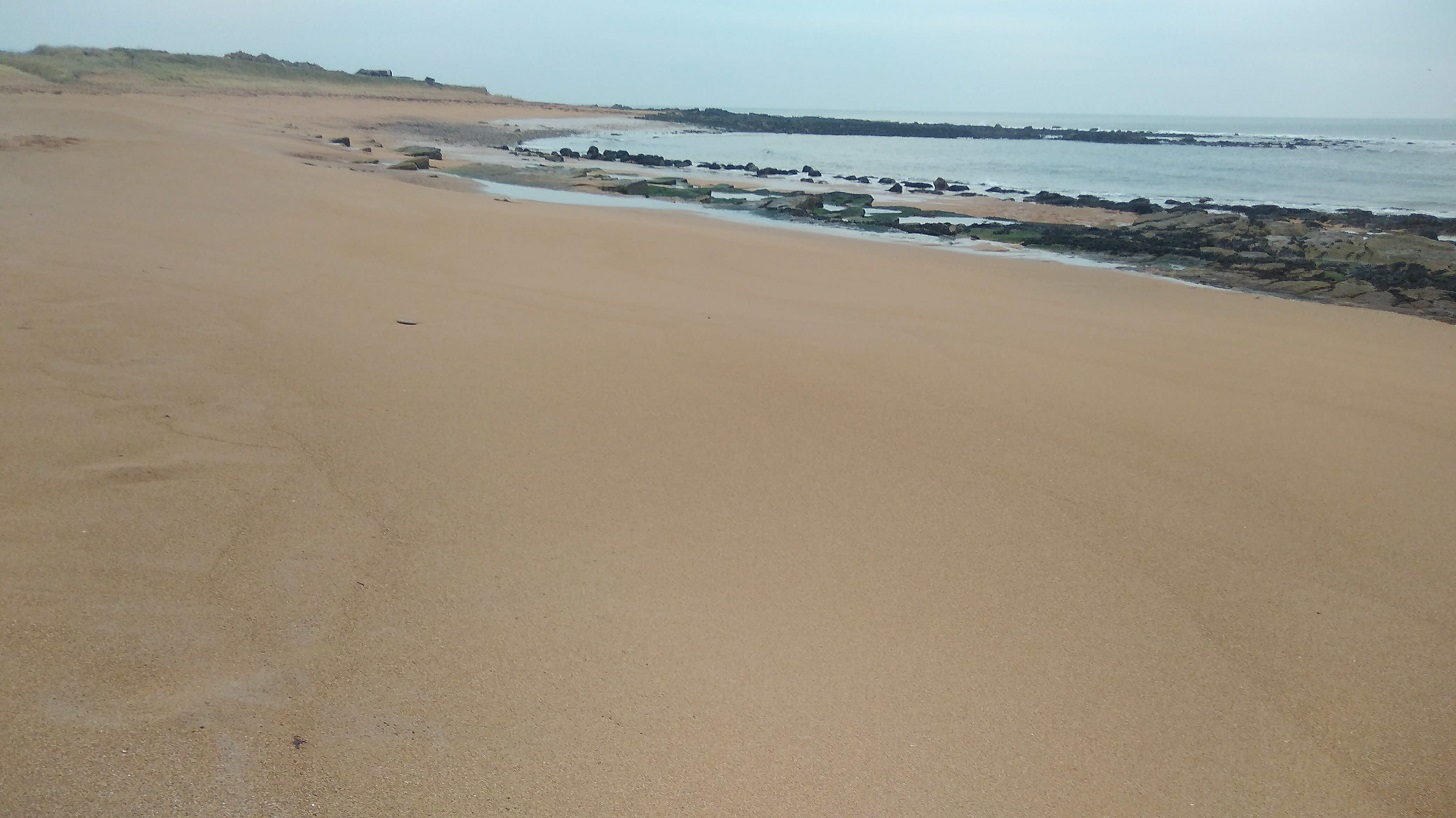
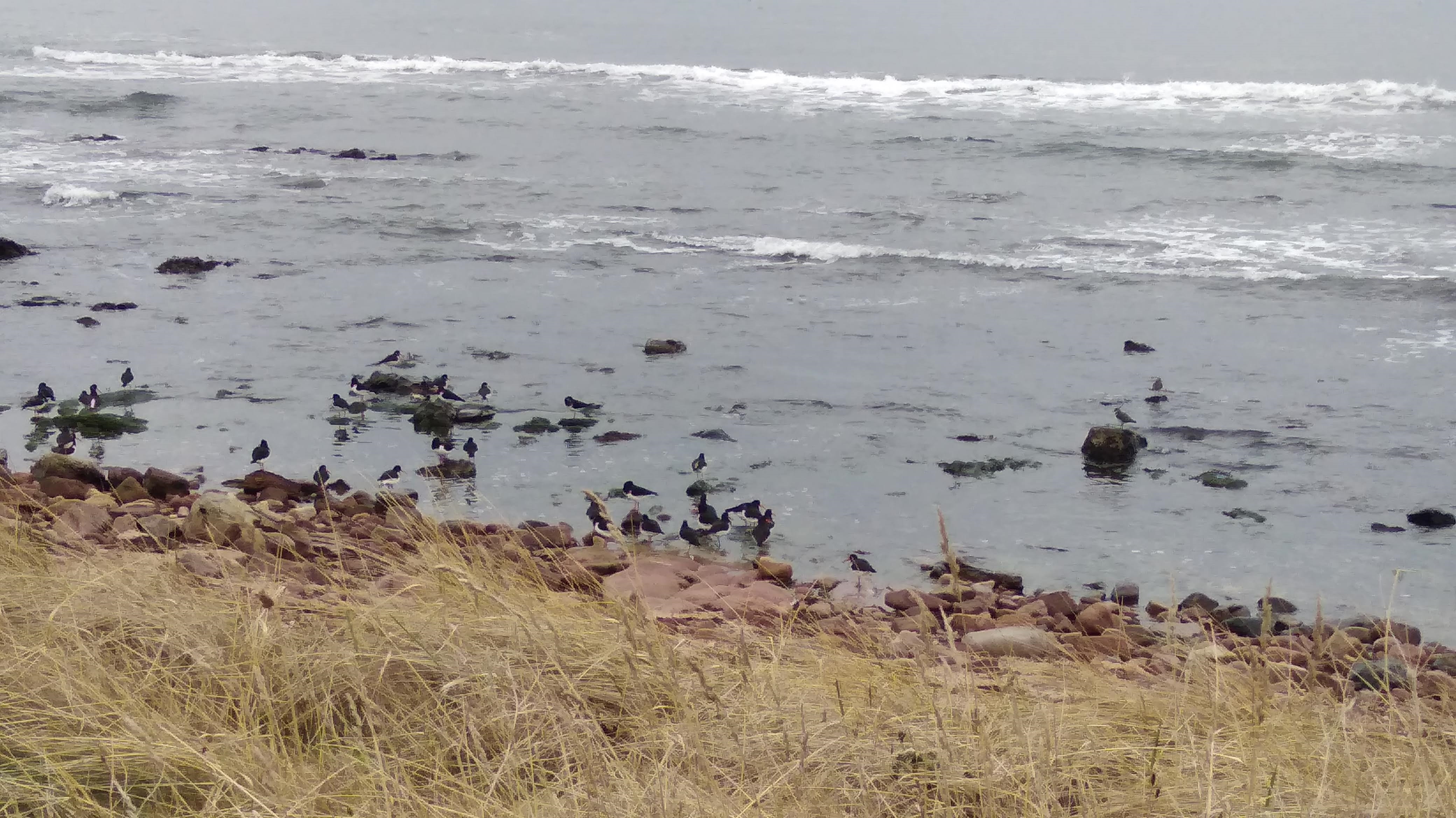
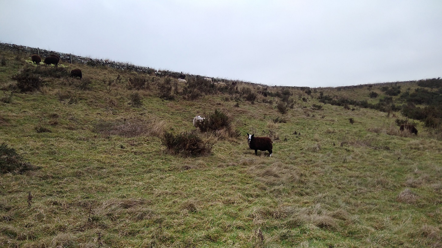
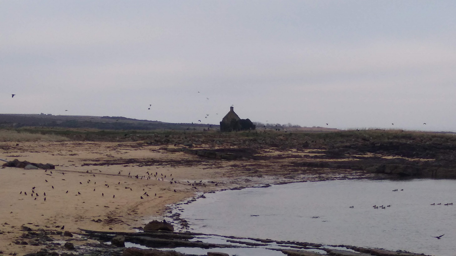
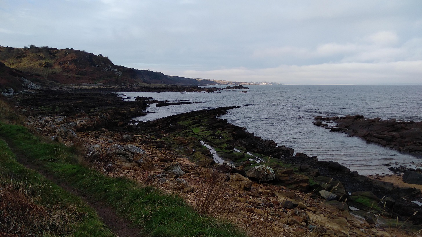
It was hard going as they warned it would be, especially on the sand, beautiful though it was in colour and smooth surface. People and dogs had been there ahead of me. Then back on the scrubby grassland beside the shore, the path was very uneven. The water in my bottle was almost too icy for me to drink which showed how cold it was. Just to think that when most of us are in our cosy houses in cities and villages, the birds and cattle are here all through the night wheeping away, floating on the waves and managing the elements, whatever the weather!

IMG_20190120_094215
Flocks and flocks of black birds, alighting and taking off, swooping around, fighting and jostling to find their place, mostly on walls, fence posts, electrical wires and strand

Inland

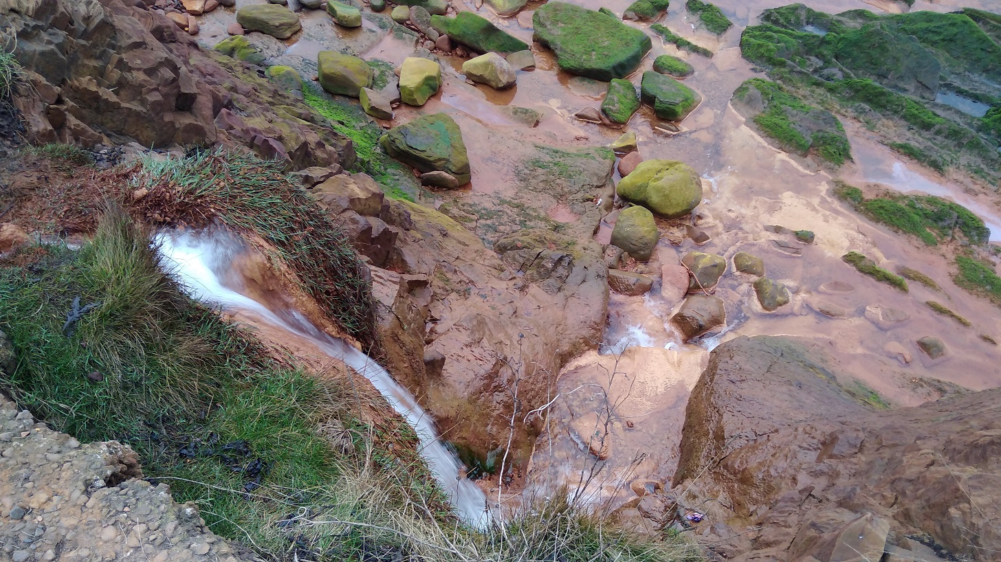
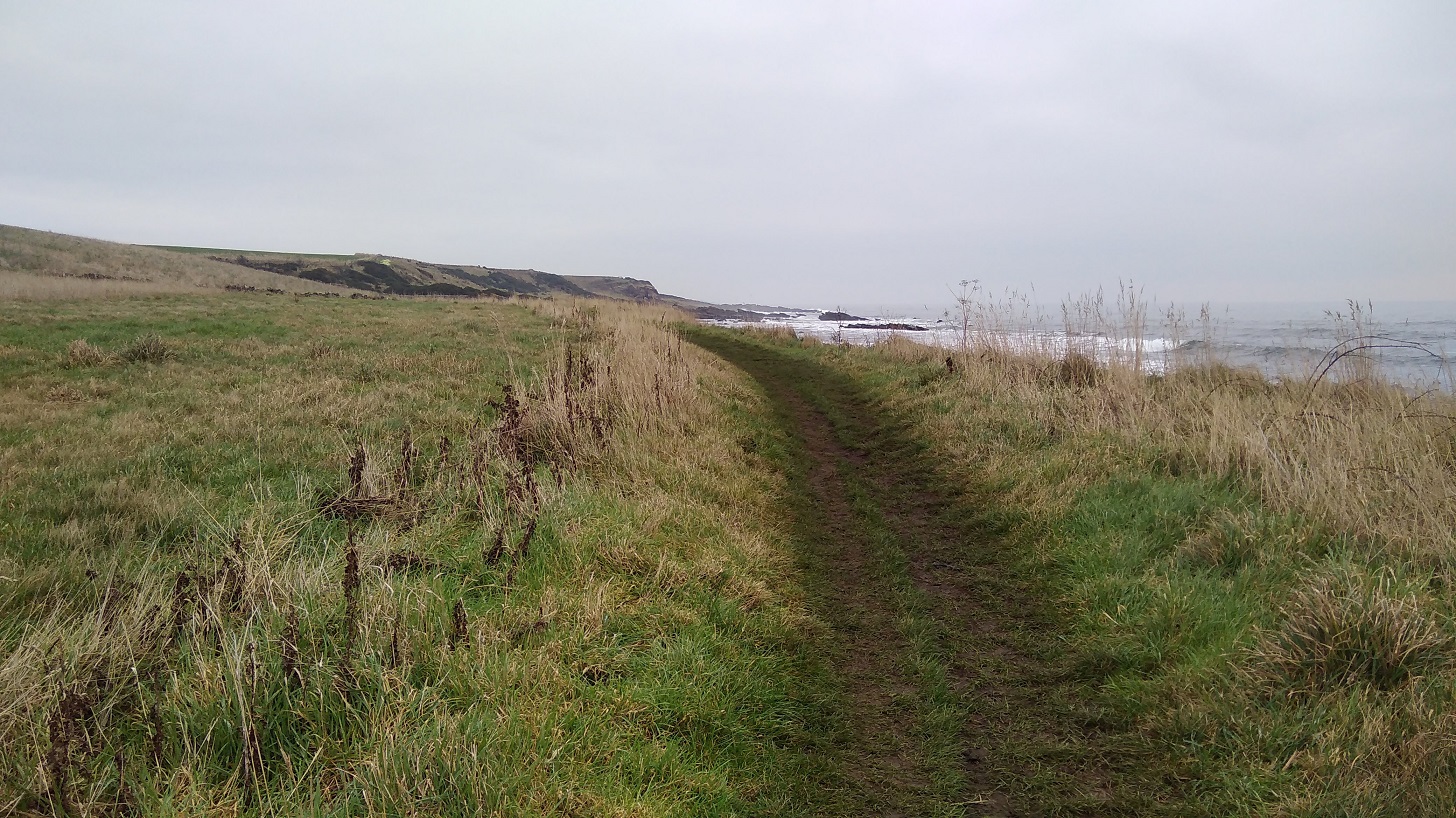
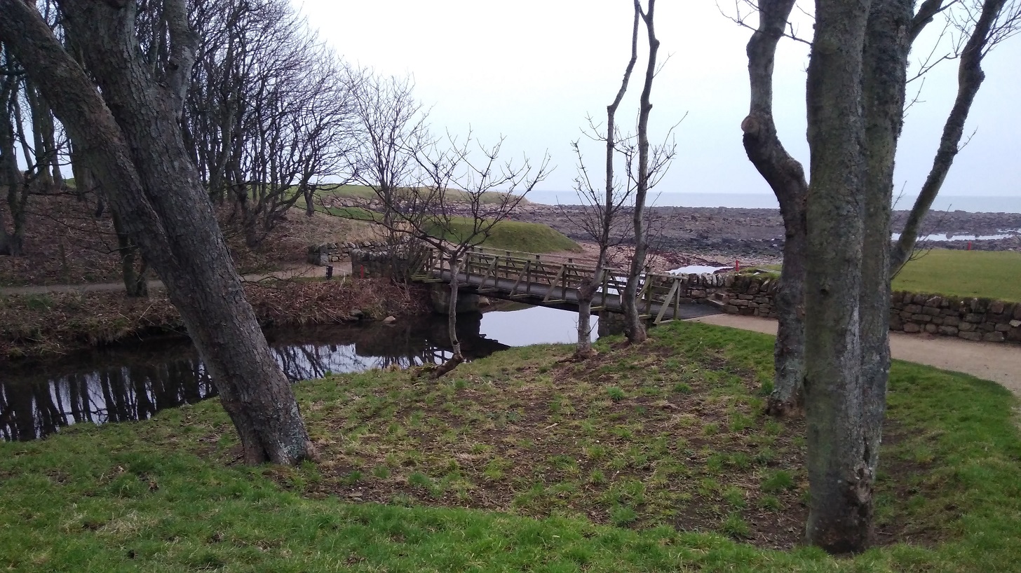
There was a detour inland to Boarhills where I crossed the Kenly Water – a well-kept path beside mossy boulders where water bumbled over stones. It was well signposted across a metal bridge, and then there was a tarmac farm road followed by an equally long, straight grassy way heading back to the shore.

IMG_20190120_102113
The corn bunting or corn dumpling, the Fat Bird of the Barley can be spotted near here. A Red List species, it flocks in winter, fluttering its wings and dangling its legs in its identifiable fashion
IMG_20190120_103657

Boarhills to St Andrews

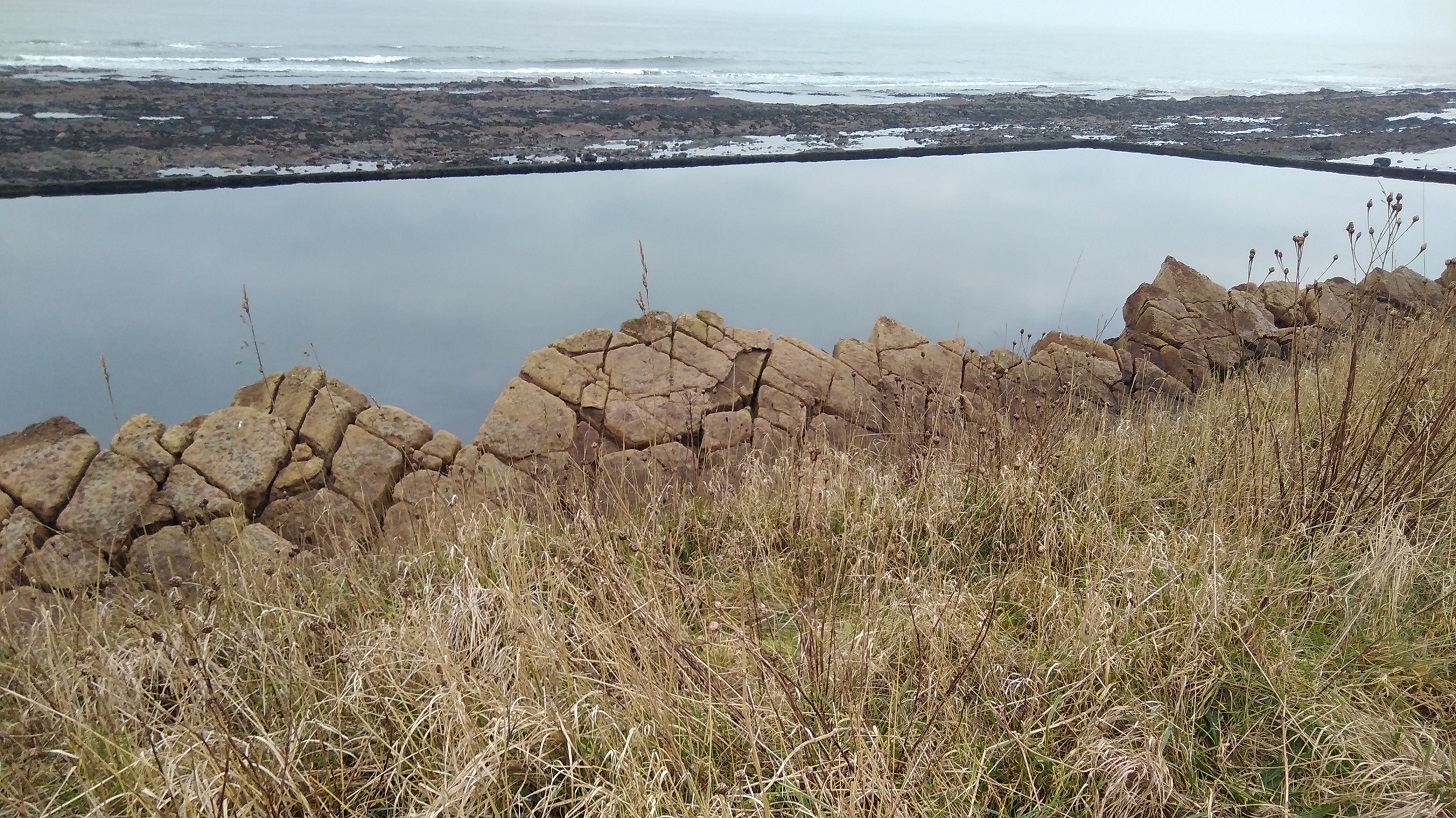
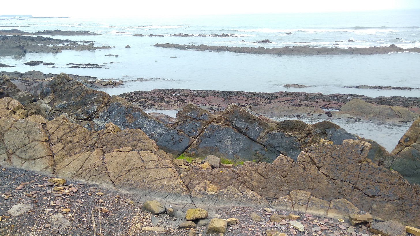
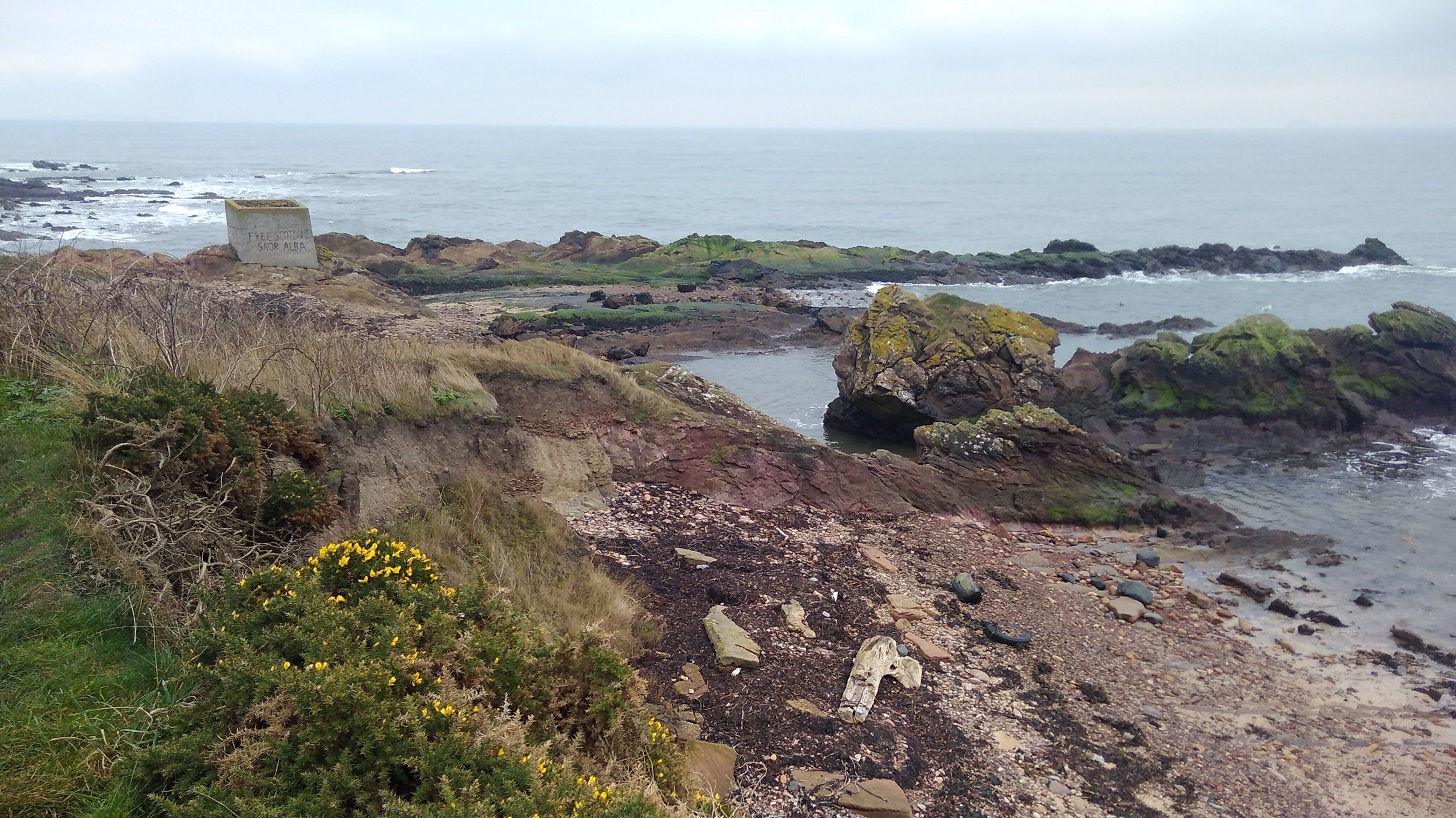
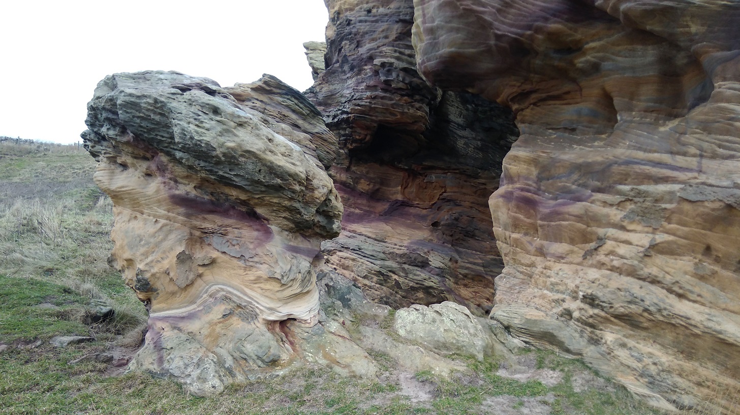
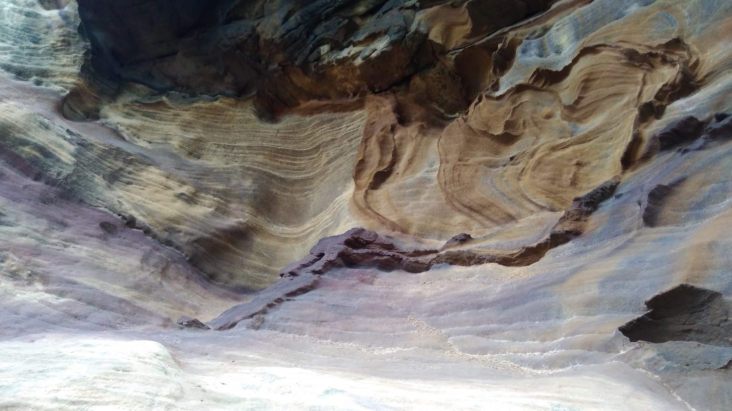
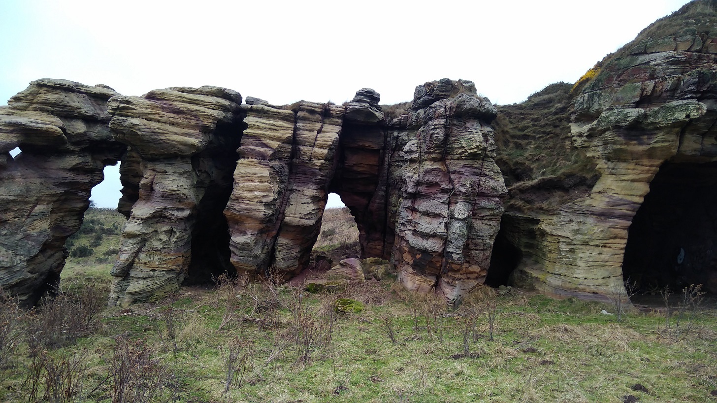
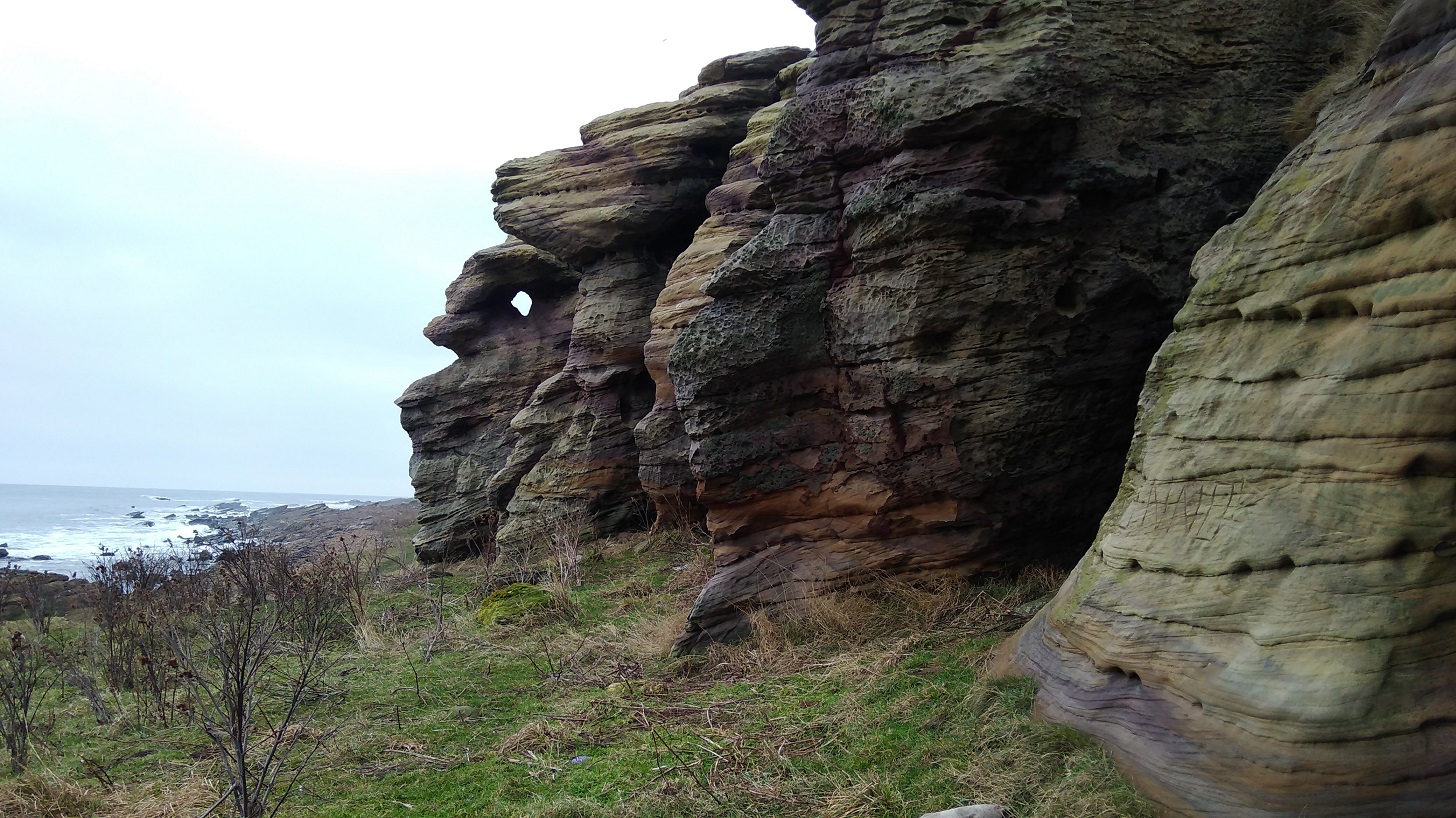
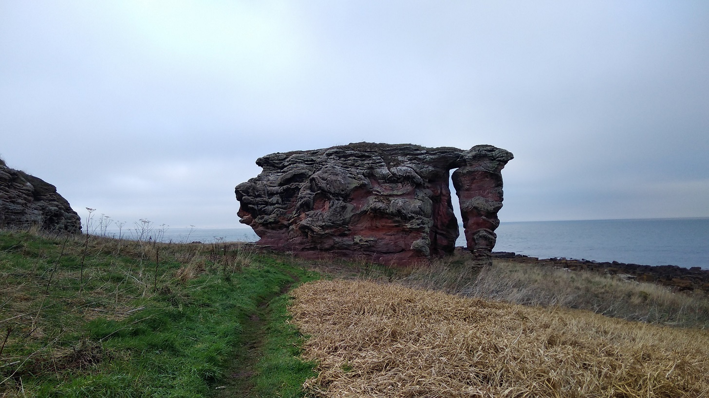
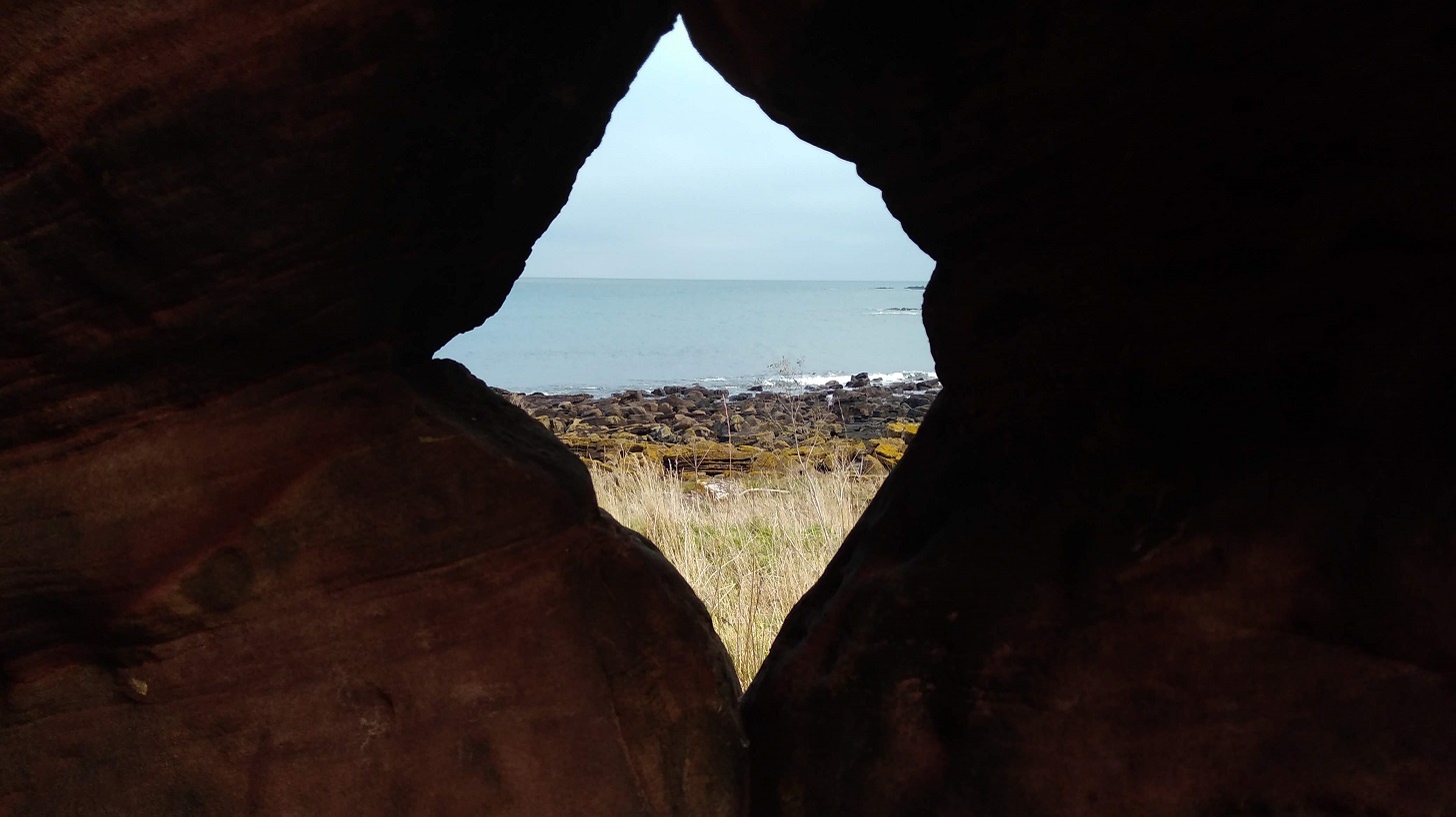
Next was a further geological treat: Buddo Rock, a stack of pink sandstone with a muted rainbow of organic colours and weathered into fascinating shapes and spaces.

Though time was galloping along, I had to stay a while and explore the nooks and crannies, gasp at the intricate patterns which had developed over centuries.

IMG_20190120_102947
The Baddo Rock in the deserted landscape where I was surprised by another photographer

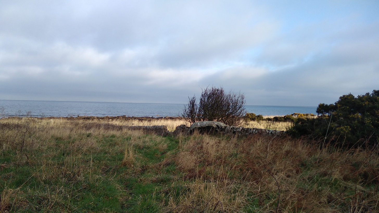
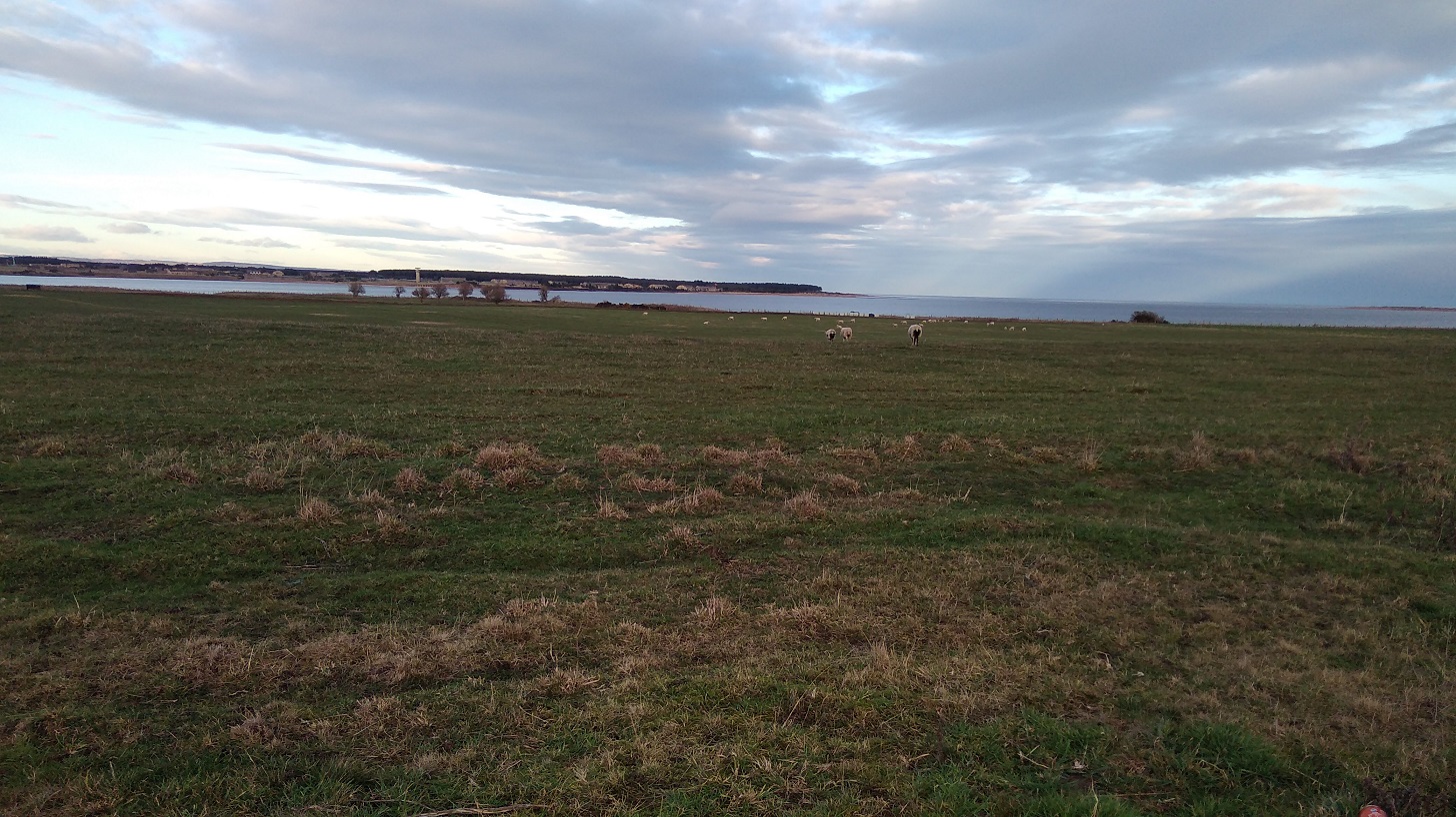
It is gentle land, unassuming and quiet, seeing to itself. Nature and birds are simply doing their thing – a situation which allowed me to think about what I wanted and do what I wanted because it didn’t care.

IMG_20190120_103112
View through the rocks, Fife

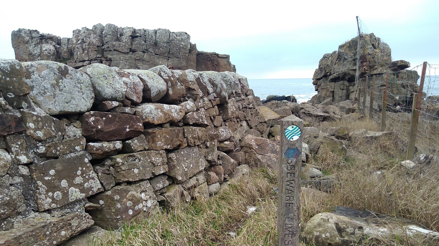
Gorse and lichen, a matching yellow, were situated amongst twisted shrubs which were sharp and almost bare of leaves. I padded along soft paths at the sides of which the sun lit up swathes of bright beige grasses with lavender coloured seedheads. Drystone walls cut into the shoreline at right angles and the sea turned alternate shades of baby blue and slate grey depending on the cloud movement.

glowing grasses
St Andrews in the distance
St Andrews started to show, glowing in the distance while the coast behind me, when I turned round, was gloomy
IMG_20190120_105310
Up and down tons of steps, it was very steep and hard work. Then back on the shore before climbing again. Fife Coastal Path

A jogger ran past. A man was doing a pee, very embarrassed as he spied me.

IMG_20190120_105647
The sun went in and there was a definite sense that the rain might be coming on, then it cleared

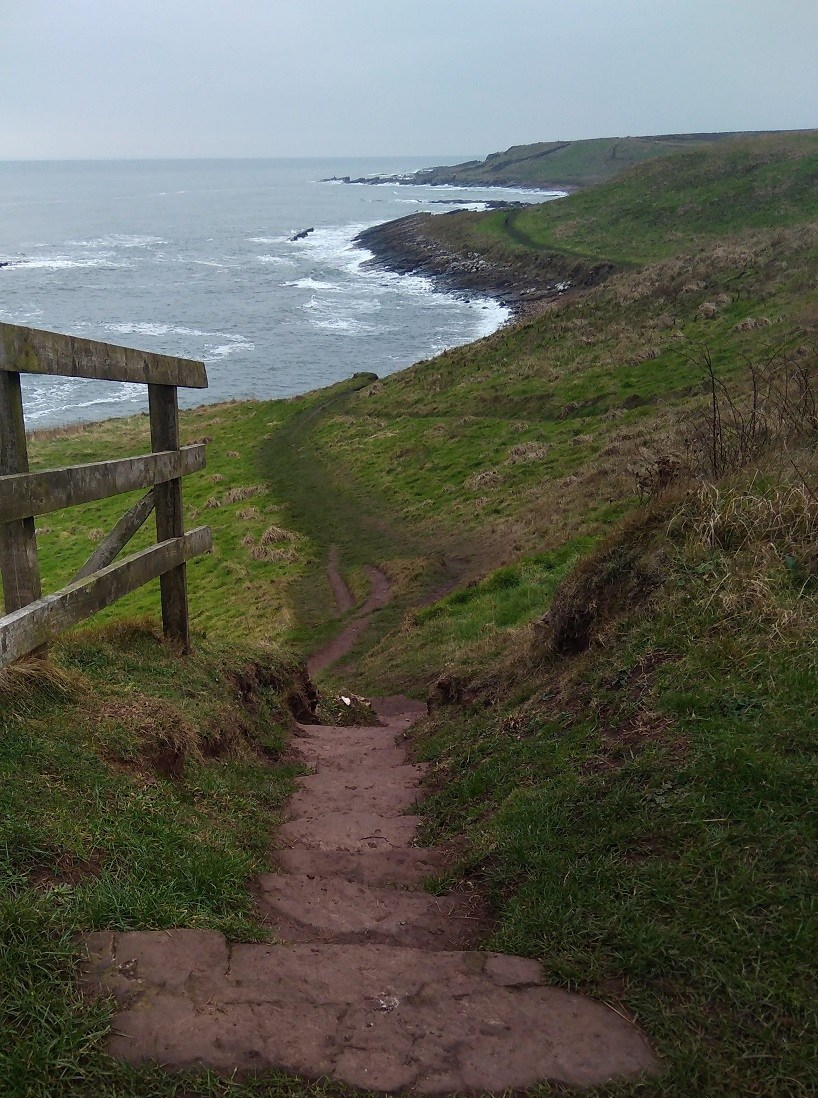
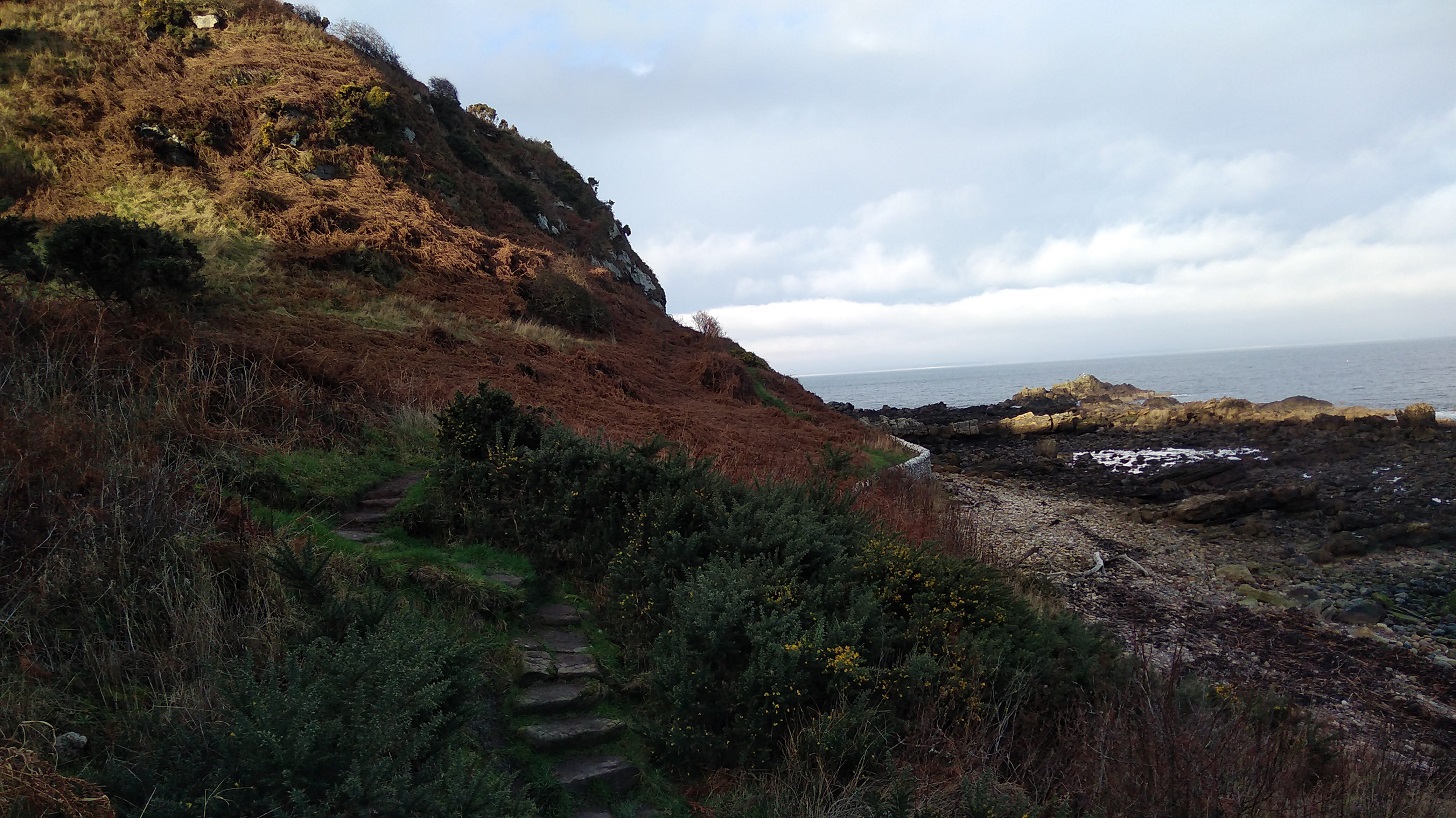
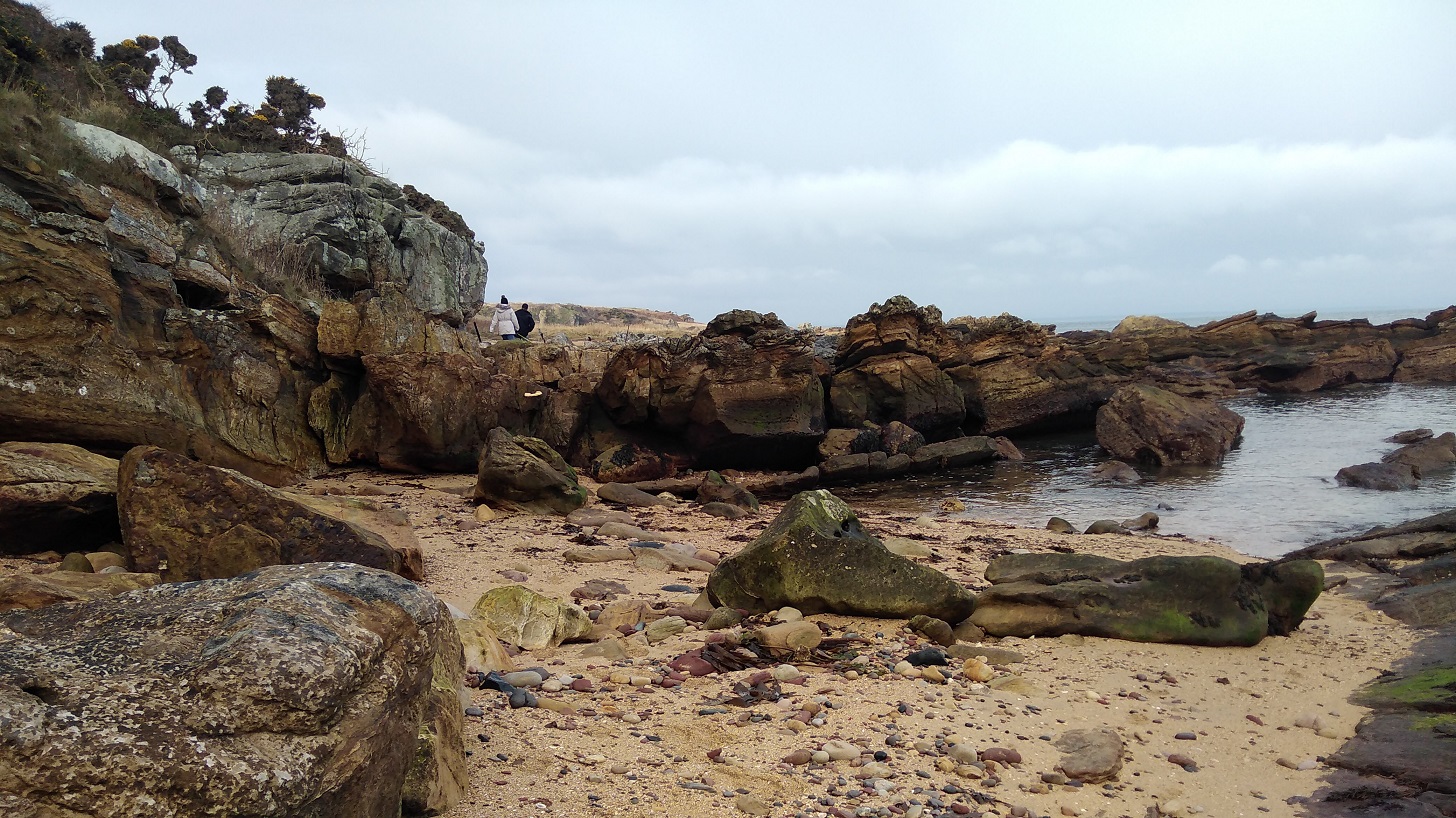
There were more walkers than I had seen before on any of the FCP – there’s nothing like the Real Tough Part for attracting lots of folk! Both enthusiastic and uninformed walkers were there, I would have said, given what they were wearing on their feet. It sure was tricky in places: steep like a roller coaster, and a real scramble up jaggedy rocks at others. The water came very close, even before the tide turned, but I didn’t get my feet wet!

In one place there was a thin plank, the width of one foot, over a narrow chasm and a couple were in front of me. The man went first with the dog and held it as it growled at me. As I passed I heard him murmuring, ‘mummy’s coming, mummy’s coming’ as the woman with beautiful makeup stood still and wondered if she wanted to cross. She took her time – there was no other way.

Rocky coastline
There was a white bit of plastic to step onto but my short legs couldn’t reach it! Precarious with a rucksack

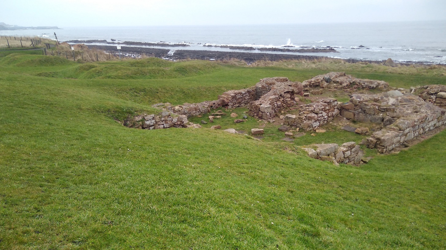
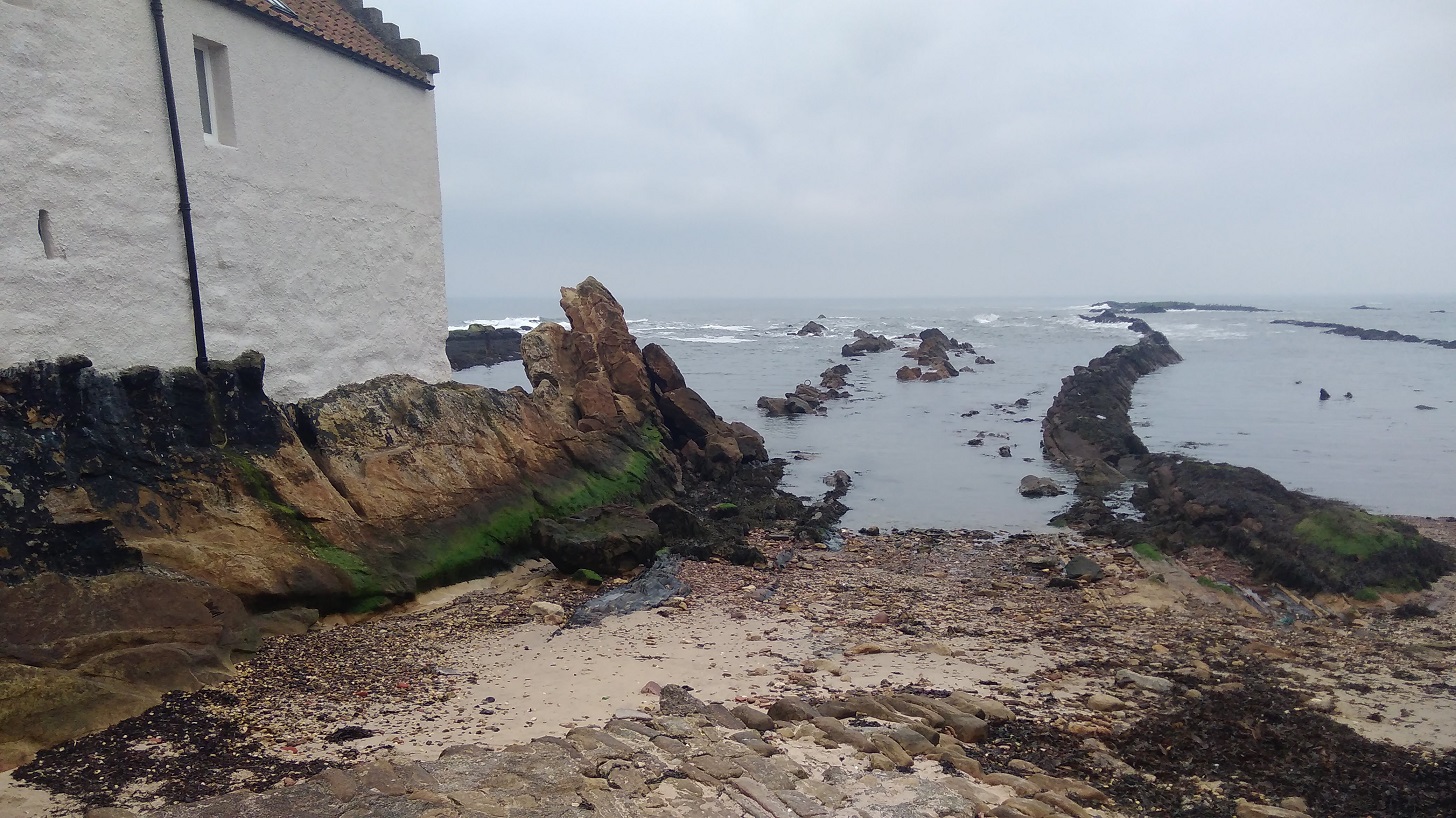
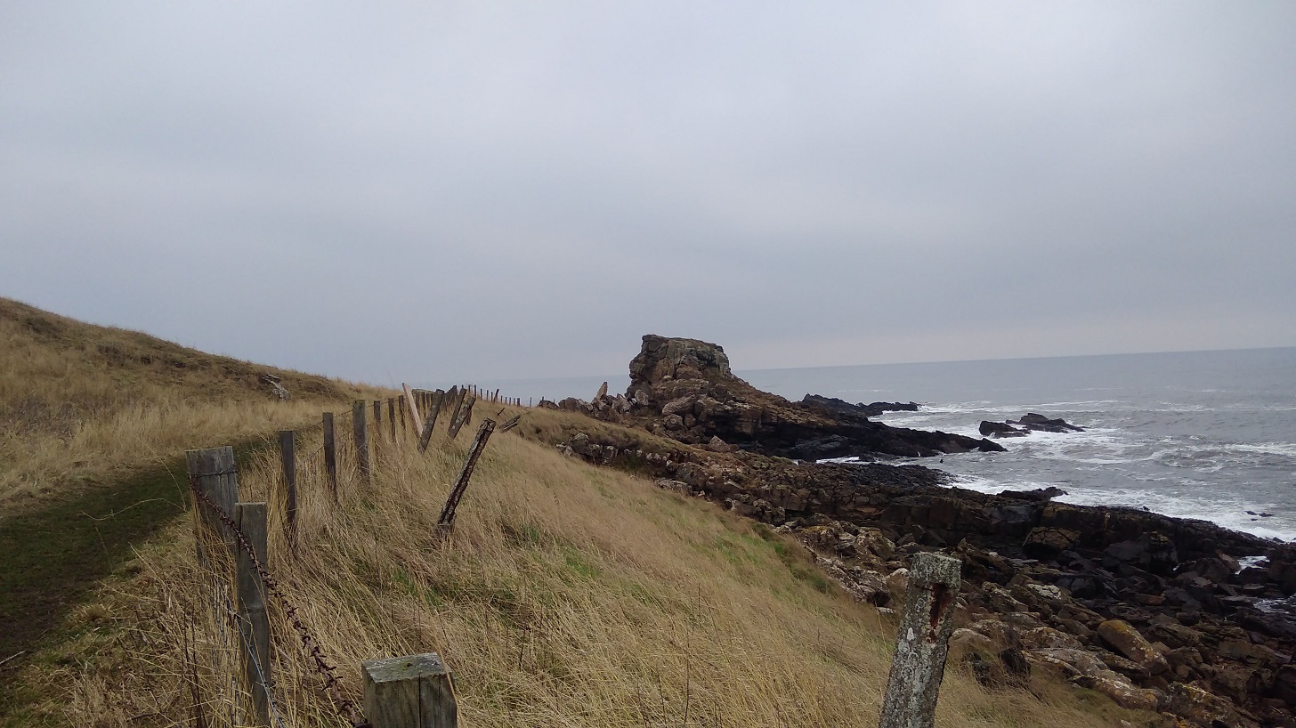
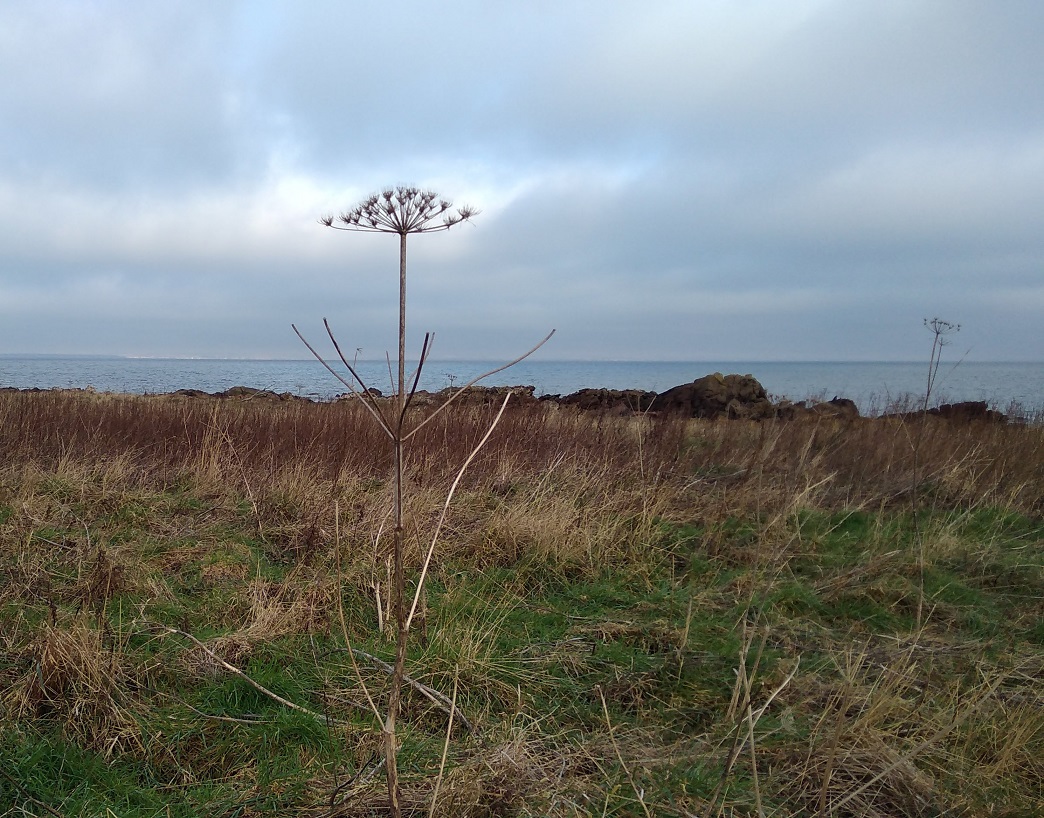
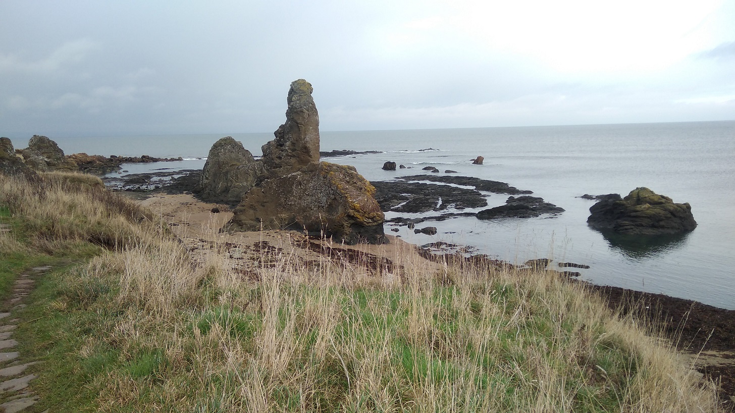
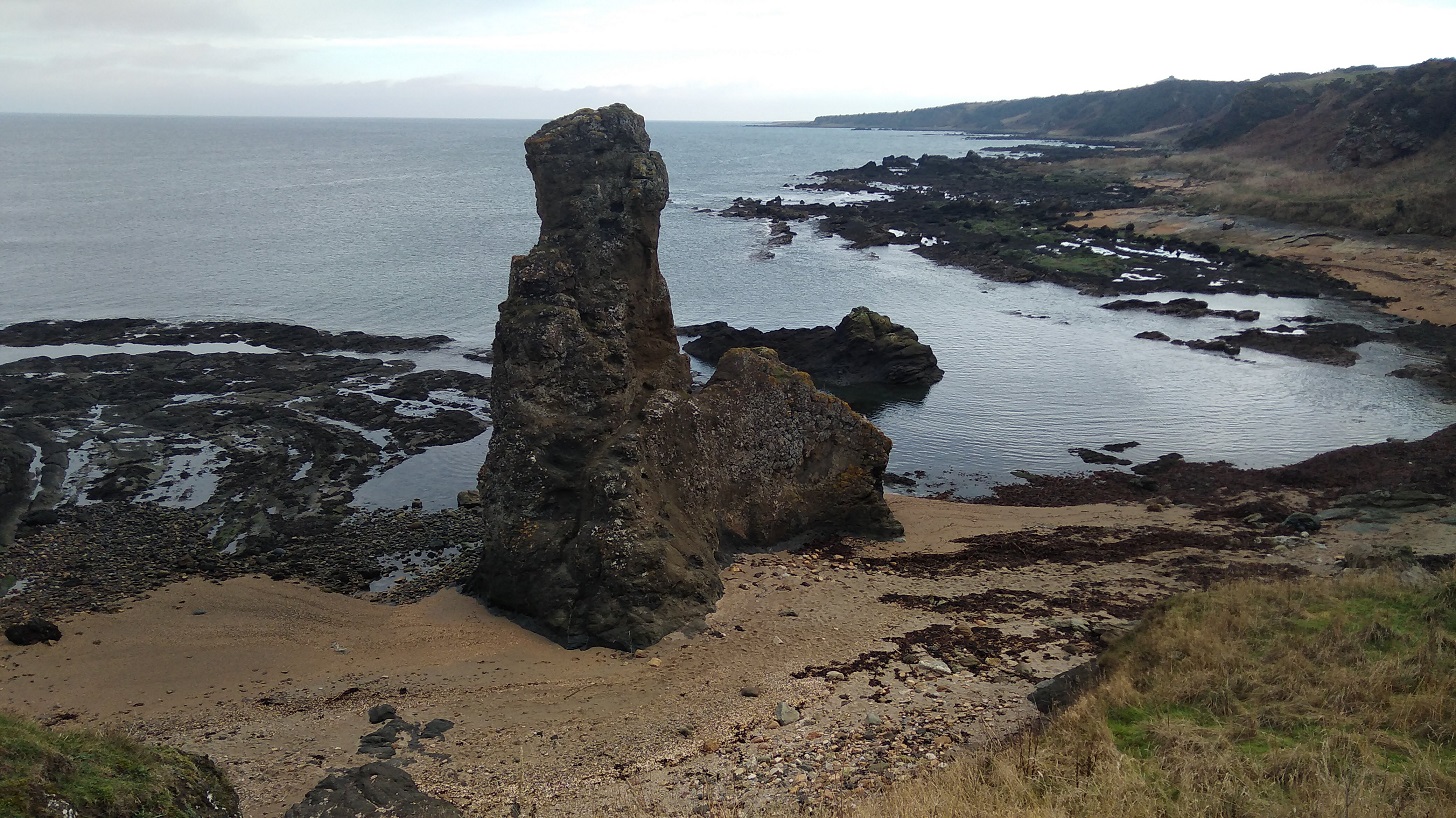
Further along was the Rock and Spindle – an eye-catching, rather thrusting geological feature standing separate from the crowd just off the main shore.
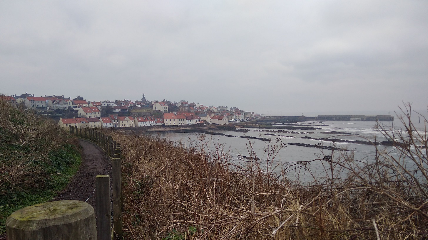
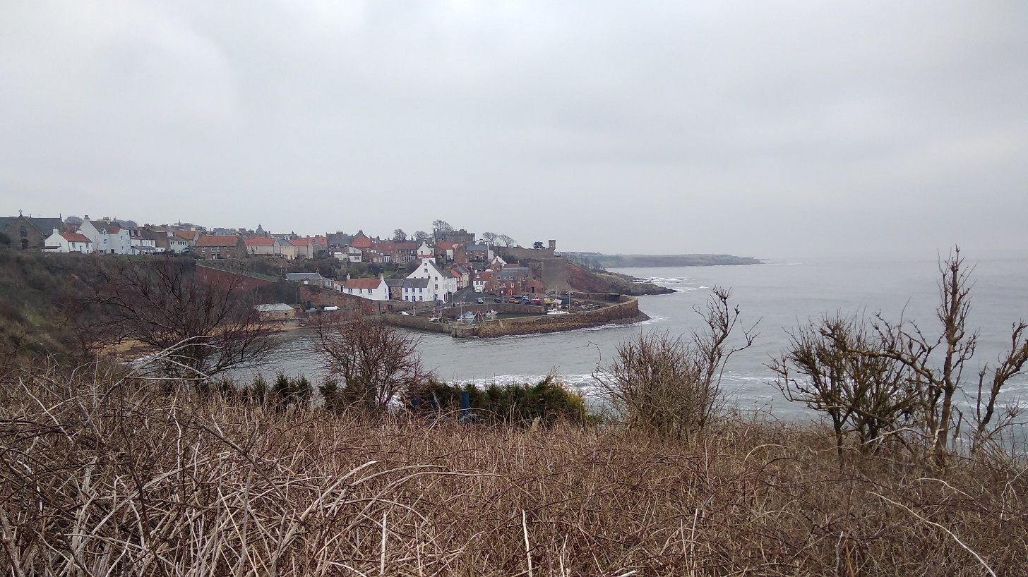
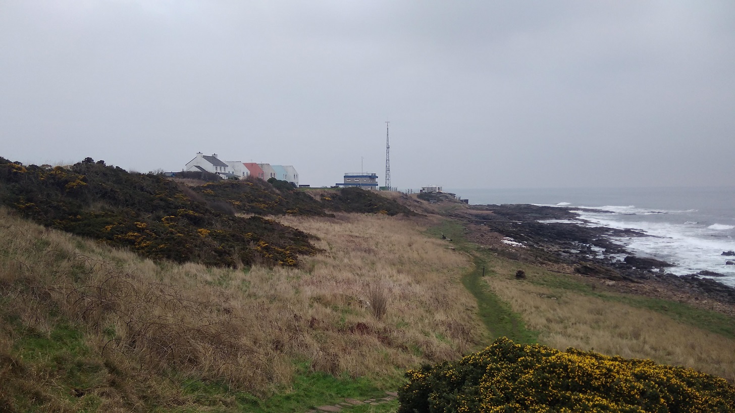
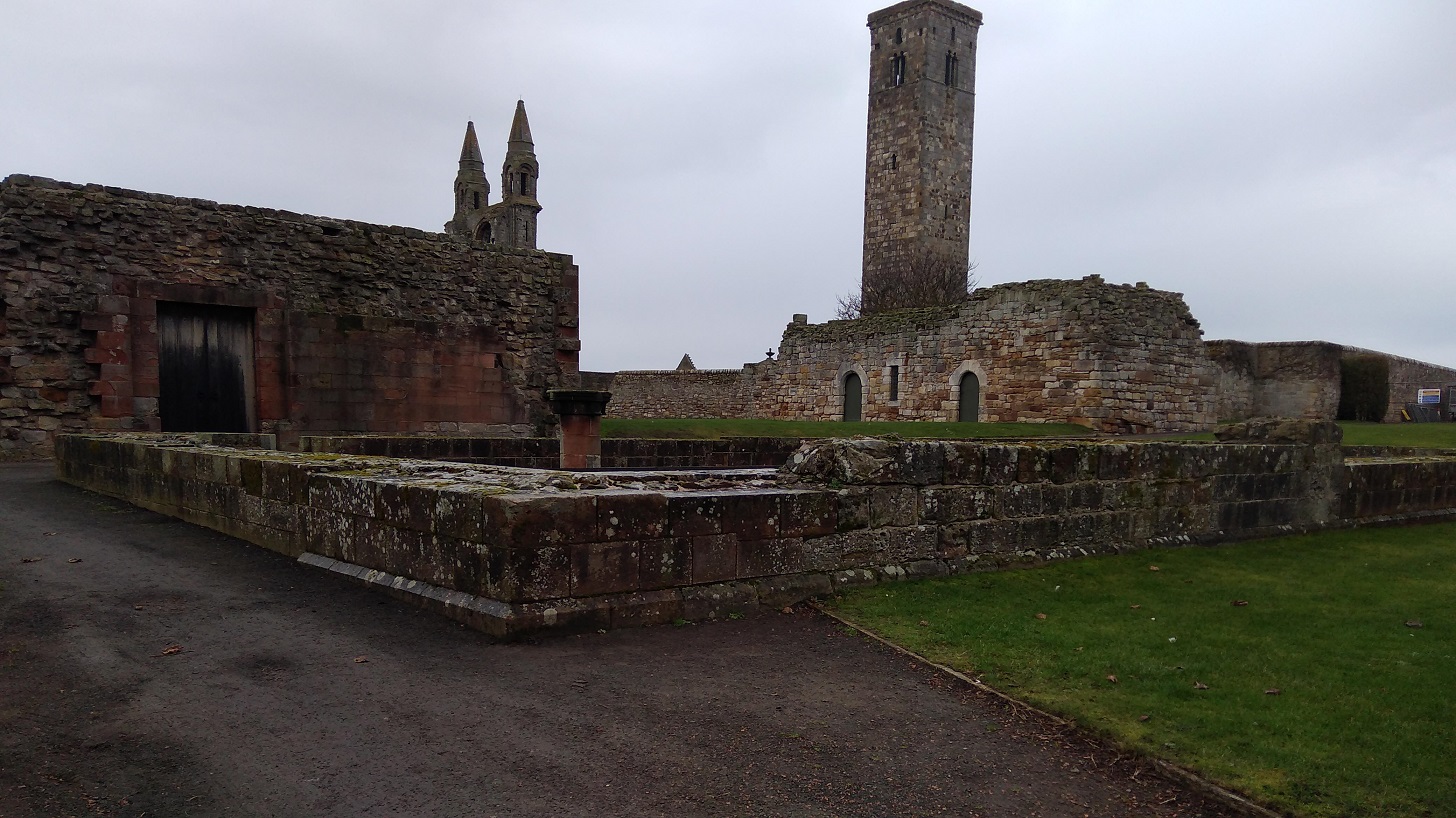
IMG_20190120_113019
Stones are set into the grass for climbing – sometimes with wooden hand rails and sometimes not. Pointing to the skies is the Rock and Spindle. See how the sea has eroded the land making semi-circular furrows which fill with water around it
IMG_20190120_113218
The Rock and Spindle closer up. Walking on pebbles, squelchy and noisy

St Andrews

High up on Kinkell Ness I stopped to ask directions from a very tall gentleman in an orange top with a beard with a petite woman and labrador beside him. Yes! 15 minutes over the high ground, he assured me, and I would be in St Andrews – I had done it, with a real sense of elation. I even laughed as the rain came down!

IMG_20190120_120602
St Andrews at last!

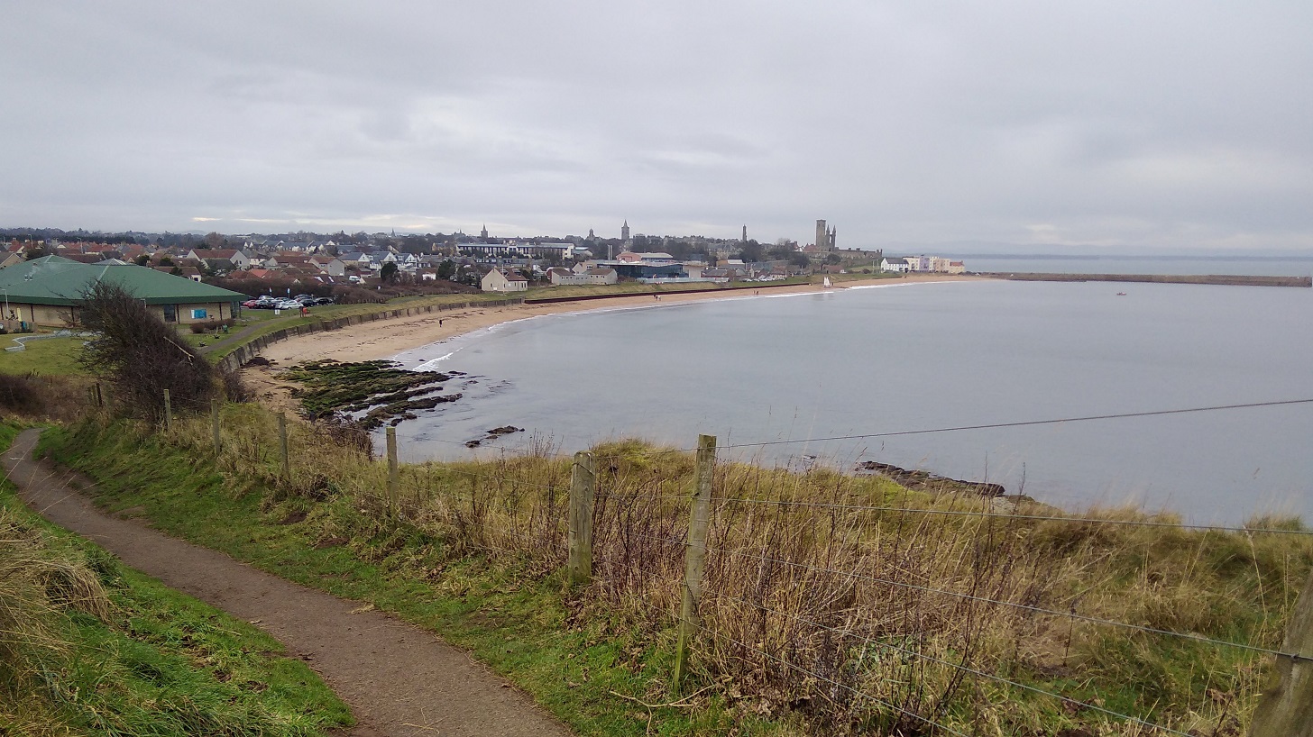
I heard children and looked down the steep cliffs to the beach, but no, it was a trick of sound over water – about 8 of them were in a boat out in the bay.

IMG_20190120_121733
East Sands, St Andrews

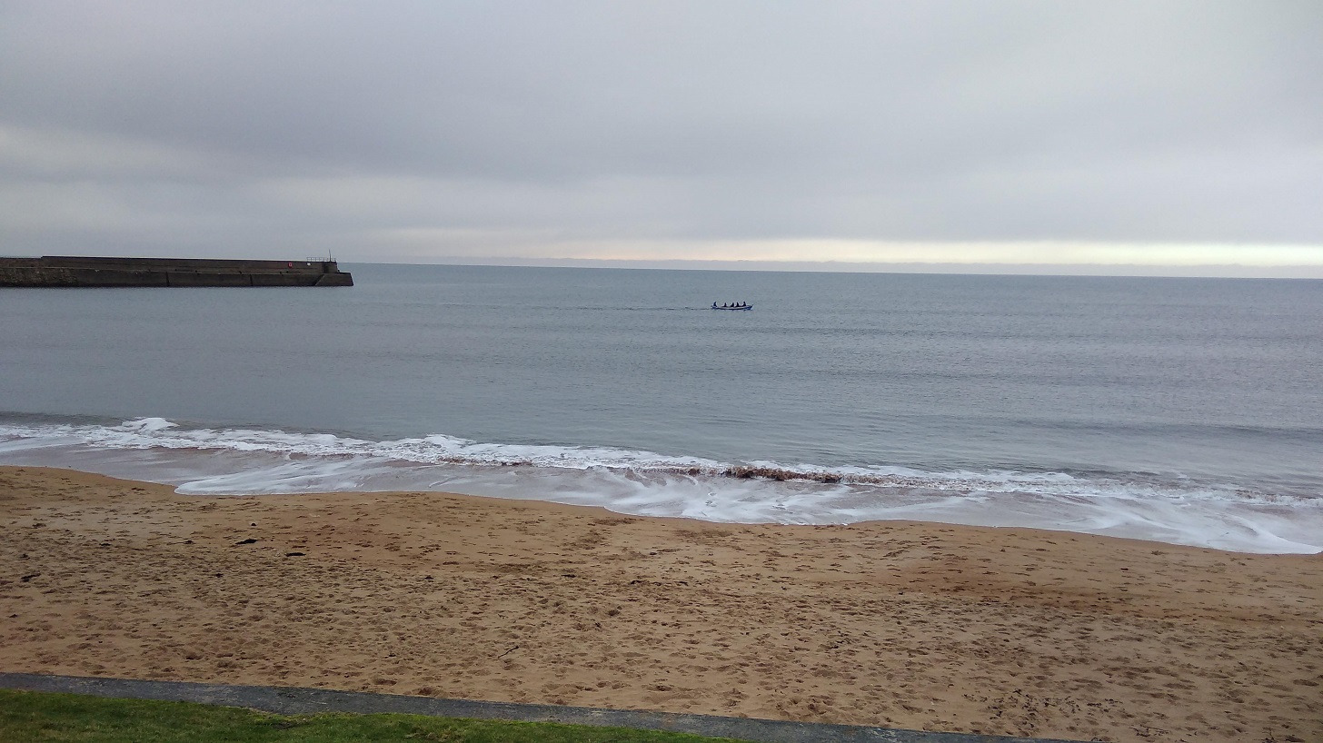
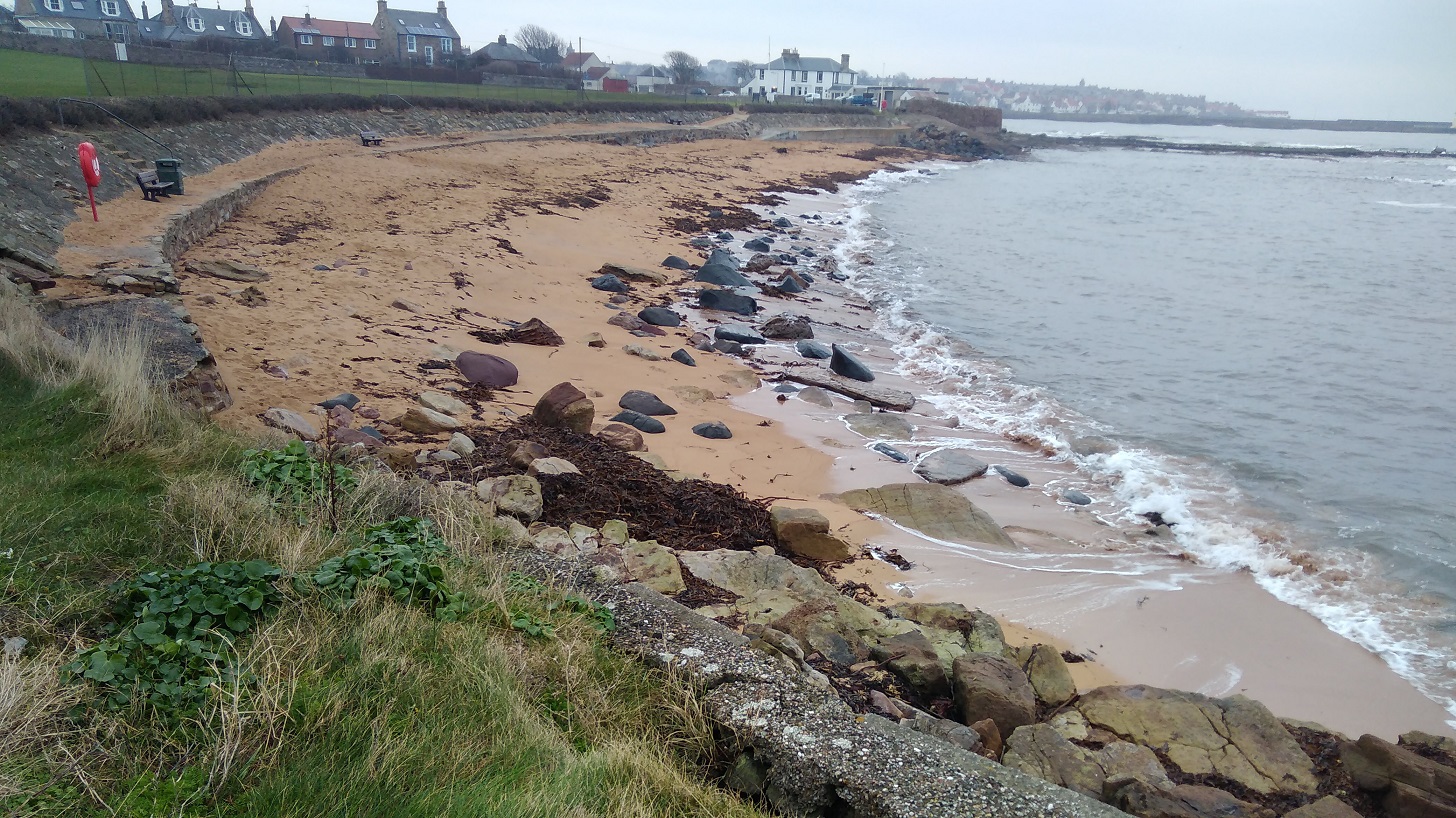
The astonishing thing is that you do actually get there, however exhausted your muscles are, Mine were all tense and brittle from yesterday’s exertion. On the East Sand, people wore trainers and sauntered with coffees, barking dogs and there were four white sails in the harbour.

IMG_20190120_120841
Jacob Polley’s poem, East Sands, Salt Prints winner of the TS Eliot Award for Poetry at East Shore, St Andrews

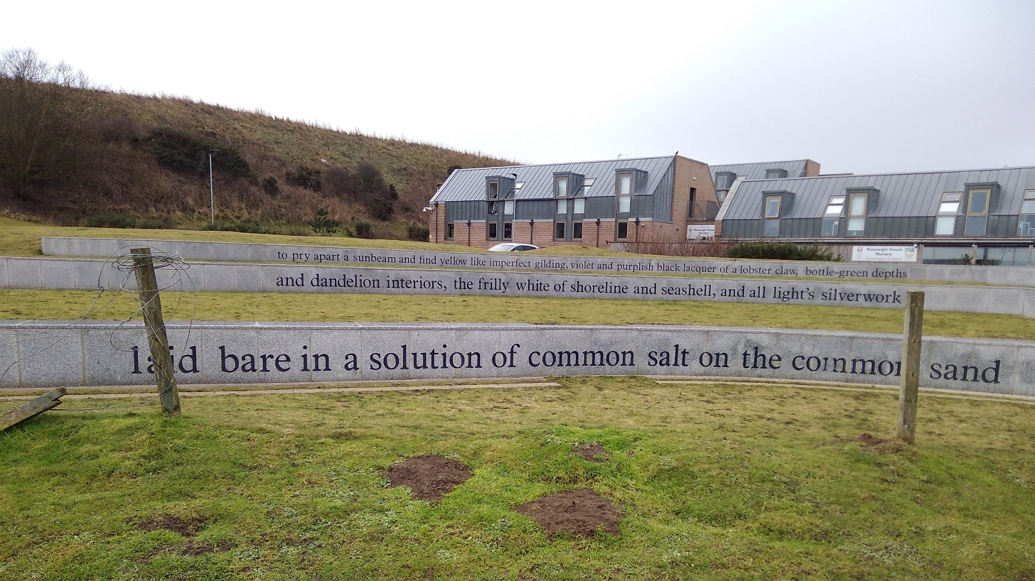
Reads, ‘to pry apart a sunbeam and find yellow like imperfect gilding, violet and purplish black laquer of a lobster claw, bottle-green depths and dandelion interiors, the frilly white of shoreline and seashell, and all light’s silverwork laid bare in a solution of common salt on the common sand.’

What did I find surrounded by a small crowd but the Cheesy Shack which I had seen advertised back at Kingsbarns Car Park!

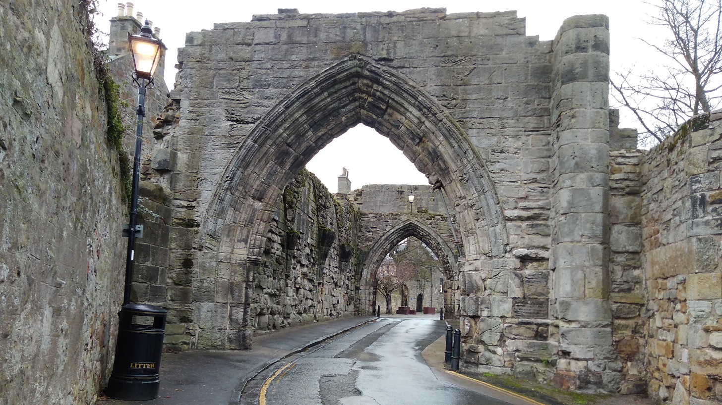
There is the option here to carry on around the cliffs and past St Andrews Castle, or turn inland through the city. I did the latter. It was a bit of a walk as there are only a few places where you can cross the Kinness Burn and take the Pends into the city. I was pretty wet now and needed shelter.

IMG_20190120_122406
The Kirkheugh remains are near the Church of St Mary on the Rocks and St Andrews Cathedral on my right as I left the sea behind me
IMG_20190120_122547
Under the arch of the St Andrews Cathedral Priory Gatehouse – Medieval ruins

I took a left along South Street to find somewhere to find hot food and somewhere to recharge my phone. The soup was spicy and warm at the North Point Cafe, an unsophisticated wee place where the staff were attentive.

Be very careful when picking up a path leaving a town – it is always one of the most difficult things on a trail like this. There is a massive and most famous golf course on the edge of St Andrews and in many places it is uncrossable, so do not skirt the sea (where the toilets were closed) or you will have a very long walk!

I eventually found my way into the club house and the receptionists were kind and let me use their sumptuous facilities!

IMG_20190120_135124
The St Andrews Old Course where the famous golfers play, with the Old Course Hotel on the left, in front of which the cycle path and the FCP runs to Leuchars

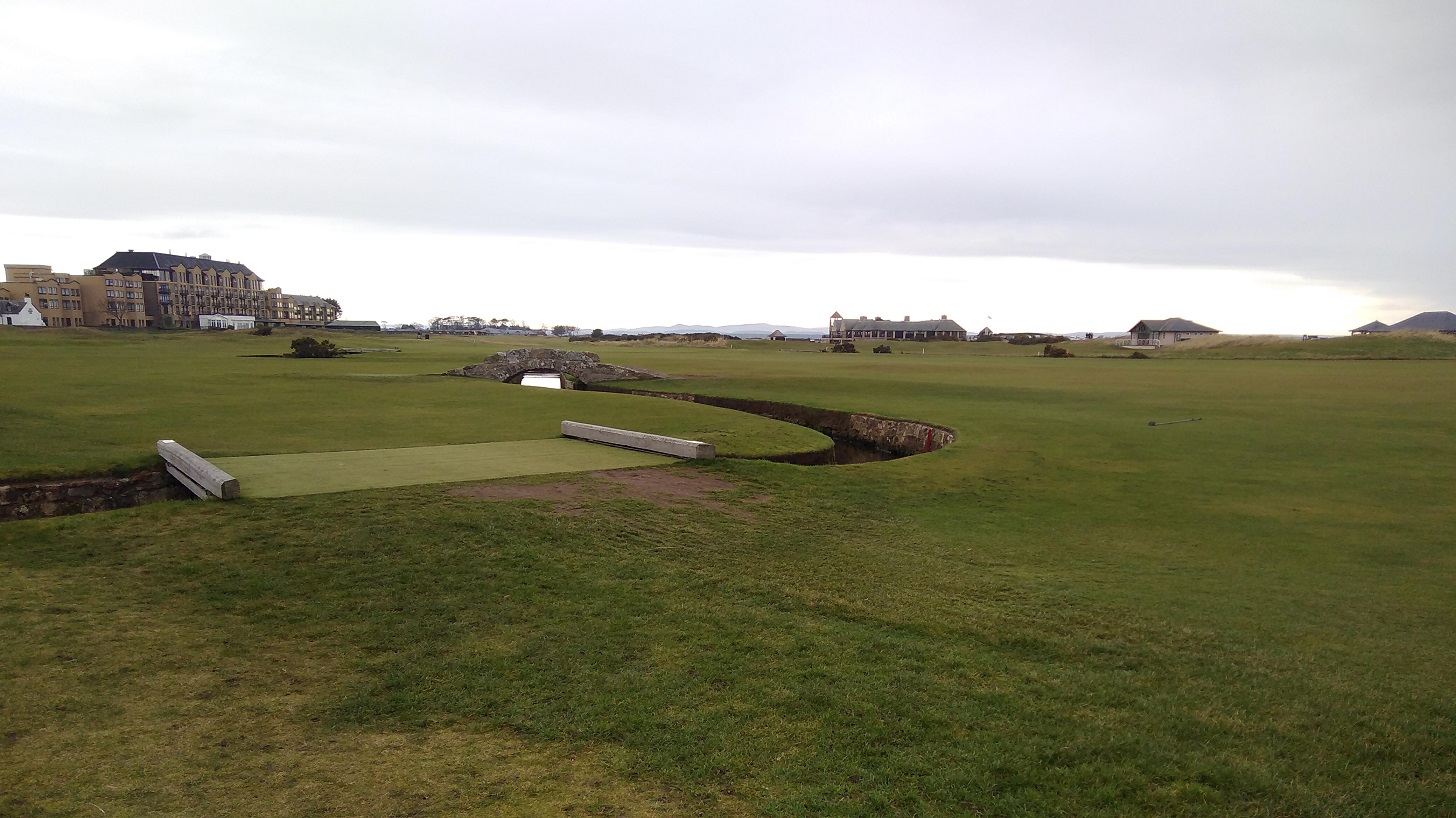
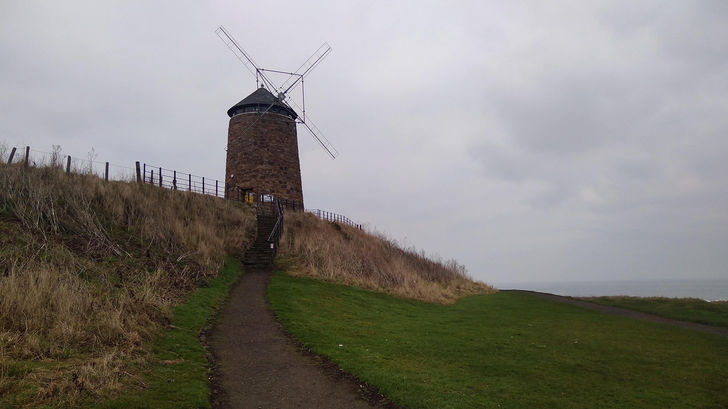
If you too stopped here for lunch here is my advice: find the main road A91 out of the city (the continuation of North street), direction: northwards. Alternatively you could ask for the Old Course if you dare (it is assumed you know where it is, as it is so well known!). Keep to the left of it ie do not follow the coast road through the car park (West Sands Road) even though it does say coastal walk, but instead head for the enormous hotel and the facade which is facing away from the sea, inland. You are looking for the tree-lined North Sea Cycle Path which goes to the left of the Tom Morris Building (turf on the roof).

cycle path
This straight path takes you from St A to Leuchars, the next village, and tracks the main road

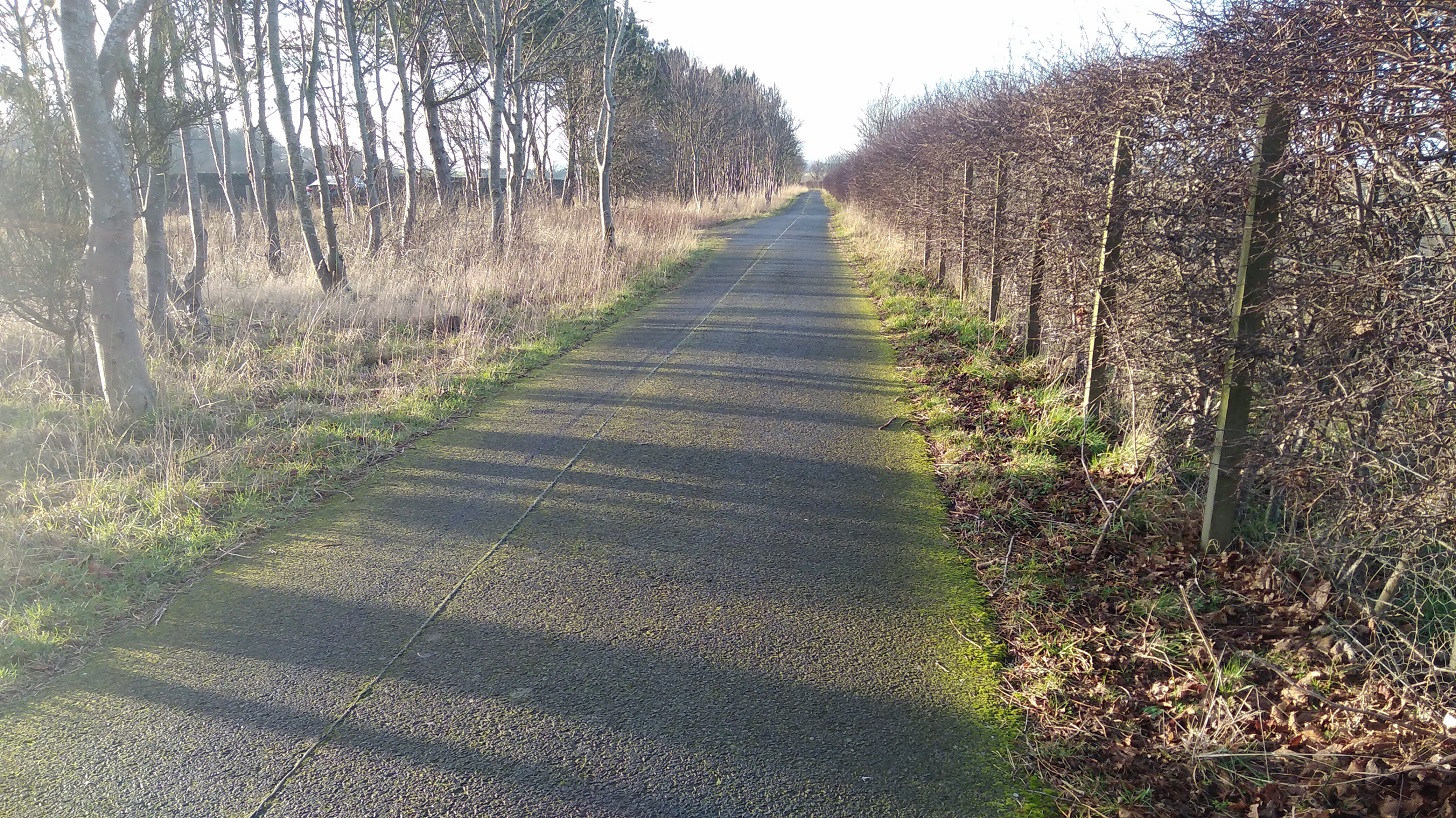
It was a long haul on hard ground after such a challenging day and there is little to entertain you but traffic noise. I changed into my other shoes, but it felt like I was wearing slippers and my feet were sore. You could always take the bus as they are frequent and cheap.

IMG_20190120_151633
On the right is a Nature Reserve, close to Guardbridge and the mouth of the River Eden. Arable land (blackcurrants?) and pastures where sheep crop
IMG_20190120_153124
The evening light was low and the industrial warehouses and hills covered in snow in the distance were lit up

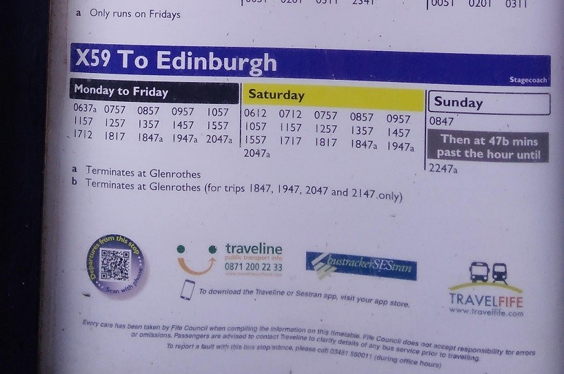
I was very tired and looking for the Guardbridge Hotel when I saw that I could get the X59 bus back to Edinburgh. I stopped and waited on the same side of the road where I had been walking until a local bus stopped and said I was on the wrong side!

Ten minutes later I was hurtling back across Fife, taking the route through Glenrothes towards the Forth Road Bridge and home in the dark. I hadn’t made it to Leuchars, the end of the day’s walk, but then again I had started at Kingsbarns instead of Cambo Sands.

IMG_20190120_154356
I have been reliably informed that Traveline (see the phone number at the bottom of the photo) is an excellent resource for buses all over Scotland.

You may be interested in:

Walking Scotland’s Coast blog

St Monans to Kingsbarns

Saturday 19 January 2019 (one year since the last leg of the journey). 26kms (16 miles)

IMG_20190119_083553

After last weekend’s walk on the Berwickshire Coastal Path I was aware of the short day-light at this time of year, so I set out in the dark with a rucksack that I found upstairs looking like it had never been used, telling myself:

  • It’s going to be harder than you think it’s going to be
  • You never know what’s going to happen

Slowly the sky lightened as I trundled through the countryside on the train from Edinburgh to Kirkcaldy, a blue glow over the misty fields. My phone registered one degrees.

IMG_20190119_084848
The majestic Adam Smith Theatre, Kirkcaldy, Fife

The X60 Stagecoach from Bennochy Road (close to Kirkcaldy railway station) dropped me off by the entrance to the Holiday Park with its puffin sign on the outside of St Monans and the memorial to George Hutchison 1945-90.

Time flies, Shadows fall, Love is forever, Over all.

By 10am I had walked through it and down the steps to the mirror clear water of the salt pans, the mini windmill, and onto the beach.

IMG_20190119_100033
On the sea side of the Holiday Park, St Monans, Fife

IMG_20190119_100354
The first of the salt pans where ‘at the end of the 18th century the dirty, smokey process of salt-making went on around the clock’ (public notice), St Monans, Fife

I heard the sea before I saw it as there was no wind. Somebody was ahead of me, somebody behind me.

IMG_20190119_100521
The windmill, another tangible reminder of the salt production industry, St Monans, Fife

IMG_20190119_100650
The remains of the St Monans pan houses where 6-8 tons of coal was needed to produce 1 ton of salt. Fife

Like last weekend, white waves rolled over themselves, but there were no cliffs just flat, jagged rocks the colour of sandstone. Closer to the water they were black, etched deeply, at right angles to the land making little coves of apricot sand. A yellow gorse bush was tucked under the eroding edge. A pair of mallards drifted, and the air was very still with the smell of smoked fish.

Big white birds perched on the outcrop and, looking closely, almost hidden, black-on-black, large dark ones as well, one standing up and opening its wide wings: cormorants.

IMG_20190119_100946
Water sliding over the rocks, slippery with weed in shades of teal

IMG_20190119_101334 (1)
The constant sound of the waves as the tide came in

IMG_20190119_101425

I could see Pittenweem’s orange roofs ahead but it was too early for a stop. I was hoping to find somewhere to buy something to eat later on though, as a picnic with my flask of (not very hot) Jasmine tea.

IMG_20190119_102407
The approaching view of Pittenweem, Fife

A bunch of friendly ladies all dressed in pink and purple left strong wafts of perfume as they chattered by, each saying ‘morning’ to me.

I had expected a cold bright sunny day like yesterday, but it was dull instead so I could not see into the distance and it was warmer as a result.

IMG_20190119_102928

Here the stink of seaweed was palpable and friendly dog walkers were out and about. Pretty cottages, all marled in pale hues – beige, pumpkin, baby blue and the odd lavender – line the harbour. Wood smoke hung in the air and as I passed a bicycle decorated with scallop shells I wondered if it was owned by a fellow camino walker.

IMG_20190119_102828

In Pittenweem I could have tasted ice cream or supped on fish and chips, drank a dram at the Larachmhor Tavern or admired the arts and antiquities off to the left. Were the toilets open? Yes, and well supplied – warm, light and clean – excellent as public facilities go. What I couldn’t spot was a food shop. Pittenweem is an active harbour, however it being the winter months, the Dory Bistro and Gallery was shut and there were few people around considering it was a Saturday morning.

IMG_20190119_103647
Pittenweem harbour, Fife

Coming out of the village, I noticed that there were not many wild flowers – one or two orange marigolds (calendula) and a few with tiny dandelion-like heads to a stalk. The path goes along the back of what look like holiday cottages. Here pink mallow in someone’s garden, there a pinky-purple hebe, otherwise not much colour at this time of year.

IMG_20190119_104710
Found poetry: soar alba / free Scotland scrawled in Gaelic, and ‘bee (sic) happy’ written in shells on the rocks

I was walking higher up now above the sea and behind a fence. Down below, right by the shoreline were man-made concrete blocks, presumably the remains of WW2 battlements or look-out towers. On my other side were well manured and beautifully ploughed dark brown fields.

The cropped green of the well manicured links (golf course) contrasted with the improvised yellow lichen of the fence posts.

A cormorant’s proud neck and head were at right angles to its body and suddenly it dove down amongst the tumultuous waves.

IMG_20190119_105744

Then I too was right down by the beach, enjoying the lovely gentle colours of the rocks – threads of khaki and caramel with carmine underneath and black above.

Sparrows trotted along with pointy beaks dabbing amongst the blades. A single cormorant flew past, neck reaching, its body the shape of a black cigar remaining dead parallel to the sea, while both black wings flapped up and down simultaneously.

I passed a big group of hikers, some of them properly dressed to tackle the north face of the Eiger. A castellated tower had a list of names below it; a war memorial.

As I entered Anstruther I spotted a street labelled ‘Formerly Witches Wynd’. I thought wryly, that’ll be before they killed them then!

IMG_20190119_110800
The Dreel Burn, Anstruther, Fife

A nearby sign read: ‘James V travelled incognito through Fife as the ‘Guid Man o’Ballengiech’, coming to the Dreel Burn and fearful of wetting his hose, he was carried across at this point by a stout gaberlunzie (beggar) woman, who was rewarded with the king’s purse.’

IMG_20190119_110956
Shell House, Anstruther

Around an extremely sharp and very dangerous bend with no pavement, was more coquille Saint-Jaques decorating a house and the Dreel Halls with a lot to see – the church architecture, its graveyard and various monuments and inscriptions.

IMG_20190119_111029
Concealing a casket, Dreel Halls, Anstruther, Fife

Around the glass the inscription reads: There is a stone coffin which has stood exposed to the injuries of the weather in the churchyard. Tradition says it once contained the relics of St Adrian. Time immemorial.

IMG_20190119_111118

Written on the stone is a poem about God:

‘…He drops into the kirk, and sits as sunlight on a rear pew. It is warm, the sermon’s mighty long.  He sucks a mint and dozes…’

Taken from ‘In Anster’, engraved on a stone in the yard, by Andrew Greig, 2013 who grew up in the town.

The path takes walkers into the town but remember to take a right turn at the wee shop, walking between the A & A Stores and The Bank hotel! The path turns quickly to the right down a very narrow wynd back to the sea.

IMG_20190119_113021

At the harbour there is the ubiquitous fish bar plus a post office, cash point and the Scottish Fisheries Museum (shut but the cafe was open and there were eco toilets that I have never seen before where the water for cleaning your hands fills the cistern after use).

You can learn about the desperate outcome of a collision in 1918 between submarine troops on an exercise who, due to the wartime blackout, collided with minesweepers, leaving 108 dead.

This is where one can take a trip to the Isle of May during the summer months.

IMG_20190119_122244
Teasal plants and an orange glow to the horizon where you can see the Island of May

Islands of the Forth

Anstruther is an extensive town made up of 3 or 4 boroughs (depending on which source you consult). It was bustling, and I happily spotted the elegant hostel where I would be spending the night.

IMG_20190119_111941
The Murray Library Hostel, Anstruther. I gave it 5 stars

Nearby was an artisan bakery where I treated myself to an expensive packet of thick and chunky cheese oatcakes (made, so the board informed, of ‘Anster cheese crafted by Jane Stewart’) which came in very handy for the remainder of the trip (ie I ate them for breakfast, lunch and tea!)

IMG_20190119_112022
They were also selling traditional Scottish fare!

A wee way along was Cellardyke Harbour (known locally as Skinfast Haven created in  1452) with washing lines beside it. I sat down and supped my tea.

IMG_20190119_113600
The Plough and the Reaper, Marion Smith. Anstruther, Fife

IMG_20190119_114707
Cellardyke harbour where there are washing lines to dry your clothes

IMG_20190119_114855
I sat a while here, looking out to sea and having a snack, Cellardyke, Fife

Oooh weep, oooh weep – big crowds of curlew with their long thin, curvy beaks. A stretch of uneven grassy path and it was definitely sniffly weather. A couple trundled ahead of me; the sea rolled and crashed close to my right shoulder; and then a kissing gate which I really had to squeeze through because I never want to take the rucksack off when I have got it comfy and settled on my back.

The high point of the day were the rocks. Sandy to the touch and with amazing colours, stripes, indentations, wave patterns and all manner of other shapes that you could make stories up about. I stood underneath them and looked up to the sky and out to the sea. There was something very powerful about the place.

IMG_20190119_124019
The colours (the camera did not do them justice)…

IMG_20190119_124147
… and patterns of these rocks amazed me

IMG_20190119_124502
Partly eroded, they create fantastic shapes, …

IMG_20190119_124630
… holes and arches to crane through

More cormorants seemed mammoths compared to the orange-legged oyster catchers beside them up to their knees at the water’s edge.

birds high quality
Taken with the zoom, this photo is blurred and no cormorants, but you can identify the oyster catchers paddling and, on a rock on the right, a lapwing

IMG_20190119_123050
The land tapering into the sea in the distance

IMG_20190119_125749
The Coastal Path sign warns of danger!

IMG_20190119_130857
Climbing up I snapped a bird in flight – there isn’t much uphill on this stretch

A stony beach meant that the withdrawing waves cause the rocks to clatter against each other and tufty puffs of white foam rise high between rocks. What’s left of the water in the pools had the setting sun reflected in them, even though it looks as though it’s way over to the horizon and nowhere near overhead.

IMG_20190119_122808
The sea was active, crashing and washing over the rocks

It was 1 o’ clock and I was already starting to feel tired and slightly anxious about the evening, a bit cranky as I came into Crail!

Crail
Crail, Fife

I lost the signs and asked a couple who directed me back the way I had come and they recommended the Golf Hotel where I duly stopped for a cup of tea and some ‘rocky road’. Report: very nice waitress, very slow service, not my sort of place.

Once out there was a clear sign downhill to the sea – I must have needed that boost!

IMG_20190119_132531
Crail coat of arms, Fife. The panel reads. ‘Restored and given new life by The National Trust for Scotland’ but if you search their site they have no results for this village!

IMG_20190119_141932
Sauchope Caravan Park, Fife

Roome Bay was next and caravan site #3: Sauchope Links. There is lots of space for visitors with little huts, white yurts with little chimneys coming out of the side and a swimming pool. One larger dwelling had a hot tub on its balcony, and overall it could not be closer to the sea. Like a spotlessly clean small village, everything is well kept and perhaps because only a few are inhabited at this time of year it seemed soulless.

Out to the ocean, I watched while banks of water gathered, dark on the forward slope, white bubbles teetering on the edge before crashing down and running into the bay. Sometimes when you think you get to the top of a mountain it turns out to be a false summit, and this was the same: that long wave was all over until it turned out that it wasn’t and there was another edge, and another beyond that, and…

IMG_20190119_124940
I looked at them and they looked at me!

My attention was attracted by baah and the sheep’s great thick ruffs of coat bunched up around their necks. When they have their heads down it looks as if you might be able to extend them, opening up those folds like a concertina.

IMG_20190119_143436
Kilminning Coast Wildlife Reserve, Fife and more rock stacks

IMG_20190119_123649
Symmetrical square and rectangular chunks lined up in a row

The massive rocks were sometimes triangular but never curved, gravity having squashed down the layers of the land. Even the vertical cuts and breaks were all at right angles.

IMG_20190119_145147
3pm saw me rounding the tip by the lighthouse and the Fife Ness bird watching hide

A little further on there were some demure cottages, more caravans and golf links. It was darkening now. The birds were in clusters and from a distance they looked as jaggedy as the rocks at very corner, battered by the waves, like dinosaurs’ backs across the peach sand to the sea.

IMG_20190119_150232

The odd quack came from ducks all settled down comfortably on the pungent seaweed interspersed with a squawk of ravens. As the cormorants were standing with their wings open but there was no sun, I could only conclude that they too were having hot sweats and needing to cool down!

Constantine’s Cave is just here. According to tradition, King Constantine I was killed in this place after a battle with Dubhghall (‘dark foreigners or Danes’) in 874.

IMG_20190119_163956

I was nervous of being stranded by the sea at night, so I took a left before I got to Cambo Ness. Although Kingsbarns village is covered up by a panel of writing on the Coastal Path map for stage 5, I had researched in advance and knew I could get a bus from there. I found my way across the corner of the golf course and up the beginnings of a small road where I spied a lit window where a woman was washing up. She kindly came to the door and advised me it would be quicker to stay by the sea. However, she is familiar with the area and I was not, so I took off up the farm track, through the yard, and narrowly missed the bus by about 3 minutes as it thundered past on the main A917. Then I had to do what she said I would and walk at the side of a very busy road, initially with no pavement, and into Kingsbarns by the church where I waited nearly half an hour for the 95 bus.

IMG_20190119_164321
I thought it looked like a member of the KKK!

Back I went to Anstruther and to the Murray House Hostel which I had seen earlier. The French hospitalier was extremely helpful and let me practice my French. The communal rooms are large, and I was put with the other solo woman Coastal Path walker in a 4-bed (usually more expensive) dorm which was very kind. Cost £14 (not including breakfast). I was told that I had to sample the famous fish and chips at the Anstruther Fish Bar and Restaurant which I dutifully did – I gave it 4 stars! The hostel has a very decent kitchen and a supermarket is not far away so there’s no need to eat out. Do book the hostel in advance during this time of year though, as it will open for 2 or more people but may be shut if you turn up on spec.

I had a very good, long sleep to prepare me for an early start to stage 6 the next day.