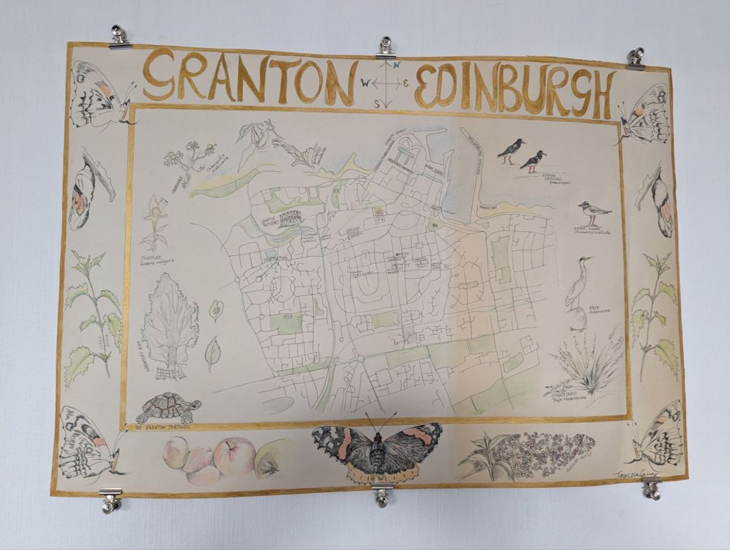
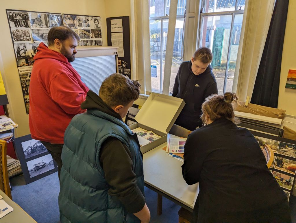
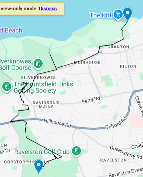
The Granton Burn, from hill to sea

This original stitched map (November 2025) shows the route of the Granton Burn, rising at the top of Corstorphine Hill not far from the Scott Tower, and flowing down to Royston / Granton / ‘The Brick’ Beach and into the Firth of Forth.

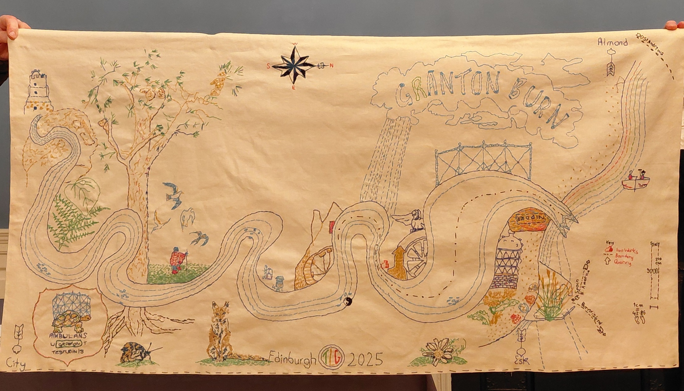
Imagine you are buried in the ground up to your armpits! This is no bird’s eye nor drone-view. The map foregrounds the river itself, looping above and below earth level, and features many examples of local wildlife, flora and fauna found in the Granton area, from a curlew and fox to ragwort and flat oyster shells. Together with the people and the soil itself, the Granton Burn and more-than-human lifeforms are who and what are indigenous to Granton and should be respected as such.

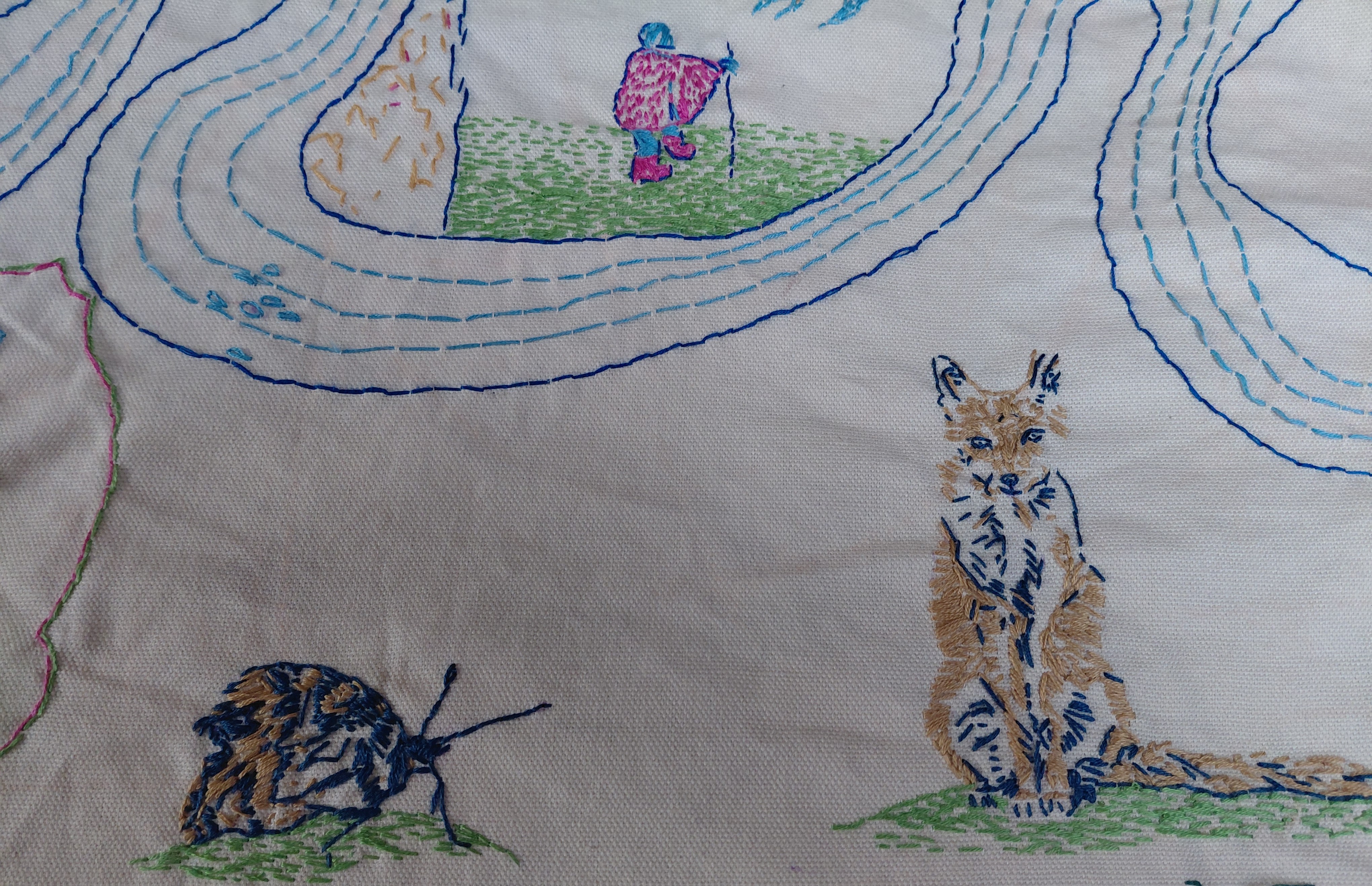
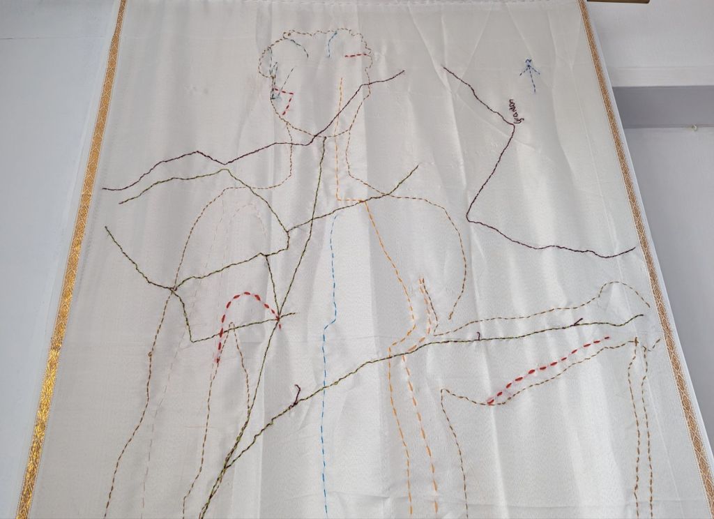
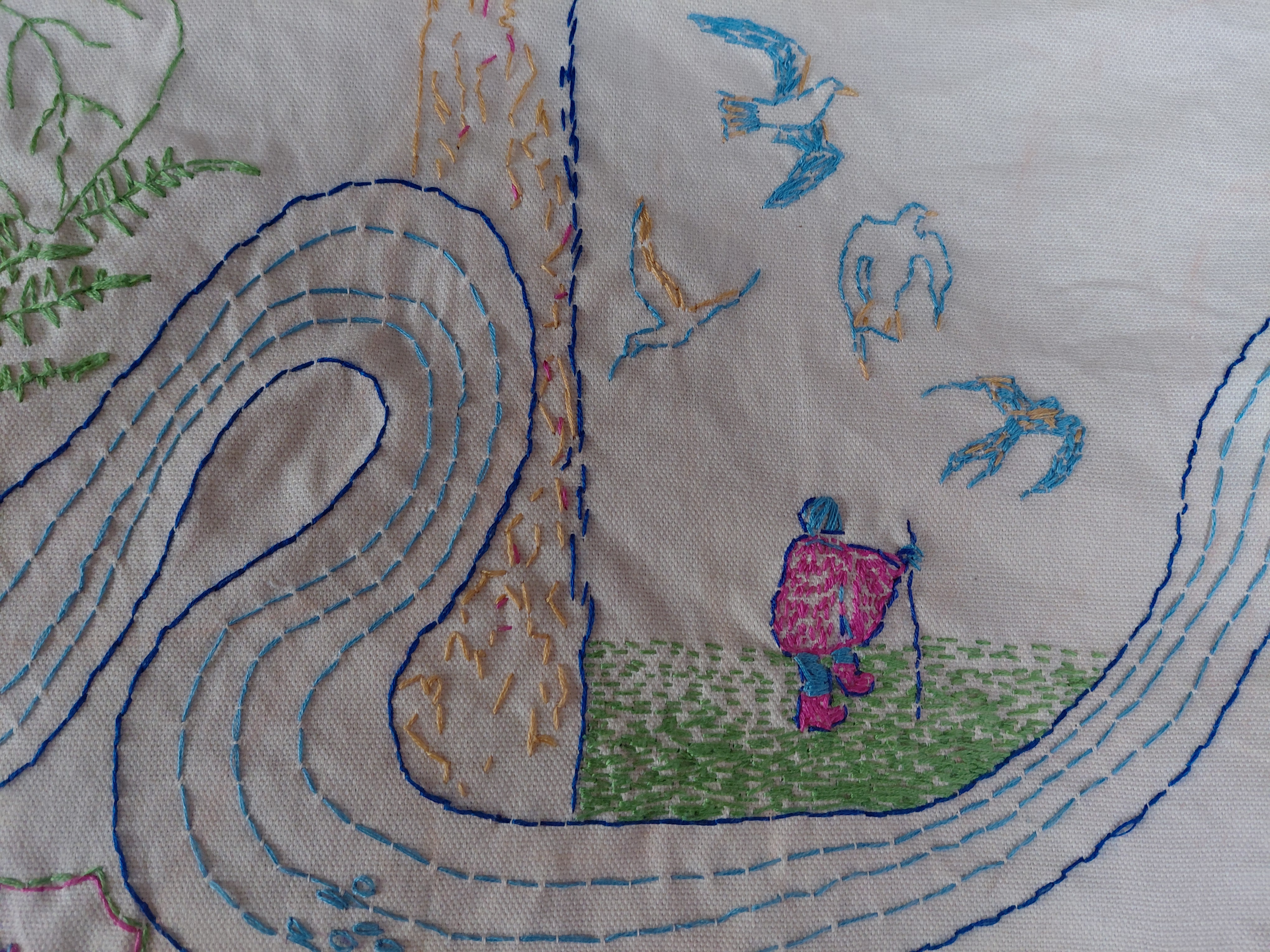
The embroidery above shows a moth, fox and traveller on foot

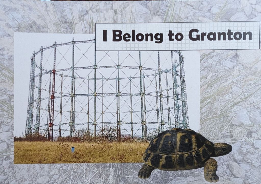
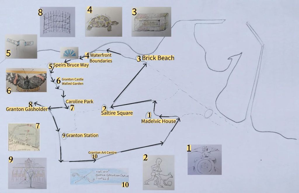
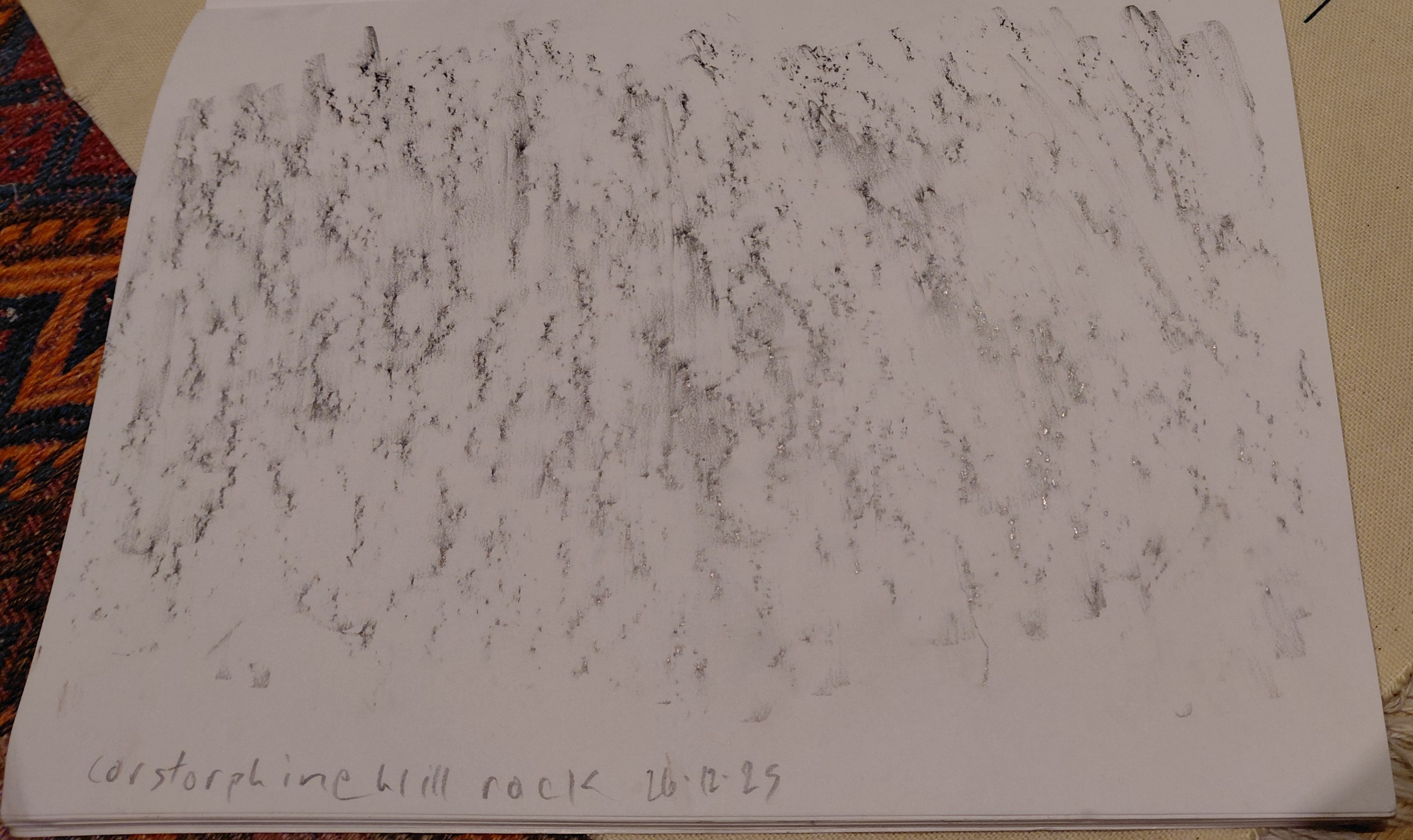
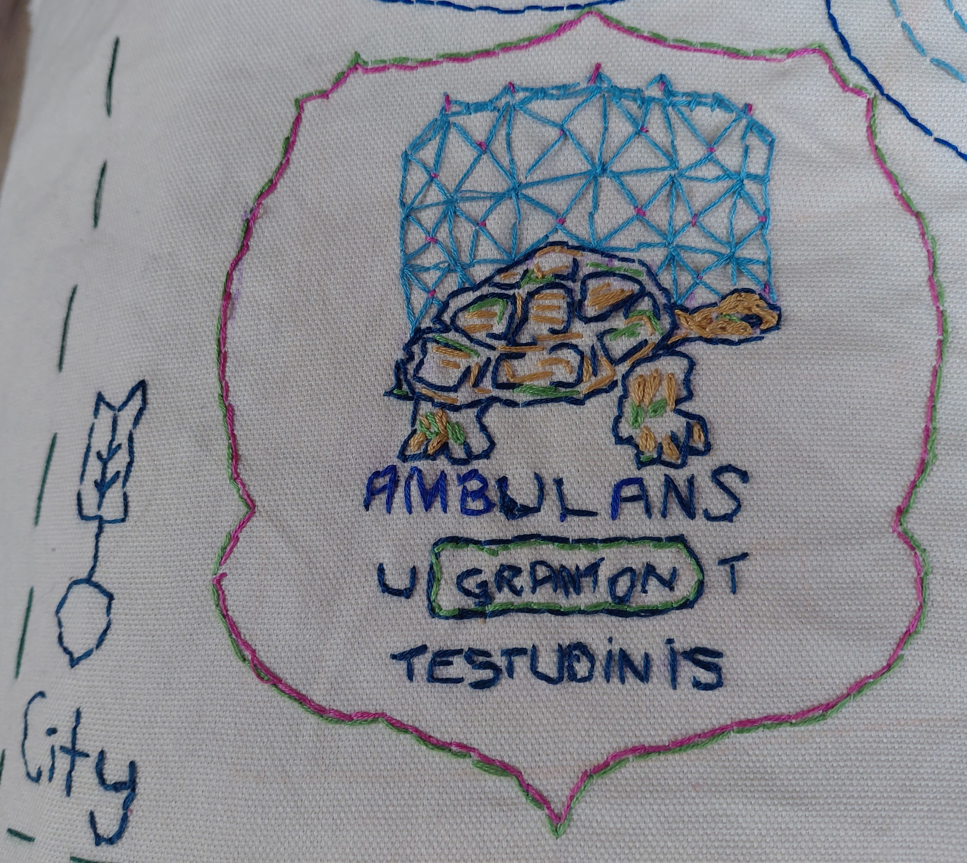
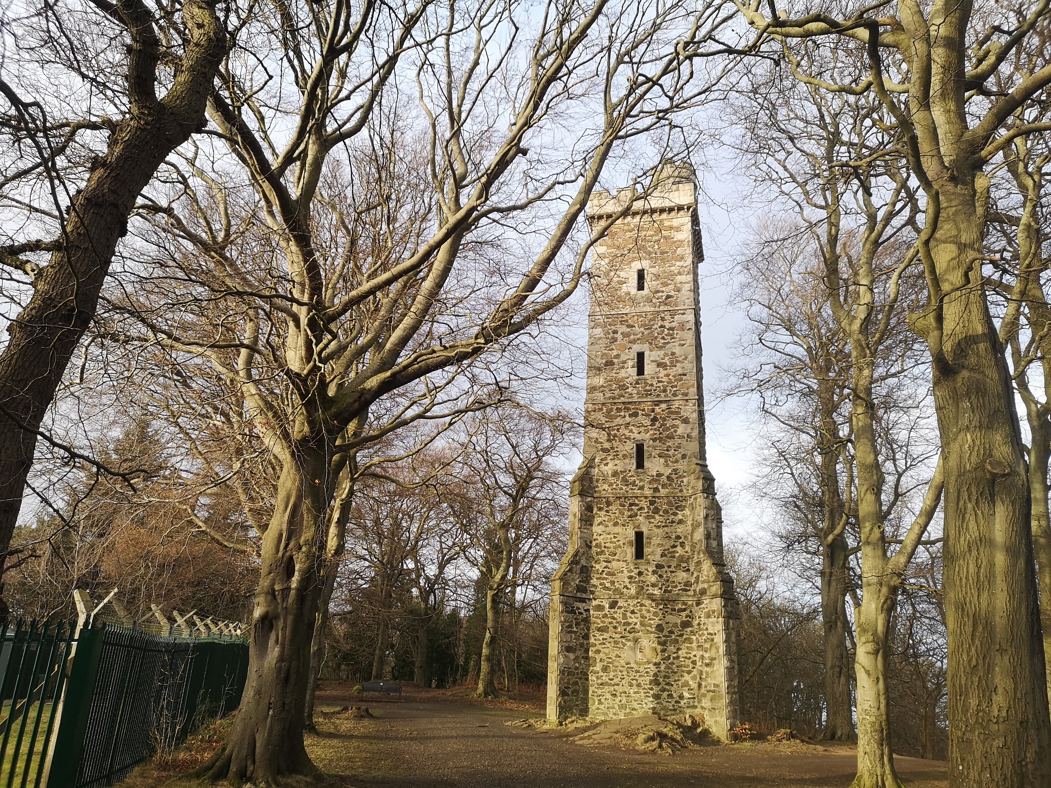
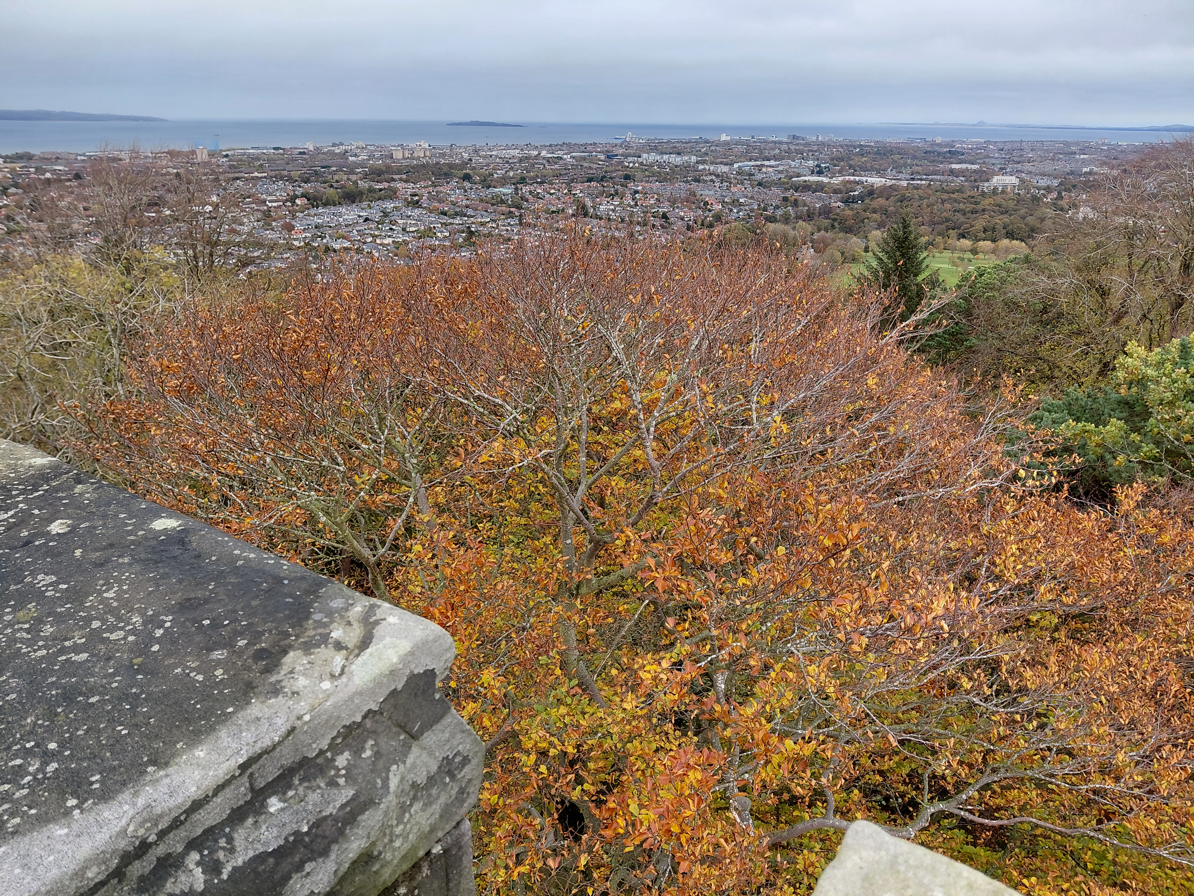
The map shows the Granton Burn rising at Corstorphine Hill near the Scott Tower, flowing under rocks (famous for their cups), woodland (oak, birch, ash and here, Scots Pine), and grassy hillside and flatter land (where someone walks, reminiscent of the figure in the VIII Cups tarot card designed by Pamela Colman Smith). There are buildings which relied on water – amongst others, a mill, the sphinx from Madelvic House (home of United Wire and the Electric Car Company), Mushet’s iron works, the Northern Lighthouse Board building (1860s), and the iconic Granton gastower (recently painted and decorated). The latter is also part of an imaginery Granton coat of arms which features the Granton Tortoise (story here) and the Latin script, ‘Ambulans ut Testudinis’ (Walking Like a Tortoise) referencing an earlier walking art project.

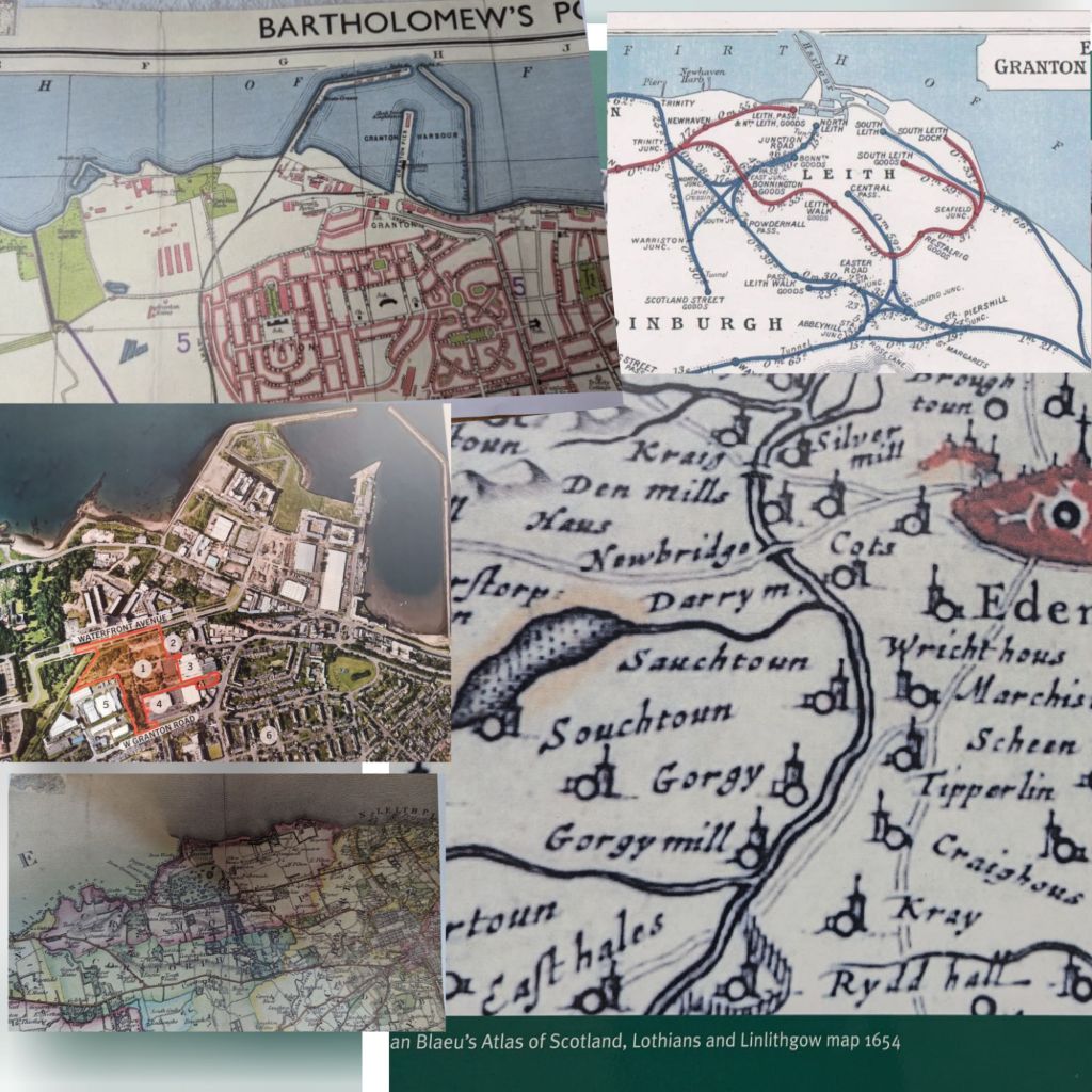
The map is embroidered in the colours found on the 1835 Bartholomew map and the 1867 Parish Johnston Plan, and the sea is stitched in different colours because, I have been told by many residents, it flowed sometimes pink, sometimes other hues according to which ink was being dumped in there by local company, A. B. Fleming.

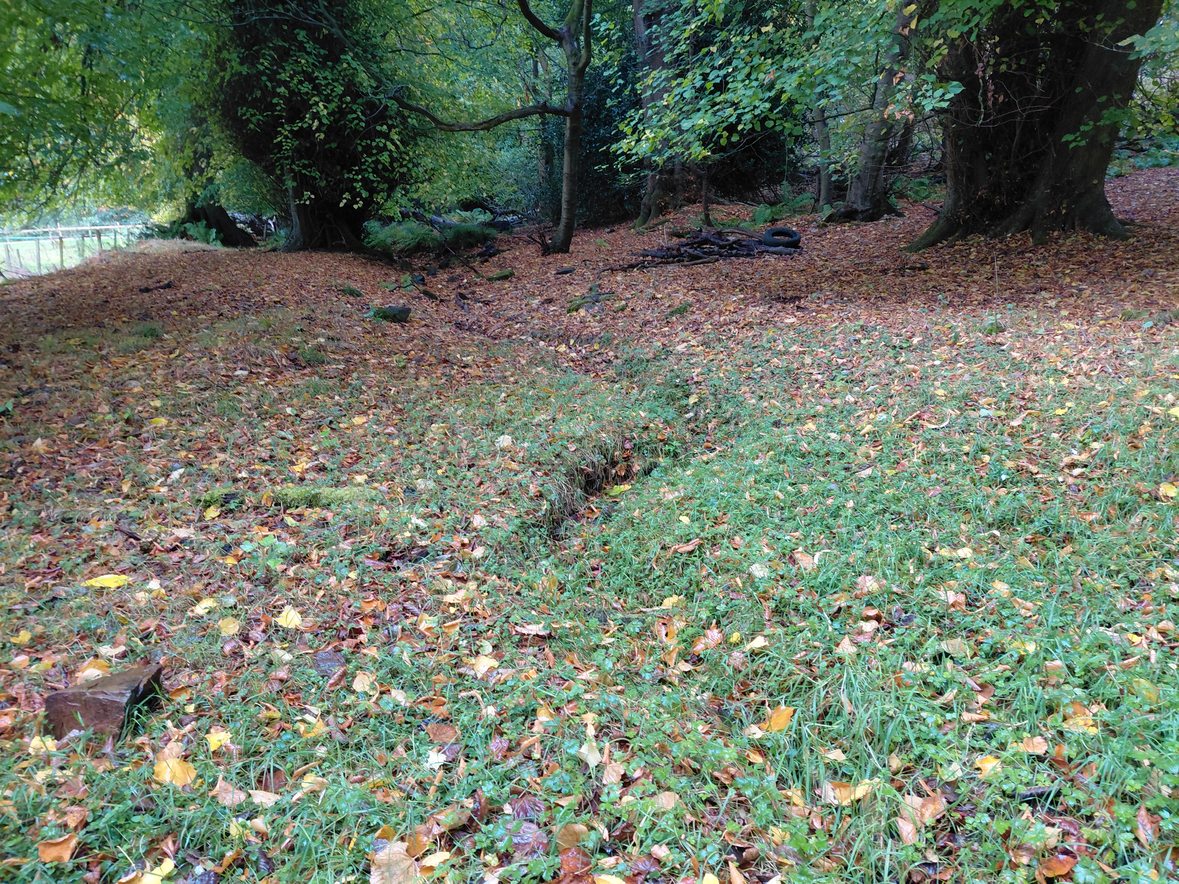
The mouth of the Burn is that particular jagged shape as seen on the Edinburghshire map of 1914. It is unclear exactly where it is nowadays, but is likely to be close to the sewage pipe. Certainly the drains beyond the Sea Gate of Caroline Park frequently overflow, meaning that the Burn streams along the road.

Caroline Park Sea Gate near where the Granton Burn flows, Edinburgh

Other embellishments come from a variety of sources. The arrows can be found on the weather vane on top of the lighthouse, and the north-point of the compass from the Drainage Plan of the Edinburgh Leith and Suburbs map, 1867. And I measured the route in my human footsteps (the walk from hill to sea was approximately 9000 steps) which, according to the scale of this map, is 1:42.86.

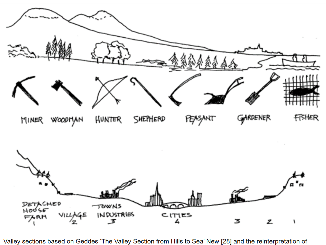
The small boat on the right of the map is similar to Geddes’ on his Valley Section (see below) with two people sitting in it, though I have given one of them a fishing rod (an age-old local industry) and the other a pilgrim’s staff with a gourd on top. The 11th century St Margaret ferry used to take pilgrims across to Fife from South Queensferry so that they could continue to walk to St Andrews. Other sea routes, and the Esparto Grass which covers the harbour, refer to the intercontinental trade which exported coal, bricks and so on, and imported goods and people, including grass for the mills along the River Almond and the Water of Leith.

Granton (Royston) The Brick Beach, Edinburgh where the Granton Burn issues into the Firth of Forth and North Sea

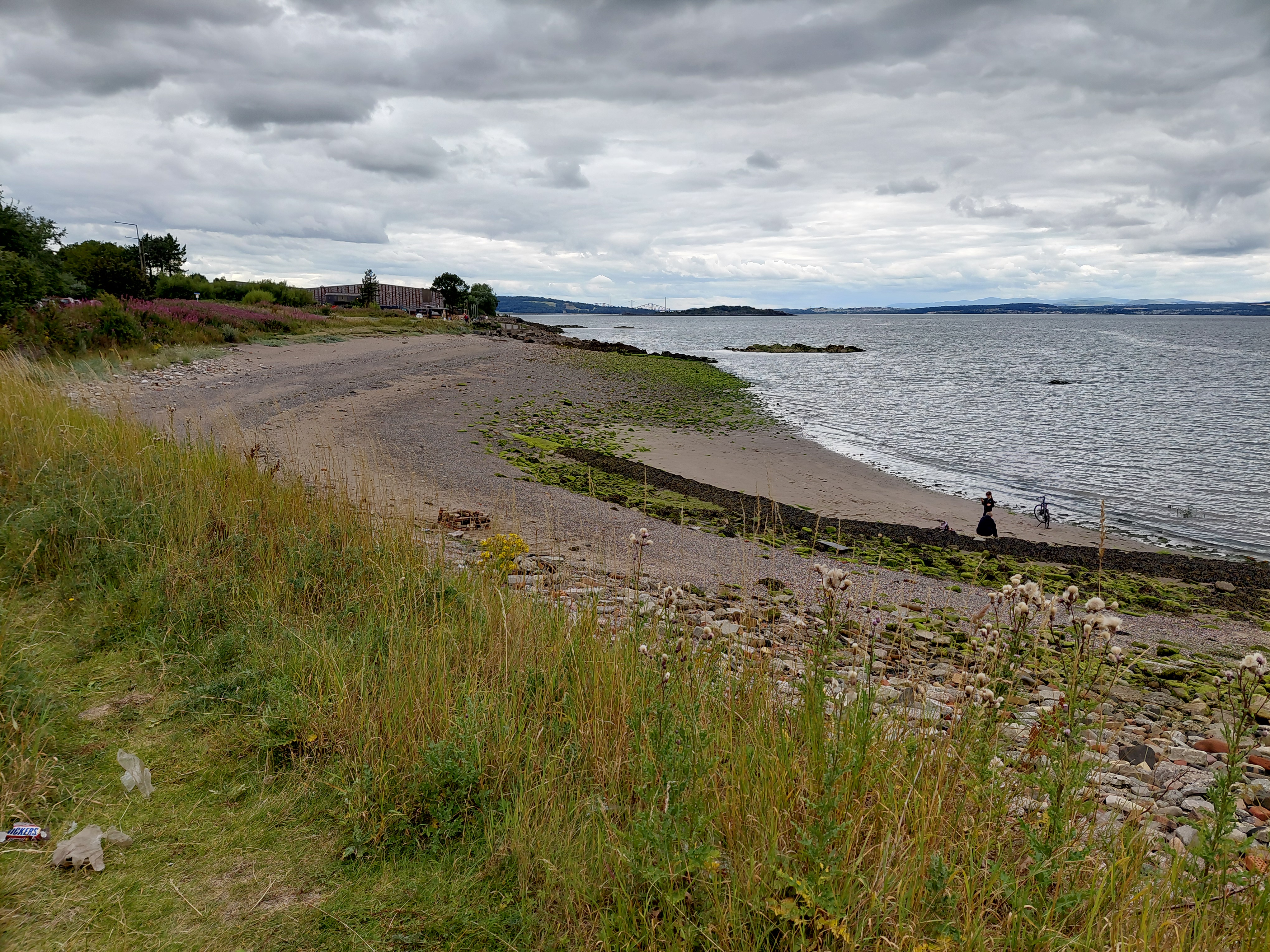
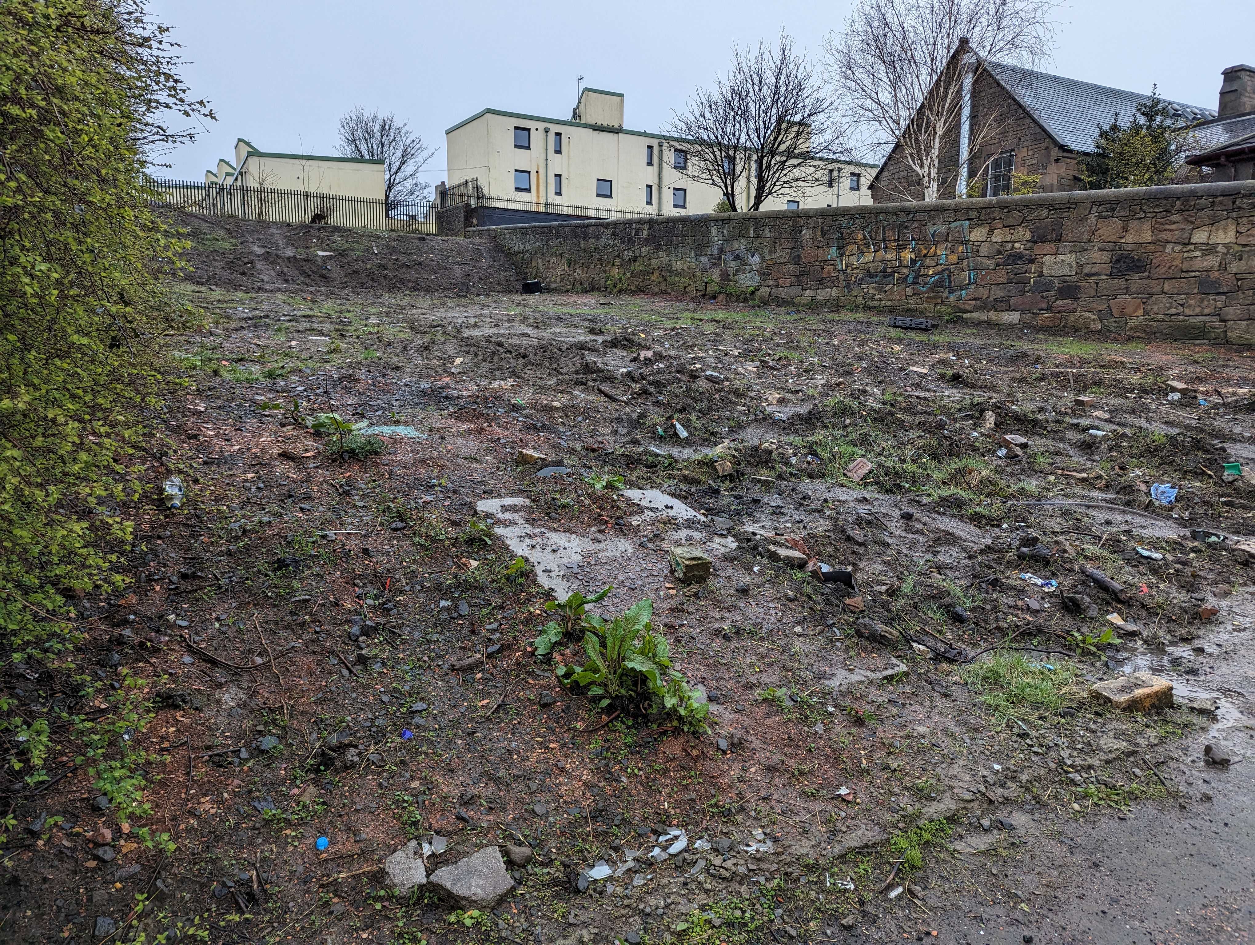
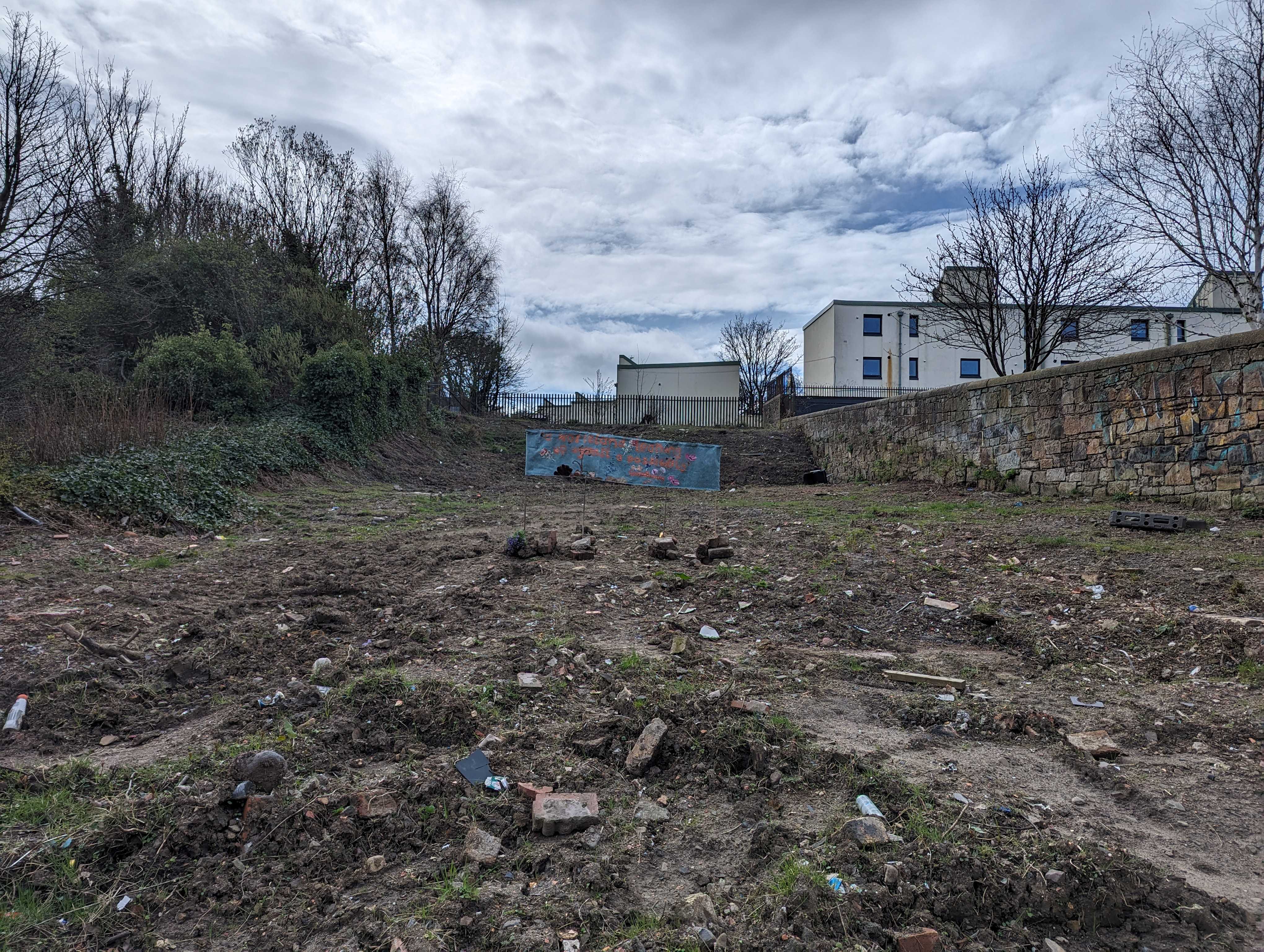
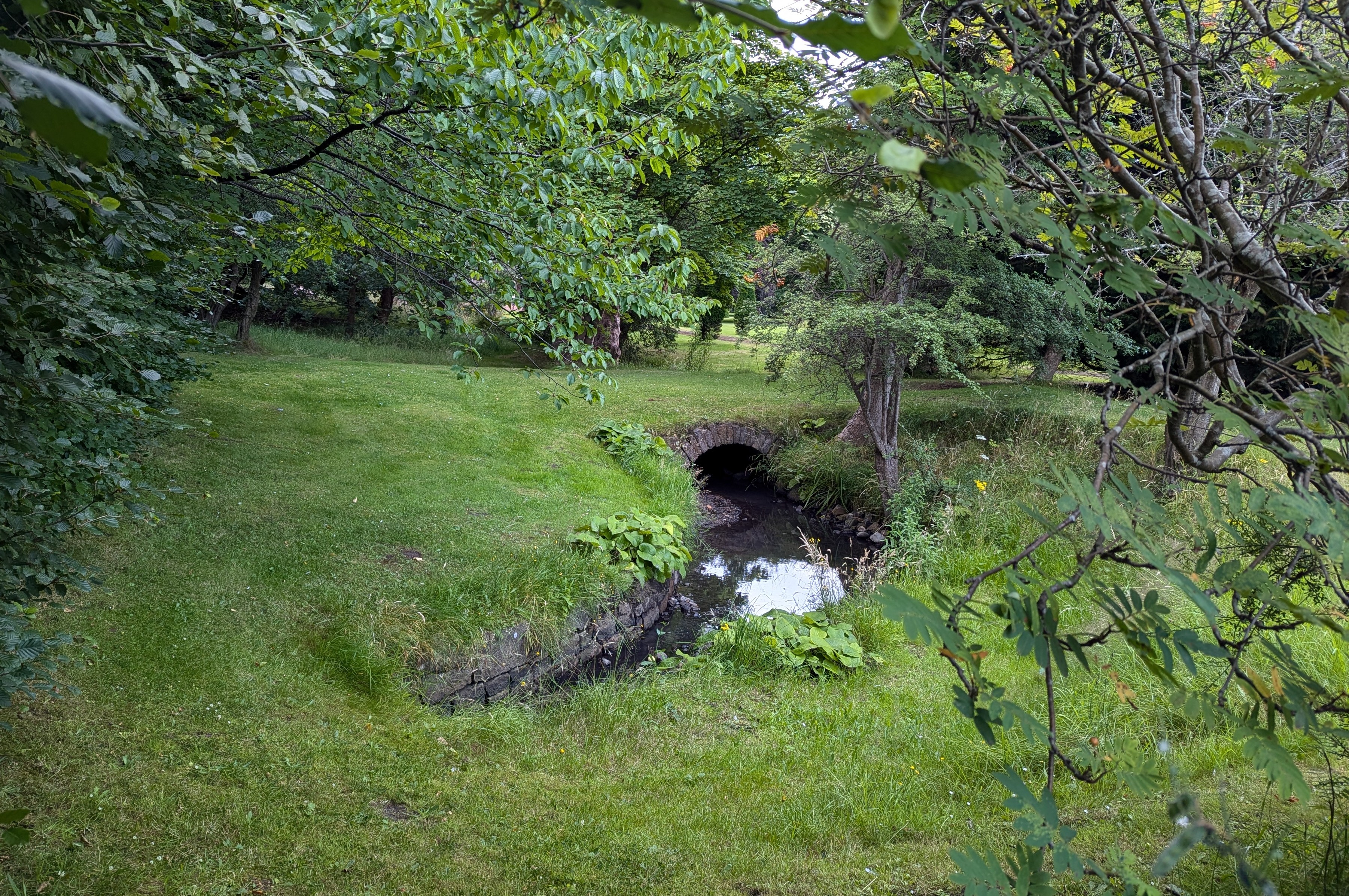
I have wanted to walk alongside this burn for a long time because it is said that it forms the western definition of Granton itself. Although it was quite clear where the second-to-last section is, as it can be seen clearly flowing above ground in the Caroline Park Grounds, and other nearby parts are also visible in Forthquarter Park, the rest of it is now mostly hidden below buildings and there are no maps showing it as far as I can find. (It is noteable, however, that the ‘new’ Scottish Gas Headquarters flooded and the grass nearby is soggy all year round whatever the weather, so it is most likely that the Burn flows under those places.)

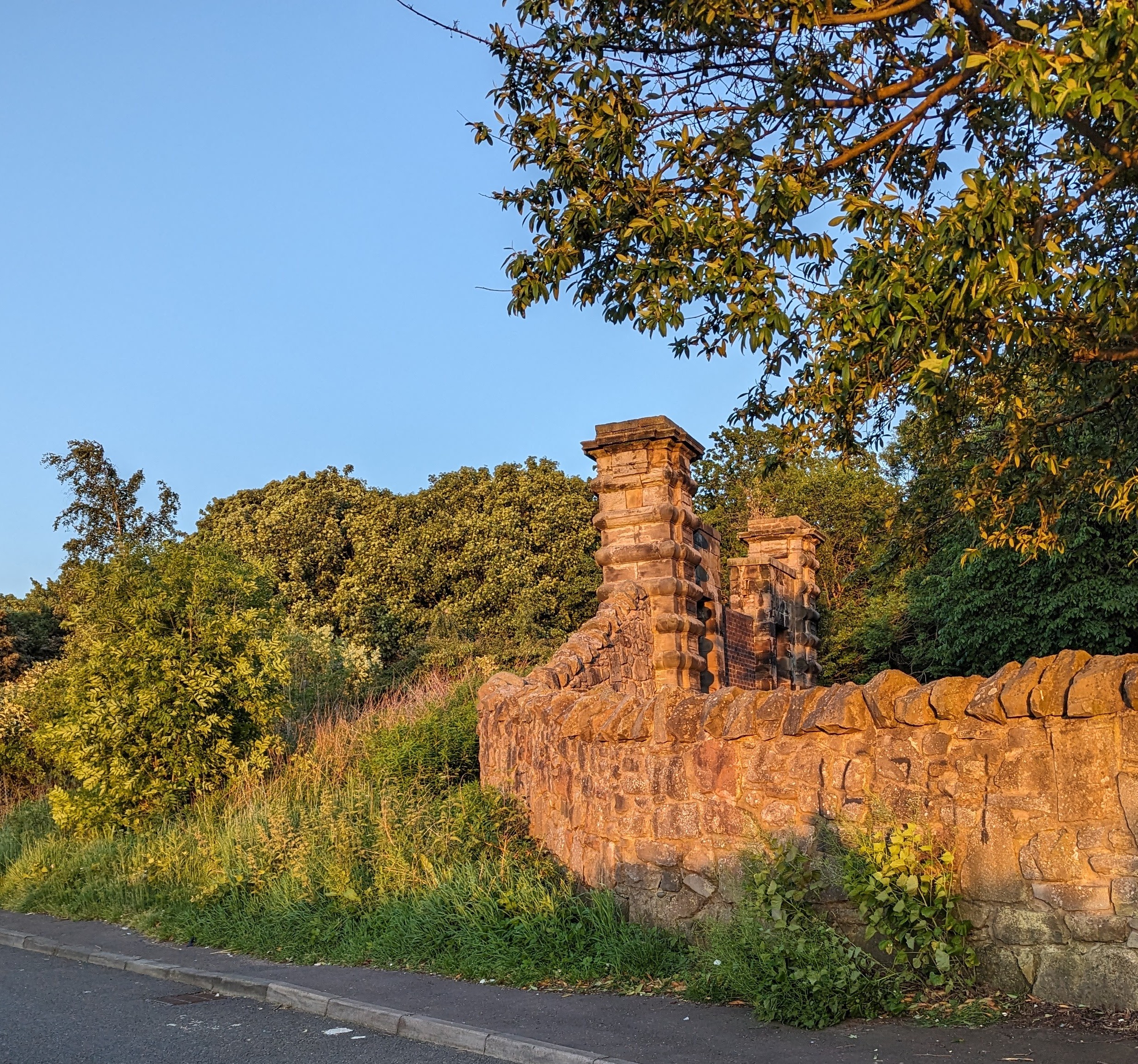
The owner of Caroline Park suggested that it rose at Corstorphine Hill, so, armed with my research from old maps and local anecdotes, I went there to look.

You can see the thin wiggly line of the Granton Burn from Caroline Park on this old map, but it stops just south of what is now West Granton Road. Notice that there is no Granton Harbour, so the map predates the 1830s

Above photo: The Granton Burn, Caroline Park

I believe that I found the route of the Granton Burn using my sense of the water I’d previously met, as well as the resources I’d compiled. I knew it’s energy in the same way that I have been practising knowing people’s energy (or chi) through my Shiatsu bodywork for over 30 years. I certainly found a small river, wetland plants, and banks along the line I’d tentatively drawn on my own map. 

Above, you can see a channel and the banks of a stream, and there were also reeds and, in a few places, water gushing out of holes in the woods. These photos were taken by me at the base of Corstorphine Hill

I think a threshing mill used to be on this site before the housing estate was built. Granton, Edinburgh

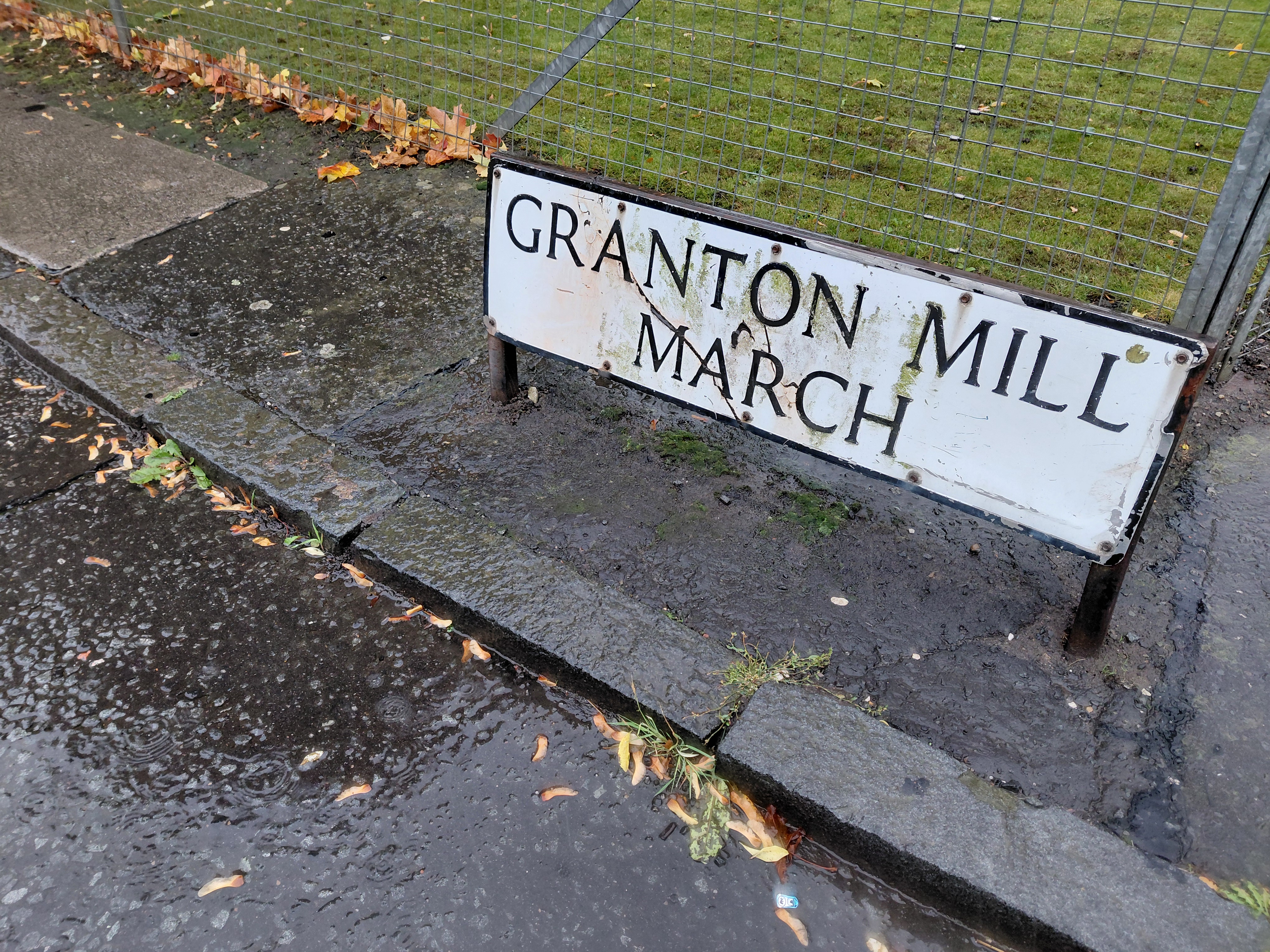
As I slid along pavements slippery from the pouring rain, I came across the area named Granton Mill with which I was familiar from earlier forays. Of course! A mill would have needed water, I was on the right route!

This work of tracing the Burn gives it power and I felt it. I recognised its distinctive voice.

My route and the approximate route of the Granton Burn, Edinburgh

If rivers are built over and erased from maps, does their power cease?

This map collapses time. It reinstates the river above ground, and juxtaposes past and present. My walking the Burn in some way also restores the original boundary. For once, it’s not roads or random lines, not politicians making the decision, but the existence of the Burn itself which decides where Granton begins and ends – a gentler, more natural way that harks back to earlier times.

Illustration above: My earlier map, 2023 (pen pencil, acrylic) exhibited at Granton Hub (2023) and Edinburgh Central Library (2024)

All the time I walked and stitched, I was in dialogue with the Burn and it in turn reinforced the original route I traced for my first drawn/painted map.

Photos above: Corstorphine Hill (Scott) Tower (1871) and the view from the top (200 feet) towards Granton

My footsteps drew the Burn above ground, and my stitches have made it manifest in fabric in the tradition of map makers of many sorts from the past. I’m thinking of the Sophia Mason 1802 map of England and Wales that’s in the Library of Congress in the US, the cross-stitched 1940s maps made by children, the Gough Map on vellum, or the circular TO Mapa Mundi. This is a way of stitching time, fixing one person’s view of a place on a specific date.

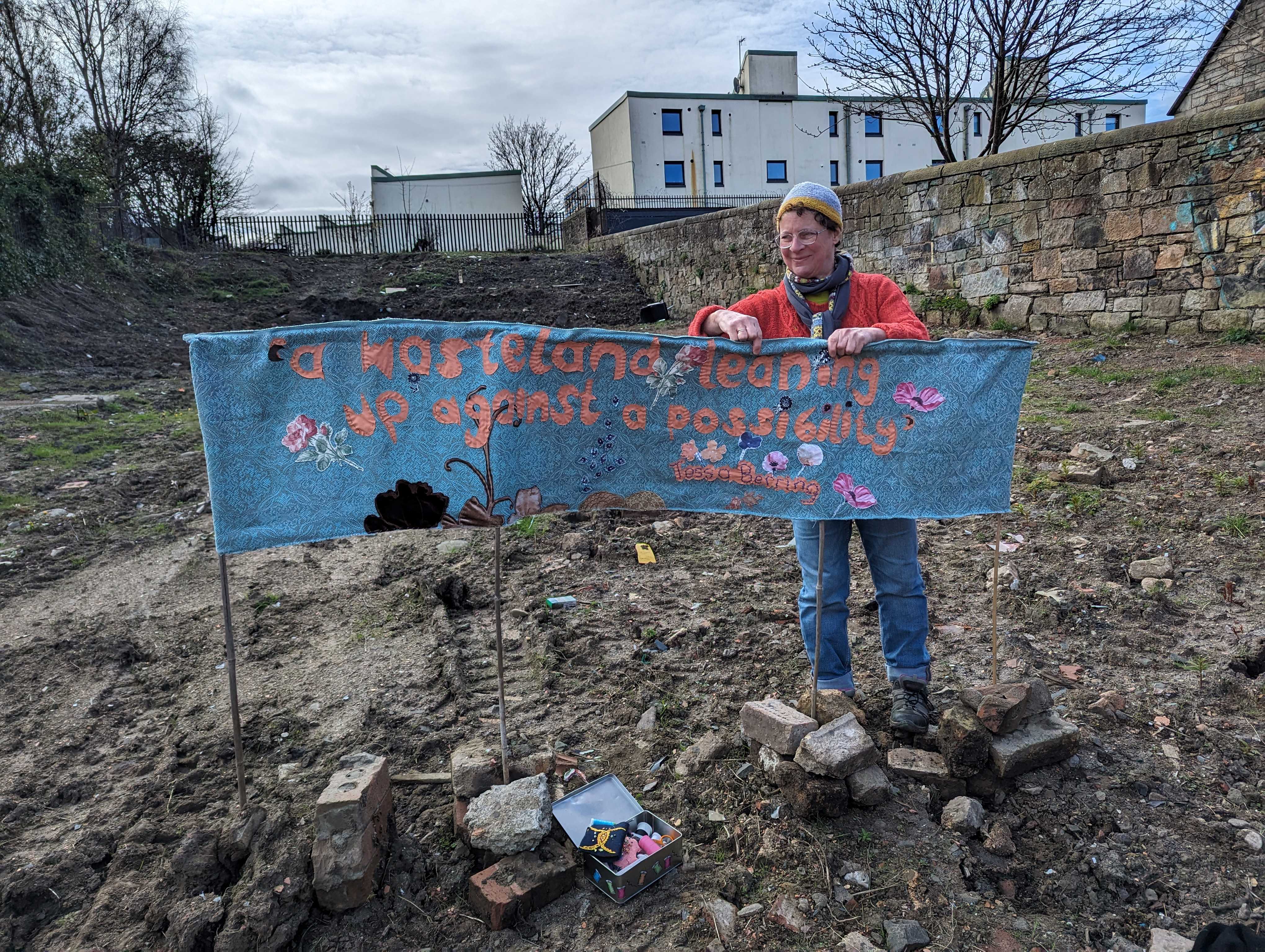
The Granton Burn map was made in response to an invitation to give a lecture for the Scottish Historic Buildings Trust (12 November 2025) as part of their Autumn / Winter series, alongside Dr Jonathan Gardner (an authority on Waste Heritage) at Riddles Court in Edinburgh. The map is currently on show at Riddles Court, alongside the stained glass window of Patrick Geddes’ Valley Section. Thanks to Ed Hollis for the initial invitation and the excuse to make the work and artwork for the event.

Thanks

This project benefitted from the help of many, in particular Scott Macintosh from the Friends of Corstorphine Hill, Catharine Ward Thompson and Suzanne Ewing, both from The University of Edinburgh College of Art, who and shared their time and valuable resources.

I have made this map for, and dedicate it to, the community of Granton in all their variety and form, past and present, amongst whom I live.

Widdershins

A short film made on the Summer Solstice 2025, a provocation curated by Kel Portman. Sub titled, Walking an Orbit on the Longest and Shortest Day, I walked an anti-clockwise circuit in Granton, Edinburgh at dawn. It included a swim in the cauldron of the Firth of Forth, and an encounter with one of the Covid Memorial Trail sculptures by Skye Loneragan and Stewart Ennis.

Below: 10 walking artists celebrate the summer solstice:

‘Widdershins, A Witch’s Walk’ (short film) was my contribution. Widdershins, a spell for the Summer Solstice. Scots: Anticlockwise. Deosil, Gaelic: turn right, towards the sun, ‘May things go right’. A Witch’s Walk, contrariwise – Fox (tod) shapeshifter – Crow (corbie) familiar – Clootie – Mugwort – Ragwort – Wych Elm – Cauldron – Spoons for stirring. Song: The Witches Reel 1591. Sculpture: Skye Loneragan and Stewart Ennis. Location: ///only.voices.passes 

Contributing artists: Claudia Zeiske, Janette Kerr, Jaqui Stearn, Kara-Louise Slattery, David Tidsall, Jaak Coetzer, Neil Greenhalgh, Martin P Eccles and Kel @kelarrowsmith

Walking Like A Tortoise 

Slow and Steady On October 7th 2025 at 7pm UK time, I’m pleased to be sharing an online event with Marie-Anne Lerjen at the Walk Listen Create Café where we will be talking about the Marsato Award we received for our work. The recording can be found here on the walklistencreate youtube channel.

One of the portraits of members of the local community I met while walking the Granton Boundary
Free postcard for residents, designed by Tamsin Grainger
Detail, Personal Mapping. Textile work re. ‘My Body is My Map’
Hand drawn / painted map of Granton showing other-than-human inhabitants we live with
One of the Walking Like a Tortoise events
Showing members of the local youth club around the History Hub
Walk Map, Granton, Edinburgh

Walking the Granton Boundary on Vimeo

Old and new maps of Granton on the edge of Edinburgh

Walking Like a Tortoise in Living Maps Journal

Granton Walking Tour

Granton Walking Tour 14 December 2024

You are welcome to join us for a Granton Heritage Walk on Saturday morning 14th December. We will leave from Granton:hub (Madelvic House, at the end of Granton Park Avenue, EH5 1HS) gathering at 10.15am for a 10.30am start, and returning to the starting point at 12 noon.

Book here via Eventbrite

We will be following part of the Curious Edinburgh Walking Tour and going by Granton Station, Saltire Square, Caroline Park, Granton Castle Walled Garden Doocot and new mural, Forthquarter Park and the Gas Tower.

This walk is on pavements and is suitable for buggies, wheelchairs and people of all ages including those with dogs (on a lead please). Please wear suitable clothing and shoes for the weather and bring some water with you. After the walk, participants will be invited inside Madelvic House for refreshments and to view the community consultation exhibition organised by Edinburgh College of Art as part of their ‘Heritage on the Edge’ research project. More details on this event will be available later.

The tour will have a maximum of 15 people. Headsets will be used to ensure everyone can hear the commentary.

On arrival, all particpants will receive a brochure with full details of the walk.

The Granton Walking Tour is also available in Polish and Arabic. For this and any specific queries about the walk, please contact tamsinlgrainger@gmail.com for more details.

Tamsin Grainger is a Paths for All walk leader.

Granton:hub will charge a small fee which contributes towards operating costs.

Wasteland Art

Walking event as part of Harbour Connections: 25 September, 5-6.30pm starting 13 Hesperus Crossway EH5 1SL (w3w///fats.inch.wrong) and walking to this patch of wasteland. With poet Tessa Berring, and Professor Catharine Ward Thompson from Edinburgh College of Art who is a researcher of green spaces and their beneficial effects on us. Book on the link above or here via eventbrite.

There’s a piece of wasteland at 2 West Granton Road, Edinburgh ///dock.entertainer.lazy which used to look like this:

Wasteland at ///dock.entertainer.lazy

Then someone cleared all the naturally wilded plants as well as the rubbish and left it looking like this.

Cleared wasteland in Granton

It’s been bothering me every time I walk past (most days). I wish it was a community garden, a beautiful place where we could grow things together and sit and enjoy each other’s company.

Later, I was at a poetry reading by members of 12, a collective of women writers at the National Library. They were reading from their book: ‘Spaces Open’ written in and about the lovely West Port Garden in the Grassmarket which was originally designed by Norah Geddes. I’d seen an exhibition about it at Central Library earlier in the year.

Making socially engaged art

A phrase in Tessa Berring’s poem ‘China Sheep’ caught my eye when I was reading it on the bus on the way home – ‘a wasteland leaning into a possibility’. It seemed so appropriate, that I went home and stitched it into a banner which I have put up on the Granton plot.

I used fabric from the Granton Scrapstore which used to be at Granton:hub.org courtesy of Toni Dickson, project manager of Lauriston Farm (an urban farm growing food for people and wildlife) fame.

Location

The site is next to Empty Kitchens, Full Hearts who are doing amazing work relieving poverty in Edinburgh by providing meals – made using surplus food – and follow-up support for people across the city of Edinburgh, free of charge and without judgement. Please note, they are always needing volunteers.

Thanks to Tom and Stuart for coming over from volunteering in their vegetable plot when I was sinking the bamboos into the ground and being so encouraging when I was putting in the final stitches. Tom took this photo

The images above show the stitched banner by Tamsin Grainger in place with the quote, ‘a wasteland leaning up against a possibility’ by Tessa Berring

It looks a bit small, doesn’t it, and may not last long given the weather we’ve been having and the history of vandalism in the area, but if it gives a few people some pleasure and something to think about, then I’ll be happy. It’s hand-made work, stitched with care, in an area that needs as much TLC as it can get.

… islands of abandonment (are) not only big, structured conservation projects that offer a return to the wild, but the scrappy abandoned car park [or other such plot] at the end of your road.

Islands of Abandonment, Cal Flynn (p326)

Dedicated to my friend and socially engaged artist Natalie Taylor who is my inspiration. See her Scran Fir Bees and other work in the area.

Links

You may like to check out my other work nearby: The Wall on the Western Breakwater of Granton Harbour, No Birds Land in the Trinity Tunnel and Is there a place for REVOlution or Peace and Biscuits in the Ferry Road tunnel of the Chancelot Path of the Edinburgh Cycle Ways.

The Sound Walk Map shows their location.

Did you know that the Roseburn Path is under threat? If you support and use the Edinburgh cycle paths, you might like to check out this website: Save the Roseburn Path

My website